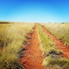
Are there any formed walking tracks or gated fire trails through here that will keep me off the public roads and 4WD tracks?
What are the best hard copy topo maps for this area and who sells them?
![]() by TerraMer » Sun 30 Sep, 2012 7:28 pm
by TerraMer » Sun 30 Sep, 2012 7:28 pm

![]() by frenchy_84 » Sun 30 Sep, 2012 7:47 pm
by frenchy_84 » Sun 30 Sep, 2012 7:47 pm


![]() by ILUVSWTAS » Sun 30 Sep, 2012 7:50 pm
by ILUVSWTAS » Sun 30 Sep, 2012 7:50 pm
frenchy_84 wrote:There is a 4x4 track from trial harbour thru Granville and I think it goes all the way to temma, I'm just unsure as to what it does near pieman heads. I'm sure there are others on this site with more knowledge.


![]() by Strider » Sun 30 Sep, 2012 8:02 pm
by Strider » Sun 30 Sep, 2012 8:02 pm
ILUVSWTAS wrote:Hits a river. Then starts again on the other side :p I believe there is a boat that goes one side to the other, but depends on the time of year?
![]() by TerraMer » Sun 30 Sep, 2012 8:05 pm
by TerraMer » Sun 30 Sep, 2012 8:05 pm
![]() by ILUVSWTAS » Sun 30 Sep, 2012 8:07 pm
by ILUVSWTAS » Sun 30 Sep, 2012 8:07 pm
Strider wrote:ILUVSWTAS wrote:Hits a river. Then starts again on the other side :p I believe there is a boat that goes one side to the other, but depends on the time of year?
You're thinking of a major arterial road, known as the "Western Explorer". And the Fatman barge is at Corinna
![]() by TerraMer » Sun 30 Sep, 2012 8:13 pm
by TerraMer » Sun 30 Sep, 2012 8:13 pm
![]() by Strider » Sun 30 Sep, 2012 8:17 pm
by Strider » Sun 30 Sep, 2012 8:17 pm
ILUVSWTAS wrote:Strider wrote:ILUVSWTAS wrote:Hits a river. Then starts again on the other side :p I believe there is a boat that goes one side to the other, but depends on the time of year?
You're thinking of a major arterial road, known as the "Western Explorer". And the Fatman barge is at Corinna
Am I???? Im sorry, I thought I was thinking of this spot...
![]() by ILUVSWTAS » Sun 30 Sep, 2012 8:24 pm
by ILUVSWTAS » Sun 30 Sep, 2012 8:24 pm
![]() by tasadam » Mon 01 Oct, 2012 9:38 am
by tasadam » Mon 01 Oct, 2012 9:38 am


![]() by tastrax » Mon 01 Oct, 2012 10:08 am
by tastrax » Mon 01 Oct, 2012 10:08 am

![]() by Hallu » Mon 01 Oct, 2012 10:24 am
by Hallu » Mon 01 Oct, 2012 10:24 am
![]() by ILUVSWTAS » Mon 01 Oct, 2012 11:46 am
by ILUVSWTAS » Mon 01 Oct, 2012 11:46 am
![]() by stepbystep » Mon 01 Oct, 2012 1:18 pm
by stepbystep » Mon 01 Oct, 2012 1:18 pm

![]() by Hallu » Mon 01 Oct, 2012 2:45 pm
by Hallu » Mon 01 Oct, 2012 2:45 pm
![]() by stepbystep » Mon 01 Oct, 2012 2:56 pm
by stepbystep » Mon 01 Oct, 2012 2:56 pm
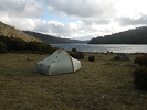
Hallu wrote:Thanks, those are two short walks near Couta Rocks, they must be about 30 min each ?
![]() by Hallu » Mon 01 Oct, 2012 3:36 pm
by Hallu » Mon 01 Oct, 2012 3:36 pm
![]() by TerraMer » Tue 02 Oct, 2012 5:47 pm
by TerraMer » Tue 02 Oct, 2012 5:47 pm
ILUVSWTAS wrote:It's OZIEXPLORER, and yes they use the 1:100's.
![]() by TerraMer » Tue 02 Oct, 2012 5:52 pm
by TerraMer » Tue 02 Oct, 2012 5:52 pm
Hallu wrote:I'll also be doing the Western Explorer in mid-November...
Users browsing this forum: No registered users and 37 guests