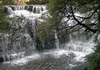
Lyons River Magnesite Karst
Forum rules
Tasmania specific bushwalking discussion. Please avoid publishing details of access to sensitive areas with no tracks.
Tasmania specific bushwalking discussion. Please avoid publishing details of access to sensitive areas with no tracks.
7 posts
• Page 1 of 1
Lyons River Magnesite Karst
We are planning to walk along Farquars Rd from the new bridge and wondered if anyone has explored the Lyons River area, karst formations and caves and would share the information?
- tida
- Nothofagus cunninghamii

- Posts: 6
- Joined: Sat 20 Aug, 2011 5:27 pm
- Region: New South Wales
Re: Lyons River Magnesite Karst
your best bet would be to contact the Savage River Caving Club.
-

scrub master - Atherosperma moschatum

- Posts: 72
- Joined: Fri 11 Jul, 2008 3:31 pm
- Region: Tasmania
Re: Lyons River Magnesite Karst
Thank you for the suggestion. I have contacted the listed phone no for the club and was told, that the only existing cave was caused by a quarry for road building removing the basalt cap some decades ago. This comes as a surprise to me as the Magnesite Karst formed part of the argument for heritage listing.
- tida
- Nothofagus cunninghamii

- Posts: 6
- Joined: Sat 20 Aug, 2011 5:27 pm
- Region: New South Wales
Re: Lyons River Magnesite Karst
The topic was discussed here Tida.
viewtopic.php?f=3&t=825&p=15648&hilit=LYONS#p15648
A couple of links:
Another dimension to the controversy is the existence of Magnesite Caves in the Lyons - Arthur River area. I don't know how current these links are!
http://209.85.173.132/search?q=cache:db ... cd=4&gl=au
http://www.acfonline.org.au/news.asp?news_id=412
Cave Systems - about 2/3rds of the way down the page!
GD
-

GerryDuke - Athrotaxis cupressoides

- Posts: 419
- Joined: Sun 18 May, 2008 12:04 am
- Location: KINGSTON BEACH, TASMANIA
- Region: Tasmania
- Gender: Male
Re: Lyons River Magnesite Karst
The well known formations would be Trowutta Arch, Lake Chisolm and the sinkhole walk at Julius River. Less well known is the track to Victory Springs (very mildly thermal) at Farquhars Bridge. The Arthur 1:100,000 topo map shows heaps of sinkholes around the Julius/Sumac area but nothing near Lyons River.
To really get to the bottom of this issue I reckon you need to read this:
Sharples, C. (1996) A Reconnaissance of Landforms and Geological Sites of Geoconservation Significance in the Circular Head Forest District; Two Volumes. Forestry Tasmania.
It seems to be the document refered to by everyone such as ET, TNC, FT, TT, TG, etc when they talk about the Karst systems.
The sort of people who may know off the top of their head would be Darvis (Mark Davis), Matthew Campbell-Ellis and Phil Pullinger. A Google search will reveal their mobile numbers for you. I've been too shy to call them myself!
-

tastrekker - Athrotaxis cupressoides

- Posts: 499
- Joined: Thu 20 Sep, 2007 9:04 pm
- Location: Lenah Valley
- Region: Tasmania
- Gender: Male
Re: Lyons River Magnesite Karst
Check out the report by Tasmanian Magnesite about why 'their patch' of the Tarkine should not be heritage listed. Pages 8 to 10 have all the academic Karst references and even a grid reference of a thermal spring on their lease. Happy reading!
Again, this article doesn't talk about the Lyons River specifically as it's outside their area but it's not far away.
...and I've been assuming you've read the Caves page on the TNC website. Here it is just in case!
Again, this article doesn't talk about the Lyons River specifically as it's outside their area but it's not far away.
...and I've been assuming you've read the Caves page on the TNC website. Here it is just in case!
-

tastrekker - Athrotaxis cupressoides

- Posts: 499
- Joined: Thu 20 Sep, 2007 9:04 pm
- Location: Lenah Valley
- Region: Tasmania
- Gender: Male
Re: Lyons River Magnesite Karst
Thank you both for the info, I had checked the links previously, they contain a broad overview but no specific detail of the area we will walk through. We might look for some outcrops around Southern and Central Creek.
- tida
- Nothofagus cunninghamii

- Posts: 6
- Joined: Sat 20 Aug, 2011 5:27 pm
- Region: New South Wales
7 posts
• Page 1 of 1
Who is online
Users browsing this forum: No registered users and 25 guests
