Forum rules
Tasmania specific bushwalking discussion. Please avoid publishing details of access to sensitive areas with no tracks.Mt Rogoona
Thu 28 Mar, 2013 8:27 pm
Hey all,
Planning a scramble up Mt Rogoona over the easter weekend. Would anyone have any GPS co-ord's that I could utilize from the base of Rogoona to the summit..??
Thx heaps,
Thomas
Planning a scramble up Mt Rogoona over the easter weekend. Would anyone have any GPS co-ord's that I could utilize from the base of Rogoona to the summit..??
Thx heaps,
Thomas
Re: Mt Rogoona
Fri 29 Mar, 2013 5:07 pm
Just follow your bro! 
Re: Mt Rogoona
Sat 06 Apr, 2013 9:42 am
Well, we didnt get to the summit, weather was a little ordinary, lots of low cloud...couple of pics...
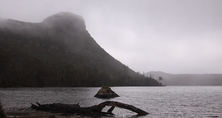
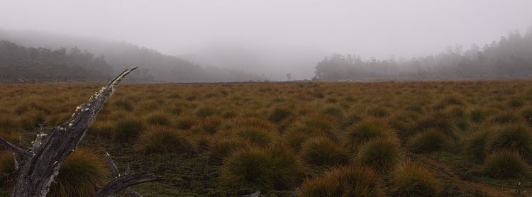
Like to go back on a nicer day!
Like to go back on a nicer day!
Re: Mt Rogoona
Thu 02 May, 2013 2:41 pm
Did you walk in on the Lake Bill Track? What was the track like as thinking of taking it to Lake Meston?
Re: Mt Rogoona
Thu 02 May, 2013 8:19 pm
Hi phlim, put a comment in your other post here.
viewtopic.php?f=3&t=12988
Wasn't an overly difficult walk and on a nice day the view walking in would be great I reckon. Apparently is around 45 minutes from Myrtle.
viewtopic.php?f=3&t=12988
Wasn't an overly difficult walk and on a nice day the view walking in would be great I reckon. Apparently is around 45 minutes from Myrtle.
Re: Mt Rogoona
Wed 08 May, 2013 2:36 pm
Great thank you - we will walk the lake Bill Track in January - probably will camp at lake Myrtle then onto Meston and the Walls.
Just purchased the Cathederal TOPO map and the track is on there so will be relatively straight forward. Thanks for the advice.
Just purchased the Cathederal TOPO map and the track is on there so will be relatively straight forward. Thanks for the advice.
Re: Mt Rogoona
Wed 08 May, 2013 7:14 pm
Pleasure.
For the record, this site shows in good detail several tracks I have been unable to see on other web sites, like the track from the Chapter Lake registration booth (I think its the Jacksons Creek track) which is now not supported by PWS.
http://www.openstreetmap.org/
Just search for Mole creek and work your way out to the area...found it really useful.
Hope you have a great walk.
© Bushwalk Australia and contributors 2007-2013.