Pelion- Arm River track.
Forum rules
Tasmania specific bushwalking discussion. Please avoid publishing details of access to sensitive areas with no tracks.
Tasmania specific bushwalking discussion. Please avoid publishing details of access to sensitive areas with no tracks.
15 posts
• Page 1 of 1
Pelion- Arm River track.
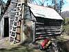
![]() by kanangra » Tue 21 Apr, 2009 11:49 am
by kanangra » Tue 21 Apr, 2009 11:49 am
I'm flying into Launceston on Friday night and heading up to Pelion on Saturday via the Arm River Track. Coming out on Monday. I see that the weather is not looking all that promising. Rain predicted on Saturday and Sunday for Devonport at least.  May have to bring a book with me. How is it looking down there?
- kanangra
- Athrotaxis selaginoides

- Posts: 1340
- Joined: Sun 25 May, 2008 3:52 pm
Re: Pelion- Arm River track.
![]() by tasadam » Tue 21 Apr, 2009 12:39 pm
by tasadam » Tue 21 Apr, 2009 12:39 pm
My weather page has all the answers.
The 4 day forecast chart shows a southwesterly stream with embedded fronts, never that promising.
Compare that with the Colour Enhanced Infrared Satellite loop and you will have a better feel for what's embedded in the chart.
The State Forecast gives a bit of a look into what's coming.
The 7 day numerical model is great for a guide.
And the Weatherzone site has a 28 day rainfall forecast by region.
Sorry to be the bearer of bad news, but I am sure regardless of the weather, walking can still be enjoyable - just to be out there in it.
-

tasadam - Magnus administratio

- Posts: 5900
- Joined: Tue 10 Apr, 2007 6:58 pm
- Location: Near Devonport, Tasmania
- ASSOCIATED ORGANISATIONS: TasmaniART, Smitten Merino, Macpac
- Region: Tasmania
- Gender: Male
Re: Pelion- Arm River track.
![]() by kanangra » Tue 21 Apr, 2009 2:35 pm
by kanangra » Tue 21 Apr, 2009 2:35 pm
Wow. It's all there. I'd better pack my rain coat.
K.
K.
- kanangra
- Athrotaxis selaginoides
- Posts: 1340
- Joined: Sun 25 May, 2008 3:52 pm
Re: Pelion- Arm River track.
![]() by tasadam » Fri 24 Apr, 2009 12:22 pm
by tasadam » Fri 24 Apr, 2009 12:22 pm
Indeed it's looking more and more like a particularly bad weekend here, weather wise.
The radar shows more - http://mirror.bom.gov.au/products/IDR521.loop.shtml
Take care / enjoy the book, whichever you do.
Tasmanian State Forecast
Issued at 11:40am on Friday the 24th of April 2009
Valid until midnight Saturday
Warnings:
1. A Gale Warning is current for lower eastern, southern and western waters between Wineglass Bay and Stanley.
2. A Strong Wind Warning is current for all remaining coastal waters.
3. A Small Craft Wind Alert is current for the Southwest and Central Plateau lakes.
4. A Road Weather Alert has been issued statewide for rain this afternoon and evening.
Tasmania:
Today:
Rain in the north and west with locally heavy falls and thunderstorms. Patchy rain elsewhere increasing for a period this afternoon or evening. Mild with fresh to strong northerly winds ahead of a cooler westerly change this evening.
Tomorrow:
Early rain in the east then showers, mainly in the west during the day. Rain then redeveloping about the northwest late afternoon and extending to the north and west during the evening with isolated thunderstorms. Cool with moderate westerly winds tending northerly later.
In Brief: Rain, tending to showers tomorrow before redeveloping about the north and west later. Locally heavy falls and thunderstorms about the north and west.
Outlook for Sunday :
Rain periods about the west. Early rain elsewhere, easing to showers, before increasing later in the southeast. Snowfalls about the highlands later. Cool to cold with moderate mostly northwest winds tending stronger southwesterly late.
Outlook for Monday :
Scattered showers about the western, central and southern districts and the Bass Strait islands where is should increase to rain later. Only isolated showers elsewhere. Showers falling as snow on the highlands. Cool to cold with moderate to fresh southwest winds easing.
Outlook for Tuesday :
Showers about the east and southeast, falling as snow about the highlands, but generally fine elsewhere. Cold with light to moderate easterly winds
The radar shows more - http://mirror.bom.gov.au/products/IDR521.loop.shtml
Take care / enjoy the book, whichever you do.
-
tasadam - Magnus administratio
- Posts: 5900
- Joined: Tue 10 Apr, 2007 6:58 pm
- Location: Near Devonport, Tasmania
- ASSOCIATED ORGANISATIONS: TasmaniART, Smitten Merino, Macpac
- Region: Tasmania
- Gender: Male
Re: Pelion- Arm River track.
![]() by kanangra » Fri 24 Apr, 2009 3:28 pm
by kanangra » Fri 24 Apr, 2009 3:28 pm
I'm just about to leave the office to catch the plane. I thought I'd take one more look on here before I did. Some update . Oh well lucky we're prepared for the worst. Tell you all about it when we get back.
K.
K.
- kanangra
- Athrotaxis selaginoides
- Posts: 1340
- Joined: Sun 25 May, 2008 3:52 pm
Re: Pelion- Arm River track.
![]() by geoskid » Fri 24 Apr, 2009 8:28 pm
by geoskid » Fri 24 Apr, 2009 8:28 pm
Geez, this really brings home how lucky we are to live here!- 1.5Hrs from home in the car and I'm at the start of the track -
Arm River, Walls, Lees Paddocks, Cradle - no excuses, must make more of an effort to do spontaneous walks. Spontaneous however normally equates to solo - so be it! I can imagine late afternoon on Friday thinking not much happening on the w/end, pack is always ready, just add food away I go - freedom, yeah!
Arm River, Walls, Lees Paddocks, Cradle - no excuses, must make more of an effort to do spontaneous walks. Spontaneous however normally equates to solo - so be it! I can imagine late afternoon on Friday thinking not much happening on the w/end, pack is always ready, just add food away I go - freedom, yeah!
Critical Thinking.. the awakening of the intellect to the study of itself.
http://www.criticalthinking.org/
http://www.criticalthinking.org/
- geoskid
- Phyllocladus aspleniifolius

- Posts: 889
- Joined: Sun 27 Apr, 2008 1:56 pm
- Region: Tasmania
- Gender: Male
Re: Pelion- Arm River track.
![]() by corvus » Fri 24 Apr, 2009 8:48 pm
by corvus » Fri 24 Apr, 2009 8:48 pm
geoskid wrote:Geez, this really brings home how lucky we are to live here!- 1.5Hrs from home in the car and I'm at the start of the track -
Arm River, Walls, Lees Paddocks, Cradle - no excuses, must make more of an effort to do spontaneous walks. Spontaneous however normally equates to solo - so be it! I can imagine late afternoon on Friday thinking not much happening on the w/end, pack is always ready, just add food away I go - freedom, yeah!
Hey "what about me" after only one day my new orthotics seem to be working and if they do
as you know I am available most weekends Mon to Mon
collige virgo rosas
-

corvus - Vercundus gearus-freakius

- Posts: 5488
- Joined: Mon 23 Apr, 2007 7:24 pm
- Location: Devonport
- Region: Tasmania
- Gender: Male
Re: Pelion- Arm River track.
![]() by geoskid » Fri 24 Apr, 2009 9:54 pm
by geoskid » Fri 24 Apr, 2009 9:54 pm
Hiya Ger.. er Corvus,
I am still happy to do Stroller walks, but also want to do spontaneous walks, and am happy to pm you and see if you are free.
I have decided on a walk to the walls on 15,16,17 May. My first to the area and a simple circuit to Dixons, Lake Adelaide and out via Trappers hut, 2 nights tenting at Dixons, peaks on middle day.
A spontaneous one I want to do is Pillinger and Mcoys Hut O/night, as we have talked about.
I know I have missed a Strollers walk to Murchison and will miss the Mt Ironstone walk, but my opportunities to go bushwalking are not unlimited, and I have a definite 'to do list', also I don't mind at all going solo.
Perhaps future Stroller walks can be a little off track or an alternative route to somewhere where a group would be beneficial, - I must admit I am a little hung up on the Walls at the moment and all the various routes in and out.
(geo)Skid.
Critical Thinking.. the awakening of the intellect to the study of itself.
http://www.criticalthinking.org/
http://www.criticalthinking.org/
- geoskid
- Phyllocladus aspleniifolius
- Posts: 889
- Joined: Sun 27 Apr, 2008 1:56 pm
- Region: Tasmania
- Gender: Male
Re: Pelion- Arm River track.
![]() by corvus » Sat 25 Apr, 2009 5:32 pm
by corvus » Sat 25 Apr, 2009 5:32 pm
geoskid wrote:Hiya Ger.. er Corvus,
I am still happy to do Stroller walks, but also want to do spontaneous walks, and am happy to pm you and see if you are free.
I have decided on a walk to the walls on 15,16,17 May. My first to the area and a simple circuit to Dixons, Lake Adelaide and out via Trappers hut, 2 nights tenting at Dixons, peaks on middle day.
A spontaneous one I want to do is Pillinger and Mcoys Hut O/night, as we have talked about.
I know I have missed a Strollers walk to Murchison and will miss the Mt Ironstone walk, but my opportunities to go bushwalking are not unlimited, and I have a definite 'to do list', also I don't mind at all going solo.
Perhaps future Stroller walks can be a little off track or an alternative route to somewhere where a group would be beneficial, - I must admit I am a little hung up on the Walls at the moment and all the various routes in and out.
(geo)Skid.
Good one dont forget to call.
c
collige virgo rosas
-
corvus - Vercundus gearus-freakius
- Posts: 5488
- Joined: Mon 23 Apr, 2007 7:24 pm
- Location: Devonport
- Region: Tasmania
- Gender: Male
Re: Pelion- Arm River track.
![]() by flyfisher » Sat 25 Apr, 2009 6:57 pm
by flyfisher » Sat 25 Apr, 2009 6:57 pm
The walls is a beautiful area summer or winter and there are indeed lots of ways to arrive or depart.
Keep me in the loop as it's one of my favourites.
FF
Keep me in the loop as it's one of my favourites.
FF
If you don't know what I'm talking about, then you need to drink more.
-
flyfisher - Athrotaxis selaginoides
- Posts: 1528
- Joined: Sat 14 Jul, 2007 8:39 pm
- Location: hobart
- ASSOCIATED ORGANISATIONS: landrover owners club of tasmania
- Region: Tasmania
Re: Pelion- Arm River track.
![]() by Darren » Sun 26 Apr, 2009 7:46 pm
by Darren » Sun 26 Apr, 2009 7:46 pm
G'Day Geoskid
On the spontaneous walk subject. For me to walk in Tassie I drive 4 hours, fly 1.5 hours then hire a car and drive to the trail head or catch a bus. I’m not complaining, I love it. I’m just starting to plan my Dec walk, Maybe Mt Anne circuit. Then in Feb. I want to do South coast.
As you can see not a lot of spontaneity but there are also many nice places near me for that
Darren
- Darren
- Athrotaxis cupressoides

- Posts: 154
- Joined: Tue 28 Oct, 2008 6:41 am
Re: Pelion- Arm River track.
![]() by corvus » Sun 26 Apr, 2009 8:36 pm
by corvus » Sun 26 Apr, 2009 8:36 pm
[quote="geoskid"
I have decided on a walk to the walls on 15,16,17 May. My first to the area and a simple circuit to Dixons, Lake Adelaide and out via Trappers hut, 2 nights tenting at Dixons, peaks on middle day.
(geo)Skid.[/quote]
geoskid ,
Count me in on this walk if you want and I suspect our mate FF would also like to be on board if his work schedule lets him,
Plenty of time for logistics so the ball is in your cart now.
Just hope my new orthotics work so I am able to do it
c
collige virgo rosas
-
corvus - Vercundus gearus-freakius
- Posts: 5488
- Joined: Mon 23 Apr, 2007 7:24 pm
- Location: Devonport
- Region: Tasmania
- Gender: Male
Re: Pelion- Arm River track.
![]() by tasadam » Mon 27 Apr, 2009 10:00 am
by tasadam » Mon 27 Apr, 2009 10:00 am
Hi there Kanangra. Looking forward to hearing how your walk went -
http://www.bom.gov.au/cgi-bin/wrap_fwo.pl?IDT13100.html
Been thinkin 'bout ya... Hope it went well.
http://www.bom.gov.au/cgi-bin/wrap_fwo.pl?IDT13100.html
Tasmanian State Forecast
Issued at 5:25am on Monday the 27th of April 2009
Valid until midnight Monday
Warnings:
1. A Gale Warning is current for eastern and southern Tasmanian coastal waters between the northern tip of Flinders Island and South East Cape excluding Banks Strait.
2. A Strong Wind Warning is current for all remaining coastal waters including Banks Strait.
3. A Small Craft Wind Alert remains current for the southwest and Central Plateau lakes.
4. A Minor Flood Warning remains current for the North Esk River.
5. A Flood Watch remains current for all southern river basins.
6. A Road Weather Alert is current for western, central and southern roads, warning of snow and ice on elevated roads.
7. A Bushwalkers Weather Alert is current for western, central and southern areas, warning of snowfalls to 700 metres.
Tasmania:
Fine in the central north and northeast with scattered showers elsewhere easing during the day. Highland snowfalls lowering to 700 metres. Cold to very cold inland at first then a cool to cold day. Fresh and gusty southwest to southerly winds gradually easing from the west during the day.
In Brief: Fine in the central north and northeast, showers elsewhere. Snow to 700 metres.
Outlook for Tuesday :
Showers in the west, south and east. Fine elsewhere. Highland snow. Very cold at first with local frost then cool to cold with moderate southerly winds.
Outlook for Wednesday :
Isolated showers in the east and later in the north. Fine elsewhere. Cool to cold, although very cold inland at first with local frost. Light winds.
Outlook for Thursday :
Isolated showers in the northeast. Fine elsewhere. Cool to cold, although very cold inland at first with local frost. Light winds tending moderate northerly later.
Been thinkin 'bout ya... Hope it went well.
-
tasadam - Magnus administratio
- Posts: 5900
- Joined: Tue 10 Apr, 2007 6:58 pm
- Location: Near Devonport, Tasmania
- ASSOCIATED ORGANISATIONS: TasmaniART, Smitten Merino, Macpac
- Region: Tasmania
- Gender: Male
Re: Pelion- Arm River track.
![]() by kanangra » Tue 28 Apr, 2009 10:08 am
by kanangra » Tue 28 Apr, 2009 10:08 am
Back in the office this morning. Flew in late last night. Absolutely fantastic trip. Weather was mixed. everything from sunshine to snow. Will post more details just as soon as I catch up on the pile of work on the desk. How I envy you guys living sown there.
- kanangra
- Athrotaxis selaginoides
- Posts: 1340
- Joined: Sun 25 May, 2008 3:52 pm
Re: Pelion- Arm River track.
![]() by kanangra » Wed 29 Apr, 2009 12:13 pm
by kanangra » Wed 29 Apr, 2009 12:13 pm
We had a wonderful weekend in the glorious Central Highlands of Tasmania. Despite adverse weather predictions we were not greatly hampered and were able to accomplish all that we set out to. Started walking at about 9:00AM on Saturday from the Arm River CP. Only one other car there. There had been heavy overnight rain and the track was very wet. The first 50 meters were all underwater as the creek had breached its banks. We had three girls in the party, all fairly new to bushwalking, and I thought I was going to have a mutiny on my hands right at the start. More sections of mud and slime were to follow before the big climb up beside the creek which was really raging. Soon Lake Price came into view with reflections of Mt Pillinger. I had noticed the track for the summit branch off just before the park sign but did not notice where it rejoined the track? New boards after the creek crossing made the next section very pleasant. In fact there was much new track work particularly from Lake Ayr on. Noticed the old Innes track come in on the left. What a major work of engineering that must have been in the late 1800s? Many of the bridge embankments were still in place! Rested up at the head of the lake and admired the view of Pelion West and Oakleigh. This was the first visit to the area for three of my party and they were all suitably impressed by the beautiful scenery. The last section into New Pelion Hut was completed quickly. There we met up with the owner of the other car in the carpark whose tracks we had been following all morning.
After lunch it was decided that a quick trip up Oakleigh could be the go. The track across the plains was very wet and I disappeared up to my waist at one spot. But once in the bush conditions improved and we were soon rewarded with great views across the plain to Ossa and Pelion West. After gaining the crest we quickly climbed to the top of the first high point. It was 4:00PM and so we decided that the summit would have to wait another day. Although I doubt it would be much higher than the point we attained? We were all safely back at the hut just on nightfall. A three course meal was the perfect end to a great day.
Sunday dawned overcast and cold. But as we made our way up towards Pelion Gap the sun came out and we were tempted to go up Ossa. But we were no sooner committed to the climb than the weather closed in. Nothing for it but to push on through fresh snow and and in places ice. The summit plateau was a desoltae place. Nothing but rock, ice and snow with visibility down to 10 meters. After the obligatory photos we bid a hasty retreat. Just as we did the cloud lifted a bit and we were treated to views out to Pelion East and away to the south. Lunched at the gap before returning to the hut. Took a late afternoon stroll out to Old Pelion and followed the old track across the river till it began to descend steeply in the direction of the Forth Valley. Anyone know if this links up with the road down below and if it is viable to walk down and out that way?
The night was even cooler and we woke to a fresh dusting of snow on the plain. It snowed on and off all morning as we walked out. It gave all the familiar terrain a completely different look. Very picturesque. Had a quick look for Mc Coy's Hut near Wurragarra Ck on the way out. Does anyone know if it is still standing? Back at the car most of the snow had melted but more blew in as we were leaving. Within an hour we were driving through verdant pastures in glowing sunshine. What countryside. What a State.
K.
- kanangra
- Athrotaxis selaginoides
- Posts: 1340
- Joined: Sun 25 May, 2008 3:52 pm
15 posts
• Page 1 of 1
Who is online
Users browsing this forum: No registered users and 15 guests