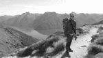
Googlemaps has a lot to answer for with its ridiculously poor algorithm for walking times in Tasmania Parks and Wildlife Service wilderness areas. No wonder inexperienced and poorly equipped people continue to get into trouble in such areas. Despite repeated attempts to get them to do something about it they simply ignore the bleeding obvious error. #googlemaps
Rangers regularly gets tourists thinking Lake Oberon is an easy day walk! I think its time for a very public campaign to get these corrected. This is only one example!
https://www.google.com/maps/dir/Huon+Ca ... 998392!3e2
No wonder people get into trouble..
Forum rules
Tasmania specific bushwalking discussion. Please avoid publishing details of access to sensitive areas with no tracks.
Tasmania specific bushwalking discussion. Please avoid publishing details of access to sensitive areas with no tracks.
14 posts
• Page 1 of 1
-

tastrax - Lagarostrobos franklinii

- Posts: 2030
- Joined: Fri 28 Mar, 2008 6:25 pm
- Location: What3words - epic.constable.downplayed
- ASSOCIATED ORGANISATIONS: RETIRED! - Parks and Wildlife Service
- Region: Tasmania
Re: No wonder people get into trouble..
![]() by north-north-west » Fri 21 Dec, 2018 9:30 am
by north-north-west » Fri 21 Dec, 2018 9:30 am
Time to take a bunch of Google executive on a walk through the WArthurs. Better still, take 'em up Farmhouse Creek...
"Mit der Dummheit kämpfen Götter selbst vergebens."
-

north-north-west - Lagarostrobos franklinii
- Posts: 15493
- Joined: Thu 14 May, 2009 7:36 pm
- Location: The Asylum
- ASSOCIATED ORGANISATIONS: Social Misfits Anonymous
- Region: Tasmania
Re: No wonder people get into trouble..
![]() by tastrax » Fri 21 Dec, 2018 9:51 am
by tastrax » Fri 21 Dec, 2018 9:51 am
Dear Google Executives,
Is there any chance you could send the Google Trekker and a couple of marathon runners on a quick 12 hour walk through the Western Arthurs? Should be an easy long day walk. It would really help the day walkers understand how beautiful that area really is.
Yours truly - frustrated Park Ranger sick of telling people its not a day walk!
-
tastrax - Lagarostrobos franklinii
- Posts: 2030
- Joined: Fri 28 Mar, 2008 6:25 pm
- Location: What3words - epic.constable.downplayed
- ASSOCIATED ORGANISATIONS: RETIRED! - Parks and Wildlife Service
- Region: Tasmania
Re: No wonder people get into trouble..
![]() by Tortoise » Fri 21 Dec, 2018 10:03 am
by Tortoise » Fri 21 Dec, 2018 10:03 am
tastrax wrote:Rangers regularly gets tourists thinking Lake Oberon is an easy day walk!
I wondered where the heck they got that idea from! We intercepted some at the track head. Mind you, the parks info there could be hugely improved to give a clear indication of what is realistic a day walk. Maybe even make a bigger song and dance at a 'designated' turnaround point. I meant to write to Parks about that, but can't remember if I ever did.
None of that detracts from the important Googlemaps issue. ( It just might help in one dangerously common spot.)
-

Tortoise - Lagarostrobos franklinii
- Posts: 5343
- Joined: Sat 28 Jan, 2012 9:31 pm
- Location: NW Tasmania
- Region: Tasmania
- Gender: Female
Re: No wonder people get into trouble..
![]() by monte » Fri 21 Dec, 2018 2:23 pm
by monte » Fri 21 Dec, 2018 2:23 pm
I'm new to all this (did my first overnighter to South Cape Rivulet a few weeks back) and it's my first post here so forgive me if I say things which are taboo 
This post pipped my interest because those tracks are on my one day if I get fit and experienced enough list and also I'm a software developer so I can see the problem really easily. Google's walking speed calculation takes into account only elevation changes but no other terrain details (probably because they don't have the data). Let's say Parks and Wildlife had the resources to determine a walking speed/terrain scaling factor for each section of trail and provided that to Google to use as a multiplier then you might get some reasonable times there. It would be a massive project to come up with that kind of data on the global scale that Google needs though.
Probably the best way to counteract Google's free bad data is with your own free good data. It seems to me that if people are using bad data and getting themselves into trouble the costs of getting them out of trouble could be significantly more than what is being made by paywalling things like 1:25000 maps or implementing something where track notes can be updated by the most recent parties on the track. Something like that could have a planning feature and give decent results based on average times of previous walkers. To be honest I find the parks website a bit frustrating. For example, I spent ages looking for info on the track to South Cape Rivulet and I only noticed that there was another campsite at Lion Rock from a dot on a map from another source and called up to check I wasn't confused. Seems crazy there isn't a rough map showing tracks and hardened campsites around the state... Luckily I know John Chapman's book is in my Christmas stocking
I bought an app called Australia Topo Maps and it's not bad... has a number of different map layer sources you can swap between but it's useless for things like campsite locations, track distances or conditions, photos and notes from other walkers, walking times etc... Would be great to have something like that, could save lives and could also let people know what they shouldn't do (like use a particular hut unless it's an emergency etc).
- monte
- Nothofagus gunnii

- Posts: 38
- Joined: Fri 21 Dec, 2018 1:24 pm
- ASSOCIATED ORGANISATIONS: Mr
- Region: Tasmania
- Gender: Male
Re: No wonder people get into trouble..
![]() by wayno » Fri 21 Dec, 2018 5:50 pm
by wayno » Fri 21 Dec, 2018 5:50 pm
same almost goes for the Tongariro crossing, marketed as the best day walk in the world, if the weather is bad its the day walk from hell... Indian tourist died of hypothermia recently, no idea about the weather. or what to wear, dead in a few hours... numerous other near misses...
most people are dressed to go to town... do a little day walk while they are at it..
most people are dressed to go to town... do a little day walk while they are at it..
from the land of the long white clouds...
-
wayno - Lagarostrobos franklinii
- Posts: 8685
- Joined: Sun 19 Jun, 2011 7:26 am
- Location: NZ
- Region: New Zealand
- Gender: Male
Re: No wonder people get into trouble..
![]() by Warin » Sat 22 Dec, 2018 7:14 am
by Warin » Sat 22 Dec, 2018 7:14 am
Giggle gives 50km and 2.5 km up and down... and 12.5 hours ... and an elevation profile that shows rapid changes ... that is a fast walking speed on good flat roads .. especially when combined with the elevation changes ... and then through muddy paths.. add in some time for looking at things and lunch ...
Not good time estimation there!
It is possible in OSM to enter details about track 'smoothness' and surface and visibility ... but I am yet to see those used for time estimations. This partiular 'route' has not been marked in OSM as a 'marked route' so it is not visible in things like https://hiking.waymarkedtrails.org/#rou ... 5!146.3121 but is present as a path.
-

Warin - Athrotaxis selaginoides

- Posts: 1467
- Joined: Sat 11 Nov, 2017 8:02 am
- Region: New South Wales
Re: No wonder people get into trouble..
![]() by RicktheHuman » Sat 22 Dec, 2018 9:50 am
by RicktheHuman » Sat 22 Dec, 2018 9:50 am
I have walked to Mt Hayes in 5.5 hours..but Oberon would be a stretch..
I lika do da cha-cha
-
RicktheHuman - Athrotaxis cupressoides

- Posts: 499
- Joined: Thu 11 Dec, 2014 2:43 pm
- Region: Tasmania
- Gender: Male
Re: No wonder people get into trouble..
![]() by JamesMc » Thu 03 Jan, 2019 3:21 pm
by JamesMc » Thu 03 Jan, 2019 3:21 pm
Met a French Canadian party at Cracroft Crossing a few years ago fully equipped with a one page print out of a google map view of the Western Arthurs Track. Didn't hear about them in the news so presumably they found their way.
- JamesMc
- Athrotaxis cupressoides
- Posts: 316
- Joined: Wed 09 Dec, 2009 5:24 pm
- Region: Victoria
- Gender: Male
Re: No wonder people get into trouble..
![]() by beardless » Thu 03 Jan, 2019 5:29 pm
by beardless » Thu 03 Jan, 2019 5:29 pm
JamesMc wrote:Met a French Canadian party at Cracroft Crossing a few years ago fully equipped with a one page print out of a google map view of the Western Arthurs Track. Didn't hear about them in the news so presumably they found their way.
Contour lines are useful.
Last summer we met a lady was coming down from having climbed Mt Anne. She was using an online map app with gps on her phone. She said something like "It is great but the map doesn't show elevation. I just followed the track. I didn't realise it would be this steep".
-
beardless - Phyllocladus aspleniifolius

- Posts: 513
- Joined: Fri 05 Jul, 2013 8:56 pm
- Region: South Australia
- Gender: Male
Re: No wonder people get into trouble..
![]() by Hot073 » Sat 23 Mar, 2019 11:48 am
by Hot073 » Sat 23 Mar, 2019 11:48 am
I use Avenza maps on my phone for the last 12 months,never had an issue with it!
- Hot073
- Atherosperma moschatum

- Posts: 65
- Joined: Wed 16 Jan, 2019 6:41 pm
- Region: Tasmania
Re: No wonder people get into trouble..
![]() by rangersac » Tue 26 Mar, 2019 12:33 pm
by rangersac » Tue 26 Mar, 2019 12:33 pm
Whilst I think anyone who relies on google for bushwalking speed estimators needs their heads examining, I do also think TasPaWS could provide more information than currently exists for many walking tracks through their website. By way of example the Parks Victoria website lists distances, approximate times, elevation changes, experience required and track gradings for multi-day walks in a very comprehensive package. Given many visitors will use google translate to get this information prior to any walks, having it listed in one place, in text format, rather than through untranslatable images such as this would be a big improvement.
- rangersac
- Athrotaxis cupressoides
- Posts: 107
- Joined: Mon 16 Apr, 2018 9:01 am
- Region: Tasmania
Re: No wonder people get into trouble..
![]() by ChrisJHC » Tue 26 Mar, 2019 12:51 pm
by ChrisJHC » Tue 26 Mar, 2019 12:51 pm
Except that the Parks Vic estimates are VERY conservative - you can usually do the hike in around 2/3 of the times they suggest.
I guess it’s better to be conservative than overly optimistic I guess.
I guess it’s better to be conservative than overly optimistic I guess.
- ChrisJHC
- Phyllocladus aspleniifolius
- Posts: 807
- Joined: Sat 25 Feb, 2017 8:22 pm
- Region: Victoria
- Gender: Male
Re: No wonder people get into trouble..
![]() by rangersac » Tue 26 Mar, 2019 1:07 pm
by rangersac » Tue 26 Mar, 2019 1:07 pm
Walks estimates for every national park I've been to worldwide are conservative, some more than others but that's always going to be the case. Years ago I did a Grand Canyon hike which had an estimate of 8-12 hours return, and it took me three. After visiting the ranger station at the end to question why the timing was so conservative, motivated because I'd pulled the pin on descending to the river and back in a day due to the trail signage advice, I was told that 90% of visitors there basically walked from the car park to the rim of the canyon and back, and they were trying to discourage anything more strenuous! Now I don't think Tasmania is that bad, however given the attire and preparation of some visitors I've seen, particularly on the Wineglass Bay lookout walk and heading up Mt Amos I do sympathise with getting the balance when describing trail timings!
- rangersac
- Athrotaxis cupressoides
- Posts: 107
- Joined: Mon 16 Apr, 2018 9:01 am
- Region: Tasmania
14 posts
• Page 1 of 1
Who is online
Users browsing this forum: No registered users and 40 guests