Unless I have missed it in the earlier posts one of the tricky and underated issues on the Western Arthurs is it is often in cloud or rain and the resulting poor visibility makes navigation difficult. The use of compass and map can be difficult due to the terrain. You cannot rely on the foot pad you are following going where you want to go or continuing. And a GPS is not the whole answer. It will not tell you if it is best to go left or right of a huge rock wall. (well maybe if it had a breadcrumb trail in it, but where is the fun in that).
So you do need to be comfortable navigating in 20 to 5M of visibility, prepared to travel slowly to get it right, be prepared to go backwards to correct rather than any other choice. And be prepared there will be a nav error somewhere.
That said in clear weather it is luverley.
Western Arthurs
Forum rules
Tasmania specific bushwalking discussion. Please avoid publishing details of access to sensitive areas with no tracks.
Tasmania specific bushwalking discussion. Please avoid publishing details of access to sensitive areas with no tracks.
42 posts
• Page 2 of 2 • 1, 2
Re: Western Arthurs
![]() by wander » Fri 18 Dec, 2009 9:33 am
by wander » Fri 18 Dec, 2009 9:33 am
- wander
- Phyllocladus aspleniifolius

- Posts: 943
- Joined: Mon 26 Oct, 2009 11:19 am
- Region: South Australia
- Gender: Male
Re: Western Arthurs
![]() by ILUVSWTAS » Fri 18 Dec, 2009 9:36 am
by ILUVSWTAS » Fri 18 Dec, 2009 9:36 am
The track going through the Arthurs is pretty easy to follow. Most of the rocky sections are cairned. I dont think it'd be too difficult in misty weather, just unpleasant, and dangerous on the slippery sections.
Nothing to see here.
-

ILUVSWTAS - Lagarostrobos franklinii

- Posts: 11027
- Joined: Sun 28 Dec, 2008 9:53 am
- Region: Tasmania
- Gender: Male
Re: Western Arthurs
![]() by chopper » Sat 19 Dec, 2009 10:35 am
by chopper » Sat 19 Dec, 2009 10:35 am
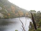
Thanks all for the advice, I think I took a bit of each suggestion on board. The most helpful was to stay at High Moor rather than push through. After a couple of days of rain and limited visibility I arrived alone at High Moor around noon just as the sun came out - a divine experience. Watched the sunset and the sunrise. In the end day one was pretty wet, windy and miserable and made it to Lake Cygnus rather than Square Lake. Second day was wet and cold and decided to stop at Oberon. Day three the weather improved and stopped at High Moor despite plans to carry on. Day four ended up being longer, High Moor to Junction Creek and out first thing on the fifth day. Ironically I was apprehensive about two parts of the track, the picture of the sidle around the beggary bump in the guidebook and the often mentioned Tilted Chasm. On the first bump out of high moor I followed the track over and down the fist bump and found some of that a little disconcerting, making me more alert of what may be to come. I arrived at Tilted Chasm and found it straightforward with minimal exposure and after the dragon was wondering were the dreaded sidle was? Read the guidebook and realised my mistake, I had gone directly over the first bump. When I do the walk again....I'll do the sidle!
- Attachments
-
-
-
- chopper
- Nothofagus cunninghamii

- Posts: 7
- Joined: Thu 10 Dec, 2009 7:24 pm
- Region: New South Wales
Re: Western Arthurs
![]() by JamesMc » Sat 19 Dec, 2009 11:55 am
by JamesMc » Sat 19 Dec, 2009 11:55 am
Terriffic photos. Glad you had a nice walk.
JamesMc
JamesMc
- JamesMc
- Athrotaxis cupressoides

- Posts: 304
- Joined: Wed 09 Dec, 2009 5:24 pm
- Region: Victoria
- Gender: Male
Re: Western Arthurs
![]() by eggs » Sat 19 Dec, 2009 8:26 pm
by eggs » Sat 19 Dec, 2009 8:26 pm
Thanks for the photos
They would have to be some of the best I have ever seen of this area.
It looks like you handled the walk very well - and a long walk from High Moor means you move pretty fast.
They would have to be some of the best I have ever seen of this area.
It looks like you handled the walk very well - and a long walk from High Moor means you move pretty fast.
-

eggs - Lagarostrobos franklinii
- Posts: 10824
- Joined: Fri 23 May, 2008 2:58 pm
- Location: Para Vista, South Australia
- Region: South Australia
Re: Western Arthurs
![]() by chopper » Sat 19 Dec, 2009 11:15 pm
by chopper » Sat 19 Dec, 2009 11:15 pm
Thanks Eggs, very nice of you to say so regarding the photos. I was using a Nikon D60 entry level DSLR and have been trying to resist my own thoughts of upgrading. These photo, my best by to date, give me hope that it's more a question of being in the right place, at the right time, with the right light rather than having a heavier more expensive body and lens.
- chopper
- Nothofagus cunninghamii
- Posts: 7
- Joined: Thu 10 Dec, 2009 7:24 pm
- Region: New South Wales
Re: Western Arthurs
![]() by dee_legg » Sun 20 Dec, 2009 7:47 am
by dee_legg » Sun 20 Dec, 2009 7:47 am
They are such amazing photos chopper! Love the depth of field in the first.
-

dee_legg - Athrotaxis cupressoides
- Posts: 447
- Joined: Mon 01 Oct, 2007 4:12 pm
- Location: Hobart
- Region: Tasmania
- Gender: Female
Re: Western Arthurs
![]() by songairen » Sun 20 Dec, 2009 11:32 am
by songairen » Sun 20 Dec, 2009 11:32 am
Gorgeous pics- now my desktop wallpaper 
- songairen
- Nothofagus gunnii

- Posts: 17
- Joined: Sun 20 Dec, 2009 9:21 am
- Region: Victoria
- Gender: Male
Re: Western Arthurs
![]() by ILUVSWTAS » Sun 20 Dec, 2009 8:51 pm
by ILUVSWTAS » Sun 20 Dec, 2009 8:51 pm
Second picture is amazing! well done on the photos and the walk!! I know how long High Moor to Junction is, we went from High Moor to Scotts. one of my longest days ever!
Nothing to see here.
-
ILUVSWTAS - Lagarostrobos franklinii
- Posts: 11027
- Joined: Sun 28 Dec, 2008 9:53 am
- Region: Tasmania
- Gender: Male
Re: Western Arthurs
![]() by stepbystep » Sun 20 Dec, 2009 8:59 pm
by stepbystep » Sun 20 Dec, 2009 8:59 pm
First pic is stunning, second is spectacular, third is sublime.
Thanks, the WA never seems to disappoint.
sbs
Thanks, the WA never seems to disappoint.
sbs
The idea of wilderness needs no defense, it only needs defenders ~ Edward Abbey
-

stepbystep - Lagarostrobos franklinii
- Posts: 7625
- Joined: Tue 19 May, 2009 10:19 am
- Location: Street urchin
- Region: Tasmania
- Gender: Male
Re: Western Arthurs
![]() by frank_in_oz » Mon 21 Dec, 2009 6:44 am
by frank_in_oz » Mon 21 Dec, 2009 6:44 am
Great thread and reinforces the value of this Fourm.
ie. advice requested, considered opinions given, some exchange on information and clarification, assistance taken and acted upon.
Feedback loop completed by a report back so others can share AND fantastic images of the area provided for all to see!
Well done to all.
ie. advice requested, considered opinions given, some exchange on information and clarification, assistance taken and acted upon.
Feedback loop completed by a report back so others can share AND fantastic images of the area provided for all to see!
Well done to all.
Frank
Check out "Our Hiking Blog" Overland Track guide, Food to Go-recipe ideas and Trekking to Everest Base Camp.
Check out "Our Hiking Blog" Overland Track guide, Food to Go-recipe ideas and Trekking to Everest Base Camp.
-
frank_in_oz - Athrotaxis cupressoides
- Posts: 372
- Joined: Fri 02 Nov, 2007 12:43 pm
- Location: Geelong, Vic
Re: Western Arthurs
![]() by north-north-west » Mon 21 Dec, 2009 7:15 pm
by north-north-west » Mon 21 Dec, 2009 7:15 pm
Brilliant photos.
And yes, I've long thought that 90% of good photography is being in the right place at the right time and having your eyes open to the possibilities.
I really, really, really have to get in there. Soon. Before I'm too old and decrepit.
And yes, I've long thought that 90% of good photography is being in the right place at the right time and having your eyes open to the possibilities.
I really, really, really have to get in there. Soon. Before I'm too old and decrepit.
"Mit der Dummheit kämpfen Götter selbst vergebens."
-

north-north-west - Lagarostrobos franklinii
- Posts: 15477
- Joined: Thu 14 May, 2009 7:36 pm
- Location: The Asylum
- ASSOCIATED ORGANISATIONS: Social Misfits Anonymous
- Region: Tasmania
42 posts
• Page 2 of 2 • 1, 2
Who is online
Users browsing this forum: No registered users and 3 guests