So Mt Dial has no easily identifiable summit/trig-point? And Mt Duncan is the highest of the four?
I'm guessing (as Mt Montgomery had perfect phone service) they're pretty safe as solo walks?
Thanks in advance
![]() by Ambience » Wed 02 Apr, 2014 9:12 am
by Ambience » Wed 02 Apr, 2014 9:12 am


![]() by pazzar » Wed 02 Apr, 2014 11:03 am
by pazzar » Wed 02 Apr, 2014 11:03 am

![]() by Tortoise » Wed 02 Apr, 2014 12:36 pm
by Tortoise » Wed 02 Apr, 2014 12:36 pm
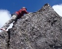
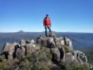
Ambience wrote:I've been up Mt Montgomery. Now to tackle Mt Dial/Gnomon/Duncan.. Can these three be done on a single circuit at all? I've read lots of conflicting information so thought I would get some ideas off here.. Though might be bad timing on gathering info as I'm planning it for tomorrow!!
So Mt Dial has no easily identifiable summit/trig-point? And Mt Duncan is the highest of the four?
I'm guessing (as Mt Montgomery had perfect phone service) they're pretty safe as solo walks?
![]() by pazzar » Wed 02 Apr, 2014 1:05 pm
by pazzar » Wed 02 Apr, 2014 1:05 pm
Tortoise wrote:I'd probably walk up the road (Hales Rd on the signs and map, not Cookes or Ironcliffe, but it's all the same road), up Duncan, turn off to tall trees track on the way down, follow it up and across Dial Rd (little dogleg iirc), continuing up the Gnomon.
![]() by Ambience » Wed 02 Apr, 2014 1:09 pm
by Ambience » Wed 02 Apr, 2014 1:09 pm
![]() by pazzar » Wed 02 Apr, 2014 1:23 pm
by pazzar » Wed 02 Apr, 2014 1:23 pm
![]() by Ambience » Wed 02 Apr, 2014 1:27 pm
by Ambience » Wed 02 Apr, 2014 1:27 pm
![]() by Tortoise » Wed 02 Apr, 2014 1:36 pm
by Tortoise » Wed 02 Apr, 2014 1:36 pm
![]() by sthughes » Wed 02 Apr, 2014 4:11 pm
by sthughes » Wed 02 Apr, 2014 4:11 pm
![]() by JackcaJ » Wed 02 Apr, 2014 4:57 pm
by JackcaJ » Wed 02 Apr, 2014 4:57 pm

![]() by Tortoise » Wed 02 Apr, 2014 6:01 pm
by Tortoise » Wed 02 Apr, 2014 6:01 pm
![]() by Eott » Thu 03 Apr, 2014 8:40 am
by Eott » Thu 03 Apr, 2014 8:40 am
![]() by sthughes » Thu 03 Apr, 2014 10:07 am
by sthughes » Thu 03 Apr, 2014 10:07 am
JackcaJ wrote:I think this may be the map Tortoise is referring too here; https://www.tasmap.tas.gov.au/do/product/25000TOPO/4244
You can buy it directly from source (the government). Also if you click on "Preview Area in LISTmap" you'll get a digital version pop up of Ulvestone, with Dial range just to the east/left.
I also plan on doing an overnight in the area, but want to avoid Penguin-Cradle Trail tracks as I'm doing that at the end of April.
![]() by Ambience » Thu 03 Apr, 2014 5:15 pm
by Ambience » Thu 03 Apr, 2014 5:15 pm
![]() by sthughes » Thu 03 Apr, 2014 9:29 pm
by sthughes » Thu 03 Apr, 2014 9:29 pm
Users browsing this forum: No registered users and 28 guests