Hi all
I'm considering heading up Mount Rogoona from Mersey Forest rd in a couple of weeks time. I know it would be a fairly big effort but am unsure if it's an unrealistic day walk. I've been able to find some info regarding walks to Lake Myrtle but there's not much to look at when going all the way through to the top of Mount Rogoona.
Does anyone have any advice from their experience in the area? The last thing I want to do is head up there with a few friends and have to turn back part way up!!
Appreciate your help
Phil
Mount Rogoona
Forum rules
Tasmania specific bushwalking discussion. Please avoid publishing details of access to sensitive areas with no tracks.
Tasmania specific bushwalking discussion. Please avoid publishing details of access to sensitive areas with no tracks.
6 posts
• Page 1 of 1
-
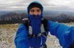
Phil - Phyllocladus aspleniifolius

- Posts: 688
- Joined: Mon 25 Aug, 2008 2:06 pm
- Location: Launceston
- Region: Tasmania
- Gender: Male
Re: Mount Rogoona
![]() by ben.h » Mon 25 May, 2009 3:00 pm
by ben.h » Mon 25 May, 2009 3:00 pm
I haven't done it myself but this description might give you a bit more info:
http://www.wildtiger.biz/index.php?tracknotes&id=33
http://www.wildtiger.biz/index.php?tracknotes&id=33
-
ben.h - Athrotaxis cupressoides

- Posts: 138
- Joined: Wed 23 Jan, 2008 6:00 pm
- Location: Hobart
Re: Mount Rogoona
![]() by Son of a Beach » Mon 25 May, 2009 3:57 pm
by Son of a Beach » Mon 25 May, 2009 3:57 pm
It takes about 3 hours to get to Lake Myrtle via the old Jackson Creek track (no longer marked), according to the time stamps on my photos, and I think it's just as long, maybe even longer via the Lake Bill track. From Lake Myrtle, the summit of Mt Ragoona Rogoona is about an hour, I think, but its about 8 years since I've been up Ragoona Rogoona, so I'm not sure. So I reckon you'd want to allow 8 hours return from Mersey Forest Road. I guess you'd be doing it a bit quicker with just a day pack, but it's still a long day, especially for the middle of winter when daylight hours are short.
You should ask Rob M. He carried 2 litres of lemonade, 1 litre of fresh milk, and 1 kilogram of lollies (amongst all the rest of his overnight kit) into Lake Myrtle, and he still walked faster than me! So maybe it's easier for some than for others.
You should ask Rob M. He carried 2 litres of lemonade, 1 litre of fresh milk, and 1 kilogram of lollies (amongst all the rest of his overnight kit) into Lake Myrtle, and he still walked faster than me! So maybe it's easier for some than for others.
Last edited by Son of a Beach on Fri 02 Sep, 2011 5:17 pm, edited 2 times in total.
Reason: Doh! I always spell this mountain incorrectly!
Reason: Doh! I always spell this mountain incorrectly!
- Son of a Beach
- Lagarostrobos franklinii

- Posts: 6929
- Joined: Thu 01 Mar, 2007 7:55 am
- ASSOCIATED ORGANISATIONS: Bit Map (NIXANZ)
- Region: Tasmania
- Gender: Male
Re: Mount Rogoona
![]() by wello » Mon 25 May, 2009 9:08 pm
by wello » Mon 25 May, 2009 9:08 pm
Hi Phil,
Mt Rogoona is do-able in a day, but you need to move fairly quickly, especially at this time of year with limited daylight. My most recent trip was a couple of years ago from the Lake Bill track. This is a pretty steep first half hour or so, then some reasonably flat walking past Lake Bill and on to Lake Myrtle. Could be a bit muddy across the button grass after wet weather. The track as far as Lake Myrtle is very good and easy to follow. From Lake Myrtle you have a couple of choices of how to go about the climb. I followed the track toward Lake Meston. About 2/3 of the way, there is a cairned route heading up to Mt Rogoona. Not sure how others have gone following it, but I was only able to stay on the broadly spaced cairns for a few hundred metres. Not to worry, the going is open due to a substantial fire about 25 years ago from which the vegetation is only slowly recovering. It takes quite a while to rock hop to the summit, which is close to a great cliff overlooking Lake Myrtle.
The other climbing option would be to go straight up from Lake Myrtle. There is a little more scrub this way, and its steeper, but probably quicker overall.
The top of the peak has numerous small tarns and is quite undulating. It would be very easy to become disoriented if the clouds dropped.
The walk took me 6.5 hours in perfect conditions, but I was really pushing hard.
Wello
- wello
- Athrotaxis cupressoides
- Posts: 147
- Joined: Sat 05 Apr, 2008 10:43 am
Re: Mount Rogoona
![]() by felidelavida » Mon 28 Feb, 2011 2:57 pm
by felidelavida » Mon 28 Feb, 2011 2:57 pm
Went up Rogoona on 25th February, and after having heard and read from several people that they couldn't find where a cairned route up from the Myrtle to Meston track began, we were determined to find it. While gung-ho walkers may find this infradig, here is a route description for newbies like me.
Take the track toward Lake Meston from Lake Myrtle and after about 10-15 minutes you reach the top of the ridge. Almost immediately you pass two short sections where there are flagstones laid along the track. At the end of the second (easternmost) section there is a thin stand of ti-tree and a sawn log (coming the other way it looks like the entrance to someone's garden). This gives on to a rounded rock bar for about 20 metres before swinging left around a fallen tree. A few metres beyond was a larger cairn which had a stick seeming to point up the mountain. The track to Meston goes directly on and it drops down a metre high step just a few metres beyond the stick cairn. The cairn line up Rogoona that we found starts here heading to the right (southward) from the main track. In fact there appear to be several sets of cairns following basically the same line up the mountain side. It's fairly instinctive where to go and once you're on top it's easy going as long as the cloud doesn't settle. The cairn line continued for about 200-300m after reaching the top then it seemed to be every walker for themself.
Take the track toward Lake Meston from Lake Myrtle and after about 10-15 minutes you reach the top of the ridge. Almost immediately you pass two short sections where there are flagstones laid along the track. At the end of the second (easternmost) section there is a thin stand of ti-tree and a sawn log (coming the other way it looks like the entrance to someone's garden). This gives on to a rounded rock bar for about 20 metres before swinging left around a fallen tree. A few metres beyond was a larger cairn which had a stick seeming to point up the mountain. The track to Meston goes directly on and it drops down a metre high step just a few metres beyond the stick cairn. The cairn line up Rogoona that we found starts here heading to the right (southward) from the main track. In fact there appear to be several sets of cairns following basically the same line up the mountain side. It's fairly instinctive where to go and once you're on top it's easy going as long as the cloud doesn't settle. The cairn line continued for about 200-300m after reaching the top then it seemed to be every walker for themself.
- felidelavida
- Nothofagus cunninghamii

- Posts: 6
- Joined: Mon 28 Feb, 2011 2:32 pm
- Region: Tasmania
- Gender: Female
Re: Mount Rogoona
![]() by north-north-west » Thu 24 Mar, 2011 8:48 pm
by north-north-west » Thu 24 Mar, 2011 8:48 pm
You must have been up there just before, or just after me.
It's pretty typical of Tassie summits: there's a cairned route to the start of the harder bits, and afterwards it's up to you to find your way.
It's pretty typical of Tassie summits: there's a cairned route to the start of the harder bits, and afterwards it's up to you to find your way.
"Mit der Dummheit kämpfen Götter selbst vergebens."
-

north-north-west - Lagarostrobos franklinii
- Posts: 15493
- Joined: Thu 14 May, 2009 7:36 pm
- Location: The Asylum
- ASSOCIATED ORGANISATIONS: Social Misfits Anonymous
- Region: Tasmania
6 posts
• Page 1 of 1
Who is online
Users browsing this forum: No registered users and 53 guests