SW Cape Circuit trip report (very basic)

Tasmania specific bushwalking discussion.
Forum rules
Tasmania specific bushwalking discussion. Please avoid publishing details of access to sensitive areas with no tracks.

SW Cape Circuit trip report (very basic)

Postby songairen » Tue 26 Jan, 2010 10:11 pm

Hi
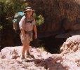
Here is a very basic trip report for our SW cape circuit trip earlier this month; sorry I can't write a nice story, am very pressed for time with work going back and all :(
I'm not sure how much I remember as well

Day 1: Melaleuca - New Harbour (about 3 hrs)
38 degree day. Left Melaleuca early with heavy packs- turnoff to New Harbour very distinct across the buttongrass. Spent the day in the shade by the floodplains and waterfall. Got sprung by group of 4 while washing naked :shock:

Day 2: New Harbour - Ketchem Bay (about 3hrs)
Some light scrub growing over track to about shoulder height. Track quite visible.

Day 3: Ketchem Bay to Wilson Bight (about 3hrs)
Found this day slower going than expected due to medium density scrub blocking the track. A little bit annoying although navigation is easy.

Day 4: Wilson Bight to Window Pane Bay (about 10 hrs)
I cut this out from my previous reply post:
Crossing the SW cape range, from Wilson's Bight to Window Pane Bay turned out to be a real trial. We were met with very poor weather along the ridges- horizontal rain (some sleet), thick cloud, and heavy winds (hence no photos). The GPS was really useful here because the cloud cover reduced our visibility to about 20m for most of the time and conditions were too poor to bother scouting for the track every time it disappeared. It took us 10 hours to walk that traverse (by comparison we did the Ironbounds in less than 5 hours) and only stopped once for a 10 minute lunch (too cold otherwise). In fact it was so cold up there we each needed to wear a thick polartec baselayer under our shells- gloves, glasses (stinging hard-driven sleet), fleece caps too. Because we expected worse weather throughout the trip, however, we were safe, dry and well equipped- I've never been so thankful to have invested in quality hardshells though. This exposed section of the route is a good reason to have the track marked as being for experienced walkers.

Day 5: Window Pane Bay- Rest Day
We met a couple who traveled Wilson - Mt. Karamu (inc. SW Cape) and then Mt. Karamu - Window Pane Bay. They found it quite windy up top but this two day venture struck us both as being a more enjoyable way to traverse the range with a higher likelihood of good views (provided you have a good tent).

Day 6: Window Pane - Murgab Creek (about 5 hrs)
Track overgrown (light scrub) in many places though quite easy to follow- Until you reach the forest behind Faults Bay. After crossing a creek just after entering the forest an uncannily convenient root helps you up the steep north embankment. The track continues up and then convincingly continues north before a fork takes you into a maze of dead trails. I think a lot of people have been lost and wandering in this area because the tracks are very clear. We got lost too (strangely our GPS was locating us in the bay itself when cross-ref with TASMAP)- but after 15mins we retraced our steps back out onto the plains where we sat down and had some lunch + R&R before walking back in. This time I noticed an almost invisible track heading east (halfway up the north bank). A small scrap of rope hangs over it about 10metres on. We walk down here and its free-sailing from there.

Day 7: Murgab - Horseshoe Inlet (about 6-7 hrs)
Track out of Murgab is not very clear but the terrain is very open and easy to navigate. After climbing the low spur (2km mark) the track can clearly be seen across the buttongrass. Easy to follow until just before Hannant Creek where there are a couple of false trails. Correct trail through the creek scrub is in the thinnest part directly below the spur you climb to the top of Pasco Range. Lovely view of Horseshoe from Pasco- track easy to see following down the pasco creek spur to horseshoe inlet. Wading around the inlet is the only real option- tea tree scrub makes skirting the edges very slow. We arrived when the water was quite high and had 3 creek swims before reaching the campsite.

Day 8: Horseshoe- Melaleuca (about 3hrs)
A short walk across the buttongrass onto the Port Davey track. Very uninteresting (and flat) walking into Melaleuca. We both agreed that visitors unfamiliar to the area would find locating the Horseshoe campsite from the opposite direction very difficult- if there was a track between Port Davey track and the site we didn't see it.

We picked up our 2nd lot of food and headed out on the Sth Coast Track the next day. Between the two I think I preferred the SW Cape circuit- the walking isn't as easy as Sth Coast but it isn't so busy and the campsites are cleaner. We encountered some pretty unhygienic campsites, some poor behaviour, and a lot of rubbish along the Sth Coast track, even spent an afternoon cleaning up the sites at Granite Beach.

Anyway here are a few pics :) I've tried to stitch some together but I'm hopeless at photo editing.........

Image
Window Pane Bay- rest day! (SWC)

Image
View to Horseshoe inlet- descending Pasco Range (SWC)

Image
Louisa Bay- the walk out to Louisa Isalnd is worth the effort (SCT)

Image
Surprise Bay- we love these shots out of the tent (SCT)
songairen
Nothofagus gunnii
Nothofagus gunnii
 
Posts: 17
Joined: Sun 20 Dec, 2009 9:21 am
Region: Victoria
Gender: Male

Re: SW Cape Circuit trip report (very basic)

Postby Son of a Beach » Wed 27 Jan, 2010 8:05 am

Thanks for the trip report and the pictures. I've not done this walk yet (nor even the South Coast track!). I hope to get there some time soon.

songairen wrote:(strangely our GPS was locating us in the bay itself when cross-ref with TASMAP)

This is probably a silly question, but did you make sure that your GPS and map were using the same map datum? Eg, AGD66, GDA94 or WGS84? This could easily put your GPS reading out by over 100 metres (I've only just learned about this sort of thing myself recently after writing some software that uses location data based on GPS readings).

Anyway here are a few pics :) I've tried to stitch some together but I'm hopeless at photo editing.

You should check out "Hugin". It's a freeware cross-platform photo stitching application. You can take full control and manually handle all the stitching points, or just let it do its thing automatically. It's very good!

Having said that, I like your pictures anyhow... we can still see the view. :-)
Son of a Beach
Lagarostrobos franklinii
 
Posts: 6929
Joined: Thu 01 Mar, 2007 7:55 am
ASSOCIATED ORGANISATIONS: Bit Map (NIXANZ)
Region: Tasmania
Gender: Male

Re: SW Cape Circuit trip report (very basic)

Postby songairen » Thu 28 Jan, 2010 7:40 pm

Hehe good call- I was pretty certain I was using the right datum but I just double checked and guess what? Out of my 4 TASMAPS the Hilliard one was using GDA94- I had assumed it was the same as the other 3 AGD66 maps! I'm glad we didn't use that map for much of the walk- It just goes to show that you should check every map and not program your waypoints at 3am! :)

I'm quite new to GPS though- just picked up a cheap etrex about 3 days before leaving- I didn't realise reading coordinates could be so complicated and was lucky to find this website explaining everything

http://www.utas.edu.au/spatial/locations/index.html

I might try Hugin- I used The GIMP for what I did above but the program is too high powered for an editing-meddler like me.
songairen
Nothofagus gunnii
Nothofagus gunnii
 
Posts: 17
Joined: Sun 20 Dec, 2009 9:21 am
Region: Victoria
Gender: Male

Re: SW Cape Circuit trip report (very basic)

Postby ecowain » Sun 31 Jan, 2010 5:22 pm

songairen wrote:Day 5: Window Pane Bay- Rest Day
We met a couple who traveled Wilson - Mt. Karamu (inc. SW Cape) and then Mt. Karamu - Window Pane Bay. They found it quite windy up top but this two day venture struck us both as being a more enjoyable way to traverse the range with a higher likelihood of good views (provided you have a good tent).


Hi, we were the couple you met at Windowpane Bay.

Yes it was quite windy up top on Mt Karamu but some of the best views around. Track out to SW Cape was fine. Water in a couple of creeks 15mins down the track to the cape from the summit of Mt K.

Only one swim on Horseshoe Inlet, the other 2 we avoided by wading out into the Inlet about 30m and the across (less than waist deep out there).

After we finished the SW Cape, we hitched a lift with TasParks boat across Bathurst Narrows in return for helping salvage the damaged dinghy with them. Then headed north and finished with a full traverse of the Arthurs and out to Scotts Peak. Very fun trip really. Glad to hear about the removal of the flying toilets, I'd been planning on writing to relevant MPs.

16 days, max pack weights 22kg and 20kg, base weights 11kg and 10kg respectively.

cheers,
owain.
ecowain
Nothofagus gunnii
Nothofagus gunnii
 
Posts: 17
Joined: Mon 14 Dec, 2009 4:51 pm
Location: Mt Victoria, the Blueys.
Region: New South Wales
Gender: Male

Re: SW Cape Circuit trip report (very basic)

Postby ILUVSWTAS » Sun 31 Jan, 2010 5:39 pm

Did this trip a couple of years ago, surprised so many peoaple talk about "the swim" we managed to wade all 3 crossing under waist deep by wading out 30+metres into the bay!! I guess people just dont realise by walking OUT into the bay you can get across easier!!

22kg?? I got a 12 day trip coming up this week and my pack is 24kg without water!!!!!!!
Nothing to see here.
User avatar
ILUVSWTAS
Lagarostrobos franklinii
 
Posts: 11027
Joined: Sun 28 Dec, 2008 9:53 am
Region: Tasmania
Gender: Male

Re: SW Cape Circuit trip report (very basic)

Postby ecowain » Sun 31 Jan, 2010 6:33 pm

ILUVSWTAS wrote:Did this trip a couple of years ago, surprised so many peoaple talk about "the swim" we managed to wade all 3 crossing under waist deep by wading out 30+metres into the bay!! I guess people just dont realise by walking OUT into the bay you can get across easier!!


At Horseshoe Creek we tried wading further out as well, but there was definitely a deeper channel there. Agree about the other creeks being wades about 30m into the inlet.

ILUVSWTAS wrote:22kg?? I got a 12 day trip coming up this week and my pack is 24kg without water!!!!!!!


Pack less :D We had a Hilleberg Kaitum 2 tent, baked fresh bread/pizzas/cakes every other night on our stove, 3L shellite between us, carried 1 to 3L of water each (depending on location), and had a good bird book with us, so weren't going completely minimalist either. Your knees feel so much happier when your weight is less, and it's so much easier scrambling in places like the Beggary Bumps if the pack is light. :)

An aside, in another post there was a comment about running shoes in mud coming off feet. If you point your toe down when you pull the foot out, it helps to break the suction.

cheers,
owain.
ecowain
Nothofagus gunnii
Nothofagus gunnii
 
Posts: 17
Joined: Mon 14 Dec, 2009 4:51 pm
Location: Mt Victoria, the Blueys.
Region: New South Wales
Gender: Male

Re: SW Cape Circuit trip report (very basic)

Postby Taurë-rana » Sun 31 Jan, 2010 6:35 pm

Owain,
I'd be interested to know what you took including food if you feel like posting it.
Cheers,
TR
Peak bagging points: 170ish
Recent walks - Picton, Wylds Crag, Rogoona
User avatar
Taurë-rana
Phyllocladus aspleniifolius
 
Posts: 960
Joined: Mon 14 Jan, 2008 8:28 pm
Location: Devonport
Region: Tasmania

Re: SW Cape Circuit trip report (very basic)

Postby climberman » Sun 31 Jan, 2010 6:55 pm

And, I'd be innerested in your bread / pizza / cakes methods ! looking to keep light but varied. Sounds like you had a great trip (no climbing gear in that pack I take it, then?).
climberman
Phyllocladus aspleniifolius
 
Posts: 657
Joined: Tue 09 Dec, 2008 7:32 pm

Re: SW Cape Circuit trip report (very basic)

Postby ILUVSWTAS » Sun 31 Jan, 2010 7:11 pm

ecowain wrote:
ILUVSWTAS wrote:Did this trip a couple of years ago, surprised so many peoaple talk about "the swim" we managed to wade all 3 crossing under waist deep by wading out 30+metres into the bay!! I guess people just dont realise by walking OUT into the bay you can get across easier!!


At Horseshoe Creek we tried wading further out as well, but there was definitely a deeper channel there. Agree about the other creeks being wades about 30m into the inlet.

ILUVSWTAS wrote:22kg?? I got a 12 day trip coming up this week and my pack is 24kg without water!!!!!!!


Pack less :D We had a Hilleberg Kaitum 2 tent, baked fresh bread/pizzas/cakes every other night on our stove, 3L shellite between us, carried 1 to 3L of water each (depending on location), and had a good bird book with us, so weren't going completely minimalist either. Your knees feel so much happier when your weight is less, and it's so much easier scrambling in places like the Beggary Bumps if the pack is light. :)

An aside, in another post there was a comment about running shoes in mud coming off feet. If you point your toe down when you pull the foot out, it helps to break the suction.

cheers,


So you were sharing? that helps keep it light!
We go totally self sufficient man for man. May be crazy, but we all like our own space and styles
owain.
Nothing to see here.
User avatar
ILUVSWTAS
Lagarostrobos franklinii
 
Posts: 11027
Joined: Sun 28 Dec, 2008 9:53 am
Region: Tasmania
Gender: Male

Re: SW Cape Circuit trip report (very basic)

Postby ecowain » Sun 31 Jan, 2010 7:12 pm

Taurë-rana wrote:Owain,
I'd be interested to know what you took including food if you feel like posting it.
Cheers,
TR


Not the best time for it now, as I'm over in NZ, and ought to be doing other things, but briefly:
Most things are lightweight options but durable.
Food - 650g per person per day - mostly home dried or staples. About 2kg flour, yeast+baking soda, then rice, pasta, all the normal.
Packs - prob 65L, one Cilogear, one Arcteryx
Tent - HB Kaitum
Light 3/4 thermarests and bum pads
Lightweight down bags (-5 one OP, one WM)
Running shoes
crocs
Fishing line to hang food
Primus omnifuel stove
2L pot plus mini "Frybake" plus metallised "teacosy" for baking
500ml bottle and 4L drom each
First aid and repair kits
My clothing (shorts, windpants, thermal pants, rainpants, l/s sunshirt, thermal top, light puffy synth jacket, paramo rainjacket, windshirt, sunhat, beanie, gloves, shell mitts, gaiters)
Lisa's - something similar but can't remember exactly
A book each to read, plus compact field guide to birds
About 10 maps?
Compass, torch, knife, trowel, toiletries etc

Hope that waffle helps some.
owain.
ecowain
Nothofagus gunnii
Nothofagus gunnii
 
Posts: 17
Joined: Mon 14 Dec, 2009 4:51 pm
Location: Mt Victoria, the Blueys.
Region: New South Wales
Gender: Male

Re: SW Cape Circuit trip report (very basic)

Postby ecowain » Sun 31 Jan, 2010 7:28 pm

climberman wrote:And, I'd be innerested in your bread / pizza / cakes methods ! looking to keep light but varied. Sounds like you had a great trip (no climbing gear in that pack I take it, then?).


Hey CM.

No climbing gear.
Maybe PM me on Chocky in a few months when I'm back for more, but briefly.

2 options

1. Easy to do things like muffins, but can't do breads, etc.
Steam baking.
Need:
Pot + lid
Some small sticks
Couple of silicon muffin cups from Coles

Method:
Put about 1cm water in bottom of pot.
Put sticks in bottom of pot to rest muffin cups on out of water
Mix up muffin/cookie/cake mix (look for ones in supermarket that only need to add water - white wings? or make your own favourite mix - much tastier)
Third to half fill the muffin cups.
Rest on sticks out of water.
Gently boil water.
Lid on to steam.
About 10mins til ready.
Makes reasonable muffins.
Experiment a bit, but that's the basics.

2. Frybake is a thick based frypan/baking dish. 2 sizes, big one is heavy! small one is reasonable, and about 15cm diameter, good for up to 2 ppl.
Best to bake in smaller quantities.
For dough - Mix up ingreds dry, incl yeast and some sugar. Add some oil.
Add water, then knead a good 10mins to activate yeast.
Leave in plastic bag (either on tummy or in sun) until risen - on a sunny afternoon it can double in size in an hour.
Bake using stove on v low heat (depressurised), on a tower made with windshield, turning regularly to not burn bottom.
Maybe turn over and keep baking...

For better results, try to find an Outback Oven tea cosy.

Hope it works. Check out "Groovy biotic cooking" on http://www.backpackinglight.com for other good ideas.
That's all from me, got to keep getting ready for 5 weeks work out tramping :D
owain.
ecowain
Nothofagus gunnii
Nothofagus gunnii
 
Posts: 17
Joined: Mon 14 Dec, 2009 4:51 pm
Location: Mt Victoria, the Blueys.
Region: New South Wales
Gender: Male

Re: SW Cape Circuit trip report (very basic)

Postby Taurë-rana » Sun 31 Jan, 2010 9:58 pm

Thanks Owain, very interesting about making muffins and bread. Enjoy your tramping, I think NZ is amazing.
Peak bagging points: 170ish
Recent walks - Picton, Wylds Crag, Rogoona
User avatar
Taurë-rana
Phyllocladus aspleniifolius
 
Posts: 960
Joined: Mon 14 Jan, 2008 8:28 pm
Location: Devonport
Region: Tasmania

Re: SW Cape Circuit trip report (very basic)

Postby songairen » Wed 03 Feb, 2010 7:54 pm

Hello again Owain :)

We can testify to Owain and Lisa's yummy stove top choccy cake- it was fluffy with tasty nuggets of melting chocolate interspersed within mmm mmmm :). Very Inventive. In fact seeing them cook made us rethink our cooking practices; we'll take a more top-down approach next time by deciding what meal we want to eat and trying to make a dehydrated version (rather than trying to invent dishes based on what we think we can dehydrate). We may be a bit restricted by our stove though- I love our $30 Aussie disposals trangia!

We carried 10 days food on the SWC leg; weight was about 25kg for me, 16-17kg for Arna. No idea what the base weight was.

I wish I'd known you were carrying a paramo jacket because I'd love to have seen it- I almost ordered a cioch jacket last year, before opting for a cheaper hardshell instead. Are the miracle stories about nikwax analogy true? You can be wet when you put it on and dry when you take it off?
songairen
Nothofagus gunnii
Nothofagus gunnii
 
Posts: 17
Joined: Sun 20 Dec, 2009 9:21 am
Region: Victoria
Gender: Male


Return to Tasmania

Who is online

Users browsing this forum: No registered users and 6 guests