Thought someone would have bought this up by now.
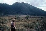
What is everyone thoughts on the idea of a new OVERLAND TRACK, going from Lake Margaret to St Clair?? Sure would make the Eldons more accessible!! Considering they are a place parks are trying to keep people away from, I doubt this project will go ahead.
Margaret to St Clair
Forum rules
Tasmania specific bushwalking discussion. Please avoid publishing details of access to sensitive areas with no tracks.
Tasmania specific bushwalking discussion. Please avoid publishing details of access to sensitive areas with no tracks.
58 posts
• Page 1 of 2 • 1, 2
-

ILUVSWTAS - Lagarostrobos franklinii

- Posts: 11027
- Joined: Sun 28 Dec, 2008 9:53 am
- Region: Tasmania
- Gender: Male
Re: Margaret to St Clair
![]() by Bap » Thu 02 Sep, 2010 11:49 am
by Bap » Thu 02 Sep, 2010 11:49 am
I saw that a couple of weeks ago in the paper, I think it is too far fetched and a total waste of money. I just love looking at the Eldons from another mountain knowing that it is still a wild place.
It is easier to go down a hill than up, but the view is much better at the top.
-

Bap - Phyllocladus aspleniifolius

- Posts: 549
- Joined: Thu 25 Mar, 2010 8:26 pm
- Location: Hobart
- Region: Tasmania
- Gender: Male
Re: Margaret to St Clair
![]() by abowen » Thu 02 Sep, 2010 12:17 pm
by abowen » Thu 02 Sep, 2010 12:17 pm
I understand that there is a very old pack trail that goes through there and this is what the proposal is based on. Would have been used in the latter half of the 19th century as a common route to get to the west coast.
I also read about parts of this track in an old 'Skyline' published by the LWC c1960. Made very interesting reading and sounded like a great adventure.
If it follows an old heritage trail then the idea may not be so bad. I like the idea of following in the steps of some tough old miners and their families. You would certainly get to apreciate their fortitude and courage. It would not have been easy country to cross and they would not have had the lighterweight gear that we carry today! Makes you wonder why they chose that particular route - was it cut that way by early explorers and surveyors and became the accepted route into the west coast area?
Andrew
Recent Walks:
Mt Gell
Mt Gell
-

abowen - Athrotaxis cupressoides

- Posts: 190
- Joined: Sat 05 Jan, 2008 8:26 am
- Location: Lindisfarne
- Region: Tasmania
- Gender: Male
Re: Margaret to St Clair
![]() by ollster » Thu 02 Sep, 2010 12:30 pm
by ollster » Thu 02 Sep, 2010 12:30 pm
ILUVSWTAS wrote:What is everyone thoughts on the idea of a new OVERLAND TRACK, going from Lake Margaret to St Clair?? Sure would make the Eldons more accessible!! Considering they are a place parks are trying to keep people away from, I doubt this project will go ahead.
Brilliant, much better than the 3 capes rubbish. I think the track should run to the north of the Eldons, between Dome Hill and Eldon Bluff. Then up past Nereus and Perrins Bluff and back onto the OLT at Pelion Hut. Alternatively it could cut back sth past the end of the Eldons and head through to the top of the Cuvier Valley and to Narcissus.
There should be more of it.
"I refuse to join any club that would have me as a member."
-

ollster - Lagarostrobos franklinii
- Posts: 3975
- Joined: Tue 02 Sep, 2008 4:14 pm
- ASSOCIATED ORGANISATIONS: LoveMyGoat.com
- Region: Australia
Re: Margaret to St Clair
![]() by frenchy_84 » Thu 02 Sep, 2010 12:53 pm
by frenchy_84 » Thu 02 Sep, 2010 12:53 pm
I personally think this is a bad idea, there already is the great overland highway another one isnt needed. I think it is best for there to be wilderness areas for the sake of wilderness areas and not for tourism. Where people who really want to go still can they just need to be experienced in doing it, not pay some commercial operator to carry them through it. There are plenty of tracks in Tasmania that are close to being 'loved' to death we dont need to create another one so as to make a few more tourist dollars in the west coast. And considering the mess parks made of the windy ridge hut (cost and design) do we really want them spending our tax dollars?
-

frenchy_84 - Athrotaxis selaginoides

- Posts: 1510
- Joined: Tue 04 Nov, 2008 7:00 pm
- Region: Queensland
- Gender: Male
Re: Margaret to St Clair
![]() by stepbystep » Thu 02 Sep, 2010 1:10 pm
by stepbystep » Thu 02 Sep, 2010 1:10 pm
There's a good argument for it, for one thing if it took even a third of the traffic off the OT this may be beneficial, but then f84 has a good point, soon there would be tracks leading off it in all directions like the OT and we would end up with 2 highways, and a much larger footprint than just one track.
But this state sorely needs more income streams, and there is an argument that there are plenty of 'untouched' wilderness areas to explore.
Historical interpretation such as Andrew suggests doesn't seem to pull tourists into wilderness areas as much as the grand vistas and photo ops, but should and could be promoted more, all over Tas.
So, not really being sure I'd have to say No, but might be persuaded. I do feel spilnters in my butt over this one!
BTW - 3 Capes walk is a total joke and waste of $$$ IMHO.
But this state sorely needs more income streams, and there is an argument that there are plenty of 'untouched' wilderness areas to explore.
Historical interpretation such as Andrew suggests doesn't seem to pull tourists into wilderness areas as much as the grand vistas and photo ops, but should and could be promoted more, all over Tas.
So, not really being sure I'd have to say No, but might be persuaded.
BTW - 3 Capes walk is a total joke and waste of $$$ IMHO.
The idea of wilderness needs no defense, it only needs defenders ~ Edward Abbey
-

stepbystep - Lagarostrobos franklinii
- Posts: 7625
- Joined: Tue 19 May, 2009 10:19 am
- Location: Street urchin
- Region: Tasmania
- Gender: Male
Re: Margaret to St Clair
![]() by frenchy_84 » Thu 02 Sep, 2010 1:22 pm
by frenchy_84 » Thu 02 Sep, 2010 1:22 pm
theres also a difference between exploring an untouched area with people who are experinced in minimal imapct bushwalk and a highway like the overland track with 2 (i assume a public one and then a commercial one) massive huts at each camp area
-
frenchy_84 - Athrotaxis selaginoides
- Posts: 1510
- Joined: Tue 04 Nov, 2008 7:00 pm
- Region: Queensland
- Gender: Male
Re: Margaret to St Clair
![]() by tastrax » Thu 02 Sep, 2010 3:19 pm
by tastrax » Thu 02 Sep, 2010 3:19 pm
I just want to know how they are going to provide the track for $50,000 as indicated in the paper!
-

tastrax - Lagarostrobos franklinii
- Posts: 2032
- Joined: Fri 28 Mar, 2008 6:25 pm
- Location: What3words - epic.constable.downplayed
- ASSOCIATED ORGANISATIONS: RETIRED! - Parks and Wildlife Service
- Region: Tasmania
Re: Margaret to St Clair
![]() by Bap » Thu 02 Sep, 2010 3:22 pm
by Bap » Thu 02 Sep, 2010 3:22 pm
I think the $50,000 was for someone to walk through a complete a study/tag a route.
It is easier to go down a hill than up, but the view is much better at the top.
-
Bap - Phyllocladus aspleniifolius
- Posts: 549
- Joined: Thu 25 Mar, 2010 8:26 pm
- Location: Hobart
- Region: Tasmania
- Gender: Male
Re: Margaret to St Clair
![]() by ILUVSWTAS » Thu 02 Sep, 2010 3:23 pm
by ILUVSWTAS » Thu 02 Sep, 2010 3:23 pm
Yes it was for a track cutter to cut a track.
This wouldnt be boardwalked or anything soft like on the OT. It'd be a nice potentially muddy slog track!!
This wouldnt be boardwalked or anything soft like on the OT. It'd be a nice potentially muddy slog track!!
Nothing to see here.
-
ILUVSWTAS - Lagarostrobos franklinii
- Posts: 11027
- Joined: Sun 28 Dec, 2008 9:53 am
- Region: Tasmania
- Gender: Male
Re: Margaret to St Clair
![]() by stu » Thu 02 Sep, 2010 3:24 pm
by stu » Thu 02 Sep, 2010 3:24 pm
I'd like to see a more detailed outline of the old route / track plan, the map in the paper was pretty vague.
Some of us have walked the stretch from Mt Arrowsmith to Calders LO - we followed some of this old pack track here, it was still discernable in sections, if overgrown.
Not sure about my stance on this one, like SBS I can see the merits & negatives of such a proposal.
I must say, with plans to do the Eldons + extras end of next year, the fact that this is such a remote, wild, inaccessible region has massive appeal, if it were tracked some of the magic would certainly disappear
-

stu - Lagarostrobos franklinii
- Posts: 2168
- Joined: Fri 02 May, 2008 8:31 am
- Region: Tasmania
Re: Margaret to St Clair
![]() by ILUVSWTAS » Thu 02 Sep, 2010 3:29 pm
by ILUVSWTAS » Thu 02 Sep, 2010 3:29 pm
stubowling wrote:
I must say, with plans to do the Eldons + extras end of next year, the fact that this is such a remote, wild, inaccessible region has massive appeal, if it were tracked some of the magic would certainly disappear
DING! Top of the class for you Mr B. SOME areas need to stay remote!!!
Nothing to see here.
-
ILUVSWTAS - Lagarostrobos franklinii
- Posts: 11027
- Joined: Sun 28 Dec, 2008 9:53 am
- Region: Tasmania
- Gender: Male
Re: Margaret to St Clair
![]() by ollster » Thu 02 Sep, 2010 4:08 pm
by ollster » Thu 02 Sep, 2010 4:08 pm
tastrax wrote:I just want to know how they are going to provide the track for $50,000 as indicated in the paper!
If you pay me $50k tax free, I'll walk up and down that area for a year. Then you will have a track. I'll even carry some signs, poles etc, make some cairns. Deal?
PS: ILSWT and Stu, you're being such elitists. The Arsonist would be proud.
"I refuse to join any club that would have me as a member."
-
ollster - Lagarostrobos franklinii
- Posts: 3975
- Joined: Tue 02 Sep, 2008 4:14 pm
- ASSOCIATED ORGANISATIONS: LoveMyGoat.com
- Region: Australia
Re: Margaret to St Clair
![]() by ILUVSWTAS » Thu 02 Sep, 2010 4:16 pm
by ILUVSWTAS » Thu 02 Sep, 2010 4:16 pm
Lol.
Im sure even Olympus was once a remote peak..... please dont put us in the same book as him though oll.....
Yeh i'd do that for 50k too, not a bad way to spend a working year......
Im sure even Olympus was once a remote peak..... please dont put us in the same book as him though oll.....
Yeh i'd do that for 50k too, not a bad way to spend a working year......
Nothing to see here.
-
ILUVSWTAS - Lagarostrobos franklinii
- Posts: 11027
- Joined: Sun 28 Dec, 2008 9:53 am
- Region: Tasmania
- Gender: Male
Re: Margaret to St Clair
![]() by tastrekker » Thu 02 Sep, 2010 10:24 pm
by tastrekker » Thu 02 Sep, 2010 10:24 pm
stubowling wrote:...the map in the paper was pretty vague.
Which paper? I would be interested to see the vague map if someone could scan it in.
-

tastrekker - Athrotaxis cupressoides
- Posts: 499
- Joined: Thu 20 Sep, 2007 9:04 pm
- Location: Lenah Valley
- Region: Tasmania
- Gender: Male
Re: Margaret to St Clair
![]() by tastrekker » Thu 02 Sep, 2010 10:45 pm
by tastrekker » Thu 02 Sep, 2010 10:45 pm
If a pot of money was available, perhaps filling in some of the gaps in the north-south Trans-Tasmania route would make more sense. I'll start a topic to that end and see what the response is like.
-
tastrekker - Athrotaxis cupressoides
- Posts: 499
- Joined: Thu 20 Sep, 2007 9:04 pm
- Location: Lenah Valley
- Region: Tasmania
- Gender: Male
Re: Margaret to St Clair
![]() by vagrom » Thu 02 Sep, 2010 11:16 pm
by vagrom » Thu 02 Sep, 2010 11:16 pm
This would have to be the old Innes Track, that leaves the Overland Track south of Lake Will and heads off in the direction of the Granite Tor Wilderness? If so, they might aim for it to come out south of Tullah and just north of Mt Murchison. But the southern end of the reservoir now encroaches upon the old bridged crossing of the Sophia(?).
So access to Lake Margaret or the Eldons would still require quite a trip south from the western end, down to the Tyndalls.
It would be great, but then again horrible if done horribly. Tullah would obviously be happy.
If this is the old track they're thinking of reopening then surely the Eldons would remain remote and viewed beautifully from the Granite Tor.
Google offers a bit on the Innes Track and Wiki answers to Mt Geikie with some links.
Surgite et .. andiamo!
-

vagrom - Athrotaxis selaginoides
- Posts: 1006
- Joined: Thu 25 Mar, 2010 10:27 pm
- Location: Adelaide
- ASSOCIATED ORGANISATIONS: WalkingSA, Frnd Cleland/Bushcare, Alltrails
- Region: South Australia
Re: Margaret to St Clair
![]() by eggs » Fri 03 Sep, 2010 12:02 am
by eggs » Fri 03 Sep, 2010 12:02 am
Wasn't there another old track that went near Gould's Sugerloaf?
-

eggs - Lagarostrobos franklinii
- Posts: 10861
- Joined: Fri 23 May, 2008 2:58 pm
- Location: Para Vista, South Australia
- Region: South Australia
Re: Margaret to St Clair
![]() by Swifty » Fri 03 Sep, 2010 4:56 am
by Swifty » Fri 03 Sep, 2010 4:56 am
Indeed, eggs. Here is a link to some documentation on the Counsel-Ewart track (1900 - 1901) which led from Lake St Clair to Eldon Bluff and then on to the Tyndall Range. Keith Lancaster was able to follow some of the original route in 1951 going from Lake Petrarch to High Dome, though even then it was overgrown. The Innes track went from the Pelion Plains to the King River bridge, apparently (?).
I plan to do this one day, whether there is a new track in there or not
http://docs.google.com/viewer?a=v&q=cac ... xtkGgHzb3w
I plan to do this one day, whether there is a new track in there or not
http://docs.google.com/viewer?a=v&q=cac ... xtkGgHzb3w
Swifty
Ossua vetera
Ossua vetera
-
Swifty - Athrotaxis cupressoides
- Posts: 351
- Joined: Wed 10 Dec, 2008 3:56 pm
- Location: Perth
- Region: Western Australia
- Gender: Male
Re: Margaret to St Clair
![]() by ILUVSWTAS » Fri 03 Sep, 2010 7:56 am
by ILUVSWTAS » Fri 03 Sep, 2010 7:56 am
Yes Eggs/Swifty. The proposed route follows Ewarts old track.
Over Pyramid Mtn, to Last Hill.
That is the route they were talking about putting the track through.
It was in last Sundays Mercury.
Over Pyramid Mtn, to Last Hill.
That is the route they were talking about putting the track through.
It was in last Sundays Mercury.
Nothing to see here.
-
ILUVSWTAS - Lagarostrobos franklinii
- Posts: 11027
- Joined: Sun 28 Dec, 2008 9:53 am
- Region: Tasmania
- Gender: Male
Re: Margaret to St Clair
![]() by ILUVSWTAS » Fri 03 Sep, 2010 8:01 am
by ILUVSWTAS » Fri 03 Sep, 2010 8:01 am
Cant be bothered scanning right now, but heres a webshot of it.
- Attachments
-
- Photo_00003.jpg (39.31 KiB) Viewed 7606 times
Nothing to see here.
-
ILUVSWTAS - Lagarostrobos franklinii
- Posts: 11027
- Joined: Sun 28 Dec, 2008 9:53 am
- Region: Tasmania
- Gender: Male
Re: Margaret to St Clair
![]() by E.G. » Fri 03 Sep, 2010 8:14 am
by E.G. » Fri 03 Sep, 2010 8:14 am
I think that it was 1902 when Ewart cleared out the old track made by Moore in 1877, which is based on much earlier tracks by Burgess and Counsel. This route was abandoned when Moore found the better Linda Track which is now largey the Lyell Higway. It was too exposed and there were some stories of difficult trips through there. Binks 'Explorers of Western Tasmania' has a lot of information about these tracks. Ewarts other track (1901), which Swifty calls Innes' comes from the Pelion Plains, off the Mole Creek Track aka Innes', and joins this track.
-
E.G. - Nothofagus gunnii

- Posts: 47
- Joined: Fri 09 May, 2008 5:56 pm
- Region: Tasmania
Re: Margaret to St Clair
![]() by oldina » Fri 03 Sep, 2010 1:39 pm
by oldina » Fri 03 Sep, 2010 1:39 pm
Afternoon All,
Whilst this proposed track has some historical interest it certainly does not warrant the construction of yet another environmental headache for parks to have to "manage".
The Eldon's should be kept as they are, relatively wild, but definitely not inaccesible. For those walkers with the appropriate ability it is a great trip, lets not ruin it by providing another "highway". In any case "parks" cannot manage properly what they already have. We should treat this as yet more polical spin designed to take our minds of the real issues, ie government mismanagement and money wasting.
Best wishes to you all and keep walking I say.
Cheers
Oldina
- oldina
- Nothofagus cunninghamii

- Posts: 2
- Joined: Fri 03 Sep, 2010 1:26 pm
- Region: Tasmania
- Gender: Female
Ewarts Track
![]() by taswegian » Fri 03 Sep, 2010 7:35 pm
by taswegian » Fri 03 Sep, 2010 7:35 pm
Many years ago my brother and I were walking (scrub bashing) to Goulds SL and I found an old survey mark that I traced to the Ewarts track.
My mind is open to this and one I can see merit in.
I am aware of the need for caution against opening up other areas but what do we do when quietly we (I) wander around in the bush, bagging obscure peaks and searching out other lost tracks/ worlds etc?
It is easy to become part of the very problem that many have concerns for.
-
taswegian - Phyllocladus aspleniifolius
- Posts: 899
- Joined: Tue 27 Jul, 2010 8:34 pm
- Region: Tasmania
- Gender: Male
Re: Margaret to St Clair
![]() by BarryJ » Fri 03 Sep, 2010 7:48 pm
by BarryJ » Fri 03 Sep, 2010 7:48 pm
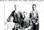
The full text from "The Mercury" archive (http://www.themercury.com.au/article/20 ... -news.html):
New tracks open possibilities
HELEN KEMPTON | August 29, 2010 12.01am
TASMANIA could soon boast another eco-tourism drawcard to take pressure off the Overland Track and other wilderness walks.
Historians, walking enthusiasts and the West Coast Council are lobbying the State Government to put some of the $250,000 earmarked to develop tourism ideas for the Lake Margaret power precinct towards redeveloping an historic pack-horse track between it and the Lake St Clair-Cradle Mountain National Park.
The track was first carved out in the 1850s to give miners access to the West Coast fields.
For 30 years, the 60km overland track provided the only direct overland access between Tasmania's south and west.
The route was uncovered by surveyor G.W. Burgess in the 1852, when he and a team of men walked unhindered across rounded summits and ridges, chopping a narrow track through prickly scorparia.
The track follows a ridgeline which has become the boundary of the Cradle Mountain-Lake St Clair National Park, the Franklin Gordon Wild Rivers National Park and the Southwest Conservation Area.
Proponents say it could cost as little as $50,000 to thoroughly map, mark and identify the track before construction work began.
"Tasmanian needs more walking tracks and the overloading of Overland Track and poor condition of the Frenchman's Cap track support the argument for more wilderness options," West Coast Mayor Darryl Gerrity said.
Two tracks are being considered: one from Lake Margaret to Cradle Mountain; the other to Lake St Clair.
"These tracks, if they eventuate, would provide high-value, world-class wilderness experiences," Cr Gerrity said.
Track supporter Chris Martin said re-construction of the track would give Lake Margaret a high-profile tourism status and may drive private investor interest in the existing Lake Margaret Village and Queenstown.
A track cutter has estimated it could cost as little as $50,000 to reopen the route and Tourism Minister Michelle O'Byrne said a steering group had been formed.
- BarryJ
- Athrotaxis cupressoides
- Posts: 207
- Joined: Sun 11 Mar, 2007 6:56 pm
- Location: Glenorchy, Tasmania
- Region: Tasmania
- Gender: Male
Re: Margaret to St Clair
![]() by Liamy77 » Sat 04 Sep, 2010 12:52 am
by Liamy77 » Sat 04 Sep, 2010 12:52 am
and here's me thinking that with parks removing tracks and huts from new maps as they couldn't manage them they already had their hands full???!
Taggunnah
GRAVITY... IS A HARSH MISTRESS!
knowledge's lighter than gadgets..but gadgets can be fun!
GRAVITY... IS A HARSH MISTRESS!
knowledge's lighter than gadgets..but gadgets can be fun!
-
Liamy77 - Auctorita modica

- Posts: 1552
- Joined: Tue 20 Apr, 2010 4:36 pm
- Location: Southern Channel, Tas.... but sometimes i leave n walk around elsewhere!
- ASSOCIATED ORGANISATIONS: Woodbridge Organics
- Region: Tasmania
- Gender: Male
Re: Margaret to St Clair
![]() by north-north-west » Mon 06 Sep, 2010 7:11 pm
by north-north-west » Mon 06 Sep, 2010 7:11 pm
Bet there'll be private operators being encouraged to do as much maintenance as possible.
And/or a charge for walkers.
And/or a charge for walkers.
"Mit der Dummheit kämpfen Götter selbst vergebens."
-

north-north-west - Lagarostrobos franklinii
- Posts: 15494
- Joined: Thu 14 May, 2009 7:36 pm
- Location: The Asylum
- ASSOCIATED ORGANISATIONS: Social Misfits Anonymous
- Region: Tasmania
Re: Margaret to St Clair
![]() by Liamy77 » Mon 06 Sep, 2010 7:18 pm
by Liamy77 » Mon 06 Sep, 2010 7:18 pm
sometimes i think this can be good... private enterprise is often run more efficiently than govt...
but i do support our govt too - heaven knows they need all the support they can get
at the same time there is the profit driven problems (like the average joe havin to get a second mortgage in order to afford the guided walk)
one day i might even get off the fence and go one way or the other!....
but i do support our govt too - heaven knows they need all the support they can get
at the same time there is the profit driven problems (like the average joe havin to get a second mortgage in order to afford the guided walk)
one day i might even get off the fence and go one way or the other!....
Taggunnah
GRAVITY... IS A HARSH MISTRESS!
knowledge's lighter than gadgets..but gadgets can be fun!
GRAVITY... IS A HARSH MISTRESS!
knowledge's lighter than gadgets..but gadgets can be fun!
-
Liamy77 - Auctorita modica
- Posts: 1552
- Joined: Tue 20 Apr, 2010 4:36 pm
- Location: Southern Channel, Tas.... but sometimes i leave n walk around elsewhere!
- ASSOCIATED ORGANISATIONS: Woodbridge Organics
- Region: Tasmania
- Gender: Male
Re: Margaret to St Clair
![]() by tastrekker » Tue 07 Sep, 2010 10:07 am
by tastrekker » Tue 07 Sep, 2010 10:07 am
Hmmm...
I haven't been back to this discussion since starting my own tangent suggesting a Trans Tasmania track. Thanks ILUVSWTAS and BarryJ for posting the map and article. I now realise the suggestion is for a triangular route. The eastern side would be the Overland Track and the southern side a traverse of the Last Hill to Goulds Sugarloaf ridge. As per previous entries here, it looks like the western side of the triangle could one of two routes. A traverse of the Tyndalls before somehow crossing the Murchison Valley to reach the Innes Track to Cradle or the Ewarts Track which descended the Murchison and Wallace Valleys to emerge on the OT over the sadlle between Ossa and Thetis. The Innes Track covers a much larger distance from Lake Margaret but the Ewarts Track uses a fair bit of the Overland Track which goes against the 'relieving the pressure' argument.
Amusingly the image in the paper shows the track crossing Lake Burbury. Lake Murchison would be a challenge for any link between the Tyndalls and Innes Track. Any of the proposed routes would involve a near-epic descent and climb in and out of the Eldon or Murchison valleys. This would be the down-hill equivalent of the Ironbounds on the South Coast Track. There are no climbs or descents that dramatic on the Overland Track. I've seen plenty of walkers battling up the hill out of Frog Flats. The climbs on these proposed tracks would make Frog Flats pale into insignificance.
Having now read some more about Margaret to St Clair / Cradle I'm still not a fan.
-
tastrekker - Athrotaxis cupressoides
- Posts: 499
- Joined: Thu 20 Sep, 2007 9:04 pm
- Location: Lenah Valley
- Region: Tasmania
- Gender: Male
Re: Margaret to St Clair
![]() by north-north-west » Wed 08 Sep, 2010 6:28 pm
by north-north-west » Wed 08 Sep, 2010 6:28 pm
Dunno, a loop would be nice. Saves having to organise transport.
"Mit der Dummheit kämpfen Götter selbst vergebens."
-
north-north-west - Lagarostrobos franklinii
- Posts: 15494
- Joined: Thu 14 May, 2009 7:36 pm
- Location: The Asylum
- ASSOCIATED ORGANISATIONS: Social Misfits Anonymous
- Region: Tasmania
58 posts
• Page 1 of 2 • 1, 2
Who is online
Users browsing this forum: No registered users and 41 guests