by Jon MS » Wed 14 Jul, 2021 4:12 pm
I was in two minds as to whether to reply to the previous post made on tue 13 July, but on reflection decided that it contained so many misleading statements that are important to refute and/or put into context.
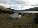
The main area covered by this topic is the remote, rarely visited Low Rocky Point region. Over the past 35 years I have walked through this location over 16 times and visited it on at least 10 other occasions (ie almost every year).
The Low Rocky Point track was put in in the 1950s to build and service the Low Rocky Point lighthouse and the region was then subjected to intensive mineral exploration between the 1950s and 1980s. The direct route from Birchs Inlet, without side tracks, is over 70 km long and now has extensive erosion and 1000s of bog holes. Due to the amount of peat soil the track has not been trafficable by 4wd vehicles for over 40 years. The main vehicles used for mineral exploration were 4wd Haflingers and tracked Bombardiers, which have a much greater off-road ability than most vehicles and are not easily available now.
By about 7 years ago the bridges over the Lewis and Wanderer Rivers had become very unsafe, mainly due to metal corrosion, but also the rotting out of their wooden joists and decking. The Lewis River bridge was also impacted during the 2019 bushfires with part of its wooden joists and decking burnt out. The extent of the bridge’s corrosion is such that it is not be possible to make the bridges safe without total replacement. These are significant sized bridges. The Lewis River bridge is about 50 m long, made using steel girders and is about 15 m above river level. To fix the Low Rocky Point track to a standard usable by 4wd vehicles would cost millions. Even to get it to quad bike standard would cost $100 000s. As a result, Parks stopped quads and motor bikes using the track. Due to this the quad bike riders also stopped using the Cowrie Beach campsite.
Every year we used to clean up the Cowrie Beach campsite, collecting and removing 100s of beer cans and bottles each time. Once the quad bike riders stopped using the Cowrie Beach campsite the number of beer cans and bottles being left dropped by at least 99%!!! There have also has been no live trees cut down at Cowrie Beach since the quads stopped going there. The quad bike riders also pushed tracks about 15 km towards the southwest, including into the World Heritage Area.
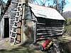
As regards the Fincham track over the Raglan Range, in the 1990s Parks spent a lot of money fixing it up so 4wds could use it but the track quickly washed out again, the southern end got very muddy and the bridge over the Nielson River rotted out. Vehicle based users also left heaps of rubbish around the old HEC hut at Fincham. In the 1990s Parks also fixed up the Mt McCall track (I note that this track has not been complained about…). Last time I drove my 4wd into Mt McCall the track was in reasonable condition.
Between Low Rocky Point and Strahan, in the area around Birthday Bay, quad and motor bike riders have been doing lots of track cutting, arson fires, digging up Aboriginal middens with their bikes and building huts. I know of about 10 huts that have been built in the last decade. Some of these hut sites would be best described as villages, with multiple huts and TONNES of rubbish.
The problem is simple.
If quad and motor bike users respected the area they would be able to get permits. Yes, some bushwalkers leave rubbish or light campfires on peat soil, but they are a small minority. The simple reality is that a very large proportion (at least 95%) of quad and motor bike riders do not do the right thing, and they are the ones responsible for getting everybody else being restricted. If complaints are going to be made, these complaints need to target those responsible for the overwhelming majority of the damage, quad and motor bike riders.