Forum rules
Only administrators may post new topics to this forum. Registered users can post replies.Re: Game - "Where am I ?"
Wed 01 Jul, 2009 2:08 pm
We had a thorooughly enjoyable walk up there last month, we only got showered on once and it was as we were crossing Blizzard Plains. There was a lot of water in the area then, I'd hate to imagine (actually I'd love to imagine) how muh water is up there now!
Over to you.........
Re: Game - "Where am I ?"
Wed 01 Jul, 2009 2:36 pm
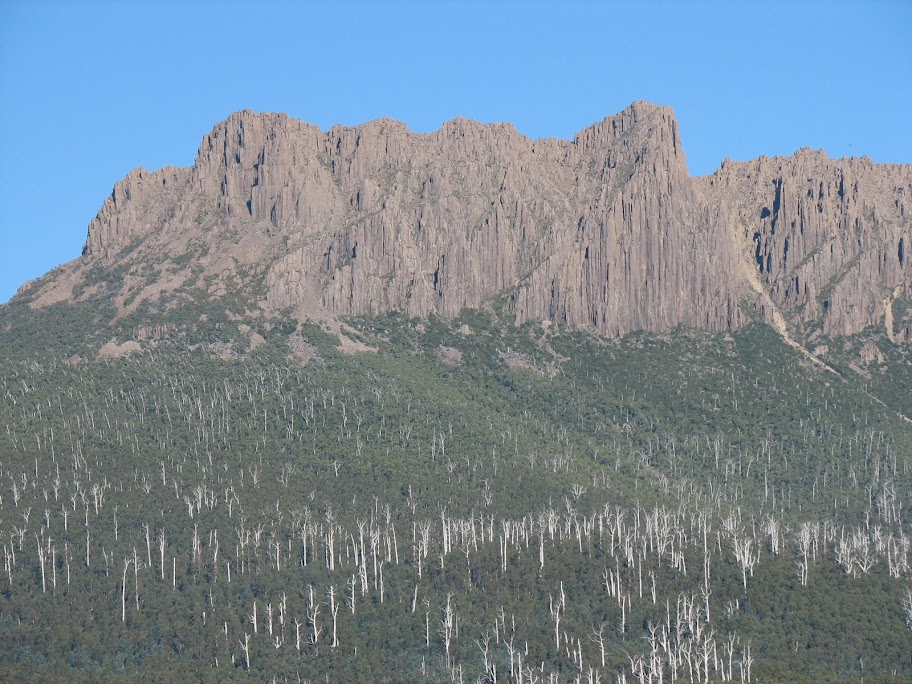
ok here is yet another picture with mountains in it
Re: Game - "Where am I ?"
Wed 01 Jul, 2009 2:45 pm
Re: Game - "Where am I ?"
Wed 01 Jul, 2009 2:51 pm
Re: Game - "Where am I ?"
Wed 01 Jul, 2009 2:51 pm
Re: Game - "Where am I ?"
Wed 01 Jul, 2009 2:52 pm
Re: Game - "Where am I ?"
Wed 01 Jul, 2009 3:03 pm
Re: Game - "Where am I ?"
Wed 01 Jul, 2009 3:04 pm
you're both right though, tas-man looks like you just pipped phil
Re: Game - "Where am I ?"
Wed 01 Jul, 2009 3:05 pm
that view is of the flat part of the track
By full Arthurs - do you mean East & West?
Re: Game - "Where am I ?"
Wed 01 Jul, 2009 3:12 pm
Re: Game - "Where am I ?"
Wed 01 Jul, 2009 4:03 pm
Re: Game - "Where am I ?"
Wed 01 Jul, 2009 4:04 pm
Re: Game - "Where am I ?"
Wed 01 Jul, 2009 4:18 pm
Re: Game - "Where am I ?"
Wed 01 Jul, 2009 4:30 pm
kramster wrote:By the looks of them Islands (which look like the Matsuyker group)... I'm guessing somewhere far South West... maybe on the hills just west of Ketcham Bay?
Yes its the Matsuyker group . . . . and Ketchen Bay is in that area
Phil wrote:Never been to the area but a guess.............on the South Coast Track.......possibly overlooking the Cox bite area?
Not on the South Coast Track, not on any track
Re: Game - "Where am I ?"
Wed 01 Jul, 2009 4:38 pm
from where you took the photo of the year 2008!
This is a nice photo Tas-man
Did you come up from New Harbour? And which way did you exit?
Re: Game - "Where am I ?"
Wed 01 Jul, 2009 4:53 pm
eggs wrote:It looks like you are approaching the top of the New Harbour Range
from where you took the photo of the year 2008!
This is a nice photo Tas-man
Did you come up from New Harbour? And which way did you exit?
Got it in one again, eggs
Re: Game - "Where am I ?"
Wed 01 Jul, 2009 4:59 pm
Part of my dreaming about future walks.
I know phil was just pipped recently - would you like to post the next one phil?
Edit - looking back, it appears phil only has access at work - so I will post one more to keep it going
Re: Game - "Where am I ?"
Wed 01 Jul, 2009 6:03 pm
Dave
Re: Game - "Where am I ?"
Wed 01 Jul, 2009 6:19 pm
A great place to watch the setting sun
Over to you
Re: Game - "Where am I ?"
Wed 01 Jul, 2009 6:37 pm
- Attachments
-
Re: Game - "Where am I ?"
Wed 01 Jul, 2009 7:40 pm
Maybe if I ask a question or two we can eliminate some possibilities.
Is it Western Arthurs?
Re: Game - "Where am I ?"
Wed 01 Jul, 2009 7:44 pm
I can see Mt Alderbaran & the distinctive tower which is over Haven Lake
Re: Game - "Where am I ?"
Wed 01 Jul, 2009 7:47 pm
Dave
Re: Game - "Where am I ?"
Wed 01 Jul, 2009 7:48 pm
TR
Edit: change my guess - maybe the other side - from Mt Sirius looking east...
Re: Game - "Where am I ?"
Wed 01 Jul, 2009 8:34 pm
A place I would love to camp at - its in the planning/dreaming...
Re: Game - "Where am I ?"
Wed 01 Jul, 2009 8:44 pm
Dave
Re: Game - "Where am I ?"
Wed 01 Jul, 2009 8:50 pm
Would someone else like to post the next one - I notice flyfisher is on tonight and he has missed a few turns where he had won.
Re: Game - "Where am I ?"
Wed 01 Jul, 2009 8:57 pm
an easy one
[Edit by Mod - to put the image here]
Re: Game - "Where am I ?"
Wed 01 Jul, 2009 10:23 pm
It's a peak in the mt. Field nat.park
ff
Re: Game - "Where am I ?"
Wed 01 Jul, 2009 10:51 pm
the link is fine
And I was thinking Eldon Bluff - way off..
I suspect this game has some rather slow patches - and tonight is one of them.
Are you able to watch it tomorrow if someone answers?
© Bushwalk Australia and contributors 2007-2013.