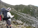
From the Falls Creek Road near Bogong Village a 4WD track goes west to the ridge and The Springs. Just above the road is a dam. Can anyone advise if the area near the dam is flat enough to camp on? Also, is the dam accessible for water? If not, contouring into the creek due west seems to be an option. Has anyone got water here?
From the foot of The Staircase it’s hoped to get a lift to Mt Beauty. If not, walking six kilometre west to 195377 and then south west under the power lines to the East Kiewa River looks viable. It’s intended to cross the East Kiewa River under the power lines and climb to the Falls Creek Road via the reservoir, but not without a bridge. Is there a bridge under the power lines? (There’s a bridge a kilometre west of where the power lines cross the East Kiewa.) TIA.
Bogong Village and Staircase - trip start and end advice sou
Forum rules
Victoria specific bushwalking discussion. Please avoid publishing details of access to sensitive areas with no tracks.
Victoria specific bushwalking discussion. Please avoid publishing details of access to sensitive areas with no tracks.
5 posts
• Page 1 of 1
-

Lophophaps - Auctorita modica

- Posts: 3475
- Joined: Wed 09 Nov, 2011 9:45 am
- Region: Victoria
- Gender: Male
Re: Bogong Village and Staircase - trip start and end advice
Lophophaps wrote:
From the foot of The Staircase it’s hoped to get a lift to Mt Beauty. If not, walking six kilometre west to 195377 and then south west under the power lines to the East Kiewa River looks viable. It’s intended to cross the East Kiewa River under the power lines and climb to the Falls Creek Road via the reservoir, but not without a bridge. Is there a bridge under the power lines? (There’s a bridge a kilometre west of where the power lines cross the East Kiewa.) TIA.
I walked back to Mount Beauty from Mountain Creek last January. I chose not to try the route along the power-line track because I had plenty of time to spare and followed the roads.
I noticed a gate (or two?) at 195377 on what I believe is Little Bogong Track which crosses Mountain Creek via a small bridge. I should have investigated this at the time because it's possible that the bridge is damaged and gated to prevent vehicles using it. Another option might be to take a very short track south two minutes west of the power-lines and cross the creek at the end of this track. Many blackberries throughout this entire area though.
At the Kiewa River East Branch end of the power-lines track there is a ford shown on the Bogong Alpine Area 1:50k map (but my copy is dated 1991). So if you then had to go west to take the bridge you mention which is on Damms Road, north of Mount Beauty, it might be easier and not much more time consuming to take Fredas Lane south from Mountain Creek Road at 164377. Not as exciting as your proposed route though, so I'd like to know how it goes. Unless you get a lift, that is!
- peregrinator
- Athrotaxis selaginoides

- Posts: 1860
- Joined: Fri 15 Apr, 2011 2:50 pm
- Region: Victoria
Re: Bogong Village and Staircase - trip start and end advice
Lophophaps wrote:
From the foot of The Staircase it’s hoped to get a lift to Mt Beauty. TIA.
Just been there so I am able to. On a fine weather weekend, you might be lucky. According to my observation, most of walkers started from Mountain Creek picnic and camp ground which is about 2kms from the base of The Staircase. If having time, hang around the picnic and camping ground, a lift back to Mt Beauty would be a possibility.
-

dplanet - Phyllocladus aspleniifolius

- Posts: 569
- Joined: Thu 04 Oct, 2007 8:21 pm
- Location: Ormond-Caulfield, Melbourne
- Region: Victoria
- Gender: Female
Re: Bogong Village and Staircase - trip start and end advice
Thank you. I will advise of the route taken and what was seen later. My map is also 1991, with a pic of Feathertop on the front. The map is 60% sticky tape, 10% furry folds, and 30% faded colour. A bit like me, now that I think of it.
-

Lophophaps - Auctorita modica

- Posts: 3475
- Joined: Wed 09 Nov, 2011 9:45 am
- Region: Victoria
- Gender: Male
Re: Bogong Village and Staircase - trip start and end advice
My 1991 is just a bit less sticky tape; but the printed colour is still the same. Just having a quick look at both maps, the 2011 is better with ski trails and walking tracks around Rocky Valley in scale 1:25 000.
-

dplanet - Phyllocladus aspleniifolius

- Posts: 569
- Joined: Thu 04 Oct, 2007 8:21 pm
- Location: Ormond-Caulfield, Melbourne
- Region: Victoria
- Gender: Female
5 posts
• Page 1 of 1
Who is online
Users browsing this forum: No registered users and 51 guests
