Smurphette wrote:Greeting!
I did first ever solo walk this morning, up Mt Montgomery! It was great, no helicopter rescue necessary!

But when I got home and checked out the GPS tracker on my phone it shows that I didn't stick to the track marked on the map, even though I followed the signs and what seemed like the most obvious track at the time..
Just curious whether anyone has any insight into what's going on there!
Has the track changed or did I go the wrong way?
Greetings, Smurphette.
Well, there I was enjoying the view from Montgomery this afternoon, and checked what was happening on bushwalk.com. And there was your post!

Had I got my act together a few hours earlier, I would have met you.
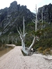
Yes, the track has changed. And there are several routes up. They've done a fair bit of work on the track/signage in the past couple of years, and have completely rerouted the bit at the beginning, and possibly other bits. Some of the old tracks are still good, but not signed. Some are still there if you know where to look, and I think other bits have grown over. Which map are you using? The Dial Range map (most of the current route is at least marked on that)? or Listmap? Or another one?
http://maps.thelist.tas.gov.au/listmap/app/list/mapI happened to come down the official route today, which I don't usually do. And I happened to have my GPS on, which I don't usually do, but I needed to check something. Yes, you went the 'right' way.