Little Hugel, Hugel & Rufus (with lots of pictures)

Trip reports, stories, track notes. Multiple/large photos are OK in this forum.
Forum rules
Posting large/multiple images in this forum is OK. Please start topic titles with the name of the location or track.

For topics focussed on photos rather than the trip, please consider posting in the 'Gallery' forum instead.

This forum is for posting information about trips you have done, not for requesting information about a track or area.

Little Hugel, Hugel & Rufus (with lots of pictures)

Postby Son of a Beach » Mon 25 May, 2009 3:43 pm

With the extra motivation of wanting to try out my new 1 man tent, I went walking last weekend and climbed Little Hugel, Mt Hugel and Mt Rufus.

I knocked off work early on Friday, and walked as far as Shadow Lake where I camped half way along the eastern shore. I was a bit unsure how long it would take me to do the trackless section from Little Hugel to the Hugel/Rufus saddle, so I wanted to make sure I got an early start from a couple of hours along the track on Saturday (turned out to be unnecessary). There are reasonable camp sites near the turn off to Shadow Lake, and near the other end, but I found a spot about half way in between, just as it was getting dark, that was well sheltered amongst the trees, and with just enough room to fit my tent in.
DSCF3613.jpg
Shadow Lake Camp Site
DSCF3613.jpg (93.18 KiB) Viewed 10040 times


I got up as soon as it got light on Saturday morning, and after a leisurely breakfast, and packing up, I started walking at 8:30am. There had been a few patches of snow alongside the road on the way in, and this continued along the track, here and there all day (being all that remained of the heavy snowfall of the previous weekend).
DSCF3624.jpg
Snow at Shadow Lake
DSCF3624.jpg (83.67 KiB) Viewed 10041 times


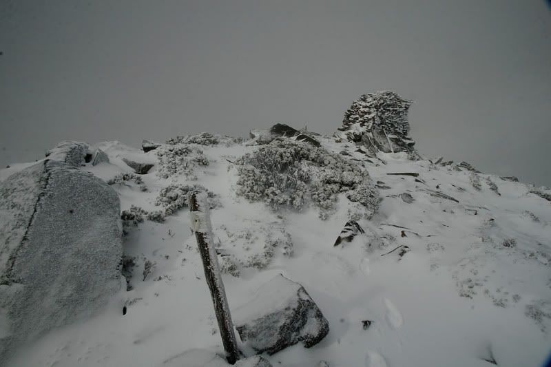
Part way up Little Hugel, I came across a single Gunnii with a lot of leaves still on it. Quite unusual for this time of May, and later I noticed a bunch of others with no leaves at all, so this one must have been in a very sheltered spot, I guess.
DSCF3627.jpg
The Last of the Nothofagus Gunnii Leaves for 2009
DSCF3627.jpg (104.72 KiB) Viewed 10040 times


The views from the top of any of the peaks in this area a fantastic. Even with the clouds obscuring most of Mt Olympus. It was a cloudy day, but with patches of blue and sunshine occasionally all day.
DSCF3629.jpg
Forgotten and Shadow Lakes & Lake St Clair from Little Hugel
DSCF3629.jpg (57.99 KiB) Viewed 10040 times


The walk from Little Hugel to the base of Mt Hugel was not too difficult, with only a little scrub and rocks to negotiate. It was very pleasant walking indeed, with fantastic views all the way. My only pointer for anyone else on this section would be that if you see a cliff/buttress about half way along, go around behind (above) it. I went in front (a more direct line) and had to negotiate several mini valleys and sinkholes with large rocks. Not terribly difficult, but behind the buttress looked pretty flat and much easier all the way.
DSCF3640.jpg
On the plateau between Little Hugel and Mt Hugel
DSCF3640.jpg (61.29 KiB) Viewed 10039 times


At this point I found myself following a line of what appeared like about half a dozen oversized natural cairns.
DSCF3644.jpg
Natural Cairns
DSCF3644.jpg (43.78 KiB) Viewed 10038 times


As I got closer to Mt Hugel, I was trying to figure out the easiest way up to the summit. I figured that just to the right of the boulder field looked about the best line, and was pleasantly surprised to find the occasional (actual) cairn up this way, which is always reassuring. Once on top, the views again were spectacular, with Mt Olympus being almost clear of cloud now.
DSCF3651.jpg
View back to Little Hugel from Mt Hugel
DSCF3651.jpg (53.71 KiB) Viewed 10039 times


It was then time to survey a route to the saddle between here and Mt Rufus. The obstacle here, as I'd been warned was the boulder field.
DSCF3646.jpg
Boulder Field Ridge, South of Mt Hugel Summit
DSCF3646.jpg (85 KiB) Viewed 10038 times

I'd never had to negotiate a boulder field quite like this one, and when walking alone it is a bit daunting. I certainly took a lot more care than I would have if I was in a group. There were occasionally holes between the boulders that went down into the darkness such that you could only see the bottom if you waited for your eyes to adjust to the darkness for a minute or so. The boulders were huge, and this stretch would have been very dangerous if they were wet (a few were still damp and slippery). A few times, I had to give up on my current position, back-track, and find another way through. There is one spot in particular where there ridge becomes a knife edge dropping off on both sides, and no real choice about which way to go. I wouldn't recommend this route to anyone with a fear of heights, nor anyone who's not confident at navigation, boulders, using your hands and arms as much as your legs, etc.

Once at the end of the ridge top, the walk down to the saddle was a little easier, with the rocks and scrub being more like what I was used to. I then reached my proposed camp site at a tarn in the saddle between Mt Hugel and Mt Rufus at 1:50pm.
DSCF3657.jpg
Tarn Between Mts Hugel and Rufus
DSCF3657.jpg (72.51 KiB) Viewed 10036 times


What to do? It was quite cold, and I had two choices to keep warm: Spend the afternoon in my sleeping bag being very bored (I didn't get around to packing a book), or go for a walk until dinner time (and get really knackered). Well, dinner time was a good 4 hours away, and with darkness still being a good 3 hours away, I figured that if I was going for a walk, I could probably get out to the car in about 3 hours, even if I went via Mt Rufus' summit. So I had some lunch, and pushed on walking (I figured that if I didn't make it out, I know there's places to camp along the way before it would get dark).

I met up with the Mt Rufus track at last, and was able to pick up the pace again a bit. But not for long, however, as the wind was getting very strong indeed. The wind was geting so strong that it was hard to stand still on the odd rock formations 1/3rd up Mt Rufus. I was counting on the pot holes on these rocks for a big drink of water, and they didn't let me down. A bit stale but refreshing, nontheless.
DSCF3658.jpg
Rock Formations, Mt Rufus
DSCF3658.jpg (65.11 KiB) Viewed 10033 times


The wind got stronger the higher up Rufus I walked, and after the rock formations, I put the camera away, as it was too difficult to hold it still.
DSCF3662.jpg
View Back to Little Hugel and Mt Olympus from part way up Mt Rufus
DSCF3662.jpg (60.96 KiB) Viewed 10037 times


I met two other groups of two each, as they came down Mt Rufus the other way. On the top, it was so windy, and I was starting to get a bit cold, that I didn't stop at all. I'd been up there before, and seen the views. I just turned left down the other track, and kept on going. The wind was so strong, and now it was right in my face, that I felt like I was leaning forwards at 45 degrees (although I'm sure it was a lot less than that in reality). I do know that when I came across a long steep sloping rock that I would not normally think about walking down, I just walked right down it without hesitating at all, because the lean I was on, and the pushing back of the wind, meant that I was not going to slip just because of how steep the rock was.

Finally, I got out of the wind after walking along the ridge of Rufus, and a couple of hours later made it out the car just as it was getting dark at 5:15pm. Sheesh... I usually try to avoid walking more than about 6 or 7 hours in a day, and this was nearly 9 hours with very little in the way of rest stops.

I think this is the first time I've done more than one mountain in single day too, and it was three in one day. I was very exhausted, and my feet ached a LOT when I got home, but it really was a great day (and a bit) out in the mountains, and I had a great time.

I might post some panoramas from the tops of Little Hugel and Hugel later, if I get around to stitching them together.
Son of a Beach
Lagarostrobos franklinii
 
Posts: 7025
Joined: Thu 01 Mar, 2007 7:55 am
ASSOCIATED ORGANISATIONS: Bit Map (NIXANZ)
Region: Tasmania
Gender: Male

Re: Little Hugel, Hugel & Rufus (with lots of pictures)

Postby stu » Mon 25 May, 2009 3:59 pm

Great report & photos Nik, sounds like you had a challenging little trip, they're the ones you remember most!
Glad you made it back safely; I know what you mean about solo walking, you tend to be a lot more cautious & tentative, but the rewards for achievement can also be higher.
The next level up of boulder hopping would be the Du Cane traverse, a spectacular trip with some of the most amazing scenery of all the Reserve walks - one you should consider for next summer?
Thanks again for the report.

Stu.
User avatar
stu
Lagarostrobos franklinii
 
Posts: 2174
Joined: Fri 02 May, 2008 8:31 am
Region: Tasmania

Re: Little Hugel, Hugel & Rufus (with lots of pictures)

Postby Son of a Beach » Mon 25 May, 2009 4:08 pm

Thanks Stu... I am actually tentatively planning the DuCane Range walk with a mate (and maybe our wives) for this summer. It's a bit unlikely, but we're hopeful.
Son of a Beach
Lagarostrobos franklinii
 
Posts: 7025
Joined: Thu 01 Mar, 2007 7:55 am
ASSOCIATED ORGANISATIONS: Bit Map (NIXANZ)
Region: Tasmania
Gender: Male

Re: Little Hugel, Hugel & Rufus (with lots of pictures)

Postby walkinTas » Mon 25 May, 2009 4:40 pm

Nice photos and great report NIk, but how did the tent go?
walkinTas
Lagarostrobos franklinii
 
Posts: 2934
Joined: Thu 07 Jun, 2007 1:51 pm
Region: Tasmania

Re: Little Hugel, Hugel & Rufus (with lots of pictures)

Postby corvus » Mon 25 May, 2009 4:54 pm

Good one Nik,
The boulder field would stop me now :shock: and yes how did the new tent perform.
c
collige virgo rosas
User avatar
corvus
Vercundus gearus-freakius
 
Posts: 5538
Joined: Mon 23 Apr, 2007 7:24 pm
Location: Devonport
Region: Tasmania
Gender: Male

Re: Little Hugel, Hugel & Rufus (with lots of pictures)

Postby tasadam » Mon 25 May, 2009 5:32 pm

Son of a Beach wrote:My only pointer for anyone else on this section would be that if you see a cliff/buttress about half way along, go around behind (above) it. I went in front (a more direct line) and had to negotiate several mini valleys and sinkholes with large rocks. Not terribly difficult, but behind the buttress looked pretty flat and much easier all the way.
DSCF3640.jpg

In the photo you show with that comment, I climbed up roughly through the saddle, the low point on the horizon - by sidling up the slope sideways. Then there was a bit of a damp gully to go up, coming out on the plateau further west to the rocky ridge, which presented pretty easy walking.

You say "half way along", are you referring to half way along the plateau once climbing up from the lake? There was one steep downhill slope I remember, as well as a final "hill" that I skirted to the right as I approached Hugel.

Son of a Beach wrote:and my feet ached a LOT when I got home

Nik you really should wear boots... :wink:
User avatar
tasadam
Magnus administratio
 
Posts: 5941
Joined: Tue 10 Apr, 2007 6:58 pm
Location: Near Devonport, Tasmania
ASSOCIATED ORGANISATIONS: TasmaniART, Smitten Merino, Macpac
Region: Tasmania
Gender: Male

Re: Little Hugel, Hugel & Rufus (with lots of pictures)

Postby north-north-west » Mon 25 May, 2009 5:47 pm

Very interesting, and well summarised. I might do that next time I'm down - provided the weather's a little better than what I encountered on my recent trip:
Image

(Yes, that was the Monday after Anzac Day. It started snowing during the night . . . )
"Mit der Dummheit kämpfen Götter selbst vergebens."
User avatar
north-north-west
Lagarostrobos franklinii
 
Posts: 15151
Joined: Thu 14 May, 2009 7:36 pm
Location: The Asylum
ASSOCIATED ORGANISATIONS: Social Misfits Anonymous
Region: Tasmania

Re: Little Hugel, Hugel & Rufus (with lots of pictures)

Postby alliecat » Mon 25 May, 2009 7:40 pm

Hi Nik,

Looks like you had a great (if tiring) trip. Thanks for the detailed report and photos - I think that sort of report is one of the most valuable resources we have as walkers.

I agree totally about that boulder field and the extra caution when being alone. I always take a lot more time and care when I'm on my own and I think that's just sensible really.

I've only done day walks around Shadow Lake and Rufus but an overnighter is on my "must do" list, so I look forward to following in your footsteps!

Cheers,
Alliecat
alliecat
Athrotaxis cupressoides
 
Posts: 313
Joined: Thu 29 May, 2008 2:17 pm
Region: Tasmania

Re: Little Hugel, Hugel & Rufus (with lots of pictures)

Postby Son of a Beach » Tue 26 May, 2009 9:49 am

tasadam wrote:In the photo you show with that comment, I climbed up roughly through the saddle, the low point on the horizon - by sidling up the slope sideways. Then there was a bit of a damp gully to go up, coming out on the plateau further west to the rocky ridge, which presented pretty easy walking.

You say "half way along", are you referring to half way along the plateau once climbing up from the lake? There was one steep downhill slope I remember, as well as a final "hill" that I skirted to the right as I approached Hugel.


I went up the hill in that photo probably just to the left of that low point, where there's a little more rock visible. I decided to go for rocky rather than scrubby, as the scrub was obscuring a lot of rocks underneath (amazing the scrub can grow that thick, when it's all rocks under). At least this way, I could see what I'm putting my feet on.

It was then about a hundred metres or so from the top of this hill to the rock cliff/buttress and little valleys and sink holes (if you head in a direct line to Mt Hugel). If you head just fractionally to the right, I reckon it would be much flatter (behind the buttress, which looked to be all flat on top).

Yes, I also skirted well to the right of the last hill before Hugel (just before the climb up the peak itself).

walkinTas wrote:Nice photos and great report NIk, but how did the tent go?

corvus wrote:Good one Nik,
The boulder field would stop me now :shock: and yes how did the new tent perform.
c


I'm planning to do a separate tent report later (maybe today). I didn't have significant wind/rain that night, so the report will be a bit limited in that sense.
Son of a Beach
Lagarostrobos franklinii
 
Posts: 7025
Joined: Thu 01 Mar, 2007 7:55 am
ASSOCIATED ORGANISATIONS: Bit Map (NIXANZ)
Region: Tasmania
Gender: Male

Re: Little Hugel, Hugel & Rufus (with lots of pictures)

Postby Son of a Beach » Wed 27 May, 2009 4:26 pm

I've looked back through my photos, and I think I've identified the little buttress that I said would have been better to walk behind (above/around), in the attached image.
file.jpeg
file.jpeg (38.57 KiB) Viewed 9827 times

So walking from Little Hugel in the distance towards the camera (Mt Hugel), I went to the the right of the buttress in the picture (to the left when walking). I think that to the left of it (in picture - to the right when walking) looked much flatter and easier. You can vaguely see a bit of a small valley in front of the buttress (to it's left) that continued on to the other side of it, and actually had a boulder filled sinkhole right at the bottom of the buttress/cliff. There was a second (and third?) smaller valley to cross after that as well.

EDIT: And a close up of the spot. You can see in this one that it is a cliff of reasonable height, but not very far across - just a buttress.
Buttress.JPG
Buttress.JPG (21.05 KiB) Viewed 9765 times
Son of a Beach
Lagarostrobos franklinii
 
Posts: 7025
Joined: Thu 01 Mar, 2007 7:55 am
ASSOCIATED ORGANISATIONS: Bit Map (NIXANZ)
Region: Tasmania
Gender: Male

Re: Little Hugel, Hugel & Rufus (with lots of pictures)

Postby Son of a Beach » Thu 28 May, 2009 12:52 pm

One more batch of pictures... this time a few basic panoramas.

The view from my Friday night campsite's kitchen at breakfast time on Saturday morning - Mt Hugel and Little Hugel from Shadow Lake:
Mt Hugel & Little Hugel from Shadow Lake.jpg


About 180 degrees of the view from Mt Hugel, looking back the way I'd come from. Some of the features from left to right are: Ducane Range, Mt Byron, Mt Olympus, Little Hugel, Forgotten Lake, Shadow Lake, Lake St Clair:
View From Mount Hugel.jpg


A more comprehensive picture of the boulder field ridge I had to negotiate on the south side of Mt Hugel:
Boulder Field Ridge.jpg
Son of a Beach
Lagarostrobos franklinii
 
Posts: 7025
Joined: Thu 01 Mar, 2007 7:55 am
ASSOCIATED ORGANISATIONS: Bit Map (NIXANZ)
Region: Tasmania
Gender: Male


Return to TAS Trip Reports & Track Notes

Who is online

Users browsing this forum: No registered users and 10 guests