Page 1 of 1
Mt Roland
Posted: Mon 14 Feb, 2011 5:46 pm
by Chrisbulldog
Trip taken last saturday . Track in good order apart from a landslip at head of O'Niell's Creek ,but it is transversable.
Still some nice flowering on the plateau. A bonus is the greenery of the farmland viewed from the summit , even
though it is summer.
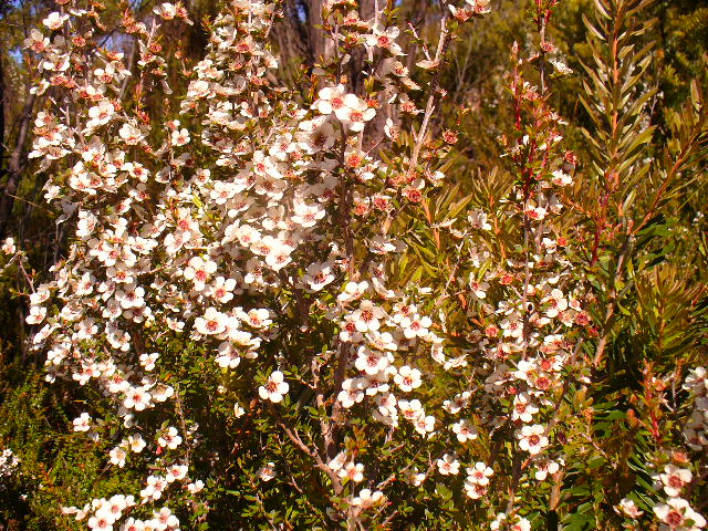
- P1000670.JPG (178.06 KiB) Viewed 4327 times
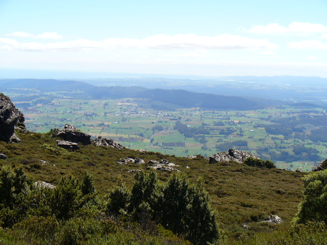
- P1000681.JPG (174.02 KiB) Viewed 4327 times
Re: Mt Roland
Posted: Wed 04 May, 2011 8:26 pm
by iandsmith
Ah, always wondered. Where does the track start from? How long does it take roughly.
Cheers, Ian
Re: Mt Roland
Posted: Thu 05 May, 2011 4:39 pm
by Chrisbulldog
The main track starts at a car park area about 2 ks along O'Niells Road. This road is about 400 metres west of the free camping area as you enter Gowrie Park
coming from Sheffield . There are plenty of signs plus a log in book there. The other track ( which I havn't done) starts at the end of Kings Road . Although shorter in distance this is much steeper.
Re: Mt Roland
Posted: Thu 05 May, 2011 4:41 pm
by ILUVSWTAS
Chrisbulldog wrote: The other track ( which I havn't done) starts at the end of Kings Road . Although shorter in distance this is much steeper.
And alot more fun. Not difficult at all, but much nicer on the eye.
Re: Mt Roland
Posted: Thu 05 May, 2011 4:44 pm
by Chrisbulldog
Sorry didn't answer other part of your question. Takes about 5 hours return which includes a couple of rest spots on the way.
Probably could be done quicker , but no point going up there and not admiring the views.
Re: Mt Roland
Posted: Sun 08 May, 2011 7:23 pm
by iandsmith
Thanks for your help fellas, I've got it pencilled in for October.