Forum rules
Posting large/multiple images in this forum is OK. Please start topic titles with the name of the location or track.For topics focussed on photos rather than the trip, please consider posting in the 'Gallery' forum instead.
This forum is for posting information about trips you have done, not for requesting information about a track or area.
Australia's Highest Ten snowshoe trip (lots of pics)
Thu 01 Sep, 2011 6:18 am
My mate Dave and I went for a snowshoe wonder on the Main Range last weekend, our aim was to bag the highest ten peaks, we did much the same trip in January but on that trip we bagged 13 of Australia’s highest peaks including the highest ten all in one day, on this trip we did the same 13 peaks over two days with the third day spent walking out.
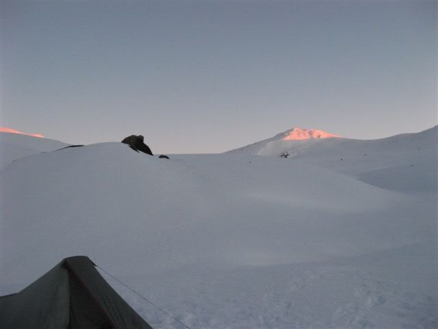
Day one, Start, Dead Horse gap 1540m, distance walked 17.6k elevation gain 1151m, camp at Wilkinsons Creek, while the cloud was high the winds where very strong and standing on top of the peaks was difficult.
Day two, distance walked 21.8k, elevation gain, 899m, camp Snowy River near Charlottes Pass, weather was brilliant, warm, light winds and lots of sunshine.
Day three, distance walked 12.75k, elevation gain, 342m, finish Dead Horse Gap, weather was low cloud, strong winds and cold.
Total distance walked 52k, Total ascent, 2392m and one of the best trips I have done.
Starting pack weight including food and water around 12kg
Peaks are in order walked.
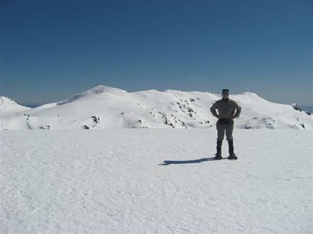
Rams Head, 2190m, 4th highest
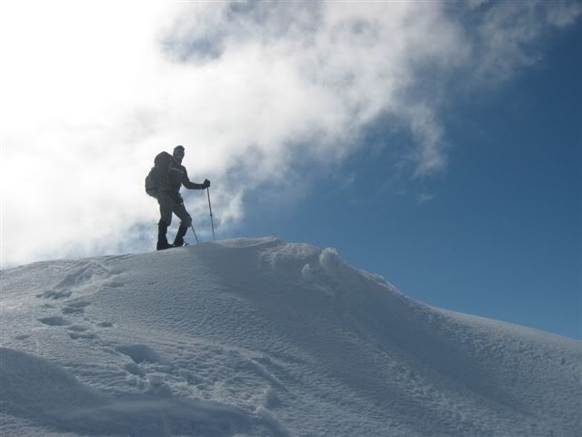
Me on top of Rams head.
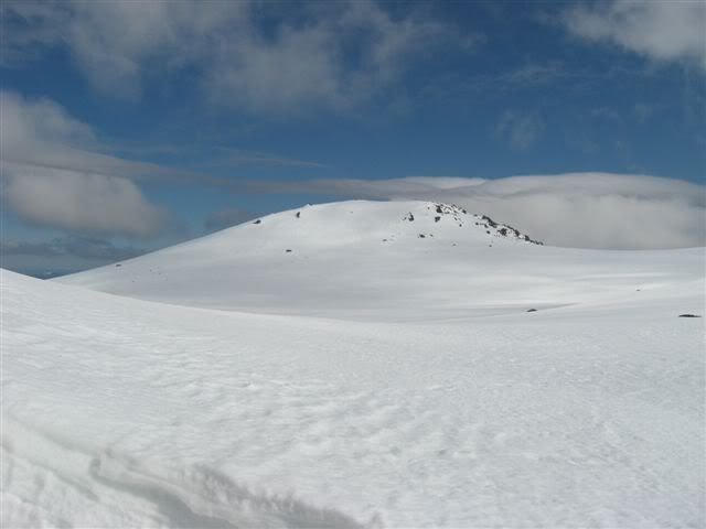
Unamed peak between Rams Head and North Rams Head, 2180+ meters
Rams Head North, 2177m, 6th highest
Mt Kosciuszko from top of Rams Head North.
On top of Unamed Peak on Etheridge Ridge, 2180m, 5th highest.
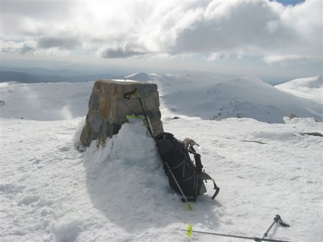
Looking NNW at Abbotts Peak from Top of Mt Kosciuszko, 2228, Australia's highest peak.
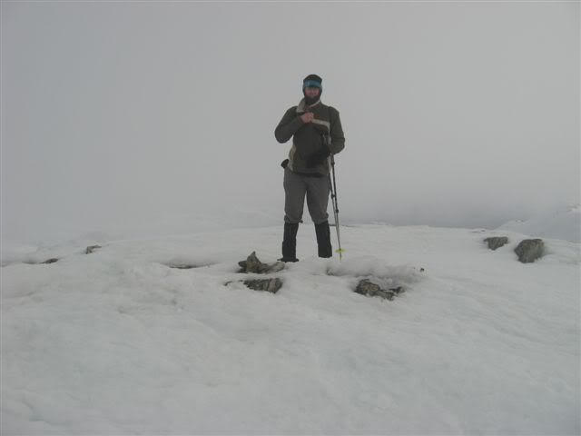
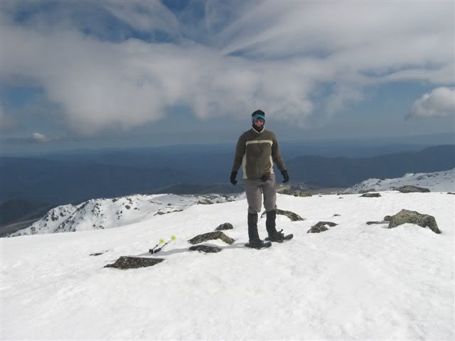
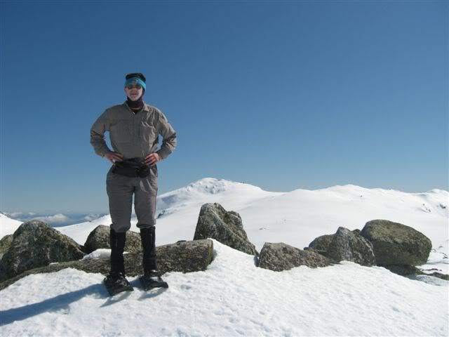
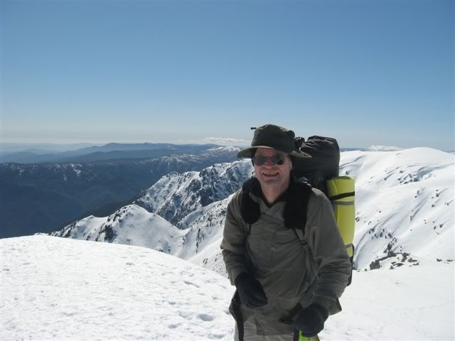
Me on Abbotts Peak, 2145m, 9th highest.

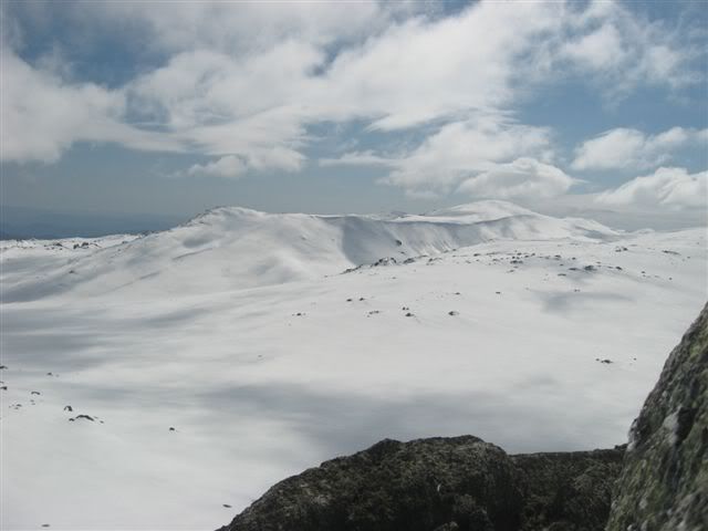
The view west from peak above Byatts Camp south-west of Abbott Peak, 2159m, 8th highest.
Sunrise on Mt Townsend, 2209m, 2nd highest.
Mt Kosciuszko from Mt Townsend.
Mt Townsend from Alice Rawson Peak 2160m, 7th highest.
Mt Townsend from Muellers Peak, 2120+m
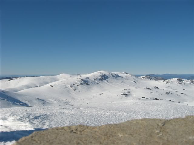
Mt Townsend and Alice Rawson Peak from Mt Northcote 2031m, 12th highest.
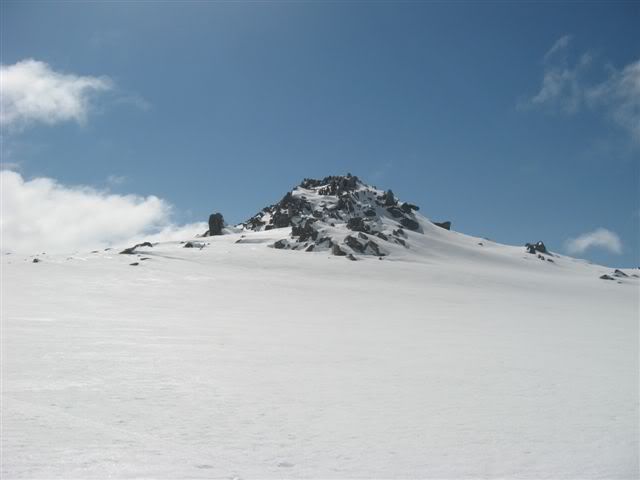
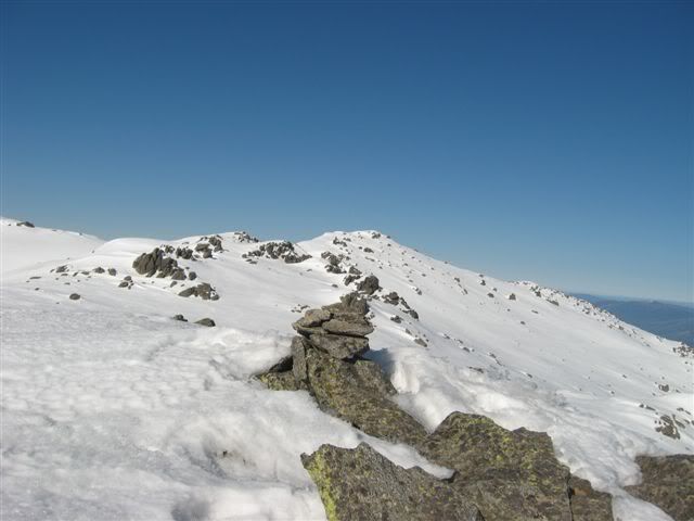
Dave on Caruthers Peak, 2145m 10th highest, with Watsons Craggs in the distance.
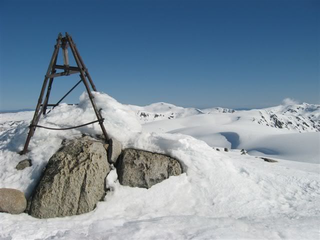
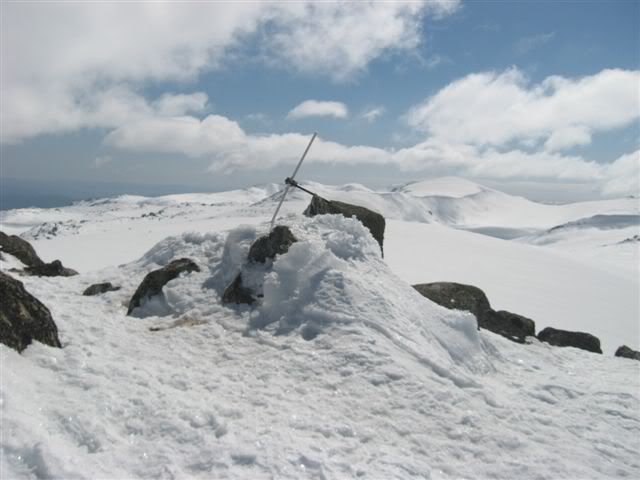
And the final Peak, the view south from Mt Twynam, 2195m, 3rd highest.
Day one, Start, Dead Horse gap 1540m, distance walked 17.6k elevation gain 1151m, camp at Wilkinsons Creek, while the cloud was high the winds where very strong and standing on top of the peaks was difficult.
Day two, distance walked 21.8k, elevation gain, 899m, camp Snowy River near Charlottes Pass, weather was brilliant, warm, light winds and lots of sunshine.
Day three, distance walked 12.75k, elevation gain, 342m, finish Dead Horse Gap, weather was low cloud, strong winds and cold.
Total distance walked 52k, Total ascent, 2392m and one of the best trips I have done.
Starting pack weight including food and water around 12kg
Peaks are in order walked.
Rams Head, 2190m, 4th highest
Me on top of Rams head.
Unamed peak between Rams Head and North Rams Head, 2180+ meters
Rams Head North, 2177m, 6th highest
Mt Kosciuszko from top of Rams Head North.
On top of Unamed Peak on Etheridge Ridge, 2180m, 5th highest.
Looking NNW at Abbotts Peak from Top of Mt Kosciuszko, 2228, Australia's highest peak.
Me on Abbotts Peak, 2145m, 9th highest.
The view west from peak above Byatts Camp south-west of Abbott Peak, 2159m, 8th highest.
Sunrise on Mt Townsend, 2209m, 2nd highest.
Mt Kosciuszko from Mt Townsend.
Mt Townsend from Alice Rawson Peak 2160m, 7th highest.
Mt Townsend from Muellers Peak, 2120+m
Mt Townsend and Alice Rawson Peak from Mt Northcote 2031m, 12th highest.
Dave on Caruthers Peak, 2145m 10th highest, with Watsons Craggs in the distance.
And the final Peak, the view south from Mt Twynam, 2195m, 3rd highest.
Australia's Highest Ten snowshoe trip (lots of pics)
Thu 01 Sep, 2011 8:04 am
Looks like it was a great trip and a good workout.
Re: Australia's Highest Ten snowshoe trip (lots of pics)
Thu 01 Sep, 2011 6:42 pm
That's good going. Wonder how much snow will be left in another month . . .
Re: Australia's Highest Ten snowshoe trip (lots of pics)
Thu 01 Sep, 2011 7:51 pm
andrewbish wrote:Looks like it was a great trip and a good workout.
Hi Andrew,
It was great trip, it has been on my list of to do walks for many years and it it did not dissapoint, it was a very good workout, my legs are still feeling sore.
north-north-west wrote:That's good going. Wonder how much snow will be left in another month . . .
Hi NNW,
Even though it still looks like there is lots of snow it was starting to thin in places, I suppose it depends on how much rain we get, we where lucky that it was cold and the snow was hard, we saw many more people using snowshoes than XC skis.
Tony
Re: Australia's Highest Ten snowshoe trip (lots of pics)
Thu 01 Sep, 2011 7:57 pm
Thanks, Tony.
It does look brilliant. I have to try to get some time off next winter.
It does look brilliant. I have to try to get some time off next winter.
Re: Australia's Highest Ten snowshoe trip (lots of pics)
Fri 02 Sep, 2011 8:55 am
Hi Tony,
Top effort. You always go to some of my favourite places. Great report and photos. Looks like mostly clear weather despite the wind. How much snow do you reckon will be left for me by the time I get down there after Christmas? It's always nice to have a fair bit still persisting but, as you said earlier, depends on the spring weather conditions. Looking at those images makes me wish I had time to go there now.
Top effort. You always go to some of my favourite places. Great report and photos. Looks like mostly clear weather despite the wind. How much snow do you reckon will be left for me by the time I get down there after Christmas? It's always nice to have a fair bit still persisting but, as you said earlier, depends on the spring weather conditions. Looking at those images makes me wish I had time to go there now.
Re: Australia's Highest Ten snowshoe trip (lots of pics)
Fri 02 Sep, 2011 9:37 am
Hi John,
The Main Range has something special about it, in both winter and summer and I just love being in the area.
In places there is still a lot of snow, the Rawsons Pass toilet was completely under snow, when I was in the area last November there was a lot of snow still around Mt Kosciuszko, it was a bit of a scramble to get over it on the way to top of Mt Kosciuszko, when I went back in January there was still a bit left. I have XC skied around Mt Tate in mid September, but had to walk from Ilawong Bridge back to Guthega.
I hope to be doing the Highest ten again in January with my walking club.
Tony
Re: Australia's Highest Ten snowshoe trip (lots of pics)
Fri 02 Sep, 2011 9:45 am
Nice pics Tony, thanks for haring.
Re: Australia's Highest Ten snowshoe trip (lots of pics)
Mon 12 Sep, 2011 12:41 pm
Looks like a great trip Tony, I was just wondering whether there is any criteria on what makes each one a peak. Its just i notice a few north and south peaks and unnamed peaks. Is there a set drop around each peak before it becomes its own peak and not just a high point next to another, something similar to the Abels concept?
Re: Australia's Highest Ten snowshoe trip (lots of pics)
Mon 12 Sep, 2011 1:52 pm
frenchy_84 wrote:Looks like a great trip Tony, I was just wondering whether there is any criteria on what makes each one a peak. Its just i notice a few north and south peaks and unnamed peaks. Is there a set drop around each peak before it becomes its own peak and not just a high point next to another, something similar to the Abels concept?
Hi Frenchy,
The trip was a most enjoyable one, I really did not want to come back.
The issue of peak prominence is one that I have wondered about myself, there is some good information on John Evans site, where there is a link to Peak Baggersite
where they have a description
, but I have no idea why some peaks like the one on Etheridge Ridge is not named or the peak on Abbotts Ridge is un-named.A prominence cutoff of 60 meters was chosen because a) it seemed about right for this list, and b) the 1:50,000 contour maps of the area have 20 meter contours, so it made sense to use a multiple of 20. Sixty meters is about 200 feet, which is similar to prominence cutoffs used for lists covering similar terrain in the eastern USA.
Tony
© Bushwalk Australia and contributors 2007-2013.