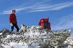
The section of the Great North Walk (GNW) between the junction with Walkers Ridge Forest Road (approx. -33.099587, 151.250034) and The Basin campsite (approx. -33.104076, 151.230609) should be approached with considerable caution.
This portion now effectively qualifies as a Grade 4 walk due to a challenging combination of steep terrain and severely degraded track conditions. In my view, it should not be attempted before mid-morning or after mid-afternoon. Low light on the forest floor, compounded by a dense canopy, makes it difficult to locate the track with confidence.
In addition, signage is virtually non-existent, further increasing the navigational challenge.
Great North Walk Cedar Creek Trackhead to the Basin Campsite
Forum rules
Posting large/multiple images in this forum is OK. Please start topic titles with the name of the location or track.
For topics focussed on photos rather than the trip, please consider posting in the 'Gallery' forum instead.
This forum is for posting information about trips you have done, not for requesting information about a track or area.
2 posts
• Page 1 of 1
Great North Walk Cedar Creek Trackhead to the Basin Campsite
![]() by Mullaitivu_83 » Tue 22 Apr, 2025 6:21 pm
by Mullaitivu_83 » Tue 22 Apr, 2025 6:21 pm
- Mullaitivu_83
- Nothofagus gunnii

- Posts: 22
- Joined: Sat 15 Aug, 2020 10:02 am
- Region: New South Wales
Re: Great North Walk Cedar Creek Trackhead to the Basin Camp
![]() by rcaffin » Wed 23 Apr, 2025 7:44 pm
by rcaffin » Wed 23 Apr, 2025 7:44 pm
I wonder.
I remember it as being a fairly simple track but with a small climb. There were signs along the way, and plenty of light.
Did the OP miss a turning somewhere? That would make it 'hard'.
Cheers
Roger
I remember it as being a fairly simple track but with a small climb. There were signs along the way, and plenty of light.
Did the OP miss a turning somewhere? That would make it 'hard'.
Cheers
Roger
-
rcaffin - Athrotaxis selaginoides

- Posts: 1305
- Joined: Thu 17 Jul, 2008 3:46 pm
2 posts
• Page 1 of 1
Return to NSW & ACT Trip Reports & Track Notes
Who is online
Users browsing this forum: No registered users and 2 guests