Clarence suggested I chip in at this stage. Yes I do wear Volleys so it was probably me.
I have watched with awe the epic day trips done by Kanangra. Oh to be young again.
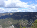
Over Easter my son and myself spent a perfect evening camped on the cliff edge of the West Wanganderry Walls. There was abundant water in the rock holes so no need to carry. Our access was by Othogonal Pass
We did make it more difficult this time by missing the correct ledge. Descent was by Travis Gully the next day. I would be interested to know details of your "water slide".
Grant Head can be climbed. A tape would be handy. There is a break in the cliffs a little to the south and west for access to the Nattai. The side creek off to the east on the Martins Creek side also looks a goer.
You can exit Martins Creek on the west through the lower cliffs at 596 104 and the top cliffs at 595 0934 . The approach along the Nattai tableland scrub would be horrendous.We had it easy in the 60's and 70's when I could drive my Beetle as far as the log dump and loading ramps at the top of the descent down the Nattai River road.
Nattai Bluff and Golden Moon Bluff are both climbable. Up one and down the other makes a great day trip. That is if you can afford the entry fee of $44,000.00 {It recently went up from $11,000.00}.
Once upon a time I camped opposite on Orange Tree Flat on Little River and well out of site to achieve this.
If I could fathom how to upload photos to this site I could post a couple of classics from the 50's showing cattle grazing peacefully on McArthurs Flat and the remains of the original Emmetts hut, not the metal rubbish that people imagine was from Emmetts. They were taken at the end of a 6 day adventure from Kanangra Walls. No tents, no topo maps and my first venture into the Greater Blue Mountains. The last day we walked from near Round Flat all the way out to Hilltop station and caught the steam train home.
Next month I hit 81 and plan to have a celebratory cliff top camp on the rim of the escarpment overlooking McArthurs flat from slightly west of north.
The Nattai wilderness was extended this year by 11000 hectares so that now the entire Park is zoned as wilderness. It has long been one of my favourite playgrounds.
Another day in the Nattai. Solving some unanswered questions
Forum rules
Posting large/multiple images in this forum is OK. Please start topic titles with the name of the location or track.
For topics focussed on photos rather than the trip, please consider posting in the 'Gallery' forum instead.
This forum is for posting information about trips you have done, not for requesting information about a track or area.
74 posts
• Page 2 of 3 • 1, 2, 3
Re: Another day in the Nattai. Solving some unanswered quest
![]() by gandolph » Mon 16 Jun, 2014 3:03 pm
by gandolph » Mon 16 Jun, 2014 3:03 pm
-
gandolph - Nothofagus gunnii

- Posts: 14
- Joined: Fri 08 Feb, 2013 2:25 pm
- Region: New South Wales
- Gender: Male
Re: Another day in the Nattai. Solving some unanswered quest
![]() by michael_p » Mon 16 Jun, 2014 3:43 pm
by michael_p » Mon 16 Jun, 2014 3:43 pm
Gandolph,
Thank you for sharing your memories of the Nattai. For those of us who are relatively recent visitors to the area your recollections of seeing cattle grazing and Emmett's original hut are fascinating. It's easy to forget this area was once farm land.
Regards,
Michael.
Thank you for sharing your memories of the Nattai. For those of us who are relatively recent visitors to the area your recollections of seeing cattle grazing and Emmett's original hut are fascinating. It's easy to forget this area was once farm land.
Regards,
Michael.
One foot in front of the other.
-
michael_p - Athrotaxis selaginoides

- Posts: 1391
- Joined: Sun 15 Nov, 2009 6:58 pm
- Location: Macarthur Region of Sydney.
- Region: New South Wales
- Gender: Male
Re: Another day in the Nattai. Solving some unanswered quest
![]() by GPSGuided » Mon 16 Jun, 2014 3:56 pm
by GPSGuided » Mon 16 Jun, 2014 3:56 pm
Gandolph, would love to see your photo magic in this thread of the area from decades back! A good photo hosting site for forums is Photobucket <http://www.photobucket.com/>. You can upload there and then insert the links to those photos in your forum posts in the following format.
Happy to help in other ways if you find it too confusing to post the photos yourself. Just let us know.
- Code: Select all
Blah, blah, blah and see the photo below...

[img]http://your photo URL/xyz.jpg[/img]
Happy to help in other ways if you find it too confusing to post the photos yourself. Just let us know.
Just move it!
-
GPSGuided - Lagarostrobos franklinii

- Posts: 6801
- Joined: Mon 13 May, 2013 2:37 pm
- Location: Sydney
- Region: New South Wales
Re: Another day in the Nattai. Solving some unanswered quest
![]() by michael_p » Mon 16 Jun, 2014 3:59 pm
by michael_p » Mon 16 Jun, 2014 3:59 pm
gandolph wrote:..If I could fathom how to upload photos to this site I could post a couple of classics from the 50's showing cattle grazing peacefully on McArthurs Flat and the remains of the original Emmetts hut, not the metal rubbish that people imagine was from Emmetts.
It took me a few minutes to find, here is a thread explaining how to upload images to the site: http://bushwalk.com/forum/viewtopic.php?f=9&t=562.
Regards,
Michael.
One foot in front of the other.
-
michael_p - Athrotaxis selaginoides
- Posts: 1391
- Joined: Sun 15 Nov, 2009 6:58 pm
- Location: Macarthur Region of Sydney.
- Region: New South Wales
- Gender: Male
Re: Another day in the Nattai. Solving some unanswered quest
![]() by kanangra » Mon 16 Jun, 2014 4:38 pm
by kanangra » Mon 16 Jun, 2014 4:38 pm
Gandolph. I too would love to see those photos. I agree that Orange tree Flat is a delightful, if illegal place to camp.
K.
PS It took me a long time and a lot of encouragement but I eventually learnt how to upload photos to this site so don't give up.
K.
PS It took me a long time and a lot of encouragement but I eventually learnt how to upload photos to this site so don't give up.
- kanangra
- Athrotaxis selaginoides
- Posts: 1340
- Joined: Sun 25 May, 2008 3:52 pm
Re: Another day in the Nattai. Solving some unanswered quest
![]() by jackhinde » Mon 16 Jun, 2014 6:54 pm
by jackhinde » Mon 16 Jun, 2014 6:54 pm
Ditto, very keen to see photos, particularly of Emmett's hut.
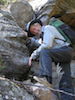
Due to the archaeological significance of locations on the wanganderry walls I will not be publicising much on here about the area. I am guessing that you are aware of at least one site as the volley print i saw was there.
Due to the archaeological significance of locations on the wanganderry walls I will not be publicising much on here about the area. I am guessing that you are aware of at least one site as the volley print i saw was there.
- jackhinde
- Athrotaxis cupressoides

- Posts: 318
- Joined: Wed 23 Nov, 2011 5:01 pm
- Location: Kangaroo Valley
- Region: New South Wales
- Gender: Male
Re: Another day in the Nattai. Solving some unanswered quest
![]() by icefest » Mon 16 Jun, 2014 7:07 pm
by icefest » Mon 16 Jun, 2014 7:07 pm
gandolph wrote:f $44,000.00 {It recently went up from $11,000.00}.
Once upon a time I camped opposite on Orange Tree Flat on Little River a
Am I reading that right?
44 thousand dollars for entry?
Men wanted for hazardous journey. Low wages, bitter cold, long hours of complete darkness. Safe return doubtful.
-

icefest - Lagarostrobos franklinii
- Posts: 4517
- Joined: Fri 27 May, 2011 11:19 pm
- Location: www.canyoninginvictoria.org
- Region: Victoria
Re: Another day in the Nattai. Solving some unanswered quest
![]() by jackhinde » Mon 16 Jun, 2014 7:20 pm
by jackhinde » Mon 16 Jun, 2014 7:20 pm
if that is so they will spend a fortune on new signage that would be better spent on something else... i recall a while back when it went from $10000 to $11000 and they replaced all the signs along the fences (those of you near such special areas will beware that in some places along roads there is a sign every 50 metres or so along the boundaries)
- jackhinde
- Athrotaxis cupressoides
- Posts: 318
- Joined: Wed 23 Nov, 2011 5:01 pm
- Location: Kangaroo Valley
- Region: New South Wales
- Gender: Male
Re: Another day in the Nattai. Solving some unanswered quest
![]() by DaveNoble » Mon 16 Jun, 2014 7:30 pm
by DaveNoble » Mon 16 Jun, 2014 7:30 pm
jackhinde wrote: i recall a while back when it went from $10000 to $11000 and they replaced all the signs along the fences (
Yes, it went up 10% when the GST came in. I would not have thought that being in the catchment area was "goods" or a "service".
Dave
- DaveNoble
- Athrotaxis selaginoides
- Posts: 1032
- Joined: Sun 03 Feb, 2008 3:56 pm
Re: Another day in the Nattai. Solving some unanswered quest
![]() by GPSGuided » Mon 16 Jun, 2014 8:25 pm
by GPSGuided » Mon 16 Jun, 2014 8:25 pm
DaveNoble wrote:Yes, it went up 10% when the GST came in. I would not have thought that being in the catchment area was "goods" or a "service".
So the question is, could they claim the GST back each year?
Just move it!
-
GPSGuided - Lagarostrobos franklinii
- Posts: 6801
- Joined: Mon 13 May, 2013 2:37 pm
- Location: Sydney
- Region: New South Wales
Re: Another day in the Nattai. Solving some unanswered quest
![]() by Grabeach » Mon 16 Jun, 2014 9:44 pm
by Grabeach » Mon 16 Jun, 2014 9:44 pm
I always understood the $10,000 / $11,000 was a maximum figure and largely irrelevant. The actual fines handed down in the courts were in the hundreds of dollars, not thousands. One assumes you’d only cop the big one if you tried to do something like poison the water or blow up the dam.
- Grabeach
- Athrotaxis cupressoides
- Posts: 309
- Joined: Wed 12 Oct, 2011 2:09 pm
- Region: New South Wales
- Gender: Male
Re: Another day in the Nattai. Solving some unanswered quest
![]() by Allchin09 » Tue 17 Jun, 2014 2:54 am
by Allchin09 » Tue 17 Jun, 2014 2:54 am
Reading through the Newsroom on the SCA website, there are a few articles relating to fines. One man was fined $6,600, but I think this was a more serious offence as he was carrying hunting equipment, and admitted to camping and lighting a campfire. http://sca.clients.squiz.net/about/news ... n-offences
The articles state that "Penalties of $300 to $44,000 apply for illegal entry and unauthorised activities", so I would hope the trespassing fine would be not much more than $300.
The articles state that "Penalties of $300 to $44,000 apply for illegal entry and unauthorised activities", so I would hope the trespassing fine would be not much more than $300.
Tackling the unknown and the awesome one adventure at a time!
Try www.bushwalkingmaps.com
Try www.bushwalkingmaps.com
- Allchin09
- Phyllocladus aspleniifolius

- Posts: 714
- Joined: Fri 27 Apr, 2012 3:24 pm
- ASSOCIATED ORGANISATIONS: Sydney Bush Walkers
- Region: New South Wales
- Gender: Male
Re: Another day in the Nattai. Solving some unanswered quest
![]() by michael_p » Tue 17 Jun, 2014 8:58 am
by michael_p » Tue 17 Jun, 2014 8:58 am
A good read about getting caught in the forbidden zone - http://users.tpg.com.au/users/eirvine/warragamba/story.htm.
One foot in front of the other.
-
michael_p - Athrotaxis selaginoides
- Posts: 1391
- Joined: Sun 15 Nov, 2009 6:58 pm
- Location: Macarthur Region of Sydney.
- Region: New South Wales
- Gender: Male
Re: Another day in the Nattai. Solving some unanswered quest
![]() by GPSGuided » Tue 17 Jun, 2014 10:14 am
by GPSGuided » Tue 17 Jun, 2014 10:14 am
All a bit unfortunate, especially after the mass paranoia of 911. It's true that the water supply of a major metropolis needs to be protected, it's true that the government would impose ever harsher scare tactics to keep clear of the zone and be seen as "responsible", it's also true that a real terrorist or other can still easily access those areas if determined. I assume terrorists (if worthy of such a title) are typically quite determined. Yawn!
Just move it!
-
GPSGuided - Lagarostrobos franklinii
- Posts: 6801
- Joined: Mon 13 May, 2013 2:37 pm
- Location: Sydney
- Region: New South Wales
Re: Another day in the Nattai. Solving some unanswered quest
![]() by gandolph » Tue 17 Jun, 2014 7:41 pm
by gandolph » Tue 17 Jun, 2014 7:41 pm
michael_p wrote:Gandolph,
Thank you for sharing your memories of the Nattai. For those of us who are relatively recent visitors to the area your recollections of seeing cattle grazing and Emmett's original hut are fascinating. It's easy to forget this area was once farm land.
Regards,
Michael.
Michael and all,
- emmett's hut.jpg (215.98 KiB) Viewed 50975 times
I hope this works. Emmetts hut summer 1952. The rear section was still habitable. My companion Noel on our 6 day walk and who has long since gone bushwalking in the sky. The hut was located exactly as shown on the Mittagong 1 inch to 1 mile army survey map, that is on a slight rise above the present popular camping flat and about midway along. If you search really hard you can find foundation rocks. All the metal rubbish across Troys Creek was an attempt in the70's or 80' to build a sort of weekender shack and make a claim on the land. It was brought in by 4wd after building the road down the creek. They also introduced trail bikes to the valley. It was a freehold block and must have been part of Emmetts original holding. National Parks finally took an interest and stopped any further development which was well before the park declaration . Emmett lived in Hilltop and probably built the track down."Starlights" seems to be a name introduced by Myles Dunphy as it first appeared on his Blue Mountains sketch map.
McArthurs Flat summer 1952. A page from my logbook of the walk from Kanangra. The cows belonged to Howard Coates who owned the Wattle ridge property.It was a much more humble affair than today's dude ranch. He was impressed by our adventure and took us in for cups of tea and plenty of talk about the area before we set off along the road to Hilltop. I allowed only 1 roll of 120 film for the trip. I was very poor in those days. That is only 8 photos. As I mentioned before, we could not afford a tent but simply made bivys out of strips of bark or slept under logs. It did rain and we got very wet. One day we actually wrung the sleeping bags out in the sun at midday. Yerranderie was alive in those days so we were able to ring home to say we were still alive and also stock up on fresh bread. We were even invited in to the old Silver Mines hotel for a free beer. It was a very friendly town. Enough for now.
Enjoy
John M
Last edited by gandolph on Wed 18 Jun, 2014 10:15 am, edited 1 time in total.
-
gandolph - Nothofagus gunnii
- Posts: 14
- Joined: Fri 08 Feb, 2013 2:25 pm
- Region: New South Wales
- Gender: Male
Re: Another day in the Nattai. Solving some unanswered quest
![]() by GPSGuided » Tue 17 Jun, 2014 7:53 pm
by GPSGuided » Tue 17 Jun, 2014 7:53 pm
Fascinating! May I assume the photo of McArthurs Flat was towards the north-west? Compared with these days, it's quite an open field.
Just move it!
-
GPSGuided - Lagarostrobos franklinii
- Posts: 6801
- Joined: Mon 13 May, 2013 2:37 pm
- Location: Sydney
- Region: New South Wales
Re: Another day in the Nattai. Solving some unanswered quest
![]() by gandolph » Tue 17 Jun, 2014 8:41 pm
by gandolph » Tue 17 Jun, 2014 8:41 pm
It is looking East towards towards the valley of Starlights track behind the foreground cow.. Ahearn lookout is on the right hand bluff.
-
gandolph - Nothofagus gunnii
- Posts: 14
- Joined: Fri 08 Feb, 2013 2:25 pm
- Region: New South Wales
- Gender: Male
Re: Another day in the Nattai. Solving some unanswered quest
![]() by DaveNoble » Tue 17 Jun, 2014 9:49 pm
by DaveNoble » Tue 17 Jun, 2014 9:49 pm
Thanks for posting the fascinating old photographs Gandolph (and the interesting commentary)
Dave
Dave
- DaveNoble
- Athrotaxis selaginoides
- Posts: 1032
- Joined: Sun 03 Feb, 2008 3:56 pm
Re: Another day in the Nattai. Solving some unanswered quest
![]() by kanangra » Wed 18 Jun, 2014 8:56 am
by kanangra » Wed 18 Jun, 2014 8:56 am
Wow! Thank you so much. That is fascinating. I just cannot believe how extensive Macarthur Flat is. Incredible to think how the bush grows back in such a relatively short time. Also amazed at how substantial Emmets Hut is. Quite a large structure. If it was in that condition in 1952 it must have been built in the 19th century?
I hope your log book is preserved as it sounds like a classic to me. A time capsule of an era that is gone for ever. Its all expensive high end technical designer fashionable gear now.
K
I hope your log book is preserved as it sounds like a classic to me. A time capsule of an era that is gone for ever. Its all expensive high end technical designer fashionable gear now.
K
- kanangra
- Athrotaxis selaginoides
- Posts: 1340
- Joined: Sun 25 May, 2008 3:52 pm
Re: Another day in the Nattai. Solving some unanswered quest
![]() by gandolph » Wed 18 Jun, 2014 11:38 am
by gandolph » Wed 18 Jun, 2014 11:38 am
kanangra wrote:Wow! Thank you so much. That is fascinating. I just cannot believe how extensive Macarthur Flat is. Incredible to think how the bush grows back in such a relatively short time. Also amazed at how substantial Emmets Hut is. Quite a large structure. If it was in that condition in 1952 it must have been built in the 19th century?
I hope your log book is preserved as it sounds like a classic to me. A time capsule of an era that is gone for ever. Its all expensive high end technical designer fashionable gear now.
K
The Nattai valley was stunningly beautiful and the walking was easy. All the clearings were free of regrowth and we simply crossed back and forth following the cow pads from clearing to clearing. The cattle were free range and not in great numbers.
Just upstream from Travis Gully an itinerant family with little children had set up a ramshackle tent camp and an old open truck provided their transport out into Burragorang Valley. With the impending flooding of the valley it seemed to be in a state of no mans land.
JM
-
gandolph - Nothofagus gunnii
- Posts: 14
- Joined: Fri 08 Feb, 2013 2:25 pm
- Region: New South Wales
- Gender: Male
Re: Another day in the Nattai. Solving some unanswered quest
![]() by michael_p » Wed 18 Jun, 2014 3:04 pm
by michael_p » Wed 18 Jun, 2014 3:04 pm
Amazing stuff and again thank you for sharing.
I've read a few of Jim Barrett's books on the history of the Burragorang. Unfortunately most of the history covered relates to the Wollondilly and Cox's Burragorang with a little about the Nattai. It's great to see your photos and read some more about the history of the area.
I think I know where the foundation rocks are. Have a look at this photo that I took in 2008. It is just a bit back and across from the main camp area. From memory the stones location roughly fits in with the location gandolph described. Maybe these are the foundation stones of the real Emmetts hut.
Regards,
Michael.
I've read a few of Jim Barrett's books on the history of the Burragorang. Unfortunately most of the history covered relates to the Wollondilly and Cox's Burragorang with a little about the Nattai. It's great to see your photos and read some more about the history of the area.
gandolph wrote:The hut was located exactly as shown on the Mittagong 1 inch to 1 mile army survey map, that is on a slight rise above the present popular camping flat and about midway along. If you search really hard you can find foundation rocks.
I think I know where the foundation rocks are. Have a look at this photo that I took in 2008. It is just a bit back and across from the main camp area. From memory the stones location roughly fits in with the location gandolph described. Maybe these are the foundation stones of the real Emmetts hut.
Regards,
Michael.
One foot in front of the other.
-
michael_p - Athrotaxis selaginoides
- Posts: 1391
- Joined: Sun 15 Nov, 2009 6:58 pm
- Location: Macarthur Region of Sydney.
- Region: New South Wales
- Gender: Male
Re: Another day in the Nattai. Solving some unanswered quest
![]() by gandolph » Wed 18 Jun, 2014 4:18 pm
by gandolph » Wed 18 Jun, 2014 4:18 pm
michael_p wrote:Amazing stuff and again thank you for sharing.
I've read a few of Jim Barrett's books on the history of the Burragorang. Unfortunately most of the history covered relates to the Wollondilly and Cox's Burragorang with a little about the Nattai. It's great to see your photos and read some more about the history of the area.gandolph wrote:The hut was located exactly as shown on the Mittagong 1 inch to 1 mile army survey map, that is on a slight rise above the present popular camping flat and about midway along. If you search really hard you can find foundation rocks.
I think I know where the foundation rocks are. Have a look at this photo that I took in 2008. It is just a bit back and across from the main camp area. From memory the stones location roughly fits in with the location gandolph described.Maybe these are the foundation stones of the real Emmetts hut
Regards,
Michael.
You have nailed it. That is definitely the site of the real Emmetts hut.
Well done
John M
-
gandolph - Nothofagus gunnii
- Posts: 14
- Joined: Fri 08 Feb, 2013 2:25 pm
- Region: New South Wales
- Gender: Male
Re: Another day in the Nattai. Solving some unanswered quest
![]() by willem » Tue 12 Aug, 2014 11:27 am
by willem » Tue 12 Aug, 2014 11:27 am
Did you have any problems with going past the 2nd gate. Earlier this year I rode out there but was to scared to continue re the sign mentioning no entry and video monitoring.
I thought just before the gate it would be a good point to drop down into Martins creek.
I thought just before the gate it would be a good point to drop down into Martins creek.
Regards,
Willem
Willem
- willem
- Nothofagus gunnii
- Posts: 29
- Joined: Thu 08 Sep, 2011 1:55 pm
- Region: New South Wales
- Gender: Male
Re: Another day in the Nattai. Solving some unanswered quest
![]() by kanangra » Tue 12 Aug, 2014 12:05 pm
by kanangra » Tue 12 Aug, 2014 12:05 pm
No no problems at all going past the second gate. I agree you could drop into Martins Ck there. I actually came out onto the road about 100m past the gate.
K.
Don't let Big Brother put you off.
K.
Don't let Big Brother put you off.
- kanangra
- Athrotaxis selaginoides
- Posts: 1340
- Joined: Sun 25 May, 2008 3:52 pm
Re: Another day in the Nattai. Solving some unanswered quest
![]() by Kainas » Tue 12 Aug, 2014 12:46 pm
by Kainas » Tue 12 Aug, 2014 12:46 pm
Fascinating reading.
-

Kainas - Athrotaxis cupressoides
- Posts: 410
- Joined: Mon 24 Nov, 2008 3:31 pm
- Location: The Hunter (Cessnock), Australia
- Region: New South Wales
Re: Another day in the Nattai. Solving some unanswered quest
![]() by Louise Enid » Tue 29 Sep, 2015 12:54 pm
by Louise Enid » Tue 29 Sep, 2015 12:54 pm
Hi, I have recently joined as I was hoping to send a message to one of you lovely Nattai explorers but I seem to be unable to message yet as I am a new user 
I have so enjoyed reading all of your posts (Clarence, jackhinde, kanangra, Gandalf) and have been very excited to try and find all the things you discuss (orthogonal pass, the very special cave etc.). It is my best friend's birthday in a few weeks and I am hoping to organise a special camp on the Wanganderry Walls - we completed two exploratory trips recently and I am so excited to be looking forward to getting to know this special place. I spend a lot of time in Ettrema and thought nothing could drag me away from getting to know every inch of that wonderful place but Nattai is so special - I can see why you all love it so much.
I usually love to just find everything myself (I am addicted to six.maps!) but it is a special birthday for my best friend and I would dearly love to be able to be able to find an easier way through the walls then we have found so far and if possible, a hint around the location of the special cave. I understand that I am a new member and you might not want to share anything with me but thought it couldn't hurt to ask! I appreciate reading all your stories either way and if anyone is interested there is the most beautiful iron bark orchid (dendrobium aemulum) in full bloom just off the side of Nattai fire trail W11E just before the switchbacks start (with the car size rock fall!).
If it is possible to message someone for a hint to the location of orthoganal pass (I think I've narrowed it down to 2 locations!) and the special cave please let me know how I can do that - I have some Ettrema secrets I can share in exchange!
Louise
-

Louise Enid - Nothofagus cunninghamii

- Posts: 1
- Joined: Tue 29 Sep, 2015 12:24 pm
- Location: Wilton
- Region: New South Wales
- Gender: Female
Re: Another day in the Nattai. Solving some unanswered quest
![]() by rachel_g » Sun 02 Aug, 2020 9:21 pm
by rachel_g » Sun 02 Aug, 2020 9:21 pm
I have enjoyed reading of the various trips others have done in the Nattai. tom_brennan & I have enjoyed three weekends out there in the last few weeks.
We should spare a thought for Sean John Ryan's "day in the Nattai"! I found his ordeal while researching the Nattai in a newspaper article from 1949.
https://trove.nla.gov.au/newspaper/article/216509070
https://trove.nla.gov.au/newspaper/arti ... 89/8425763
https://trove.nla.gov.au/newspaper/arti ... 1/11574085
https://trove.nla.gov.au/newspaper/article/18100339
Unfortunately the picture is not very good quality.
We should spare a thought for Sean John Ryan's "day in the Nattai"! I found his ordeal while researching the Nattai in a newspaper article from 1949.
https://trove.nla.gov.au/newspaper/article/216509070
BUSH RESCUE IS LONG AND PAINFUL ORDEAL SYDNEY
Pitifully weak and unable to walk, 56-year-old university lecturer, Sean John Ryan, is lying on a rough bush stretcher, marooned on a 2,240 foot wild goat plateau at Burragorang, in the heart of some of the wildest country in the State. Ryan is being fed stimulants and liquid food in the rough shelter of a small cave by a rescue party of 15 police and civilians who already have carried him more than 10 miles through the Blue Mountains, and still face at least another eight miles trek to the nearest road head. Last Sunday Ryan and a friend, Claude Walter Lee were hiking through the mountainous country when Lee left Ryan to search for water. Unable to find Ryan again, Lee made his way to Central Burragorang police station late on Monday. On Tuesday a search party found Ryan in a state of collapse. Lee stayed with Ryan while police returned to Nattai and early on Thursday set off again on the hazardous trip back to Ryan.
Harassed by gorges, thorny undergrowth, scorching sun and at times drench rain, the party, laboured at snail's pace throughout yesterday to bring Ryan out. The journey took such great toil of Ryan's strength that it was considered dangerous to attempt the treacherous descent from Wild Goat Plateau. The possibility of bringing
Ryan out by helicopter was explored, but weather conditions, trees, and undergrowth reduced the chances of success to a minimum. Until he recovers his strength Ryan may have to stay on the plateau for several days.
https://trove.nla.gov.au/newspaper/arti ... 89/8425763
SICK MAN ON TOP OF MOUNTAIN, SYDNEY
Sat : Burragorang police will try to day to rescue 56-year-old Sean John Ryan from the top of a 2240ft. mountain. He is seriously ill after a four-day ordeal in a gorge without food and water. He became separated from fellow hiker Claude Lee of Mittagong, while searching for water early on Sunday, and was not found until Wednesday night. Police tried to get an RAAF helicopter to land on top of the mountain, but none was available.
Ryan was carried from the bottom of the gorge, where he was found, up a foot-wide path which sometimes rose a foot in three. His stretcher-bearers repeatedly lost their footing and clutched the cliff-like face to stop themselves crashing into the valley.
It will be another two days before he can be brought out and taken to hospital.
He is still 12 miles from the nearest road and the stretcher party will have to cut a path through rugged bush and undergrowth.
Ryan is lecturer in accountancy at Sydney University and lives in Summer Hill.
https://trove.nla.gov.au/newspaper/arti ... 1/11574085
POLICE FIGURE IN DRAMATIC RESCUE. LOST MAN FOUND.
Constable E. F. Fairlamb, who is in charge of the Burragorang police station, and a tracker led the intensive search for Sean John Ryan, University lecturer, who was lost in the Burragorang Valley for eight days, and who was found on Thursday. Police risked their lives on mountains 3000 feet high to bring Ryan down to safety in the
valley. He was found by a tracker, Ted Green, dying from thirst and starvation on a bluff 15 miles from Burragorang. After a hazardous descent a party of police brought Mr. Ryan to the home of Constable Fairlamb on Sunday and given food. He was later driven to his home in Summer Hill. First-Class Constable Fairlamb is a son of Sgt E S. Fairlamb, officer-in charge of police at Muswellbrook.
https://trove.nla.gov.au/newspaper/article/18100339
PATH OF POLICE RESCUE PARTY
Golden Moon Bluff, with dotted line showing the path along which Sean John Ryan's rescuers carried him on Sunday. The arrow at top points to a cave behind the bluff near a creek where Ryan spent Saturday night. The bottom arrow shows the point at which Ryan was picked up by car and taken to Burragorang Police Station. The men in the foreground are police members of the second rescue party
Unfortunately the picture is not very good quality.
- rachel_g
- Nothofagus gunnii
- Posts: 17
- Joined: Wed 06 Apr, 2016 1:17 pm
- Region: New South Wales
- Gender: Female
Re: Another day in the Nattai. Solving some unanswered quest
![]() by puredingo » Mon 03 Aug, 2020 3:02 pm
by puredingo » Mon 03 Aug, 2020 3:02 pm
Thanks Rachel, that is really interesting reading. I suppose that photo of the rescue team is taken from the little river fire trail?
- puredingo
- Athrotaxis selaginoides
- Posts: 1326
- Joined: Mon 13 Feb, 2012 6:54 am
- Region: New South Wales
Re: Another day in the Nattai. Solving some unanswered quest
![]() by michael_p » Mon 03 Aug, 2020 4:43 pm
by michael_p » Mon 03 Aug, 2020 4:43 pm
Excellent find Rachel. So easy to forget that area really was wilderness once upon a time. I believe that is the Claude Lee that the pass near Mittagong is named after.
Your post jogged my memory about a map I found on Trove some time back. It has a very interesting section showing the amount of land Samuel Emmett had (and now we know his name was Samuel Emmett). Original map here: https://nla.gov.au/nla.obj-233861038/view . Here is a snippet showing the relevant section. It would appear that his lease went all the way from Rocky Waterholes Ck to Round Flat along the river. Amazing.
Some things worth noting:
- An area, adjacent to the Wattle Ridge property, was reserved for mining. Imagine a mine out there, how it would have changed the area.
- Mcarthur's Flat appears further along the river. I always thought it was just the section across from Emmetts Flat.
- And that weird Lot 122 is still on the maps (top right).
Michael.
One foot in front of the other.
-
michael_p - Athrotaxis selaginoides
- Posts: 1391
- Joined: Sun 15 Nov, 2009 6:58 pm
- Location: Macarthur Region of Sydney.
- Region: New South Wales
- Gender: Male
Re: Another day in the Nattai. Solving some unanswered quest
![]() by tom_brennan » Tue 04 Aug, 2020 1:55 pm
by tom_brennan » Tue 04 Aug, 2020 1:55 pm
michael_p wrote: - An area, adjacent to the Wattle Ridge property, was reserved for mining. Imagine a mine out there, how it would have changed the area.
Interesting that you say that. On one of our nights in the Nattai recently, we were camped on the cliff edge and could see what looked like a large pipe sticking out of the cliff across the valley.
Our map didn't cover that area, but on inspection at home, it turned out to be the conveyor belt from the Valley 3 Mine.
- Valley 3 Mine
- Valley 3 Mine (detail)
- Valley 3 Mine (aerial photo)
- 2020-08-04 13_12_00-NSW Bushwalking Maps.png (629.94 KiB) Viewed 34557 times
So depending on the sort of mine the Wattle Ridge mine was going to be, it might have just been a hole in the cliffs like this one.
Bushwalking NSW - http://bushwalkingnsw.com
-
tom_brennan - Athrotaxis selaginoides
- Posts: 1428
- Joined: Wed 29 Sep, 2010 9:21 am
- Location: Sydney
- Region: New South Wales
- Gender: Male
74 posts
• Page 2 of 3 • 1, 2, 3
Return to NSW & ACT Trip Reports & Track Notes
Who is online
Users browsing this forum: No registered users and 2 guests