I have done a bit of walking in the Wild Dogs and around Narrowneck before, but this was my first journey to Kanangra and the hike from Cloudmaker down to the Cox's was a lot rougher & steeper and therefore slower than I'd anticipated. As seems to be traditional, I got lost leaving Dex's Creek after a coffee break; I actually lost the track about 5 times between there and the Cox's, but was able to reconnect with the track by navigating with the OpenStreetMap map I had loaded on my phone. Thank you to whoever took the time to load that track in!
I hit the Cox's about 1KM downstream of the Kanangra Ck junction a bit after 2pm and although I was interested in seeing Konangaroo Clearing, and had planned on picking up water from Kanangra Creek, I was feeling pretty knackered and decided against adding another 2KM to my journey so just crossed over the river where I was, then quickly found the path that heads up Yellow Pup Ridge. I was moving pretty slowly due to fatigue so I was happy to make Mobbs Swamp before dark (about 5:45pm), although the water there looked so gross (stained brown by leaves) it would have been better if I couldn't see it. Good thing I have a filter
I briefly considered overnighting at Mobbs but since I only had a jacket + 2 space blankets to keep me warm, the thoughts of a warm bed was enough motivation to push on into the dark, with a headlight on the footpads and using the light of the moon on the firetrails. I only lost the trail once between Mobbs and Medlow Gap, but bush was easy enough to bash through and I used the OSM map again to reconnect.
At Medlow Gap I thought about heading to Carlons and phoning a friend to pick me up, but I would only have saved a few KMs by doing that, and was keen to finish what I had started so I boiled some water and ate some 2 minute noodles then headed up Mt Debert. This part of the track is very well travelled and easy to navigate by torch light. On the few occasions I took a wrong step, the distinctive sound of treading on fresh leaves instantly alerted me to my mistake.
When I got to Tarros ladder (about 9PM) I briefly considered looking for the alternate way up (the "Wallaby Track") but after checking the climbing spikes by torchlight the ascent seemed easy enough, so up I went.
The final slog along Narrowneck was boring as always.
When I started at Kanangra there was about 20 cars in the carpark so was expecting to meet a few other parties on the trail, but the only sign of other humans I saw was a tent at Mobbs.
The track notes I used say the total ascent K2K is 1350m but my GPSr logged the ascent as as 2100m (and 2100m down as well). Maybe I took too many wrong turns. At 18hrs 20 mins it took a lot longer than I'd hoped - I made it to the locked gate on Glenraphael drive at 9 minutes past midnight so not 100% sure if I can technically claim to have done the K2K "in a day" but sure feels good to have finished it.
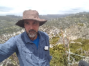
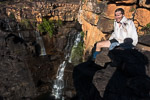
I took a lot of photos on the trip until it got dark - these are just random snapshots of the track ahead & or the "views" from the track (distant mountains filtered by trees) so as to create a feel for what the walk was like. These [along with my gps track] are uploaded here