Forum rules
The place for bushwalking topics that are not location specific.Re: What are your views on bushwalkers using GPS?
Tue 20 Sep, 2011 1:12 pm
One thing I do know is that its good to hang onto your old first editions of which I have many being a bit of a map collector. I was a member of the local SES briefly a number of years ago and went to a meeting where one of the old blokes was throwing armfuls of old maps into the skip. Apparently they had recieved funding to purchase all new gear so they were just turfing them out, I asked if I could have them, he said no worries, so I sorted them all out at home and doubled my collection overnight. Gold.
WarrenH wrote:I wonder if this is in response to Google Maps having several court cases against them. Sued over deaths when people have followed GM's directions to places without thinking. One lady died when the best directions for a walking route given was on a US freeway.
Warren.
Seriously makes you wonder doesnt it?? I mean, where's all the common sense gone, it seems to be a very rare commodity these days... Using of maps, compasses and GPS are all fine, legitimate measn of navigation but above all whats needed is a little common sense... Whoa theres a cliff there, hang on my GPS says its okay, weeeeeee!
Re: What are your views on bushwalkers using GPS?
Tue 20 Sep, 2011 1:17 pm
phan_TOM wrote:..........................WarrenH wrote:I wonder if this is in response to Google Maps having several court cases against them. Sued over deaths when people have followed GM's directions to places without thinking. One lady died when the best directions for a walking route given was on a US freeway.
Warren.
Seriously makes you wonder doesnt it?? I mean, where's all the common sense gone, it seems to be a very rare commodity these days... Using of maps, compasses and GPS are all fine, legitimate measn of navigation but above all whats needed is a little common sense... Whoa theres a cliff there, hang on my GPS says its okay, weeeeeee!
I think it's about time (US mainly) judges sat back and said something like "You stupid idiot! Case dismissed."
Re: What are your views on bushwalkers using GPS?
Tue 20 Sep, 2011 1:34 pm
photohiker wrote:Its not just Google either ...
I fully realise that, it is just that Google Maps are so convenient compared to getting out the paper maps and leaving no one in the house room to walk.
photohiker wrote:Its often instructive to compare the google map to the google satellite images (and to paper maps for that matter).
In NSW, State Forests produce excellent maps, they're not topos but they show who owns what parcels of land. Not unlike Victorian Maps but far easier to determine who owns what. A feature that I wish my GPS had. So often what looks like private land is Crown Land or Vacant Land. Not all the best/scenic wild country is in National Parks or State Forests. LHPA has fantastic parcels of land that very few use.
As the maps are dumbed down for public use it will only be land managers and research officers who will end up knowing anything different and who has free access to regions.
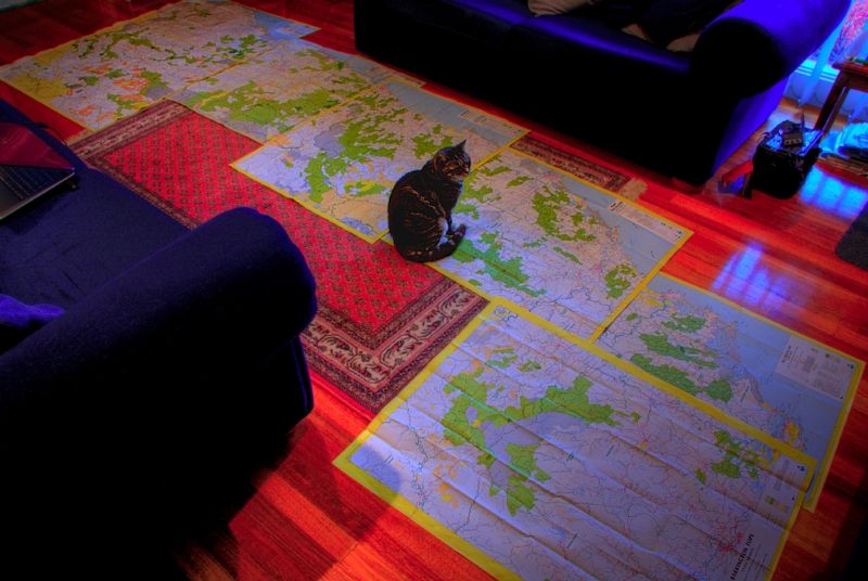
My cat and I know who owns what ... but She thinks that she owns it all by putting pin pricks in all of my maps. Bush roads on the Great Divide from Killarney to the Barrington Tops. I need a bigger sitting room to reach the forests around Tumut and to the forests of the South East. As much as I like my GPS to play with, it shows me nothing that I want to know. What I need to know, makes the GPS just a toy and an ordinary toy at that.
Re: What are your views on bushwalkers using GPS?
Tue 20 Sep, 2011 1:45 pm
It certainly seems that they seem to have a disproportionate number of contenders for the darwin awards over there. Reminds me of one night when I was backpacking in Canada and had settled in front of the TV at a yoof hostel and was watching the nightly news. There were images of mass carnage down through a pine forest along the side of a highway somewhere and I was thinking that a passenger plane had gone down. Turns out that a retiree had sold his house and bought one of those greyhound bus sized luxury RV's and after he'd gotten comfy on the highway thought he'd put on the cruise control and go back and make a coffee
Re: What are your views on bushwalkers using GPS?
Tue 20 Sep, 2011 2:27 pm
WarrenH wrote:My cat and I know who owns what ... but She thinks that she owns it all by putting pin pricks in all of my maps. Bush roads on the Great Divide from Killarney to the Barrington Tops. I need a bigger sitting room to reach the forests around Tumut and to the forests of the South East. As much as I like my GPS to play with, it shows me nothing that I want to know. What I need to know, makes the GPS just a toy and an ordinary toy at that.
That's by your choice. There is nothing about GPS tech stopping you using a GPS as something more than a toy. You could have all that you need to know (assuming its actually on maps) on a GPS if you wanted. You don't want to, and that's fine, but it does not alter the fact that a GPS is in the same league as map and compass.
Like I said, its all just technology. Making a choice about what we use does not diminish the value of the other alternatives. I personally enjoy using all of them.
Re: What are your views on bushwalkers using GPS?
Tue 20 Sep, 2011 2:55 pm
photohiker wrote:That's by your choice. There is nothing about GPS tech stopping you using a GPS as something more than a toy. You could have all that you need to know (assuming its actually on maps) on a GPS if you wanted. You don't want to, and that's fine, but it does not alter the fact that a GPS is in the same league as map and compass.
Like I said, its all just technology. Making a choice about what we use does not diminish the value of the other alternatives. I personally enjoy using all of them.
I have been putting my 1:25000 topo's into my new mapping GPS.
What is the difference from reading a map on a screen and reading a map on paper?, I am still reading the same map, the GPS tells me where I currently am on the map, where I have been, how far to go, how far I have been, I can track back if needed, I can record my tracks for future reference.
Several times now I have appreciated the usefullness of GPS in whiteout conditions.
Tony
- My winter highest ten trip overlayed on Google Earth and my scanned Topo's
Re: What are your views on bushwalkers using GPS?
Tue 20 Sep, 2011 3:16 pm
I don't own a GPS, but one day ... (that Santa fella is going to be a busy boy).
I've always used a map and compass and was trained in their use while in the Army as a surveyor. This does not mean I will never own a GPS. They are as many have said just a tool and should be seen as just one component of the navigational tool kit. I believe a GPS should be used, skillfully, in conjucture with other available navigational devices. I'm getting back into bushwalking with my son. He will be taught how to use a map and compass. We will borrow a GPS from his uncle and learn how to use that too. I will make sure he can find his direction using only the sun and to navigate at night. All these are necessary skills a bushwalker really should take the time to learn (even if all a person has is a digital watch). I have great respect for people who use only a map and compass.
As for location beacons, I consider them to be just as important as a first aid kit. Especially now that I'm going scrub with my lad.
Cheers
Gary
Re: What are your views on bushwalkers using GPS?
Tue 20 Sep, 2011 3:49 pm
photohiker wrote:That's by your choice. There is nothing about GPS tech stopping you using a GPS as something more than a toy. You could have all that you need to know (assuming its actually on maps) on a GPS if you wanted. You don't want to, and that's fine, but it does not alter the fact that a GPS is in the same league as map and compass.
I was talking about my GPS not your GPS or Tony's flash GPS with colour.
My GPS is a toy. It is a 10 year old Explorist, lower than entry level nowadays. I've given up dreaming of having a map in my GPS one day. Anything that is in my GPS, I have to log in ... and I don't mean downloading stuff into it.
I do think that I know a bit about using GPS and even EPIRBS (not PLBs) and compass and charts, having navigated racing yachts for a while, in long distance races. That's is why I prefer basic navigation nowadays and have cast off the GPS ... I've retired from concerning myself about not having a boat travel one inch further or one degree off an efficient line more than necessary. There is some sophisticated stuff on racing yachts that makes the hand held stuff we walkers have, pale.
When on land using a GPS you have a waypoint to get to, if you lave logged it accurately or the GPS has it already featured in the map. Using a navigation station on a racing yacht you just don't make the next mark the way the GPS cursor points to it. To get there requires being totally efficient. By knowing the true wind angle, the true wind speed, the true wind direction (especially from gusts), adjusting the heading to the apparent wind angle, keeping the velocity high consistent with making the boat's velocity good (VMG), by repeatedly adjusting the boat's heading to keep the VMG high and when gusts come determining which side of the gust is favoured to shorten the distance to the mark and to make it to the mark ... and done in the dark at times while calculating tide times and the speeds that the tide is running while avoiding hazards like rocks and reefs and channel markers and cardinals. All done while keeping clear of other boats and big ships ... that's why using a GPS on land seams basic and takes away the real challenge of navigation for me.
I have always enjoyed navigation. Flying by the seat of one's pants has a lot going for it. Being self reliant, I feel offers more to the experience.
Warren.
Re: What are your views on bushwalkers using GPS?
Wed 21 Sep, 2011 6:10 pm
Did you scan your topo at 1:1 then register it to Coordinates then load it into your GPS?
Coud you run through the process for us this looks great, I have contours in my GPS but this is a step better in the right direction!
Genesis
Tony wrote:photohiker wrote:That's by your choice. There is nothing about GPS tech stopping you using a GPS as something more than a toy. You could have all that you need to know (assuming its actually on maps) on a GPS if you wanted. You don't want to, and that's fine, but it does not alter the fact that a GPS is in the same league as map and compass.
Like I said, its all just technology. Making a choice about what we use does not diminish the value of the other alternatives. I personally enjoy using all of them.
I have been putting my 1:25000 topo's into my new mapping GPS.
What is the difference from reading a map on a screen and reading a map on paper?, I am still reading the same map, the GPS tells me where I currently am on the map, where I have been, how far to go, how far I have been, I can track back if needed, I can record my tracks for future reference.
Several times now I have appreciated the usefullness of GPS in whiteout conditions.
Tony
Re: What are your views on bushwalkers using GPS?
Wed 21 Sep, 2011 6:31 pm
Genesis wrote:WarrenH,
Did you scan your topo at 1:1 then register it to Coordinates then load it into your GPS?
Coud you run through the process for us this looks great, I have contours in my GPS but this is a step better in the right direction!
Genesis
Hi Genesis,
I think you might mean Tony.
The process to put custom maps into a Garmin GPS is quite involved, I will writeup tonight what I do and post in its own thread, I will then do a wiki on the topic.
Tony
Re: What are your views on bushwalkers using GPS?
Wed 21 Sep, 2011 7:13 pm
photohiker wrote: Very handy for planning which cliff you are going to walk off while staring at your GPS
But it's so much more fun when you ad lib.
Re: What are your views on bushwalkers using GPS?
Thu 22 Sep, 2011 7:43 am
Tony wrote:Genesis wrote:WarrenH,
Did you scan your topo at 1:1 then register it to Coordinates then load it into your GPS?
Coud you run through the process for us this looks great, I have contours in my GPS but this is a step better in the right direction!
Genesis
Hi Genesis,
I think you might mean Tony.
The process to put custom maps into a Garmin GPS is quite involved, I will writeup tonight what I do and post in its own thread, I will then do a wiki on the topic.
Tony
Ah yes um well......
Tony Sorry about that, I find the quotes a bit hard to read sometimes...
A process would be great thatnk a heap for that.
Genesis
Re: What are your views on bushwalkers using GPS?
Fri 23 Sep, 2011 11:11 am
As for maps, I totally agree that there is a loss of detail in many new NSW topos. Whether they are deliberate omissions, I can't say. I recently discovered that a significant peak in the Wollemi, Mt Savage, is not marked on the second edition maps, where it was on the first, so it seems it isn't just man made features that are being dropped off!
Re: What are your views on bushwalkers using GPS?
Fri 23 Sep, 2011 1:09 pm
I believe that NPWS have a lot of control over what LPI can/can't show in Parks.
Re: What are your views on bushwalkers using GPS?
Fri 23 Sep, 2011 3:34 pm
Still, no GPS or map and compass for that matter can replace common sense. I was once on traverse in the jungles of Sulawesi where our course slowly turned 180 degrees and my field crew insisted that the compass was wrong! - because they didn't feel us turning around. They would rather have believed their "feelings" that the geomagnetic field!
I've been lost in the fog in on the Denison Range in 1980 - a GPS would have been very useful then. But I generally don't take one, just through laziness probably. But I wouldn't hesitate to refer to someone else's GPS track for reference before a long off-track trip.
Re: What are your views on bushwalkers using GPS?
Fri 23 Sep, 2011 7:11 pm
Ticklebelly
Re: What are your views on bushwalkers using GPS?
Fri 23 Sep, 2011 7:30 pm
I don't have any problems with using GPS's but I do when people are so reliant on them they are relatively (absolutely) useless in navigation to the point where they are desensitised to their surroundings and 'lost' without them.
There are analogies here to all manner of navigational aids but GPS is the only one requiring a battery and as such is at the whim of its little device that drives it. I don't believe its quite fair to directly align GPS with maps, compass, sextant, watches, and due to their dependance on power as in battery(s) they are not equal.
Yes an aid but only while the battery lasts.
I often look in awe and wonder at those poor soles who live in remote mountainous areas and know how to survive and at the (too often) times when natural disasters strike and destory everything in their path and how well the majority of the western world would cope in such events.
Most would have no idea how to survive and would probably perish quickly. Those less reliant on modern contrivances would adapt and scrounge and eke out an existence.
It's these natural instincts that modern 'westerners' have lost that renders a GPS (amongst other things) as an indispensable item that one 'can't live without'.
I hear the comments re 'whiteouts', 'crevices' etc and they are valid and I'm not speaking against them.
It's just that longheld belief (of mine) that the more we become refined in our ways and dependant on electronic devices we become more open to problems when the proverbial hit's the fan.
So I say use your GPs but please take the time and effort for those who are less endowed with navigational skills, to look about and learn some skills so you can find your way in times of need.
It will also enhance the experience as one becomes more aware of what's out there and what makes this great outdoors 'tick'.
Which I guess is what we are out there in the first place.
Re: What are your views on bushwalkers using GPS?
Wed 28 Sep, 2011 1:52 pm
Hi. I think just "joining the GPS bandwagon" would be a dangerous course of action, however using GPS *in addition* to map&compass and staying aware of directions, landmarks, etc. etc. adds an extra degree of safety, even if you never turn the receiver on. GPS can be worse than useless however, if you're not thoughly familiar with your receiver and how to use it; What can it do and what can it not?
So, with other sound safety and navigation etc. meathods already in use, GPS is a big plus when used properly.
PS. It's a bit off topic but as for Open Street Maps (OSM.org) GPS maps being compiled by people "who have been there", that's increasingly just plain wrong, and it bugs me no end. I'd hazard that *most* new entries to the OSM project are sourced from online documents and other online info, and not from that which users physically collect or sight. One
unfortunate (IMHO) exeption to this 'rule' is that nearly every fire trail, walking trail,
animal trail, and ant trail is being entered into the OSM map in my area.
Re: What are your views on bushwalkers using GPS?
Wed 28 Sep, 2011 4:20 pm
JohnFisher wrote:PS. It's a bit off topic but as for Open Street Maps (OSM.org) GPS maps being compiled by people "who have been there", that's increasingly just plain wrong, and it bugs me no end. I'd hazard that *most* new entries to the OSM project are sourced from online documents and other online info, and not from that which users physically collect or sight. One
unfortunate (IMHO) exeption to this 'rule' is that nearly every fire trail, walking trail,
animal trail, and ant trail is being entered into the OSM map in my area.
And there is the rub. Its a community resource, and the community must maintain it if it is to remain worthwhile. I'm not finding many errors or useless entries once we get off the bitumen though, what area are you talking about?
Re: What are your views on bushwalkers using GPS?
Wed 28 Sep, 2011 9:16 pm
Again use more than one source for info. even if the only other source is your own two (or in my case about one and a half) eyes.
Cheers.
Re: What are your views on bushwalkers using GPS?
Thu 29 Sep, 2011 12:44 pm
I'm a genunine old fart but I have to say the new technology is exciting, has the potential to make walking a whole lot more safe for lot of people, and might even attract some new people into our fraternity.
Remember, a majority of people frowned on motor vehicles and stuck with horses....you may have noticed there aren't that many riding on the roads anymore.
GPS makes sense to me and EPIRB sounds like something I would consider if I was doing multi day walks like a lot of you guys.
The world is moving on, so should you.
Cheers all
Re: What are your views on bushwalkers using GPS?
Fri 30 Sep, 2011 4:31 pm
For more remote walk I carry a sat phone and have done since 2003
And I think my kids think I'm an old fart. I'm certainly semi-retired.
Re: What are your views on bushwalkers using GPS?
Mon 03 Oct, 2011 12:39 pm
Re: What are your views on bushwalkers using GPS?
Thu 06 Oct, 2011 2:38 pm
taswegian wrote:I wonder if the thread has lost its way?In what FatCanyoner originally meant by his query
Well please let me be a tad more succinct ... it isn't an adventure if you already know all the answers.
It is also fairly obvious to me, that all who have posted here ... have come back alive, so I trust them. Well done everybody.
Warren.
Re: What are your views on bushwalkers using GPS?
Thu 06 Oct, 2011 3:03 pm
FatCanyoner wrote:I try to enforce this on others on my trips, to varying success, and if a GPS does come out I demand the person show on the map where they think we are first, before turning it on. Most of my argument is about the fact that it encourages the same sort of lazy navigation that you get from people just following the track / following the leader, rather than actively reading the terrain. Given practice is the most important part of navigation, this would seem to create a cycle where people use GPS because they are not confident, but never get competent because they always use GPS.
The above is my take on it. Work out where you are first. Then confirm with GPS if you feel you need to.
I had exactly this argument/discussion on the weekend with a GPS afficionado in our group. 6 of the 8 of us had maps and compasses and were using them to track the route. At one point he was about to start giving us a grid ref and I told him to "shush" and wait until everyone had worked out where we were first. I tried to explain my reasoning afterwards - he was a little put out at the time.
If your map position and GPS position differ, you then need to work out which one is right and why. GPS is not infallible, and if you go to it first you create an unconscious bias that means you can't then independently work out where you are.
I find the GPS track is most useful at home, if down the track I want to remember where a trip went, or how long it took to get from A to B (I don't make many notes as I go). I leave it switched on in the top pocket of my pack.
A friend of mine uses the altimeter on his watch as a sort of GPS. If it's been calibrated, it will give you the vertical position, whereas the GPS will give you the horizontal position. That said, he is also a good map/compass navigator (and he doesn't have a GPS).
Re: What are your views on bushwalkers using GPS?
Thu 06 Oct, 2011 8:30 pm
A PLB is to bushwalking what an airbag is to car safety....I expect people to have one.
Re: What are your views on bushwalkers using GPS?
Mon 07 Nov, 2011 8:21 am
Bushwalking to me is all about the individual - some people like trundling along a well-formed track and some like taking that left-hand turn off the track and into the bush to get away from it all (including most forms of technology); some like to cruise along stopping at every interesting plant / rock / bird and others like to try to set landspeed records between each camp (I like camping with them - it usually means that they'll have a cuppa ready as I roll in. I just need to work out how to get them to carry my tent and put it up for me now
What concerns me is those who rely completely on technology or who don't understand how it operates. As stated above, the loss of 'bushcraft' skills (and a degree of common sense) leads to the death by GPS scenarios and keeps the Darwin Awards going strong. Whilst amusing from a distance, each involved a real person (except for the urban myths
Technology - whether its your gortex, cooker, GPS or even the basic technology of a map and compass - should be there as an aid and anyone who goes out should be able to survive without any of them in case of malfunction, damage or loss; you really owe it to your family and friends (and those who have to come to your assistance) to be able to look after yourself.
Re: What are your views on bushwalkers using GPS?
Mon 02 Jan, 2012 2:00 pm
Re: What are your views on bushwalkers using GPS?
Mon 02 Jan, 2012 3:26 pm
duff wrote:i have walked extensively in tasmania,i carry niether map or compass,keep it real
Um? Similar statement are made by our SES re lack of preparedness when they have to rescue people
Maps, compasses, GPS, PLB, mobile phones, signalling mirrors, etc are all tools and not the work of the devil. Why do we live in a society that finds evils in objects or superiority in not taking advantage of them? Arh yes! Warehouse 13 thinking
As for comments that stupid follow anything. Well, I would much rather follow the footsteps of an old timer than smash a path through using dead reckoning.
Finally, if you have not been geographically challenged you probably have not been outside your house. In that case every tool is handy, providing you can figure it out. And yes mucking up datum on GPS is more common than what many will admit. And I challenge anyone to be pin point with a GPS on a 1:100,000 map. But when the probable happens then given me a GPS even if it takes me half an hour to figure it out. Better still give me a GPS with someone that is good at using it
Cheers
Re: What are your views on bushwalkers using GPS?
Mon 02 Jan, 2012 4:50 pm
However, I have been suprised how much "distance" it loses compared with the routes in the guidebooks, when in forest and gullies. It is clear that it has trouble keeping track of where it is under some conditions so I would not rely on it. I did orienteering for about 10 yrs so I can find my way off track with a compass and map if necessary and did so recently when a poorly marked track disappeared.
© Bushwalk Australia and contributors 2007-2013.