- trekker_shot2-660x371.jpg (55.33 KiB) Viewed 6087 times
Google intend to map 'everything' in 3D just like street viewer and are including hiking trails:
Luc Vincent, a Street View engineering director, recently took a Trekker with him on a ski trip in Tahoe, collecting images that could be used for Street View shots of the slopes. Of wearing the backpack while skiing, Vincent said, “It’s really not so bad. You’ve got to be a bit careful obviously, but, hey, it works.”
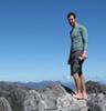
Google says only a handful of the backpacks currently exist, and unlike the other products it demoed Wednesday, the Trekker isn’t a consumer technology that anyone can try out for him or herself. The company plans on using the Trekkers to map out castles, ruins, hiking trails, and the Grand Canyon — places where wheeled vehicles and planes can’t go.
Looks like I can now ditch my compass and GPS and simply hike via my Android phone