Page 1 of 1

Google Earth

PostPosted: Tue 15 Jul, 2008 8:21 pm
by Pompom
I don't know where to put this thread so the moderator can sort it out should it need it.I have today noticed that Earth has been upgraded and as far as I can see practically the whole state is now well defined, especially in my area of interest the Central Plateau. I found one comical part and that was where River Nile runs off Ben Lomond and after a short while dries up on the junction of two overlaps.
Bob Cooper

Re: Google Earth

PostPosted: Tue 15 Jul, 2008 11:02 pm
by sthughes
Earth has been upgraded


LOL - Planet Earth 2.0 :P

Wow -yeah you are right, heaps of the state has been given a major upgrade! Burnie now exists as more than just a smear on the state map - still second class to Devonport and Ulverstone though!
The new stuff isn't as good as the really good areas - but it's still good and there is sooo much more of it!

Thanks for the heads up Pompom

Re: Google Earth

PostPosted: Wed 16 Jul, 2008 7:47 am
by Son of a Beach
It still just shows an empty paddock where my house is. :(

Re: Google Earth

PostPosted: Wed 16 Jul, 2008 7:04 pm
by tastrax
Yes, most of it is Spot data (2.5 metre resolution - unforunately no dates for these images). Much better than the old Landsaat data, but not as good as the Digitalglobe (0.6m resolution - some of the major population areas plus a few other locations - some of this is up to 7 or 8 years old).

The Digital Globe images just west of Rosevears are from April 2003 and to the east December 2006.

Cheers - Phil

Re: Google Earth

PostPosted: Wed 16 Jul, 2008 11:11 pm
by sthughes
I'd say the new imagery is the summer of 05-06 or thereabounts. Thats just going on what buildings I've done at work that are build or not. Could be early 06-07 summer I guess - before the bushfires in the southwest - but I boubt it.

Re: Google Earth

PostPosted: Fri 18 Jul, 2008 2:30 pm
by tasadam
tastrax wrote:Yes, most of it is Spot data (2.5 metre resolution - unforunately no dates for these images). Much better than the old Landsaat data, but not as good as the Digitalglobe (0.6m resolution - some of the major population areas plus a few other locations - some of this is up to 7 or 8 years old).

The Digital Globe images just west of Rosevears are from April 2003 and to the east December 2006.

Cheers - Phil

I could ask how you find stuff like that out, but then I am inviting myself something to do that I do not have time for.
Interesting, though.

I don't use google earth as such, but do use google maps and switch to satellite view. That's the same data, right?

Re: Google Earth

PostPosted: Sun 20 Jul, 2008 3:27 pm
by tastrax
Its actually quite easy to find out. I have Google earth PLUS and in the status bar at the bottom it tells you the date of the imagery (for Digital Globe).

GE_Status_bar.jpg
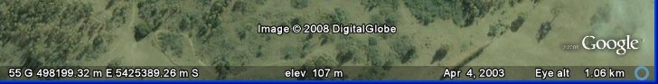
GE_Status_bar.jpg (20.44 KiB) Viewed 8729 times


As for details of resolution just check out something like Wikipedia and they have info on each of the image suppliers.

http://en.wikipedia.org/wiki/Spot_Image - for the Cnes/Spot Imagery
http://en.wikipedia.org/wiki/Digital_Globe - for Digital Globe

If you want to check out even later imagery then go to the MORE layers, tick Digital Globe and you will see what is available to purchase. You can even just show those images with <10% cloud cover etc. Sinclair Knight Mertz are the agent for digital globe in Aus. Before you rush out for the better photography I suggest you consider the pricing - I got a quote for a friends farm and it was about a quarter of one image and it was over $2000!

Needless to say the current imagery is good enough for him and with Stitchmaps I was able to get a very nice image for next to nothing!

As for Googlemaps - that's something I don't use much but yes, it looks like the same images.

Re: Google Earth

PostPosted: Wed 23 Jul, 2008 1:34 pm
by Speculator
sthughes wrote:Burnie now exists as more than just a smear on the state map


It's amazing what they can do with technology these days, 'cos when I drive through Burnie it still looks like a smear in real life! Smells a bit like it too! ;)

L8r.

Re: Google Earth

PostPosted: Tue 29 Jul, 2008 10:12 pm
by Steve
Speculator wrote:
sthughes wrote:Burnie now exists as more than just a smear on the state map


It's amazing what they can do with technology these days, 'cos when I drive through Burnie it still looks like a smear in real life! Smells a bit like it too! ;)

L8r.

Hahaha, everyone bags Burnie, its not anywhere near as bad as it used to be. The water is heaps clearer, less pollution and no smell.. besides the smell of pine from the woodchips every now and then. Not to mention its won the Australian Tidy Towns Award twice, i think, in recent years.

Even though I live up north now I'll always be patriot of the south. :P