Forum rules
Only administrators may post new topics to this forum. Registered users can post replies.Re: GAME: Where Am I? (Continued)
Sat 19 Sep, 2009 8:09 pm
Re: GAME: Where Am I? (Continued)
Sat 19 Sep, 2009 9:14 pm
Over to you
Re: GAME: Where Am I? (Continued)
Sat 19 Sep, 2009 9:22 pm
next pic.
Re: GAME: Where Am I? (Continued)
Sat 19 Sep, 2009 10:07 pm
Re: GAME: Where Am I? (Continued)
Sat 19 Sep, 2009 10:34 pm
Re: GAME: Where Am I? (Continued)
Sat 19 Sep, 2009 10:56 pm
this one was taken just last week when we had that awesome sunny day..
Re: GAME: Where Am I? (Continued)
Sat 19 Sep, 2009 11:26 pm
Re: GAME: Where Am I? (Continued)
Sun 20 Sep, 2009 9:09 am
Re: GAME: Where Am I? (Continued)
Sun 20 Sep, 2009 2:40 pm
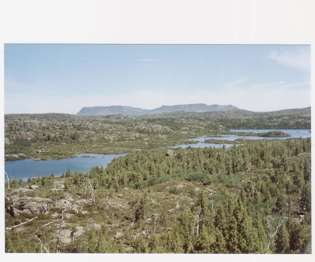
This was a daywalk from Launnie if that helps (no, we didn't drive for 5 hours..)
Re: GAME: Where Am I? (Continued)
Sun 20 Sep, 2009 4:46 pm
It doesn't quite add up but I have this fixation on the ridge on the right.
It reminds me of the mountains we saw north of the road on the drive through Fingal to St Marys.
The view appears top be a zoom which will distort the sense of distance.
And the mountains on the left appear to be part of a large run of mountain(s) - sooo - are you on the way up towards Stacks Bluff looking towards the east coast?
[Edit - this will not be right. Just checked some photos out. But I am not up to chasing it any more for now.]
Re: GAME: Where Am I? (Continued)
Sun 20 Sep, 2009 6:38 pm
Re: GAME: Where Am I? (Continued)
Sun 20 Sep, 2009 6:43 pm
Re: GAME: Where Am I? (Continued)
Sun 20 Sep, 2009 6:44 pm
Re: GAME: Where Am I? (Continued)
Sun 20 Sep, 2009 7:01 pm
Re: GAME: Where Am I? (Continued)
Sun 20 Sep, 2009 7:06 pm
Ok im really only guessing Stein Crags?
Re: GAME: Where Am I? (Continued)
Sun 20 Sep, 2009 7:13 pm
Re: GAME: Where Am I? (Continued)
Sun 20 Sep, 2009 7:17 pm
Re: GAME: Where Am I? (Continued)
Sun 20 Sep, 2009 7:19 pm
Re: GAME: Where Am I? (Continued)
Sun 20 Sep, 2009 7:22 pm
ok hint, it's not part of the ben lomond plataeu
Re: GAME: Where Am I? (Continued)
Sun 20 Sep, 2009 7:23 pm
ok next guess is......
Re: GAME: Where Am I? (Continued)
Sun 20 Sep, 2009 7:25 pm
Arthur?
Maurice........
Re: GAME: Where Am I? (Continued)
Sun 20 Sep, 2009 7:34 pm
Re: GAME: Where Am I? (Continued)
Sun 20 Sep, 2009 7:36 pm
- Attachments
-
Re: GAME: Where Am I? (Continued)
Sun 20 Sep, 2009 7:39 pm
It's on the edge of the Western Tiers. We walked from near Lake Mackenzie to the cliffs
Re: GAME: Where Am I? (Continued)
Sun 20 Sep, 2009 7:46 pm
Re: GAME: Where Am I? (Continued)
Sun 20 Sep, 2009 7:50 pm
Re: GAME: Where Am I? (Continued)
Sun 20 Sep, 2009 7:57 pm
This one must be easy.
Re: GAME: Where Am I? (Continued)
Sun 20 Sep, 2009 8:03 pm
And I got no Idea of that pic Robl......
Re: GAME: Where Am I? (Continued)
Sun 20 Sep, 2009 8:37 pm
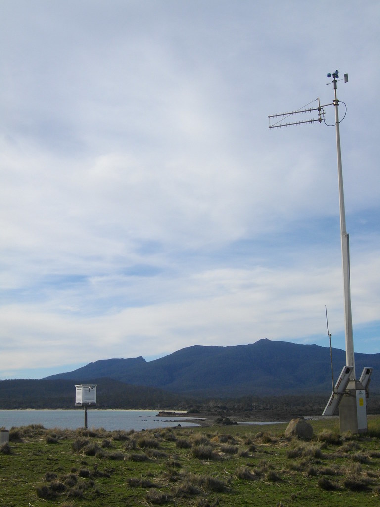
Are you at the weather station at Miena?
Edit 2: Gee - strike 2. That has got to be a beach with that white sand and the vegetation pattern.
Edit 3: Hmm - that might place it on Maria Is - is this a remote solar powered automatic weather station at Encampment Cove?
Re: GAME: Where Am I? (Continued)
Sun 20 Sep, 2009 9:35 pm
It is Bishop And Clerk and Mt Maria from the AWS near hill 30 at Pt Lesueur.
(about 1.5k from Encampment Cove)
Did you google to the answer?
© Bushwalk Australia and contributors 2007-2013.