Western Arthurs
Tasmania specific bushwalking discussion. Please avoid publishing details of access to sensitive areas with no tracks.
Western Arthurs
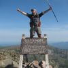
![]() by chopper » Thu 10 Dec, 2009 7:42 pm
by chopper » Thu 10 Dec, 2009 7:42 pm
- chopper
- Nothofagus cunninghamii

- Posts: 7
- Joined: Thu 10 Dec, 2009 7:24 pm
- Region: New South Wales
Re: Western Arthurs
![]() by ILUVSWTAS » Thu 10 Dec, 2009 7:45 pm
by ILUVSWTAS » Thu 10 Dec, 2009 7:45 pm
And its more than JUST a notch or 2 up from the overland... the overland is a stroll in the park by comparison! theres LOTS of VERY steep sections that need negogiating. and while there is a good track/pad leading through it yes.. it still is very rough in places. Pack a rope just in case........
-

ILUVSWTAS - Lagarostrobos franklinii

- Posts: 11027
- Joined: Sun 28 Dec, 2008 9:53 am
- Region: Tasmania
- Gender: Male
Re: Western Arthurs
![]() by ILUVSWTAS » Thu 10 Dec, 2009 7:46 pm
by ILUVSWTAS » Thu 10 Dec, 2009 7:46 pm
Check the trip report out, and remember pictures NEVER do justice of how rough/steep the terrain is.
-
ILUVSWTAS - Lagarostrobos franklinii
- Posts: 11027
- Joined: Sun 28 Dec, 2008 9:53 am
- Region: Tasmania
- Gender: Male
Re: Western Arthurs
![]() by tasadam » Thu 10 Dec, 2009 7:46 pm
by tasadam » Thu 10 Dec, 2009 7:46 pm
I think you'll find it more than a notch or two up on the Overland tracfk (putting it mildly).
Several topics here on the forum including South West Walking Simulation have some interesting info here for you.
-

tasadam - Magnus administratio

- Posts: 5900
- Joined: Tue 10 Apr, 2007 6:58 pm
- Location: Near Devonport, Tasmania
- ASSOCIATED ORGANISATIONS: TasmaniART, Smitten Merino, Macpac
- Region: Tasmania
- Gender: Male
Re: Western Arthurs
![]() by eggs » Thu 10 Dec, 2009 8:10 pm
by eggs » Thu 10 Dec, 2009 8:10 pm
And probably the day you will be thinking "what have we got ourselves into" - climbing up cliffs, dropping down extreme mud walls and negotiating the very vertical Beggary Bumps.
Actually - you would do well to consider how it was getting to Oberon, and if you feel it has been very tough, I would seriously contemplate going back the way you came. Its still a most glorious walk. That would line up with our 3.5 day effort - afternoon walk to Junction Creek - next day to Square Lake - then a half day exploring through to the top of Pegasus before returning with packs to Cygnus - then getting wind blasted going back over Hesperus to Moraine A and back to the car.
Edit - I thought the trip url from ILUVSWTAS might have been this one http://bushwalk.com/forum/viewtopic.php?f=3&t=1998.
His is a great sample of fantastic scenery - but please read this link - it is about a recent journey that tested one persons expectations to the limit.
It also has a few more track centred photos.
-

eggs - Lagarostrobos franklinii
- Posts: 10832
- Joined: Fri 23 May, 2008 2:58 pm
- Location: Para Vista, South Australia
- Region: South Australia
Re: Western Arthurs
![]() by ILUVSWTAS » Thu 10 Dec, 2009 8:13 pm
by ILUVSWTAS » Thu 10 Dec, 2009 8:13 pm
-
ILUVSWTAS - Lagarostrobos franklinii
- Posts: 11027
- Joined: Sun 28 Dec, 2008 9:53 am
- Region: Tasmania
- Gender: Male
Re: Western Arthurs
![]() by Beeper » Thu 10 Dec, 2009 8:38 pm
by Beeper » Thu 10 Dec, 2009 8:38 pm
- Beeper
- Atherosperma moschatum

- Posts: 76
- Joined: Mon 16 Mar, 2009 5:53 pm
- Region: Tasmania
Re: Western Arthurs
![]() by ILUVSWTAS » Thu 10 Dec, 2009 8:40 pm
by ILUVSWTAS » Thu 10 Dec, 2009 8:40 pm
-
ILUVSWTAS - Lagarostrobos franklinii
- Posts: 11027
- Joined: Sun 28 Dec, 2008 9:53 am
- Region: Tasmania
- Gender: Male
Re: Western Arthurs
![]() by Beeper » Thu 10 Dec, 2009 8:49 pm
by Beeper » Thu 10 Dec, 2009 8:49 pm
- Beeper
- Atherosperma moschatum
- Posts: 76
- Joined: Mon 16 Mar, 2009 5:53 pm
- Region: Tasmania
Re: Western Arthurs
![]() by Son of a Beach » Thu 10 Dec, 2009 10:05 pm
by Son of a Beach » Thu 10 Dec, 2009 10:05 pm
I think doing it the other way is better because you get a shorter plain walk out from morraine A and the long plains walk on the way in builds a lot of anticipation walking the length of the range in view.
- Son of a Beach
- Lagarostrobos franklinii
- Posts: 6929
- Joined: Thu 01 Mar, 2007 7:55 am
- ASSOCIATED ORGANISATIONS: Bit Map (NIXANZ)
- Region: Tasmania
- Gender: Male
Re: Western Arthurs
![]() by DaveNoble » Thu 10 Dec, 2009 10:53 pm
by DaveNoble » Thu 10 Dec, 2009 10:53 pm
Day 1 - Scotts Peak to Square Lake
Day 2 - Square Lake to High Moor
Day 3 - High Moor to Lake Cirona (or near L Vesta)
Day 4 - back to SPD
Its a great shame to race through the range in a short time like this on your first visit. And it is definitely worth traversing all the way to the end of the range (Crags of Lucifer). And if you are fit, experienced, competent and like scrambling AND have a good spell of weather - then you may want to consider - Day 1 - SPD to L Oberon, Day 2 - to Haven Lake, Day 3 - to L Rossane, Day 4 - back along the Arthur Plains to SPD. It is common and part of the Western Arthurs experience to spend at least one day stormbound in your tent.
But if you have bad weather, or a bad forecast - then you may only want to walk out to Lake Oberon and back (via Moraine A)
If you don't like the scramble down to Lake Oberon - then seriously consider not going beyond L Oberon.
Have a good walk.
Dave
- DaveNoble
- Athrotaxis selaginoides

- Posts: 1032
- Joined: Sun 03 Feb, 2008 3:56 pm
Re: Western Arthurs
![]() by PeterJ » Fri 11 Dec, 2009 7:41 am
by PeterJ » Fri 11 Dec, 2009 7:41 am
I have been there several times, the last being in February 2009 and you can read my notes on the web Personally I wouldn't contemplate going from Oberon to Haven in a day, we did side trips and took 6 hours from Oberon to High Moor and another 6 to Haven. These are the hardest sections from a technical perspective with plenty of tricky ups and downs. Also be warned you need good weather for them. The log history for the range indicates that lots of parties turn back and on my last trip we encountered a couple who decided on that course at Square Lake.
My bushwalks pages
-

PeterJ - Athrotaxis cupressoides

- Posts: 428
- Joined: Mon 24 Sep, 2007 5:06 pm
- Location: Lenah Valley
- Region: Tasmania
- Gender: Male
Re: Western Arthurs
![]() by ILUVSWTAS » Fri 11 Dec, 2009 7:52 am
by ILUVSWTAS » Fri 11 Dec, 2009 7:52 am
DaveNoble wrote:
If you don't like the scramble down to Lake Oberon - then seriously consider not going beyond L Oberon.
This is probably the best advice so far, It all seems quite easy up until this point. And all of a sudden it's like WOAH STEEP!!
BUT it is only a taste of whats to come! It gets MUCH MUCH steeper.....
-
ILUVSWTAS - Lagarostrobos franklinii
- Posts: 11027
- Joined: Sun 28 Dec, 2008 9:53 am
- Region: Tasmania
- Gender: Male
Re: Western Arthurs
![]() by Son of a Beach » Fri 11 Dec, 2009 8:11 am
by Son of a Beach » Fri 11 Dec, 2009 8:11 am
If there is anyone in your group who has not experienced anything more substantial in this regard than the Overland Track, then you should definitely allow longer for this walk. It's not a "notch or two up from that". It's more like 10 notches up from the Overland Track.
Additionally, if the weather forecast is "a bit drizzly" for any location anywhere near there, it's quite likely that it will be quite drizzly, and perhaps full-on rain, for the entire trip (although not necessarily the case). That part of the South West has a very localised wet climate all of its own.
- Son of a Beach
- Lagarostrobos franklinii
- Posts: 6929
- Joined: Thu 01 Mar, 2007 7:55 am
- ASSOCIATED ORGANISATIONS: Bit Map (NIXANZ)
- Region: Tasmania
- Gender: Male
Re: Western Arthurs
![]() by alliecat » Fri 11 Dec, 2009 8:55 am
by alliecat » Fri 11 Dec, 2009 8:55 am
Son of a Beach wrote:If there is anyone in your group who has not experienced anything more substantial in this regard than the Overland Track, then you should definitely allow longer for this walk. It's not a "notch or two up from that". It's more like 10 notches up from the Overland Track.
That raises an interesting point. Should we have a "difficulty rating" list of Tassie walks somewhere on the site? Say the OT is a 1 and the WA is a 10, and people can rate walks on that scale? With a whole 'nother scale for off-track areas maybe. Maybe different ratings for vertical exposure, scrub, exposure of campsites, etc.
Just a thought.
- alliecat
- Athrotaxis cupressoides
- Posts: 314
- Joined: Thu 29 May, 2008 2:17 pm
- Region: Tasmania
Re: Western Arthurs
![]() by ILUVSWTAS » Fri 11 Dec, 2009 8:57 am
by ILUVSWTAS » Fri 11 Dec, 2009 8:57 am
-
ILUVSWTAS - Lagarostrobos franklinii
- Posts: 11027
- Joined: Sun 28 Dec, 2008 9:53 am
- Region: Tasmania
- Gender: Male
Re: Western Arthurs
![]() by ollster » Fri 11 Dec, 2009 9:02 am
by ollster » Fri 11 Dec, 2009 9:02 am
alliecat wrote:That raises an interesting point. Should we have a "difficulty rating" list of Tassie walks somewhere on the site? Say the OT is a 1 and the WA is a 10, and people can rate walks on that scale? With a whole 'nother scale for off-track areas maybe. Maybe different ratings for vertical exposure, scrub, exposure of campsites, etc.
Just a thought.
Nice thought. It'd be good if the site system could do a poll whereby you could allocate 1-10 to each major walk listed. Then you need to look at side trips too... Maybe too complicated?
I think off track walking shouldn't have a scale, considering it's too variable. At that point if you don't have the experience to figure it out for yourself (with a little prep info) then don't even attempt it. I'm sure you know what I mean.
-

ollster - Lagarostrobos franklinii
- Posts: 3975
- Joined: Tue 02 Sep, 2008 4:14 pm
- ASSOCIATED ORGANISATIONS: LoveMyGoat.com
- Region: Australia
Re: Western Arthurs
![]() by Son of a Beach » Fri 11 Dec, 2009 9:12 am
by Son of a Beach » Fri 11 Dec, 2009 9:12 am
alliecat wrote:Son of a Beach wrote:If there is anyone in your group who has not experienced anything more substantial in this regard than the Overland Track, then you should definitely allow longer for this walk. It's not a "notch or two up from that". It's more like 10 notches up from the Overland Track.
That raises an interesting point. Should we have a "difficulty rating" list of Tassie walks somewhere on the site? Say the OT is a 1 and the WA is a 10, and people can rate walks on that scale? With a whole 'nother scale for off-track areas maybe. Maybe different ratings for vertical exposure, scrub, exposure of campsites, etc.
Just a thought.
It's a great idea, and could be done on the Wiki. As suggested, a series of polls could be used to formulate a consensus for each value.
The wiki page could be set up similarly to the List of High Places page, with a column for each rating variable (eg, days/hours, kilometres, steepness, technical climbing, scrub, overall difficulty). The name of the track could then link to a wiki page dedicated to that particular track (these per-track pages do not need to exist, but the links will encourage people to add them if they wish to).
Anybody want to take this on?
- Son of a Beach
- Lagarostrobos franklinii
- Posts: 6929
- Joined: Thu 01 Mar, 2007 7:55 am
- ASSOCIATED ORGANISATIONS: Bit Map (NIXANZ)
- Region: Tasmania
- Gender: Male
Re: Western Arthurs
![]() by plaz » Fri 11 Dec, 2009 1:15 pm
by plaz » Fri 11 Dec, 2009 1:15 pm
A resource that I would have liked and suggest in parrallel to the rating scheme above is for experienced walkers to list comparable walks in other states. I imagine in the blue mountains the three peaks walk over 48 hours would give you a sense of the endurance, and maybe the Taros ladder or CArlton head off narrowneck a sense of the exposure...Its been so long since I've been to these places I've forgotten how steep they are, but I would have liked to be able to plan a training walk of similar intensity to the WAs near home, more for the confidence than anything else.
HAve a good trip.
- plaz
- Nothofagus gunnii

- Posts: 17
- Joined: Mon 26 Oct, 2009 10:18 am
- Gender: Male
Re: Western Arthurs
![]() by Ent » Fri 11 Dec, 2009 3:24 pm
by Ent » Fri 11 Dec, 2009 3:24 pm
(Shawshank Redemption)
-

Ent - Lagarostrobos franklinii
- Posts: 4059
- Joined: Tue 13 May, 2008 3:38 pm
- Region: Tasmania
Re: Western Arthurs
![]() by ILUVSWTAS » Fri 11 Dec, 2009 3:27 pm
by ILUVSWTAS » Fri 11 Dec, 2009 3:27 pm
Not really anywhere else that comes to mind is anything like the Arthurs
-
ILUVSWTAS - Lagarostrobos franklinii
- Posts: 11027
- Joined: Sun 28 Dec, 2008 9:53 am
- Region: Tasmania
- Gender: Male
Re: Western Arthurs
![]() by chopper » Fri 11 Dec, 2009 3:36 pm
by chopper » Fri 11 Dec, 2009 3:36 pm
- chopper
- Nothofagus cunninghamii
- Posts: 7
- Joined: Thu 10 Dec, 2009 7:24 pm
- Region: New South Wales
Re: Western Arthurs
![]() by Lindsay » Fri 11 Dec, 2009 3:57 pm
by Lindsay » Fri 11 Dec, 2009 3:57 pm
Son of a Beach wrote:alliecat wrote:Son of a Beach wrote:If there is anyone in your group who has not experienced anything more substantial in this regard than the Overland Track, then you should definitely allow longer for this walk. It's not a "notch or two up from that". It's more like 10 notches up from the Overland Track.
That raises an interesting point. Should we have a "difficulty rating" list of Tassie walks somewhere on the site? Say the OT is a 1 and the WA is a 10, and people can rate walks on that scale? With a whole 'nother scale for off-track areas maybe. Maybe different ratings for vertical exposure, scrub, exposure of campsites, etc.
Just a thought.
It's a great idea, and could be done on the Wiki. As suggested, a series of polls could be used to formulate a consensus for each value.
The wiki page could be set up similarly to the List of High Places page, with a column for each rating variable (eg, days/hours, kilometres, steepness, technical climbing, scrub, overall difficulty). The name of the track could then link to a wiki page dedicated to that particular track (these per-track pages do not need to exist, but the links will encourage people to add them if they wish to).
Anybody want to take this on?
The Wildwalks site has done this for parts of NSW. Their classifcation sytem may be of interest.
http://www.wildwalks.com/bushcraft/tech ... ystem.html
-

Lindsay - Phyllocladus aspleniifolius

- Posts: 680
- Joined: Thu 01 Oct, 2009 3:00 pm
- Location: Sydney
- Region: New South Wales
- Gender: Male
Re: Western Arthurs
![]() by Beeper » Fri 11 Dec, 2009 5:28 pm
by Beeper » Fri 11 Dec, 2009 5:28 pm
- Beeper
- Atherosperma moschatum
- Posts: 76
- Joined: Mon 16 Mar, 2009 5:53 pm
- Region: Tasmania
Re: Western Arthurs
![]() by norts » Sat 12 Dec, 2009 10:02 am
by norts » Sat 12 Dec, 2009 10:02 am
Roger
-
norts - Lagarostrobos franklinii
- Posts: 2005
- Joined: Wed 01 Aug, 2007 10:45 am
- Location: Germantown Tas.
- Region: Tasmania
Re: Western Arthurs
![]() by pez2290 » Tue 15 Dec, 2009 10:02 pm
by pez2290 » Tue 15 Dec, 2009 10:02 pm
Q: Most of the discussions on the WA have involved groups (2 or more) completing the trek. Is it possible to be completed alone without too much risk?
Q. Would mid to late March be an advisable time to go?
Thanks
Pez
- pez2290
- Nothofagus cunninghamii
- Posts: 1
- Joined: Tue 15 Dec, 2009 11:46 am
- Region: New South Wales
- Gender: Male
Re: Western Arthurs
![]() by ILUVSWTAS » Wed 16 Dec, 2009 7:11 am
by ILUVSWTAS » Wed 16 Dec, 2009 7:11 am
There is LOTS of info scattered around this site on the Western Arthurs. Use the search function on the top right of the page.
Also check John Chapmans Walking in SW tas.
Going solo into the Arthurs is always risky!! Unless your very very experienced I wouldnt advise it. Its subject to some of the worst weather in Tas. It's exposed, its steep VERY steep in places, and if something does go wrong your often a long way from help.
-
ILUVSWTAS - Lagarostrobos franklinii
- Posts: 11027
- Joined: Sun 28 Dec, 2008 9:53 am
- Region: Tasmania
- Gender: Male
Re: Western Arthurs
![]() by Son of a Beach » Wed 16 Dec, 2009 8:02 am
by Son of a Beach » Wed 16 Dec, 2009 8:02 am
The Western Arthurs is a LOT more difficult than the other walks you've listed (physically and psychologically) - at least the ones I know
- Son of a Beach
- Lagarostrobos franklinii
- Posts: 6929
- Joined: Thu 01 Mar, 2007 7:55 am
- ASSOCIATED ORGANISATIONS: Bit Map (NIXANZ)
- Region: Tasmania
- Gender: Male
Re: Western Arthurs
![]() by Orion » Wed 16 Dec, 2009 1:20 pm
by Orion » Wed 16 Dec, 2009 1:20 pm
pez2290 wrote:I haven't done too much research on the WA yet.
Pez, come back and ask questions after you have done a little more reading and poking about.
The thing about the Western Arthurs is that it includes a fair amount of exposed and sometime loose or slippery scrambling. That makes it different in an important way from the other things you've listed.
- Orion
- Athrotaxis selaginoides
- Posts: 1963
- Joined: Mon 02 Feb, 2009 12:33 pm
- Region: Other Country
Re: Western Arthurs
![]() by Steve » Thu 17 Dec, 2009 8:20 pm
by Steve » Thu 17 Dec, 2009 8:20 pm
chopper wrote:I'm very excited to be heading off to the Western Arthur's Traverse on Saturday.
Think I passed you two on the way out (an hour and a half from the Scotts Peak carpark). Were you that bloke with the scruffy hair putting gaiters on?
Regardless, was pretty miserable weather that end of the week.
- Steve
- Athrotaxis cupressoides
- Posts: 235
- Joined: Sat 09 Feb, 2008 3:19 pm
- Region: Tasmania
- Gender: Male
Who is online
Users browsing this forum: No registered users and 2 guests