difficulties in navigation, physical effort but particularly, the technical aspects of the climbs. I had read a number of accounts, including those of Hiking Fiasco, Big Kev and Mr Bean, along with various comments by others who did it or attempted it. Finally, I got around to it 2 days ago. I had recently walked up the north spur of Mt McDonald with 3 of my children and so knew that if I was up to it, they were too. My son had some leave, so off we went. Live and learn? Yes. After our late start up Mt McDonald, we decided to drive up to Upper Howqua camping ground the day before hiking, to get an early start on the walk.
NAVIGATION
Some years ago, I had spent a while looking for the start of the track. I think I had misinterpreted what others had written and looked for a track directly behind the toilet at Upper Howqua camping area. With the eye of faith, I had been able to convince myself there was some sort of route, a bit clearer than the surrounding bush. However, after a km or so of wandering in the bush, it was clear that this was going nowhere good. More recently, I was pleased with myself a couple of years ago that I found an old vehicle track that comes off the road into the camping area, about 10 metres after the bridge over the Howqua River. In some of the many posts about Helicopter Spur, there was a some difference of opinion about where the start of the track was. However, Mr Bean's account was definite and included a helpful, specific photo showing the start. It turns out that track goes into the bush about 5 metres before heading west to join up with the vehicle track that I had seen. So, both approaches are correct. As described in others' accounts, there is a good, clear, old vehicle track, probably good enough to drive your mate's 4WD up (maybe not quite good enough to drive your own) for a couple of km. The only point of note is to take the right fork where the track divides ~2km up: they say the left fork goes up the spur to Picture Point. Soon after the division of the track, it becomes a walking track but by then, it is on the spur. The track is not ambiguous, at least not at present: it's pretty clear and it just follows the high ground.
- The old vehicle track: good enough for your mate's 4WD
Once you are on the spur, you soon meet the first rock band. Point number 1 about the rock bands: the sequence is left, left, right: i.e. first rock band, walk up to the track to the cliff, then follow it to the LEFT- don't go up the cliff, but also, don't turn left before you get to the cliff or you'll be wandering in the wilderness. There is a gap in the cliff which is steep but has good hand and footholds. It's hard work; a really steep climb and it requires persistence and patience but not extraordinary skill or rock-climbing ability. After self-congratulations and a rest to admire the spectacular view, soon you'll be at the fabled second rock band. Again, walk to the cliff, then follow the track downhill to the LEFT and you'll see a chute soon appear. It's steep and some of the dirt may be a bit loose but there are tree branches and rocks providing good hand-holds. At the third rock band, the track up to the RIGHT is fairly clear and a bit shorter than the previous two.
- coming up the chute of the first rock band
- One rock band down; next one coming up
- 2nd rock band: at the cliff, turn left downhill until you come to the ......
- gap in the rock face, leading up
- and then come out at the top end of the chute
I can't claim to be fat, as Big Kev and Baeng 72 do, but I am not as young as I used to be and could only go at a moderate pace, with several stops to rest and breathe. With that, it took us 2 and a half hours from the campsite to the top of the third rockband. I'm sure plenty of others would be quicker. We did have cool weather and it was dry. It would definitely be harder in the wet. Having been up it, I would not see a problem going down it. I can't imagine a scenario where I would want a rope to haul me or my pack up or down it.
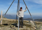
- View from the top of the spur, looking across to Picture Point, Mt Magdala and Mt Howitt
FURTHER PROGRESS
It took us another 2 1/2 hours to get to the saddle between Brocks Road and Mt Magdala for our lunch-stop We had gone up to Picture Point for the views, then had a bit of a look for the water a bit south of the road near Picture Point, described by Mr Bean, without success. Similarly, we went looking for water near where the AAWT heads away from Brocks Rd to Mt Magdala. I should have taken a picture of Mr Bean's map: I hadn't remembered the details of the location and we were not looking in the right places. Maybe next time, if I look in the right places, I might find water!
At Mt Magdala, we took the 'alternative' track around the north side of the peak, partly for the alternative views but largely, to avoid carrying our packs up an extra 100 m altitude: we would find camp, then come back without packs. The campsite at the saddle above Hellfire Creek is a beautiful, grassy site with many old snowgums for shelter. We found a level site for the tent and went to find water. Just south of the camping site, someone has placed a trail of red markers on the trees to indicate the path down to Hellfire Creek: thanks! The creek was running- barely. I think it took 2 minutes to fill a 2L water bottle, and that was capturing pretty much all the flow. I don't think it will be flowing for much more of the summer.
- looking west across the face of Magdala from the 'alternative' track
- Picturesque campsite above Hellfire Creek. Note the red markers on the trees, indicating 'walk this way for water'
- Hellfire Creek: barely a trickle
After a cup of tea, we walked back to the Magdala summit and had fantastic views, including cloud rolling up over Crosscut Saw, then down the Howqua valley. It was definitely worth going back for the views from the top.
Next day, we set off under cloudy skies for Mt Howitt and the decision to either descend down Stanleys Name Spur or, if the weather looked threatening, down Howitt Spur instead. The weather came in but we decided to see SNS anyway. I was surprised that it was not steep immediately as it comes off Crosscut Saw but after 500m or so, there are some steep, rocky descents which led to slow progress. As described by others, the campsite ~2 km down from Crosscut was a great place to eat lunch. It would be a very pleasant campsite. The creek, only ~100 m away, along an obvious path, was flowing well. It looked a fairly reliable water source. Do others know if it flows year-round?
The rest of the walk down to the Howqua River was uneventful except that the track to Queen Spur Road was getting overgrown, mostly with 'egg and bacon' (is that what it is usually called?) and the Queen Spur Road had some areas quite overgrown with blackberries. Fortunately for us, it was a cool, wet day, so we had our wet weather gear on and weren't much troubled by them. On a hot, sunny day with less clothing on, they would be a real nuisance.
Overall, a great two days. New tracks covered: Helicopter Spur and Stanleys Name Spur; new campsites and water sources seen; and fantastic scenery. We met two other pairs of walkers who seemed fairly capable but had seemed somewhat put off attempting Helicopter Spur due to its reputation. I tried to convince them that it is not incredibly difficult. If you are interested in it and you're prepared for a long, steep walk, give it a go.