by farefam » Fri 17 Mar, 2023 12:55 am
The E-W survey lines, and a number of N-S linking survey lines were laid out as part of a large grid, primarily for exploration mapping and to a lesser extent to enable geophysical surveys if the mapping identified anything that looked interesting. I actually traversed a large number of those survey lines in the late spring and "summer" of 1991-1992 in my first stint as a geologist. That "summer" was in the time before climate change became so very apparent in Western Tasmania, as I distinctly remember that the weather was mostly cold and miserable on that thankless job. The leeches seemed to enjoy it though. At first we walked into the northern part of the grid in the valleys of the Thomas Currie Rivulet and the Garfleld River. But once that section was finished and as the daily walk in and out was becoming prohibitively long, in the second part of the "summer" we hired a helicopter to fly us into to the Clark Valley section of the grid. That was supposed to have been done on a daily basis for a couple of fortnight's. Unfortunately though, the low cloud in the area was so persistent that we lost many days just waiting at the Queenstown airport, looking south, before giving up and driving back to the exploration base at Zeehan. The team only flew into the Clark Valley just a few times before the horrendous expense and terrible productivity forced the use of helicopters to be abandoned for the rest of that season.
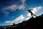
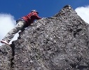
I do remember it was impressive one time to fly in close alongside the eastern cliffs of Mt Sorell. Another time I was running late for pickup and we had to try to run along the grid lines to reach the helicopter. That's not fun when you can't see where the helipad is hidden in the rainforest and scrub, yet it misleadingly sounds like it is parked idling just a stone's throw away. On that occasion the ex-military pilot decided to play about and did a sudden terrain hugging descent flying across the Sorell-Darwin saddle into the Clark Valley, which felt like it sent my stomach into my head. On one other occasion myself and a field assistant were dropped in by helicopter to a more remote part of the grid on the north side of Mt Sorell, intending to stay in a tent for a few nights then walk out. We did one day's good work but then It poured so much during the next day that we abandoned the mapping. We had to walk back out along an old mining tramway and the survey grid, to then cross the Garfield River so that we didn't get stranded there. It wasn't much fun crossing a big area of wind-felled forest and then having to strip off to our jocks to wade across the cold Garfield Rive; all the while carrying the heavy rock samples I had collected. Although I was only in my early days as a bushwalker, I felt reasonably comfortable with this "adventure", but my field assistant who had drawn the short straw was rather less so, and he made his views on that matter very clear. However, my field assistant did manage to maintain a cracking pace once we reached the 4WD track and he knew that salvation in the form of the warmth of the work vehicle was only another hour or so away! All in all it was a pretty unproductive "summer" and it was a sobering initiation into the difficulties of exploring the West Coast. It certainly gave me a huge amount of respect for the pioneering explorer's; that's for sure. I wasn't unhappy at all when I was made redundant, which put an end to my time in the Clark Valley. In places the bauera and ti-tree scrub was so thick that the survey team essentially tunneled through it with chainsaws.
Although in the subsequent three decades I have climbed dozens of mountains in Tasmania, including Farrell, Murchison, Julia Peak, the Tyndalls, Lyell, Huxley and Jukes, I've yet to summit Mt Sorell or Mt Darwin. Too many residual unpleasant memories of that "summer" perhaps???? In contrast it is astonishing just how much drier the West Coast summers have become since the 1990's, especially in the last dozen or so years. In the last 6 years or so I have hardly had to wear my rain gear at all.
As an aside, although I haven't worked as a geologist for a decade now, I have always firmly believed that there are places where exploration and mining is acceptable, and also that there are places where exploration and mining is definitely not acceptable. The Tarkine falls firmly into the unacceptable category, as do the areas east of the Anthony Road and south of Macquarie Harbour. It is appalling that successive Tasmanian and Federal Governments have not properly designated large areas of the Tarkine as National Park. The current tin exploration by Venture Minerals ought to be stopped permanently before any more damage is done. I would find it completely morally wrong to work in any of those areas.