Hi everyone, I have a bit of an odd request.
Just some background first, I'm a 5th year Masters of Architecture student at the University of Tasmania and I am currently undertaking my graduate project and Honours thesis on wilderness architecture in the Tasmanian southwest.
The physical site I have chosen for the the project is the area immediately to the west of the Scotts Peak Dam, adjacent to Red Knoll. The reason I have chosen this site specifically is that it straddles the physical boundary between the conservation disaster that was/is Lake Pedder, and the relatively pristine southwest wilderness area, and perhaps more so because it represents a focal point between various conservation, land management, and land exploitation ideologies. As such, the ongoing story surrounding Lake Pedder will be one of the key issues I consider.
So my request to you:
- Does anyone have a detailed topographical map of the Lake Pedder area before it was flooded, or know where I could find one?
- Does anyone have any photos of the valley between Red Knoll and Scotts Peak before the flooding?
Likewise, I am very interested in the cultural and social history of the area, as well as the physical place, so if anyone has any information they think would be helpful I'd be hugely grateful!
Thanks, Nick Clark
UTas BEnvDes
UTas MArch (Hons)
Scotts Peak/Lake Pedder information
Forum rules
Tasmania specific bushwalking discussion. Please avoid publishing details of access to sensitive areas with no tracks.
Tasmania specific bushwalking discussion. Please avoid publishing details of access to sensitive areas with no tracks.
18 posts
• Page 1 of 1
Scotts Peak/Lake Pedder information
![]() by nickthetasmaniac » Wed 02 Mar, 2011 11:40 am
by nickthetasmaniac » Wed 02 Mar, 2011 11:40 am
Rondanestien (Nor), Southern Ranges (Tas), Western Arthurs (Tas)
http://peopleandotherstrangecreatures.wordpress.com/
http://peopleandotherstrangecreatures.wordpress.com/
- nickthetasmaniac
- Athrotaxis cupressoides

- Posts: 395
- Joined: Thu 30 Apr, 2009 6:26 pm
- Region: Tasmania
Re: Scotts Peak/Lake Pedder information
![]() by taswegian » Wed 02 Mar, 2011 12:07 pm
by taswegian » Wed 02 Mar, 2011 12:07 pm
Nick have you tried Hydro Tasmania? They are helpful (from my experience).
Others would be TasMap but you may have to get the right contact otherwise it woud be a dead end and frustrating experience.
Be interested in your final product.
I still have a bottle of sand off the original lake shore- reminder of lost worlds. A great place then
Others would be TasMap but you may have to get the right contact otherwise it woud be a dead end and frustrating experience.
Be interested in your final product.
I still have a bottle of sand off the original lake shore- reminder of lost worlds. A great place then
-
taswegian - Phyllocladus aspleniifolius

- Posts: 899
- Joined: Tue 27 Jul, 2010 8:34 pm
- Region: Tasmania
- Gender: Male
Re: Scotts Peak/Lake Pedder information
![]() by ILUVSWTAS » Wed 02 Mar, 2011 1:17 pm
by ILUVSWTAS » Wed 02 Mar, 2011 1:17 pm
Contact the HWC Nick, they would have lots of things like this.
Nothing to see here.
-

ILUVSWTAS - Lagarostrobos franklinii

- Posts: 11027
- Joined: Sun 28 Dec, 2008 9:53 am
- Region: Tasmania
- Gender: Male
Re: Scotts Peak/Lake Pedder information
![]() by nickthetasmaniac » Wed 02 Mar, 2011 1:21 pm
by nickthetasmaniac » Wed 02 Mar, 2011 1:21 pm
Thanks guys, HEC were my next point of contact as my site is actually on HEC land (they own the narrow strip encompassing the two dams, within the Southwest Con Area and NP...).
I'll get onto HWC as well!
I'll get onto HWC as well!
Rondanestien (Nor), Southern Ranges (Tas), Western Arthurs (Tas)
http://peopleandotherstrangecreatures.wordpress.com/
http://peopleandotherstrangecreatures.wordpress.com/
- nickthetasmaniac
- Athrotaxis cupressoides
- Posts: 395
- Joined: Thu 30 Apr, 2009 6:26 pm
- Region: Tasmania
Re: Scotts Peak/Lake Pedder information
![]() by shazcol » Wed 02 Mar, 2011 1:24 pm
by shazcol » Wed 02 Mar, 2011 1:24 pm
Hi Nick, Have you looked at this link? There are some great images but not sure if they are what your after.
http://www.lakepedder.org/index.html.
This is also brilliant.
http://www.youtube.com/watch?v=m0qoYQ_AzPU
Hope it helps. Apolpgies if you have already seen them.
Sharon
http://www.lakepedder.org/index.html.
This is also brilliant.
http://www.youtube.com/watch?v=m0qoYQ_AzPU
Hope it helps. Apolpgies if you have already seen them.
Sharon
If common sense is so common, why don't you see more of it?
-

shazcol - Athrotaxis cupressoides
- Posts: 459
- Joined: Mon 11 Jun, 2007 9:25 pm
- Location: Launceston
- Region: Tasmania
Re: Scotts Peak/Lake Pedder information
![]() by tastrax » Wed 02 Mar, 2011 4:58 pm
by tastrax » Wed 02 Mar, 2011 4:58 pm
I would also try the Mines Dept - here is a quick scan from a 1960 Mines department map of the SW that included the old Lake Pedder
Not that detailed but I bet they have more stuff somehwere.
Not that detailed but I bet they have more stuff somehwere.
- EarlyLakePedderMines1960.jpg (88.98 KiB) Viewed 6866 times
-

tastrax - Lagarostrobos franklinii
- Posts: 2031
- Joined: Fri 28 Mar, 2008 6:25 pm
- Location: What3words - epic.constable.downplayed
- ASSOCIATED ORGANISATIONS: RETIRED! - Parks and Wildlife Service
- Region: Tasmania
Re: Scotts Peak/Lake Pedder information
![]() by ILUVSWTAS » Wed 02 Mar, 2011 5:08 pm
by ILUVSWTAS » Wed 02 Mar, 2011 5:08 pm
Sad that i never got to see it like that.
Thanks for posting that Phil
Thanks for posting that Phil
Nothing to see here.
-
ILUVSWTAS - Lagarostrobos franklinii
- Posts: 11027
- Joined: Sun 28 Dec, 2008 9:53 am
- Region: Tasmania
- Gender: Male
Re: Scotts Peak/Lake Pedder information
![]() by tastrax » Wed 02 Mar, 2011 5:31 pm
by tastrax » Wed 02 Mar, 2011 5:31 pm
And here is a bit more with some interesting trips noted...
-
tastrax - Lagarostrobos franklinii
- Posts: 2031
- Joined: Fri 28 Mar, 2008 6:25 pm
- Location: What3words - epic.constable.downplayed
- ASSOCIATED ORGANISATIONS: RETIRED! - Parks and Wildlife Service
- Region: Tasmania
Re: Scotts Peak/Lake Pedder information
![]() by Luuk Veltkamp » Wed 02 Mar, 2011 8:36 pm
by Luuk Veltkamp » Wed 02 Mar, 2011 8:36 pm
Thats a great map!
- Luuk Veltkamp
- Nothofagus gunnii

- Posts: 20
- Joined: Thu 13 Nov, 2008 10:43 pm
- Location: Hobart
- Region: Tasmania
Re: Scotts Peak/Lake Pedder information
![]() by JamesMc » Wed 02 Mar, 2011 9:06 pm
by JamesMc » Wed 02 Mar, 2011 9:06 pm
Isn't "wilderness architecture" a contradiction, like "American intelligence", "German humour" or "English cuisine"?
Seriously, there used to be 2 inch to the mile dyline contour maps of this area. Plotted contours with the new Lake Pedder later drawn in by hand. I got mine years ago (since disposed of) from the cartography deparment in what was the Lands Dept in Macquarie St Hobart about 20 years ago. I think they really appreciated someone who was interested in maps coming in. I suggest you go and talk to them. There's a good chance they'll be able to run off a dyline for you. Failing that, try the Hobart Library.
JamesMc
- JamesMc
- Athrotaxis cupressoides
- Posts: 321
- Joined: Wed 09 Dec, 2009 5:24 pm
- Region: Victoria
- Gender: Male
Re: Scotts Peak/Lake Pedder information
![]() by nickthetasmaniac » Thu 03 Mar, 2011 10:39 am
by nickthetasmaniac » Thu 03 Mar, 2011 10:39 am
Thanks again everyone  Phil those maps are great, thanks! Sharon, I've trolled through the lakepedder.org website but I hadn't spotted the youtube clip so thank you, I've never seen footage of the old lake!
The further into this project I get the deeper it seems to go. The Lake Pedder history is only one of about half dozen major issues I have to research and alone it's turning into something of a blackhole... Oh well, it's turning into quite an interesting subject If anyone is interested in the project I'll continue to post work here throughout the year.
Firstly, thanks for your suggestion of contacting the Lands Department.
Yes, wilderness architecture can be a contradiction of terms and to be honest usually is. But then, in the context of my site at Scotts Peak Dam, would you actually call it wilderness? If you regard wilderness as landscape untouched by human influence, then it certainly isn't. Beyond the obvious impact made by the Lake Pedder dams and the local quarries developed to build them, you also have a century of impact from bushwalkers, prospectors and explorers (think erosion, pollution from human waste and the introduction Phytophthora to begin with), and several millennia of land management by the indigenous population.
I don't mean to say that a project in the area wouldn't need to be sensative to the natural place, of course it would, but I am interested in exploring the potential for architecture in wild places to be a positive element of its environment, rather than a violent intrusion. Naturally, I may find that there shouldn't be built works in these areas, but then that's the purpose of the project
The further into this project I get the deeper it seems to go. The Lake Pedder history is only one of about half dozen major issues I have to research and alone it's turning into something of a blackhole... Oh well, it's turning into quite an interesting subject
JamesMc wrote:Isn't "wilderness architecture" a contradiction, like "American intelligence", "German humour" or "English cuisine"?
JamesMc
Firstly, thanks for your suggestion of contacting the Lands Department.
Yes, wilderness architecture can be a contradiction of terms and to be honest usually is. But then, in the context of my site at Scotts Peak Dam, would you actually call it wilderness? If you regard wilderness as landscape untouched by human influence, then it certainly isn't. Beyond the obvious impact made by the Lake Pedder dams and the local quarries developed to build them, you also have a century of impact from bushwalkers, prospectors and explorers (think erosion, pollution from human waste and the introduction Phytophthora to begin with), and several millennia of land management by the indigenous population.
I don't mean to say that a project in the area wouldn't need to be sensative to the natural place, of course it would, but I am interested in exploring the potential for architecture in wild places to be a positive element of its environment, rather than a violent intrusion. Naturally, I may find that there shouldn't be built works in these areas, but then that's the purpose of the project
Rondanestien (Nor), Southern Ranges (Tas), Western Arthurs (Tas)
http://peopleandotherstrangecreatures.wordpress.com/
http://peopleandotherstrangecreatures.wordpress.com/
- nickthetasmaniac
- Athrotaxis cupressoides
- Posts: 395
- Joined: Thu 30 Apr, 2009 6:26 pm
- Region: Tasmania
Re: Scotts Peak/Lake Pedder information
![]() by nickthetasmaniac » Thu 03 Mar, 2011 10:56 am
by nickthetasmaniac » Thu 03 Mar, 2011 10:56 am
For anyone interested, here's another couple of videos I found. It's one broadcast in two parts from the 'last summer'.
Pt 1.
http://www.youtube.com/watch?v=xYEb08HVFxg&feature=related
Pt 2.
http://www.youtube.com/watch?v=dhvfJGHI16o&feature=related
Pt 1.
http://www.youtube.com/watch?v=xYEb08HVFxg&feature=related
Pt 2.
http://www.youtube.com/watch?v=dhvfJGHI16o&feature=related
Rondanestien (Nor), Southern Ranges (Tas), Western Arthurs (Tas)
http://peopleandotherstrangecreatures.wordpress.com/
http://peopleandotherstrangecreatures.wordpress.com/
- nickthetasmaniac
- Athrotaxis cupressoides
- Posts: 395
- Joined: Thu 30 Apr, 2009 6:26 pm
- Region: Tasmania
Re: Scotts Peak/Lake Pedder information
![]() by tas-man » Thu 17 Mar, 2011 12:54 am
by tas-man » Thu 17 Mar, 2011 12:54 am
nickthetasmaniac wrote:<snip>- Does anyone have any photos of the valley between Red Knoll and Scotts Peak before the flooding?
<snip>
Here's one returning from Lake Pedder and approaching Scotts Peak Dam under construction, that I posted in another thread a long time back -
download/file.php?id=1824&mode=view
I would have others from my trip in 1971, so will have a look at the old slides and post anything that that might cover the area you are interested in.
Another forum thread with more photos and information about the original Lake Pedder is here - viewtopic.php?f=9&t=699
Good luck with your research!
"The world reveals itself to those who travel on foot."
Werner Herzog
Werner Herzog
-

tas-man - Athrotaxis selaginoides

- Posts: 1479
- Joined: Mon 03 Sep, 2007 8:55 pm
- Location: Riverside
- Region: Tasmania
- Gender: Male
Re: Scotts Peak/Lake Pedder information
![]() by nickthetasmaniac » Sat 19 Mar, 2011 9:54 pm
by nickthetasmaniac » Sat 19 Mar, 2011 9:54 pm
Thanks Ian! If you have any more slides that would be a huge help
Rondanestien (Nor), Southern Ranges (Tas), Western Arthurs (Tas)
http://peopleandotherstrangecreatures.wordpress.com/
http://peopleandotherstrangecreatures.wordpress.com/
- nickthetasmaniac
- Athrotaxis cupressoides
- Posts: 395
- Joined: Thu 30 Apr, 2009 6:26 pm
- Region: Tasmania
Re: Scotts Peak/Lake Pedder information
![]() by tas-man » Mon 21 Mar, 2011 4:08 pm
by tas-man » Mon 21 Mar, 2011 4:08 pm
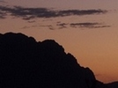
Hi Nick, I have looked through my other old slides and found another from further west of the Scotts Peak Dam that shows the ridge leading up to Red Knoll on the RH side, and Schnells Ridge on the LH skyline. Both photos posted below with a diagra mof where they were taken from relative to your site on Red Knoll. I trust this will be of use, and happy to let you make use of the photos in your project if you wish to.
- Photo 1
- Photo 2
- Photo locations
"The world reveals itself to those who travel on foot."
Werner Herzog
Werner Herzog
-
tas-man - Athrotaxis selaginoides
- Posts: 1479
- Joined: Mon 03 Sep, 2007 8:55 pm
- Location: Riverside
- Region: Tasmania
- Gender: Male
Re: Scotts Peak/Lake Pedder information
![]() by nickthetasmaniac » Thu 24 Mar, 2011 6:19 pm
by nickthetasmaniac » Thu 24 Mar, 2011 6:19 pm
Thanks again Ian. I'll let you know if I use any of the slides you sent me
Rondanestien (Nor), Southern Ranges (Tas), Western Arthurs (Tas)
http://peopleandotherstrangecreatures.wordpress.com/
http://peopleandotherstrangecreatures.wordpress.com/
- nickthetasmaniac
- Athrotaxis cupressoides
- Posts: 395
- Joined: Thu 30 Apr, 2009 6:26 pm
- Region: Tasmania
Re: Scotts Peak/Lake Pedder information
![]() by stepbystep » Wed 29 Jun, 2011 12:30 pm
by stepbystep » Wed 29 Jun, 2011 12:30 pm
Was reading through a copy of 'The Pedder Parers' last night. Didn't realise there were 2 other options on the table. Would have been fantastic if they went for option 3 instead 
- Attachments
-
The idea of wilderness needs no defense, it only needs defenders ~ Edward Abbey
-

stepbystep - Lagarostrobos franklinii
- Posts: 7625
- Joined: Tue 19 May, 2009 10:19 am
- Location: Street urchin
- Region: Tasmania
- Gender: Male
Re: Scotts Peak/Lake Pedder information
![]() by razor » Thu 04 Aug, 2011 12:22 pm
by razor » Thu 04 Aug, 2011 12:22 pm
I belive that the sucess of saving the Franklin River lies in the lessons learnt and hurt of the loss of the original Lake Pedder. If one of the alternatives had gone ahead for Lake Pedder would the outcome for the Franklin have been the same?
- razor
- Nothofagus gunnii
- Posts: 15
- Joined: Mon 05 Oct, 2009 12:35 pm
- Location: Rosebery
- Region: Tasmania
- Gender: Male
18 posts
• Page 1 of 1
Who is online
Users browsing this forum: No registered users and 37 guests