| Start | (-33.7217468,151.0442126) |
| Mode | Bus Car (There is free parking available.) |
| Directions | From Pennant Hills Road, A28
|
| Finish | (-33.7320121,151.0782166) |
| Mode (end) | Car Shuttle Bus Car (There is free parking available.) Train |
| Turn map | Directions & comments |
|---|---|
 |
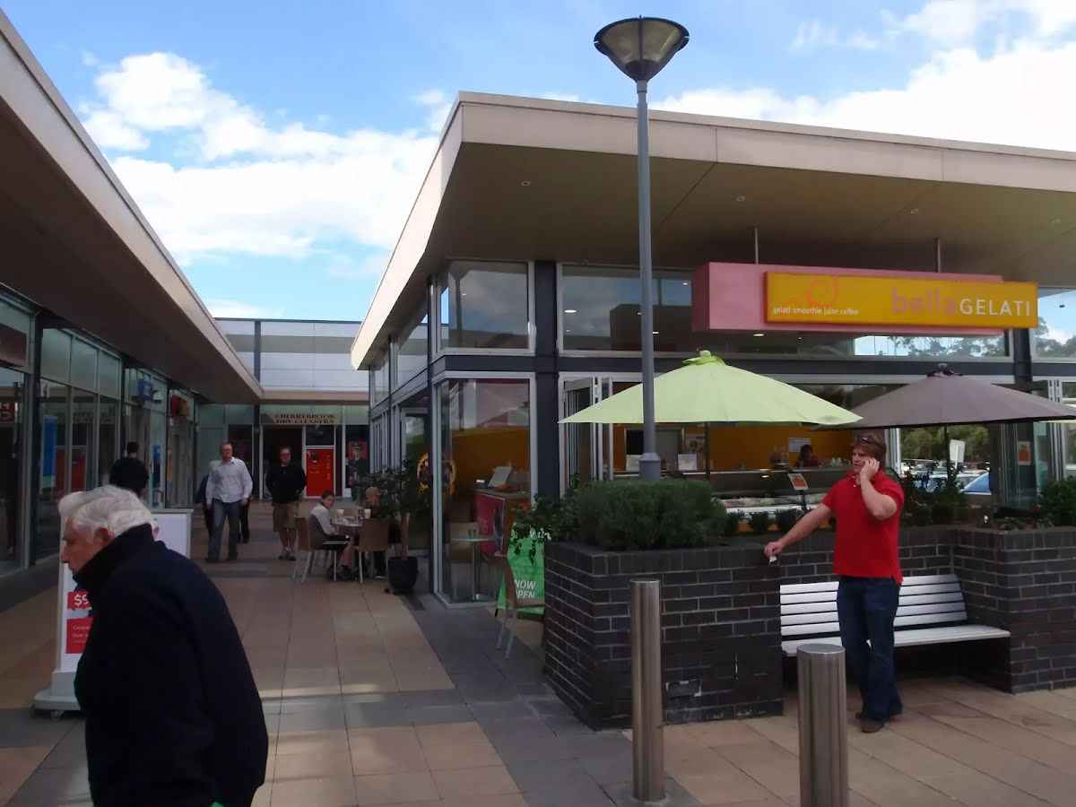 The Cherrybrook Village shopping centre is located at 41/47 Shepherds Drive, Cherrybrook. There are a number of local cafes and eateries here, plus some franchises such as Subway and Gloria Jeans, making a great stop for walkers. There is also a Woolworths supermarket. The centre is open 9:00-5:30 Mon-Wed & Fri, 9:00-9:00 Thu, 9:00-5:00 Sat and 10:00-4:00 Sun. Some of the cafes and eateries open directly outside so they may be open longer hours.
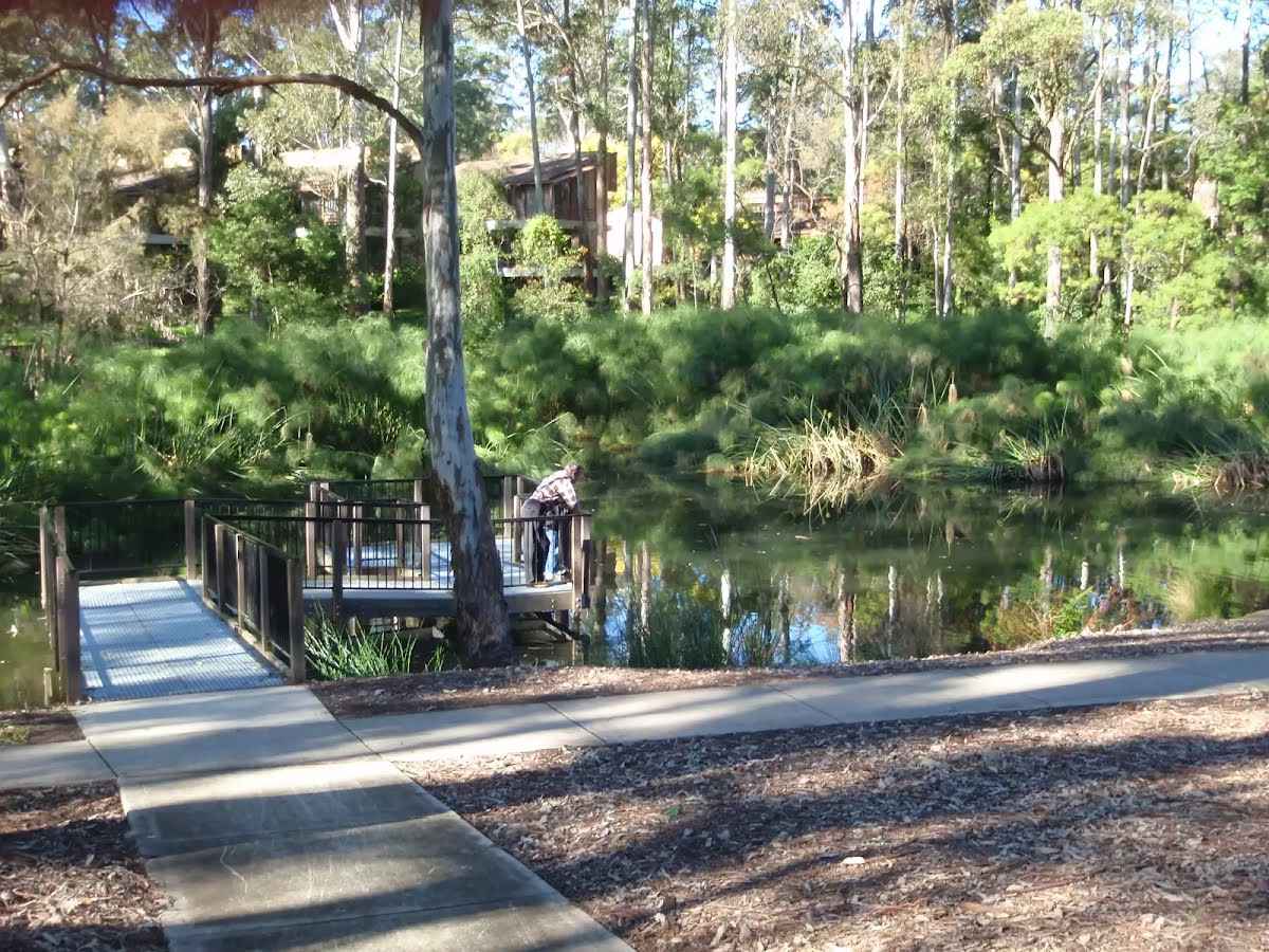 The Lakes Of Cherrybrook is a park at the intersection of Shepherds Dr and Macquarie Dr, Cherrybrook. The lakes featured in the park were formed when the local creek was dammed for the benefit of farmers. The park has a free electric BBQ, sheltered picnic tables, taps and bubblers as well as a playground for the kids. There is a large shopping centre nearby. There are several signposted buswalks in the area, including the 5.1km 'Callicoma Walk' loop track.
|
 |
|
 |
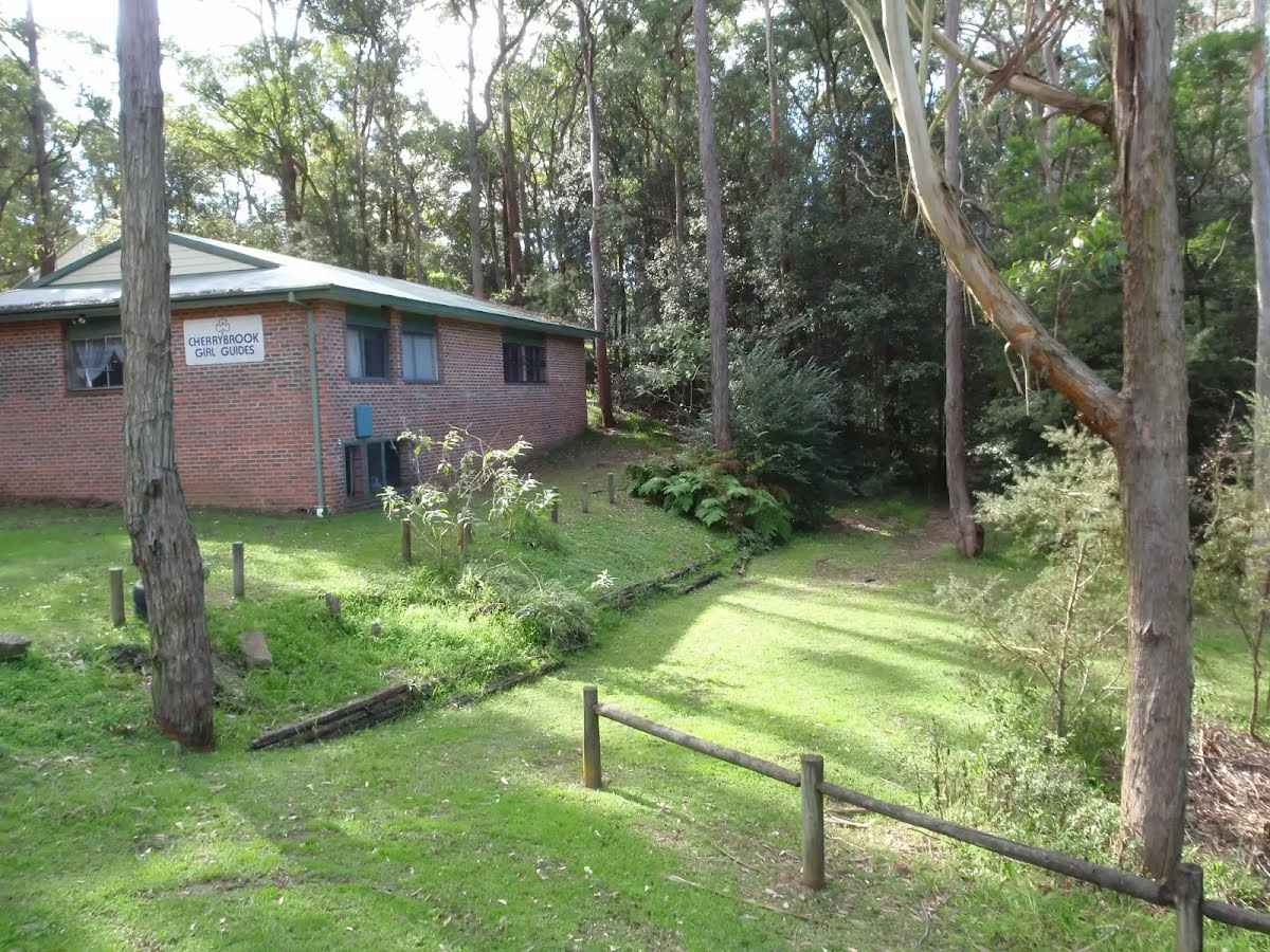 The Cherrybrook Girl Guides building is at the corner of Shepherds Dr and Macquarie Dr, Cherrybrook.
 The Cherrybrook Rural Fire Brigade building is in Shepherds Dr (near the intersection with Macquarie Dr), Cherrybrook. This is the home of the Cherrybrook Rural Fire Service, a wholly volunteer brigade. There is an entry onto the 'Blackwattle Trail' and some of the local bushwalks behind the building, and a water tap at the front of the building.
|
 |
|
 |
|
 |
|
 |
|
 |
|
 |
At the intersection of Schofield Firetrail & The Great North Walk turn left, to head along The Great North Walk (a walking track).
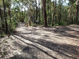
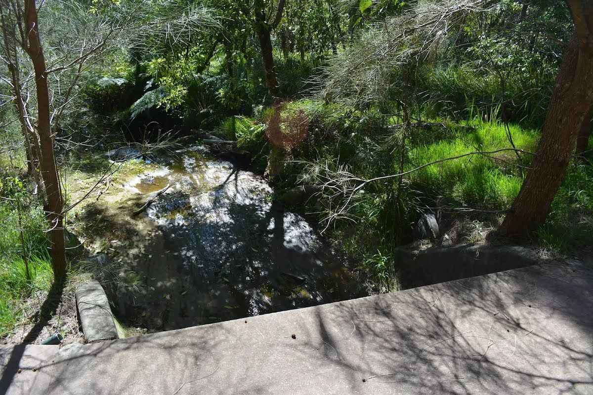
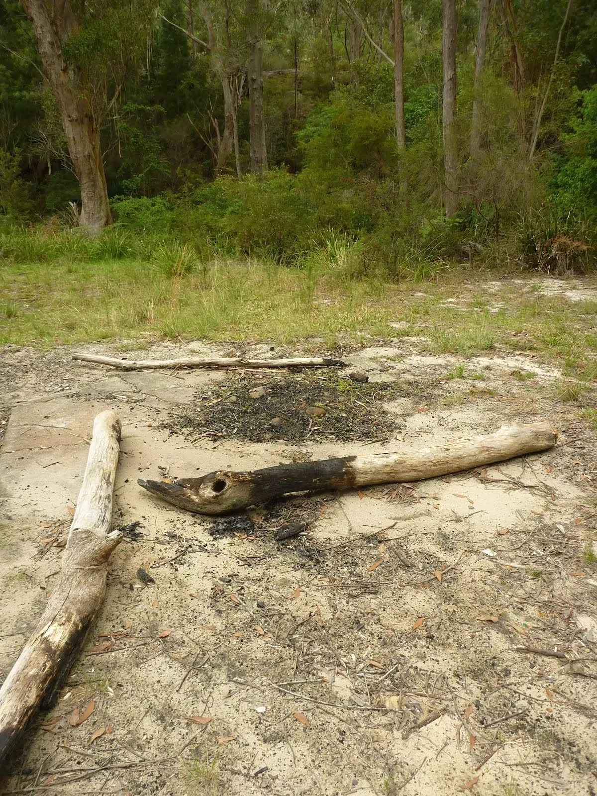 The Jungo is a relatively small clearing and campsite near the junction of Berowra and ZigZag Creeks at a well signposted intersection. There is often water in the creeks (treat well before drinking) but there are no facilities. Speculation on the source of the name 'Jungo' includes the Aussie tendency to abbreviate words ('Junction' gets corrupted to 'jung-o' etc) as well as a possible derivation from one of a few similar sounding aboriginal words.
|
 |
The starting point of an optional sidetrip. An optional side trip to Thornleigh Quarry. To start this optional side trip turn left here. On returning from this side trip continue straight when you get back to this intersection. Details below.
After another 680 m (at the intersection of Timbarra Road - Bellamy Street Cycleway & The Great North Walk) turn right, to head along Timbarra Road - Bellamy Street Cycleway.
 The Thornleigh zigzag railway originally ran from the main rail line near Thornleigh to a historic quarry, near present day De Saxe Cl, Thornleigh. There are only minor fragments still visible today. The 'Heritage Trail' in Thornleigh has interpretive signs for the railway and the old Thornleigh Quarry. A book is available with some detail on railway and associated quarry: 'Sydney's Forgotten Quarry Railways' by John Oakes, ISBN 0 9757870 3 9
|
 |
Sydney Cove
|
 |
|
 |
|
 |
After another 15 m (at the intersection of Morgan Street & Dale Close) continue straight, to head along Morgan Street.
|
 |
|
 |
|
 |
|
 |
|
 |
|
 |
|
 |
|
 |
|
 |
|
 |
|
 |
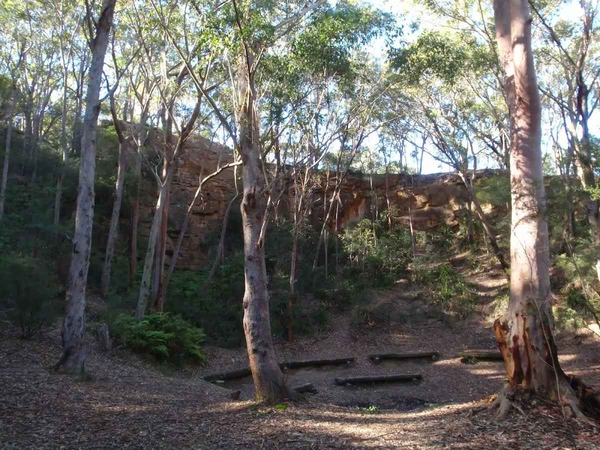 The old Thornleigh Quarry is located beside the Heritage Trail in Thornleigh, within Berowra Valley Regional Park. The quarry dates back to 1883 and was initially a source of 'ballast' for portions of the Sydney (Homebush) to Newcastle (Waratah) rail link. There is a firm, flat dirt track that leads about 40m from the concrete trail to the centre of the old quarry. You will find a series of log seats in this amphitheatre making this a pleasant spot to sit and enjoy the intriguing mix of nature and history. A book is available with some detail on this quarry and the associated zigzag railway: 'Sydney's Forgotten Quarry Railways' by John Oakes, ISBN 0 9757870 3 9
|

|
|
Class 3/6 Moderate track |
|---|---|
| Length | 4.7 km |
| Time | 1 h 30 min to 1 h 45 min |
| Quality of track | Formed track, with some branches and other obstacles (3/6) |
| Gradient | Short steep hills (3/6) |
| Signage | Directional signs along the way (3/6) |
| Infrastructure | Limited facilities, not all cliffs are fenced (3/6) |
| Experience Required | Some bushwalking experience recommended (3/6) |
| Weather | Storms may impact on navigation and safety (3/6) |
| Item | From Start | Name & link to notes |
|---|---|---|
Campsite
| 1.7 km | The Jungo |
Seat
| 4.7 km | [seat] |
Toilet
| 4.7 km | [toilet] |