| Turn map |
Directions & comments |
|
|

Start.

Find the seat at the start. , has no backrest.

Find the picnic table at the start. , has no backrest.

Find the car park at the start.
|
|
|

After another 8 m continue straight.

After another 35 m pass the "Garie Surf Living Saving Club" (8 m on your right).
Then find the "Garie Beach Kiosk" (45 m on your right).
Garie Beach Kiosk is at the side of the carpark at the end of Garie Rd, in the Royal National Park. The kiosk is only open on weekends and most days during the summer holidays. The opening hours are based on demand and is generally open from 10:30am to 3pm (later in summer). The kiosk sells, cold drinks, ice creams, pies, salad rolls etc. Contact for Audley kiosk (same managers) 9521 2240.

Then pass the toilet (60 m on your right).
 Turn left
.
After another 35 m pass a seat (9 m on your left)., has no backrest.

After another 530 m cross the bridge (about 10 m long)
|
|
|
After another 6 m continue straight.
|
|
|

After another 130 m veer right.

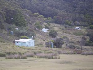
After another 8 m find the "Little Garie" (10 m on your right).
Little Garie beach and cabin community is in the Royal National park about 800m south west of Garie Beach. The beach is a yellow sand looking east. The beach is edge lined along the edge with smooth rock with a rock shelf on both ends of the beach. There are no facilities or life saving services at the beach. The cabins built just above the beach are dotted through the valley and includes a green community hall and church up the hill on the south side.
After another 275 m pass a seat (on your right)., has no backrest.

After another 145 m come to the viewpoint.
After another 150 m pass a seat (on your right)., has no backrest.

After another 45 m head down the earthen steps (about 150 m long)
|
|
|
Continue straight.

After another 15 m come to the "North Era Beach Campground" (70 m on your right). Campsite managed byNSW National Parks and Wildlife Service. There is a fee to use this campsite.
|
|
|

After another 75 m veer left.
|
|
|
After another 140 m veer left.
|
|
|
After another 20 m continue straight.
|
|
|
After another 660 m continue straight.
|
|
|
After another 245 m veer right, to head along Coast Walk.
After another 225 m come to the viewpoint.
|
|
|
At the intersection of Burgh Ridge Track & Coast Walk continue straight, to head along Burgh Ridge Track.

After another 6 m pass the "Figure 8 Pools" (on your left).
After another 200 m come to the viewpoint.
|
|
|
After another 610 m continue straight, to head along Burgh Ridge Track.
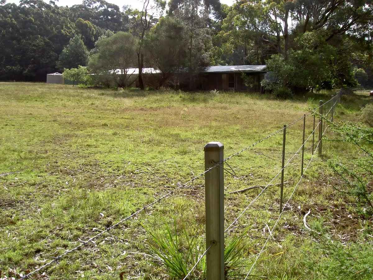
After another 310 m find the "Garawarra Farm" (100 m on your right).
Garawarra Farm is a clearing in the southern section of Royal National Park near the intersection of the Squeeze Way and Burgh Ridge track. This area was initially protected in 1934, when it and the surrounding area was turned into the Garawarra Park. This protection occurred after much lobbing from Myles Dunphy and the Mountain trails club, following their concerns of the impact been caused from logging and grazing in the area. This area and much more was re-named to Royal National Park in 1954 following the first visit of Queen Elizabeth II. The old farmhouse is now used by NPWS and is not open to the public. There is a large public carpark that are popular for people walking in the area.
|
|
|
At the intersection of Garawarra Ridge Management Trail & Burgh Ridge Track veer left, to head along Garawarra Ridge Management Trail (a vehicle track).
|
|
|
After another 85 m continue straight, to head along Garawarra Ridge Management Trail.
|
|
|
After another 1.2 km continue straight, to head along Garawarra Ridge Management Trail.

After another 470 m pass the "Bulgo Hill" (45 m on your left).
|
|
|
After another 910 m (at the intersection of Garawarra Ridge Management Trail & Lilyvale Track) continue straight, to head along Garawarra Ridge Management Trail.
|
|
|
After another 370 m turn left.
After another 10 m pass the "Garrawarra Ridge" (8 m on your right).
After another 430 m continue straight.
After another 10 m come to the "Werrong Lookout" (25 m on your right).
After another 55 m come to the viewpoint (15 m on your right).
|
|
|
Continue straight.
After another 1.7 km pass the sign (5 m on your right).
After another 640 m cross the bridge (about 7 m long)
|
|
|
After another 80 m continue straight.
After another 165 m pass the toilet (35 m on your left).
|
|
|

Turn right.
|
|
|
After another 65 m veer left.
|
|
|
After another 325 m turn right.
|
|
|
After another 115 m continue straight.
After another 75 m cross the bridge (about 15 m long)

After another 75 m head up the earthen steps (about 140 m long)
After another 45 m pass the "Burgh Ridge" (on your right).
|
|
|
Veer left, to head along Burgh Ridge Track.
|
|
|
After another 210 m (at the intersection of Coast Walk & Burgh Ridge Track) turn right, to head along Coast Walk.
|
|
|
After another 210 m veer left.
|
|
|
After another 245 m continue straight.
|
|
|
After another 660 m continue straight.
|
|
|
After another 20 m veer right.
|
|
|
After another 140 m veer right.
After another 60 m head up the earthen steps (about 150 m long)
|
|
|
Continue straight.
|
|
|
After another 590 m veer left.
|
|
|
After another 150 m veer left.
|
|
|
After another 130 m continue straight.
After another 6 m cross the bridge (about 10 m long)
|
|
|
After another 530 m continue straight.
|
|
|
After another 30 m turn right.
After another 30 m pass the car park (30 m on your left).
|
|
|
Continue straight.
|
|
|

After another 20 m come to the end.
|