| Start | (-33.5736804,150.2921125) |
| Mode | Car (There is free parking available.) |
| Directions | From Great Western Highway, A32
|
| Finish | (-33.5994548,150.3459193) |
| Mode (end) | Car Shuttle Car (There is free parking available.) |
| Turn map | Directions & comments |
|---|---|
 |
|
 |
|
 |
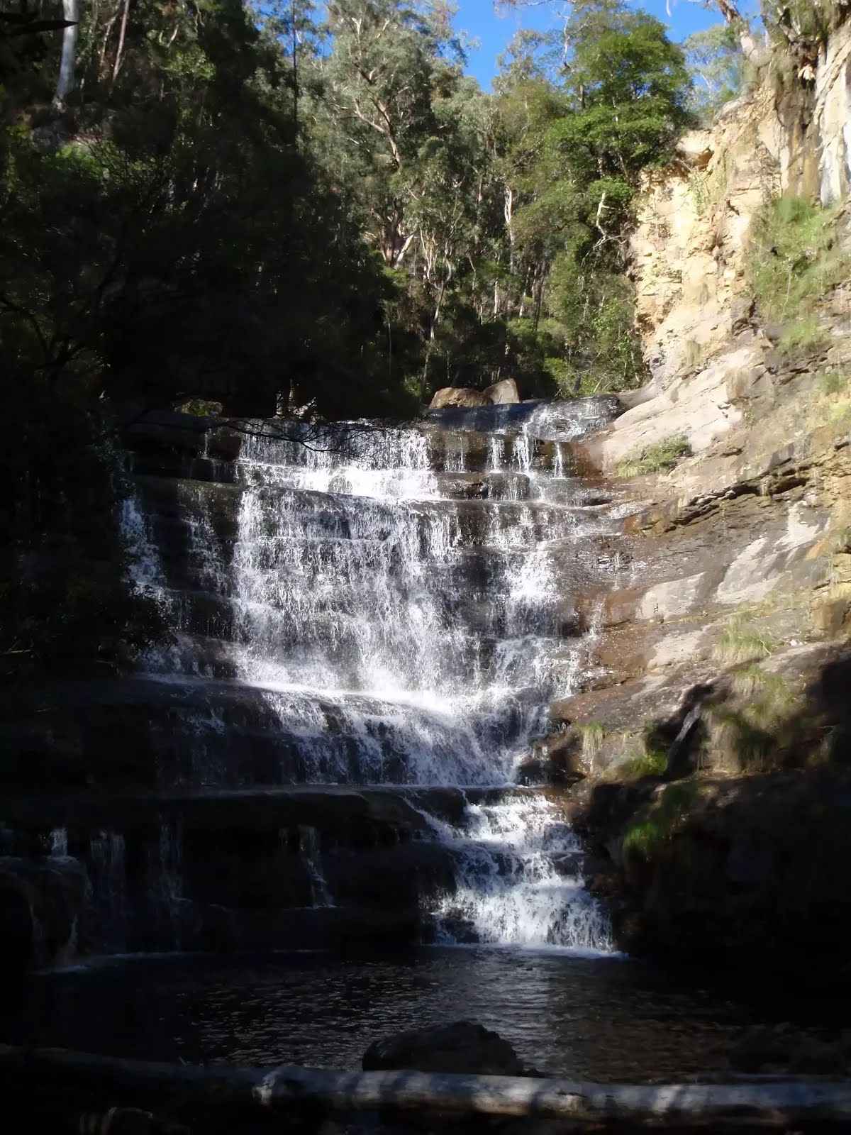
The starting point of an optional sidetrip. An optional side trip to Victoria Creek Cascades. To start this optional side trip veer right here. On returning from this side trip error >360 when you get back to this intersection. Details below.
|
 |
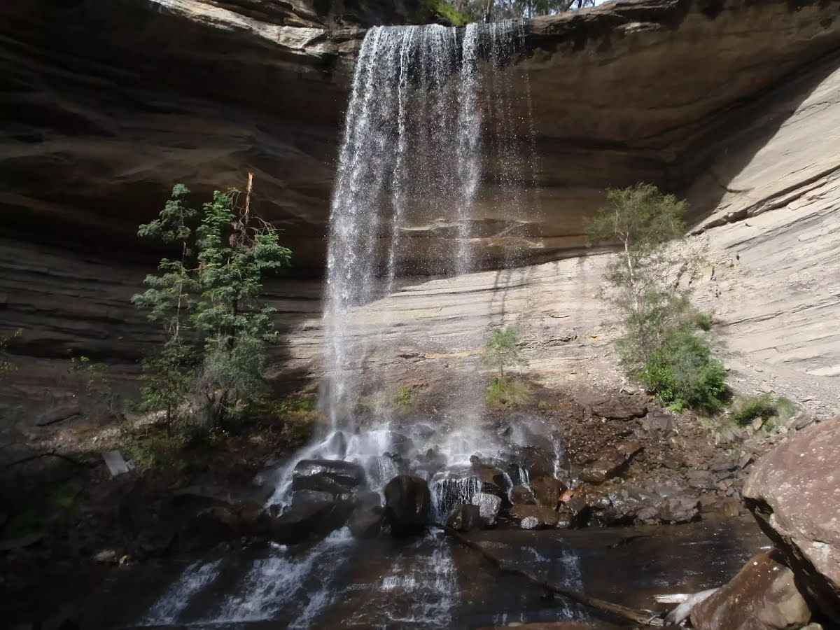
The starting point of an optional sidetrip. An optional side trip to Victoria Falls. To start this optional side trip turn around here. On returning from this side trip continue straight when you get back to this intersection. Details below.
|
 |
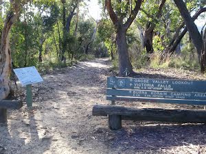
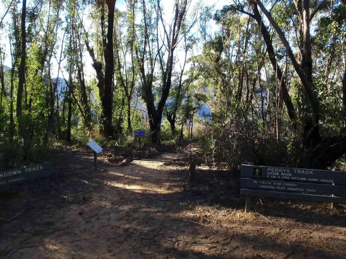
The starting point of an optional sidetrip. An optional side trip to Top of Falls. To start this optional side trip continue straight here. On returning from this side trip veer right when you get back to this intersection. Details below.  Burra Korain Flat Camping Area, Blue Mountains NP, is a small clearing between the Victoria Creek and Grose River. The campsite is well signposted and has nice sitting logs and plenty of space for a few tents. Water can be accessed from either river or creek but should be treated before use.
|
 |
|
 |
|
 |
|
 |
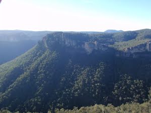
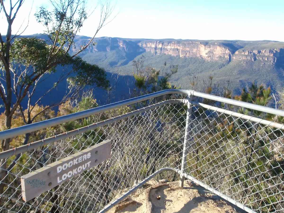
The starting point of an optional sidetrip. An optional side trip to Dockers Lookout. To start this optional side trip turn right here. On returning from this side trip continue straight when you get back to this intersection. Details below. 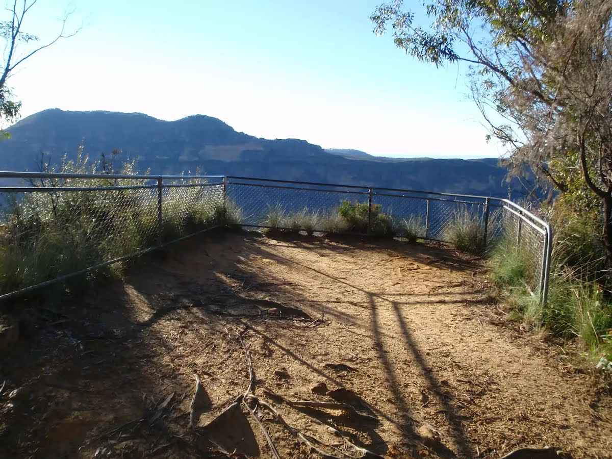 Perry's Lookdown, Blue Mountains NP, has views over the Grose Valley, with Blue Gum Forest nearly directly below and Lockleys Pylon to the south. The lookout is presumably named after Captain William Perry, the Deputy Surveyor General who worked under the leadership of Sir Thomas Mitchell.
|
 |
|
 |
 Perrys Lookdown offers a simple campsite, close to some spectacular lookouts and well located as starting point for longer walks exploring the Grose Valley. There are 5 tent sites and a non-flush toilet, but no water available. This area allows fuel stoves only (no camp fires). The camping area is a short walk from the car park. Limit to one night stay (sites cannot be reserved).
|
| Turn map | Directions & comments |
|---|---|
 |
|
 |

|
|
Class 5/6 Very challenging |
|---|---|
| Length | 15.3 km |
| Time | 6 h to 8 h 30 min |
| Quality of track | Rough unclear track (5/6) |
| Gradient | Very steep (4/6) |
| Signage | Minimal directional signs (4/6) |
| Infrastructure | Limited facilities (such as cliffs not fenced, significant creeks not bridged) (4/6) |
| Experience Required | Some bushwalking experience recommended (3/6) |
| Weather | Weather generally has little impact on safety (1/6) |
| Item | From Start | Name & link to notes |
|---|---|---|
Toilet
| -7 m | [toilet] |
Campsite
| 3.4 km | Burra Korain Flat Camping Area |
Campsite
| 15.3 km | Perrys Lookdown campground |