Kanning Cave Walk
Darkinjung & Guringai Country

20 min to 40 min

970 m
return

↑ 27 m
↓ -27 m

Easy track
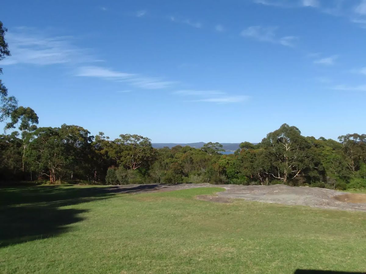
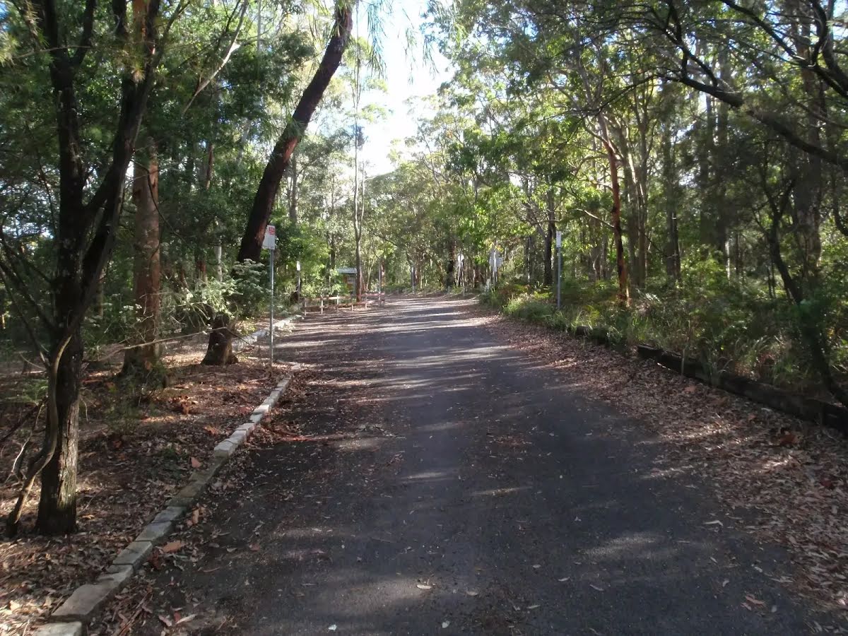
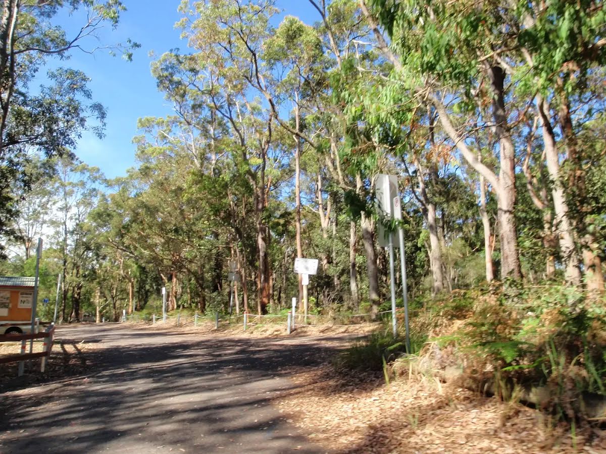
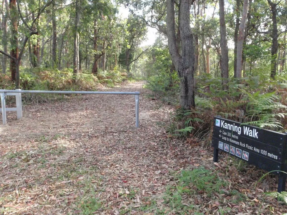
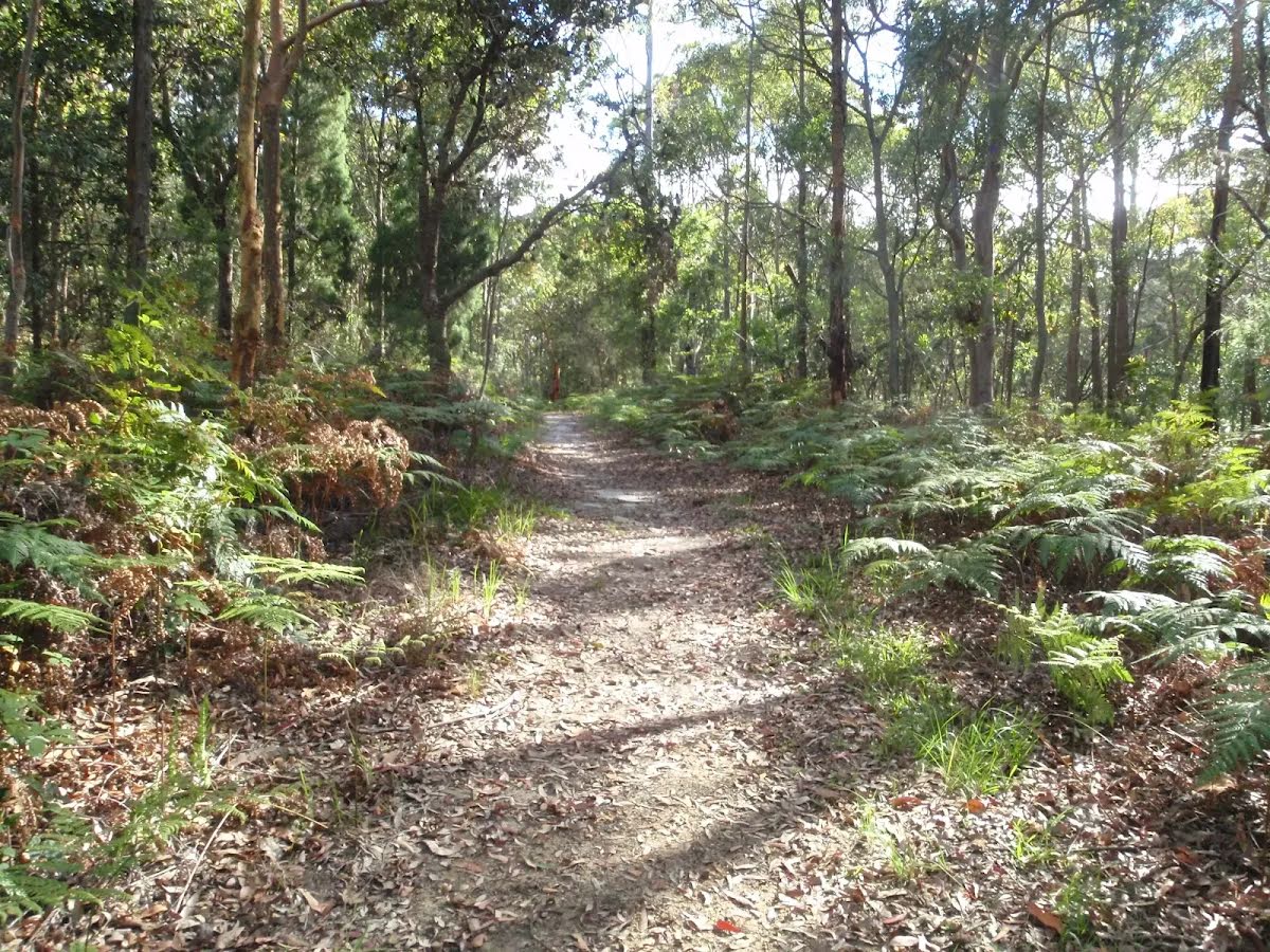
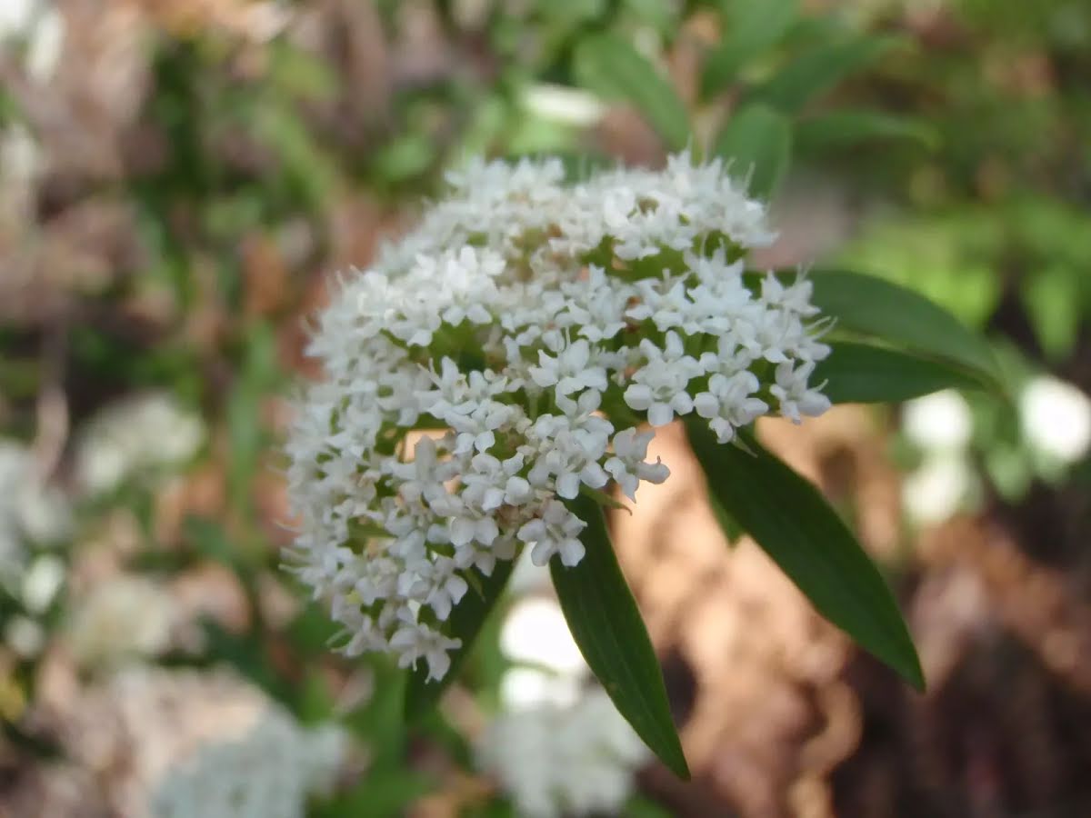
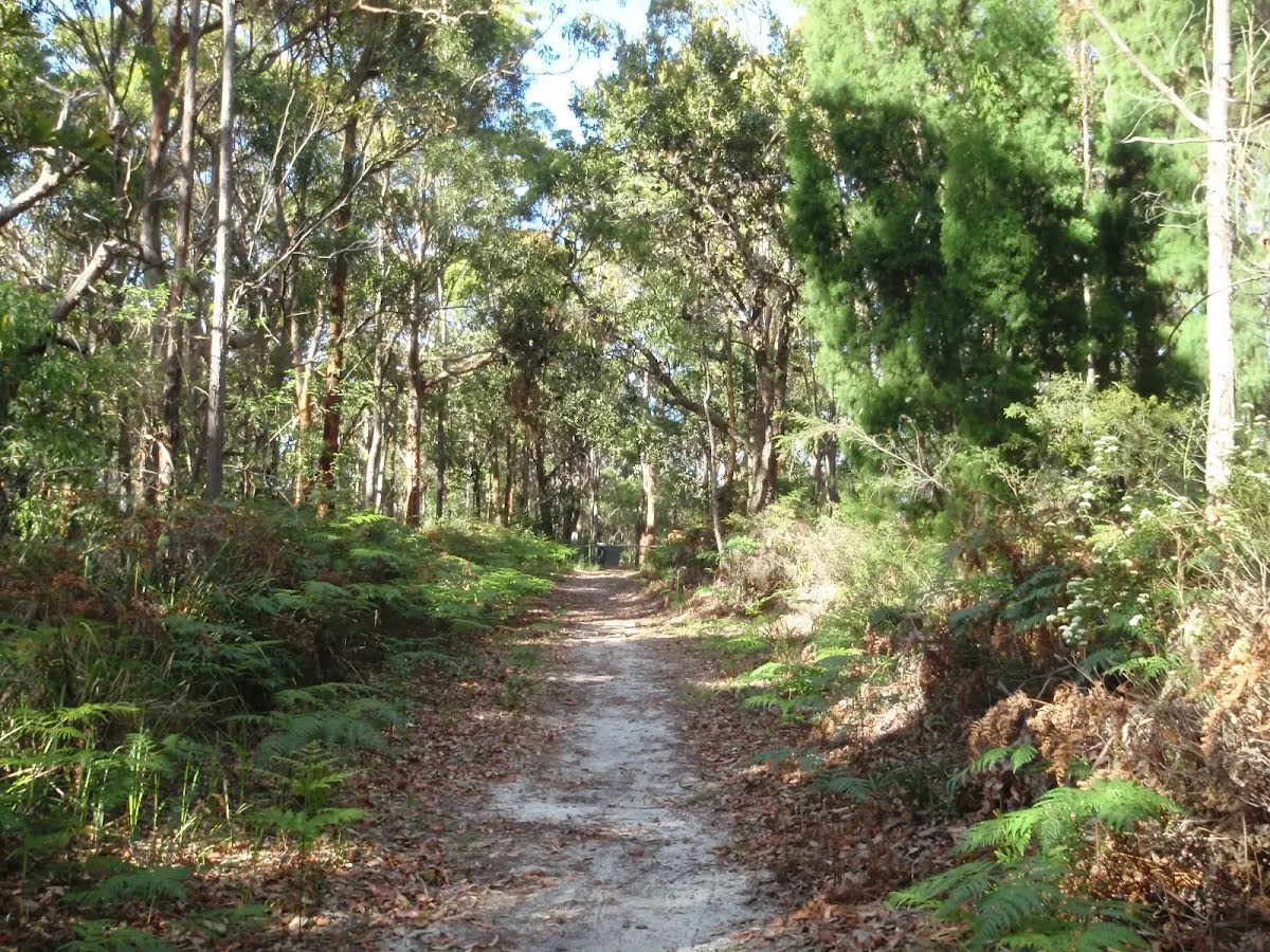
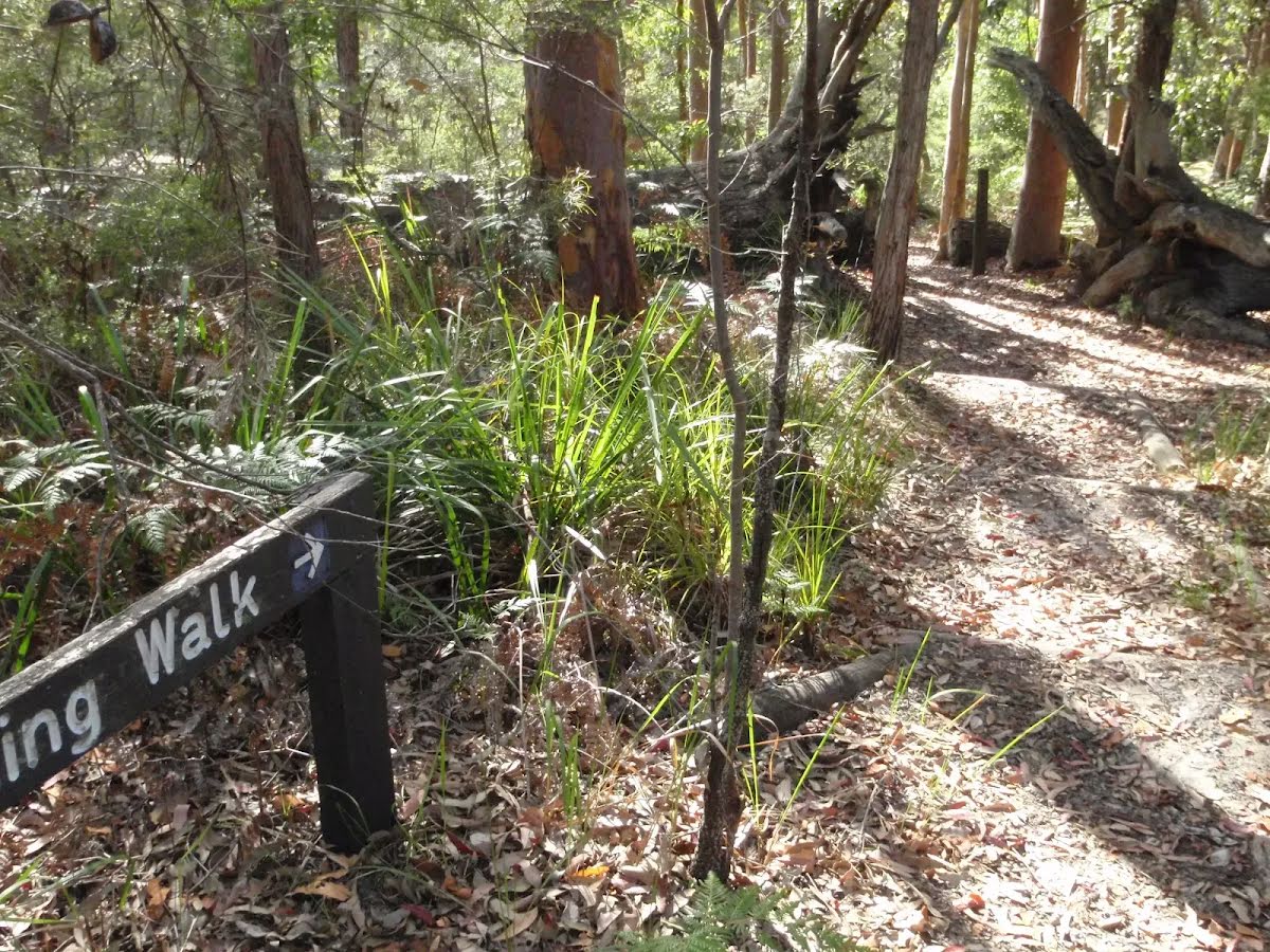
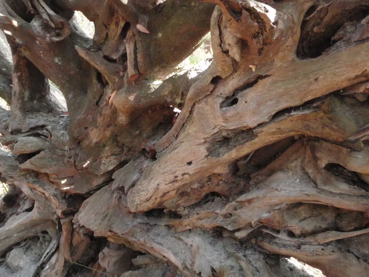
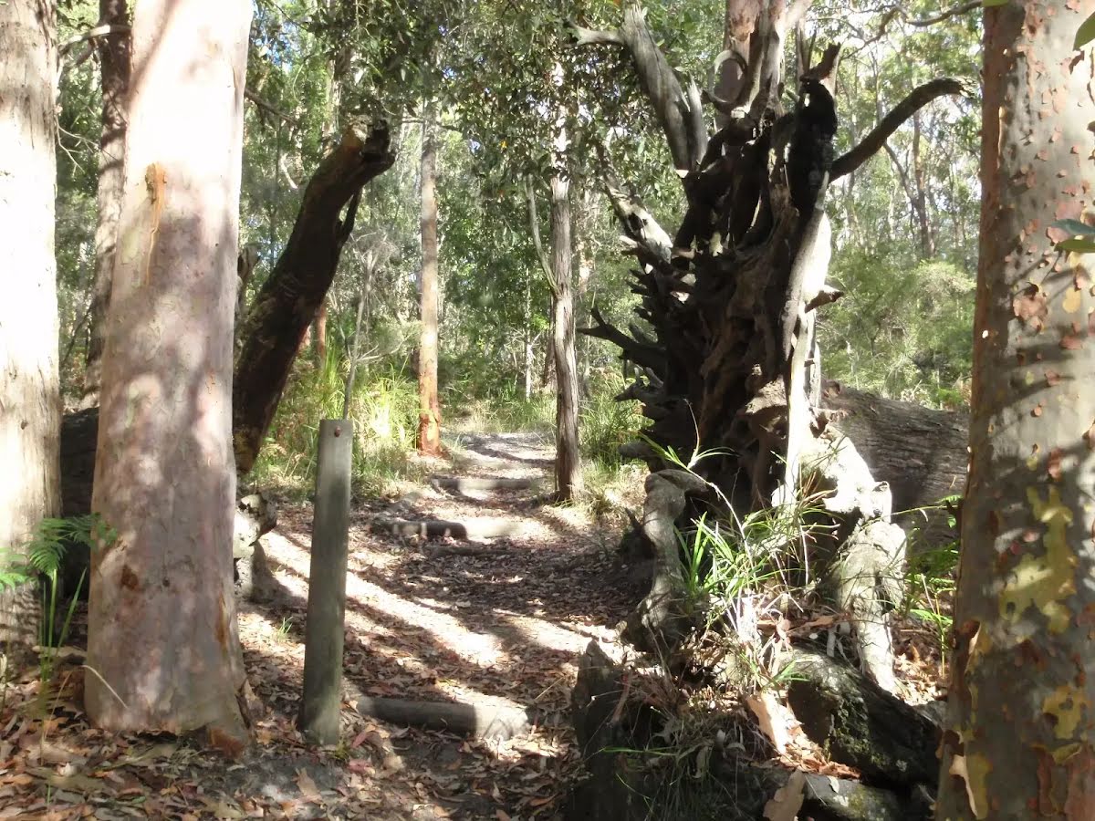
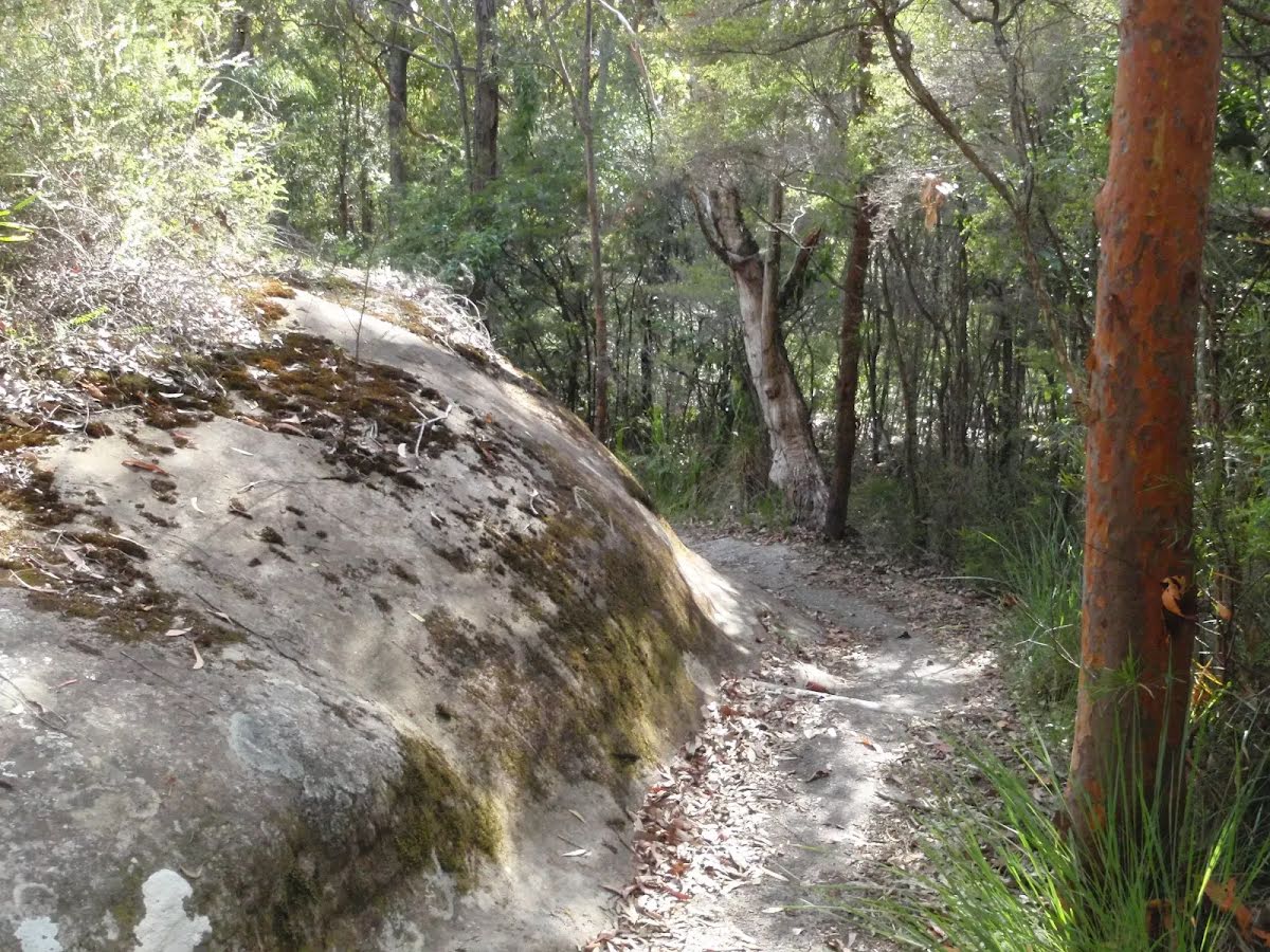
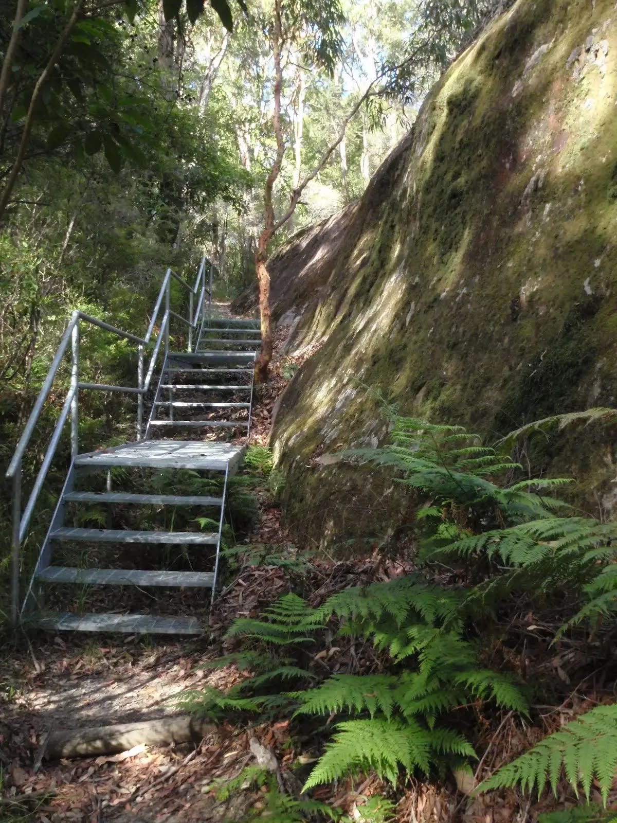
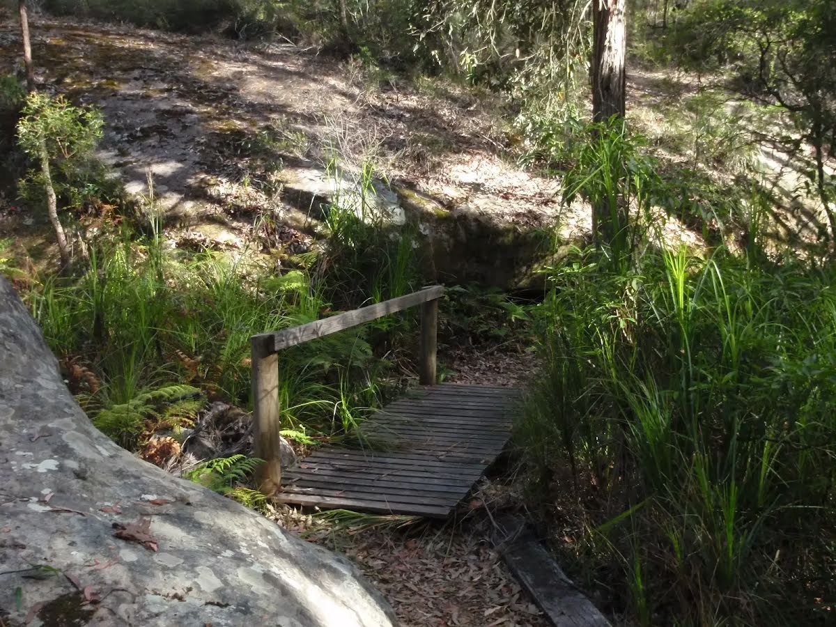
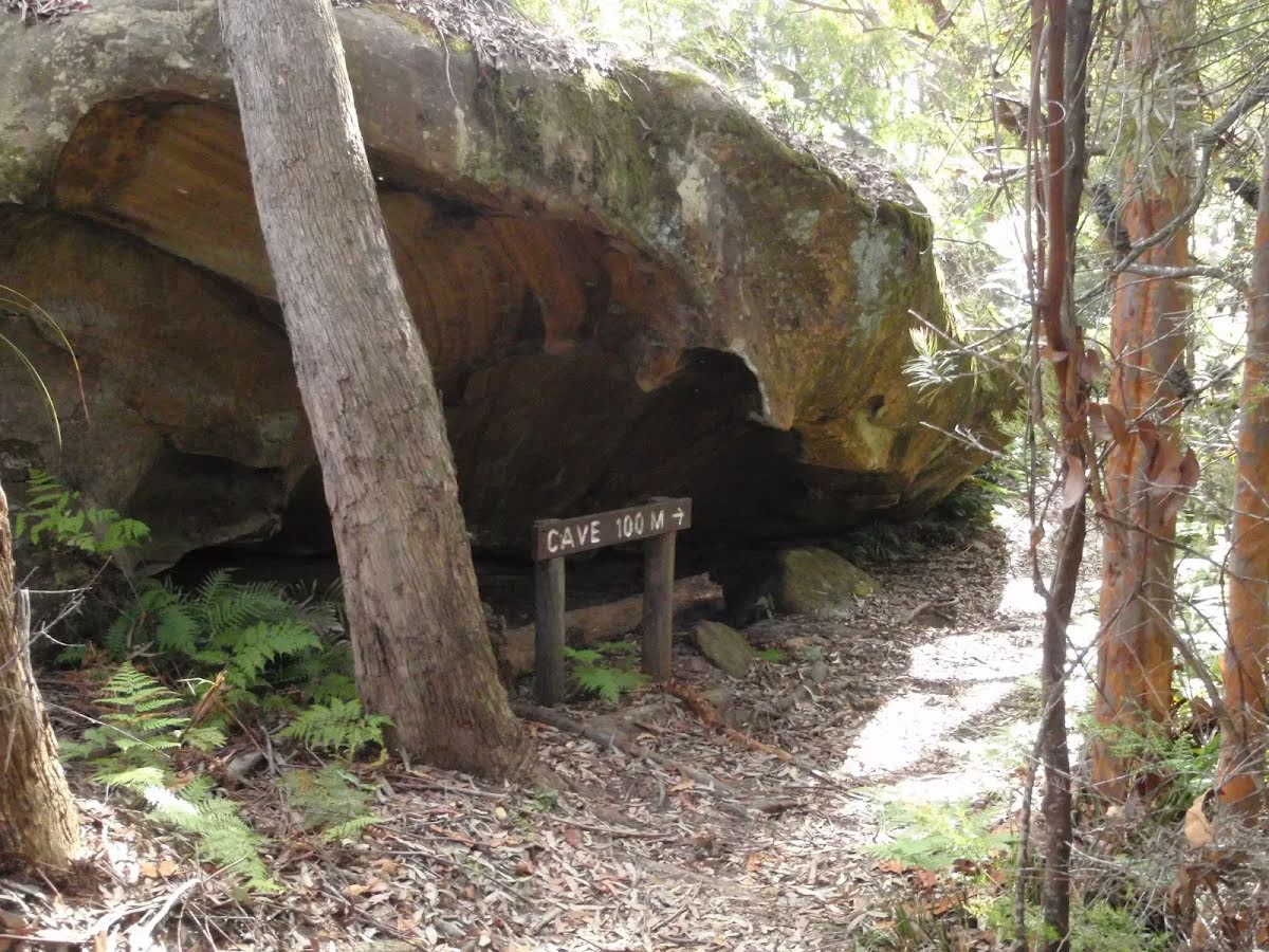
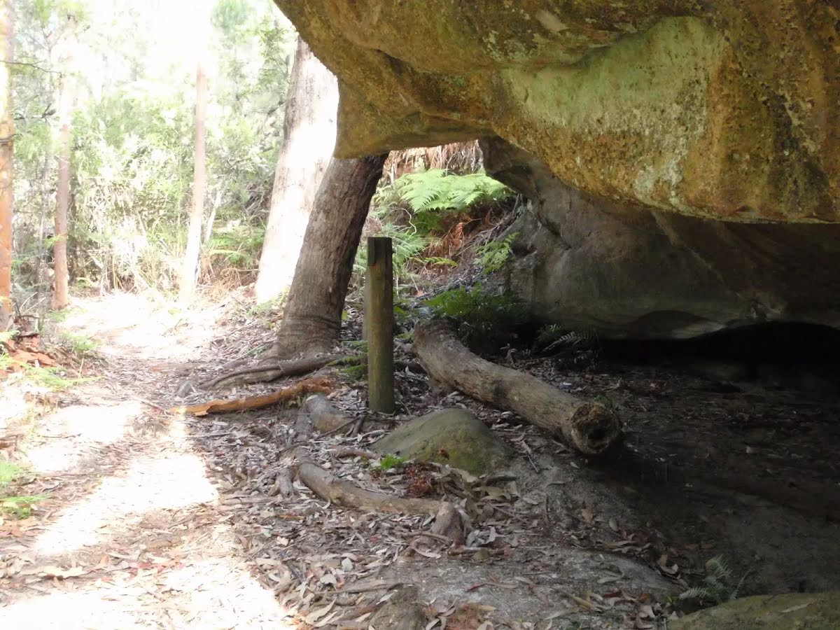
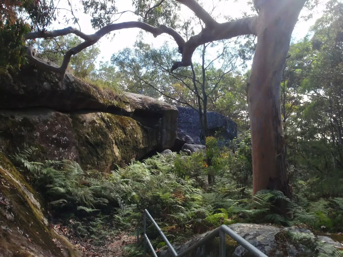
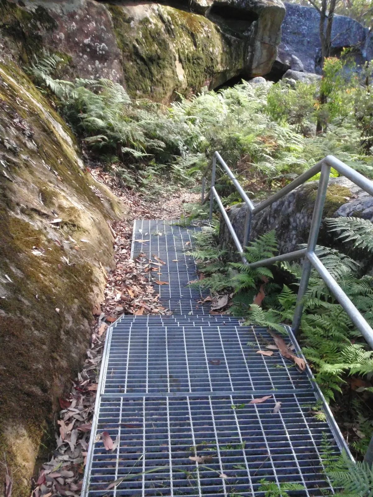
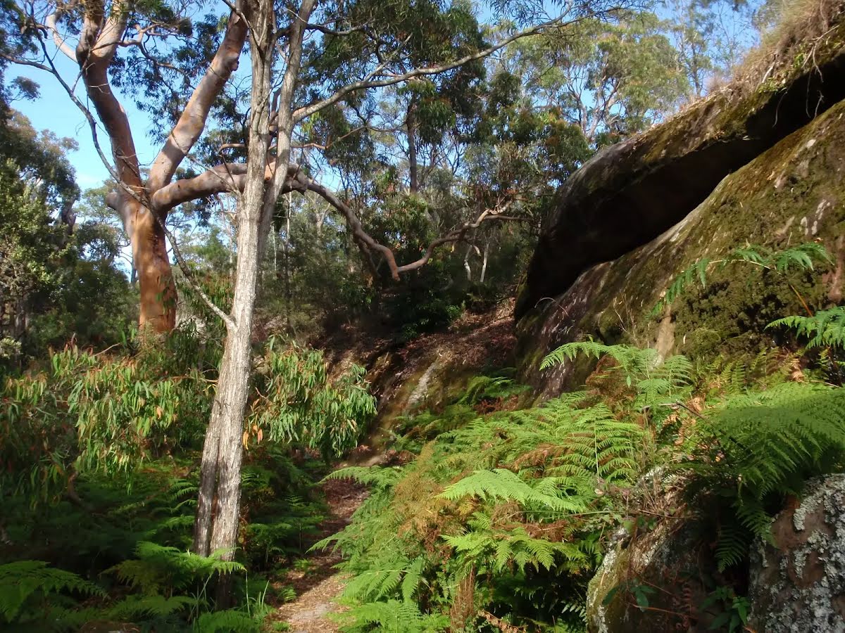
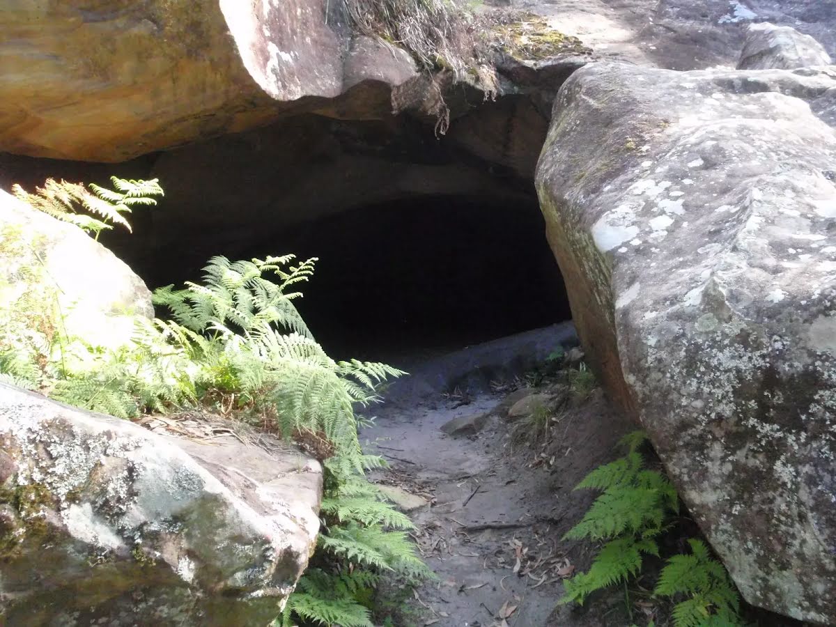
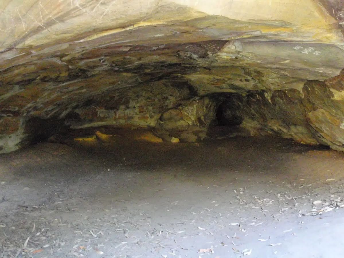
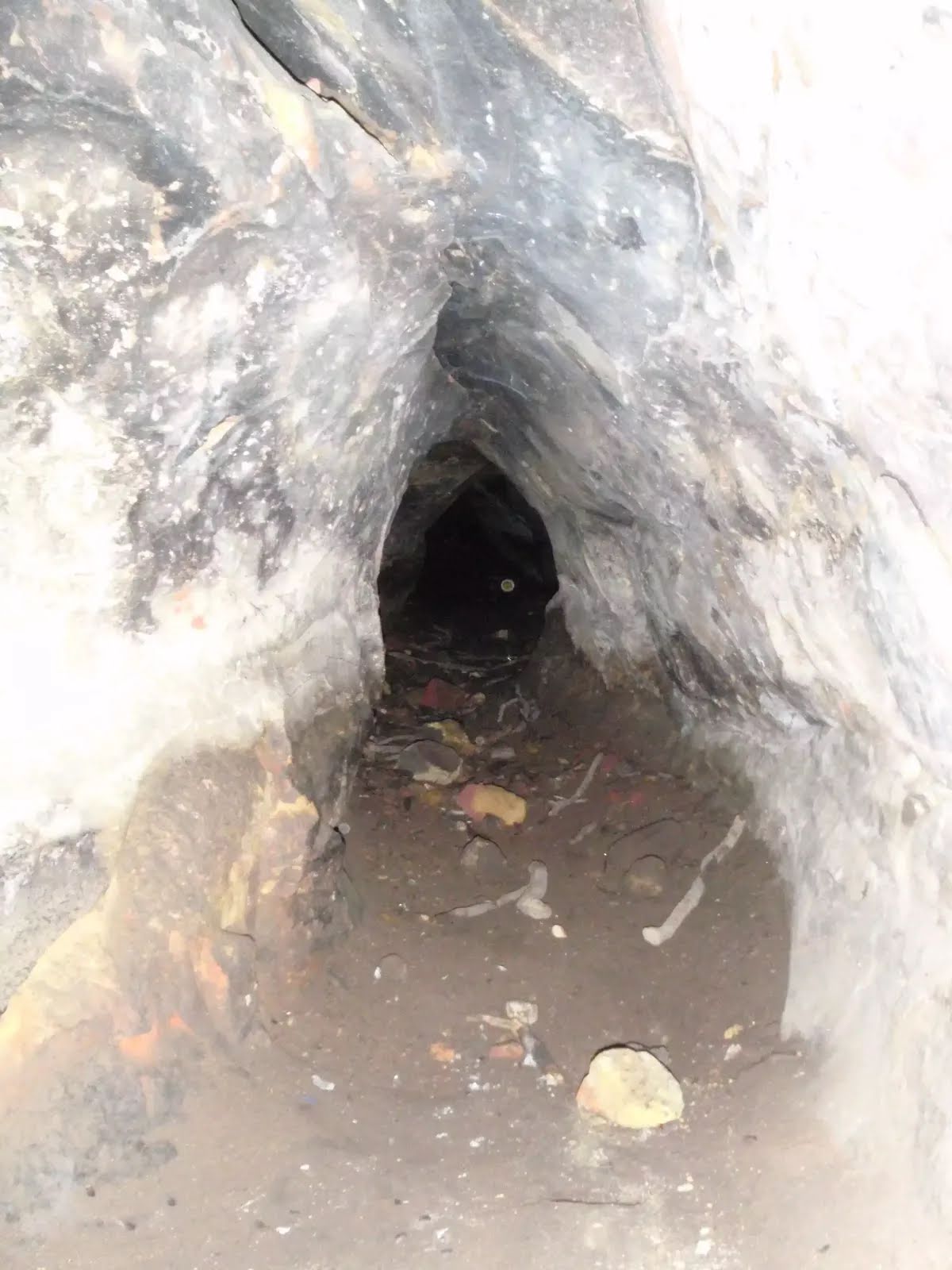
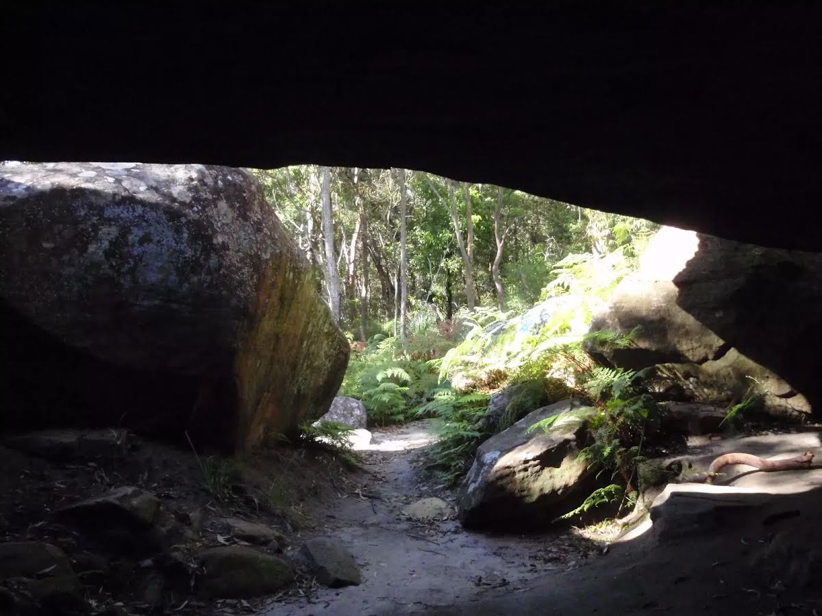
This short walk follows a clear track to a large sandstone cave on the Kanning Walk. From the Honeman's Picnic Area, follow Kanning Walk through the bush and along the side of a long rock wall. There are several caves along the way, the main one being quiet large and tucked behind some large boulders. The cave provides a cool spot on hot days. After admiring the cave, walk back the same way, passing some large angophora trees. Let us begin by acknowledging the Darkinjung & Guringai people, Traditional Custodians of the land on which we travel today, and pay our respects to their Elders past and present. 
Show all
Honeman Rock Picnic Area. | Photo by admin, 2009.
Mub brick building. | Photo by admin, 2009.
Walking along Island View Dr. | Photo by admin, 2009.
Island View Dr. | Photo by admin, 2009.
Start of the Kanning Walk. | Photo by admin, 2009.
Kanning Walk. | Photo by admin, 2009.
Native Parsnip flower (Platysace lanceolata). | Photo by admin, 2009.
Kanning Walk. | Photo by admin, 2009.
Sign on first bend on the Kanning Walk. | Photo by admin, 2009.
Old Exposed roots of a tree. | Photo by admin, 2009.
Walking between two old trees. | Photo by admin, 2009.
Track passing beside rockface. | Photo by admin, 2009.
Steps beside rock. | Photo by admin, 2009.
Small bridge in Kanning Walk. | Photo by admin, 2009.
Smaller cave west of the main cave. | Photo by admin, 2009.
Smaller cave on Kanning Walk. | Photo by admin, 2009.
Large Angophra near main cave. | Photo by admin, 2009.
Metal stairs. | Photo by admin, 2009.
Near the main cave on Kanning Walk. | Photo by admin, 2009.
Entrance to cave. | Photo by admin, 2009.
Inside the Kanning Walk Cave. | Photo by admin, 2009.
Small tunnel at the back of the cave. | Photo by admin, 2009.
Inside looking out of the cave. | Photo by admin, 2009.
Inside the cave. | Photo by admin, 2009.
Downloads GPX PDF

+
-
Safer Bushwalks
Tips on staying safe on track
Before you start any bushwalk ensure you;
• Tell someone you trust where you are going and what to do if you are overdue
• Have adequate equipment, supplies, skills & knowledge for the whole journey
• Consider the impact of weather forecasts, park/track closures & fire dangers
• Can respond to emergencies & call for help at any point
• Are healthy and fit enough for this journey
If not, change plans and stay safe. It is okay to delay and ask people for help.
+
-
Getting There
Transport options and directions
Start (-33.4594139,151.3915736)
Mode Car (There is free parking available.)
DirectionsFrom Avoca Drive
  • Turn on to Island View Drive then drive for 180 m
  • Turn slight left onto Panorama Parade and drive for another 145 m
  • Turn left onto Waterford Boulevard and drive for another 55 m
  • Turn left onto Kincumber Street and drive for another 1.7 km
+
-
Track Notes
Turn by turn instructions & maps
Getting started
From the car park, this walk heads up the road, initially keeping the mud brick building to the left. Soon the road leads to an intersection (next to an information board and fence on the left).
From the intersection, this walk follows the 'One Way' road sign away from the picnic area and along the road. Almost immediately, there is a locked gate and the 'Kanning Walk' sign (on the left).....
Turn map Directions & comments
Start heading along Island View Drive.
Find the park at the start.
After another 70 m find the "Mud Brick Building" (10 m on your left).
Mud Brick Building
Mud Brick Building

The mud brick building is a landmark in the main picnic area at Kincumber Mountain, and is a popular spot to gather. Also known as 'Kincumber Mountain Information Centre', 'The Kiosk', 'Kincumber Kiosk' and 'Kincumber Mountain Kiosk', the building was constructed in 1986 with funding from Community Employment Programme. The building is generally locked but can be booked through the local Lions Club for special events. The building has a rain water tank, small kitchen and one main large room. The verandah also provides good shelter.
+
-
The mud brick building is a landmark in the main picnic area at Kincumber Mountain, and is a popular spot to gather. Also known as 'Kincumber Mountain Information Centre', 'The Kiosk', 'Kincumber Kiosk' and 'Kincumber Mountain Kiosk', the building was constructed in 1986 with funding from Community Employment Programme. The building is generally locked but can be booked through the local Lions Club for special events. The building has a rain water tank, small kitchen and one main large room. The verandah also provides good shelter.

After another 20 m pass the "Kincumba Mountain Kiosk" (30 m on your left).
After another 45 m find the "Honeman's Rock picnic area" (45 m on your left).
Honeman's Rock picnic area

Honeman's Rock picnic area is a large picnic area at the top end of Island View Drive. This picnic area has a couple of large grassy areas, composting toilets, free electric BBQs, picnic tables, shelters, garbage bins, drinking water and information signs. The picnic area is home to a mud brick building (available for hire) and Honeman's Rock, from which the area derives its name. There is a fair amount of parking available next the picnic area, and some extra spaces a few hundred meters down the road.
+
-
Honeman's Rock picnic area is a large picnic area at the top end of Island View Drive. This picnic area has a couple of large grassy areas, composting toilets, free electric BBQs, picnic tables, shelters, garbage bins, drinking water and information signs. The picnic area is home to a mud brick building (available for hire) and Honeman's Rock, from which the area derives its name. There is a fair amount of parking available next the picnic area, and some extra spaces a few hundred meters down the road.

Turn sharp right, to head along Island View Drive.
After another 15 m (at the intersection of Island View Drive & Kanning Walk) turn left, to head along Kanning Walk (a walking track).
After another 10 m head through/around the gate.
After another 240 m cross the bridge (about 35 m long)
Then head up the 12 metal steps (about 35 m long)
Then cross the bridge (about 15 m long)
Then head up the 12 metal steps (about 15 m long)
Continue another 60 m to find the end. Then turn around here and retrace the main route for 480 m to get back to the start.
About 10 m past the end is "Kanning Walk Cave".
Kanning Walk Cave
Kanning Walk Cave

The main cave on Kanning Walk is surprising large for a sandstone environment. The cave has two main sections. There is a large cabin about 7m wide and 9m deep. A small tunnel extends about 10m further to a small chamber at the back. The entrance to the cave is behind two large boulders, providing extra shelter. It is believed that A. A. Glasson lived in the cave in the early 1930's, which was not uncommon during the depression. The cave has proved to be a great place to rest on hot days.
+
-
The main cave on Kanning Walk is surprising large for a sandstone environment. The cave has two main sections. There is a large cabin about 7m wide and 9m deep. A small tunnel extends about 10m further to a small chamber at the back. The entrance to the cave is behind two large boulders, providing extra shelter. It is believed that A. A. Glasson lived in the cave in the early 1930's, which was not uncommon during the depression. The cave has proved to be a great place to rest on hot days.

+
-
Terrain
Know the Hills, grading & facilities

Kanning Cave Walk


Grading
Class 2/6
Easy track
Length 970 m
Time 20 min to 40 min
Quality of track Clear and well formed track or trail (2/6)
Gradient Gentle hills with occasional steps (2/6)
Signage Clearly signposted (1/6)
Infrastructure Generally useful facilities (such as fenced cliffs and seats) (1/6)
Experience Required No experience required (1/6)
Weather Weather generally has little impact on safety (1/6)
+
-
Articles
Discover more details to thrive on track
Get more information
Wildwalks
+
-
Reviews & Feedback
Share your experience
+
-
Weather & Alerts
Check forecasts & closures
Show Full Weather
Alerts and Closures
Show all alerts
Show all alerts
Show all alerts
+
-
Other Journeys
Discover nearby and similar journeys
Some of the information and maps on this page was generated using data from the awesome © OpenStreetMap contributors.
Please see how you can embed some widgets, access data and other stuff to that might be helpful.