| Start | (-33.7515329,151.1717022) |
| Mode | Bus Car (There is free parking available.) |
| Directions | From Mona Vale Road, A3
|
| Finish | (-33.7417333,151.1666367) |
| Mode (end) | Car Shuttle Bus Car (There is free parking available.) |
| Turn map | Directions & comments |
|---|---|
 |
|
 |
|
 |
|
 |
|
 |
|
 |
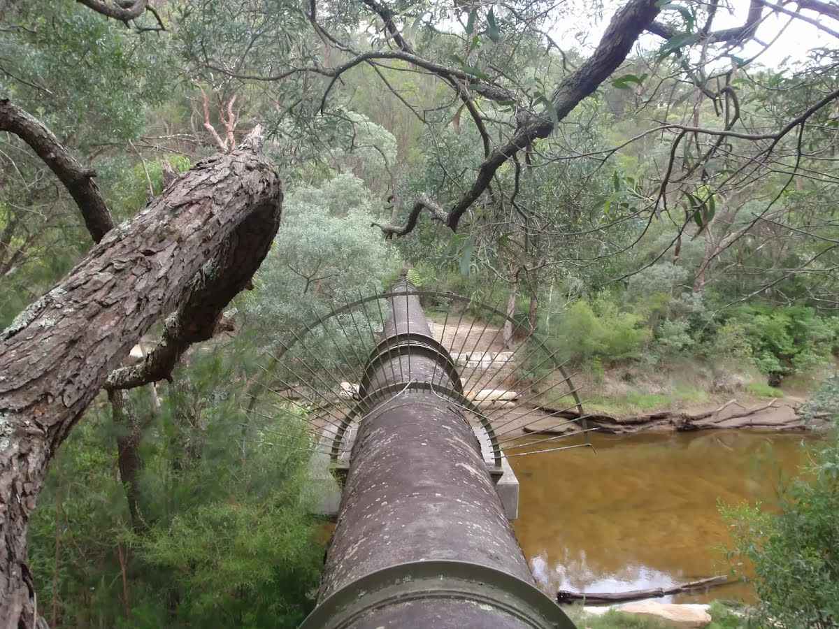 This pipeline is unearthed at Hunter Street, St Ives, and travels through Garigal National Park, across Middle Harbour Creek to John Oxley Drive, Sorlie. The pipe carries water under pressure From Ryde to Pymble to the reservoir at Beacon Hill. The old smaller-capacity pipe can still be seen running parallel to the larger pipe.
|
 |
The starting point of an optional sidetrip. An optional side trip to Int of Gov. Phillip and Bungaroo tracks. To start this optional side trip continue straight here. On returning from this side trip turn sharp right when you get back to this intersection. Details below.
|
 |
|
 |
|
 |
|
 |

|
|
Class 5/6 Very challenging |
|---|---|
| Length | 6.8 km |
| Time | 2 h 45 min to 3 h |
| Quality of track | Rough unclear track (5/6) |
| Gradient | Very steep (4/6) |
| Signage | Directional signs along the way (3/6) |
| Infrastructure | Limited facilities, not all cliffs are fenced (3/6) |
| Experience Required | Some bushwalking experience recommended (3/6) |
| Weather | Weather generally has little impact on safety (1/6) |