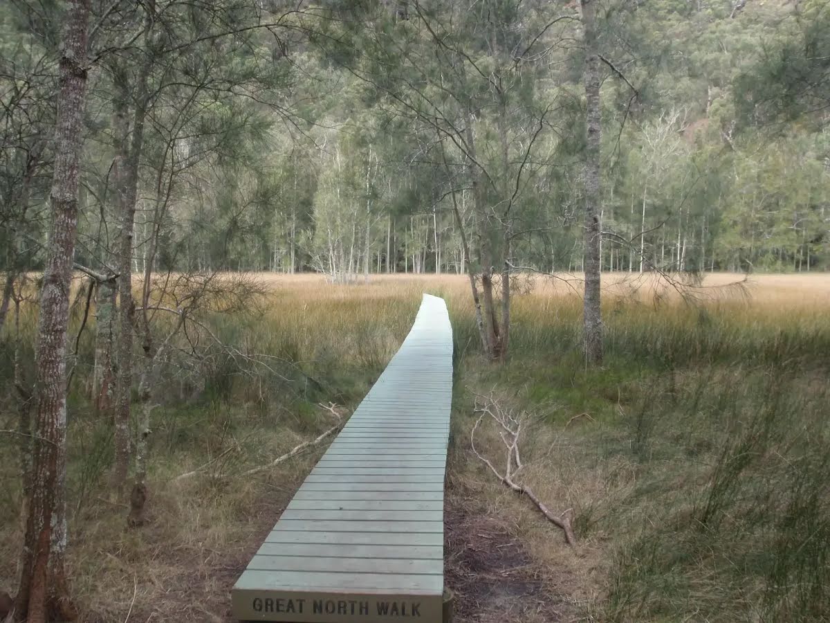
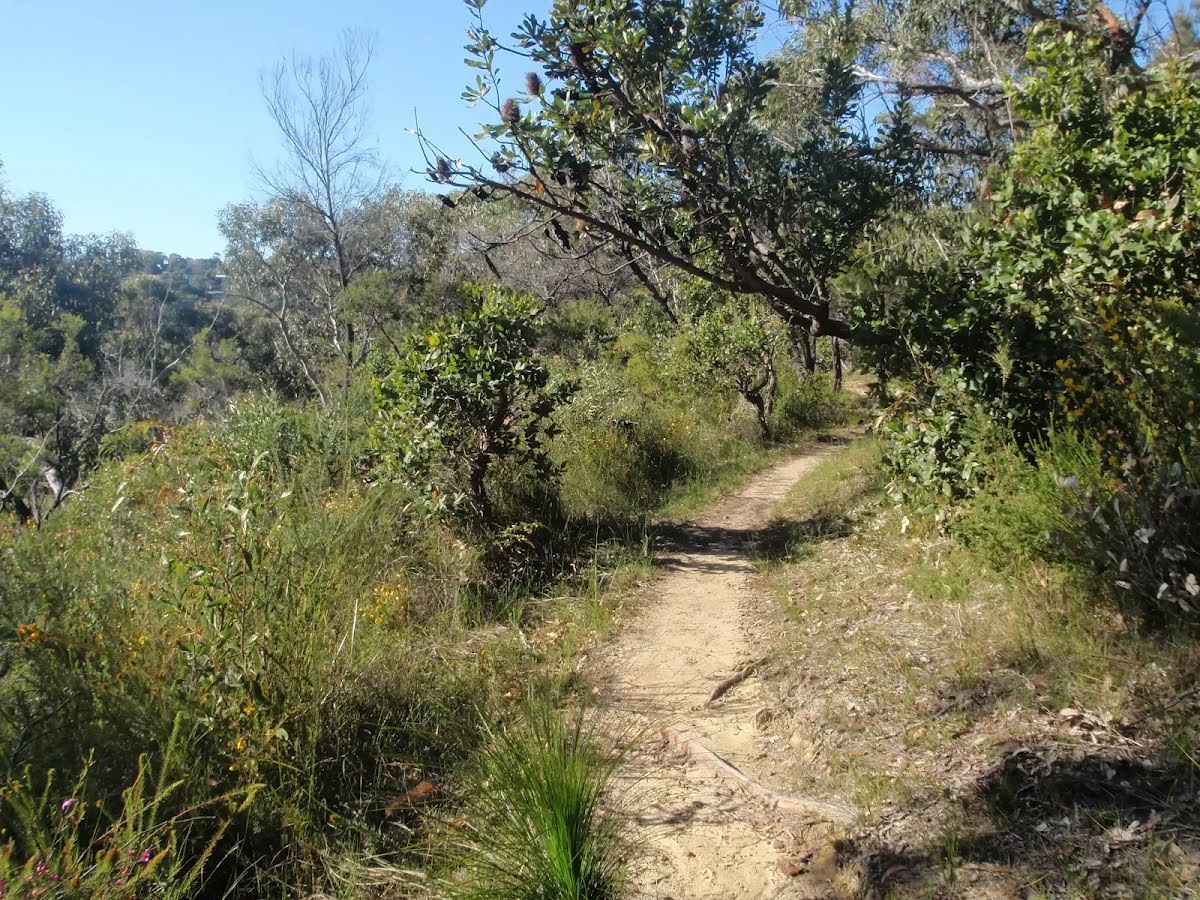
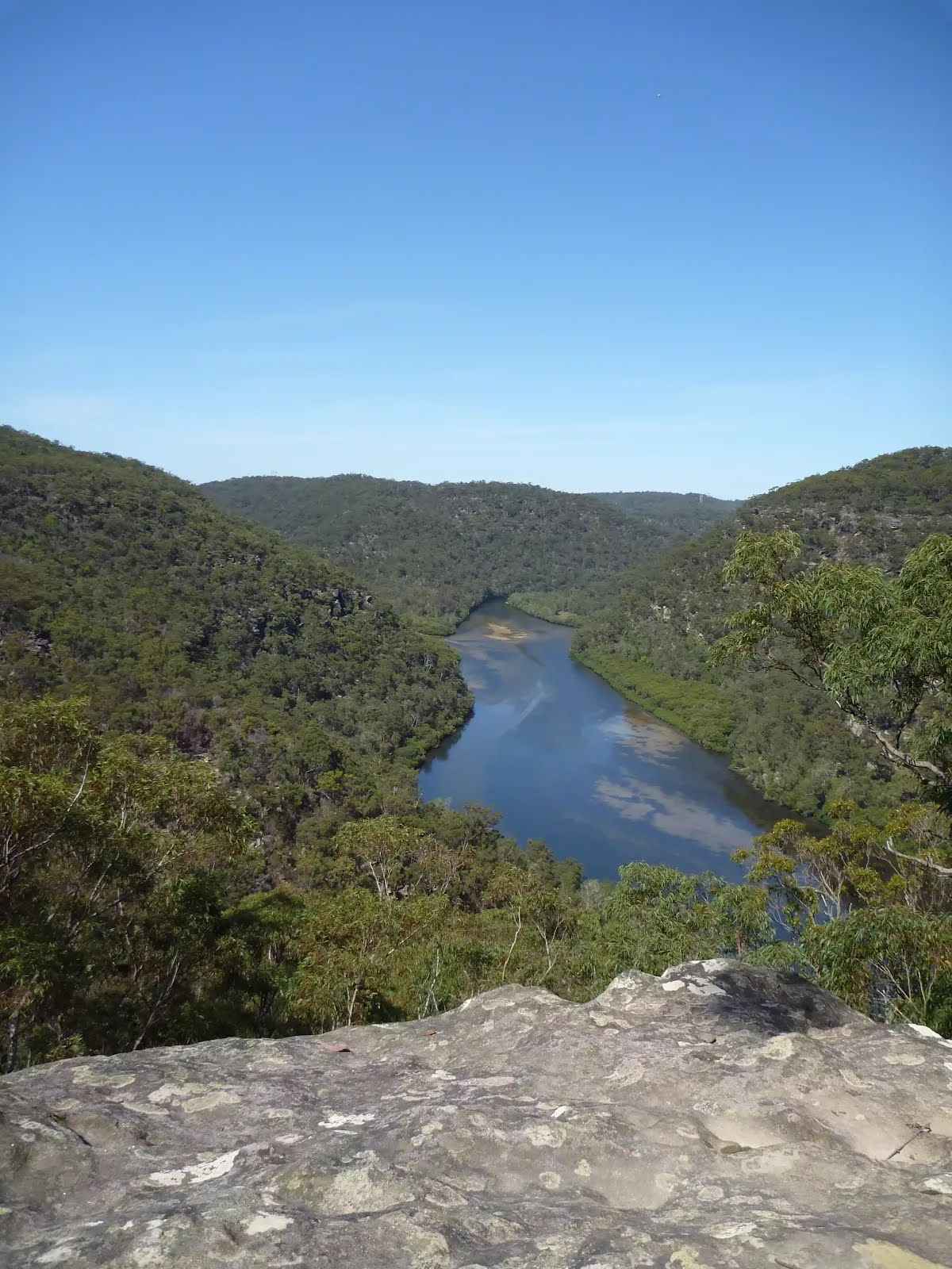
Following the Great North Walk and Berowra Creek through Berowra Valley Regional Park, this walk cuts straight through the length of the Park. The views are good, providing a broad idea of what this park has to offer. Conserve your energy for the section between Berowra Waters and Cowan as there are several solid hills. You can refill the tummy in Berowra Waters with a couple cafes to choose from.
Note this walk was re-routed in early 2016 to go via the streets of Hornsby Heights. This re-route is due to the multi-agency decision to close the Fishponds to Steele Bridge section of the Benowie Track. This decision has upset many people and the protest continues. Let us begin by acknowledging the Traditional Custodians of the land on which we travel today, and pay our respects to their Elders past and present.
Before you start any bushwalk ensure you;
• Tell someone you trust where you are going and what to do if you are overdue
• Have adequate equipment, supplies, skills & knowledge for the whole journey
• Consider the impact of weather forecasts, park/track closures & fire dangers
• Can respond to emergencies & call for help at any point
• Are healthy and fit enough for this journey
If not, change plans and stay safe. It is okay to delay and ask people for help.
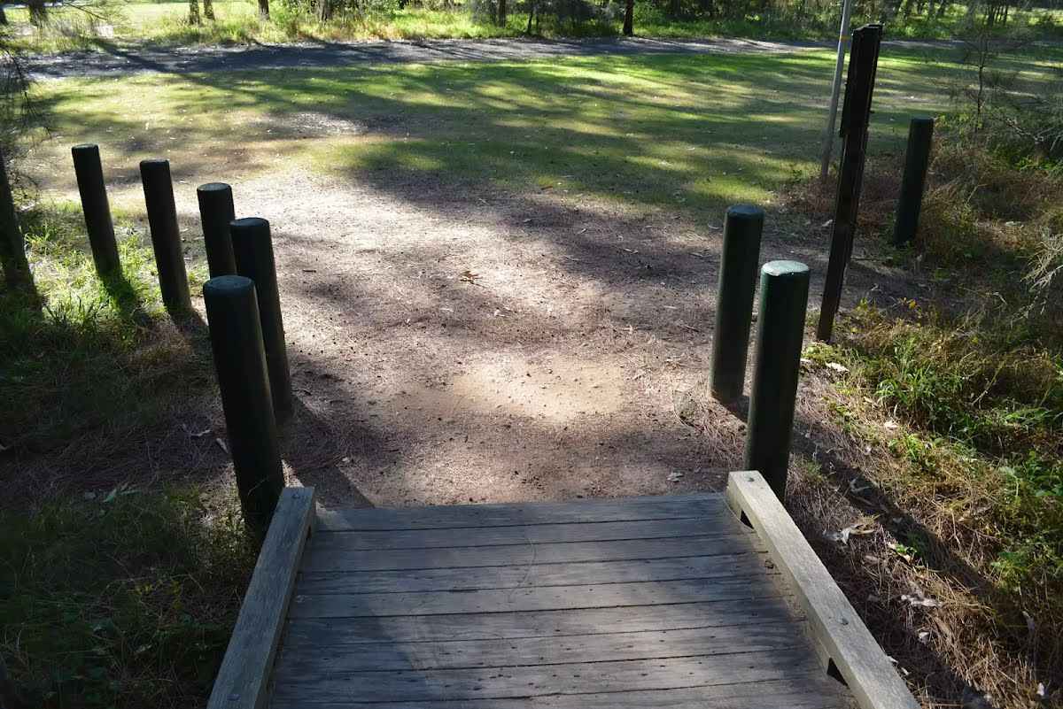
Getting started From the western (north bound) side of Thornleigh Station, this walk follows the 'Jungo Rest Area' sign along the footpath towards the car park and The Esplanade. The walk then heads down a short distance further to turn left and cross 'The Esplanade' at the traffic lights, then continue straight along the footpath down along Eddy Rd. Following a couple of GNW arrows down Eddy Rd as it then bends left, turning into Tilock St, and shortly later this walk then turns right into Morgan St. Continuing down till just before the end of this street, this walk comes to an intersection marked with a GNW arrow and the 'Elouera Bushland Natural Park' sign (on the right).....
Turn map
Directions & comments
Start.
Then cross the bridge (about 35 m long)
Monday Morning (about 55 m back from the start).
There is a pay phone (about 20 m back from the start).
Find the The Great North Walk at the start.
Find the seat at the start. , has a backrest.
Find the car park at the start.
After 25 m pass the toilet (20 m on your left)., female.
Then pass the toilet (15 m on your left)., male.
Then cross the bridge (about 8 m long)
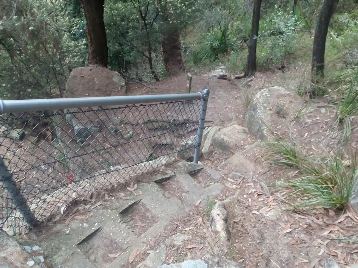
Then head down the 19 concrete steps (about 10 m long)
Then pass a seat (55 m on your left)., has a backrest.
After another 10 m pass the "The Great North Walk" (on your right).
Then find the "Zacs Great Food" (about 35 m ahead).
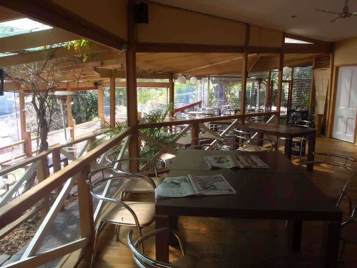
This restaurant can be found on Pennont Hills road just a stones throw from the station. They are open for breakfast, lunch and dinner with a continental menu ranging from about $20. for a meal. The opening hours are from 6.oo am to 10.00 pm from Tuesdays to Saterdays, and closed Sundays and Mondays. For more information on bookings call (02) 9484 6799.
Then pass the "Curl and Wisker Cafe" (55 m on your left).
Then head down the 5 concrete steps (about 3 m long)
After another 35 m pass a seat (20 m on your right)., has a backrest.
After another 35 m turn right, to head along Wells Street.
Then cross the bridge (about 35 m long)
Tillock St
After another 470 m by following the "Tillock St" sign turn left.
After another 40 m turn right.
After another 5 m (at the intersection of Morgan Street & Tillock Street) continue straight, to head along Morgan Street (a residential road).
After another 10 m pass the "The Great North Walk" (on your right).
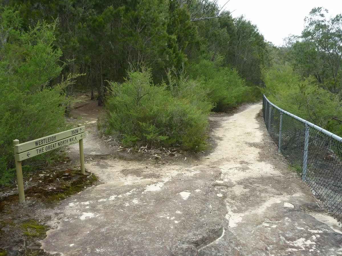
Elouera Bushland Natural Park
After another 265 m (at the intersection of The Great North Walk & Morgan Street) by following the "Elouera Bushland Natural Park" sign turn right, to head along The Great North Walk (a walking track).
After another 35 m pass the "The Great North Walk" (on your left).
After another 115 m cross the bridge (about 3 m long)
After another 90 m pass the sign (on your left).
The Jungo
At the intersection of Timbarra Road - Bellamy Street Cycleway & The Great North Walk by following the "The Jungo" sign veer right, to head along Timbarra Road - Bellamy Street Cycleway.
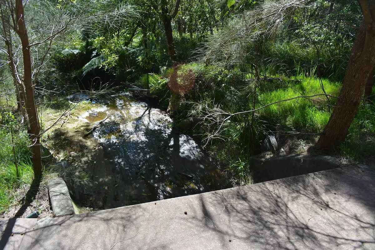
After another 15 m find the "Trip Hazard" (on your right).
Unfenced and unmarked edge with potential 80cm or higher fall into the creek. Keep clear of the culvert's edge when crossing.
Then cross the bridge (about 7 m long)
After another 125 m find the "Thornleigh zigzag railway" (10 m on your right).
The Thornleigh zigzag railway originally ran from the main rail line near Thornleigh to a historic quarry, near present day De Saxe Cl, Thornleigh. There are only minor fragments still visible today. The 'Heritage Trail' in Thornleigh has interpretive signs for the railway and the old Thornleigh Quarry. A book is available with some detail on railway and associated quarry: 'Sydney's Forgotten Quarry Railways' by John Oakes, ISBN 0 9757870 3 9
The Great North Walk
At the intersection of The Great North Walk & Timbarra Road - Bellamy Street Cycleway by following the "The Great North Walk" sign turn left, to head along The Great North Walk (a vehicle track).
After another 7 m pass the sign (on your left).
After another 680 m cross the bridge (about 7 m long)
After another 295 m cross the ford.
After another 120 m cross the ford.
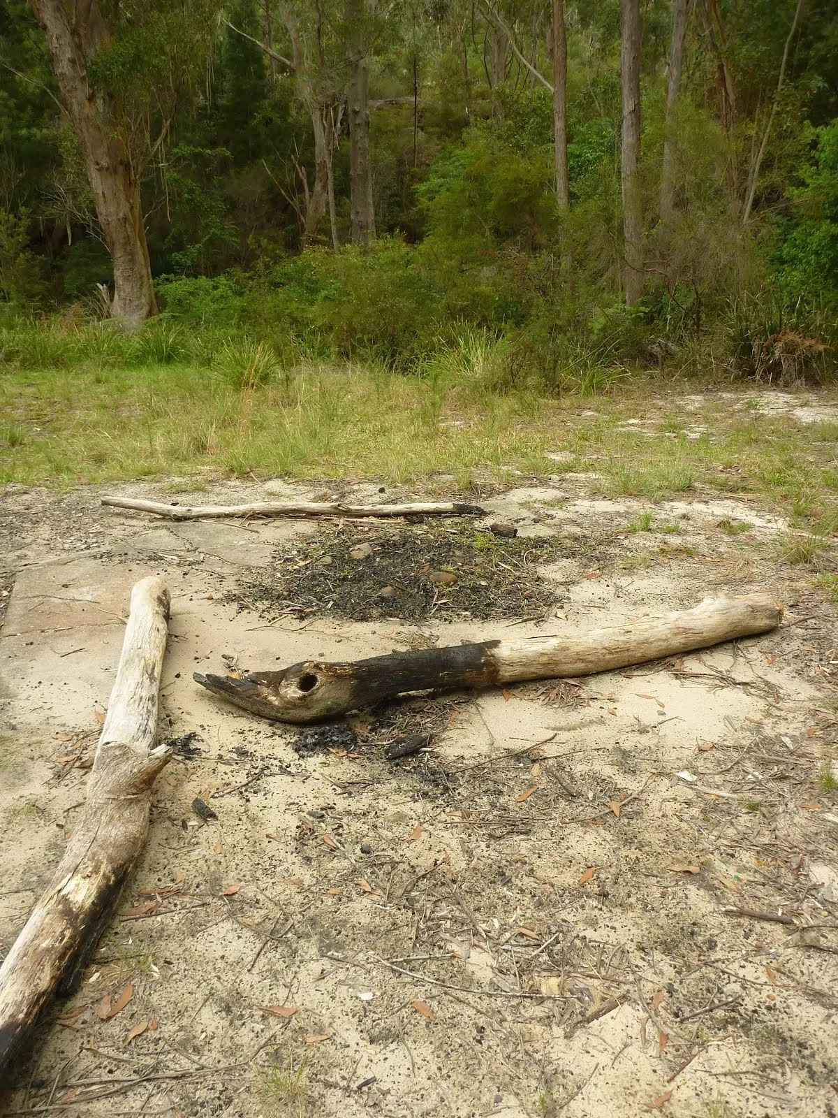
After another 320 m come to the "The Jungo" (9 m on your left).
This is a free campsite.
After another 15 m pass the sign (4 m on your left).
At the intersection of Schofield Firetrail & The Great North Walk turn right, to head along Schofield Firetrail.
After another 15 m find the "The Jungo" (on your right).
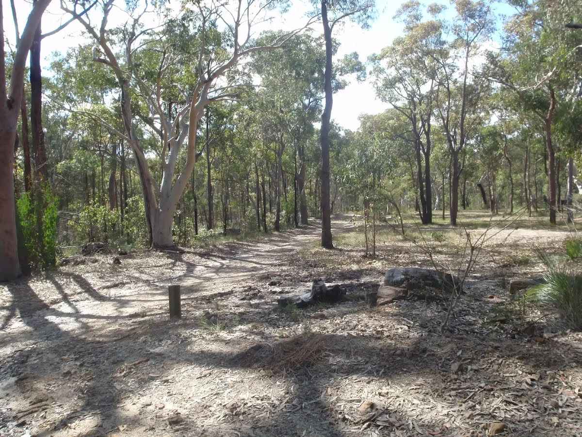
The Jungo is a relatively small clearing and campsite near the junction of Berowra and ZigZag Creeks at a well signposted intersection. There is often water in the creeks (treat well before drinking) but there are no facilities. Speculation on the source of the name 'Jungo' includes the Aussie tendency to abbreviate words ('Junction' gets corrupted to 'jung-o' etc) as well as a possible derivation from one of a few similar sounding aboriginal words.
After another 15 m cross the ford.
After another 65 m (at the intersection of The Great North Walk & Schofield Firetrail) veer right, to head along The Great North Walk (a walking track).
After another 90 m cross the ford.
Then pass the "The Great North Walk" (on your right).
After another 10 m continue straight, to head along The Great North Walk.
After another 205 m cross the bridge (about 3 m long)
After another 270 m cross the ford.
After another 185 m pass the "The Great North Walk" (10 m on your left).
After another 10 m pass the sign (6 m on your right).
After another 7 m pass the sign (10 m on your left).
After another 25 m pass the "The Great North Walk" (about 10 m ahead).
After another 215 m (at the intersection of The Great North Walk & Great North Walk access) continue straight, to head along The Great North Walk.
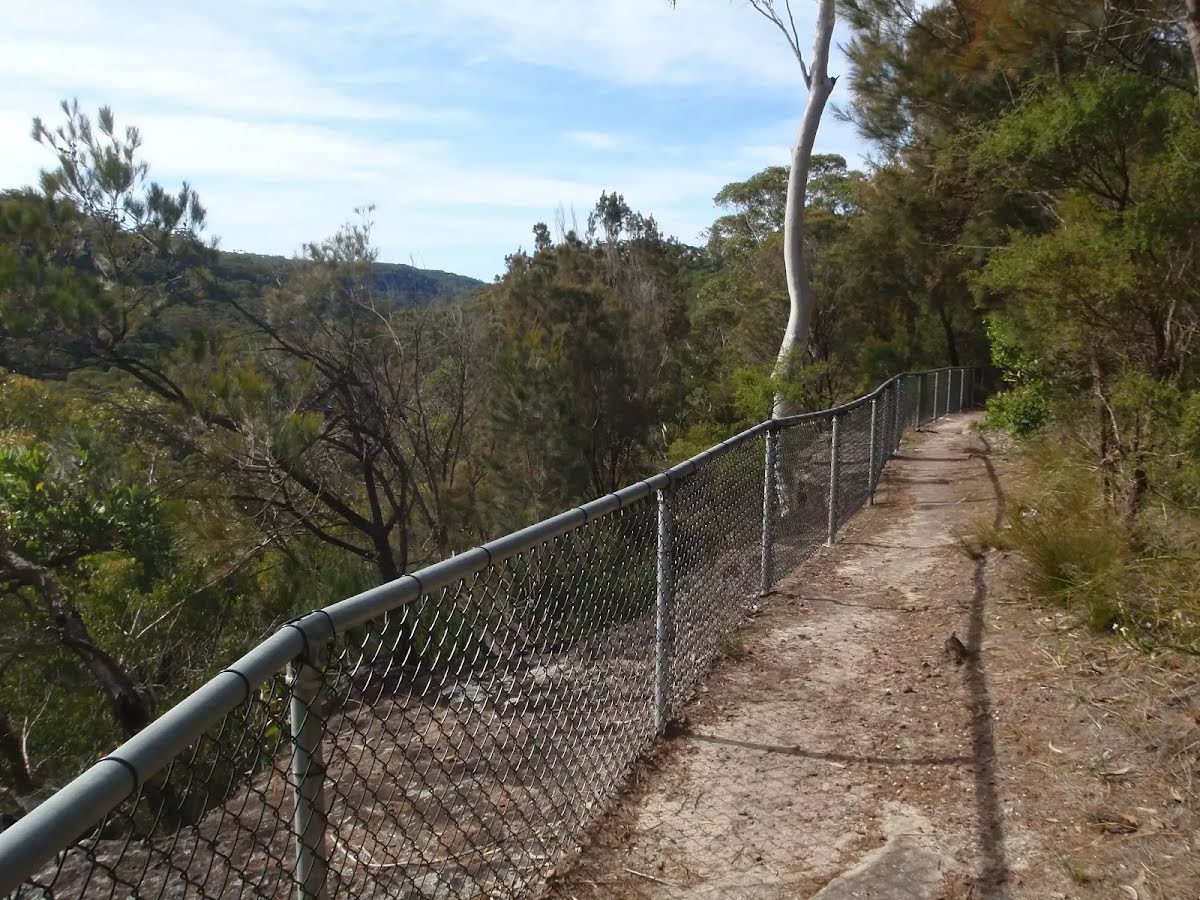
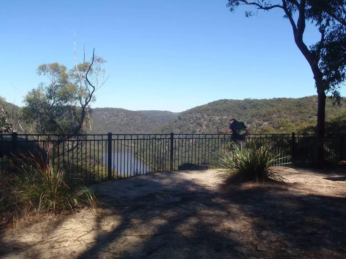
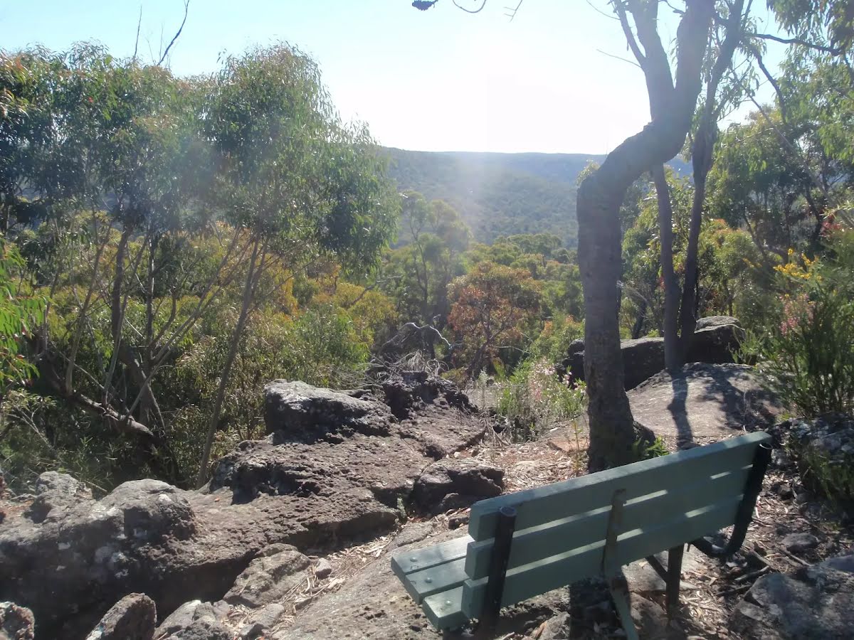
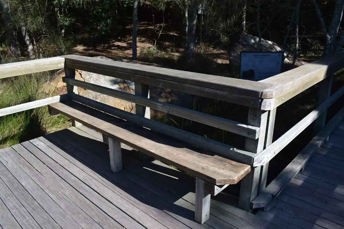
Then find the "Elouera Lookout" (6 m on your left).
This fenced lookout is on the Benowie Track close to Westleigh. There are uninterrupted views from the clifftop across the Berowra Creek valley, which is rare for the area. As well as being on the Great North Walk, this lookout can be accessed by a short walk from Elouera Rd, Westleigh. This section of fenced rock platform is about 100m long, and there is some limited shade from the casuarina near the lookout if you want to take a rest.
After another 75 m pass the "The Great North Walk" (on your left).
After another 100 m pass the "The Great North Walk" (5 m on your left).
After another 370 m cross the ford.
Then cross the bridge (about 6 m long)
After another 100 m cross the bridge (about 8 m long)
After another 9 m (at the intersection of The Great North Walk & Rough Very Steep Track) continue straight, to head along The Great North Walk.
Then head up the 8 earthen steps (about 4 m long)
After another 60 m cross the bridge
Then cross the bridge
After another 25 m veer right.
After another 100 m turn right.
After another 90 m turn left, to head along Barwood Firetrail.
After another 500 m turn left.
After another 30 m turn right, to head along The Great North Walk.
After another 400 m cross the bridge (about 4 m long)
After another 135 m cross the ford.
After another 70 m head up the 6 earthen steps (about 3 m long)
After another 55 m pass the "Great North Walk" (on your left).
Continue straight, to head along The Great North Walk.
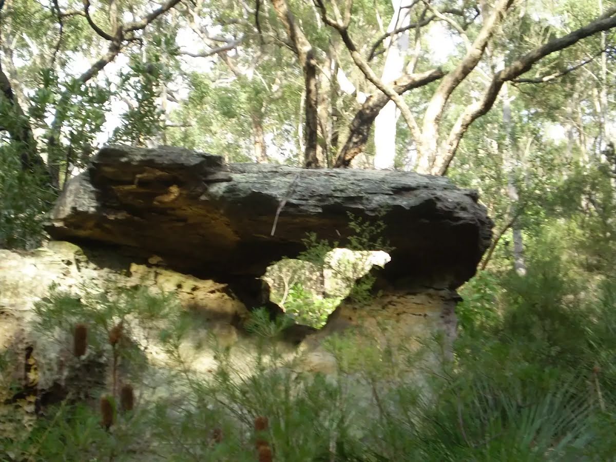
After another 285 m find the "Blackfellow Head Engravings" (50 m on your right).
On the far north west corner of Quarter Sessions Road (beside no.280), there is a lookout and some Aboriginal engravings. The signposted site has a timber platform providing some filtered views across the valley. On the left side of the platform is a sandstone block with the engraved images of two wallabies. There are reports of other engravings in the area, but like many similar sites, their exact locations are not published to protect them. Please keep off the engravings area, to reduce wear.
After another 75 m come to the viewpoint (50 m on your right).
After another 175 m cross the ford.
After another 165 m pass the sign (on your left).
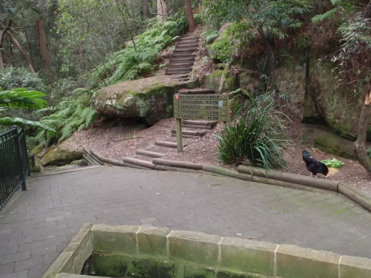
Fishponds
At the intersection of Blue Gum Walk & The Great North Walk by following the "Fishponds" sign continue straight, to head along Blue Gum Walk.
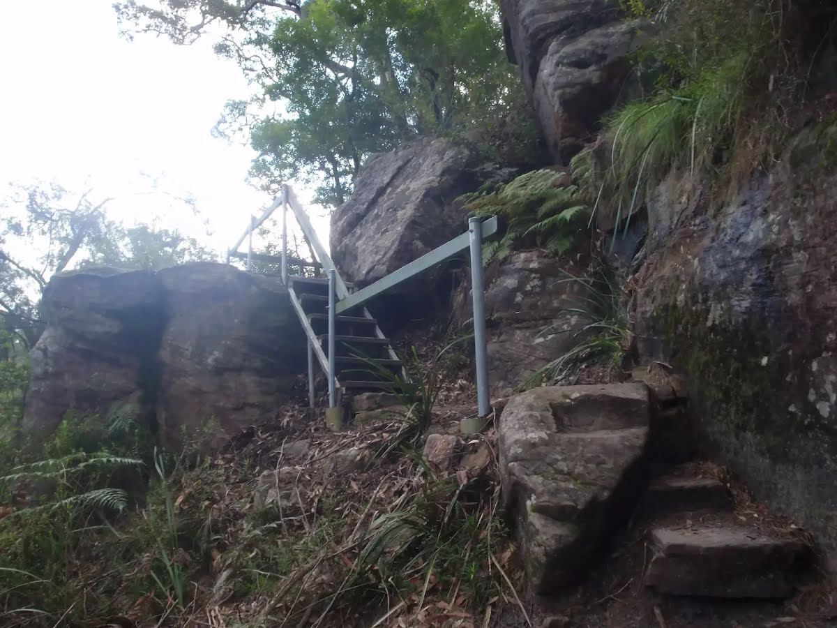
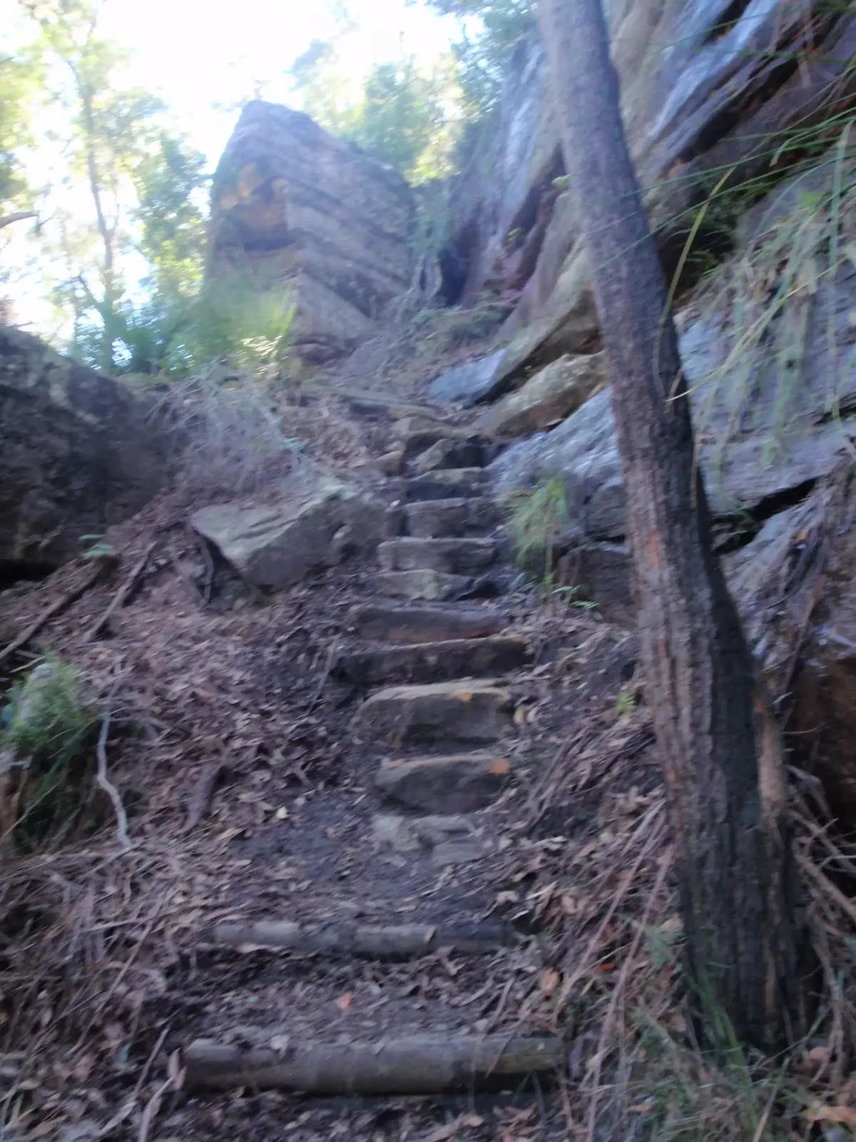
After another 230 m head down the 22 stone steps (about 10 m long)
After another 230 m head down the stone steps (about 9 m long)
After another 50 m head down the rock steps (about 10 m long)
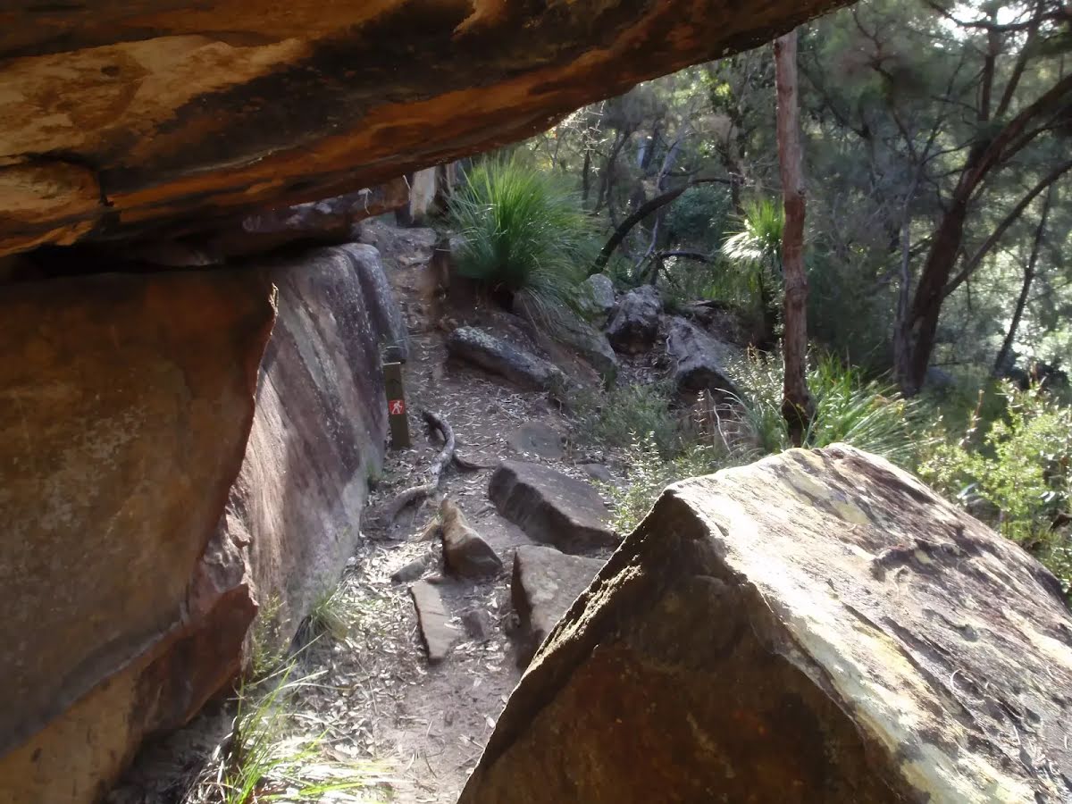
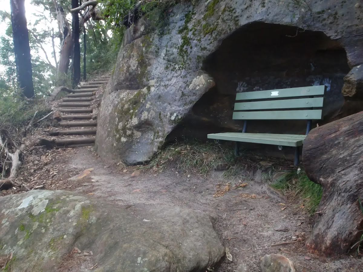
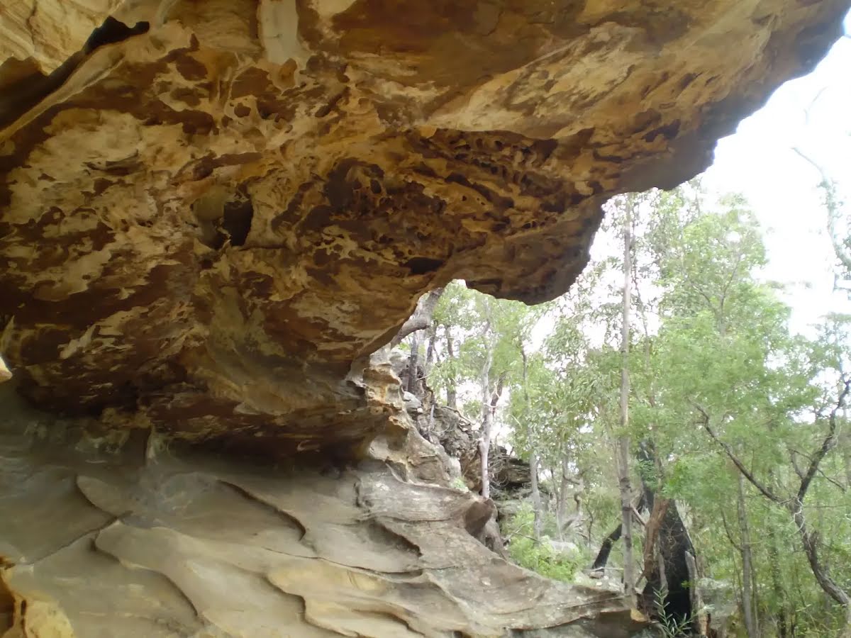
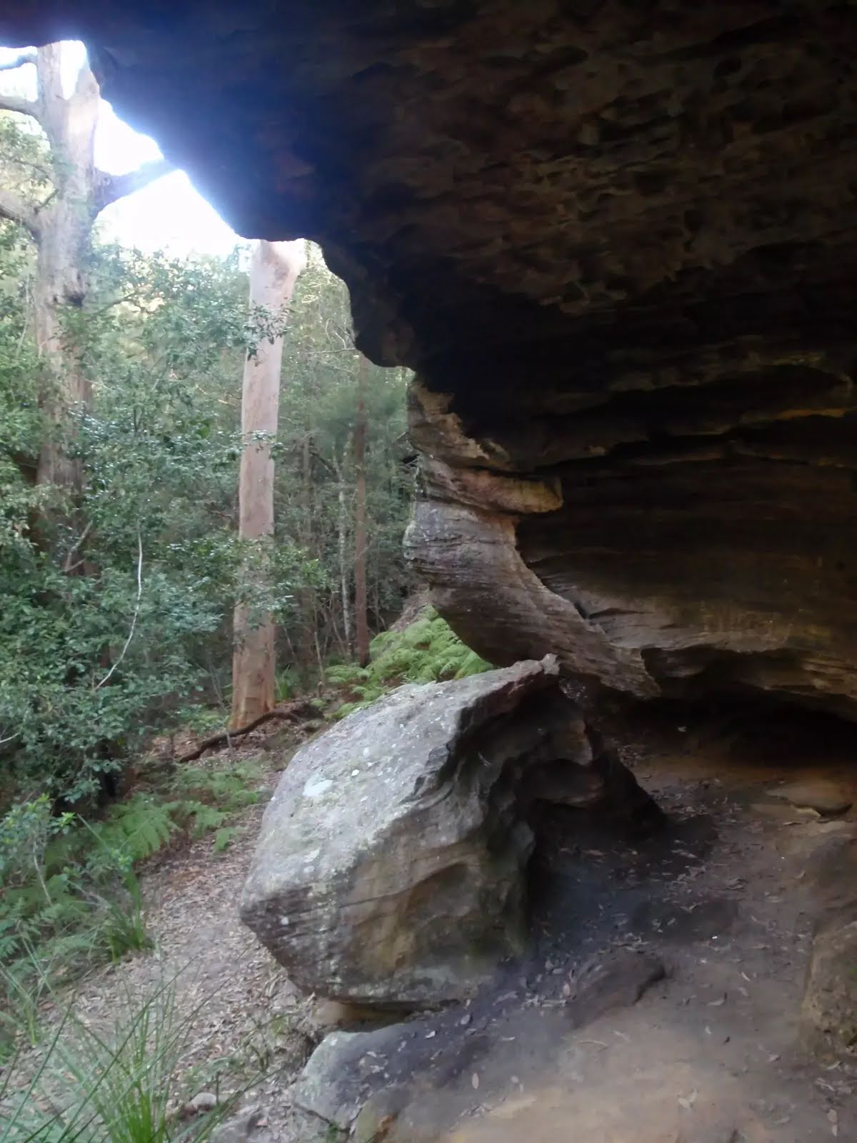
After another 35 m pass the cave (on your right).
After another 25 m cross the ford.
This is flood prone; never cross flooded waterways.
After another 35 m head down the rock steps (about 7 m long)
After another 285 m cross the bridge (about 3 m long)
Then head up the 13 earthen steps (about 7 m long)
After another 30 m come to the "Fishponds Lookout" (on your left).
Then find the "Fishponds" (about 80 m ahead).
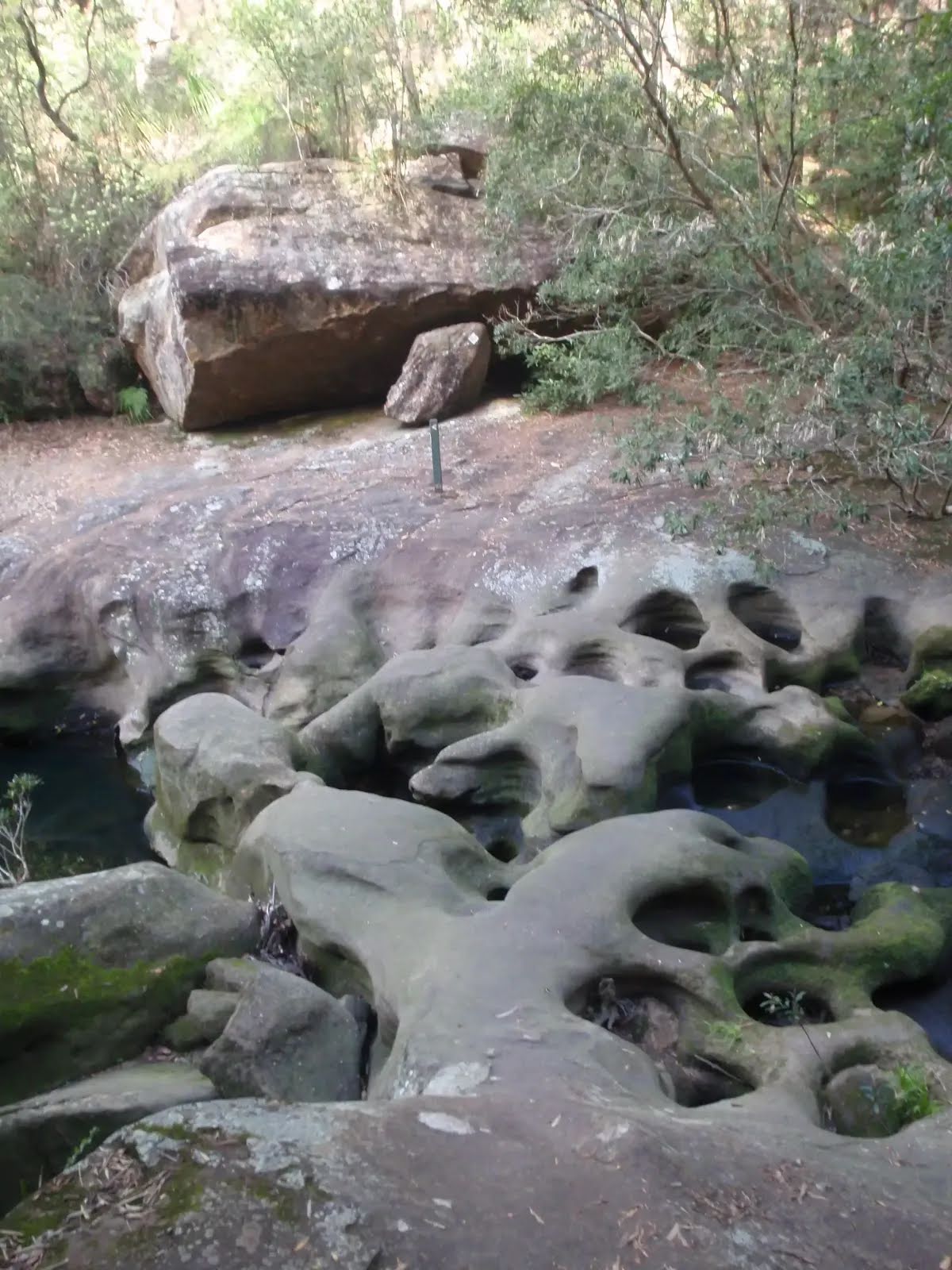
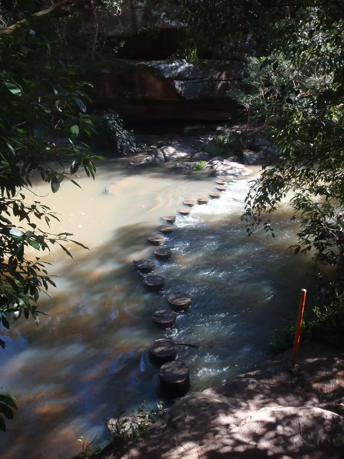
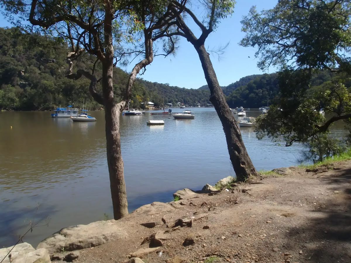
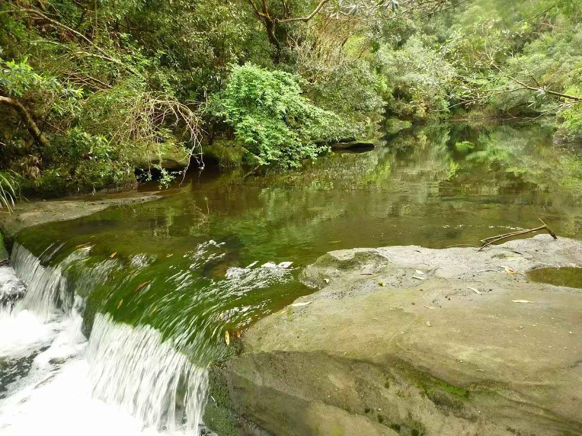
Fishponds is a long waterhole on Berowra Creek in Berowra Valley Regional Park. The waterhole is lined with tall cliffs and a few sandstone caves. At the southern end, there are stepping stones to help cross the creek, and a small timber bridge at the northern end. This is a beautiful spot and a worthy place to rest and enjoy the water passing by. The waterhole is fairly popular with local teens in summer, cooling off. Swimming and jumping at the Fishponds waterhole has resulted in fatalities - please heed the signs and Cora's parents' plea and enjoy the water from the edge.
The starting point of an optional sidetrip. An optional side trip to Fishponds crossing. To start this optional side trip continue straight here. On returning from this side trip turn left when you get back to this intersection. Details below.
Rosemead Rd Trackhead
At the intersection of Blue Gum Walk & Great North Walk by following the "Rosemead Rd Trackhead" sign turn sharp right, to head along Blue Gum Walk.
Then pass the sign (on your left).
After another 75 m (at the intersection of Blue Gum Walk & Negotiable) continue straight, to head along Blue Gum Walk.
Then cross the bridge (about 3 m long)
After another 30 m come to the viewpoint (40 m on your right).
After another 115 m head up the steps (about 10 m long)
Galston Gorge
After another 15 m (at the intersection of The Great North Walk & Blue Gum Walk) by following the "Galston Gorge" sign turn left, to head along The Great North Walk.
Then cross the bridge (about 5 m long)
Then pass the sign (on your left).
Then head up the 9 steps (about 15 m long)
After another 8 m head up the 7 steps (about 3 m long)
After another 20 m head up the 14 stone steps (about 3 m long)
After another 9 m head up the 37 steps (about 20 m long)
After another 10 m head up the 39 steps (about 35 m long)
After another 10 m head up the 20 steps (about 10 m long)
After another 35 m head up the 25 steps (about 15 m long)
After another 20 m head up the 7 stone steps (about 2 m long)
After another 7 m head up the 40 steps (about 30 m long)
After another 10 m head up the 9 steps (about 5 m long)
After another 6 m head up the 19 earthen steps (about 20 m long)
Then head up the 15 wooden steps (about 4 m long)
Then head up the 13 wooden steps (about 4 m long)
Then head up the 14 stone steps (about 10 m long)
After another 25 m (at the intersection of Manor Road & The Great North Walk) veer left, to head along Manor Road (a residential road).
After another 850 m (at the intersection of Rosamond Street & Watson Avenue) continue straight, to head along Rosamond Street.
After another 270 m (at the intersection of Stewart Avenue & Rosamond Street) turn left, to head along Stewart Avenue.
After another 310 m (at the intersection of Stewart Avenue & Berowra Valley Quarry Firetrail) continue straight (a walking track).
After another 170 m turn right.
After another 10 m (at the intersection of Clarinda Firetrail & Clarinda Street) turn left, to head along Clarinda Firetrail.
After another 30 m head through/around the gate.
After another 245 m turn left, to head along Clarinda Firetrail.
After another 105 m cross the ford.
After another 75 m continue straight, to head along Clarinda Firetrail.
After another 620 m (at the intersection of The Great North Walk & Clarinda Firetrail) turn left, to head along The Great North Walk (a walking track).
After another 345 m head down the 9 stone steps (about 6 m long)
After another 25 m head down the 25 steps (about 10 m long)
After another 10 m head down the 8 stone steps (about 5 m long)
After another 15 m cross the ford.
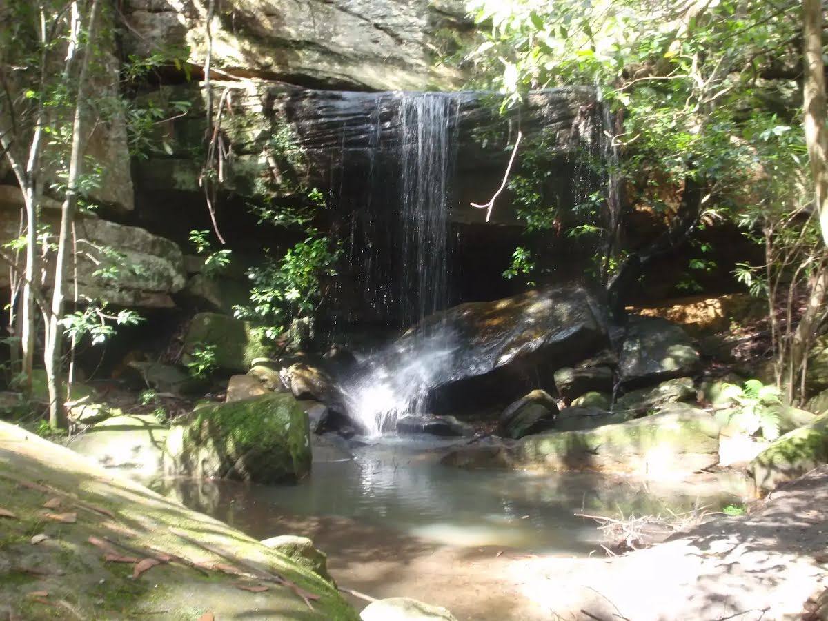
Then pass the waterfall (20 m on your left).
Then head up the 31 stone steps (about 15 m long)
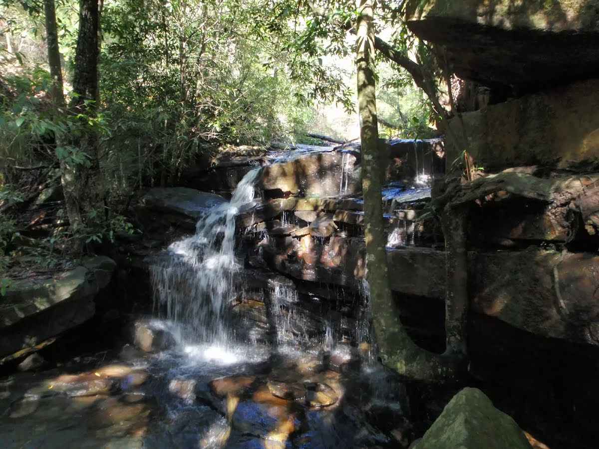
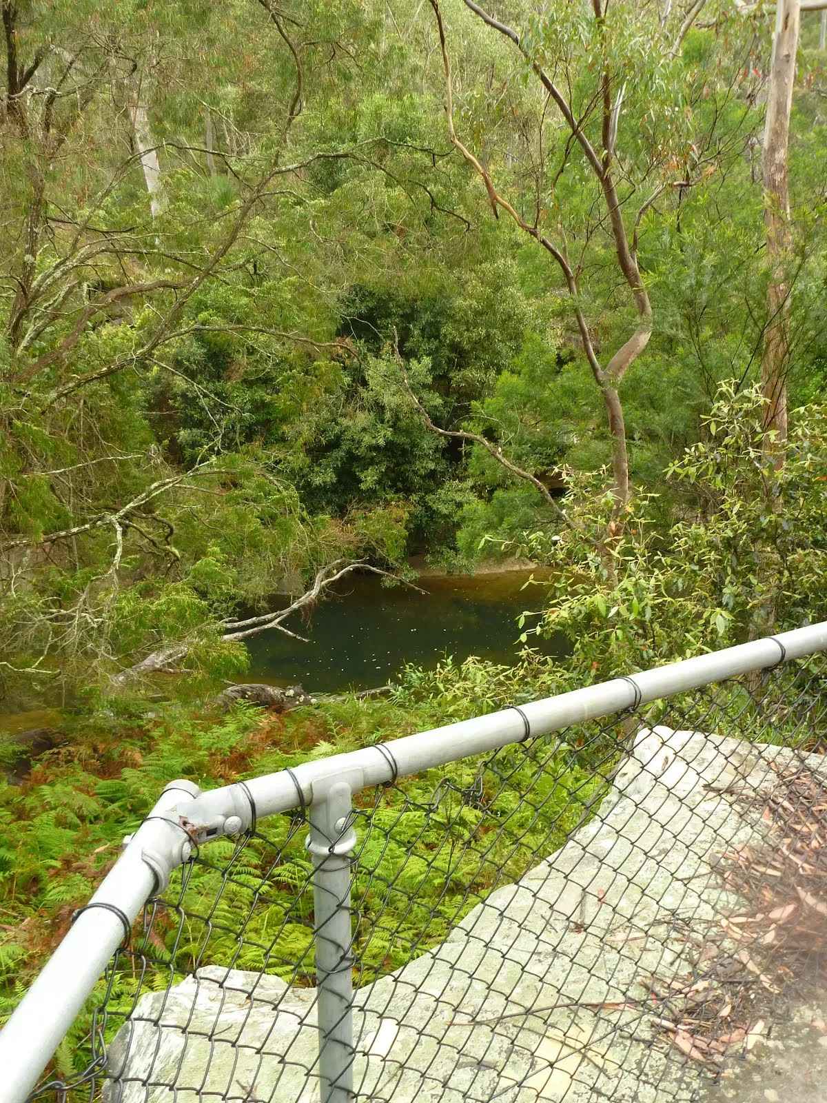
Then find the "Unnamed waterfall" (on your left).
This waterfall is about 3 meters tall, with a square black face. The water cascades down to a rock platform and into the sandy creek. The waterfall is active after recent rain, and may offer a trickle at other times. At this section of the creek, the gully is quite steep, creating a wonderful environment for the green moss and ferns to grow. A great spot to rest and enjoy the cool on hot days.
After another 75 m (at the intersection of Berowra Valley Quarry Firetrail & The Great North Walk) turn right, to head along Berowra Valley Quarry Firetrail (a vehicle track).
After another 380 m (at the intersection of Berowra Valley Quarry Firetrail & Great North Walk) continue straight, to head along Berowra Valley Quarry Firetrail.
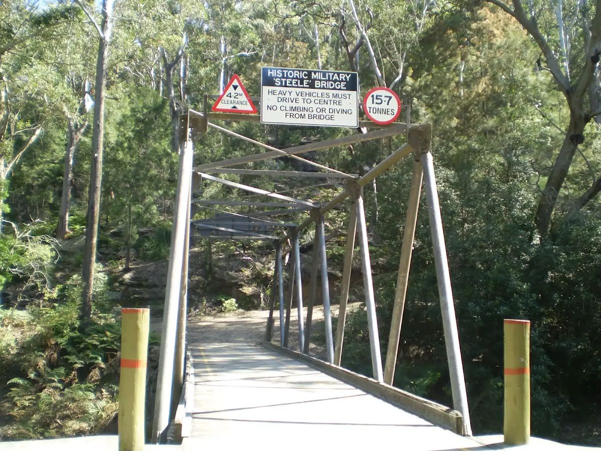
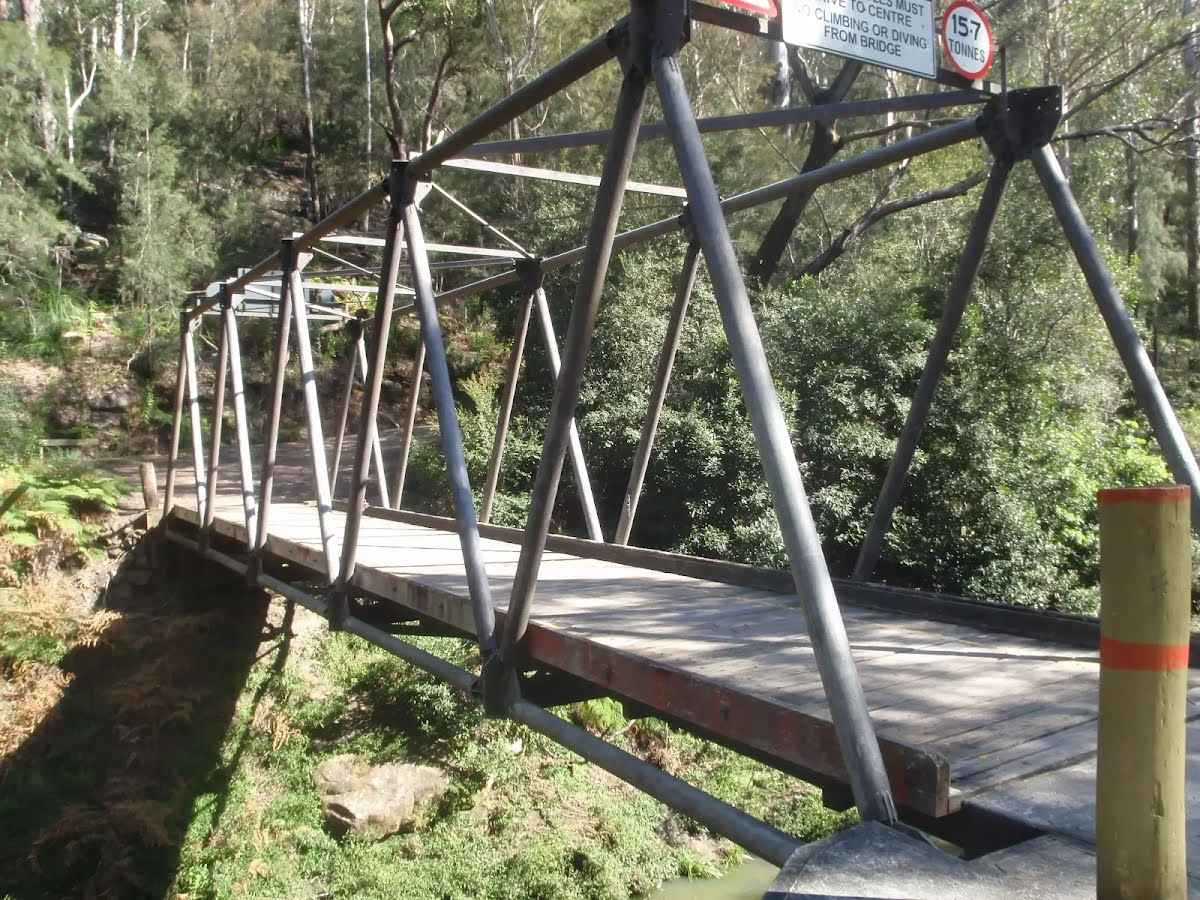
After another 9 m cross the Steele Bridge (about 20 m long)
Then find the "Historic Military 'Steele' Bridge" (6 m on your right).
This large steel and timber bridge spans Berowra Creek north of Fishponds. The creek is fairly wide at this point and the bridge provides a great view of the sandstone overhangs along the creek's edge. The bridge was commissioned in 1965 to allow access for fire trucks. The bridge was designed by Major General Sir Clive Steele in 1942. Bridges of this type were critical during the WWII South West Pacific campaigns. The bridge is designed on the Warren truss style and is one of only 4 'Steele' bridges still in use in NSW.
After another 225 m cross the ford.
After another 580 m continue straight, to head along Berowra Valley Quarry Firetrail.
After another 870 m continue straight, to head along Berowra Valley Quarry Firetrail.
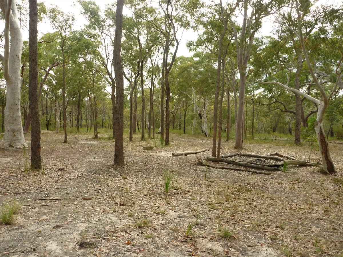
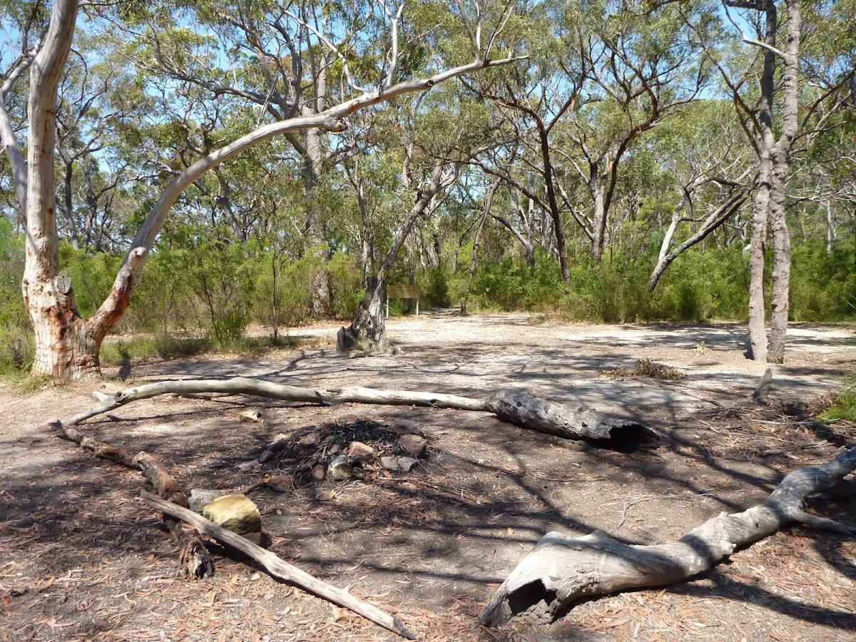
After another 115 m come to the "Tunks Ridge Campground" (20 m on your left).
This is a free campsite.
After another 15 m find the "Tunks Ridge Rest Area" (10 m on your left).
Tunks Ridge Rest Area is a large, shady and gently sloping campsite at the junction of three management trails. There is no water or other facilities (you will need to carry your own in). A sign at the top of the campsite reminds campers that there is a one night limit and that it is a fuel stove only area (no campfires). Please note that the composting toilet has been removed and no longer available.
At the intersection of Tunks Trail & Berowra Valley Quarry Firetrail veer right, to head along Tunks Trail.
After another 260 m cross the ford.
After another 190 m cross the ford.
After another 160 m come to the viewpoint (55 m on your left).
After another 520 m continue straight, to head along Tunks Trail.
After another 235 m find the "Top of Galston Gorge Campsite" (20 m on your right).
This campsite can be found on the Great North Walk, off the service trail just before it descends into Galston Gorge (when coming from the south). There is plenty of room for a group of tents, however there is no available water or facilities. Although this is an official campsite for the Great North Walk, there are some threatened species in the area, therefore Tunks Ridge Reserve (1.4km South) would make a better alternative, with better facilities.
At the intersection of The Great North Walk & Tunks Trail veer left, to head along The Great North Walk (a walking track).
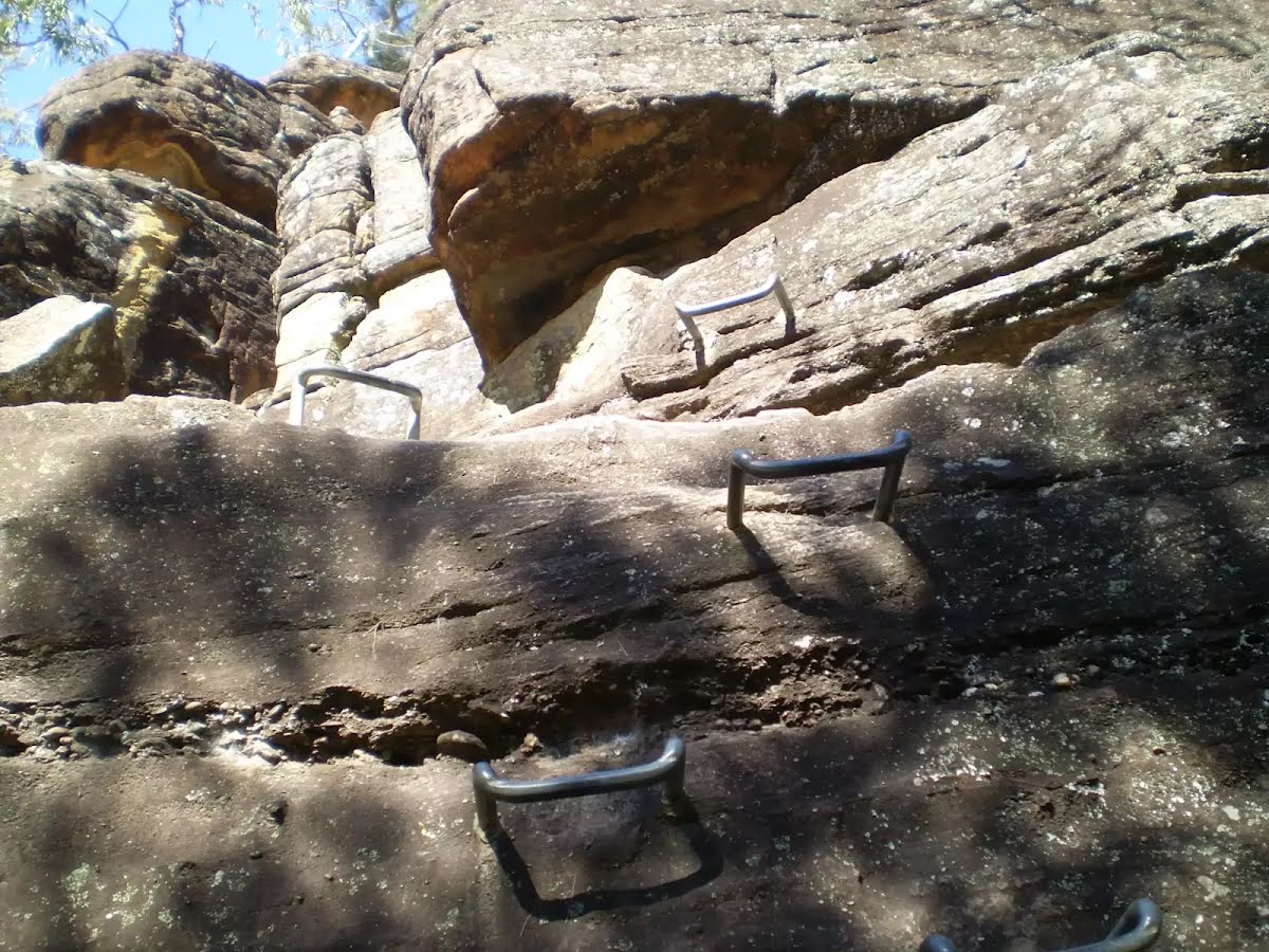
After another 80 m head down the 87 rock steps (about 50 m long)
After another 255 m head down the 35 steps (about 20 m long)
After another 25 m head down the 21 stone steps (about 10 m long)
After another 5 m head down the 17 steps (about 10 m long)
After another 20 m head down the 9 steps (about 3 m long)
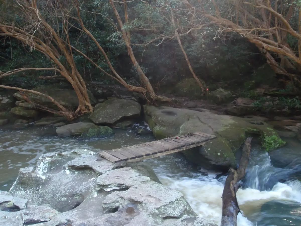
Then cross the stepping stones (about 10 m long)
Then cross the stepping stones.
This is flood prone; never cross flooded waterways.
After another 15 m find the "Galston Gorge track head" (15 m on your right).
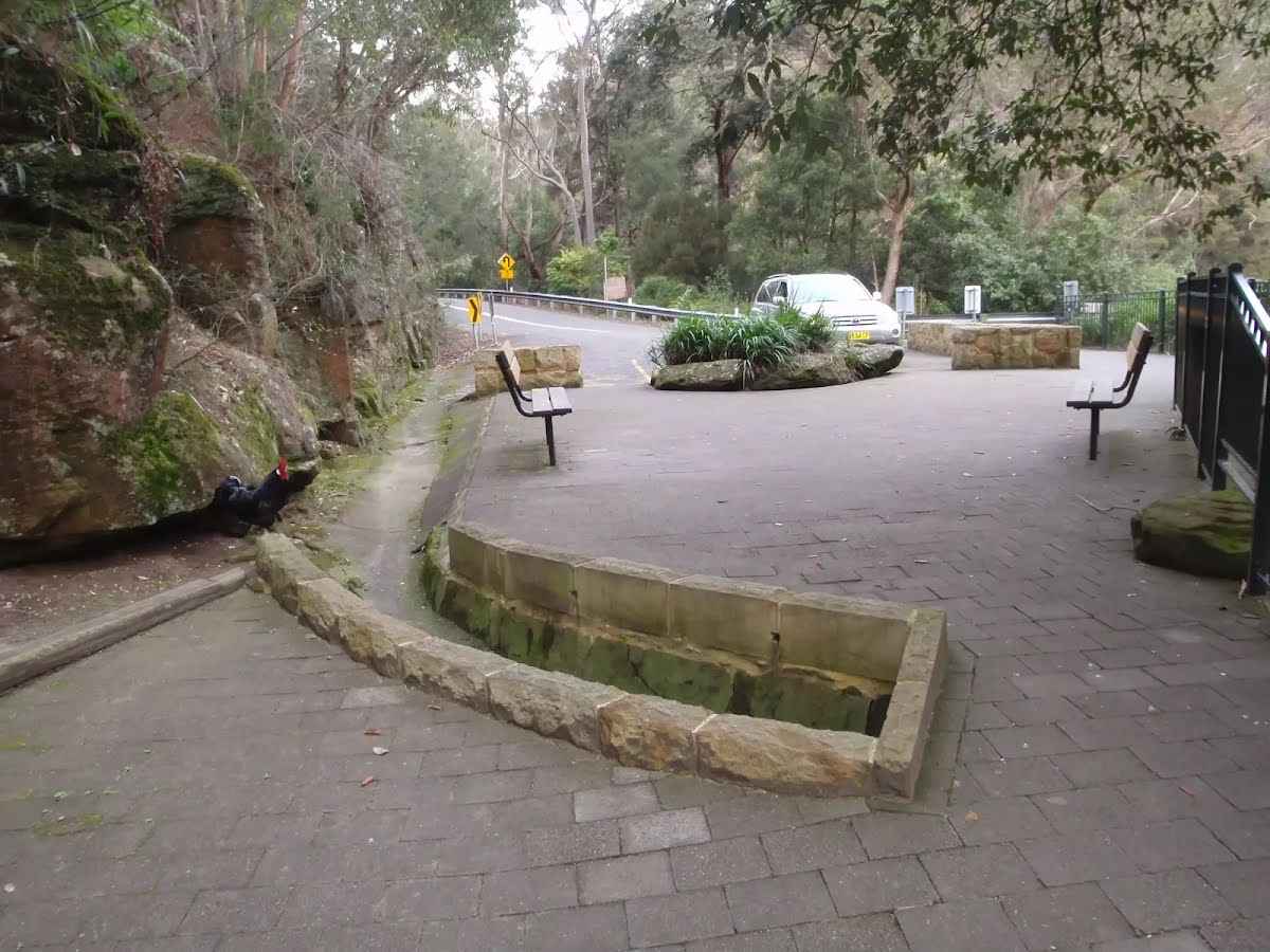
Galston Gorge track head is located at a small car park on the eastern side of Berowra Creek, near the bottom of the gorge on Galston Road. This track head is a good access point for those wanting to do sections of the Great North Walk and is well signposted. Keep an eye open for the local chickens.
After another 25 m head up the 21 rock steps (about 25 m long)
Turn right, to head along The Great North Walk.
Then head up the 14 rock steps (about 15 m long)
Veer left, to head along The Great North Walk.
After another 7 m pass the car park (about 10 m ahead).
Turn left, to head along The Great North Walk.
After another 1 m continue straight, to head along The Great North Walk.
Then head up the 32 earthen steps (about 20 m long)
After another 360 m head down the 38 earthen steps (about 20 m long)
After another 620 m cross the ford.
Veer left, to head along The Great North Walk.
After another 30 m head up the 33 stone steps (about 15 m long)
After another 15 m head up the 35 stone steps (about 9 m long)
After another 185 m find the "Gulley Creek Falls" (15 m on your right).
This is a nice little creek crossing on the Great North Walk in Galston Gorge. The small falls flow just upstream of the track, even after a small amount of rain. Enjoy the cool shade of the trees at the creek crossing from the track.
After another 30 m cross the ford.
Turn left, to head along The Great North Walk.
After another 810 m continue straight, to head along The Great North Walk.
After another 490 m come to the viewpoint.
After another 580 m cross the ford.
At the intersection of The Great North Walk & Provest Creek veer left, to head along The Great North Walk.
After another 280 m cross the ford.
Veer left, to head along The Great North Walk.
After another 140 m continue straight, to head along The Great North Walk.
After another 135 m cross the bridge (about 6 m long)
After another 170 m cross the bridge (about 10 m long)
After another 65 m continue straight, to head along The Great North Walk.
After another 6 m cross the bridge (about 6 m long)
After another 90 m continue straight, to head along The Great North Walk.
After another 600 m continue straight, to head along The Great North Walk.
After another 30 m find the "Berowra Creek campsite" (15 m on your right).
This shady campsite is located on the Benowie Track a short distance back from Berowra Creek, south of the Crosslands Reserve. Providing plenty of tree cover, flat ground and an established fire scar, this campsite is a great spot for those walkers who want a quiet night's sleep away from the more popular Crosslands Reserve. The creek water is brackish at this point, so it is not drinkable (except after heavy rain and lower tide, but then the water is more polluted) - best to bring your own water.
After another 20 m turn right, to head along The Great North Walk.
After another 20 m veer right, to head along The Great North Walk.
After another 325 m turn left, to head along The Great North Walk.
After another 315 m cross the bridge (about 8 m long)
After another 45 m continue straight, to head along The Great North Walk.
After another 100 m continue straight, to head along The Great North Walk.
After another 350 m head down the 15 earthen steps (about 8 m long)
After another 130 m pass the toilet (10 m on your right). This toilet is wheelchair accessible.
After another 10 m pass the water tap (15 m on your right).
Continue straight.
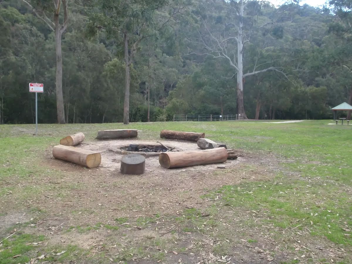
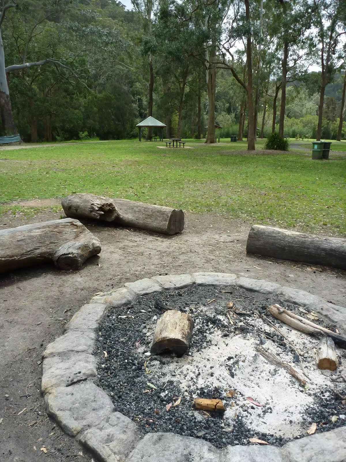
After another 9 m find the "Crosslands Campsite" (15 m on your right).
On the far southern end of Crosslands Reserve is a toilet block and campsite. The campsite is well set up and managed by Hornsby Council. There are picnic tables, electric barbecues, toilets, a children's playground, garbage bins and town water. There is a large flat grassy areas to camp and a single authorised fire pit. The campsite must be booked and fees apply - $9 per night for adults and $6 for children (infants under 4 are free). The gate at the top of the hill is locked at 5.30pm EST and 7.30pm (daylight savings time). A pleasant and well established campsite beside the river.
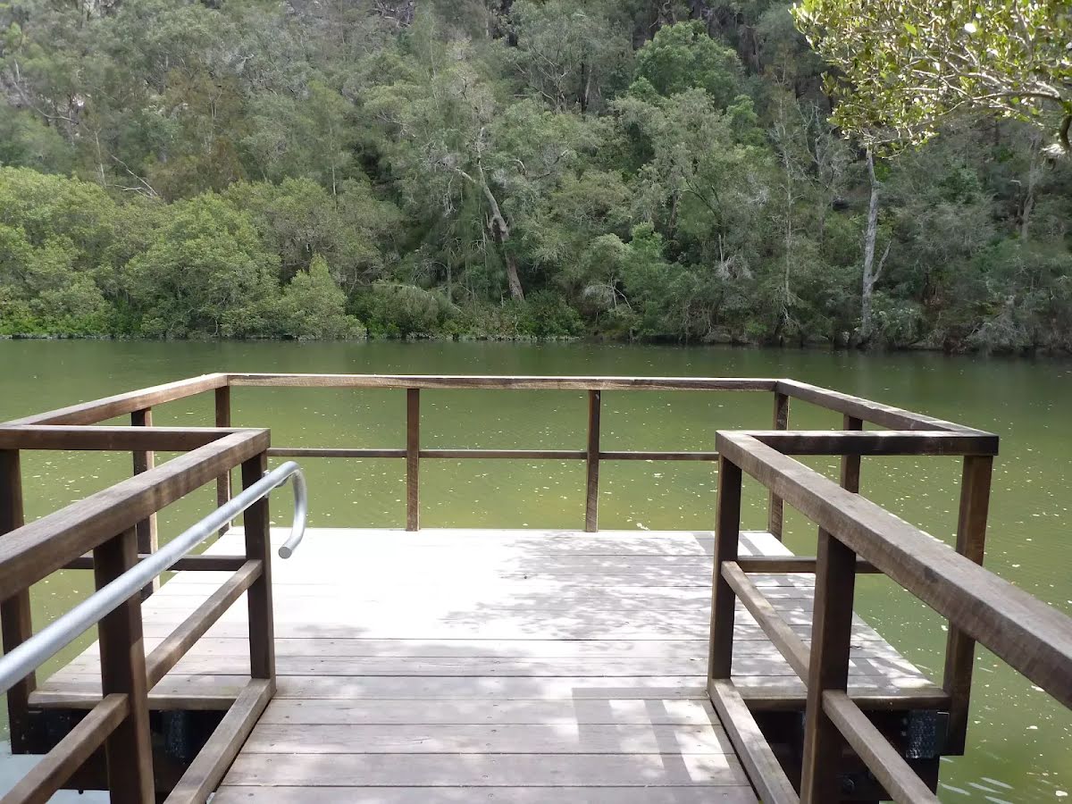
After another 90 m come to the "Viewing Platform" (20 m on your left). This viewpoint is wheelchair accessible.
After another 145 m come to the "Viewing Platform" (7 m on your left). This viewpoint is wheelchair accessible.
After another 55 m find the "Crosslands Youth & Convention Centre" (75 m on your left).
Crosslands Youth & Convention Centre is a wonderful facility run by the Seventh-day Adventist Church. The centre provides a large tent-based campsite ($12 pp/pn), large group dorm-style and unit-style accommodation. The units have 5 beds (plus sofa bed) and cost $36 a night per person. The units are equipped with a kitchen, TV, blankets, supplies for hot drinks, pillows, blankets and a balcony with views over Berowra Creek. You will need your own sheets, pillow cases and towels. Meal packs range from $5-$10 per person per meal. Breakfast includes juice, fresh fruit, cereal, toast and optional hash browns, eggs and sausages. Dinner includes juice, dinner rolls, salad, pie or sausage (or optional steak) and desert. No cigarettes, alcohol or other drugs are allowed on site. For more information, call your hosts John & Margaret on (02) 9653 1041.
After another 35 m pass the car park (5 m on your right).
Then find the "Crosslands".
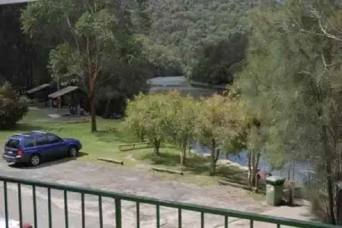
Crosslands Reserve is lovely and long mixed use picnic area, spanning along the edge of Berowra Creek. There are picnic tables, electric barbecues, toilets, car parking, a children's playground, garbage bins, camping area, toilets and town water. The southern part of Crosslands is managed by Hornsby Council and the northern half by the NPWS within the Berowra Valley National Park.
The first inhabitants of this area were a subgroup of the Dharug people who enjoyed the sandstone caves, fish and abundant plant life in the area. It is now managed by Hornsby Shire Council, but in 1856 Matthew Charlton asked Burton Crossland to be caretaker on this area. Burton built a house and made a living by harvesting timber, growing fruit, fishing and boat-building.
Continue straight.
After another 7 m pass the sign (on your right).
After another 40 m pass the car park (5 m on your right).
After another 80 m continue straight.
After another 30 m pass the "Windeyer Scout Camp" (65 m on your left).
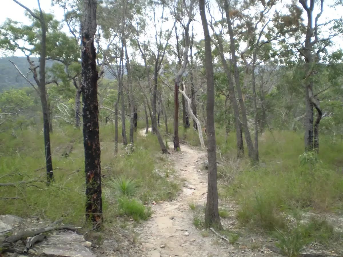
After another 95 m continue straight, to head along Benowie Walking Track.
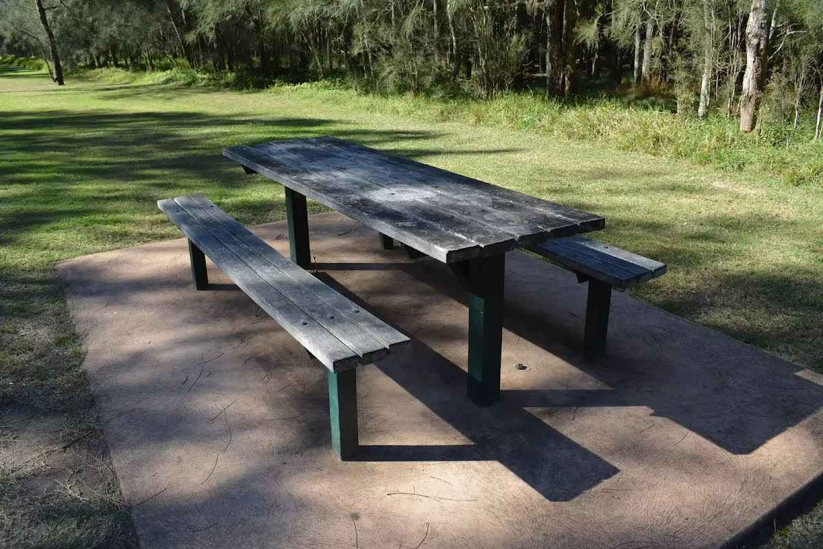
After another 20 m find the "Picnic Table" (on your right).
A timber slat picnic table and bench seat. The table is 77cm high, 73cm deep and 2.4m wide. The seats are 47cm high, 29cm deep and 2.4m wide. On a conrete slab (3x5.5m) and about 7m (across grass) from the path.
After another 25 m pass the "tap" (on your right).
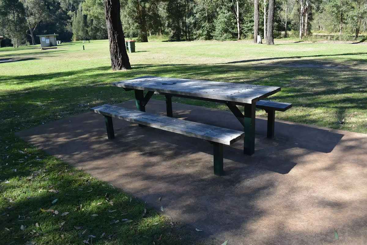
After another 15 m find the "Picnic Table" (on your right).
A timber slat picnic table and bench seats. The table is 77cm high, 73cm deep and 2.4m wide. The seats are 47cm high, 29cm deep and 2.4m wide. On a conrete slab (2.8x4.1m) and about 4m (across grass) from the path.
After another 155 m pass the shelter (30 m on your left).
After another 5 m find the "Picnic Table" (40 m on your left).
A timber slat picnic table and bench seats. The table is 77cm high, 73cm deep and 2.4m wide. The seats are 47cm high, 29cm deep and 2.4m wide. On a conrete slab (3.8x5.5m) and about 25m (across grass) from the nearest path.
After another 20 m pass the BBQ (50 m on your left).
After another 15 m pass the shelter (50 m on your left).
After another 10 m find the "Crosslands North Picnic area" (about 9 m ahead).
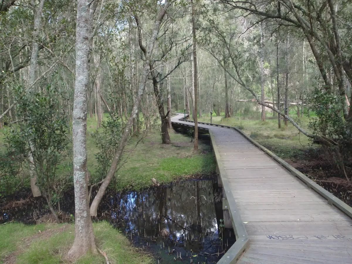
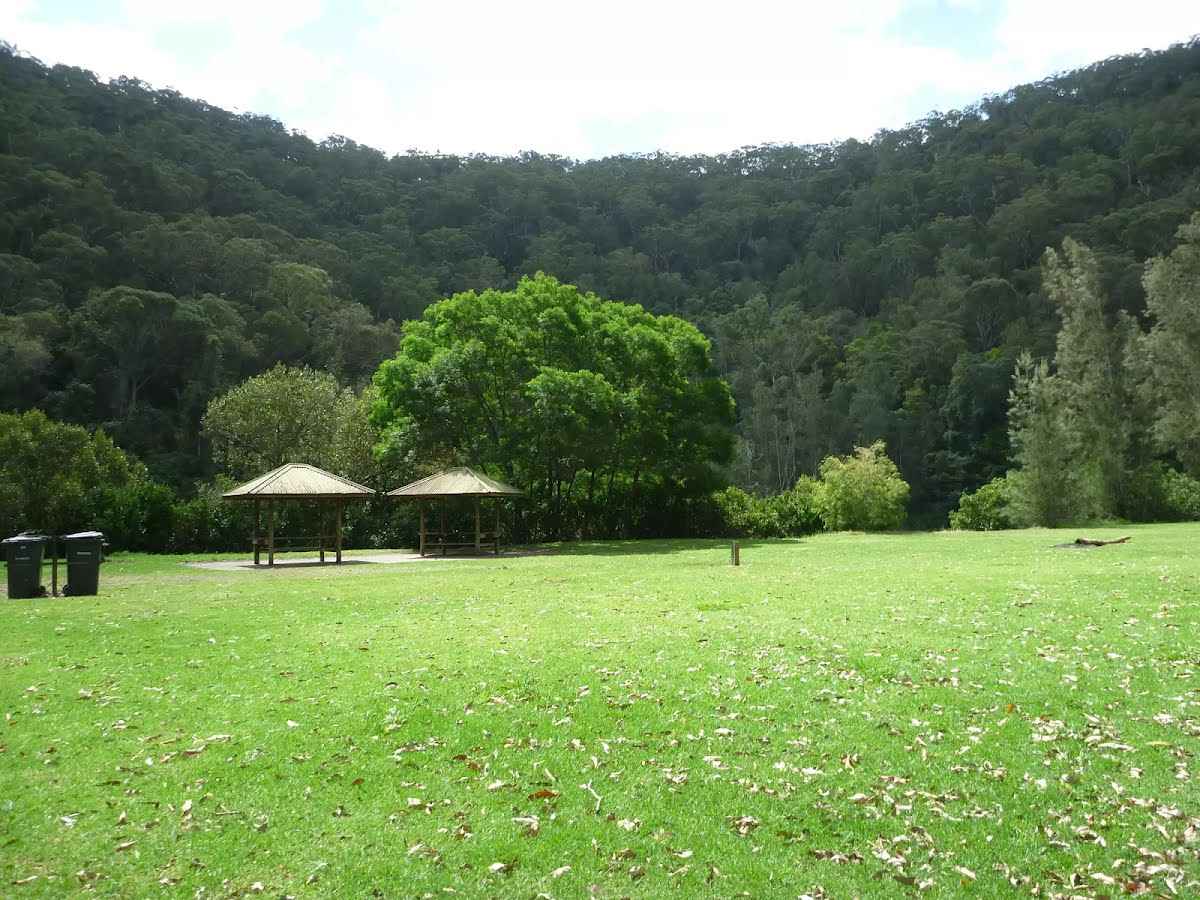
The northern section of Crosslands is in Berowra Valley NP and is a less formal picnic area compared with the southern area. There is a toilet block and a few sandy beaches with direct access to the water. Here you will find a few picnic tables and shelters, as well as garbage bins. The eastern side is home to a boardwalk exploring the estuarine wetland. A pleasant area to rest and enjoy the water. Fires are only permitted in formally established fire places .
Then pass the toilet (60 m on your left).
Turn right, to head along The Great North Walk.
After another 20 m find the "Trip Hazard" (on your left).
There is a 4cm step from between the dirt path and the northern end of the timber boardwalk.
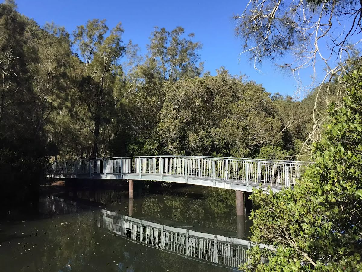
Then cross the bridge (about 55 m long)
After another 75 m cross the bridge (about 80 m long)
After another 35 m pass a seat (8 m on your left)., has a backrest.
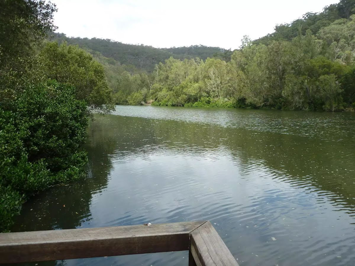
Then find the "Berowra Creek (Estuarie) Lookout" (on your left).
The Estuarie lookout over Berowara Creek is found at the end of the wheelchair-accessible walk in Crosslands area. The timber lookout platform provides great views over Berowra Creek, the timber fence is 95cm high. There are also information signs about the local flora and fauna and the 'Original Inhabitants'. There are two timber bench seats encouraging you to take some time to soak up this view.
Then find the "Seat" (10 m on your left).
Two timber slat bench seats built into timber viewing platform. Each seat are 41cm high, 28cm deep and 2.5m wide with a 54cm high backrest.
After another 230 m cross the bridge (about 15 m long)
After another 320 m head up the 65 steps (about 55 m long)
After another 20 m continue straight, to head along The Great North Walk.
After another 20 m head down the 72 steps (about 55 m long)
Then pass a seat (on your left)., has no backrest.
After another 10 m cross the Calna Creek Bridge (about 30 m long)
After another 3 m (at the intersection of The Great North Walk & Lyrebird Gully Track) continue straight, to head along The Great North Walk.
After another 560 m continue straight, to head along The Great North Walk.
After another 1.1 km cross the ford.
At the intersection of The Great North Walk & Sams Creek continue straight, to head along The Great North Walk.
After another 20 m cross the "Sams Creek Crossing".
This is flood prone; never cross flooded waterways.
Sams Creek Crossing continue straight, to head along The Great North Walk.
After another 50 m head up the 5 stone steps (about 4 m long)
After another 8 m head up the 7 earthen steps
After another 15 m head up the 18 earthen steps (about 10 m long)
After another 20 m head up the 31 earthen steps (about 10 m long)
After another 45 m head up the 41 earthen steps (about 15 m long)
After another 40 m head up the 24 earthen steps (about 15 m long)
After another 40 m head up the 7 wooden steps
After another 50 m head up the 11 stone steps (about 7 m long)
After another 105 m head up the 30 stone steps (about 15 m long)
After another 15 m pass a seat (on your right)., has a backrest.
Then head up the 30 wooden steps (about 15 m long)
After another 10 m head up the 37 stone steps (about 15 m long)
Then head up the 8 wooden steps (about 7 m long)
Then head up the 7 earthen steps (about 5 m long)
After another 35 m veer right, to head along The Great North Walk.
After another 315 m continue straight, to head along Berkeley Firetrail.
After another 15 m come to the "Naa Badu Lookout" (15 m on your left).
Then pass the sign (10 m on your left).
After another 8 m pass a seat (15 m on your left)., has a backrest.
Then find the "Naa Badu Lookout" (on your left).
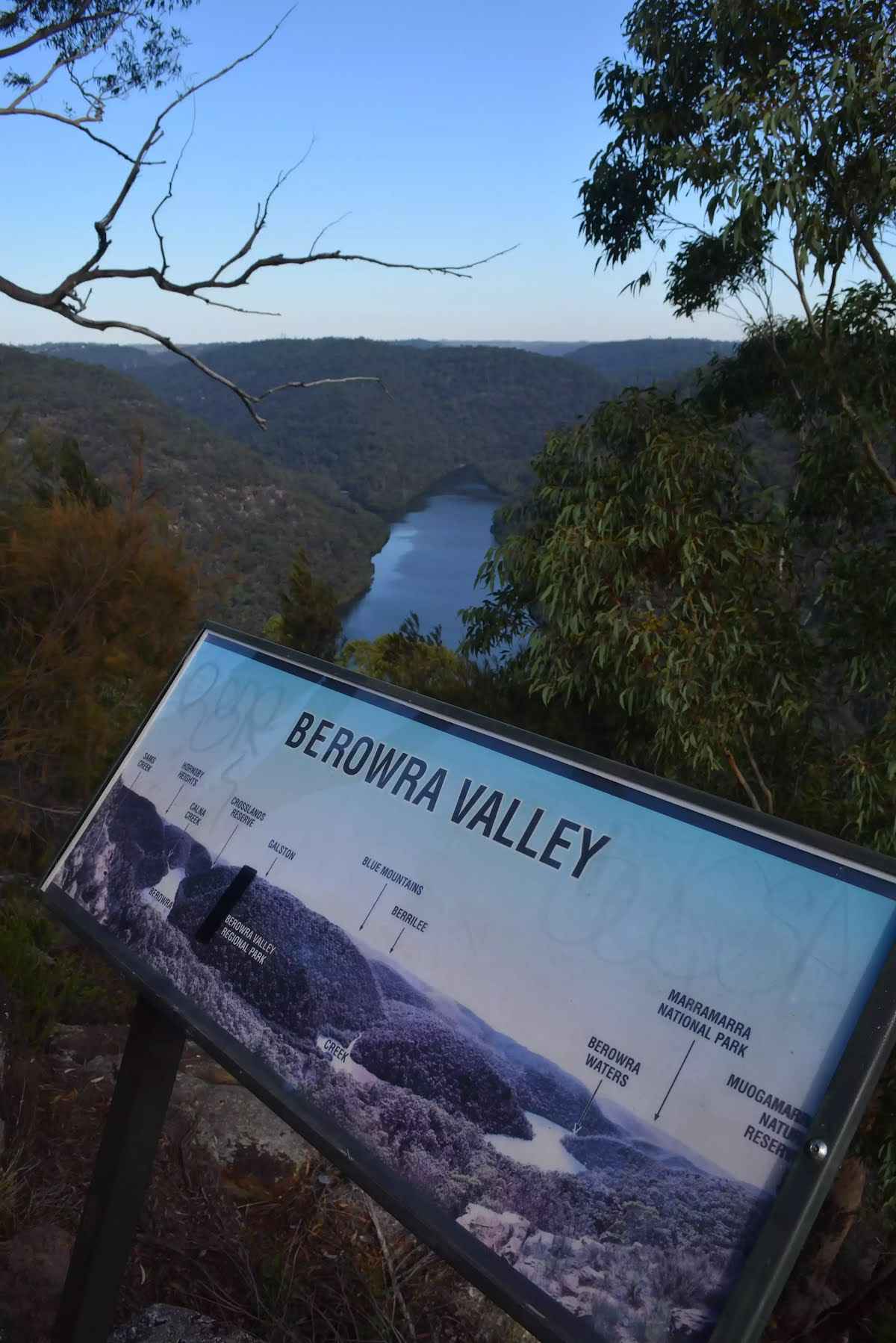
Naa Badu Lookout offers magnificent views south over Berowra Creek as well as over Sams and Calna Creeks. Naa Badu means 'See water' in the Aboriginal tribal language of the Dharug people. It is believed that Berowra Creek was the boundary between the Dharug and Guringai Aboriginal peoples. The lookout is fenced, has a bench seat, picnic table and a fair amount of natural shade.
After another 200 m find the "Barnetts Lookout" (80 m on your right).
Barnetts Lookout provides stunning views over Berowra Creek and the surprisingly wild Berowra Valley NP. There are two stone seats, a concrete base (4.6x4m) and a 1.3m high metal fence (filtered views when seated in a wheelchair). To the left there are views upstream along Berowra Creek past Calna Creek, on a clear day you can just make out the Blue Mountains straight ahead and Berowra Waters to the right.
After another 345 m (at the intersection of The Great North Walk & Berkeley Firetrail) turn left, to head along The Great North Walk (a walking track).
After another 7 m head down the 23 earthen steps (about 15 m long)
After another 8 m head down the 14 earthen steps (about 6 m long)
After another 15 m cross the bridge (about 10 m long)
Then head up the 17 earthen steps (about 9 m long)
After another 30 m head up the 19 earthen steps (about 10 m long)
After another 155 m pass a seat (on your right)., has a backrest.
After another 65 m cross the ford.
Continue straight, to head along The Great North Walk.
After another 95 m head up the 27 stone steps (about 10 m long)
After another 120 m veer left, to head along The Great North Walk.
After another 1.1 km come to the viewpoint (4 m on your left).
After another 85 m head down the 11 earthen steps (about 20 m long)
Then head down the 27 stone steps (about 15 m long)
Then pass a seat (on your left)., has no backrest.
Then come to the viewpoint (on your left).
Continue straight, to head along The Great North Walk.
After another 30 m head down the 27 earthen steps (about 10 m long)
After another 20 m head down the 7 stone steps
After another 145 m cross the ford.
At the intersection of The Great North Walk & Washtub Gully turn left, to head along The Great North Walk.
After another 260 m pass the pay phone (25 m on your left).
Then head down the 13 earthen steps (about 10 m long)
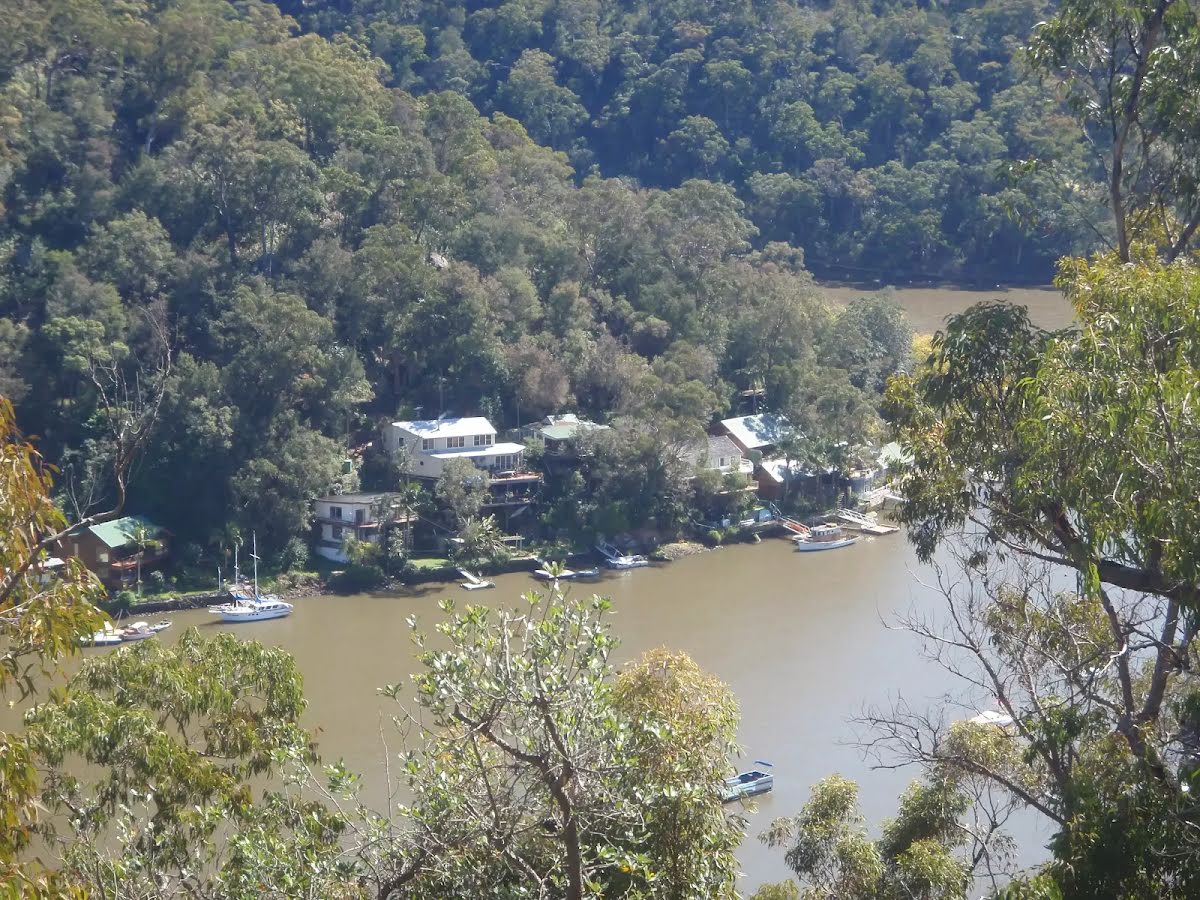
After another 15 m find the "Berowra Waters Garden House" (20 m on your left).
#######CLOSED###### This picturesque little restaurant sits on the eastern side of Berowra Creek and is just a hop, skip and a jump from the ferry. With breakfast, lunch and dinner menus, the Garden House Restaurant is a great spot for those looking to tap into the Berowra Valley's full potential. For information on bookings and opening hours phone (02)9456 2955.
After another 10 m head down the 18 earthen steps (about 6 m long)
Then head down the 4 stone steps
After another 5 m (at the intersection of Kirkpatrick Way & Berowra Waters Road) continue straight, to head along Kirkpatrick Way (a residential road).
After another 35 m pass the water tap (15 m on your right).
After another 10 m pass the toilet (15 m on your right).
After another 85 m continue straight, to head along Kirkpatrick Way.
After another 120 m continue straight, to head along Kirkpatrick Way.
After another 610 m head up the 14 wooden steps (about 3 m long)
Then head up the 5 wooden steps
Then pass a seat (on your right)., has no backrest.
After another 40 m head up the 28 earthen steps (about 10 m long)
After another 235 m (at the intersection of The Great North Walk & Alston Drive Track) continue straight, to head along The Great North Walk.
After another 20 m come to the viewpoint (35 m on your right).
After another 130 m cross the ford.
Continue straight, to head along The Great North Walk.
After another 250 m continue straight, to head along The Great North Walk.
After another 830 m (at the intersection of Great North Walk - Firetrail & The Great North Walk) continue straight, to head along Great North Walk - Firetrail (a vehicle track).
After another 10 m continue straight, to head along Great North Walk - Firetrail.
After another 275 m find the "Ridge Top Campground" (7 m on your right).
About 800m from Turners Rd, Berowra Heights lies this pleasant ridge top campsite. This is a fairly popular campsite on the Great North Walk, providing a flat area with plenty of shade. There are no facilities (or water) at this large campsite. A faint track leads west from the campsite to an unfenced cliff with great views over the Berowra Waters Valley.
At the intersection of The Great North Walk & Great North Walk - Firetrail veer left, to head along The Great North Walk (a walking track).
After another 210 m (at the intersection of The Great North Walk & Firetrail) continue straight, to head along The Great North Walk.
After another 145 m veer left, to head along The Great North Walk.
After another 205 m veer right, to head along The Great North Walk.
After another 65 m come to the viewpoint (25 m on your left).
After another 75 m continue straight, to head along The Great North Walk.
After another 1 km cross the ford.
At the intersection of The Great North Walk & Joe Crafts Creek veer right, to head along The Great North Walk.
After another 510 m pass a seat (5 m on your right).
After another 215 m come to the viewpoint (15 m on your right).
Turn left, to head along The Great North Walk.
After another 590 m (at the intersection of The Great North Walk & Glendale Trail) turn right, to head along The Great North Walk (a walking track).
After another 295 m (at the intersection of The Great North Walk & Glendale Road) continue straight, to head along The Great North Walk.
After another 840 m cross the bridge (about 4 m long)
After another 35 m (at the intersection of Cowan Trail & The Great North Walk) turn right, to head along Cowan Trail (a vehicle track).
After another 50 m head through/around the gate.
After another 10 m (at the intersection of Pacific Highway & Cowan Trail) turn left, to head along Pacific Highway (a highway|primary).
After another 15 m turn left.
After another 290 m veer left, to head along Pacific Highway.
After another 100 m turn right.
After another 50 m turn right.
After another 15 m turn right.
After another 65 m pass the emergency call device (10 m on your left).
After another 8 m pass the toilet (15 m on your left).
Mo-Fr
After another 50 m come to a pay phone.
About 80 m past the end is "Great North Walk".
The end.
An optional side trip to Fishponds crossing.
Turn map
Directions & comments
Dural
At the intersection of Great North Walk & Blue Gum Walk by following the "Dural" sign Start heading along Great North Walk (a walking track).
Find the Fishponds Lookout at the start.
Fishponds Lookout is a fenced rock platform at the intersection of the Benowie walking track and the Rosemead trackhead. It is marked with a number of Great North Walk signs. This informally named lookout has good views down over Fishponds, a large waterhole on Berowra Creek. Looking north across the creek, there are views to the upper waterhole and the cliffs on the other side.
Find the sign at the start.
After another 60 m cross the stepping stones (about 7 m long)
This is flood prone; never cross flooded waterways.
The end.
Turn around and retrace your steps back the 75 m to the main route.
Thornleigh to Cowan
Grading
Class 4/6
Hard track
Length
35.9 km
Time
15 h, 18 h to 2 days
Quality of track
Rough track, where fallen trees and other obstacles are likely (4/6)
Gradient
Very steep (4/6)
Signage
Directional signs along the way (3/6)
Infrastructure
Limited facilities, not all cliffs are fenced (3/6)
Experience Required
Moderate level of bushwalking experience recommended (4/6)
Weather
Foretasted & unexpected storms and severe weather may impact on navigation and safety (4/6)
Some facilities on route
Campsite: There are 9 on route, on average they are 3.6 km apart with the largest gap of 10.9 km.
Shelter: There are 2 on route, on average they are 12 km apart with the largest gap of 22.3 km.
Toilet: There are 6 on route, on average they are 5.1 km apart with the largest gap of 21.4 km.
Seat: There are 12 on route, on average they are 2.8 km apart with the largest gap of 22.5 km.
UV Alert: Sun protection not recommended, UV Index predicted to reach 2 [Low]
Sunday 20 July
4°C → 17°C
Sunny. 20% chance of rain
Areas of morning frost. Mostly sunny day. Slight chance of a shower at night. Light winds becoming southerly 15 to 20 km/h in the middle of the day then becoming light in the evening.
Monday 21 July
8°C → 17°C
Shower or two. 50% chance of rain 0 → 2mm
Partly cloudy. Medium chance of showers. The chance of morning fog in the outer west. Light winds.
Partly cloudy. Slight chance of a shower, most likely in the afternoon and evening. Light winds becoming north to northeasterly 15 to 20 km/h during the day then becoming light during the evening.
Wednesday 23 July
10°C → 19°C
Shower or two. 60% chance of rain 0 → 4mm
Cloudy. Medium chance of showers. Light winds becoming northwesterly 15 to 20 km/h during the day.
Thursday 24 July
7°C → 17°C
Sunny. 20% chance of rain
Mostly sunny. Slight chance of a shower. Light winds becoming south to southeasterly 15 to 20 km/h during the day.
Friday 25 July
7°C → 18°C
Shower or two. 70% chance of rain 0 → 7mm
Partly cloudy. High chance of showers. Light winds becoming north to northeasterly 15 to 20 km/h during the day.
Cowan Station access to and from Brooklyn closed from 6 am Friday, October 24, 2025, to 2 am Monday, October 27, 2025. Due to rail works, the carpark and the section of the GNW leading on the eastern side of the rail line (between Cowan Station and the bridge over the motorway) will be closed during these times. There are no planned closures on the rest of the track, so access to Brooklyn Dam will still be possible from Brooklyn.
The general current status of the Great North Walk is;
Mooney Mooney North & South campgrounds Closed: These campsites are no longer to be used due to flood risk; the infrastructure and signage are being removed. The nearest alternative camping locations are Mt Wondabyne (or near Wondabyne Station) to the south and the Quarry Campsite to the north.
Open to walkers between Cherry Lane, Kulnura to Newcastle, however:
Some areas of GNW in the Watagans remain currently inaccessible by private vehicles and only accessible to walkers. Walkers must be self-sufficient and also be aware of local track damage from recent rain/flood events.
Many forest roads (outside of closure notice https://www.forestrycorporation.com.au/visit/closures/olney-state-forest-partially-closed) are open and accessible. Access to the Watagan Forestry HQ Campsite and general areas is via Watagan Forest Road Only - Due to weather damage, there is no access from Quorrobolong, Cooranbong or Freemans Waterhole via Mount Faulk Road or Heatons Road. Visitors are to remain on alert for heavy vehicle movements, road grading and vegetation road edge maintenance.
The following roads are accessible for 4WD only - they are damaged and not currently scheduled for upgrades:
Hammonds Road
Barniers Road
Archery Road, Wakefield
Gap Rd off Freemans Drive
Other planned events: Surface and vegetation works Vegetation and surface works will be carried out from Monday 21 July to Monday 18 August 2025 on the following trails in Berowra Valley National Park:
Ulolo Trail
Outlook Trail
Top of Gorge Trail
Walkers permitted but there may be delays. Please follow all signage and instructions from NPWS staff and contractors. Penalties apply for non-compliance. For more information, contact the North Western Sydney area office on 02 8448 0400.
Safety alerts: Swimming safety in Berowra Valley National Park Swimming is not advisable in Berowra Creek at certain times as the water may be subject to variable pollution levels and algal blooms. Please refer to the Hornsby Shire Council website before swimming in Berowra Creek. Alternatively you can call the Hornsby Council 24 hour information line on 9847 6666 or the Algal information line on 1800 999 457.
Swimming at Fishponds is not advised at any time due to heavy water pollution. Penalties apply for non-compliance.For more information, contact the NPWS Chatswood area office on 02 8448 0400 or visit the NSW National Parks safety page for park safety guidelines.
Other planned events: Muogamarra Nature Reserve open season 2025 Muogamarra Nature Reserve is only open to the public for 6 weeks every year, around spring time for pre-booked tours only. The dates for the 2025 Open Season are from Saturday 9 August to Sunday 14 September.
Due to the sensitive nature of the reserve, access is restricted at other times to approved educational and research activities only.
For more information about the reserve, call the NPWS Contact Centre on 1300 072 757 or the NPWS North Western Sydney area office on 02 8448 0400.