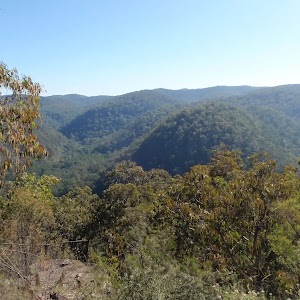
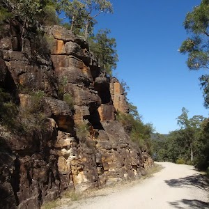
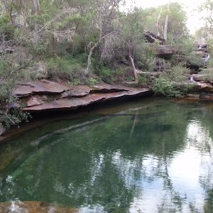
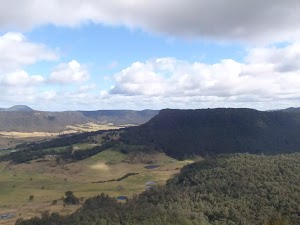
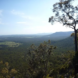
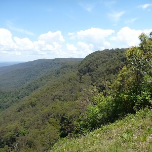
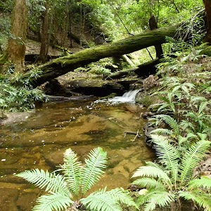
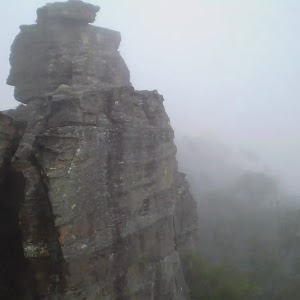
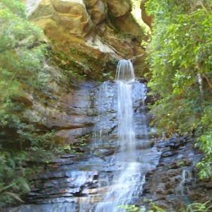
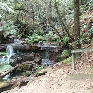
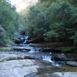
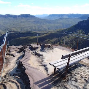
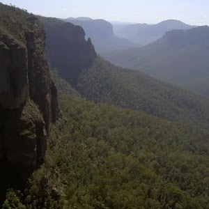
A beautiful walk along part of the 11km Circuit walk, climbing up through a beautiful moist gully before emerging to drier forest and a nice viewpoint. The walk provides a great variety of scenery with a mixture of vegetation and some great boulder and cliff scenery along the way. The climbs and descents are pretty steep at times but not too long.
11km Circuit northern lookout
11km Circuit northern lookout

2 hrs 15 mins

382 m
Hard track
Mill Creek picnic area

(0km) Mill Creek Picnic Area car park → 11km Nth rock platform

2.2 km
57 mins
301m
-81m
Hard track
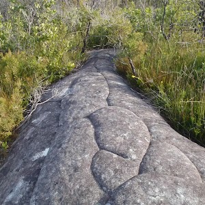
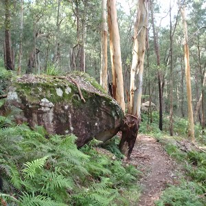
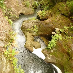
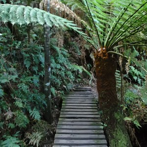
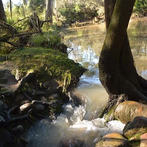
Turn sharp left: From the signposts at the end of Mill Creek Picnic area, the walk crosses the picnic area to a visble handrail and steps going down to a wooden bridge. The walk crosses the bridge and bends to the left, following the bush track. After climbing gently around the hill for a while, the track climbs, steeply at times, through areas with beautiful boulder and moist forest scenery.
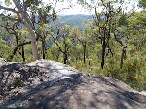
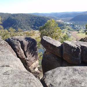
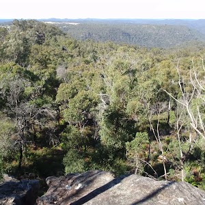
As the track climbs higher, it moves through drier forest and zigzags up the side of the hill. Keep an eye out for the track markers, ensuring you follow a cluster of markers up over some stepped rocks. After reaching the top of a ridge, the track swings to the left and climbs along the ridge line, passing over the small hill and down the ridge line on the other side. The track then passes a track marker on the right, keeping the large open rock platform to the left, and arrives at the junction on a small rock platform (the main track bends to the right here, going past a track marker with an old arrow nailed to the tree above it). There are minor tracks from this small rock platform to the nearby, large open platform with nice views.
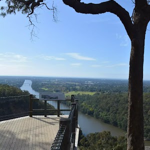
11km circuit Nth Viewpoint
Maps for the 11km Circuit northern lookout walk
You can download the PDF for this walk to print a map.
These maps below cover the walk and the wider area around the walk, they are worth carrying for safety reasons.
| Gunderman | 1:25 000 Map Series | 91313S GUNDERMAN | NSW-91313S |
| Lower Portland | 1:25 000 Map Series | 90312S LOWER PORTLAND | NSW-90312S |
| Gosford | 1:100 000 Map Series | 9131 GOSFORD | 9131 |
| St Albans | 1:100 000 Map Series | 9031 ST ALBANS | 9031 |
Cross sectional view of the 11km Circuit northern lookout bushwalking track

Analysis and summary of the altitude variation on the 11km Circuit northern lookout

Overview of this walks grade – based on the AS 2156.1 – 2001
Under this standard, a walk is graded based on the most difficult section of the walk.
| Length | 4.5 km | ||
| Time | 2 hrs 15 mins | ||
| . | |||
| Grade 4/6 Hard track |
AS 2156.1 | Gradient | Very steep (4/6) |
| Quality of track | Rough track, where fallen trees and other obstacles are likely (4/6) | ||
| Signs | Directional signs along the way (3/6) | ||
| Experience Required | Some bushwalking experience recommended (3/6) | ||
| Weather | Storms may impact on navigation and safety (3/6) | ||
| Infrastructure | Generally useful facilities (such as fenced cliffs and seats) (1/6) |
Some more details of this walks Grading
Here is a bit more details explaining grading looking at sections of the walk
Gradient
Around 2.1km of this walk is very steep, whilst the remaining 100m is flat with no steps.
Quality of track
Around 2.1km of this walk follows a rough track, where fallen trees and other obstacles are likely, whilst the remaining 100m follows a clear and well formed track or trail.
Signs
Around 2.1km of this walk has directional signs at most intersection, whilst the remaining 100m is clearly signposted.
Experience Required
Around 2.1km of this walk requires some bushwalking experience, whilst the remaining 100m requires no previous bushwalking experience.
weather
Around 2.1km of this walk is affected by storms that may impact your navigation and safety, whilst the remaining 100m is not usually affected by severe weather events (that would unexpectedly impact safety and navigation).
Infrastructure
This whole walk, 2.2km is close to useful facilities (such as fenced cliffs and seats).
Similar walks
A list of walks that share part of the track with the 11km Circuit northern lookout walk.
Other Nearby walks
A list of walks that start near the 11km Circuit northern lookout walk.
Plan your trip to and from the walk here
The 11km Circuit northern lookout walk starts and ends at the Mill Creek Picnic Area car park (gps: -33.400835, 151.04778)
Your transport options to Mill Creek Picnic Area car park are by;
![]() Bus. Wisemans Ferry Dialacar provides a taxi style mini-bus service based in Wisemans Ferry. The cost is typically about per km (ex Wisemans Ferry). They will pick-up and drop-off from Sydney or the Central Coast and will happily drop walkers off or pick them up from tracks in the area. The cost for a pick-up from Gosford and drop off near Wisemans Ferry would be approximately 0 (please call for up-to-date pricing) and the minivan can carry up to 13 passengers. Phone: 0448 122 374 (get details)
Bus. Wisemans Ferry Dialacar provides a taxi style mini-bus service based in Wisemans Ferry. The cost is typically about per km (ex Wisemans Ferry). They will pick-up and drop-off from Sydney or the Central Coast and will happily drop walkers off or pick them up from tracks in the area. The cost for a pick-up from Gosford and drop off near Wisemans Ferry would be approximately 0 (please call for up-to-date pricing) and the minivan can carry up to 13 passengers. Phone: 0448 122 374 (get details)
![]() Car. There is free parking available.
Car. There is free parking available.
(get details)
Fire Danger
Each park may have its own fire ban, this rating is only valid for today and is based on information from the RFS Please check the RFS Website for more information.
Weather Forest
This walk starts in the Hunter weather district always check the formal BOM forecast or pdf before starting your walk.
Forecast snapshot
Park Information & Alerts
Short URL = http://wild.tl/1cnl
Gallery images
There are other downloads I am still working on.
You will probably need to login to access these — still all free.
* KML (google earth file)
* GPX (GPS file)
Special Maps/ brochures
* A3 topo maps
* PDF with Lands Topo map base
* PDF with arial image (and map overlay)
I wanted to get the main site live first, this extra stuff will come in time.
Happy walking
Matt 🙂
11km Circuit
11km Circuit

4 hrs 15 mins

634 m
Hard track
This excellent circuit walk offers a lot of beautiful scenery and views. Although shorter than the name suggests, it is a reasonably tough walk, with some steep rocky sections. The sections in the gullies and valleys are mostly very moist with lots of ferns, while the higher sections are through drier forest, so there is quite a bit of variety. There are also some lovely cliffs and boulder scenery at various points around the walk.
Mill Creek picnic area

(0km) Mill Creek Picnic Area car park → Int of Grass Tree and 11km circuits

870 m
24 mins
84m
-48m
Moderate track
Continue straight: From the ‘Start/Finish’ walking track signpost at the end of the picnic area, the walk follows the bush track and immediately takes the right hand branch at a fork in the track (the other track is the return leg of the Grass Tree circuit). The walk passes through a mix of closed in, dense vegetation and more open forest with some beautiful views and lots of grasstrees. After crossing a creek using wooden steps and a concreted stone path, the track climbs more steeply before dropping to the signposted intersection of the ’11km Walking Track’ and ‘1.5km Grass Tree Circuit’.
Grasstrees

(0.87km) Int of Grass Tree and 11km circuits → Int of 11km circuit and Link track

2.6 km
1 hr 9 mins
257m
-92m
Hard track
Turn right: From the creek, the walk follows the walker arrow along the bush track, going downstream and keeping the creek to the right. This section of the walk has several steep climbs and plenty of great scenery. After meandering for some time the walk passes a regenerating bush track, to the right (marked with a walker post and old arrows on the trees), and continues, crossing a gully marked with walker arrows in both directions. After crossing another gully (unmarked), the walk climbs very steeply, passing a track marker and climbing further to reach an intersection at the top of the hill (very faint bush track to the right), marked with two arrow track markers on a post.
(3.47km) Int of 11km circuit and Link track → 11km Nth rock platform

2.4 km
1 hr 8 mins
212m
-194m
Hard track
11km circuit Nth Viewpoint

(5.91km) 11km Nth rock platform → Mill Creek Picnic Area car park

2.2 km
57 mins
81m
-301m
Hard track
Turn sharp right: From the ‘Start/Finish’ walking track signpost at the end of the Mill Creek picnic area, the walk crosses the picnic area to the car park (Mill Creek picnic area is signposted on Wisemans Ferry Rd, about 6km east of Wisemans Ferry crossing).
Maps for the 11km Circuit walk
You can download the PDF for this walk to print a map.
These maps below cover the walk and the wider area around the walk, they are worth carrying for safety reasons.
| Gunderman | 1:25 000 Map Series | 91313S GUNDERMAN | NSW-91313S |
| Lower Portland | 1:25 000 Map Series | 90312S LOWER PORTLAND | NSW-90312S |
| Gosford | 1:100 000 Map Series | 9131 GOSFORD | 9131 |
| St Albans | 1:100 000 Map Series | 9031 ST ALBANS | 9031 |
Cross sectional view of the 11km Circuit bushwalking track

Analysis and summary of the altitude variation on the 11km Circuit

Overview of this walks grade – based on the AS 2156.1 – 2001
Under this standard, a walk is graded based on the most difficult section of the walk.
| Length | 8.2 km | ||
| Time | 4 hrs 15 mins | ||
| . | |||
| Grade 4/6 Hard track |
AS 2156.1 | Gradient | Very steep (4/6) |
| Quality of track | Rough track, where fallen trees and other obstacles are likely (4/6) | ||
| Signs | Directional signs along the way (3/6) | ||
| Experience Required | Some bushwalking experience recommended (3/6) | ||
| Weather | Storms may impact on navigation and safety (3/6) | ||
| Infrastructure | Limited facilities, not all cliffs are fenced (3/6) |
Some more details of this walks Grading
Here is a bit more details explaining grading looking at sections of the walk
Gradient
6km of this walk is very steep and another 1.6km has short steep hills. The remaining (210m) is flat with no steps.
Quality of track
6km of this walk follows a rough track, where fallen trees and other obstacles are likely and another 1.6km follows a formed track, with some branches and other obstacles. The remaining (210m) follows a clear and well formed track or trail.
Signs
Around 8km of this walk has directional signs at most intersection, whilst the remaining 210m is clearly signposted.
Experience Required
Around 8km of this walk requires some bushwalking experience, whilst the remaining 210m requires no previous bushwalking experience.
weather
Around 7km of this walk is affected by storms that may impact your navigation and safety, whilst the remaining 970m is not usually affected by severe weather events (that would unexpectedly impact safety and navigation).
Infrastructure
Around 5km of this walk has limited facilities (such as not all cliffs fenced), whilst the remaining 3.1km is close to useful facilities (such as fenced cliffs and seats).
Similar walks
A list of walks that share part of the track with the 11km Circuit walk.
Other Nearby walks
A list of walks that start near the 11km Circuit walk.
Plan your trip to and from the walk here
The 11km Circuit walk starts and ends at the Mill Creek Picnic Area car park (gps: -33.400835, 151.04778)
Your transport options to Mill Creek Picnic Area car park are by;
![]() Bus. Wisemans Ferry Dialacar provides a taxi style mini-bus service based in Wisemans Ferry. The cost is typically about per km (ex Wisemans Ferry). They will pick-up and drop-off from Sydney or the Central Coast and will happily drop walkers off or pick them up from tracks in the area. The cost for a pick-up from Gosford and drop off near Wisemans Ferry would be approximately 0 (please call for up-to-date pricing) and the minivan can carry up to 13 passengers. Phone: 0448 122 374 (get details)
Bus. Wisemans Ferry Dialacar provides a taxi style mini-bus service based in Wisemans Ferry. The cost is typically about per km (ex Wisemans Ferry). They will pick-up and drop-off from Sydney or the Central Coast and will happily drop walkers off or pick them up from tracks in the area. The cost for a pick-up from Gosford and drop off near Wisemans Ferry would be approximately 0 (please call for up-to-date pricing) and the minivan can carry up to 13 passengers. Phone: 0448 122 374 (get details)
![]() Car. There is free parking available.
Car. There is free parking available.
(get details)
Fire Danger
Each park may have its own fire ban, this rating is only valid for today and is based on information from the RFS Please check the RFS Website for more information.
Weather Forest
This walk starts in the Hunter weather district always check the formal BOM forecast or pdf before starting your walk.
Forecast snapshot
Park Information & Alerts
Comments
Short URL = http://wild.tl/22
Gallery images
There are other downloads I am still working on.
You will probably need to login to access these — still all free.
* KML (google earth file)
* GPX (GPS file)
Special Maps/ brochures
* A3 topo maps
* PDF with Lands Topo map base
* PDF with arial image (and map overlay)
I wanted to get the main site live first, this extra stuff will come in time.
Happy walking
Matt 🙂
Georges Road Rest Area to 125r Lookout
Georges Road Rest Area to 125r Lookout

3 hrs 30 mins

209 m
Moderate track
This return walk starts from a nice rest area on Georges Road and follows the road along the ridge, passing several great lookout points across the valley, to the quiet little 125r lookout, which provides a nice open clearing that just screams lunch time. Please note that Watagan and Georges Roads are dry weather roads only, if you are unsure, check with the park office before heading out. This walk can be made shorter by driving further along Georges Rd.
Great North Walk Rest Area

(0km) Northern rest area → Top of the 125r Lookout trail

1.3 km
31 mins
68m
-76m
Moderate track
(1.32km) Top of the 125r Lookout trail → 125r Lookout Rest Area

860 m
17 mins
15m
-50m
Moderate track
Maps for the Georges Road Rest Area to 125r Lookout walk
You can download the PDF for this walk to print a map.
These maps below cover the walk and the wider area around the walk, they are worth carrying for safety reasons.
| Quorrobolong | 1:25 000 Map Series | 91322S QUORROBOLONG | NSW-91322S |
| Cessnock | 1:50 000 Map Series | 91322 CESSNOCK | CW-91322 |
| Cessnock | 1:100 000 Map Series | 9132 CESSNOCK | 9132 |
Cross sectional view of the Georges Road Rest Area to 125r Lookout bushwalking track

Analysis and summary of the altitude variation on the Georges Road Rest Area to 125r Lookout

Overview of this walks grade – based on the AS 2156.1 – 2001
Under this standard, a walk is graded based on the most difficult section of the walk.
| Length | 4.4 km | ||
| Time | 3 hrs 30 mins | ||
| . | |||
| Grade 3/6 Moderate track |
AS 2156.1 | Gradient | Short steep hills (3/6) |
| Quality of track | Clear and well formed track or trail (2/6) | ||
| Signs | Directional signs along the way (3/6) | ||
| Experience Required | No experience required (1/6) | ||
| Weather | Weather generally has little impact on safety (1/6) | ||
| Infrastructure | Limited facilities, not all cliffs are fenced (3/6) |
Some more details of this walks Grading
Here is a bit more details explaining grading looking at sections of the walk
Gradient
Around 1.3km of this walk has short steep hills, whilst the remaining 860m has gentle hills with occasional steps.
Quality of track
This whole walk, 2.2km follows a clear and well formed track or trail.
Signs
This whole walk, 2.2km has directional signs at most intersection.
Experience Required
This whole walk, 2.2km requires no previous bushwalking experience.
weather
This whole walk, 2.2km is not usually affected by severe weather events (that would unexpectedly impact safety and navigation).
Infrastructure
This whole walk, 2.2km has limited facilities (such as not all cliffs fenced).
Similar walks
A list of walks that share part of the track with the Georges Road Rest Area to 125r Lookout walk.
Other Nearby walks
A list of walks that start near the Georges Road Rest Area to 125r Lookout walk.
Plan your trip to and from the walk here
The Georges Road Rest Area to 125r Lookout walk starts and ends at the Northern rest area (gps: -32.973467, 151.34537)
Your main transport option to Northern rest area is by;
![]() Car. There is free parking available.
Car. There is free parking available.
(get details)
Fire Danger
Each park may have its own fire ban, this rating is only valid for today and is based on information from the RFS Please check the RFS Website for more information.
Weather Forest
This walk starts in the Hunter weather district always check the formal BOM forecast or pdf before starting your walk.
Forecast snapshot
Park Information & Alerts
Comments
Short URL = http://wild.tl/grrat1l
Gallery images
There are other downloads I am still working on.
You will probably need to login to access these — still all free.
* KML (google earth file)
* GPX (GPS file)
Special Maps/ brochures
* A3 topo maps
* PDF with Lands Topo map base
* PDF with arial image (and map overlay)
I wanted to get the main site live first, this extra stuff will come in time.
Happy walking
Matt 🙂
WW1 Hospital to Georges Heights Lookout
WW1 Hospital to Georges Heights Lookout

30 mins

26 m
Easy track
WW1 Hospital
(0km) Int. WW1 Hospital and Chowder Bay Trk → Georges Head Lookout

450 m
8 mins
11m
-15m
Easy track
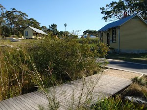
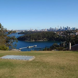
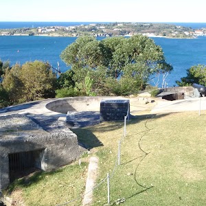
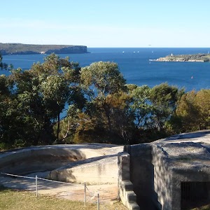
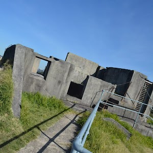
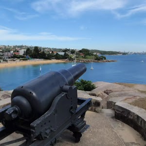
Turn left: From the intersection, this walk follows the sign to Georges Head Lookout, down the hill to the circular paved lookout above the fortifications.
Georges Heights

Maps for the WW1 Hospital to Georges Heights Lookout walk
You can download the PDF for this walk to print a map.
These maps below cover the walk and the wider area around the walk, they are worth carrying for safety reasons.
| Sydney Heads | 1:25 000 Map Series | 91302N SYDNEY HEADS | NSW-91302N |
| Sydney | 1:100 000 Map Series | 9130 SYDNEY | 9130 |
Cross sectional view of the WW1 Hospital to Georges Heights Lookout bushwalking track

Analysis and summary of the altitude variation on the WW1 Hospital to Georges Heights Lookout

Overview of this walks grade – based on the AS 2156.1 – 2001
Under this standard, a walk is graded based on the most difficult section of the walk.
| Length | 904 m | ||
| Time | 30 mins | ||
| . | |||
| Grade 2/6 Easy track |
AS 2156.1 | Gradient | Gentle hills with occasional steps (2/6) |
| Quality of track | Smooth and hardened path (1/6) | ||
| Signs | Clearly signposted (1/6) | ||
| Experience Required | No experience required (1/6) | ||
| Weather | Weather generally has little impact on safety (1/6) | ||
| Infrastructure | Generally useful facilities (such as fenced cliffs and seats) (1/6) |
Some more details of this walks Grading
Here is a bit more details explaining grading looking at sections of the walk
Gradient
Around 380m of this walk has gentle hills with occasional steps, whilst the remaining 70m is flat with no steps.
Quality of track
This whole walk, 450m follows a smooth and hardened path.
Signs
This whole walk, 450m is clearly signposted.
Experience Required
This whole walk, 450m requires no previous bushwalking experience.
weather
This whole walk, 450m is not usually affected by severe weather events (that would unexpectedly impact safety and navigation).
Infrastructure
This whole walk, 450m is close to useful facilities (such as fenced cliffs and seats).
Similar walks
A list of walks that share part of the track with the WW1 Hospital to Georges Heights Lookout walk.
Other Nearby walks
A list of walks that start near the WW1 Hospital to Georges Heights Lookout walk.
Plan your trip to and from the walk here
The WW1 Hospital to Georges Heights Lookout walk starts and ends at the Int. WW1 Hospital and Chowder Bay Trk (gps: -33.833346, 151.25851)
Your transport options to Int. WW1 Hospital and Chowder Bay Trk are by;
![]() Bus. (get details)
Bus. (get details)
![]() Car. There is free parking available.
Car. There is free parking available.
(get details)
Fire Danger
Each park may have its own fire ban, this rating is only valid for today and is based on information from the RFS Please check the RFS Website for more information.
Weather Forest
This walk starts in the Metropolitan weather district always check the formal BOM forecast or pdf before starting your walk.
Forecast snapshot
Park Information & Alerts
Comments
Short URL = http://wild.tl/whtghl
Gallery images
There are other downloads I am still working on.
You will probably need to login to access these — still all free.
* KML (google earth file)
* GPX (GPS file)
Special Maps/ brochures
* A3 topo maps
* PDF with Lands Topo map base
* PDF with arial image (and map overlay)
I wanted to get the main site live first, this extra stuff will come in time.
Happy walking
Matt 🙂
12 Best day walks in the Blue Mountains
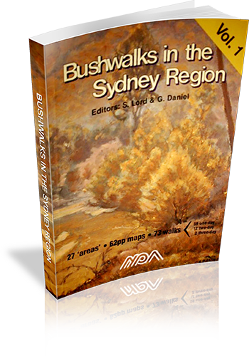
Bushwalks in the Sydney Region : Volume 1
Bushwalks in the Sydney Region : Volume 1
Author: Ed: Stephen Lord,Ed: George Daniel
Edition: 3
Publisher: National Parks Association of New South Wales Inc
ISBN: 0959916075
Number of pages: 112
Year of Publication: 2000
Cover Price (au$): 14.95
Format: Paperback
Website: http://www.npansw.org.au/website/index.php?option=com_wrapper&Itemid=418
Weight (grams): 220
Regions the book covers: Sydney and surrounds
Height (cm): 25
Subjects:
Hiking - New South Wales - Sydney Region - Guidebooks,Sydney Region (N.S.W.) - Guidebooks
Authors Comments:
THESE BOOKS (vols 1&2) are the results of the efforts of volunteers to produce two new walks books which would describe interesting walks in the Sydney region and raise funds for NPA.
THE SYDNEY REGION: Nominated as an area within 110km radius from Sydney. It includes:- Frazer Park to the N – Glen Davis to the NW – Jenolan Caves & Kanangra Walls to the W – Yerranderie to the SW – and the Northern Part of Morton NP & [nr] Nowra in the SSW.
THE WALKS are generally those not covered by other walks books however some classic walks are included such as Valley of the Waters and Blue Gum Forest. There are some walks that have not previously been described. Volume 1 has 93 walks and Volume 2 has 80 walks.
THE MAPS are of 1:25000 scale which we considered the minimum for the detail required. Most one day walks fit on a single page map. [The small pocket sized book philosophy was just not good enough]. All maps have True North up and include a compass variation/bearing aid diagram. All maps have a key included. All maps show km guide marks along the route. Spot heights are shown (in metres above sea level) at significant places. Most maps are within 1 page of their respective walk descriptions. Rivers and creeks have direction of flow shown. All maps are in two colours. In many cases the maps and track notes will save having to obtain NP&WS pamphlets, or other maps.
THE TRACK NOTES (DESCRIPTIONS). By using several techniques, we fit more text per page than other similar sized books. The notes give directions for getting to starting point of each walk; they also mention where to obtain water, where navigation care is required, (with detailed help), point out where hazards are, and even mention good places to stop for lunch etc.
PAPER: The books are printed on paper from sustainable forests. Book size is approx 250x175x10mm thick.
PROCEEDS, all go to support NPA projects and activities.
Niche: Many walks in Sydney and surrounding regions.
Interpretive Information: Minimal
Grade system explained: No
Ascent and/or Decent provided: Yes
Driving directions provided: No
Date walks last reviewed provided: No
A summary of walks provided: Yes
Regional Map of walks provided: No
Maps designed for walking: Yes - reasonable detail
Type of maps used (for walking): Sketch
Colour used in walking maps: Black and White
Size of walking maps: Full page
Walking map Comment: A few walks refer to each map, and a number of walks cross between two maps.
Colour depth of photos: None
Level of detail in tracknotes: Detailed route information
Alternate route and side trip suggestions: Some walks
List of walks in book
| Walk Name | Length | Time | Grade | Page |
|---|---|---|---|---|
| Bairne Trail - Portuguese Beach - The Basin | 13 km | M | 9 | |
| Canoelands- Gentlemans Halt | 19 km | M | 9 | |
| Towlers Bay Track - Birnie Lookout | 8 km | E | 12 | |
| Elvina Bay Circuit | 5 km | E | 12 | |
| Mt Kuring-Gai - Berowra via Cowan Creek | 8 km | EM | 13 | |
| The Sphinx- Bobbin Head- Mt Kuring-Gai | 10 km | EM | 13 | |
| Mt Kuring-Gai- Berowra via Berowra Creek | 8 km | EM | 16 | |
| Manly to The Spit | 9 km | E | 18 | |
| Garie Beach- Garrawarra- Burning Palms | 10 km | EM | 20 | |
| Curra Moors - Curracurrong | 9 km | E | 20 | |
| Heathcote- Heathcote Creek- Waterfall | 11 km | EM | 23 | |
| Campbell Drive - Wybung Head- Frazer Beach | 10 km | E | 24 | |
| Timber, Ghosties and Moonee Beaches | 5 km | E | 24 | |
| Bateau Bay- Wyrrabalong Head- Wamberal | 14 km | EM | 27 | |
| Red Gum and Lillypilly Loop Trails | 6 km | E | 27 | |
| Killcare- Box Head- Lobster Beach | 10 km | E | 29 | |
| Maitland Bay - Putty Beach Circuit | 9 km | E | 29 | |
| Abbotts Falls | 7 km | E | 31 | |
| Koolewong Ridge | 10 km | EM | 36 | |
| Staples Lookout - Kariong Brook | 11 km | E | 39 | |
| Wondabyne- Pindar Cave | 12 km | EM | 39 | |
| Mooney Mooney Creek Circuit | 12 km | M | 41 | |
| Wondabyne- Yarramalong Section GNW | 49 km | 3 Days | M | 41 |
| Mill Creek Circuit | 7 km | EM | 47 | |
| Colo River via Bob Turners Track | 7 km | EM | 50 | |
| Mountain Lagoon - Colo River Gorge View | 10 km | E | 50 | |
| Mountain Lagoon- Mailes Ridge- Colo River | 24 km | 2 Days | M | 53 |
| Wolgan Valley- Glow Worm Tunnel | 10 km | EM | 53 | |
| Newnes to Glen Davis via the Pipeline Track | 21 km | 2 Days | M | 55 |
| Newnes - Wolgan River- Rocky Creek - Annie Rowan Creek | 43 km | 3 Days | M | 58 |
| Hawkesbury Height - Shaws Creek | 7 km | EM | 61 | |
| Winmalle - Grose Mountain | 15 km | EM | 61 | |
| Glenbrook Gorge | 6 km | M | 63 | |
| Lapstone Zig Zag Railway | 8 km | E | 63 | |
| Red Hands Cave Circuit | 9 km | E | 66 | |
| Red Hands Cave Road to Kanuka Brook (Crayfish Pool) | 2 km | E | 66 | |
| Glenbrook- St. Helena Crater- Springwood | 21 km | 2 Days | EM | 68 |
| Pisgah Rock - Erskine Creek - Dadder Cave | 5 km | EM | 68 | |
| Erskine Creek via Jack Evans Track | 6 km | E | 70 | |
| Caleys Lookout- Mt Banks- Banks Wall | 11 km | EM | 72 | |
| Warragamba - Nepean River - Nortons Basin | 12 km | EM | 72 | |
| Govetts Leap - Blue Gum Forest - Perrys Lookdown | 20 km | 2 Days | M | 74 |
| Govetts Leap to Pulpit Rock | 6 km | E | 74 | |
| Lockley Track - The Pinnacles - Lockley Pylon | 8 km | EM | 76 | |
| Vera Falls - Hippocrene Falls - Wentworth Pass | 5 km | M | 78 | |
| Wentworth Falls - Undercliff Walk - National Pass | 4 km | E | 78 | |
| Golden Stairs - Castle Head | 7 km | E | 80 | |
| Carlon's Farm - Bellbird Point | 6 km | E | 82 | |
| Golden Stairs - Ruined Castle - Mt Solitary | 15 km | M | 82 | |
| Carlon's Farm - Medlow Gap - Mt Mouin | 19 km | M | 83 | |
| Carlon's Farm - Medlow Gap - Taros Ladder | 21 km | M | 83 | |
| Carlon's Farm - Coxs River - Jenolan River - Ironmonger Hill | 19 km | 2 Days | M | 87 |
| Carlon's Farm Splendour Rock - Knights Deck - Coxs River | 31 km | 2 Days | M | 87 |
| Carlon's Farm - Mt Yellow Dog - Coxs River - Konangaroo Clearing | 36 km | 2 Days | MH | 88 |
| Kanangra Walls - Crafts Wall - Pages Pinnacle - Mt Berry | 13 km | EM | 89 | |
| Kanangra Walls - Cottage Rock | 9 km | EM | 91 | |
| Kanangra Walls - Gingra Creek - Kowmung River - Gingra Range | 34 km | 2 Days | H | 94 |
| Kanangra Walls - Brumby Ridge - Kowmung River | 20 km | 2 Days | M | 96 |
| Kanangra Walls - Hughes Ridge - Kowmung River - Roots Ridge | 27 km | 2 Days | M | 96 |
| Yerranderie - Yerranderie Peak | 4 km | M | 97 | |
| Yerranderie - Colong Gap | 7 km | EM | 99 | |
| Yerranderie - Tonalli River | 5 km | E | 99 | |
| Thirlmere Lakes - Blue Gum Creek - Little River | 15 km | EM | 101 | |
| Starlights Track - Nattai River - Russells Needle | 16 km | M | 101 | |
| Nattai River- Beloon Pass | 25 km | 2 Days | MH | 103 |
| Macquarie Rivulet | 9 km | M | 107 | |
| Meryla Pass - Yarrunga Creek | 16 km | 2 Days | EM | 107 |
| Clover Hill Rd - Macquarie Rivulet | 7 km | M | 109 | |
| Macquarie Rivulet Tributary | 6 km | M | 109 | |
| Cartington Falls | 5 km | E | 111 | |
| Gerringong Falls | 7 km | E | 111 |
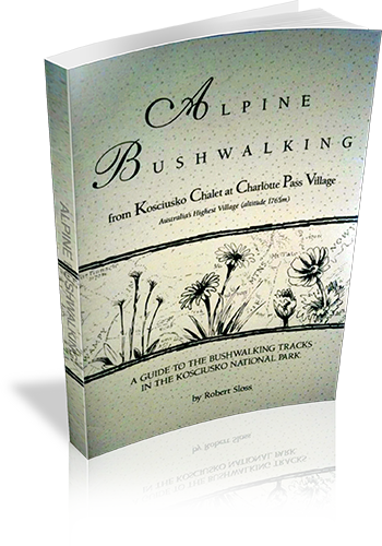
Alpine Bushwalking from Kosciusko Chalet at Charlotte Pass Village : Australia’s Highest Village (altitude 1765m) : A Guide To The Bushwalking Tracks In The Kosciusko National Park
Alpine Bushwalking from Kosciusko Chalet at Charlotte Pass Village : Australia's Highest Village (altitude 1765m) : A Guide To The Bushwalking Tracks In The Kosciusko National Park
Author: Robert Sloss
Edition: 1
Publisher: Robert Sloss
ISBN: 0958651256
Number of pages: 31
Year of Publication: 1995
Cover Price (au$): 9.90
Format: Paperback
Website: http://www.robertsloss.com.au/Guide%20Index.htm
Weight (grams): 45
Regions the book covers: Kosciuszko National Park
Height (cm): 21
Subjects:
Hiking - New South Wales - Kosciuszko National Park,Hiking - New South Wales - Charlotte Pass
Interpretive Information: Minimal
Grade system explained: Yes
Ascent and/or Decent provided: No
Driving directions provided: No
Date walks last reviewed provided: No
A summary of walks provided: No
Regional Map of walks provided: No
Maps designed for walking: Yes - limited detail
Type of maps used (for walking): Detailed Topographic
Colour used in walking maps: Simple colour
Size of walking maps: Full page
Colour depth of photos: Black and White
Comment on Photographs: A route overview photograph is provided for most walks.
Level of detail in tracknotes: General route description
List of walks in book
| Walk Name | Length | Time | Grade | Page |
|---|---|---|---|---|
| Johnnies Plain Walk | 2.5 km | 1 Hr | 7 | |
| Mount Stilwell Circuit | 4.9 km | 2 hrs 30 mins | 7 | |
| Rawsons Creek Valley Track | 2 km | 1 Hr | 10 | |
| Mount Kosciucko via Charlottes Pass | 16 km | 6 hrs | 11 | |
| Snowy River Plains | 2.5 km | 1 Hr | 15 | |
| Lake Albina Track | 3.4 km | 1 hr 30 mins | 16 | |
| Main Range - Lakes View Track | 20 km | 7 hrs | 17 | |
| Blue Lake - Headley Tarn | 4.6 km | 2 hrs | 21 | |
| Mount Twynan | 5.6 km | 3 hrs | 21 | |
| The Sugarloaf Track | 2 km | 45 mins | 22 | |
| Spencer Creek Weir | 4.5 km | 1 hr 30 mins | 22 | |
| Porcupine Rocks Circuit | 7.5 km | 3 hrs | 24 | |
| Pipers Creek Trail (Circuit) | 14 km | 28 | ||
| Pipers Creek Trail (Summit Road to Guthega Road)) | 5 km | 28 | ||
| Rainbow Lake | 3.2 km | 1 Hr | 29 |
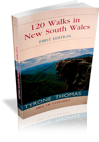
120 walks in New South Wales
120 walks in New South Wales
Author: Tyrone Thomas
Edition: 1
Publisher: Hill of Content
ISBN: 0855722975
Number of pages: 393
Year of Publication: 2000
Cover Price (au$): 32.95
Format: Paperback
Website: http://web.archive.org/web/20041010022224/members.ozemail.com.au/~tyronet/100nsw.html
Weight (grams): 315
Regions the book covers: New South Wales
Height (cm): 18
Subjects:
Hiking -- New South Wales -- Guidebooks,New South Wales -- Guidebooks
Niche: Many walks scattered throughout NSW, including Lord Howe and Norfolk Islands
Interpretive Information: Minimal
Grade system explained: No
Ascent and/or Decent provided: No
Driving directions provided: No
Date walks last reviewed provided: Yes
A summary of walks provided: Yes
Regional Map of walks provided: No
Maps designed for walking: Yes - reasonable detail
Type of maps used (for walking): Simple Topographic
Colour used in walking maps: Greyscale
Size of walking maps: Full page
Walking map Comment: Individual maps for most walks.
Colour depth of photos: Colour
Comment on Photographs: There are a few photo plates scattered through the book.
Level of detail in tracknotes: Detailed route information
Alternate route and side trip suggestions: Some walks
List of walks in book
| Walk Name | Length | Time | Grade | Page |
|---|---|---|---|---|
| Clifton Gardens-Bradleys head | 6 km | 2 hrs | Easy | 27 |
| Bundeena to Little Marley | 13.6 km | 4 hrs | Easy | 29 |
| Bundeena - Marley - Garie-Otford | 27 km | 8 hrs 30 mins | Hard | 32 |
| Otford Burning Palms | 11.5 km | 4 hrs | Easy | 36 |
| The basin | 5 km | 2 hrs | Easy | 39 |
| Somersby | 19.5 km | 7 hrs | Hard | 42 |
| Bouddi National Park | 9.5 km | 3 hrs 30 mins | Easy | 46 |
| Bobbin Head | 2 km | 4 hrs 15 mins | Easy | 49 |
| Heathcote - Uloola-Audley | 15.4 km | 5 hrs 30 mins | Medium | 52 |
| Erskine Creek | 6 km | 3 hrs | Easy | 55 |
| Springwood - Magdala Creek | 11.5 km | 4 hrs | Easy | 58 |
| Inspiration Point | 7 km | 3 hrs | Easy | 61 |
| Lockley Pylon | 7 km | 3 hrs | Easy | 64 |
| Mount Hay | 15 km | 5 hrs 30 mins | Medium | 66 |
| Katoomba-Three Sisters | 7 km | 3 hrs | Easy | 69 |
| Katoomba-Federal Pass | 103 km | 4 hrs | Medium | 73 |
| Golden Stairs-Mount Solitary | 14 km | 5 hrs | Medium | 77 |
| Blackhealth - Govetts Leap | 8 km | 3 hrs | Easy | 80 |
| Govetts Leap - Grand Canyon | 10.3 km | 4 hrs 15 mins | Medium | 83 |
| Neates Glen - Grand Canyon | 6.4 km | 2 hrs 30 mins | Easy | 86 |
| Blue Gum Forest | 22.25 km | 2 Days | Medium | 88 |
| Pulpit Rock | 6 km | 2 hrs 15 mins | Easy | 92 |
| Valley of the waters - National Pass | 7 km | 3 hrs | Easy | 95 |
| Lawson | 8 km | 2 hrs 45 mins | Easy | 98 |
| Leura Cliffs Lyrebird Dell | 6 km | 2 hrs 45 mins | Easy | 101 |
| Darwins Walk | 5 km | 2 hrs 15 mins | Easy | 104 |
| Mount York | 11 km | 4 hrs 9 mins | Medium | 107 |
| Kanangra Walls - Crafts Wall | 12 km | 4 hrs 30 mins | Medium | 110 |
| Jenolan Caves | 1.3 km | Easy | 114 | |
| Mount Victoria | 6.4 km | 2 hrs 30 mins | Easy | 117 |
| Mount Banks | 4.8 km | 2 hrs | Easy | 120 |
| Mount Wilson | 6 km | 2 hrs 30 mins | Easy | 124 |
| Wollangambe River | 9 km | 2 hrs 30 mins | Medium | 126 |
| Colo River-Tootie Creek | 6 km | 3 hrs | Medium | 129 |
| Colo River-Canoe Creek | 6 km | 3 hrs 30 mins | Hard | 131 |
| Newnes - Glow worm tunnel | 10 km | 4 hrs | Medium | 134 |
| Barrington Tops | 25.6 km | 2 Days | Medium | 137 |
| Mount Gower - Lord Howe Is. | 8.5 km | 7 hrs | Hard | 141 |
| Malabar Hill - Lord Howe Is. | 9 km | 4 hrs | Medium | 147 |
| Norfolk Island | 14 km | 6 hrs | Medium | 151 |
| The Rock | 6.5 km | 2 hrs 30 mins | Easy | 157 |
| Campbells Island | 18.5 km | 6 hrs 30 mins | Medium | 159 |
| Woolshed Falls and Bluff | 6 km | 2 hrs 30 mins | Easy | 162 |
| Jacks Creek | 2.5 km | 1 Hr | Easy | 165 |
| Belougery Split Rock | 7.8 km | 3 hrs 30 mins | Easy | 168 |
| The Breadknife | 12 km | 4 hrs 45 mins | Easy | 170 |
| Mount Exmouth | 16.6 km | 5 hrs 30 mins | Medium | 174 |
| Macha Tor-Mount Exmouth | 26.7 km | 2 Days | Medium | 175 |
| Fans Horizon | 3.2 km | 1 hr 30 mins | Easy | 179 |
| Yulludunida Crater | 4 km | 2 hrs | Easy | 180 |
| Bald Rock | 3.7 km | 2 hrs | Easy | 182 |
| South Bald Rock | 23.2 km | 2 Days | Medium | 185 |
| Mount Cougal | 7 km | 3 hrs 30 mins | Easy | 189 |
| Mount Warning | 8.8 km | 4 hrs | Medium | 192 |
| Cape Byron | 4 km | 1 hr 45 mins | Easy | 194 |
| Jerusalem Creek | 9 km | 3 hrs 30 mins | Easy | 196 |
| Yuraugir | 10.5 km | 4 hrs | Easy | 199 |
| Anvil Rock-Gibraltar Range | 4 km | 1 hr 30 mins | Easy | 202 |
| Cardinals Cap | 6 km | 2 hrs 30 mins | Easy | 204 |
| Washpool | 8.2 km | 3 hrs 12 mins | Easy | 205 |
| Bucca Bucca Creek | 5 km | 1 hr 45 mins | Easy | 208 |
| Never Never - Rosewood River | 8.2 km | 3 hrs 30 mins | Medium | 210 |
| Dorrigo Wonga Walk | 6.6 km | 2 hrs 30 mins | Easy | 212 |
| Point Lookout | 6.8 km | 2 hrs 30 mins | Easy | 215 |
| Eagles Nest | 3.3 km | 1 hr 30 mins | Easy | 218 |
| Woolpack Rocks | 8 km | 3 hrs | Easy | 220 |
| Cathedral Rocks | 5.8 km | 2 hrs 30 mins | Easy | 223 |
| Wollomombi Falls | 3 km | 1 hr 30 mins | Easy | 226 |
| Hat Head | 8.4 km | 3 hrs | Easy | 228 |
| Trial Bay - Gap Beach | 8.7 km | 3 hrs 30 mins | Easy | 231 |
| South-West Rocks - Trial Bay | 9.5 km | 3 hrs 45 mins | Easy | 234 |
| North Smoky | 5.2 km | 2 hrs | Easy | 235 |
| North Brother Mountain | 5 km | 3 hrs | Medium | 238 |
| Diamond Head | 5.5 km | 2 hrs | Easy | 240 |
| Booti Booti | 8.3 km | 3 hrs | Easy | 243 |
| Dark Point | 9 km | 3 hrs 15 mins | Easy | 245 |
| Hawkes Nest-Yacaaba | 6 km | 2 hrs 30 mins | Easy | 248 |
| Welby Coal Railway | 8.8 km | 3 hrs 15 mins | Easy | 251 |
| Fort Foot Falls - Nattai River | 11.4 km | 4 hrs 30 mins | Medium | 254 |
| Hilltop-Nattai River | 12 km | 5 hrs | Medium | 256 |
| Bundanoon Glow Worm Glen | 8.5 km | 3 hrs 15 mins | Easy | 258 |
| Bundanoon - Nicholas Pass | 9.5 km | 3 hrs 30 mins | Easy | 261 |
| Fitzroy Falls West Rim | 4.5 km | 1 hr 30 mins | Easy | 263 |
| Barren Grounds - Cooks Nose | 7.2 km | 3 hrs | Easy | 266 |
| Barren Grounds - Stone Bridge | 9 km | 3 hrs 45 mins | Easy | 267 |
| Badgerys - Shoalhaven River | 5 km | 2 hrs 30 mins | Medium | 271 |
| Long Point - Bungonia Gorge | 18 km | 2 Days | Medium | 273 |
| Berrima | 6 km | 3 hrs 30 mins | Easy | 276 |
| Drawing Room Rocks | 4.5 km | 2 hrs 15 mins | Easy | 280 |
| Bomaderry Creek | 5.5 km | 2 hrs 15 mins | Easy | 283 |
| Tallowa Dam | 6 km | 2 hrs 15 mins | Easy | 285 |
| Abrahams Bosom | 8.5 km | 3 hrs | Easy | 287 |
| Mount Bushwalker | 7 km | 3 hrs | Easy | 290 |
| Talaterang Mountain | 17 km | 2 Days | Hard | 294 |
| Pigeon House Mountain | 4.8 km | 2 hrs 15 mins | Medium | 295 |
| Kalianna Ridge-Monolith Valley | 23 km | 2 Days | Hard | 297 |
| Newhaven Gap-Monolith Valley | 58.4 km | 5 Days | Hard | 302 |
| Mount Dromedary | 11 km | 4 hrs 30 mins | Medium | 313 |
| Mount Imlay | 7 km | 7 hrs | Medium | 316 |
| Mallacoota-Nadgee | 51.2 km | 3 Days | Medium | 318 |
| Tinderry Twin Peak | 13 km | 5 hrs 30 mins | Hard | 327 |
| Square Rock | 10.4 km | 4 hrs | Easy | 330 |
| Booroomba Rocks | 4.5 km | 2 hrs | Easy | 333 |
| Mount Gingera | 15 km | 5 hrs 30 mins | Medium | 335 |
| Mount Bimberi | 19.6 km | 8 hrs | Hard | 338 |
| Mount Wee Jasper | 17 km | 6 hrs 30 mins | Hard | 341 |
| Blowering Dam - Browns Creek | 20.8 km | 2 Days | Easy | 344 |
| Big Talbingo Mountain | 22 km | 8 hrs 30 mins | Hard | 347 |
| Talbingo - Buddong Falls | 23.5 km | 9 hrs | Hard | 351 |
| Round Mountain - Mount Jagungal | 42.3 km | 2 Days | Medium | 355 |
| Mount Gungartan | 23 km | 8 hrs | Hard | 360 |
| Blue Cow Mountain | 2.8 km | 1 hr 30 mins | Easy | 363 |
| Skitube - Mount Twynam | 27 km | 3 Days | Medium | 365 |
| Perisher Valley - The Porcupine | 10 km | 3 hrs 30 mins | Easy | 371 |
| Charlottes Pass - Blue Lake | 10 km | 3 hrs | Easy | 374 |
| Kosciuszko Lakes Walk | 22.2 km | 8 hrs | Hard | 376 |
| Kosciuszko Sunrise | 17.2 km | 6 hrs | Medium | 380 |
| Thredbo - Mount Kosciuszko | 12.4 km | 4 hrs 30 mins | Medium | 383 |
| Thredbo - Mount Twynam | 35.6 km | 2 Days | Medium | 386 |
| Charlottes Pass - Mount Townsend | 22 km | 8 hrs 30 mins | Medium | 391 |


































































































Comments