Track Classification System
![]()
![]() An Australian standard for bush track was developed in 2001 in consultation with a number of out door bodies and organisations. These Standards are used to describe the condition of the track and the terrain and give a feel for the level of experience required by people using them.
An Australian standard for bush track was developed in 2001 in consultation with a number of out door bodies and organisations. These Standards are used to describe the condition of the track and the terrain and give a feel for the level of experience required by people using them.
The following tables gives a bit of a feel for the tack classification standards. I have modified them a bit from the AS 2156.1-2001 to suit the need of the website. As well as these elements for classifying a track the standard does also outline guides for management, these include facilities to provide, publicity and intervention levels.
The pictures in this table act a a bit of a guide, but only refer to the specific element been studied (IE just the sign or gradient)
| General | A well maintained path suitable for wheelchairs |
A popular and well maintained nature trail |
A well used and obvious bush track |
An established bush track with limited signage |
A marked trail that can become unclear in places |
A known route with n signs and a very indistinct track if any |
| Track Conditions |
Hard surfaced track suitable for wheelchairs. 1.2m wide. Minimal intrusions. |
Modified or hardened surface. At least 0.9m wide. Minimal intrusions. |
Modified surface, sections may be hard. <1.2m wide. Mostly clear of intrusions. |
Generally distinct without major modification. Debris and obstacles are likely. |
Limited modification, indistinct in places. Debris and obstacles are likely |

No modification of the natural environment. |
| Gradient |
Steps allowed only with alternate ramp access. |
Generally no steeper than 1:10. Minimal use of steps. |
May exceed 1:10 for short sections generally not > 1:10. Steps may be common. |
Limited to environmental and maintenance considerations. |
May include steep sections of unmodified surfaces. | |
| Signage |
Signs for interpretation used frequently. Arrow markers used at intersections. |
Signs and track markers used for direction. Limited signage for interpretation. |

Minimal signage for management and directional purposes. |
Signage is limited and only for management purposes. |
Signage is generally not provided. But may still be track markers. |
|
| Infrastructure | 
Generally includes facilities such as seats, lookout platforms, safety and hand railing. |

Generally facilities are not provided expect to deal with particular safety and environmental issues. |

Generally facilities are not provided expect to deal with particular safety and environmental issues. |
Generally facilities are not provided. | ||
| Terrain | No previous experience required, exercise normal care. | Need no bushwalking experience and a minimum level of specialized skills. May encounter steep slopes, unstable surfaces and minor water crossings. | Require a moderate level of specialized skills such as navigation. Require maps and navigation equipment. Need to be self-reliant, in particular for 1st aid and adverse weather. | Require a high level of specialized skills such as navigation. Require maps and navigation equipment. Need to be self-reliant, in particular for 1st aid and adverse weather. | Users require previous experience in the outdoors and a high level of specialized skills such as navigation. Require maps and navigation equipment. Need to be self-reliant, in particular for 1st aid and adverse weather. | |
| Weather | 
Not applicable |

Forecasted and unforecasted storms may impact on navigation and safety |

Forecasted and unforecasted storms and severe weather may impact on navigation and safety |

Forecasted and unforecasted storms and severe weather may impact on navigation and safety |
||


A walk is then classified based on the higest class number found.
In this table below you will see the range of assessments made for a particular track ranged the full gamut but generally sat around class 3. But because the one element of weather ranged from 1 to 4 then this walk will be ranked a 4. However if in the summer months the weather class never extends beyond 3, then you could class this was as a 3 in summer and 4 in other seasons.
| Standard Class | ||||||
| Elements | 1 | 2 | 3 | 4 | 5 | 6 |
| Track Conditions | ||||||
| Gradiant | ||||||
| Signage | ||||||
| Infrastructure | ||||||
| Terrain | ||||||
| Weather | ||||||
Please see the AS 2156.1-2001 standard for more information.
West Sydney Wild : exploring nature in Sydney’s western suburbs
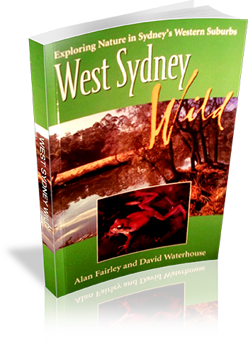
Author: Alan Fairley,David Waterhouse
Edition: 1
Publisher: Rosenberg Publishing
ISBN: 1877058386
Number of pages: 179
Year of Publication: 2005
Cover Price (au$): 9.95
Format: Paperback
Website: http://www.rosenbergpub.com.au/browseProduct.asp?id=2
Weight (grams): 275
Regions the book covers: Western Sydney
Height (cm): 23
Subjects:
National parks and reserves - New South Wales - Western Sydney - Guidebooks,Natural areas - New South Wales - Western Sydney - Guidebooks,Western Sydney (N.S.W.) - Guidebooks,Western Sydney (N.S.W.) - Description and travel
Overview of Book:
This book is a fairly comprehensive guide to Western Sydney's National Parks and reserves. Parks are described in great detail, with a focus on flora and fauna. The book is not primarily a walking guidebook, and there is a small amount of information on a limited number of walks in some parks.
Niche: Detailed information on Reserves and National Parks in Western Sydney, with indications to walks
Interpretive Information: Detailed
Ascent and/or Decent provided: No
Driving directions provided: Yes
Date walks last reviewed provided: No
A summary of walks provided: No
Regional Map of walks provided: No
Maps designed for walking: Yes - limited detail
Type of maps used (for walking): Sketch
Colour used in walking maps: Black and White
Size of walking maps: Half page
Colour depth of photos: Colour
Comment on Photographs: Many photographs, mainly of plants and animals
Level of detail in tracknotes: General route description
Alternate route and side trip suggestions: None
The Great North Walk
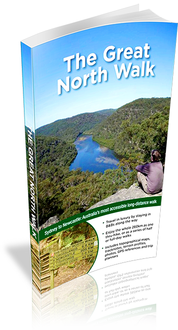
Download Sample: Download PDF
Author: Matt McClelland
Edition: 1
Publisher: Woodslane
ISBN: 9781921683121
Number of pages: 232
Year of Publication: 2012
Cover Price (au$): 30
Format: Paperback
Website: http://www.wildwalks.com/
Weight (grams): 440
Regions the book covers: Sydney, Central Coast, Newcastle
Height (cm): 22
Subjects:
Hiking - New South Wales - Great North Walk - Guidebooks, Walking - New South Wales - Guidebooks
Niche: Thru hiking, inn-to-inn hiking, day walks
Interpretive Information: Plenty
Grade system explained: Yes
Ascent and/or Decent provided: Yes
Driving directions provided: Yes
Date walks last reviewed provided: Yes
A summary of walks provided: Yes
Regional Map of walks provided: Yes
Maps designed for walking: Yes - limited detail
Type of maps used (for walking): Detailed Topographic
Colour used in walking maps: Multicolour
Size of walking maps: 3/4 page
Walking map Comment: scale varies on each map
Colour depth of photos: Colour
Level of detail in tracknotes: Detailed route information
Alternate route and side trip suggestions: Many walks
The Beaten Track : A Guide to the Bushland Around Sydney
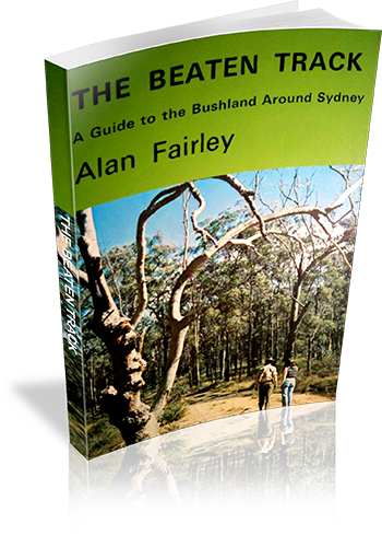
Author: Alan Fairley
Edition: 1
Publisher: Alan Fairley
ISBN: 0959903208
Number of pages: 106
Year of Publication: 1972
Format: Paperback
Weight (grams): 165
Regions the book covers: Sydney, Blue Mountains, Southern Highlands
Height (cm): 21
Subjects:
Hiking - New South Wales - Sydney region,Sydney Region (N.S.W.) - Guidebooks
Interpretive Information: Plenty
Grade system explained: No
Ascent and/or Decent provided: No
Driving directions provided: Yes
Date walks last reviewed provided: No
A summary of walks provided: No
Regional Map of walks provided: No
Maps designed for walking: Yes - limited detail
Type of maps used (for walking): Sketch
Colour used in walking maps: Black and White
Size of walking maps: Full page
Colour depth of photos: Black and White
Comment on Photographs: There are a number of regional photographs throughout the book, and pictographs of wildflowers.
Level of detail in tracknotes: General route description
Take A Walk in Kosciuszko National Park
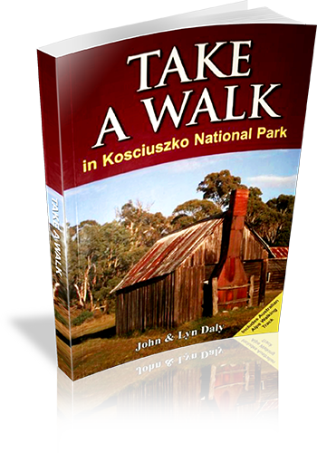
Author: John Daly,Lyn Daly
Edition: 1
Publisher: Take a Walk Publications
ISBN: 9780957793187
Number of pages: 255
Year of Publication: 2010
Cover Price (au$): 34.95
Format: Paperback
Website: http://www.takeawalk.com.au/
Weight (grams): 340
Regions the book covers: kosciuszko national park
Height (cm): 21
Subjects:
Hiking - New South Wales - Kosciuszko National Park - Guidebooks. | National parks and reserves - New South Wales - Kosciuszko National Park - Guidebooks. | Kosciuszko National Park (N.S.W.) - Guidebooks.
Niche: kosciuszko
Grade system explained: Yes
Ascent and/or Decent provided: No
Driving directions provided: Yes
Date walks last reviewed provided: No
A summary of walks provided: Yes
Regional Map of walks provided: Yes
Maps designed for walking: Yes - reasonable detail
Type of maps used (for walking): Sketch
Colour used in walking maps: Multicolour
Size of walking maps: 1/4 page
Walking map Comment: varey in sizes
Colour depth of photos: Colour
Comment on Photographs: small to medium colour photo's every second page
Level of detail in tracknotes: General route description
Alternate route and side trip suggestions: Some walks
Take a walk in a national park – Sydney to Port Macquarie
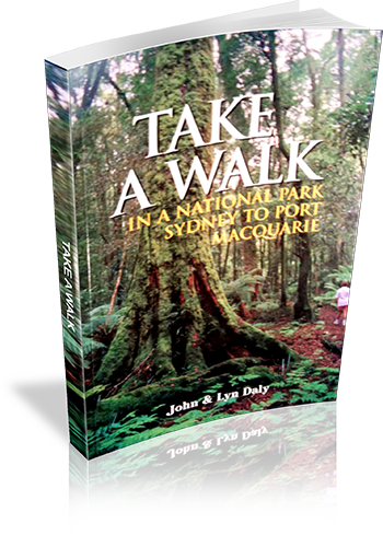
Author: John Daly, Lyn Daly
Edition: 1
Publisher: Take A Walk Publications
ISBN: 0957793111
Number of pages: 224
Year of Publication: 2000
Cover Price (au$): 21.95
Format: Paperback
Website: http://www.takeawalk.com.au/
Weight (grams): 390
Regions the book covers: Between Sydney City and Port Macquarie NSW (mostly near the coast)
Height (cm): 21
Subjects:
Hiking - New South Wales - Guidebooks,National parks and reserves - New South Wales - Guidebooks
Interpretive Information: Plenty
Grade system explained: No
Ascent and/or Decent provided: No
Driving directions provided: Yes
Date walks last reviewed provided: No
A summary of walks provided: Yes
Regional Map of walks provided: Yes
Maps designed for walking: No - no maps intended for use when walking
Colour depth of photos: Colour
Comment on Photographs: Colour plat of 16 photo's provided at the centre of the book. No other photos provided
Level of detail in tracknotes: Detailed route information
Alternate route and side trip suggestions: Some walks
Newnes & the Glow Worm Tunnel : a guide to the walking tracks & historic features of the Newnes village & the Glow Worm Tunnel
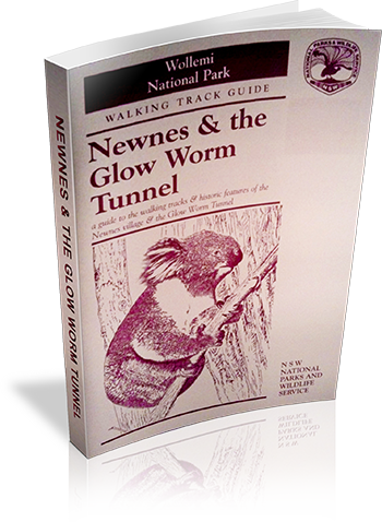
Author: Stephen Alton
Edition: 1
Publisher: NSW National Parks and Wildlife Service
ISBN: 0731088239
Number of pages: 20
Year of Publication: 1996
Cover Price (au$): 4.50
Format: Paperback
Website: http://www.environment.nsw.gov.au/nationalparks/
Weight (grams): 45
Regions the book covers: Newnes Region
Height (cm): 21
Subjects:
National parks and reserves - New South Wales - Blue Mountains - Guidebooks,Nature trails - New South Wales - Wollemi National Park - Guidebooks,Newnes (N.S.W.),Wollemi National Park (N.S.W.)
Interpretive Information: Plenty
Grade system explained: No
Ascent and/or Decent provided: No
Driving directions provided: Yes
Date walks last reviewed provided: No
A summary of walks provided: No
Regional Map of walks provided: Yes
Maps designed for walking: Yes - limited detail
Type of maps used (for walking): Sketch
Colour used in walking maps: Greyscale
Size of walking maps: Full page
Walking map Comment: Maps for main two walks only. No walking maps for harder walks lasted at end of book.
Colour depth of photos: Black and White
Comment on Photographs: Some historic photographs, and one aerial photograph provided.
Level of detail in tracknotes: General route description
Jenolan Caves & The 6 Foot Track
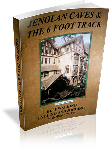
Author: Robert Sloss
Edition: 1
Publisher: Robert Sloss
ISBN: 0958651280
Number of pages: 26
Year of Publication: 2000
Cover Price (au$): 11.90
Format: Paperback
Website: http://www.robertsloss.com.au/Guide%20Index.htm
Weight (grams): 55
Regions the book covers: Jenolan Caves, Six Foot Track
Height (cm): 21
Subjects:
Hiking -- New South Wales -- Jenolan Caves -- Guidebooks,Hiking -- New South Wales -- Blue Mountains -- Guidebooks,Jenolan Caves (N.S.W.) -- Guidebooks,Blue Mountains (N.S.W.) -- Guidebooks
Interpretive Information: Some
Grade system explained: Yes
Ascent and/or Decent provided: No
Driving directions provided: No
Date walks last reviewed provided: No
Regional Map of walks provided: Yes
Maps designed for walking: Yes - limited detail
Type of maps used (for walking): Sketch
Colour used in walking maps: Simple colour
Size of walking maps: Full page
Colour depth of photos: Colour
Comment on Photographs: Small photograph on most pages, giving a sense of the region
Level of detail in tracknotes: Detailed route information
Alternate route and side trip suggestions: Many walks
Heritage Walks In New South Wales
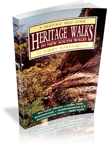
Author: Garry McDougall
Edition: 1
Publisher: Kangaroo Press
ISBN: 0864173830
Number of pages: 128
Year of Publication: 1992
Cover Price (au$): 14.95
Format: Paperback
Website: http://www.members.optusnet.com.au/utravel/
Weight (grams): 140
Regions the book covers: NSW
Height (cm): 19
Subjects:
Nature trails - New South Wales - Guidebooks,Historic sites - New South Wales - Guidebooks,Hiking - New South Wales - Guidebooks,Walking - New South Wales - Guidebooks
Overview of Book:
A guide to seven historic walking regions in NSW. Much information is shared regarding human and environmental heritage in each region, and many walks are described in varying levels of detail - some giving just a sense of the walk, others describing the author's experiences, uncluding navigational and interpretive information.
Niche: Walks linked with human or environmental heritage.
Interpretive Information: Plenty
Grade system explained: No
Ascent and/or Decent provided: No
Driving directions provided: Yes
Date walks last reviewed provided: No
A summary of walks provided: No
Regional Map of walks provided: Yes
Maps designed for walking: Yes - limited detail
Type of maps used (for walking): Sketch
Colour used in walking maps: Black and White
Size of walking maps: 3/4 page
Walking map Comment: Maps provided for each region, however additional maps would be required for most walks, as stated by the author.
Colour depth of photos: None
Level of detail in tracknotes: General route description
Discovering the Colo Wilderness on foot
Author: Anthony Dunk
Edition: 2
Publisher: Envirobook
ISBN: 9780858812277
Number of pages: 79
Year of Publication: 2009
Cover Price (au$): 13.95
Format: Paperback
Website: http://adunk.ozehosting.com/booktoc.html
Weight (grams): 85
Regions the book covers: Colo River
Height (cm): 18
Subjects:
Hiking -- New South Wales -- Colo Wilderness -- Guidebooks,Colo Wilderness (N.S.W.) -- Guidebooks
Authors Comments:
This book describes 20 bushwalks in Wollemi National Park, which is located north-west of
Sydney. A central feature of the park is the Colo River which flows through more than 40 kms
of rugged wilderness surrounded by huge sandstone cliffs. A number of the walks in the
book describe the easier passes into the gorge, while others cover walks in the surrounding
areas such as Putty, Mt Wilson, Newnes, and Rylstone.
Some history and background of the area is provided as well as suggestions for extended
walks, and details of equipment and techniques for bushwalking in the area.
Niche: Walking in Colo region
Interpretive Information: Plenty
Grade system explained: No
Ascent and/or Decent provided: No
Driving directions provided: Yes
Date walks last reviewed provided: No
A summary of walks provided: No
Regional Map of walks provided: Yes
Maps designed for walking: Yes - limited detail
Type of maps used (for walking): Sketch
Colour used in walking maps: Black and White
Size of walking maps: Full page
Walking map Comment: Some maps are shared by a number of walks.
Colour depth of photos: Black and White
Comment on Photographs: There is an average of one photograph every four pages.
Level of detail in tracknotes: Detailed route information
Alternate route and side trip suggestions: Some walks