Beaufort Scale (for wind speed)

ImageThe Beaufort scale is a standard scale to communicate wind force.  The scale starts at traditionally ranges from 0 to 12, with zero been no wind and 12 been a hurricane force wind of over 120km/h.  The scale has since grown to 17, to describe more severe hurricane winds.  For the sake of this article I have just included the 0-12.  The scale include descriptions of the what to expect to see from such a force. Rear-Admiral, Sir Francis Beaufort, was born in Ireland in 1774. He entered the Royal Navy at the age of 13 and was a midshipman aboard the Aquilon. By 1800 he had risen to the rank of Commander. In the summer of 1805 Beaufort was appointed to the command of the Woolwich, a 44 gun man-of-war.

In 1806 he wrote in his log book a wind force scale. The scale was simple and very similar to one that Alexander Dalrymple had written in a book in 1789. A year later he added some criteria to the 0-12 scale that indicated how much of a ship’s sails would be employed by a British man-of-war under each condition. It was not relate to the speed of the wind.

Over the following years he continued to use his scale in his logs. It was finally adopted in December 1838 by the British Admiralty for use in all Royal Navy logbooks. However, as ship design and the introduction of steam power became widespread even that scale had to be modified.

In 1912 the International Commission for Weather Telegraphy sought some agreement on velocity equivalents for the Beaufort scale. A uniform set of equivalents was accepted in 1926 and revised slightly in 1946, extending the scale to 17 values (the added five values further refining the hurricane-force winds). By 1955, wind velocities in knots replaced Beaufort numbers on weather maps.

Today’s Beaufort Scale including the observed land conditions…

Beaufort Wind speed Description Land conditions

kt km/h

0 0 0 Calm Calm. Smoke rises vertically.
1 1-3 1-6 Light air Wind motion visible in smoke.
2 4-6 7-11 Light breeze Wind felt on exposed skin. Leaves rustle.
3 1-10 12-19 Gentle breeze Leaves and smaller twigs in constant motion.
4 11-15 20-29 Moderate breeze Dust and loose paper raised. Small branches begin to move.
5 16-21 30-39 Fresh breeze Smaller trees sway.
6 22-27 40-50 Strong breeze Large branches in motion. Whistling heard in overhead wires. Umbrella use becomes difficult.
7 28-33 51-62 Near gale Whole trees in motion. Effort needed to walk against the wind.
8 34-40 63-75 Gale Twigs broken from trees. Cars veer on road.
9 41-47 76-87 Strong gale Light structure damage.
10 48-55 88-102 Storm Trees uprooted. Considerable structural damage.
11 56-63 103-119 Violent storm Widespread structural damage.
12 64-80 >120 Hurricane Considerable and widespread damage to structures.

Track Classification System

Image Image An Australian standard for bush track was developed in 2001 in consultation with a number of out door bodies and organisations.  These Standards are used to describe the condition of the track and the terrain and give a feel for the level of experience required by people using them.


The following tables gives a bit of a feel for the tack classification standards.  I have modified them a bit from the AS 2156.1-2001 to suit the need of the website.  As well as these elements for classifying a track the standard does also outline guides for management, these include facilities to provide, publicity and intervention levels.


The pictures in this table act a a bit of a guide, but only refer to the specific element been studied (IE just the sign or gradient)


 General Image

A well maintained path suitable for wheelchairs

Image

A popular and well maintained nature trail

Image

A well used and obvious bush track

Image

An established bush track with limited signage

Image

A marked trail that can become unclear in places

Image 

A known route with n signs and a very indistinct track if any

Track Conditions

Hard surfaced track suitable for wheelchairs. 1.2m wide. Minimal intrusions.

Modified or hardened surface. At least 0.9m wide. Minimal intrusions.

Modified surface, sections may be hard. <1.2m wide. Mostly clear of intrusions.

Generally distinct without major modification. Debris and obstacles are likely.

Limited modification,  indistinct in places. Debris and obstacles are likely

No modification of the natural environment.

Gradient

Steps allowed only with alternate ramp access.

Generally no steeper than 1:10. Minimal use of steps.

May exceed 1:10 for short sections generally not > 1:10. Steps may be common.

Limited to environmental and maintenance considerations.

May include steep sections of unmodified surfaces.
Signage

Signs for interpretation used frequently. Arrow markers used at intersections.

Signs and track markers used for direction. Limited signage for interpretation.

Minimal signage for management and directional purposes.

Signage is limited and only for management purposes.

Signage is generally not provided. But may still be track markers.

Infrastructure

 Generally includes facilities such as seats, lookout platforms, safety and hand railing.

 Generally facilities are not provided expect to deal with particular safety and environmental issues.

 Generally facilities are not provided expect to deal with particular safety and environmental issues.

 Generally facilities are not provided.
Terrain No previous experience required, exercise normal care. Need no bushwalking experience and a minimum level of specialized skills. May encounter steep slopes, unstable surfaces and minor water crossings. Require a moderate level of specialized skills such as navigation. Require maps and navigation equipment. Need to be self-reliant, in particular for 1st aid and adverse weather. Require a high level of specialized skills such as navigation. Require maps and navigation equipment. Need to be self-reliant, in particular for 1st aid and adverse weather. Users require previous experience in the outdoors and a high level of specialized skills such as navigation. Require maps and navigation equipment. Need to be self-reliant, in particular for 1st aid and adverse weather.
Weather

 Not applicable

Forecasted and unforecasted storms may impact on navigation and safety

Forecasted and unforecasted storms and severe weather may impact on navigation and safety

Forecasted and unforecasted storms and severe weather may impact on navigation and safety


A walk is then classified based on the higest class number found.


In this table below you will see the range of assessments made for a particular track ranged the full gamut but generally sat around class 3.  But because the one element of weather ranged from 1 to 4 then this walk will be ranked a 4. However if in the summer months the weather class never extends beyond 3, then you could class this was as a 3 in summer and 4 in other seasons.


  Standard Class
Elements  1   2  3  4  5  6
Track Conditions          
Gradiant          
Signage            
Infrastructure            
Terrain          
Weather      


Please see the AS 2156.1-2001 standard for more information.

Heat Index

Image You have heard it said that “It’s not the heat, it’s the humidity” Well, actually it’s both. Our bodies dissipate heat by varying the rate and depth of blood circulation, by losing water through the skin and sweat glands, and, as the last extremity is reached, by panting. As the body heats up, the heart begins to pump more blood, blood vessels to accommodate the increased flow, and the tiny capillaries in the upper layers of skin are put into operation.


The body’s blood is circulated closer to the skin’s surface, and excess heat drains off into the cooler atmosphere by one or a combination of three ways…

  • radiation,
  • convection, and
  • evaporation.

At lower temperatures, radiation and convection are efficient methods of removing heat. However, once the air temperature reaches 35°C, heat loss by radiation and convection ceases. It is at this point that heat loss by sweating becomes all-important. But sweating, by itself, does nothing to cool the body, unless the water is removed by evaporation (sweat changing to water vapor). The downside of this method of cooling is that high relative humidity retards evaporation.


Relative humidity is a measure of the amount of water vapor contained in the air, divided by the maximum amount the air can hold, expressed as a percent. A relative humidity of 50% means the air contains ½ of the water vapor it can actually hold. The maximum amount of water vapor the air can hold is dependent upon the temperature (the “relative” in relative humidity). The higher the temperature, the more water (actually water vapor) the air can hold. For example, air with a temperature of 0°C can hold about 4.5ml of water. Air with a temperature of 26°C can hold about an 30ml of water.


So, what does this all mean? Sweat is evaporated (changes from a liquid to a gas, i.e. water vapor) when heat is added. The heat is supplied by your body. The results are summed up in the table below…


Relative

Humidity

Capacity for air

to hold water

Amount of

Evaporation

HEAT removed

from the body

low

LARGER

HIGHER

MORE

HIGH

smaller

lower

less


We, at the National Weather Service, as part of our mission for protecting life and property, have a measure of how the hot weather “feels” to the body. The Heat Index is based on work by R.G. Steadman and published in 1979 under the title “The Assessment of Sultriness, Parts 1 and 2.” In this work, Steadman constructed a table which uses relative humidity and dry bulb temperature to produce the “apparent temperature” or the temperature the body “feels”.


We use this table to provide you with Heat Index values. These values are for shady locations only. Exposure to full sunshine can increase heat index values by up to 10°C. Also, strong winds, particularly with very hot, dry air, can be extremely hazardous as the wind adds heat to the body. The Heat Index Table is below.


            Relative Humidity %        
      0 10 20 30 40 50 60 70 80 90 100
  T
e
m
p

°C

60 54 60 65 70 75 80 85 90 96 101 106
  50 44 49 53 58 62 67 71 75 80 84 89
  40 34 38 42 45 49 53 56 60 64 67 71
  30 24 27 30 33 36 39 42 44 47 50 53
  20 14 16 18 20 22 24 26 28 30 32 34
  10 4 5 7 8 9 10 11 12 13 14 15


Remember, these values are in the SHADE. You can add up to 10°C to these values if you are in direct sunlight.


The chart below tells you the risk to the body from continued exposure to the excessive heat.


Category

Classification

Heat Index/Apparent Temp (°C)

General Affect on People in High Risk Groups

I

Extremely Hot

54°C or Higher

Heat/Sunstroke HIGHLY LIKELY with continued exposure

II

Very Hot

40°C – 54°C

Sunstroke, heat cramps, or heat exhaustion LIKELY, and heatstroke POSSIBLE with prolonged exposure and/or physical activity

III

Hot

32°C – 40°C

Sunstroke, heat cramps, or heat exhaustion POSSIBLE with prolonged exposure and/or physical activity

IV

Very Warm

26°C – 32°C

Fatigue POSSIBLE with prolonged exposure and/or physical activity

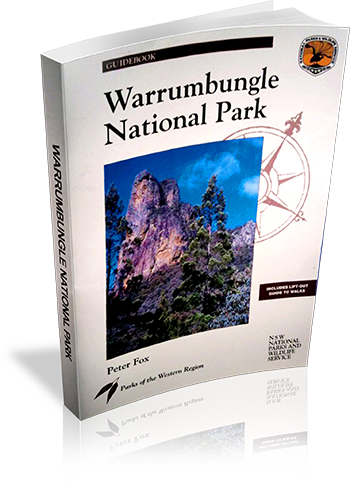
Wurrumbungle National Park

Wurrumbungle National Park

1876131004

Title: Wurrumbungle National Park
Author: Peter Fox
Edition: 1
Publisher: The Beaten Track Press
ISBN: 1876131004
Number of pages: 80
Year of Publication: 1996
Cover Price (au$): 11.00
Format: Paperback
Websitehttp://www.beatentrack.com.au/btgroup/btg_frame.cfm?topic=catalogue&product=catalogue
Weight (grams): 225
Regions the book covers: Warrumbungle National Park
Height (cm): 25


Subjects
National parks and reserves - New South Wales,Warrumbungle National Park (N.S.W.), Physical geography - New South Wales - Warrumbungle Range
Interpretive Information: Detailed
Grade system explained: No
Date walks last reviewed provided: No
A summary of walks provided: Yes
Regional Map of walks provided: Yes
Maps designed for walking: Yes - limited detail
Type of maps used (for walking): Simple Topographic
Colour used in walking maps: Multicolour
Size of walking maps: Full page
Walking map Comment: Lift out walking information including maps an extra 28 page booklet. Maps are aerial photographs with tracks and other features marked.
Colour depth of photos: Colour
Level of detail in tracknotes: Detailed route information


List of walks in book

Walk Name Length Time Grade Page
Fan's Horizon 3.6 km 2 hrs Moderate to steep 8
Breadknife and Grand High Tops (Pincham Trail) 12.5 km 5 hrs Moderate then steep 8
Breadknife and Grand High Tops Circuit (Via west Spirey Creek) 14.5 km 6 hrs Generally steep 18
Bluff Mountain (via Grand High Tops) 16.9 km 8 hrs Generally steep 19
Mt. Exmouth (via West Spirey Creek) 18 km 7 hrs Steep 20
Mt Exmouth (Via Burbie Fire Trail) 17.3 km 7 hrs Moderate to steep 23
Gould's Circuit 6.3 km 3 hrs Moderate to steep 23
Bridget and Bress Peaks 6.6 km 4 hrs Very steep, ungraded track 24
Belougery Split Rock Circuit 4.6 km 3 hrs Steep 24
Burbie Canyon 3.8 km 1 hr 30 mins Easy to Moderate 25
Gurianawa Track 1 km 20 mins Easy 26
Wambelong Nature Track 1.1 km 30 mins Easy 26
Whitegum Lookout 1 km 30 mins Easy 26

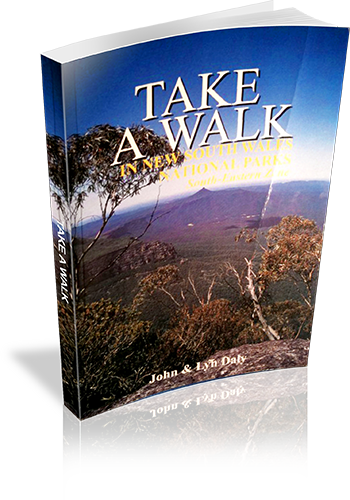
Take A Walk in New South Wales National Park – South-Eastern Zone

Take A Walk in New South Wales National Park - South-Eastern Zone

0957793138

Title: Take A Walk in New South Wales National Park - South-Eastern Zone
Author: John Daly, Lyn Daly
Edition: 1
Publisher: Take A Walk Publications
ISBN: 0957793138
Number of pages: 319
Year of Publication: 2002
Cover Price (au$): 24.95
Format: Paperback
Websitehttp://www.takeawalk.com.au/
Weight (grams): 390
Regions the book covers: A wide coastal strip from Sydney City to NSW/Vic boarder
Height (cm): 21


Subjects
Hiking - New South Wales - Guidebooks,National parks and reserves - New South Wales - Guidebooks
Interpretive Information: Plenty
Grade system explained: No
Ascent and/or Decent provided: No
Driving directions provided: Yes
Date walks last reviewed provided: No
A summary of walks provided: Yes
Regional Map of walks provided: Yes
Maps designed for walking: No - no maps intended for use when walking
Type of maps used (for walking): Sketch
Colour used in walking maps: Black and White
Size of walking maps: 1/4 page
Walking map Comment: There are just of 50 small sketch maps throughout the book, some walk provide a map referance
Colour depth of photos: Colour
Comment on Photographs: There are 18 colour images in the colour plate section in the middle of the book
Level of detail in tracknotes: Detailed route information
Alternate route and side trip suggestions: Some walks


List of walks in book

Walk Name Length Time Grade Page
Werrong Beach Circuit 5.2 km 2 hrs Moderate 6
Panania, Georges River, Yeramba Lagoon,Saltpan Creek, Padstow 17 km 6 hrs 30 mins Easy 29
Little Moon Bay 3.5 km 1 hr 30 mins Easy 31
Mill Creek Trail 7 km 2 hrs 30 mins Easy 32
Jennifer Street Boardwalk 700 m 30 mins Easy 38
Cape Banks Fortifications to Henry Head 4 km 2 hrs Easy 39
La Perouse, Congwong Beach, Henry Head 5 km 2 hrs 30 mins Easy 40
Monument Track 2 km 1 Hr Easy 41
Banks-Solander, Yena and Muru Tracks Circuit 1.8 km 1 Hr Easy 42
EasyCape Solander to Potter Point 4 km 2 hrs Easy 43
Bungoona Lookout 1 km 30 mins Easy 51
Honeymoon Track, Audley, Bridle Track Circuit 3.5 km 2 hrs Moderate 52
Lady Carrington Drive to Jersey Spring 5.8 km 2 hrs Easy 53
Robertsons Roundabout 1.7 km 1 Hr Easy 53
Deer Pool, Little Marley Beach 8.2 km 3 hrs Easy 54
Bundeena, Jibbon Point, Little Marley 12 km 4 hrs Easy 54
Providential Point 1 km 30 mins Easy 56
Walumarra Track to Bola Creek 5 km 2 hrs Easy 56
Walumarra Track, Palona Brook, Karani Ridge 12.5 km 5 hrs Moderate 57
Curra Moors Circuit 10.8 km 3 hrs Easy 57
Garawarra, Thelma Ridge, South Era, Burning Palms Circuit 12 km 4 hrs Moderate 58
Forest Island Circuit 4.4 km 1 hr 30 mins Easy 59
Palona Cave 7.2 km 2 hrs 30 mins Moderate 60
Red Cedar Loop Track 1 km 30 mins Easy 60
Coast Walk - Otford to Bundeena 28 km 10 hrs Hard 60
Figure of Eight Pool, Burning Palms, Garawarra 13 km 6 hrs Moderate 64
Bulgo Beach, Werrong Beach Circuit 5.5 km 3 hrs Moderate 64
Loftus, Audley, Winifred Falls, Anice Falls, Bundeena 20 km 8 hrs Moderate 66
Waterfall, Uloola Track, Karloo Pool, Heathcote 11.5 km 5 hrs Moderate 67
Waterfall, Kangaroo Creek, Karloo, Heathcote 12.5 km 5 hrs Moderate 68
Helensburgh to Waterfall via the Burgh Track,Hacking River, Bola Ridge and Couranga Track 16.5 km 6 hrs Moderate 69
Tamaroo Ridge, Mirang Pool, Gunners Cave,Eddles Pool, Banya Pool Circuit 13 km 6 hrs 30 mins Moderate 74
Scouters Mountain, Tamaroo Ridge, Mirang Pool 11.5 km 6 hrs Moderate 76
Mooray Track, Bullawarring Track, Kingfisher Pool Circuit 5.5 km 2 hrs Easy 78
Mooray Track, Battery Causeway, Lake Eckersley, Bullawarring Track Circuit 15.5 km 5 hrs Moderate 79
Myuna Creek to Ripple Rill 9.5 km 4 hrs Moderate 80
Lake Toolooma, Mt Westmacott, Yellow Pool 8.5 km 3 hrs Easy 80
Mt Minda, Minda Pool, Miara Pool, Gunners Gully,Mirang Road Circuit 10.5 km 4 hrs Moderate 81
Morella Ridge to Ripple Rill 5.6 km 2 hrs 30 mins Easy 82
Sarahs Knob, Broula Pool, Gurra Causeway 9 km 3 hrs Easy 83
Cascade Track 3.6 km 2 hrs Moderate 86
Macquarie Rivulet to Rainbow Falls 7 km 4 hrs Moderate 87
Clover Hill Road, Macquarie Rivulet, Rainbow Falls Circuit 7.7 km 4 hrs Hard 87
Rainforest Loop Walk 1.6 km 1 Hr Easy 93
Minnamurra Falls 4.2 km 2 hrs Moderate 94
Gerringong Falls Circuit 9.5 km 3 hrs Easy 94
Warris Chair, Missingham Lookout 4.2 km 2 hrs 30 mins Moderate 95
Carrington Falls Circuit 2.6 km 1 Hr Easy 96
Minnie Ha Ha Falls 2 km 2 hrs 30 mins Moderate 97
Herbarium Trail 1.5 km 30 mins Easy 100
Griffiths Loop Trail 9 km 3 hrs 30 mins Easy 101
Drawing Room Rocks Trail 21 km 8 hrs Moderate 102
Drawing Room Rocks Track 4 km 3 hrs Moderate 103
Trestles Track 7.5 km 3 hrs 30 mins Moderate 109
Orange Track 2.4 km 1 Hr Easy 109
Green Track 5.5 km 3 hrs Moderate 110
White Track to Mt Ayre 1.5 km 45 mins Easy 111
Red Track 5 km 5 hrs Hard 112
Red Track, Shoalhaven River, White Track Circuit 9 km 7 hrs Hard 113
Yellow Track 5.5 km 1 hr 30 mins Moderate 113
Belmore Falls 1.2 km 30 mins Easy 121
Fitzroy Falls West Rim 3.4 km 1 hr 30 mins Easy 122
Fitzroy Falls East Rim 5 km 2 hrs Easy 122
Meryla Pass to Griffins Fire Trail and Ruins 10 km 4 hrs Moderate 123
Timealong Trail 16 km 5 hrs Moderate 125
Wombat Hill Lookout and Rebecca's View 12 km 3 hrs Easy 125
Glow Worm Glen and Mark Morton Lookout 5.6 km 2 hrs Easy 126
Amphitheatre Track 2.4 km 1 Hr Easy 127
Mark Morton Lookout 2.4 km 1 Hr Easy 128
Erith Coal Mine Circuit 2.2 km 1 Hr Easy 128
Echo Point, Lovers Walk, Bonnie View Circuit 2.5 km 1 Hr Easy 129
Mt Carnarvon 1.3 km 30 mins Easy 129
Tooths Lookout, Bundanoon Creek, Fairy Bower Falls Circuit 5.5 km 2 hrs Moderate 130
Badgerys Lookout to Shoalhaven Gorge 9 km 6 hrs Hard 131
Long Point to McCallums Flat 10 km 4 hrs Moderate 131
Long Point, Shoalhaven River, Bungonia Gorge 18 km 2 Days Moderate 132
Four Lookouts Trail 12 km 5 hrs Easy 133
McPhails Fire Trail to Mt Carrialoo 11 km 6 hrs Moderate 134
Beehive Point Circuit 10.8 km 4 hrs Easy 135
Griffins Fire Trail to The Ruins 12 km 5 hrs Moderate 136
Manning Lookouts 1.2 km 30 mins Easy 137
Sassafras, Tanderra Camp, Folly Point, Hidden Valley, Quiltys Mountain 65.5 km 4 Days Moderate 137
Styles Creek, Hidden Valley, Quiltys Mountain,Mt Haughton 53.5 km 3 Days Moderate 141
Pigeon House Mountain 4.8 km 4 hrs Moderate 141
Wog Wog, Corang Peak, Canowie Brook, Corang River, Goodsell Creek Circuit 24 km 2 Days Moderate 144
Florance Head 6 km 2 hrs 30 mins Easy 147
Rusden Head 8 km 3 hrs Moderate 148
Mt Bushwalker 7 km 2 hrs 30 mins Easy 148
Gadara Point 12 km 5 hrs Moderate 149
Talaterang Mountain 18 km 8 hrs Hard 150
Pigeon House, Longfella Pass, Yadboro 7 km 4 hrs Moderate 152
Yadboro, Tinga Clearing, Clyde Gorge, Cooyoyo Creek 22 km 8 hrs Moderate 152
Byangee Mountain 11.5 km 8 hrs Hard 153
The Castle via Kalianna Ridge 11 km 9 hrs Hard 155
The Castle, Nibelung Pass, Monolith Valley, Mt Owen 24.5 km 3 Days Hard 156
Seven Mile Beach Circuit 3.5 km 1 Hr Easy 162
White Sands and Scribbly Gum Tracks 2.8 km 1 Hr Easy 168
White Sands Walk 3.5 km 1 hr 30 mins Easy 168
Wirreecoo Walk 1.7 km 45 mins Easy 169
Botanic Gardens 6 km 2 hrs Easy 175
Ryans Swamp Circuit 2.7 km 1 Hr Easy 176
Steamers Beach, St George Head, Blacks Waterhole Circuit 14.5 km 5 hrs Moderate 177
Telegraph Creek Nature Trail 1.8 km 1 Hr Easy 178
Murrays Walking Trail 5.5 km 2 hrs 30 mins Easy 178
Murrays Beach to Hole In The Wall 2.3 km 1 Hr Easy 179
Murrays Beach to Green Patch 5 km 1 hr 30 mins Easy 180
Monument Beach Circuit 7.8 km 2 hrs 30 mins Easy 183
Monument Beach, Berrara Creek, Fishermans Rock Circuit 10 km 3 hrs 30 mins Moderate 184
Narrawallee Creek Circuit 9.6 km 2 hrs Easy 185
Buckleys Point, Narrawallee Inlet, Conjola Beach 5.4 km 1 hr 30 mins Easy 186
Belowra Fire Trail, Belowra & Dendrobium Creek 9.5 km 5 hrs Moderate 190
Mt Budawang 7 km 2 hrs 30 mins Moderate 192
Dolphin Point, Lagoon Head Circuit 4.2 km 1 hr 30 mins Moderate 194
Crampton Island Circuit 2.3 km 1 Hr Easy 195
Tabourie Point to Bawley Point 13.3 km 5 hrs Easy 196
Stokes Island to Termeil Point 3.6 km 1 hr 30 mins Easy 197
Meroo Head 1.8 km 1 Hr Easy 197
Bawley Point to Meroo Head 7.8 km 2 hrs 30 mins Easy 198
Murramarang Aboriginal Area 5 km 2 hrs Easy 200
Pretty Beach to Durras Mountain 9 km 4 hrs Moderate 201
Pretty Beach to Snake Bay 7.6 km 2 hrs 30 mins Easy 202
Pebbly Beach to Durras Mountain 7.8 km 3 hrs Moderate 203
Clear Point and Snake Bay 7.8 km 3 hrs Easy 203
Pebbly Beach, Durras Mountain, Pretty Beach, Snake Bay Circuit 16.5 km 6 hrs Moderate 204
Discovery Trail 1.5 km 45 mins Easy 205
Durras Lake Trail 7 km 4 hrs Easy 206
Rainforest Walk 700 m 30 mins Easy 206
Depot Beach to Pebbly Beach 4.5 km 1 hr 30 mins Easy 207
Durras North Loop Trail 3.2 km 1 hr 30 mins Easy 207
Wasp Head 500 m 30 mins Easy 208
Emily Miller Beach 600 m 30 mins Easy 208
Emily Miller, Dark and Myrtle Beaches Circuit 8 km 3 hrs Moderate 209
Richmond Beach 1 km 30 mins Easy 211
Little Oaky and Oaky Beaches 2.4 km 1 Hr Easy 211
North Head 2.2 km 1 Hr Easy 212
Corn Trail 25 km 10 hrs Moderate 215
The Big Hole 4 km 1 hr 30 mins Easy 221
Marble Arch 10 km 5 hrs 30 mins Moderate 221
Wyanbene Caves Mountain Circuit 2.9 km 2 hrs Moderate 222
Deua Grand Traverse 52.3 km 4 Days Hard 223
Bendethera Caves 8 km 2 hrs 30 mins Moderate 227
Deua River Trail 16 km 8 hrs Moderate 228
Congo Point to Pedro Point 4 km 1 hr 30 mins Easy 231
Bingie Bingie Point Circuit 500 m 30 mins Easy 231
Lake Brou 1.5 km 1 Hr Easy 232
Lake Brou, Brou Beach 3.8 km 1 hr 30 mins Easy 232
Gulaga 14 km 5 hrs Moderate 236
Coast Walk 6 km 2 hrs Easy 238
Razorback Fire Trail, Wadbilliga Trig 14 km 5 hrs 30 mins Moderate 242
Tuross Cascades and Tuross Falls 3.5 km 2 hrs Moderate 243
Mumbulla Creek Falls Walking Track 400 m 30 mins Easy 246
The Mimosa Rocks 2.4 km 1 Hr Easy 250
Middle Lagoon, Middle Beach Circuit 3.4 km 1 hr 30 mins Easy 251
Headland Trig Circuit 1.5 km 1 Hr Easy 252
Nelson Beach 1 km 30 mins Easy 252
Wajurda Point 1 km 30 mins Easy 253
Moon Bay 1 km 1 Hr Easy 253
Kangarutha Track 12 km 5 hrs Moderate 258
Wallagoot Lake, Bournda Trig, Bondi Lake 8 km 3 hrs Moderate 259
Bournda Lagoon, Sandy Beach Creek Circuit 6 km 2 hrs 30 mins Moderate 260
North Tura, Bournda Lagoon, Hobart Beach, Scotts Bay, Bournda Trig Circuit 18 km 6 hrs 30 mins Moderate 261
The Forest Walk 250 m 30 mins Easy 270
Six Mile Creek 1 km 30 mins Easy 270
Wolumla Peak Trail 8 km 4 hrs Moderate 271
Goodenia Rainforest Walk 1.2 km 45 mins Easy 272
Myanba Gorge 2 km 1 Hr Easy 273
Pheasants Peak 4.5 km 2 hrs Moderate 273
Wog Wog Mountain 5.5 km 5 hrs Hard 275
Neenah Gorge 8.5 km 6 hrs Moderate 275
Genoa Wilderness Walk 41.5 km 4 Days Moderate 277
Northern Genoa River Walk 17.5 km 7 hrs Moderate 279
Long Beach and The Pinnacles Circuit 2.3 km 1 Hr Easy 286
Severs Beach 1 km 30 mins Easy 287
North Long Beach 600 m 30 mins Easy 287
Haycock Point to Barmouth 5 km 1 hr 30 mins Easy 287
City Rock 1 km 30 mins Easy 289
Davidson Whaling Station Site 500 m 30 mins Easy 289
Boyds Tower 500 m 30 mins Easy 290
Light to Light Walk 29.5 km 3 Days Easy 296
Mt Imlay 6 km 4 hrs Moderate 296
Merrica River, Tumbledown Mountain Circuit 17.5 km 5 hrs 30 mins Moderate 301
Nadgee Wilderness Circuit - Merrica River, Harrys Hut, Nadgee Lake, Cape Howe, NewtonsBeach 65.5 km 4 Days Moderate 302
Bay Cliff to Greenglade 8 km 2 hrs 30 mins Easy 305
Bay Cliff Headland Circuit 3.5 km 1 hr 30 mins Easy 306
Maxwells Rainforest Walk 1.2 km 45 mins Easy 307
Howe Flat to Lake Barracoota 11 km 5 hrs Easy 307
Nadgee-Howe Wilderness Walk - Howe Flat to Merrica River 50.5 km 4 Days Moderate 308

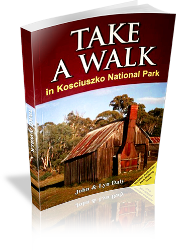
Take A Walk in Kosciuszko National Park

Take A Walk in Kosciuszko National Park

9780957793187

Title: Take A Walk in Kosciuszko National Park
Author: John Daly,Lyn Daly
Edition: 1
Publisher: Take a Walk Publications
ISBN: 9780957793187
Number of pages: 255
Year of Publication: 2010
Cover Price (au$): 34.95
Format: Paperback
Websitehttp://www.takeawalk.com.au/
Weight (grams): 340
Regions the book covers: kosciuszko national park
Height (cm): 21


Subjects
Hiking - New South Wales - Kosciuszko National Park - Guidebooks. | National parks and reserves - New South Wales - Kosciuszko National Park - Guidebooks. | Kosciuszko National Park (N.S.W.) - Guidebooks.
Niche: kosciuszko
Grade system explained: Yes
Ascent and/or Decent provided: No
Driving directions provided: Yes
Date walks last reviewed provided: No
A summary of walks provided: Yes
Regional Map of walks provided: Yes
Maps designed for walking: Yes - reasonable detail
Type of maps used (for walking): Sketch
Colour used in walking maps: Multicolour
Size of walking maps: 1/4 page
Walking map Comment: varey in sizes
Colour depth of photos: Colour
Comment on Photographs: small to medium colour photo's every second page
Level of detail in tracknotes: General route description
Alternate route and side trip suggestions: Some walks


List of walks in book

Walk Name Length Time Grade Page
Bulllocks Track 4.6 km 1 hr 30 mins easy 42
Mount Kosciuszko 12.4 km 4 hrs mod 42
Rams head, Rawson Pass Circuit 11.5 km 5 hrs mod 44
Dead Horse Gap and Thredbo River Tracks 9.1 km 2 hrs 30 mins mod 46
Merritts Nature Track 3.8 km 1 hr 30 mins mod 47
Southern Main Range Circuit 50.9 km 4 Days hard 48
The Chimneys 16.1 km 5 hrs mod 53
Waterfall Walk 5.5 km 1 hr 30 mins mod 55
Pallaibo and Sawpit Tracks 11.2 km 3 hrs easy 56
Rennix Walk 11.0 km 3 hrs 30 mins easy 57
Raindbow Lake 3.0 km 1 Hr easy 58
Porcupine Rocks 5.4 km 2 hrs easy 60
Blue Lake 10.0 km 3 hrs mod 61
Blue Lake, Club Lake Circuit 13.1 km 4 hrs 30 mins mod 63
Mount Stilwell 3.6 km 1 hr 30 mins easy 64
Charlotte Pass, Main Range, Rolling Ground, Munyang 29.7 km 2 Days hard 65
Whites River Hut, Rolling Ground, Dicky Cooper Bogong 26.3 km 2 Days hard 70
Brassy Mountains, Mawsons Hut, Kerries Ridge Circuit 40.6 km 3 Days hard 73
Guthega, Mount Tate, Tate East Ridge Circuit 12.9 km 5 hrs mod 76
The Pilot 43.0 km 3 Days mod 79
Kiandra Heritage Trail 1.2 km 30 mins easy 84
Elaine Mine 16.2 km 5 hrs mod 86
Cabramurra Pleteau 6.3 km 2 hrs easy 87
Goldseekers Track 3.0 km 1 Hr easy 88
Black Jack and Manjar 19.8 km 6 hrs mod 90
Jagungal Wilderness 66.8 km 4 Days hard 92
Southern Cloud Crash Site 15.2 km 5 hrs mod 99
Snakey Plain and Wheelers Hut 16.4 km 5 hrs mod 100
Kiandra Plain 7.0 km 2 hrs 30 mins mod 102
Gooandra Homestead 10.0 km 3 hrs easy 103
Blue Creek Coppermine 21.5 km 8 hrs mod 105
Old Currango 9.2 km 3 hrs easy 120
Leura Gap 27.0 km 9 hrs hard 121
Bimberi Peak 21.2 km 8 hrs hard 122
Blue Waterholes to Clarkes Gorge 5.0 km 1 hr 30 mins easy 126
Nichols Gorge Circuit 6.7 km 2 hrs mod 127
Glory Hole and River Walk 3.3 km 1 hr 30 mins easy 131
Bluff Lookout Circuit 2.3 km 1 Hr Easy 132
Castle Cave 2.6 km 1 Hr easy 133
Jounama Homestead Ruins 15.7 km 5 hrs easy 135
Talbingo Reservoir Viewpoint 12.6 km 4 hrs 30 mins mod 137
Warogong Sugarloaf 10.4 km 4 hrs 30 mins mod 140
Blowering Cliffs 4.8 km 1 hr 30 mins mod 141
Blowering Basin 3.4 km 1 hr 30 mins easy 143
Buddong Falls 2.4 km 1 Hr mod 144
Jounama Creek 6 km 2 hrs easy 145
Old Mountain Road Walk 8.2 km 3 hrs mod 146
Landers Falls Lookout and Big Talbingo 20.8 km 7 hrs mod 147
Bogong Wilderness 41.4 km 2 Days mod 148
Vickerys Hut 5.2 km 2 hrs mod 152
The Hole 13.0 km 5 hrs mod 153
Walhalla to Mount Hotham 235.2 km 17 Days hard 162
Mount Hotham to Thredbo 213.5 km 15 Days hard 189
Thredbo to Namadgi Visitor Centre 223.1 km 11 Days hard 217

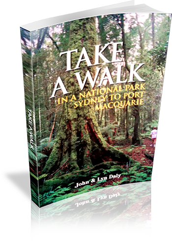
Take a walk in a national park – Sydney to Port Macquarie

Take a walk in a national park - Sydney to Port Macquarie

0957793111

Title: Take a walk in a national park - Sydney to Port Macquarie
Author: John Daly, Lyn Daly
Edition: 1
Publisher: Take A Walk Publications
ISBN: 0957793111
Number of pages: 224
Year of Publication: 2000
Cover Price (au$): 21.95
Format: Paperback
Websitehttp://www.takeawalk.com.au/
Weight (grams): 390
Regions the book covers: Between Sydney City and Port Macquarie NSW (mostly near the coast)
Height (cm): 21


Subjects
Hiking - New South Wales - Guidebooks,National parks and reserves - New South Wales - Guidebooks
Interpretive Information: Plenty
Grade system explained: No
Ascent and/or Decent provided: No
Driving directions provided: Yes
Date walks last reviewed provided: No
A summary of walks provided: Yes
Regional Map of walks provided: Yes
Maps designed for walking: No - no maps intended for use when walking
Colour depth of photos: Colour
Comment on Photographs: Colour plat of 16 photo's provided at the centre of the book. No other photos provided
Level of detail in tracknotes: Detailed route information
Alternate route and side trip suggestions: Some walks


List of walks in book

Walk Name Length Time Grade Page
Clifton Gardens, Chowder Bay, Taylors Bay, Bradleys Head 6.8 km 3 hrs Easy 32
Dobroyd Head Circuit 3 km 1 hr 30 mins Easy 34
Grotto Point 2.6 km 2 hrs Easy 35
Fairfax Walking Track 1 km 30 mins Easy 36
Hermitage Foreshore Track 2.8 km 1 hr 30 mins Easy 37
Coastal Cliff Walk, Camp Cove, Lady Bay, South Head 7.5 km 3 hrs Easy 38
Goat Island 2 km 2 hrs Easy 39
Fiddens Wharf Walking Track 3.5 km 2 hrs 30 mins Easy 43
DeBurghs Bridge Circuit 10 km 5 hrs Moderate 44
Long Neck Lagoon 5 km 2 hrs Easy 48
Mitchell Park Circuit 4 km 2 hrs Easy 52
Convict Lagoon 3.5 km 1 hr 30 mins Easy 53
Hawkesbury River Lookout 800 m 30 mins Easy 53
Flat Rock, Bantry Bay, Bates Creek Circuit 8.5 km 3 hrs Easy 57
Lyrebird, Carroll Creek, Casuarina Tracks Circuit 8.8 km 3 hrs Moderate 58
Two Creeks Track 10.5 km 3 hrs 30 mins Easy 59
The Cascades, Frenchs Creek and Bare Creek 13.5 km 4 hrs 30 mins Easy 60
Centre Track, McCarrs Creek Circuit 9.5 km 4 hrs Easy 66
Elvina Track 5 km 2 hrs Easy 67
Elvina Track, Lovett Bay, Towlers Bay Circuit 11.5 km 5 hrs Moderate 68
Challenger Track 3 km 1 hr 30 mins Easy 69
Basin Track, Mackerel Track Circuit 7.2 km 3 hrs Easy 69
Flint and Steel Beach 4.5 km 2 hrs 30 mins Moderate 70
Koolewong Trail 800 m 30 mins Easy 71
Red Hands Cave, Resolute Beach, West Head Beach Circuit 5.5 km 3 hrs Easy 71
Perimeter Track to Smiths Creek 11 km 4 hrs Moderate 73
Murrua Track, Bobbin Head, Gibberagong Circuit 11.5 km 5 hrs Moderate 74
The Sphinx, Warrimoo, Bobbin Head Circuit 10.5 km 3 hrs 30 mins Easy 75
Apple Tree Bay, Cockle Creek Lookout Circuit 3.5 km 1 hr 30 mins Easy 77
Mt Ku-ring-gai Track, Apple Tree Bay, Waratah Bay, Berowra 12 km 5 hrs Moderate 77
Cowan, Jerusalem Bay, Campbells Crater, Brooklyn 12 km 6 hrs Moderate 78
Central Popran Wildflower Walk 5 km 2 hrs Easy 83
Popran Creek Track 4.5 km 2 hrs Moderate 84
Mt Olive and Mailmans Track to Glenworth Valley 8 km 3 hrs Moderate 84
248 Track, Emerald Pool Circuit 8.5 km 3 hrs Moderate 85
Grass Tree Circuit 1.4 km 1 Hr Easy 86
11km Walking Track 11 km 5 hrs Moderate 89
Ten Mile Hollow, Simpsons Track, Mangrove Creek,Clares Bridge 48 km 2 Days Moderate 90
Finchs Line, Devines Hill Circuit 9.5 km 3 hrs Easy 92
Coba Ridge Trail to Coba Point 18 km 6 hrs Moderate 96
Marramarra Ridge, Smugglers Ridge Circuit 17 km 5 hrs Moderate 97
Canoelands Ridge to Gentlemans Halt 20 km 8 hrs Hard 98
Girrakool Aboriginal Art Site 1.5 km 30 mins Easy 103
Piles Creek Loop Track 6.0 km 3 hrs Moderate 104
Girrakool to Somersby Falls 14.7 km 5 hrs 30 mins Moderate 104
Girrakool Loop Track 1 km 30 mins Easy 106
Somersby Falls 1 km 30 mins Easy 107
Mooney Mooney Creek Circuit 12 km 5 hrs Moderate 107
Robinson Road to Somersby Falls 14 km 5 hrs Moderate 108
Bulgandry Aboriginal Site 1 km 1 Hr Easy 110
Bulgandry, Rat Creek, Camp Kariong Circuit 8.5 km 3 hrs Easy 110
Staples Lookout to Girrakool 15 km 6 hrs Easy 111
Rocky Ponds Trail 15 km 4 hrs 30 mins Moderate 113
Wondabyne to Pindar Cave 12 km 4 hrs Moderate 114
Umina, Pearl Beach, Mt Ettalong Circuit 9 km 4 hrs Moderate 116
Patonga to Staples Lookout 15.5 km 6 hrs Moderate 117
Patonga to Pearl Beach 8 km 4 hrs Easy 119
Patonga Creek Wetlands 1.5 km 2 hrs Easy 119
Koolewong Ridge 11 km 4 hrs 30 mins Moderate 120
Daleys Ridge Aboriginal Site 5 km 2 hrs Easy 125
Putty Beach, Gerrin Point, Maitland Bay, Bouddi Spur,Maitland Bay Information Centre Circuit 14.3 km 6 hrs Moderate 126
Tallow Beach, Little Tallow Beach, Box Head Circuit 5 km 2 hrs Easy 128
Bouddi Ridge, Lobster Beach and Wagstaff Point 7 km 2 hrs 30 mins Easy 129
Bullimah Lookout 2 km 1 Hr Easy 130
Little Beach, The Bouddi Trail, Bombi Moor,Bouddi Spur Circuit 10.7 km 4 hrs Easy 131
Coast Walking Track 9.5 km 3 hrs Moderate 135
Lillypilly Trail and Red Gum Forest Circuit 7.3 km 2 hrs 30 mins Easy 136
Abbotts Falls Circuit 8 km 4 hrs Moderate 142
The Pines and Wildflower Trails 2 km 1 Hr Easy 143
Boarding House Dam 650 m 30 mins Easy 143
Monkey Face Lookout 1.2 km 30 mins Easy 144
Gap Creek Falls 1.5 km 1 hr 30 mins Moderate 144
Morna Point 5.5 km 2 hrs 30 mins Easy 148
Tomaree Head 2.4 km 1 hr 30 mins Moderate 149
Boulder Bay to Fingal Head 5.5 km 2 hrs 30 mins Easy 150
Boulder Bay to Samurai Beach 12 km 5 hrs Moderate 151
The Spit 2.4 km 1 Hr Moderate 153
Stephens Peak 1.8 km 1 hr 30 mins Moderate 154
Yacaaba Headland 6.5 km 3 hrs Moderate 157
Pipers Creek to Robinsons Crossing 8 km 3 hrs Easy 159
Robinsons Crossing to Dark Point 9 km 4 hrs Moderate 159
Wildflower Walk 8 km 4 hrs Easy 160
Mungo Brush, Brambles Green, Tamboy 15 km 5 hrs Moderate 161
Mungo Brush Rainforest Walk 2.5 km 1 Hr Easy 162
Johnsons Hill 8 km 3 hrs Easy 162
Tickerabit 16 km 5 hrs Easy 164
Shelley Beach 22 km 7 hrs Moderate 164
River Mouth Fire Trail 9 km 3 hrs Easy 165
Violet Hill 1.5 km 1 Hr Easy 166
River Walk 3.6 km 1 hr 30 mins Easy 170
Cabbage Tree Palm Circuit 1.7 km 1 Hr Easy 170
Shelly Beach 1 km 30 mins Easy 175
Booti Hill, Elizabeth Beach, Wallis Lake Circuit 6 km 2 hrs 30 mins Moderate 175
McBrides Beach 2.4 km 1 Hr Moderate 176
Cape Hawke 900 m 30 mins Moderate 177
Rocky Crossing 16 km 5 hrs Moderate 182
Lagoon Pinch to Careys Peak 24 km 10 hrs Hard 184
Lagoon Pinch, Careys Peak, Edwards Swamp, Junction Pools, Black Swamp, Big Hole 37 km 2 Days Moderate 186
Burraga Swamp 2 km 1 Hr Easy 188
Sharpes Creek Circuit 4.5 km 2 hrs Moderate 189
Antarctic Beach Forest Walk 3 km 1 hr 30 mins Easy 190
River Walk 2.1 km 1 Hr Easy 191
Gloucester Falls Walk 2 km 1 Hr Easy 191
The Link Trail Gloucester Tops to Careys Peak 44 km 2 Days Moderate 192
Devils Hole Lookout Circuit 4.5 km 2 hrs Moderate 197
Middle Brother Trail 19.5 km 8 hrs Moderate 197
Rainforest Loop 500 m 15 mins Easy 201
Laurieton Track to North Brother Mountain 5 km 3 hrs Hard 201
Humbug Point 8.5 km 3 hrs 30 mins Easy 206
Fishermans Track 2 km 1 Hr Moderate 206
Diamond Head Circuit 5.2 km 2 hrs Moderate 208
Kylies Beach to Crowdy Head 22 km 8 hrs Moderate 209
Bago Bluff Circuit 17 km 7 hrs Hard 212
Herons Creek, Bago Bluff Circuit 7.5 km 2 hrs 30 mins Moderate 213

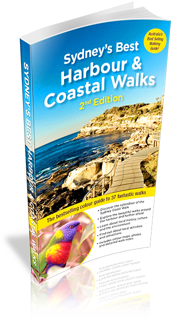
Sydney’s Best Harbour & Coastal Walks

Sydney's Best Harbour & Coastal Walks

9781921606274

Title: Sydney's Best Harbour & Coastal Walks
Author: Katrina O'Brien
Edition: 2
Publisher: Woodslane Press
ISBN: 9781921606274
Number of pages: 176
Year of Publication: 2006
Cover Price (au$): 29.95
Format: Paperback
Websitehttp://www.woodslane.com.au/
Weight (grams): 315
Regions the book covers: Sydney Inner Harbour and Coast
Height (cm): 22


Subjects
Trails - New South Wales - Sydney Region - Guidebooks,Coasts - New South Wales - Sydney Region - Guidebooks,Sydney Harbour (N.S.W.) - Description and travel,Sydney Region (N.S.W.) - Guidebooks


Authors Comments
Sydney has some outstanding walks right in the heart of the city. Most Sydneysiders know of the well-trodden Bondi-to-Coogee and Spit-to-Manly walks but Sydney's Best Harbour and Coastal Walks details thirty seven waterside walks from Brisbane Water National Park in the north to the Royal National Park in the south. Everyone in the community is aware of the need for daily activity to keep healthy and walking is increasingly popular with people who would not call themselves bushwalkers. In Sydney's Best Harbour and Coastal Walks, Katrina O'Brien, travel guide author and local resident, combined her walking experience and passion for Sydney's undeveloped places to produce a bestselling user-friendly guide to the city's best quiet and wild walks as well as the classic walks. In this 2nd edition the walks have all been re-walked and updated, and the book has been arranged to better follow Sydney's Great Coastal Walk - a route now being actively promoted by various Sydney tourism bodies and councils. The book fully covers the entire route from Palm Beach to La Perouse, and also includes dozens of walks around the harbour and further afield, including the Royal National Park, Ku-ring-gai and a new walk from Patonga to Pearl Beach in Brisbane Water National Park. The text is complemented by more than 150 full-colour photographs and detailed full-colour maps.
Niche: Waterside walks in Sydney
Interpretive Information: Plenty
Grade system explained: Yes
Ascent and/or Decent provided: No
Driving directions provided: No
Date walks last reviewed provided: No
A summary of walks provided: Yes
Regional Map of walks provided: Yes
Maps designed for walking: Yes - reasonable detail
Type of maps used (for walking): Sketch
Colour used in walking maps: Multicolour
Size of walking maps: Half page
Walking map Comment: Road atlas-style maps for every walk
Colour depth of photos: Colour
Comment on Photographs: Many colourful pictures, giving a good sense of the regions
Level of detail in tracknotes: Detailed route information
Alternate route and side trip suggestions: Many walks


List of walks in book

Walk Name Length Time Grade Page
Patonga to Pearl Beach 6 km 2 hrs 30 mins Medium 14
West Head to Resolute Beach 3 km 1 Hr Easy 18
Elvina Bay 6 km 2 hrs 30 mins Medium 22
Barrenjoey Head 3.5 km 1 hr 30 mins Medium 28
Palm Beach to Avalon 7 km 3 hrs Medium 32
Avalon to Narrabeen 11 km 4 hrs Medium 36
Collaroy to Manly 11.5 km 4 hrs Medium 41
Manly to North Head 9 km 3 hrs 30 mins Medium 45
Spit Bridge to Manly 10 km 3 hrs 30 mins Medium 53
Harold Reid Reserve 5 km 2 hrs Easy 60
Two Creeks Track 6 km 2 hrs 30 mins Medium 63
Flat Rock and Magazine Tracks 9.5 km 3 hrs 30 mins Medium 66
Bantry Bay 7 km 3 hrs Medium 69
Cremorne Point 3 km 1 Hr Easy 74
Mosman to Taronga Zoo 2 km 1 Hr Easy 77
Taronga Zoo to Balmoral 6.5 km 3 hrs Medium 80
Circular Quay to Lavender Bay 4 km 1 hr 30 mins Easy 84
McMahons Point to Waverton 3 km 1 Hr Easy 87
Balls Head and Berry Island 7 km 2 hrs 30 mins Easy 90
Circular Quay to Botanic Gardens 5 km 2 hrs Easy 96
Circular Quay to Darling Harbour & Pyrmont 6 km 2 hrs Easy 102
Anzac Bridge, Rozelle & Blackwattle Bays 5 km 2 hrs Easy 110
Balmain to Birchgrove 8 km 3 hrs Easy 118
The Iron Cove Bay Run 7 km 2 hrs Easy 118
Hen & Chicken Bay 9 km 3 hrs Easy 121
Hunters Hill and Wollwich 5 km 2 hrs Easy 125
Greenwich 2.5 km 1 Hr Easy 129
Double Bay to Rose Bay 4 km 1 hr 30 mins Easy 134
Hermitage Foreshore to Vaulcluse 5 km 2 hrs Medium 138
Watsons Bay to South Head 2.45 km 1 Hr Easy 142
The Gap to Dover Heights 5 km 2 hrs Easy 146
Bondi to Coogee 6 km 2 hrs 30 mins Easy 154
Coogee to Maroubra 5 km 2 hrs Easy 158
Maroubra to La Perouse 10.5 km 4 hrs Medium 162
Cape Baily, Botany Bay 8 km 3 hrs Medium 170
Bundeena to Jibbon Head 5 km 2 hrs Medium 174
Bundeena to Marley Beach 10 km 3 hrs 30 mins Medium 178

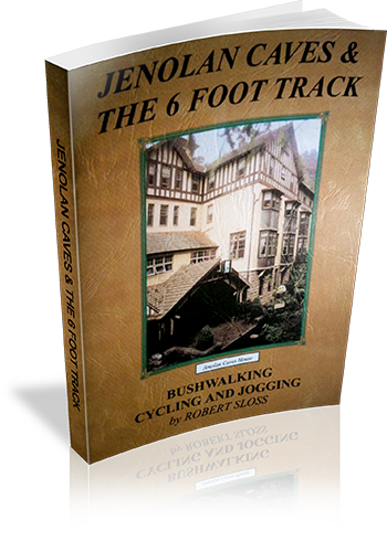
Jenolan Caves & The 6 Foot Track

Jenolan Caves & The 6 Foot Track

0958651280

Title: Jenolan Caves & The 6 Foot Track
Author: Robert Sloss
Edition: 1
Publisher: Robert Sloss
ISBN: 0958651280
Number of pages: 26
Year of Publication: 2000
Cover Price (au$): 11.90
Format: Paperback
Websitehttp://www.robertsloss.com.au/Guide%20Index.htm
Weight (grams): 55
Regions the book covers: Jenolan Caves, Six Foot Track
Height (cm): 21


Subjects
Hiking -- New South Wales -- Jenolan Caves -- Guidebooks,Hiking -- New South Wales -- Blue Mountains -- Guidebooks,Jenolan Caves (N.S.W.) -- Guidebooks,Blue Mountains (N.S.W.) -- Guidebooks
Interpretive Information: Some
Grade system explained: Yes
Ascent and/or Decent provided: No
Driving directions provided: No
Date walks last reviewed provided: No
Regional Map of walks provided: Yes
Maps designed for walking: Yes - limited detail
Type of maps used (for walking): Sketch
Colour used in walking maps: Simple colour
Size of walking maps: Full page
Colour depth of photos: Colour
Comment on Photographs: Small photograph on most pages, giving a sense of the region
Level of detail in tracknotes: Detailed route information
Alternate route and side trip suggestions: Many walks


List of walks in book

Walk Name Length Time Grade Page
Carlotta Arch Circuit 1.3 km 45 mins 6
Blue Lake Circuit 1 km 30 mins 6
The Hydro Track 2.8 km 1 Hr 7
Lucas Rocks Circuit 1.9 km 1 Hr 7
Devils Lookdown Circuit 2.85 km 1 hr 30 mins 7
McKeowns Valley - Rose Cottage Track 9.2 km 3 hrs 8
The Binda Ridge Circuit 11.6 km 4 hrs 11
Ginkin Lookout Track 4 km 30 mins 12
Banshee Rocks Circuit 6.1 km 3 hrs 12
Bulls Creek Circuit 13.5 km 6 hrs 13
The 6 Foot Track 44 km 3 Days 15
Jenolan Caves to Black Range 8.2 km 16
Clack Range to Alum Creek 13.1 km 16
Alum Creek to Coxs River 5.5 km 18
Coxs River to Megalong Road 7 km 20
Megalong Road to Katoomba 10.2 km 20
The Great Diving Range Circuit 6.5 km 3 hrs 26
Boggy Creek Circuit 11 km 3 hrs 26

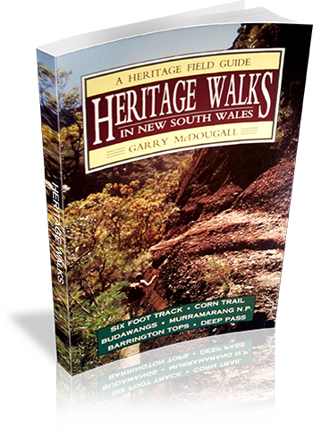
Heritage Walks In New South Wales

Heritage Walks In New South Wales

0864173830

Title: Heritage Walks In New South Wales
Author: Garry McDougall
Edition: 1
Publisher: Kangaroo Press
ISBN: 0864173830
Number of pages: 128
Year of Publication: 1992
Cover Price (au$): 14.95
Format: Paperback
Websitehttp://www.members.optusnet.com.au/utravel/
Weight (grams): 140
Regions the book covers: NSW
Height (cm): 19


Subjects
Nature trails - New South Wales - Guidebooks,Historic sites - New South Wales - Guidebooks,Hiking - New South Wales - Guidebooks,Walking - New South Wales - Guidebooks


Overview of Book
A guide to seven historic walking regions in NSW. Much information is shared regarding human and environmental heritage in each region, and many walks are described in varying levels of detail - some giving just a sense of the walk, others describing the author's experiences, uncluding navigational and interpretive information.
Niche: Walks linked with human or environmental heritage.
Interpretive Information: Plenty
Grade system explained: No
Ascent and/or Decent provided: No
Driving directions provided: Yes
Date walks last reviewed provided: No
A summary of walks provided: No
Regional Map of walks provided: Yes
Maps designed for walking: Yes - limited detail
Type of maps used (for walking): Sketch
Colour used in walking maps: Black and White
Size of walking maps: 3/4 page
Walking map Comment: Maps provided for each region, however additional maps would be required for most walks, as stated by the author.
Colour depth of photos: None
Level of detail in tracknotes: General route description


List of walks in book

Walk Name Length Time Grade Page
Gillwinga Track 12
Katoomba to Jenolan Caves (Six Foot Track) 15
Megalong Valley to Coxes River 15
Nellies Glen 15
Jenolan State Forest to Katoomba 15
Kiaora Hill 15
The Corn Trail 31
The Buckenbowra River 31
Murramarang Point 2 hrs 46
Pretty Beach and Snapper Point 1 Hr 46
Pretty Beach to Durras Mtn 4 hrs 47
Durras Mountain, Clear Point to Pretty Beach 4 hrs 49
Pebbly Beach 1 Hr 50
Pebbly to Clear Point 2 hrs 50
Pebbly to Depot Beach 1 Hr 52
Depot Beach to Nth Durras 1 hr 30 mins 52
Durras Lake Inlet Walk 3 hrs 52
Durras Lake Forestry Walk 3 hrs 52
North to South Durras 53
North Head 2 hrs 54
Richmond Beach to North Head 4 hrs 57
South Durras to Richmond Beach 3 hrs 58
A Murramarang Trek 3 Days 59
Newhaven Gap to Yadboro River 61
Hidden Valley 61
Yadboro to Monolith Valley 61
Yadboro to The Castle/Cooyoyo 61
Wow Wog to Monolith Valley via Corang Peak 61
The Rocky Crossing Walk 84
Jerusalem Creek Walking Trail 2 km 89
Jerusalem Creek Forest Park - Scenic Falls 89
Telegherry Forest Walk 89
Dundungra Falls Walk and Chichester Arboretum 89
Frying Pan Creek Forest Walk 89
Antarctic Beech Forest 89
Burraga Swamp 89
Cabre Bald 89
Careys Peak via the Corker 90
Gloucester Falls Walk 2 km 94
Laurie Lookout 95
The Falls Lookout 95
The Beech Forest Walk 8 km 96
The Gloucester Tops Circuit Walk 96
The Link Track 96
Gloucester River Waterlife 98
Sharpes Creek Walk 100
Gloucester Upriver Walk and Trek 2 Days 101
A little Day Stroll (Gloucester River Campsite) 102
A little Night Stroll (Gloucester River Campsite) 102
Beean Beean Plain to Big Hole 1 hr 30 mins 108
Big Hole to Careys Peak 1 Hr 109
Junction Pool to Careys Peak 2 hrs 109
Careys Peak to Junction Pools 3 hrs 110
Junction Pools to Beean Beean Plain 2 hrs 111
Wombat Creek 30 mins 111
Selby Hut 1 Hr 111
Polblue to Little Murrays 1 hr 30 mins 113
To Beean Beean Plain 500 m 113
Polnlue to Gloucester Tops 70 km 114
Barrington House to Barrington Tops 4 Days 114
Polblue to Dungog via Chichester State Forest and The Mountaineer 114
Local tracks in Deep Pass 117