Take A Walk in Kosciuszko National Park
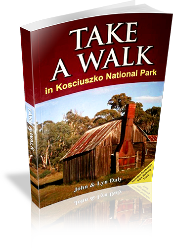
Title: Take A Walk in Kosciuszko National Park
Author: John Daly,Lyn Daly
Edition: 1
Publisher: Take a Walk Publications
ISBN: 9780957793187
Number of pages: 255
Year of Publication: 2010
Cover Price (au$): 34.95
Format: Paperback
Website: http://www.takeawalk.com.au/
Weight (grams): 340
Regions the book covers: kosciuszko national park
Height (cm): 21
Subjects:
Hiking - New South Wales - Kosciuszko National Park - Guidebooks. | National parks and reserves - New South Wales - Kosciuszko National Park - Guidebooks. | Kosciuszko National Park (N.S.W.) - Guidebooks.
Niche: kosciuszko
Grade system explained: Yes
Ascent and/or Decent provided: No
Driving directions provided: Yes
Date walks last reviewed provided: No
A summary of walks provided: Yes
Regional Map of walks provided: Yes
Maps designed for walking: Yes - reasonable detail
Type of maps used (for walking): Sketch
Colour used in walking maps: Multicolour
Size of walking maps: 1/4 page
Walking map Comment: varey in sizes
Colour depth of photos: Colour
Comment on Photographs: small to medium colour photo's every second page
Level of detail in tracknotes: General route description
Alternate route and side trip suggestions: Some walks
List of walks in book
Walk Name | Length | Time | Grade | Page |
---|---|---|---|---|
Bulllocks Track | 4.6 km | 1 hr 30 mins | easy | 42 |
Mount Kosciuszko | 12.4 km | 4 hrs | mod | 42 |
Rams head, Rawson Pass Circuit | 11.5 km | 5 hrs | mod | 44 |
Dead Horse Gap and Thredbo River Tracks | 9.1 km | 2 hrs 30 mins | mod | 46 |
Merritts Nature Track | 3.8 km | 1 hr 30 mins | mod | 47 |
Southern Main Range Circuit | 50.9 km | 4 Days | hard | 48 |
The Chimneys | 16.1 km | 5 hrs | mod | 53 |
Waterfall Walk | 5.5 km | 1 hr 30 mins | mod | 55 |
Pallaibo and Sawpit Tracks | 11.2 km | 3 hrs | easy | 56 |
Rennix Walk | 11.0 km | 3 hrs 30 mins | easy | 57 |
Raindbow Lake | 3.0 km | 1 Hr | easy | 58 |
Porcupine Rocks | 5.4 km | 2 hrs | easy | 60 |
Blue Lake | 10.0 km | 3 hrs | mod | 61 |
Blue Lake, Club Lake Circuit | 13.1 km | 4 hrs 30 mins | mod | 63 |
Mount Stilwell | 3.6 km | 1 hr 30 mins | easy | 64 |
Charlotte Pass, Main Range, Rolling Ground, Munyang | 29.7 km | 2 Days | hard | 65 |
Whites River Hut, Rolling Ground, Dicky Cooper Bogong | 26.3 km | 2 Days | hard | 70 |
Brassy Mountains, Mawsons Hut, Kerries Ridge Circuit | 40.6 km | 3 Days | hard | 73 |
Guthega, Mount Tate, Tate East Ridge Circuit | 12.9 km | 5 hrs | mod | 76 |
The Pilot | 43.0 km | 3 Days | mod | 79 |
Kiandra Heritage Trail | 1.2 km | 30 mins | easy | 84 |
Elaine Mine | 16.2 km | 5 hrs | mod | 86 |
Cabramurra Pleteau | 6.3 km | 2 hrs | easy | 87 |
Goldseekers Track | 3.0 km | 1 Hr | easy | 88 |
Black Jack and Manjar | 19.8 km | 6 hrs | mod | 90 |
Jagungal Wilderness | 66.8 km | 4 Days | hard | 92 |
Southern Cloud Crash Site | 15.2 km | 5 hrs | mod | 99 |
Snakey Plain and Wheelers Hut | 16.4 km | 5 hrs | mod | 100 |
Kiandra Plain | 7.0 km | 2 hrs 30 mins | mod | 102 |
Gooandra Homestead | 10.0 km | 3 hrs | easy | 103 |
Blue Creek Coppermine | 21.5 km | 8 hrs | mod | 105 |
Old Currango | 9.2 km | 3 hrs | easy | 120 |
Leura Gap | 27.0 km | 9 hrs | hard | 121 |
Bimberi Peak | 21.2 km | 8 hrs | hard | 122 |
Blue Waterholes to Clarkes Gorge | 5.0 km | 1 hr 30 mins | easy | 126 |
Nichols Gorge Circuit | 6.7 km | 2 hrs | mod | 127 |
Glory Hole and River Walk | 3.3 km | 1 hr 30 mins | easy | 131 |
Bluff Lookout Circuit | 2.3 km | 1 Hr | Easy | 132 |
Castle Cave | 2.6 km | 1 Hr | easy | 133 |
Jounama Homestead Ruins | 15.7 km | 5 hrs | easy | 135 |
Talbingo Reservoir Viewpoint | 12.6 km | 4 hrs 30 mins | mod | 137 |
Warogong Sugarloaf | 10.4 km | 4 hrs 30 mins | mod | 140 |
Blowering Cliffs | 4.8 km | 1 hr 30 mins | mod | 141 |
Blowering Basin | 3.4 km | 1 hr 30 mins | easy | 143 |
Buddong Falls | 2.4 km | 1 Hr | mod | 144 |
Jounama Creek | 6 km | 2 hrs | easy | 145 |
Old Mountain Road Walk | 8.2 km | 3 hrs | mod | 146 |
Landers Falls Lookout and Big Talbingo | 20.8 km | 7 hrs | mod | 147 |
Bogong Wilderness | 41.4 km | 2 Days | mod | 148 |
Vickerys Hut | 5.2 km | 2 hrs | mod | 152 |
The Hole | 13.0 km | 5 hrs | mod | 153 |
Walhalla to Mount Hotham | 235.2 km | 17 Days | hard | 162 |
Mount Hotham to Thredbo | 213.5 km | 15 Days | hard | 189 |
Thredbo to Namadgi Visitor Centre | 223.1 km | 11 Days | hard | 217 |
Take a walk in a national park – Sydney to Port Macquarie
Take a walk in a national park - Sydney to Port Macquarie
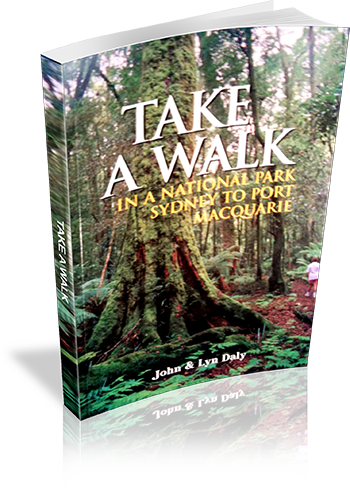
Title: Take a walk in a national park - Sydney to Port Macquarie
Author: John Daly, Lyn Daly
Edition: 1
Publisher: Take A Walk Publications
ISBN: 0957793111
Number of pages: 224
Year of Publication: 2000
Cover Price (au$): 21.95
Format: Paperback
Website: http://www.takeawalk.com.au/
Weight (grams): 390
Regions the book covers: Between Sydney City and Port Macquarie NSW (mostly near the coast)
Height (cm): 21
Subjects:
Hiking - New South Wales - Guidebooks,National parks and reserves - New South Wales - Guidebooks
Interpretive Information: Plenty
Grade system explained: No
Ascent and/or Decent provided: No
Driving directions provided: Yes
Date walks last reviewed provided: No
A summary of walks provided: Yes
Regional Map of walks provided: Yes
Maps designed for walking: No - no maps intended for use when walking
Colour depth of photos: Colour
Comment on Photographs: Colour plat of 16 photo's provided at the centre of the book. No other photos provided
Level of detail in tracknotes: Detailed route information
Alternate route and side trip suggestions: Some walks
List of walks in book
Walk Name | Length | Time | Grade | Page |
---|---|---|---|---|
Clifton Gardens, Chowder Bay, Taylors Bay, Bradleys Head | 6.8 km | 3 hrs | Easy | 32 |
Dobroyd Head Circuit | 3 km | 1 hr 30 mins | Easy | 34 |
Grotto Point | 2.6 km | 2 hrs | Easy | 35 |
Fairfax Walking Track | 1 km | 30 mins | Easy | 36 |
Hermitage Foreshore Track | 2.8 km | 1 hr 30 mins | Easy | 37 |
Coastal Cliff Walk, Camp Cove, Lady Bay, South Head | 7.5 km | 3 hrs | Easy | 38 |
Goat Island | 2 km | 2 hrs | Easy | 39 |
Fiddens Wharf Walking Track | 3.5 km | 2 hrs 30 mins | Easy | 43 |
DeBurghs Bridge Circuit | 10 km | 5 hrs | Moderate | 44 |
Long Neck Lagoon | 5 km | 2 hrs | Easy | 48 |
Mitchell Park Circuit | 4 km | 2 hrs | Easy | 52 |
Convict Lagoon | 3.5 km | 1 hr 30 mins | Easy | 53 |
Hawkesbury River Lookout | 800 m | 30 mins | Easy | 53 |
Flat Rock, Bantry Bay, Bates Creek Circuit | 8.5 km | 3 hrs | Easy | 57 |
Lyrebird, Carroll Creek, Casuarina Tracks Circuit | 8.8 km | 3 hrs | Moderate | 58 |
Two Creeks Track | 10.5 km | 3 hrs 30 mins | Easy | 59 |
The Cascades, Frenchs Creek and Bare Creek | 13.5 km | 4 hrs 30 mins | Easy | 60 |
Centre Track, McCarrs Creek Circuit | 9.5 km | 4 hrs | Easy | 66 |
Elvina Track | 5 km | 2 hrs | Easy | 67 |
Elvina Track, Lovett Bay, Towlers Bay Circuit | 11.5 km | 5 hrs | Moderate | 68 |
Challenger Track | 3 km | 1 hr 30 mins | Easy | 69 |
Basin Track, Mackerel Track Circuit | 7.2 km | 3 hrs | Easy | 69 |
Flint and Steel Beach | 4.5 km | 2 hrs 30 mins | Moderate | 70 |
Koolewong Trail | 800 m | 30 mins | Easy | 71 |
Red Hands Cave, Resolute Beach, West Head Beach Circuit | 5.5 km | 3 hrs | Easy | 71 |
Perimeter Track to Smiths Creek | 11 km | 4 hrs | Moderate | 73 |
Murrua Track, Bobbin Head, Gibberagong Circuit | 11.5 km | 5 hrs | Moderate | 74 |
The Sphinx, Warrimoo, Bobbin Head Circuit | 10.5 km | 3 hrs 30 mins | Easy | 75 |
Apple Tree Bay, Cockle Creek Lookout Circuit | 3.5 km | 1 hr 30 mins | Easy | 77 |
Mt Ku-ring-gai Track, Apple Tree Bay, Waratah Bay, Berowra | 12 km | 5 hrs | Moderate | 77 |
Cowan, Jerusalem Bay, Campbells Crater, Brooklyn | 12 km | 6 hrs | Moderate | 78 |
Central Popran Wildflower Walk | 5 km | 2 hrs | Easy | 83 |
Popran Creek Track | 4.5 km | 2 hrs | Moderate | 84 |
Mt Olive and Mailmans Track to Glenworth Valley | 8 km | 3 hrs | Moderate | 84 |
248 Track, Emerald Pool Circuit | 8.5 km | 3 hrs | Moderate | 85 |
Grass Tree Circuit | 1.4 km | 1 Hr | Easy | 86 |
11km Walking Track | 11 km | 5 hrs | Moderate | 89 |
Ten Mile Hollow, Simpsons Track, Mangrove Creek,Clares Bridge | 48 km | 2 Days | Moderate | 90 |
Finchs Line, Devines Hill Circuit | 9.5 km | 3 hrs | Easy | 92 |
Coba Ridge Trail to Coba Point | 18 km | 6 hrs | Moderate | 96 |
Marramarra Ridge, Smugglers Ridge Circuit | 17 km | 5 hrs | Moderate | 97 |
Canoelands Ridge to Gentlemans Halt | 20 km | 8 hrs | Hard | 98 |
Girrakool Aboriginal Art Site | 1.5 km | 30 mins | Easy | 103 |
Piles Creek Loop Track | 6.0 km | 3 hrs | Moderate | 104 |
Girrakool to Somersby Falls | 14.7 km | 5 hrs 30 mins | Moderate | 104 |
Girrakool Loop Track | 1 km | 30 mins | Easy | 106 |
Somersby Falls | 1 km | 30 mins | Easy | 107 |
Mooney Mooney Creek Circuit | 12 km | 5 hrs | Moderate | 107 |
Robinson Road to Somersby Falls | 14 km | 5 hrs | Moderate | 108 |
Bulgandry Aboriginal Site | 1 km | 1 Hr | Easy | 110 |
Bulgandry, Rat Creek, Camp Kariong Circuit | 8.5 km | 3 hrs | Easy | 110 |
Staples Lookout to Girrakool | 15 km | 6 hrs | Easy | 111 |
Rocky Ponds Trail | 15 km | 4 hrs 30 mins | Moderate | 113 |
Wondabyne to Pindar Cave | 12 km | 4 hrs | Moderate | 114 |
Umina, Pearl Beach, Mt Ettalong Circuit | 9 km | 4 hrs | Moderate | 116 |
Patonga to Staples Lookout | 15.5 km | 6 hrs | Moderate | 117 |
Patonga to Pearl Beach | 8 km | 4 hrs | Easy | 119 |
Patonga Creek Wetlands | 1.5 km | 2 hrs | Easy | 119 |
Koolewong Ridge | 11 km | 4 hrs 30 mins | Moderate | 120 |
Daleys Ridge Aboriginal Site | 5 km | 2 hrs | Easy | 125 |
Putty Beach, Gerrin Point, Maitland Bay, Bouddi Spur,Maitland Bay Information Centre Circuit | 14.3 km | 6 hrs | Moderate | 126 |
Tallow Beach, Little Tallow Beach, Box Head Circuit | 5 km | 2 hrs | Easy | 128 |
Bouddi Ridge, Lobster Beach and Wagstaff Point | 7 km | 2 hrs 30 mins | Easy | 129 |
Bullimah Lookout | 2 km | 1 Hr | Easy | 130 |
Little Beach, The Bouddi Trail, Bombi Moor,Bouddi Spur Circuit | 10.7 km | 4 hrs | Easy | 131 |
Coast Walking Track | 9.5 km | 3 hrs | Moderate | 135 |
Lillypilly Trail and Red Gum Forest Circuit | 7.3 km | 2 hrs 30 mins | Easy | 136 |
Abbotts Falls Circuit | 8 km | 4 hrs | Moderate | 142 |
The Pines and Wildflower Trails | 2 km | 1 Hr | Easy | 143 |
Boarding House Dam | 650 m | 30 mins | Easy | 143 |
Monkey Face Lookout | 1.2 km | 30 mins | Easy | 144 |
Gap Creek Falls | 1.5 km | 1 hr 30 mins | Moderate | 144 |
Morna Point | 5.5 km | 2 hrs 30 mins | Easy | 148 |
Tomaree Head | 2.4 km | 1 hr 30 mins | Moderate | 149 |
Boulder Bay to Fingal Head | 5.5 km | 2 hrs 30 mins | Easy | 150 |
Boulder Bay to Samurai Beach | 12 km | 5 hrs | Moderate | 151 |
The Spit | 2.4 km | 1 Hr | Moderate | 153 |
Stephens Peak | 1.8 km | 1 hr 30 mins | Moderate | 154 |
Yacaaba Headland | 6.5 km | 3 hrs | Moderate | 157 |
Pipers Creek to Robinsons Crossing | 8 km | 3 hrs | Easy | 159 |
Robinsons Crossing to Dark Point | 9 km | 4 hrs | Moderate | 159 |
Wildflower Walk | 8 km | 4 hrs | Easy | 160 |
Mungo Brush, Brambles Green, Tamboy | 15 km | 5 hrs | Moderate | 161 |
Mungo Brush Rainforest Walk | 2.5 km | 1 Hr | Easy | 162 |
Johnsons Hill | 8 km | 3 hrs | Easy | 162 |
Tickerabit | 16 km | 5 hrs | Easy | 164 |
Shelley Beach | 22 km | 7 hrs | Moderate | 164 |
River Mouth Fire Trail | 9 km | 3 hrs | Easy | 165 |
Violet Hill | 1.5 km | 1 Hr | Easy | 166 |
River Walk | 3.6 km | 1 hr 30 mins | Easy | 170 |
Cabbage Tree Palm Circuit | 1.7 km | 1 Hr | Easy | 170 |
Shelly Beach | 1 km | 30 mins | Easy | 175 |
Booti Hill, Elizabeth Beach, Wallis Lake Circuit | 6 km | 2 hrs 30 mins | Moderate | 175 |
McBrides Beach | 2.4 km | 1 Hr | Moderate | 176 |
Cape Hawke | 900 m | 30 mins | Moderate | 177 |
Rocky Crossing | 16 km | 5 hrs | Moderate | 182 |
Lagoon Pinch to Careys Peak | 24 km | 10 hrs | Hard | 184 |
Lagoon Pinch, Careys Peak, Edwards Swamp, Junction Pools, Black Swamp, Big Hole | 37 km | 2 Days | Moderate | 186 |
Burraga Swamp | 2 km | 1 Hr | Easy | 188 |
Sharpes Creek Circuit | 4.5 km | 2 hrs | Moderate | 189 |
Antarctic Beach Forest Walk | 3 km | 1 hr 30 mins | Easy | 190 |
River Walk | 2.1 km | 1 Hr | Easy | 191 |
Gloucester Falls Walk | 2 km | 1 Hr | Easy | 191 |
The Link Trail Gloucester Tops to Careys Peak | 44 km | 2 Days | Moderate | 192 |
Devils Hole Lookout Circuit | 4.5 km | 2 hrs | Moderate | 197 |
Middle Brother Trail | 19.5 km | 8 hrs | Moderate | 197 |
Rainforest Loop | 500 m | 15 mins | Easy | 201 |
Laurieton Track to North Brother Mountain | 5 km | 3 hrs | Hard | 201 |
Humbug Point | 8.5 km | 3 hrs 30 mins | Easy | 206 |
Fishermans Track | 2 km | 1 Hr | Moderate | 206 |
Diamond Head Circuit | 5.2 km | 2 hrs | Moderate | 208 |
Kylies Beach to Crowdy Head | 22 km | 8 hrs | Moderate | 209 |
Bago Bluff Circuit | 17 km | 7 hrs | Hard | 212 |
Herons Creek, Bago Bluff Circuit | 7.5 km | 2 hrs 30 mins | Moderate | 213 |
Sydney bushwalks
Sydney bushwalks
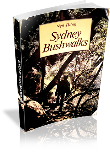
Title: Sydney bushwalks
Author: Neil Paton
Edition: 1
Publisher: Kangaroo Press
ISBN: 0864171072
Number of pages: 192
Year of Publication: 1986
Cover Price (au$): 21.95
Format: Paperback
Weight (grams): 180
Regions the book covers: Sydney
Height (cm): 19
Subjects:
Hiking - New South Wales - Sydney,Trails - New South Wales - Sydney
Niche: Bushwalks in Sydney
Interpretive Information: Minimal
Grade system explained: No
Ascent and/or Decent provided: No
Driving directions provided: No
Date walks last reviewed provided: No
A summary of walks provided: No
Regional Map of walks provided: No
Maps designed for walking: Yes - limited detail
Type of maps used (for walking): Sketch
Colour used in walking maps: Black and White
Size of walking maps: Full page
Colour depth of photos: Black and White
Comment on Photographs: Photographs, on average, every four to six pages
Level of detail in tracknotes: Detailed route information
Alternate route and side trip suggestions: Many walks
List of walks in book
Walk Name | Length | Time | Grade | Page |
---|---|---|---|---|
Fullers Bridge to Epping Road | 28 | |||
Fullers Bridge to De Burghs Bridge, East Side | 32 | |||
De Burghs Bridge to Fullers Bridge, West Side | 37 | |||
Lorna Pass | 38 | |||
Comenarra Parkway to Kissing Point Road | 41 | |||
Kissing Point Road to De Burghs Bridge | 45 | |||
Pennant Hills Park Area | 47 | |||
De Burghs Bridge to Khartoum Road | 48 | |||
Browns Waterhole Tracks | 49 | |||
Roseville Bridge to Lindfield | 53 | |||
Gordon Creek to Hunter Avenue | 57 | |||
Upper Middle Harbour Creek | 62 | |||
East Killara | 65 | |||
Upper Middle Harbour Creek, West Side | 66 | |||
The Bare Creek Track | 68 | |||
The Heath Track | 69 | |||
Pipelines and Carroll Creek | 70 | |||
The Quarry Track | 70 | |||
The Govenor Phillip Walk | 74 | |||
East Gordon Fire Trails | 76 | |||
Casuarina Track | 77 | |||
Flat Rock Track | 78 | |||
The Magazine Track | 79 | |||
Cook Street to Forestville Park | 81 | |||
The Oval Track | 83 | |||
The Old Bullock Track | 85 | |||
The Timbergetters Track | 86 | |||
The Engravings Track | 87 | |||
The Bay Track and the Bluff | 88 | |||
Pennant Hills to Galston Gorge | 91 | |||
Hornsby to Fishponds Waterhole | 96 | |||
Mt Kuring-Gai to Calna Creek | 97 | |||
Galston Gorge to Berowra | 100 | |||
Jerusalem Bay | 109 | |||
Berowra to Bobbin Head | 112 | |||
The Mt Kuring-Gai Track | 114 | |||
Bobbin Head to the Sphinx Track | 115 | |||
The Bobbin Head Track | 116 | |||
Christies Pool | 120 | |||
The Warrimoo Track | 120 | |||
The Grosvenor Track | 122 | |||
The Murrua Track | 125 | |||
The Fraser Brook Tracks | 126 | |||
Hornsby Area and Links Track | 128 | |||
The Ryland and Cooyong Tracks | 130 | |||
The Bibbenluke and Namba Road Tracks | 133 | |||
Duffys Track and Slade Lookout | 134 | |||
The Cullamine Track, Long Track and Cowan Track | 135 | |||
The Wilkins Track | 137 | |||
The Perimeter Track | 138 | |||
Smiths Creek | 140 | |||
Duckhole Track | 141 | |||
The Chiltern Road Trails | 144 | |||
Flint and Steel Beach | 148 | |||
America Bay | 149 | |||
The Basin and Basin Track | 150 | |||
Challenger Track | 151 | |||
The Bairne Track | 152 | |||
The Topham Track | 152 | |||
The Towlers Bay Track | 153 | |||
The Willunga Track | 153 | |||
The Salvation and Wallaroo Tracks | 156 | |||
The Elvina Track | 158 | |||
The Waratah Track | 158 | |||
The Bullawarring Track | 161 | |||
The Battery Causeway | 166 | |||
Mt Westmacott | 167 | |||
The Moray Track | 168 | |||
Kingfisher Creek | 169 | |||
The Moray Ridge Trail | 169 | |||
Morella Ridge | 170 | |||
Scouters Mountain | 171 | |||
Engadine to Audley | 175 | |||
Audley to Warumbul Road | 177 | |||
Winifred Falls | 178 | |||
Maianbar and Bundeena | 179 | |||
The Coast Track | 179 | |||
The Cliff Track | 184 | |||
Governor Game Lookout | 185 | |||
Couranga Track | 186 | |||
Wettong | 186 | |||
Waterfall to Uloola Fails | 187 | |||
Uloola Falls to Heathcote | 188 | |||
Gurrumboola Ridge | 189 | |||
The Marley Track | 190 |
Snowy Mountains Walks
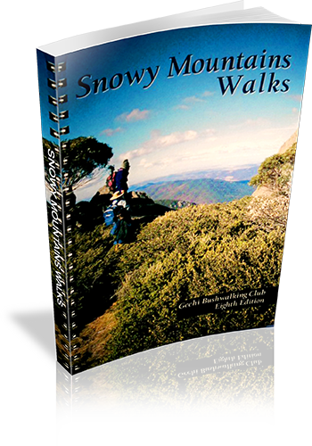
Title: Snowy Mountains Walks
Author: Geehi Club
Edition: 1
Publisher: Geehi Club
ISBN: 0959965114
Number of pages: 148
Year of Publication: 1978
Cover Price (au$): 29.95
Format: Paperback
Weight (grams): 340
Regions the book covers: Snowy Mountains
Height (cm): 21
Subjects:
Hiking - New South Wales - Snowy Mountains - Guidebooks,Snowy Mountains Region (N.S.W.) - Description and travel
Niche: Bushwalks in the Snowy Mountains
Interpretive Information: Detailed
Grade system explained: No
Ascent and/or Decent provided: Yes
Driving directions provided: No
Date walks last reviewed provided: No
A summary of walks provided: No
Regional Map of walks provided: Yes
Maps designed for walking: Yes - reasonable detail
Type of maps used (for walking): Detailed Topographic
Colour used in walking maps: Multicolour
Size of walking maps: Full page
Walking map Comment: Detailed topographic maps, unique for most walks.
Colour depth of photos: Colour
Comment on Photographs: Photographs every few pages.
Level of detail in tracknotes: Detailed route information
Alternate route and side trip suggestions: Many walks
List of walks in book
Walk Name | Length | Time | Grade | Page |
---|---|---|---|---|
Hannels Spur (Crackenback Top Station - Mt Kosciuszko - Hannels Spur - Geehi) | 20 km | 9 hrs | 48 | |
Canyon Falls (Crackenback Top Station - Mt Kosciuszko - Mt Townsend - Townsend SPur - Canyon Falls - Watsons Crag or Tumbling Waters) | 12 km | 2 Days | 53 | |
Watsons Crag (Charlottes - Pass Watsons Crags - Geehi River | 13 km | 10 hrs | 56 | |
Tate West Ridge (Guthega - Consett Stephens Pass - Tate west Ridge - Geehi Dam) | 13 km | 8 hrs | 58 | |
Leaning Rock (Whites River Hut - Windy Creek - Leaning Rock - Geehi Dam) | 9 km | 6 hrs | 60 | |
Crackenback top station - Rawson Pass - Mt Townsend | 11 km | 7 hrs | 62 | |
The Lakes Walk (Charlottes Pass - Rawson Pass - Muellers Pass - Carruthers Peak - Charlottes Pass) | 22 km | 7 hrs | 66 | |
Club Lake (Charlottes Pass - Hedley Tarn Lookout - Club Lake) | 5.5 km | 2 hrs | 71 | |
Charlottes Pass to the Sentinel | 10 km | 3 hrs 30 mins | 73 | |
North Ramshead | 5 km | 3 hrs | 75 | |
Lake Cootapatamba | 8 km | 4 hrs | 77 | |
Crachenback Chairlift to Ramshead and Dead Horse Gap | 8 km | 4 hrs 30 mins | 78 | |
Guthega Dam to Mount Tate | 11 km | 4 hrs | 81 | |
Mount Twynam (Guthega - Mt Twynam - Tate East RIdge - Guthega) | 15 km | 9 hrs | 84 | |
Mount Twynam (Charlottes Pass - Blue Lake - Mt Twynam - Guthega) | 9 km | 4 hrs | 84 | |
Persher Village to Mount Wheatley and the Porcupine | 8 km | 3 hrs | 88 | |
Rennex Gap to Snowy Adit | 10 km | 4 hrs | 92 | |
Dead Horse Gap to the Chimneys and the Cascades | 16 km | 8 hrs | 104 | |
Guthega Power Station to Schlink Pass | 7.5 km | 5 hrs | 111 | |
Schlink Pass to Valentine Falls | 7 km | 2 hrs 30 mins | 113 | |
Valentine Falls to Grey Mare Hut | 4 km | 2 hrs | 113 | |
Grey Mare Hut to Jagungal | 10 km | 3 hrs | 116 | |
Emu Plain to Manjar And Black Jack | 128 | |||
Kiandra to Nine Mile Diggings and Tabletop Mountain | 24 km | 10 hrs | 132 | |
Milk Shanty Falls | 136 | |||
Blue Creek Coppermine | 141 | |||
Landers Creek Falls to Big Talbingo Trig | 3 km | 146 | ||
Cave Creek and Blue Water Hole Area (River Cave, Murray Cave, Cooleman Cave, Barbers Cave, White Fish Cave, Murderers Cave, Blackfellows Cave) | 148 |
Jenolan Caves & The 6 Foot Track
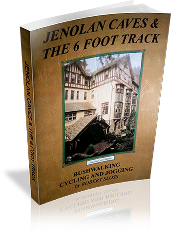
Title: Jenolan Caves & The 6 Foot Track
Author: Robert Sloss
Edition: 1
Publisher: Robert Sloss
ISBN: 0958651280
Number of pages: 26
Year of Publication: 2000
Cover Price (au$): 11.90
Format: Paperback
Website: http://www.robertsloss.com.au/Guide%20Index.htm
Weight (grams): 55
Regions the book covers: Jenolan Caves, Six Foot Track
Height (cm): 21
Subjects:
Hiking -- New South Wales -- Jenolan Caves -- Guidebooks,Hiking -- New South Wales -- Blue Mountains -- Guidebooks,Jenolan Caves (N.S.W.) -- Guidebooks,Blue Mountains (N.S.W.) -- Guidebooks
Interpretive Information: Some
Grade system explained: Yes
Ascent and/or Decent provided: No
Driving directions provided: No
Date walks last reviewed provided: No
Regional Map of walks provided: Yes
Maps designed for walking: Yes - limited detail
Type of maps used (for walking): Sketch
Colour used in walking maps: Simple colour
Size of walking maps: Full page
Colour depth of photos: Colour
Comment on Photographs: Small photograph on most pages, giving a sense of the region
Level of detail in tracknotes: Detailed route information
Alternate route and side trip suggestions: Many walks
List of walks in book
Walk Name | Length | Time | Grade | Page |
---|---|---|---|---|
Carlotta Arch Circuit | 1.3 km | 45 mins | 6 | |
Blue Lake Circuit | 1 km | 30 mins | 6 | |
The Hydro Track | 2.8 km | 1 Hr | 7 | |
Lucas Rocks Circuit | 1.9 km | 1 Hr | 7 | |
Devils Lookdown Circuit | 2.85 km | 1 hr 30 mins | 7 | |
McKeowns Valley - Rose Cottage Track | 9.2 km | 3 hrs | 8 | |
The Binda Ridge Circuit | 11.6 km | 4 hrs | 11 | |
Ginkin Lookout Track | 4 km | 30 mins | 12 | |
Banshee Rocks Circuit | 6.1 km | 3 hrs | 12 | |
Bulls Creek Circuit | 13.5 km | 6 hrs | 13 | |
The 6 Foot Track | 44 km | 3 Days | 15 | |
Jenolan Caves to Black Range | 8.2 km | 16 | ||
Clack Range to Alum Creek | 13.1 km | 16 | ||
Alum Creek to Coxs River | 5.5 km | 18 | ||
Coxs River to Megalong Road | 7 km | 20 | ||
Megalong Road to Katoomba | 10.2 km | 20 | ||
The Great Diving Range Circuit | 6.5 km | 3 hrs | 26 | |
Boggy Creek Circuit | 11 km | 3 hrs | 26 |
Heritage Walks In New South Wales
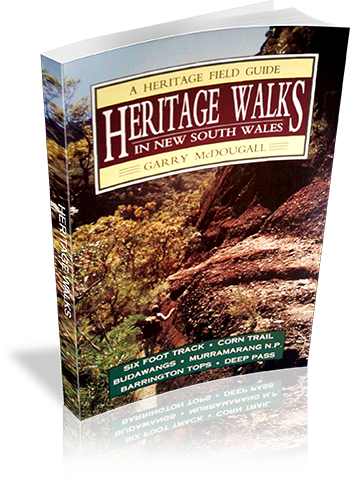
Title: Heritage Walks In New South Wales
Author: Garry McDougall
Edition: 1
Publisher: Kangaroo Press
ISBN: 0864173830
Number of pages: 128
Year of Publication: 1992
Cover Price (au$): 14.95
Format: Paperback
Website: http://www.members.optusnet.com.au/utravel/
Weight (grams): 140
Regions the book covers: NSW
Height (cm): 19
Subjects:
Nature trails - New South Wales - Guidebooks,Historic sites - New South Wales - Guidebooks,Hiking - New South Wales - Guidebooks,Walking - New South Wales - Guidebooks
Overview of Book:
A guide to seven historic walking regions in NSW. Much information is shared regarding human and environmental heritage in each region, and many walks are described in varying levels of detail - some giving just a sense of the walk, others describing the author's experiences, uncluding navigational and interpretive information.
Niche: Walks linked with human or environmental heritage.
Interpretive Information: Plenty
Grade system explained: No
Ascent and/or Decent provided: No
Driving directions provided: Yes
Date walks last reviewed provided: No
A summary of walks provided: No
Regional Map of walks provided: Yes
Maps designed for walking: Yes - limited detail
Type of maps used (for walking): Sketch
Colour used in walking maps: Black and White
Size of walking maps: 3/4 page
Walking map Comment: Maps provided for each region, however additional maps would be required for most walks, as stated by the author.
Colour depth of photos: None
Level of detail in tracknotes: General route description
List of walks in book
Walk Name | Length | Time | Grade | Page |
---|---|---|---|---|
Gillwinga Track | 12 | |||
Katoomba to Jenolan Caves (Six Foot Track) | 15 | |||
Megalong Valley to Coxes River | 15 | |||
Nellies Glen | 15 | |||
Jenolan State Forest to Katoomba | 15 | |||
Kiaora Hill | 15 | |||
The Corn Trail | 31 | |||
The Buckenbowra River | 31 | |||
Murramarang Point | 2 hrs | 46 | ||
Pretty Beach and Snapper Point | 1 Hr | 46 | ||
Pretty Beach to Durras Mtn | 4 hrs | 47 | ||
Durras Mountain, Clear Point to Pretty Beach | 4 hrs | 49 | ||
Pebbly Beach | 1 Hr | 50 | ||
Pebbly to Clear Point | 2 hrs | 50 | ||
Pebbly to Depot Beach | 1 Hr | 52 | ||
Depot Beach to Nth Durras | 1 hr 30 mins | 52 | ||
Durras Lake Inlet Walk | 3 hrs | 52 | ||
Durras Lake Forestry Walk | 3 hrs | 52 | ||
North to South Durras | 53 | |||
North Head | 2 hrs | 54 | ||
Richmond Beach to North Head | 4 hrs | 57 | ||
South Durras to Richmond Beach | 3 hrs | 58 | ||
A Murramarang Trek | 3 Days | 59 | ||
Newhaven Gap to Yadboro River | 61 | |||
Hidden Valley | 61 | |||
Yadboro to Monolith Valley | 61 | |||
Yadboro to The Castle/Cooyoyo | 61 | |||
Wow Wog to Monolith Valley via Corang Peak | 61 | |||
The Rocky Crossing Walk | 84 | |||
Jerusalem Creek Walking Trail | 2 km | 89 | ||
Jerusalem Creek Forest Park - Scenic Falls | 89 | |||
Telegherry Forest Walk | 89 | |||
Dundungra Falls Walk and Chichester Arboretum | 89 | |||
Frying Pan Creek Forest Walk | 89 | |||
Antarctic Beech Forest | 89 | |||
Burraga Swamp | 89 | |||
Cabre Bald | 89 | |||
Careys Peak via the Corker | 90 | |||
Gloucester Falls Walk | 2 km | 94 | ||
Laurie Lookout | 95 | |||
The Falls Lookout | 95 | |||
The Beech Forest Walk | 8 km | 96 | ||
The Gloucester Tops Circuit Walk | 96 | |||
The Link Track | 96 | |||
Gloucester River Waterlife | 98 | |||
Sharpes Creek Walk | 100 | |||
Gloucester Upriver Walk and Trek | 2 Days | 101 | ||
A little Day Stroll (Gloucester River Campsite) | 102 | |||
A little Night Stroll (Gloucester River Campsite) | 102 | |||
Beean Beean Plain to Big Hole | 1 hr 30 mins | 108 | ||
Big Hole to Careys Peak | 1 Hr | 109 | ||
Junction Pool to Careys Peak | 2 hrs | 109 | ||
Careys Peak to Junction Pools | 3 hrs | 110 | ||
Junction Pools to Beean Beean Plain | 2 hrs | 111 | ||
Wombat Creek | 30 mins | 111 | ||
Selby Hut | 1 Hr | 111 | ||
Polblue to Little Murrays | 1 hr 30 mins | 113 | ||
To Beean Beean Plain | 500 m | 113 | ||
Polnlue to Gloucester Tops | 70 km | 114 | ||
Barrington House to Barrington Tops | 4 Days | 114 | ||
Polblue to Dungog via Chichester State Forest and The Mountaineer | 114 | |||
Local tracks in Deep Pass | 117 |
Camping and bushwalking in the northern Kosciuszko National Park
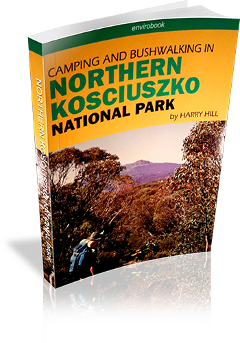
Title: Camping and bushwalking in the northern Kosciuszko National Park
Author: Harry Hill
Edition: 1
Publisher: Envirobook
ISBN: 0858812061
Number of pages: 138
Year of Publication: 2006
Cover Price (au$): 29.95
Format: Paperback
Website: http://envirobook.com.au/Publishing/publishing.htm
Weight (grams): 280
Regions the book covers: Northern Kosciuzko National Park
Height (cm): 21
Subjects:
National parks and reserves - New South Wales - Kosciuszko National Park,Hiking - New South Wales - Kosciuszko National Park,Camping - New South Wales - Kosciuszko National Park,Kosciuszko National Park (N.S.W.) - Guidebooks
Niche: Camping, driving and walking in Northern Kosciuzko National Park
Interpretive Information: Plenty
Grade system explained: No
Ascent and/or Decent provided: No
Driving directions provided: No
Date walks last reviewed provided: No
A summary of walks provided: No
Regional Map of walks provided: No
Maps designed for walking: Yes - limited detail
Type of maps used (for walking): Sketch
Colour used in walking maps: Black and White
Size of walking maps: 3/4 page
Walking map Comment: Unique map for every walk
Colour depth of photos: Colour
Comment on Photographs: Photographs on every second page, giving a good sense of the region,
Level of detail in tracknotes: Detailed route information
Alternate route and side trip suggestions: Some walks
List of walks in book
Walk Name | Length | Time | Grade | Page |
---|---|---|---|---|
Thomas Boyd Trackhead to 'The Hole' | 15 km | 47 | ||
The Coat of Arms Walk | 2 km | 51 | ||
The Old Mountain Road | 4 km | 56 | ||
Falls on Mill Creek | 3 km | 61 | ||
Buddong Creek | 17 km | 64 | ||
Buddong Falls (top falls) | 400 m | 30 mins | Easy | 69 |
Buddong Falls (bottom falls) | 1.6 km | 1 hr 30 mins | Medium | 69 |
Big Talbingo Mountain | 18 km | 74 | ||
Jounama Peak | 7 km | 8 hrs | 79 | |
Millers Hut | 3 km | 25 mins | 84 | |
Cooinbil to Mosquito Creek Fire Trail | 10 km | 88 | ||
Cooinbil to Hainsworth Hut | 14 km | 88 | ||
Oldfields Hut | 6 km | 92 | ||
Top end of Long Plain | 12 km | 96 | ||
Cooleman Plain | 11.5 km | 101 | ||
Cherry Garden | 12 km | 105 | ||
Blue Creek Coppermine | 20 km | 111 | ||
Pig Gully to Bullocks Head Creek | 12 km | 115 | ||
Milk Shanty Falls | 16 km | 120 | ||
Black Jack Firetower | 20 km | 124 | ||
Round Mountain to Tumut River | 7.6 km | 129 | ||
Lorna Doone Mine | 26 km | 134 |
Bushwalks in the Sydney Region : Volume 1
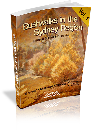
Title: Bushwalks in the Sydney Region : Volume 1
Author: Ed: Stephen Lord,Ed: George Daniel
Edition: 3
Publisher: National Parks Association of New South Wales Inc
ISBN: 0959916075
Number of pages: 112
Year of Publication: 2000
Cover Price (au$): 14.95
Format: Paperback
Website: http://www.npansw.org.au/website/index.php?option=com_wrapper&Itemid=418
Weight (grams): 220
Regions the book covers: Sydney and surrounds
Height (cm): 25
Subjects:
Hiking - New South Wales - Sydney Region - Guidebooks,Sydney Region (N.S.W.) - Guidebooks
Authors Comments:
THESE BOOKS (vols 1&2) are the results of the efforts of volunteers to produce two new walks books which would describe interesting walks in the Sydney region and raise funds for NPA.
THE SYDNEY REGION: Nominated as an area within 110km radius from Sydney. It includes:- Frazer Park to the N – Glen Davis to the NW – Jenolan Caves & Kanangra Walls to the W – Yerranderie to the SW – and the Northern Part of Morton NP & [nr] Nowra in the SSW.
THE WALKS are generally those not covered by other walks books however some classic walks are included such as Valley of the Waters and Blue Gum Forest. There are some walks that have not previously been described. Volume 1 has 93 walks and Volume 2 has 80 walks.
THE MAPS are of 1:25000 scale which we considered the minimum for the detail required. Most one day walks fit on a single page map. [The small pocket sized book philosophy was just not good enough]. All maps have True North up and include a compass variation/bearing aid diagram. All maps have a key included. All maps show km guide marks along the route. Spot heights are shown (in metres above sea level) at significant places. Most maps are within 1 page of their respective walk descriptions. Rivers and creeks have direction of flow shown. All maps are in two colours. In many cases the maps and track notes will save having to obtain NP&WS pamphlets, or other maps.
THE TRACK NOTES (DESCRIPTIONS). By using several techniques, we fit more text per page than other similar sized books. The notes give directions for getting to starting point of each walk; they also mention where to obtain water, where navigation care is required, (with detailed help), point out where hazards are, and even mention good places to stop for lunch etc.
PAPER: The books are printed on paper from sustainable forests. Book size is approx 250x175x10mm thick.
PROCEEDS, all go to support NPA projects and activities.
Niche: Many walks in Sydney and surrounding regions.
Interpretive Information: Minimal
Grade system explained: No
Ascent and/or Decent provided: Yes
Driving directions provided: No
Date walks last reviewed provided: No
A summary of walks provided: Yes
Regional Map of walks provided: No
Maps designed for walking: Yes - reasonable detail
Type of maps used (for walking): Sketch
Colour used in walking maps: Black and White
Size of walking maps: Full page
Walking map Comment: A few walks refer to each map, and a number of walks cross between two maps.
Colour depth of photos: None
Level of detail in tracknotes: Detailed route information
Alternate route and side trip suggestions: Some walks
List of walks in book
Walk Name | Length | Time | Grade | Page |
---|---|---|---|---|
Bairne Trail - Portuguese Beach - The Basin | 13 km | M | 9 | |
Canoelands- Gentlemans Halt | 19 km | M | 9 | |
Towlers Bay Track - Birnie Lookout | 8 km | E | 12 | |
Elvina Bay Circuit | 5 km | E | 12 | |
Mt Kuring-Gai - Berowra via Cowan Creek | 8 km | EM | 13 | |
The Sphinx- Bobbin Head- Mt Kuring-Gai | 10 km | EM | 13 | |
Mt Kuring-Gai- Berowra via Berowra Creek | 8 km | EM | 16 | |
Manly to The Spit | 9 km | E | 18 | |
Garie Beach- Garrawarra- Burning Palms | 10 km | EM | 20 | |
Curra Moors - Curracurrong | 9 km | E | 20 | |
Heathcote- Heathcote Creek- Waterfall | 11 km | EM | 23 | |
Campbell Drive - Wybung Head- Frazer Beach | 10 km | E | 24 | |
Timber, Ghosties and Moonee Beaches | 5 km | E | 24 | |
Bateau Bay- Wyrrabalong Head- Wamberal | 14 km | EM | 27 | |
Red Gum and Lillypilly Loop Trails | 6 km | E | 27 | |
Killcare- Box Head- Lobster Beach | 10 km | E | 29 | |
Maitland Bay - Putty Beach Circuit | 9 km | E | 29 | |
Abbotts Falls | 7 km | E | 31 | |
Koolewong Ridge | 10 km | EM | 36 | |
Staples Lookout - Kariong Brook | 11 km | E | 39 | |
Wondabyne- Pindar Cave | 12 km | EM | 39 | |
Mooney Mooney Creek Circuit | 12 km | M | 41 | |
Wondabyne- Yarramalong Section GNW | 49 km | 3 Days | M | 41 |
Mill Creek Circuit | 7 km | EM | 47 | |
Colo River via Bob Turners Track | 7 km | EM | 50 | |
Mountain Lagoon - Colo River Gorge View | 10 km | E | 50 | |
Mountain Lagoon- Mailes Ridge- Colo River | 24 km | 2 Days | M | 53 |
Wolgan Valley- Glow Worm Tunnel | 10 km | EM | 53 | |
Newnes to Glen Davis via the Pipeline Track | 21 km | 2 Days | M | 55 |
Newnes - Wolgan River- Rocky Creek - Annie Rowan Creek | 43 km | 3 Days | M | 58 |
Hawkesbury Height - Shaws Creek | 7 km | EM | 61 | |
Winmalle - Grose Mountain | 15 km | EM | 61 | |
Glenbrook Gorge | 6 km | M | 63 | |
Lapstone Zig Zag Railway | 8 km | E | 63 | |
Red Hands Cave Circuit | 9 km | E | 66 | |
Red Hands Cave Road to Kanuka Brook (Crayfish Pool) | 2 km | E | 66 | |
Glenbrook- St. Helena Crater- Springwood | 21 km | 2 Days | EM | 68 |
Pisgah Rock - Erskine Creek - Dadder Cave | 5 km | EM | 68 | |
Erskine Creek via Jack Evans Track | 6 km | E | 70 | |
Caleys Lookout- Mt Banks- Banks Wall | 11 km | EM | 72 | |
Warragamba - Nepean River - Nortons Basin | 12 km | EM | 72 | |
Govetts Leap - Blue Gum Forest - Perrys Lookdown | 20 km | 2 Days | M | 74 |
Govetts Leap to Pulpit Rock | 6 km | E | 74 | |
Lockley Track - The Pinnacles - Lockley Pylon | 8 km | EM | 76 | |
Vera Falls - Hippocrene Falls - Wentworth Pass | 5 km | M | 78 | |
Wentworth Falls - Undercliff Walk - National Pass | 4 km | E | 78 | |
Golden Stairs - Castle Head | 7 km | E | 80 | |
Carlon's Farm - Bellbird Point | 6 km | E | 82 | |
Golden Stairs - Ruined Castle - Mt Solitary | 15 km | M | 82 | |
Carlon's Farm - Medlow Gap - Mt Mouin | 19 km | M | 83 | |
Carlon's Farm - Medlow Gap - Taros Ladder | 21 km | M | 83 | |
Carlon's Farm - Coxs River - Jenolan River - Ironmonger Hill | 19 km | 2 Days | M | 87 |
Carlon's Farm Splendour Rock - Knights Deck - Coxs River | 31 km | 2 Days | M | 87 |
Carlon's Farm - Mt Yellow Dog - Coxs River - Konangaroo Clearing | 36 km | 2 Days | MH | 88 |
Kanangra Walls - Crafts Wall - Pages Pinnacle - Mt Berry | 13 km | EM | 89 | |
Kanangra Walls - Cottage Rock | 9 km | EM | 91 | |
Kanangra Walls - Gingra Creek - Kowmung River - Gingra Range | 34 km | 2 Days | H | 94 |
Kanangra Walls - Brumby Ridge - Kowmung River | 20 km | 2 Days | M | 96 |
Kanangra Walls - Hughes Ridge - Kowmung River - Roots Ridge | 27 km | 2 Days | M | 96 |
Yerranderie - Yerranderie Peak | 4 km | M | 97 | |
Yerranderie - Colong Gap | 7 km | EM | 99 | |
Yerranderie - Tonalli River | 5 km | E | 99 | |
Thirlmere Lakes - Blue Gum Creek - Little River | 15 km | EM | 101 | |
Starlights Track - Nattai River - Russells Needle | 16 km | M | 101 | |
Nattai River- Beloon Pass | 25 km | 2 Days | MH | 103 |
Macquarie Rivulet | 9 km | M | 107 | |
Meryla Pass - Yarrunga Creek | 16 km | 2 Days | EM | 107 |
Clover Hill Rd - Macquarie Rivulet | 7 km | M | 109 | |
Macquarie Rivulet Tributary | 6 km | M | 109 | |
Cartington Falls | 5 km | E | 111 | |
Gerringong Falls | 7 km | E | 111 |
Bushwalks in the Hunter Valley
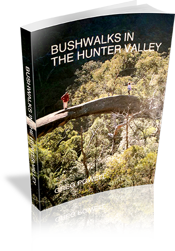
Title: Bushwalks in the Hunter Valley
Author: Greg Powell
Edition: 1
Publisher: Macstyle
ISBN: 0958841799
Number of pages: 140
Year of Publication: 1989
Cover Price (au$): 11.95
Weight (grams): 210
Regions the book covers: Hunter Valley and Central Coast
Height (cm): 21
Subjects:
Hiking - New South Wales - Hunter River Region,Hunter River Region (N.S.W.) - Guidebooks
Niche: Walksin the Hunter Valley, south to Central Coast, north to Barrington
Interpretive Information: Some
Grade system explained: No
Ascent and/or Decent provided: No
Driving directions provided: Yes
Date walks last reviewed provided: No
A summary of walks provided: No
Regional Map of walks provided: No
Maps designed for walking: Yes - limited detail
Type of maps used (for walking): Sketch
Colour used in walking maps: Black and White
Size of walking maps: Half page
Walking map Comment: Decorative maps, one for almost every walk
Colour depth of photos: Black and White
Comment on Photographs: There are a few photos throughout the book.
Level of detail in tracknotes: General route description
List of walks in book
Walk Name | Length | Time | Grade | Page |
---|---|---|---|---|
Paterson River | 25 | |||
Allyn River | 26 | |||
Williams River | 28 | |||
Karuah River (Whispering Gully) | 29 | |||
Gloucester River | 31 | |||
Barrington Tops | 36 | |||
Gloucester Tops | 38 | |||
Mount Royal | 40 | |||
Burning Mountain | 42 | |||
Colo River | 60 | |||
Widden Valley | 64 | |||
Goulburn River | 70 | |||
Mount Yengo | 72 | |||
Howes Valley | 74 | |||
The Great North Road | 76 | |||
Central Coast | 88 | |||
Ten Mile Hollow | 90 | |||
Munmorah State Recreation Area | 92 | |||
Simpson Track | 94 | |||
Watagan Mountains | 98 | |||
Awaba | 100 | |||
Green Point | 102 | |||
The Great North Walk | 104 | |||
Tomaree National Park | 108 | |||
Coastal Walks | 110 | |||
Alum Mountain - Bulahdelah | 112 | |||
Williams and Paterson Valleys | 114 | |||
Whispering Gully (Karuah River) | 117 | |||
Gloucester Bucketts (Gloucester) | 117 | |||
Stockrington Railway Tunnels and Caves | 117 | |||
Wangi Point (Lake Macquarie) | 117 | |||
Mount Munibung (Speer Point) | 117 | |||
Mungo Track (Hawkes Nest) | 117 | |||
Gillwinga Walk (Allyn River) | 117 | |||
Myuna Bay (Lake Macquarie) | 117 | |||
Mount Carrow (Mount Royal Area) | 117 | |||
Coolah Tops (Liverpool Range) | 117 | |||
Ben Hall Gap (Timor) | 117 | |||
Wallabadah ROck (Wallabadah) | 117 | |||
Walka Waterworks (Maitland) | 117 | |||
Yellow Rock (Broke) | 117 | |||
Broken Back Range (Polkobin) | 117 | |||
Blackbutt Reserve (New Lambton) | 117 | |||
Shortland Wetlands (Shortlands) | 117 | |||
Botanic Gardens (Raymond Terrace) | 117 | |||
Awabakal Reserve (Dudley) | 117 | |||
Wingen Maid (Scone) | 117 | |||
Timor Caves (Timor) | 117 | |||
Wallingat Forest (Bungwahl) | 117 | |||
Mountain Maid Mine (Copeland) | 117 | |||
Eskania Park (Ourimbah) | 117 |
120 walks in New South Wales
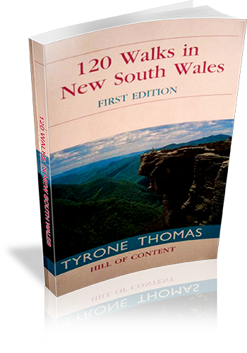
Title: 120 walks in New South Wales
Author: Tyrone Thomas
Edition: 1
Publisher: Hill of Content
ISBN: 0855722975
Number of pages: 393
Year of Publication: 2000
Cover Price (au$): 32.95
Format: Paperback
Website: http://web.archive.org/web/20041010022224/members.ozemail.com.au/~tyronet/100nsw.html
Weight (grams): 315
Regions the book covers: New South Wales
Height (cm): 18
Subjects:
Hiking -- New South Wales -- Guidebooks,New South Wales -- Guidebooks
Niche: Many walks scattered throughout NSW, including Lord Howe and Norfolk Islands
Interpretive Information: Minimal
Grade system explained: No
Ascent and/or Decent provided: No
Driving directions provided: No
Date walks last reviewed provided: Yes
A summary of walks provided: Yes
Regional Map of walks provided: No
Maps designed for walking: Yes - reasonable detail
Type of maps used (for walking): Simple Topographic
Colour used in walking maps: Greyscale
Size of walking maps: Full page
Walking map Comment: Individual maps for most walks.
Colour depth of photos: Colour
Comment on Photographs: There are a few photo plates scattered through the book.
Level of detail in tracknotes: Detailed route information
Alternate route and side trip suggestions: Some walks
List of walks in book
Walk Name | Length | Time | Grade | Page |
---|---|---|---|---|
Clifton Gardens-Bradleys head | 6 km | 2 hrs | Easy | 27 |
Bundeena to Little Marley | 13.6 km | 4 hrs | Easy | 29 |
Bundeena - Marley - Garie-Otford | 27 km | 8 hrs 30 mins | Hard | 32 |
Otford Burning Palms | 11.5 km | 4 hrs | Easy | 36 |
The basin | 5 km | 2 hrs | Easy | 39 |
Somersby | 19.5 km | 7 hrs | Hard | 42 |
Bouddi National Park | 9.5 km | 3 hrs 30 mins | Easy | 46 |
Bobbin Head | 2 km | 4 hrs 15 mins | Easy | 49 |
Heathcote - Uloola-Audley | 15.4 km | 5 hrs 30 mins | Medium | 52 |
Erskine Creek | 6 km | 3 hrs | Easy | 55 |
Springwood - Magdala Creek | 11.5 km | 4 hrs | Easy | 58 |
Inspiration Point | 7 km | 3 hrs | Easy | 61 |
Lockley Pylon | 7 km | 3 hrs | Easy | 64 |
Mount Hay | 15 km | 5 hrs 30 mins | Medium | 66 |
Katoomba-Three Sisters | 7 km | 3 hrs | Easy | 69 |
Katoomba-Federal Pass | 103 km | 4 hrs | Medium | 73 |
Golden Stairs-Mount Solitary | 14 km | 5 hrs | Medium | 77 |
Blackhealth - Govetts Leap | 8 km | 3 hrs | Easy | 80 |
Govetts Leap - Grand Canyon | 10.3 km | 4 hrs 15 mins | Medium | 83 |
Neates Glen - Grand Canyon | 6.4 km | 2 hrs 30 mins | Easy | 86 |
Blue Gum Forest | 22.25 km | 2 Days | Medium | 88 |
Pulpit Rock | 6 km | 2 hrs 15 mins | Easy | 92 |
Valley of the waters - National Pass | 7 km | 3 hrs | Easy | 95 |
Lawson | 8 km | 2 hrs 45 mins | Easy | 98 |
Leura Cliffs Lyrebird Dell | 6 km | 2 hrs 45 mins | Easy | 101 |
Darwins Walk | 5 km | 2 hrs 15 mins | Easy | 104 |
Mount York | 11 km | 4 hrs 9 mins | Medium | 107 |
Kanangra Walls - Crafts Wall | 12 km | 4 hrs 30 mins | Medium | 110 |
Jenolan Caves | 1.3 km | Easy | 114 | |
Mount Victoria | 6.4 km | 2 hrs 30 mins | Easy | 117 |
Mount Banks | 4.8 km | 2 hrs | Easy | 120 |
Mount Wilson | 6 km | 2 hrs 30 mins | Easy | 124 |
Wollangambe River | 9 km | 2 hrs 30 mins | Medium | 126 |
Colo River-Tootie Creek | 6 km | 3 hrs | Medium | 129 |
Colo River-Canoe Creek | 6 km | 3 hrs 30 mins | Hard | 131 |
Newnes - Glow worm tunnel | 10 km | 4 hrs | Medium | 134 |
Barrington Tops | 25.6 km | 2 Days | Medium | 137 |
Mount Gower - Lord Howe Is. | 8.5 km | 7 hrs | Hard | 141 |
Malabar Hill - Lord Howe Is. | 9 km | 4 hrs | Medium | 147 |
Norfolk Island | 14 km | 6 hrs | Medium | 151 |
The Rock | 6.5 km | 2 hrs 30 mins | Easy | 157 |
Campbells Island | 18.5 km | 6 hrs 30 mins | Medium | 159 |
Woolshed Falls and Bluff | 6 km | 2 hrs 30 mins | Easy | 162 |
Jacks Creek | 2.5 km | 1 Hr | Easy | 165 |
Belougery Split Rock | 7.8 km | 3 hrs 30 mins | Easy | 168 |
The Breadknife | 12 km | 4 hrs 45 mins | Easy | 170 |
Mount Exmouth | 16.6 km | 5 hrs 30 mins | Medium | 174 |
Macha Tor-Mount Exmouth | 26.7 km | 2 Days | Medium | 175 |
Fans Horizon | 3.2 km | 1 hr 30 mins | Easy | 179 |
Yulludunida Crater | 4 km | 2 hrs | Easy | 180 |
Bald Rock | 3.7 km | 2 hrs | Easy | 182 |
South Bald Rock | 23.2 km | 2 Days | Medium | 185 |
Mount Cougal | 7 km | 3 hrs 30 mins | Easy | 189 |
Mount Warning | 8.8 km | 4 hrs | Medium | 192 |
Cape Byron | 4 km | 1 hr 45 mins | Easy | 194 |
Jerusalem Creek | 9 km | 3 hrs 30 mins | Easy | 196 |
Yuraugir | 10.5 km | 4 hrs | Easy | 199 |
Anvil Rock-Gibraltar Range | 4 km | 1 hr 30 mins | Easy | 202 |
Cardinals Cap | 6 km | 2 hrs 30 mins | Easy | 204 |
Washpool | 8.2 km | 3 hrs 12 mins | Easy | 205 |
Bucca Bucca Creek | 5 km | 1 hr 45 mins | Easy | 208 |
Never Never - Rosewood River | 8.2 km | 3 hrs 30 mins | Medium | 210 |
Dorrigo Wonga Walk | 6.6 km | 2 hrs 30 mins | Easy | 212 |
Point Lookout | 6.8 km | 2 hrs 30 mins | Easy | 215 |
Eagles Nest | 3.3 km | 1 hr 30 mins | Easy | 218 |
Woolpack Rocks | 8 km | 3 hrs | Easy | 220 |
Cathedral Rocks | 5.8 km | 2 hrs 30 mins | Easy | 223 |
Wollomombi Falls | 3 km | 1 hr 30 mins | Easy | 226 |
Hat Head | 8.4 km | 3 hrs | Easy | 228 |
Trial Bay - Gap Beach | 8.7 km | 3 hrs 30 mins | Easy | 231 |
South-West Rocks - Trial Bay | 9.5 km | 3 hrs 45 mins | Easy | 234 |
North Smoky | 5.2 km | 2 hrs | Easy | 235 |
North Brother Mountain | 5 km | 3 hrs | Medium | 238 |
Diamond Head | 5.5 km | 2 hrs | Easy | 240 |
Booti Booti | 8.3 km | 3 hrs | Easy | 243 |
Dark Point | 9 km | 3 hrs 15 mins | Easy | 245 |
Hawkes Nest-Yacaaba | 6 km | 2 hrs 30 mins | Easy | 248 |
Welby Coal Railway | 8.8 km | 3 hrs 15 mins | Easy | 251 |
Fort Foot Falls - Nattai River | 11.4 km | 4 hrs 30 mins | Medium | 254 |
Hilltop-Nattai River | 12 km | 5 hrs | Medium | 256 |
Bundanoon Glow Worm Glen | 8.5 km | 3 hrs 15 mins | Easy | 258 |
Bundanoon - Nicholas Pass | 9.5 km | 3 hrs 30 mins | Easy | 261 |
Fitzroy Falls West Rim | 4.5 km | 1 hr 30 mins | Easy | 263 |
Barren Grounds - Cooks Nose | 7.2 km | 3 hrs | Easy | 266 |
Barren Grounds - Stone Bridge | 9 km | 3 hrs 45 mins | Easy | 267 |
Badgerys - Shoalhaven River | 5 km | 2 hrs 30 mins | Medium | 271 |
Long Point - Bungonia Gorge | 18 km | 2 Days | Medium | 273 |
Berrima | 6 km | 3 hrs 30 mins | Easy | 276 |
Drawing Room Rocks | 4.5 km | 2 hrs 15 mins | Easy | 280 |
Bomaderry Creek | 5.5 km | 2 hrs 15 mins | Easy | 283 |
Tallowa Dam | 6 km | 2 hrs 15 mins | Easy | 285 |
Abrahams Bosom | 8.5 km | 3 hrs | Easy | 287 |
Mount Bushwalker | 7 km | 3 hrs | Easy | 290 |
Talaterang Mountain | 17 km | 2 Days | Hard | 294 |
Pigeon House Mountain | 4.8 km | 2 hrs 15 mins | Medium | 295 |
Kalianna Ridge-Monolith Valley | 23 km | 2 Days | Hard | 297 |
Newhaven Gap-Monolith Valley | 58.4 km | 5 Days | Hard | 302 |
Mount Dromedary | 11 km | 4 hrs 30 mins | Medium | 313 |
Mount Imlay | 7 km | 7 hrs | Medium | 316 |
Mallacoota-Nadgee | 51.2 km | 3 Days | Medium | 318 |
Tinderry Twin Peak | 13 km | 5 hrs 30 mins | Hard | 327 |
Square Rock | 10.4 km | 4 hrs | Easy | 330 |
Booroomba Rocks | 4.5 km | 2 hrs | Easy | 333 |
Mount Gingera | 15 km | 5 hrs 30 mins | Medium | 335 |
Mount Bimberi | 19.6 km | 8 hrs | Hard | 338 |
Mount Wee Jasper | 17 km | 6 hrs 30 mins | Hard | 341 |
Blowering Dam - Browns Creek | 20.8 km | 2 Days | Easy | 344 |
Big Talbingo Mountain | 22 km | 8 hrs 30 mins | Hard | 347 |
Talbingo - Buddong Falls | 23.5 km | 9 hrs | Hard | 351 |
Round Mountain - Mount Jagungal | 42.3 km | 2 Days | Medium | 355 |
Mount Gungartan | 23 km | 8 hrs | Hard | 360 |
Blue Cow Mountain | 2.8 km | 1 hr 30 mins | Easy | 363 |
Skitube - Mount Twynam | 27 km | 3 Days | Medium | 365 |
Perisher Valley - The Porcupine | 10 km | 3 hrs 30 mins | Easy | 371 |
Charlottes Pass - Blue Lake | 10 km | 3 hrs | Easy | 374 |
Kosciuszko Lakes Walk | 22.2 km | 8 hrs | Hard | 376 |
Kosciuszko Sunrise | 17.2 km | 6 hrs | Medium | 380 |
Thredbo - Mount Kosciuszko | 12.4 km | 4 hrs 30 mins | Medium | 383 |
Thredbo - Mount Twynam | 35.6 km | 2 Days | Medium | 386 |
Charlottes Pass - Mount Townsend | 22 km | 8 hrs 30 mins | Medium | 391 |