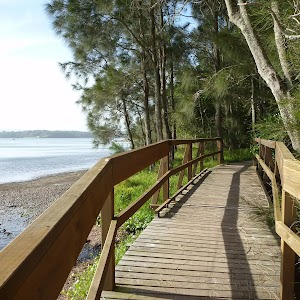
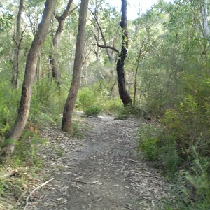
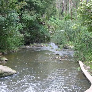
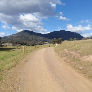
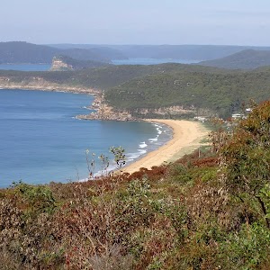
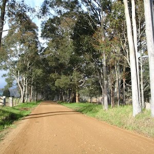
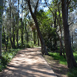
248 Track
248 Track


3 hrs 15 mins

255 m
Moderate track
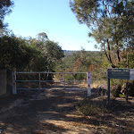


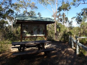
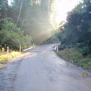
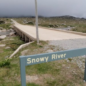
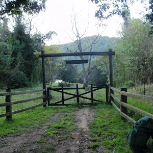
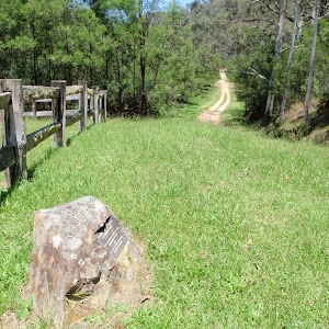
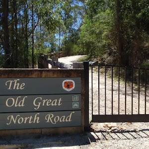
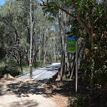
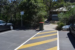
(0km) Int of Ironbark Rd and Popran Pipeline Trail → Ironbark Rd picnic area

1.7 km
35 mins
88m
-19m
Easy track
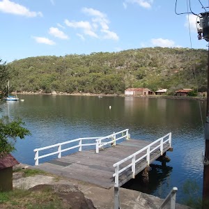
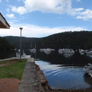
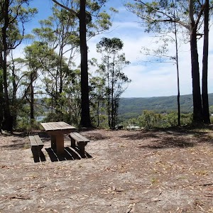
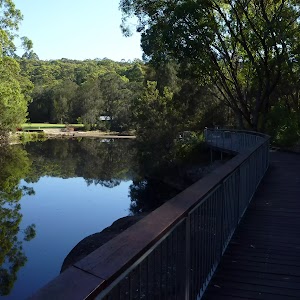
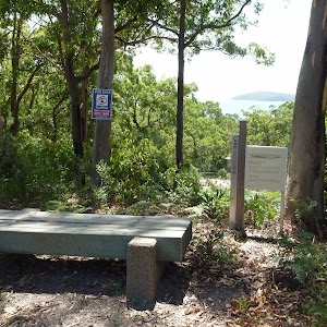
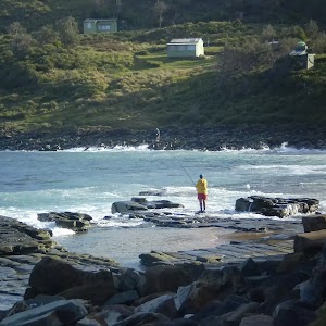
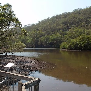
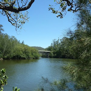
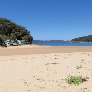
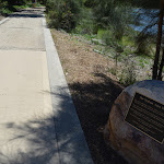
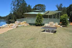
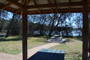
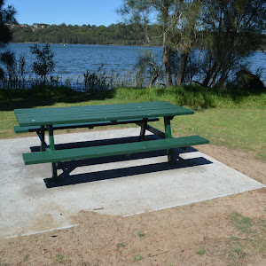
Ironbark Rd Picnic area
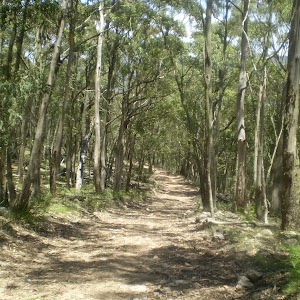
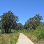
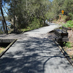
(1.7km) Ironbark Rd picnic area → Int of Mt Olive trail and 248 Trail
310 m
6 mins
10m
-10m
Easy track
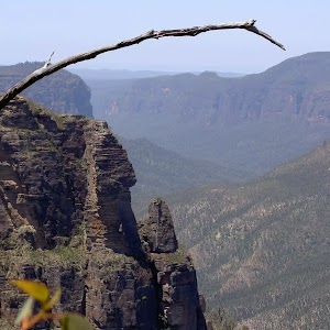
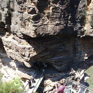
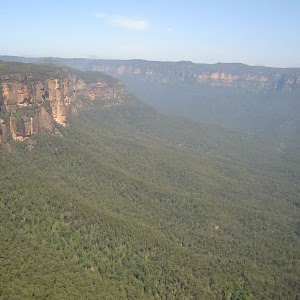
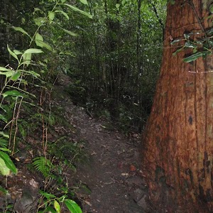
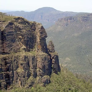
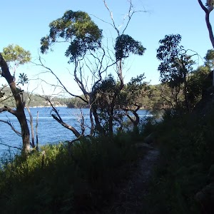
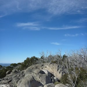
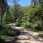
(2.01km) Int of Mt Olive trail and 248 Trail → Top of Mt Olive
210 m
5 mins
22m
-2m
Hard track
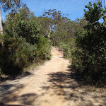
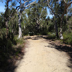
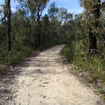
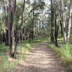
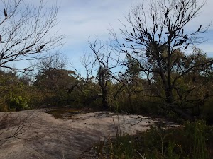
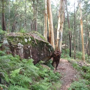
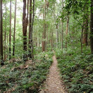
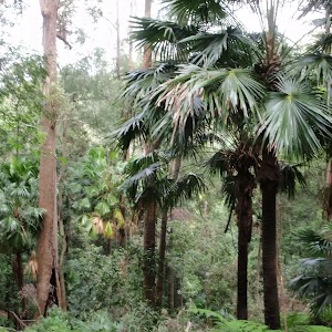
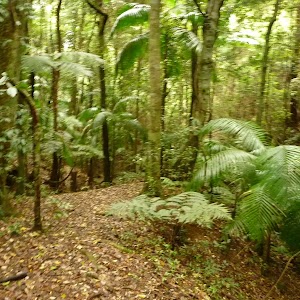
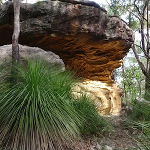
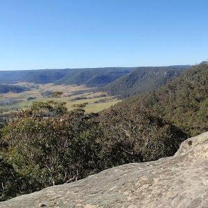
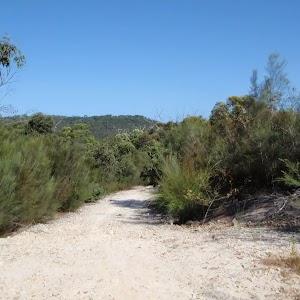
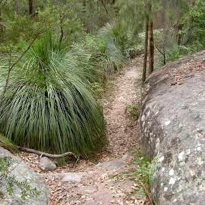
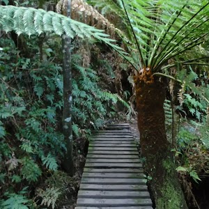
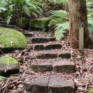
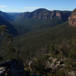
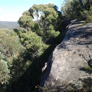
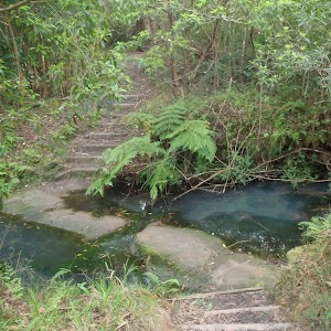
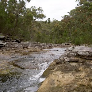
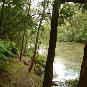
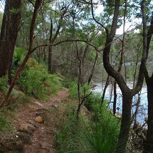
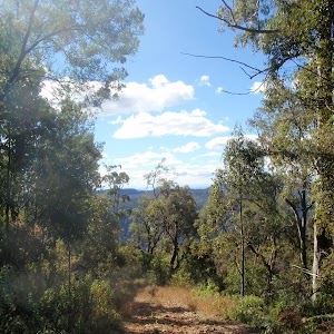
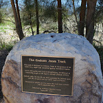
Turn left: From the intersection, the walk follows the ‘Mt Olive’ signpost along the bush track. The walk meanders for a while before reaching an intersection with another bush track.
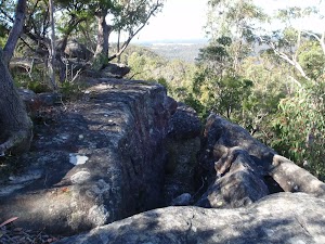
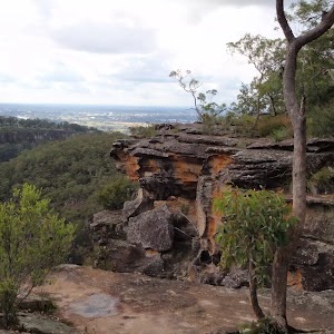
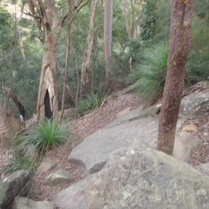
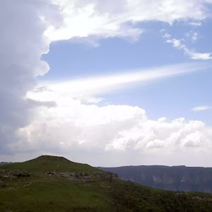
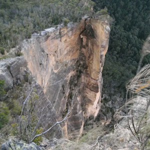
Turn left: From the intersection, the walk follows the bush track steeply up the hill and soon arrives at the top of Mt Olive. At the end of this side trip, retrace your steps back to the main walk then Turn left.
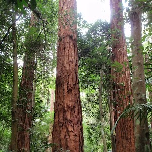
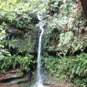
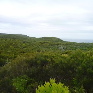
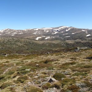
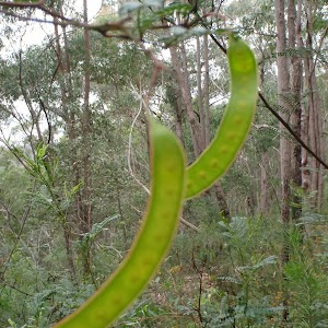
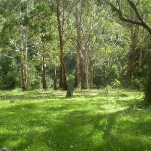
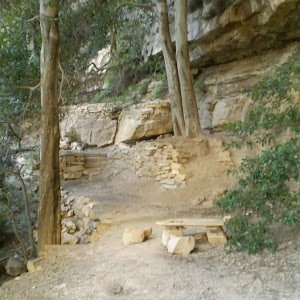
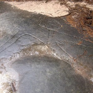
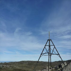
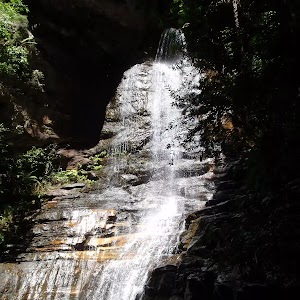
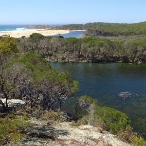
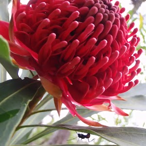
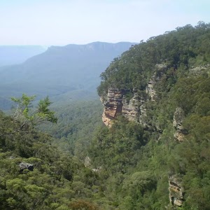
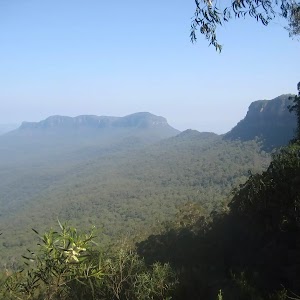
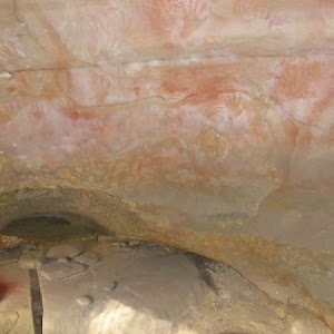
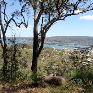
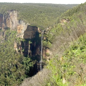
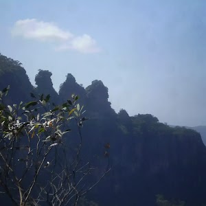
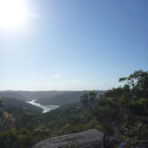
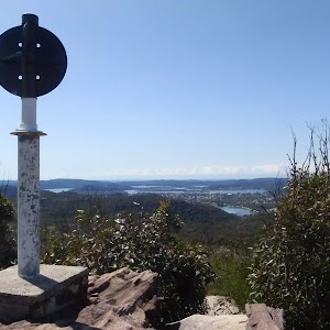
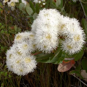
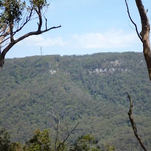
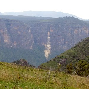
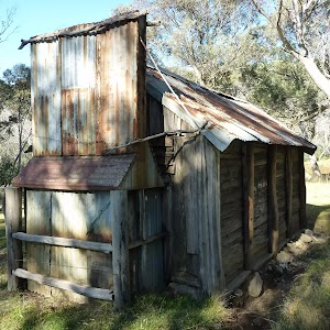
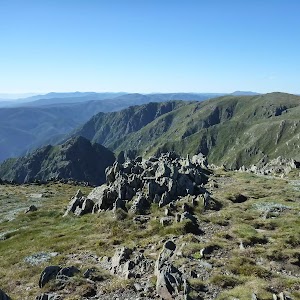
Mt Olive
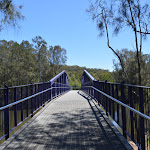
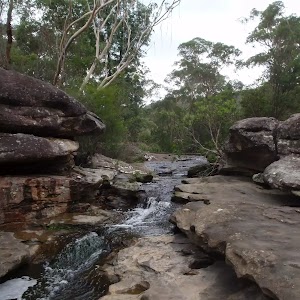
(2.01km) Int of Mt Olive trail and 248 Trail → End of 248 Trail
2.1 km
41 mins
45m
-83m
Moderate track
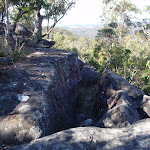
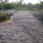
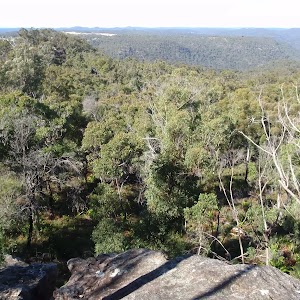
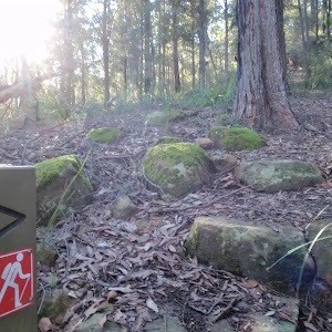
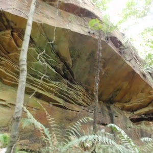
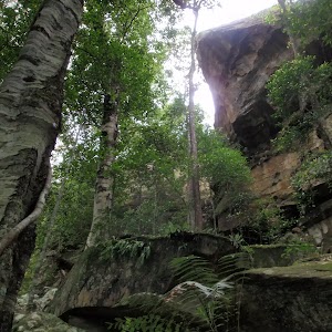
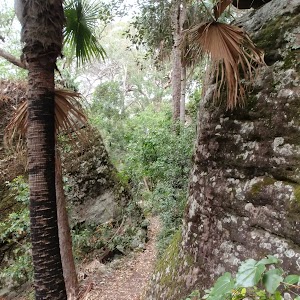
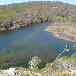
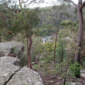
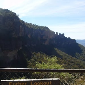
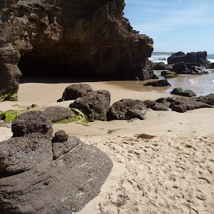
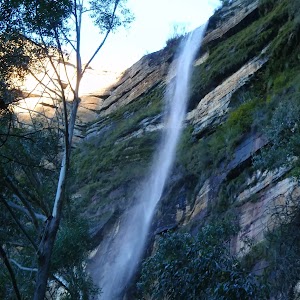
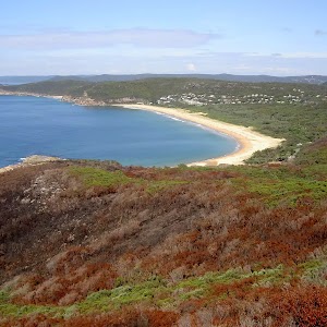
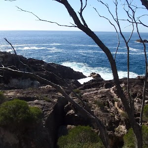
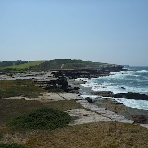
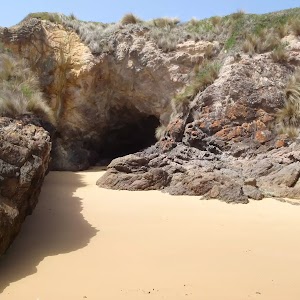
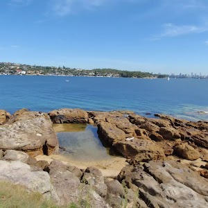
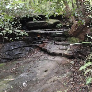
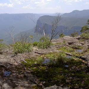
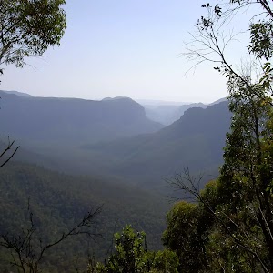
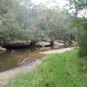
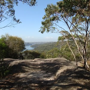
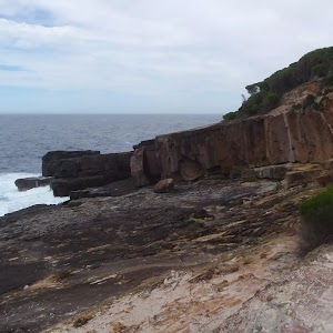
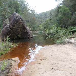
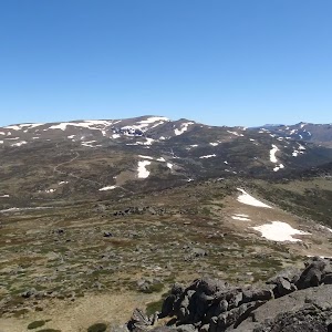
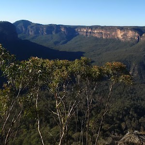
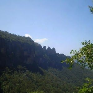
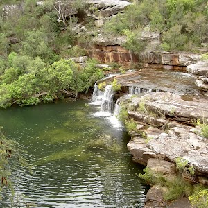
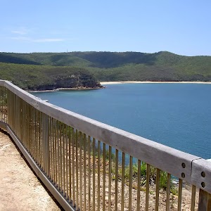
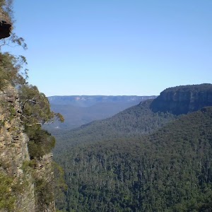
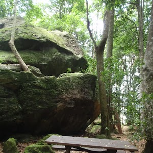
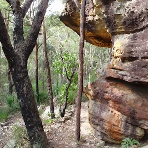
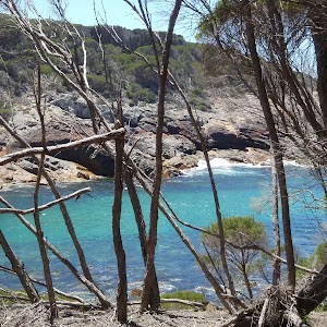
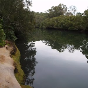
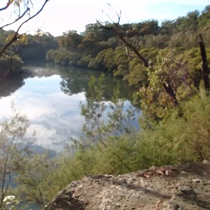
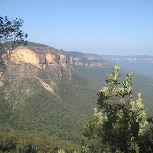
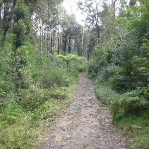
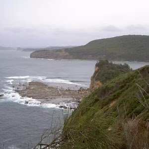
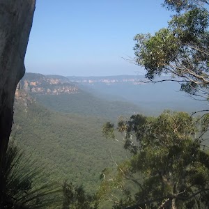
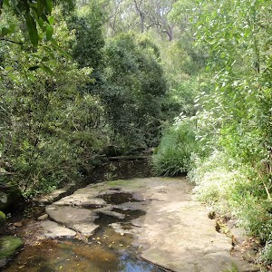
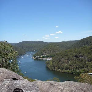
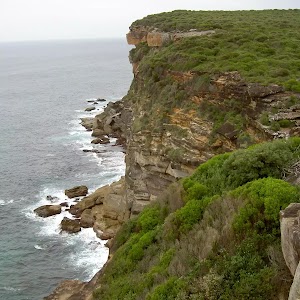
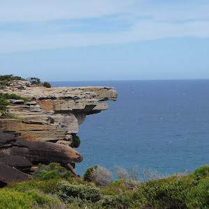
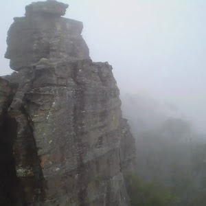
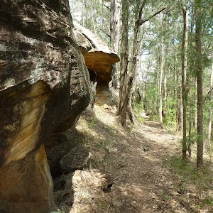
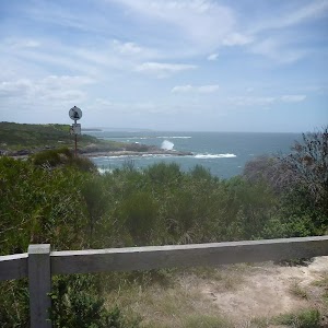
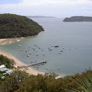
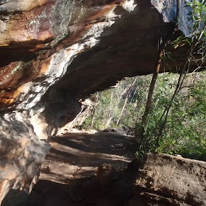
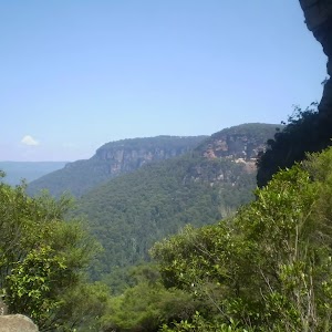
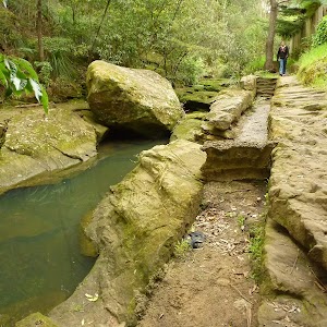
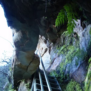
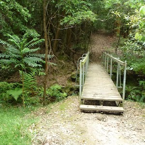
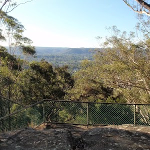
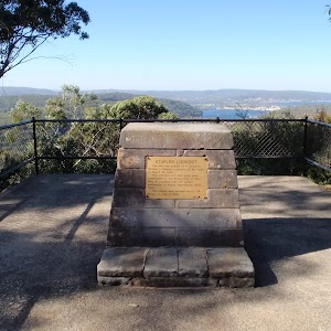
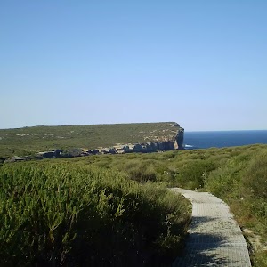
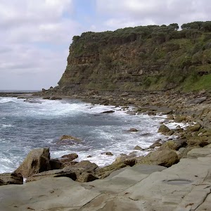
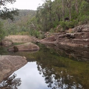
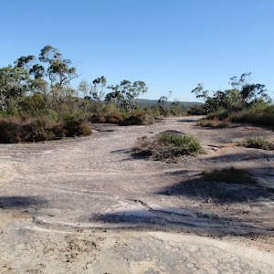
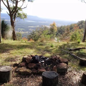
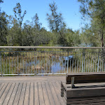
Veer right: From the intersection, the walk follows the ‘248 Trail’ arrow along the overgrown management trail, going gently up the hill. The track ends at a large rocky outcrop which is interesting to explore and has some nice views.
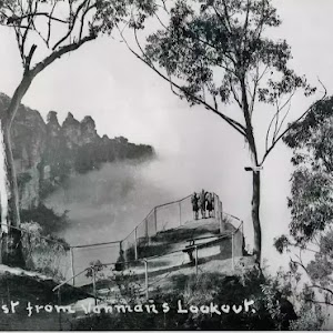
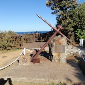
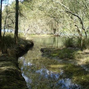
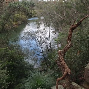
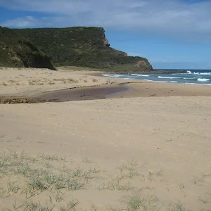
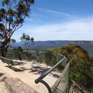
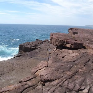
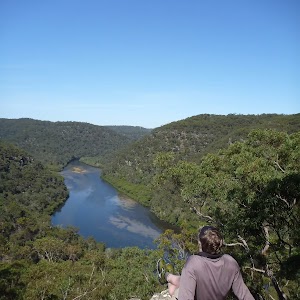
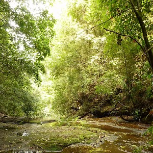
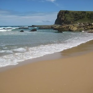
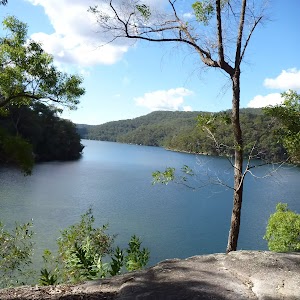
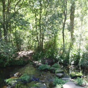
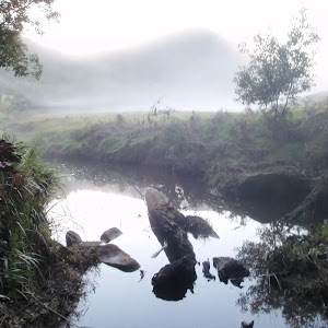
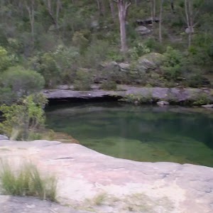
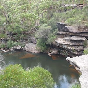
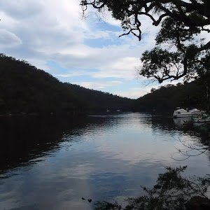
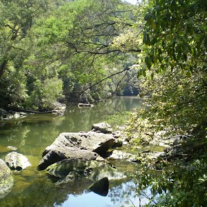
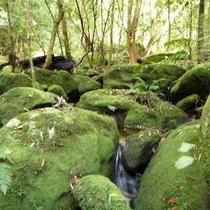
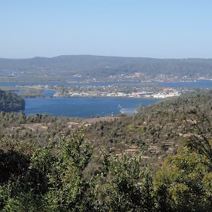
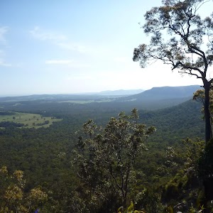
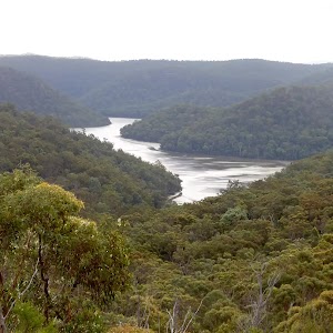
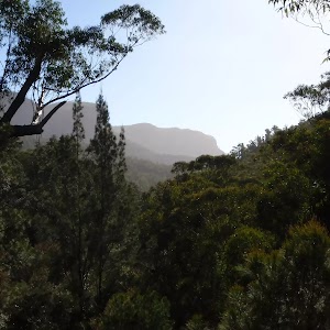
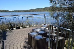
End of 248 Trail lookout
Maps for the 248 Track walk
You can download the PDF for this walk to print a map.
These maps below cover the walk and the wider area around the walk, they are worth carrying for safety reasons.
| Gunderman | 1:25 000 Map Series | 91313S GUNDERMAN | NSW-91313S |
| Mangrove | 1:25 000 Map Series | 91313N MANGROVE | NSW-91313N |
| Gosford | 1:100 000 Map Series | 9131 GOSFORD | 9131 |
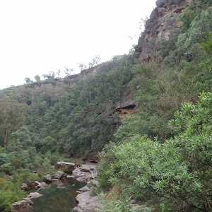
Cross sectional view of the 248 Track bushwalking track

Analysis and summary of the altitude variation on the 248 Track

Overview of this walks grade – based on the AS 2156.1 – 2001
Under this standard, a walk is graded based on the most difficult section of the walk.
| Length | 8.3 km | ||
| Time | 3 hrs 15 mins | ||
| . | |||
| Grade 3/6 Moderate track |
AS 2156.1 | Gradient | Gentle hills with occasional steps (2/6) |
| Quality of track | Formed track, with some branches and other obstacles (3/6) | ||
| Signs | Directional signs along the way (3/6) | ||
| Experience Required | No experience required (1/6) | ||
| Weather | Weather generally has little impact on safety (1/6) | ||
| Infrastructure | Limited facilities, not all cliffs are fenced (3/6) |
Some more details of this walks Grading
Here is a bit more details explaining grading looking at sections of the walk
Gradient
Around 3.5km of this walk has gentle hills with occasional steps, whilst the remaining 600m is flat with no steps.
Quality of track
Around 3.5km of this walk follows a clear and well formed track or trail, whilst the remaining 600m follows a formed track, with some branches and other obstacles.
Signs
Around 2.1km of this walk has directional signs at most intersection, whilst the remaining 2km is clearly signposted.
Experience Required
This whole walk, 4.1km requires no previous bushwalking experience.
weather
This whole walk, 4.1km is not usually affected by severe weather events (that would unexpectedly impact safety and navigation).
Infrastructure
Around 2.1km of this walk has limited facilities (such as not all cliffs fenced), whilst the remaining 2km is close to useful facilities (such as fenced cliffs and seats).
Similar walks
A list of walks that share part of the track with the 248 Track walk.
4.4 km Return
2 hrs
Hard track

10.1 km Return
4 hrs 15 mins
Hard track

10.8 km Circuit
4 hrs 15 mins
Hard track

Other Nearby walks
A list of walks that start near the 248 Track walk.

6 km One way
2 hrs 30 mins
Hard track

21.1 km One way
8 hrs
Hard track

47.4 km One way
3 Days
Hard track

26.7 km One way
2 Days
Hard track

1.7 km Return
45 mins
Moderate track

3 km Circuit
1 hr 30 mins
Moderate track

1.7 km Circuit
1 Hr
Moderate track

2.2 km One way
1 Hr
Moderate track

1.8 km Circuit
1 Hr
Moderate track

8.1 km Circuit
3 hrs 30 mins
Moderate track

426 m Return
20 mins
Moderate track

2.3 km Circuit
1 Hr
Moderate track

Plan your trip to and from the walk here
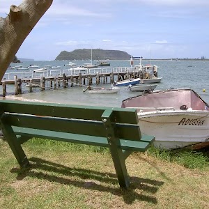
The 248 Track walk starts and ends at the Int of Ironbark Rd and Popran Pipeline Trail (gps: -33.37159, 151.19528)
Your main transport option to Int of Ironbark Rd and Popran Pipeline Trail is by;
![]() Car. There is free parking available.
Car. There is free parking available.
(get details)


Short URL = http://wild.tl/2t
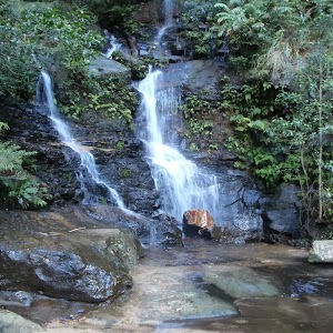
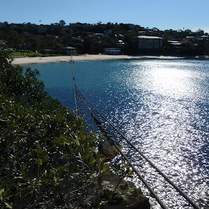
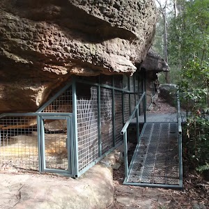
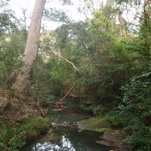
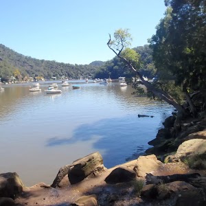
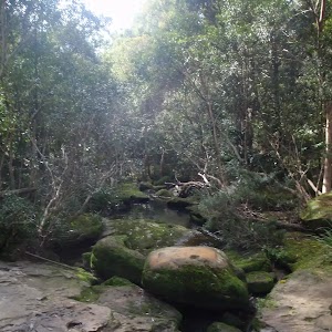
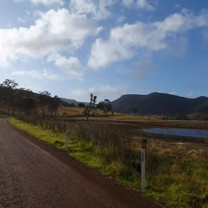
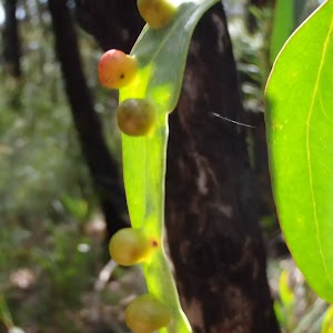
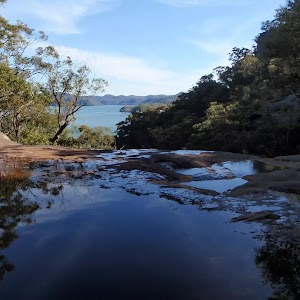
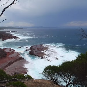
Gallery images
There are other downloads I am still working on.
You will probably need to login to access these — still all free.
* KML (google earth file)
* GPX (GPS file)
Special Maps/ brochures
* A3 topo maps
* PDF with Lands Topo map base
* PDF with arial image (and map overlay)
I wanted to get the main site live first, this extra stuff will come in time.
Happy walking
Matt 🙂
470Mhz (FM) CB frequency table
 This article lists the channel, use and frequency table for the 470 MHz FM CB radio for Australia. These radios are becoming very common in the outdoors. Cheap handed held radios that operate over 1-2km are available for less than $100 at many electronic shops. These types of CB radios give access to a large network of freely accessible repeaters throughout Australia. The use of these repeaters can extend the range of communications up 50km. Includes links to lists of all UHF CB repeaters in Australia
UHF CB repeaters NSW
UHF CB repeaters VIC
UHF CB repeaters TAS
UHF CB repeaters SA
UHF CB repeaters WA
UHF CB repeaters QLD
UHF CB repeaters ACT
UHF CB repeaters NT
| Channel | Freq (MHz) | Use |
| 1 | 476.425 | Repeater access (In Duplex mode) |
| 2 | 476.450 | Repeater access (In Duplex mode) |
| 3 | 476.475 | Repeater access (In Duplex mode) |
| 4 | 476.500 | Repeater access (In Duplex mode) |
| 5 | 476.525 | Emergency Call channel (simplex or duplex) |
| 6 | 476.550 | Repeater access (In Duplex mode) |
| 7 | 476.575 | Repeater access (In Duplex mode) |
| 8 | 476.600 | Repeater access (In Duplex mode) |
| 9 | 476.625 | |
| 10 | 476.650 | |
| 11 | 476.675 | Call channel |
| 12 | 476.700 | |
| 13 | 476.725 | |
| 14 | 476.750 | |
| 15 | 476.775 | |
| 16 | 476.800 | |
| 17 | 476.825 | |
| 18 | 476.850 | |
| 19 | 476.875 | |
| 20 | 476.900 | |
| 21 | 476.925 | |
| 22 | 476.950 | Telemetry and Remote control (ie no talking) |
| 23 | 476.975 | Telemetry and Remote control (ie no talking) |
| 24 | 477.000 | |
| 25 | 477.025 | |
| 26 | 477.050 | |
| 27 | 477.075 | |
| 28 | 477.100 | |
| 29 | 477.125 | |
| 30 | 477.150 | |
| 31 | 477.175 | (Outgoing channel for duplex repeater access) |
| 32 | 477.200 | (Outgoing channel for duplex repeater access) |
| 33 | 477.225 | (Outgoing channel for duplex repeater access) |
| 34 | 477.250 | (Outgoing channel for duplex repeater access) |
| 35 | 477.275 | (Outgoing channel for duplex repeater access -Emergency) |
| 36 | 477.300 | (Outgoing channel for duplex repeater access) |
| 37 | 477.325 | (Outgoing channel for duplex repeater access) |
| 38 | 477.350 | (Outgoing channel for duplex repeater access) |
| 39 | 477.375 | |
| 40 | 477.400 | Road channel |
Hard Tracks (Grade 4 walks)
110 m Return
10 mins
Hard track


194 m Circuit
10 mins
Hard track

360 m Return
15 mins
Hard track


406 m Return
30 mins
Hard track

416 m Return
15 mins
Hard track

482 m Return
12 mins
Hard track

512 m Return
30 mins
Hard track

522 m Return
20 mins
Hard track

702 m Return
20 mins
Hard track


715 m Circuit
20 mins
Hard track

756 m Return
30 mins
Hard track

768 m Return
20 mins
Hard track

816 m Return
45 mins
Hard track

854 m Circuit
45 mins
Hard track

869 m Circuit
1 hr 15 mins
Hard track

886 m Return
30 mins
Hard track

892 m Circuit
30 mins
Hard track

900 m Return
30 mins
Hard track

904 m Return
30 mins
Hard track


926 m Return
45 mins
Hard track

930 m Return
30 mins
Hard track

948 m Return
30 mins
Hard track

1.1 km Return
45 mins
Hard track

1.1 km Circuit
2 hrs
Hard track

1.1 km Return
1 Hr
Hard track


1.1 km Return
1 Hr
Hard track

1.2 km Circuit
30 mins
Hard track

1.2 km Return
2 hrs
Hard track

1.2 km Return
1 hr 45 mins
Hard track

1.2 km Return
1 hr 30 mins
Hard track

1.4 km Return
1 Hr
Hard track

1.4 km Circuit
45 mins
Hard track

1.5 km One way
45 mins
Hard track

1.5 km Return
1 hr 30 mins
Hard track

1.5 km Return
45 mins
Hard track

1.5 km Circuit
1 hr 45 mins
Hard track

1.6 km Return
45 mins
Hard track

1.6 km Return
45 mins
Hard track

1.7 km Return
2 hrs
Hard track

1.7 km Return
1 hr 30 mins
Hard track

1.7 km Return
1 hr 15 mins
Hard track

1.7 km Circuit
1 Hr
Hard track

1.7 km Return
1 Hr
Hard track

1.7 km Return
3 hrs 45 mins
Hard track

1.8 km Return
1 Hr
Hard track

1.8 km Return
1 Hr
Hard track

1.8 km Return
1 Hr
Hard track


1.9 km Return
1 Hr
Hard track

1.9 km Circuit
2 hrs 30 mins
Hard track

1.9 km One way
45 mins
Hard track

1.9 km Return
1 hr 30 mins
Hard track

2 km Circuit
1 Hr
Hard track

2 km Return
1 hr 15 mins
Hard track

2.1 km Return
45 mins
Hard track

2.1 km Circuit
1 hr 15 mins
Hard track

2.1 km Return
1 Hr
Hard track


2.2 km Circuit
1 hr 30 mins
Hard track

2.2 km One way
1 Hr
Hard track


2.2 km Return
1 Hr
Hard track

2.2 km Return
1 hr 15 mins
Hard track


2.2 km Return
1 hr 15 mins
Hard track

2.3 km Return
45 mins
Hard track


2.3 km Return
1 hr 30 mins
Hard track

2.3 km Return
1 hr 30 mins
Hard track

2.3 km Circuit
1 hr 15 mins
Hard track


2.4 km Return
1 Hr
Hard track

2.4 km Return
1 hr 30 mins
Hard track

2.5 km Circuit
1 Hr
Hard track

2.5 km Return
1 hr 15 mins
Hard track

2.5 km Circuit
1 Hr
Hard track

2.5 km Circuit
1 Hr
Hard track

2.5 km Circuit
1 Hr
Hard track

2.5 km Return
1 hr 30 mins
Hard track

2.5 km Return
1 Hr
Hard track

2.6 km Return
1 Hr
Hard track

2.6 km One way
1 hr 15 mins
Hard track

2.6 km Circuit
1 hr 30 mins
Hard track

2.6 km Circuit
1 Hr
Hard track

2.6 km One way
1 Hr
Hard track

2.7 km Return
1 hr 30 mins
Hard track

2.8 km Circuit
1 hr 15 mins
Hard track

2.9 km Circuit
1 hr 15 mins
Hard track

2.9 km One way
1 hr 15 mins
Hard track

2.9 km One way
2 hrs
Hard track

2.9 km Circuit
1 hr 30 mins
Hard track

3 km One way
1 hr 30 mins
Hard track

3 km Return
1 hr 15 mins
Hard track


3 km Return
1 hr 30 mins
Hard track

3.1 km Return
1 hr 30 mins
Hard track

3.1 km One way
3 hrs
Hard track

3.1 km Circuit
1 hr 30 mins
Hard track

3.1 km Return
2 hrs
Hard track


3.1 km One way
3 hrs
Hard track

3.1 km Return
1 hr 45 mins
Hard track

3.1 km One way
2 hrs
Hard track

3.1 km Circuit
2 hrs
Hard track

3.1 km Return
2 hrs
Hard track

3.2 km One way
1 hr 45 mins
Hard track

3.2 km Circuit
1 Hr
Hard track

3.2 km Return
1 hr 30 mins
Hard track


3.3 km Circuit
1 hr 30 mins
Hard track

3.3 km Return
1 hr 30 mins
Hard track

3.3 km One way
1 hr 45 mins
Hard track

3.3 km Return
2 hrs 15 mins
Hard track

3.5 km Circuit
2 hrs
Hard track

3.5 km Return
2 hrs
Hard track

3.5 km Circuit
1 hr 30 mins
Hard track

3.5 km One way
1 hr 15 mins
Hard track

3.5 km Circuit
1 hr 45 mins
Hard track

3.5 km Return
2 hrs
Hard track

3.6 km Return
1 hr 30 mins
Hard track

3.6 km Circuit
1 hr 30 mins
Hard track

3.6 km One way
3 hrs
Hard track

3.7 km Circuit
2 hrs 30 mins
Hard track

3.7 km Return
1 hr 30 mins
Hard track

3.7 km Return
1 hr 30 mins
Hard track

3.8 km Return
2 hrs 30 mins
Hard track

3.8 km Return
1 hr 30 mins
Hard track

3.8 km One way
1 hr 30 mins
Hard track

3.8 km Return
1 hr 45 mins
Hard track

3.8 km One way
1 hr 30 mins
Hard track

3.8 km Return
1 hr 30 mins
Hard track

3.8 km Circuit
1 hr 30 mins
Hard track

3.8 km One way
2 hrs 30 mins
Hard track

3.8 km Circuit
3 hrs
Hard track

3.8 km One way
1 hr 45 mins
Hard track


3.8 km One way
1 hr 30 mins
Hard track

3.9 km Circuit
2 hrs
Hard track

3.9 km Return
1 hr 45 mins
Hard track

3.9 km Circuit
2 hrs
Hard track

3.9 km Return
1 hr 30 mins
Hard track

4 km Return
2 hrs
Hard track

4.1 km One way
2 hrs
Hard track

4.1 km One way
1 hr 45 mins
Hard track

4.1 km One way
2 hrs
Hard track

4.1 km Circuit
1 hr 45 mins
Hard track

4.2 km Return
1 hr 45 mins
Hard track

4.2 km One way
2 hrs 30 mins
Hard track

4.2 km Circuit
2 hrs
Hard track

4.2 km Circuit
1 hr 45 mins
Hard track

4.2 km Circuit
2 hrs 15 mins
Hard track

4.3 km Circuit
2 hrs 30 mins
Hard track

4.3 km Return
4 hrs
Hard track


4.3 km One way
2 hrs
Hard track

4.3 km One way
2 hrs 30 mins
Hard track

4.4 km One way
2 hrs
Hard track

4.4 km One way
3 hrs 45 mins
Hard track

4.4 km One way
1 hr 45 mins
Hard track

4.4 km One way
2 hrs
Hard track

4.4 km Return
2 hrs
Hard track
4.4 km One way
1 hr 45 mins
Hard track

4.5 km Return
1 hr 30 mins
Hard track

4.5 km Return
2 hrs 15 mins
Hard track

4.5 km One way
1 hr 45 mins
Hard track

4.5 km Circuit
2 hrs 30 mins
Hard track

4.5 km One way
1 hr 45 mins
Hard track


4.5 km One way
2 hrs
Hard track

4.6 km One way
2 hrs
Hard track

4.6 km Circuit
3 hrs 30 mins
Hard track

4.6 km Circuit
2 hrs
Hard track

4.6 km One way
2 hrs
Hard track

4.7 km One way
2 hrs 15 mins
Hard track

4.8 km Circuit
3 hrs
Hard track

4.8 km Circuit
4 hrs
Hard track

4.8 km Return
2 hrs
Hard track

4.8 km Circuit
3 hrs
Hard track

4.8 km Circuit
3 hrs
Hard track

4.9 km Return
2 hrs
Hard track

5 km Circuit
2 hrs 15 mins
Hard track

5 km Circuit
4 hrs
Hard track

5 km One way
1 hr 45 mins
Hard track

5 km One way
2 hrs 30 mins
Hard track

5.1 km Return
2 hrs
Hard track

5.1 km One way
2 hrs
Hard track

5.1 km Circuit
4 hrs
Hard track

5.1 km Circuit
2 hrs
Hard track


5.2 km Circuit
2 hrs 30 mins
Hard track


5.2 km Circuit
2 hrs 15 mins
Hard track

5.2 km Return
2 hrs
Hard track

5.2 km One way
2 hrs 45 mins
Hard track

5.2 km Circuit
2 hrs
Hard track

5.2 km Return
2 hrs
Hard track

5.3 km One way
2 hrs 30 mins
Hard track


5.3 km One way
2 hrs
Hard track

5.3 km One way
2 hrs
Hard track

5.3 km Circuit
2 hrs 30 mins
Hard track

5.3 km One way
3 hrs
Hard track

5.4 km One way
2 hrs
Hard track

5.4 km Circuit
3 hrs 30 mins
Hard track

5.4 km Circuit
3 hrs 30 mins
Hard track

5.4 km Return
2 hrs
Hard track

5.4 km One way
2 hrs 30 mins
Hard track

5.4 km Circuit
3 hrs
Hard track

5.4 km Return
3 hrs
Hard track

5.5 km Return
2 hrs
Hard track

5.5 km One way
2 hrs
Hard track

5.5 km One way
2 hrs 15 mins
Hard track

5.5 km One way
2 hrs 30 mins
Hard track

5.6 km Return
2 hrs 30 mins
Hard track

5.6 km Return
2 hrs
Hard track

5.6 km Circuit
2 hrs 30 mins
Hard track


5.6 km Return
2 hrs 30 mins
Hard track

5.6 km One way
2 hrs 45 mins
Hard track

5.7 km One way
2 hrs 45 mins
Hard track

5.7 km One way
2 hrs 30 mins
Hard track

5.8 km Circuit
3 hrs
Hard track

5.8 km Return
2 hrs 30 mins
Hard track

5.8 km One way
2 hrs 30 mins
Hard track

5.8 km One way
2 hrs 30 mins
Hard track

5.8 km Circuit
5 hrs 30 mins
Hard track

5.9 km Circuit
3 hrs
Hard track

5.9 km Circuit
3 hrs 30 mins
Hard track

6 km One way
2 hrs 30 mins
Hard track

6 km One way
2 hrs 30 mins
Hard track


6 km One way
2 hrs 45 mins
Hard track

6 km Return
2 hrs 30 mins
Hard track

6 km One way
3 hrs
Hard track

6 km Circuit
2 hrs 15 mins
Hard track

6 km One way
2 hrs 30 mins
Hard track
6.1 km One way
2 hrs 30 mins
Hard track

6.1 km One way
2 hrs 30 mins
Hard track

6.1 km One way
3 hrs
Hard track


6.1 km Circuit
2 hrs 45 mins
Hard track

6.5 km One way
3 hrs
Hard track

6.5 km One way
2 hrs 30 mins
Hard track

6.6 km Circuit
2 hrs 30 mins
Hard track

6.6 km One way
4 hrs
Hard track

6.6 km One way
4 hrs 15 mins
Hard track

6.6 km Circuit
3 hrs
Hard track

6.7 km Circuit
3 hrs
Hard track

6.7 km Return
2 hrs 30 mins
Hard track


6.7 km Circuit
3 hrs
Hard track

6.8 km Circuit
5 hrs
Hard track

6.8 km Return
3 hrs 15 mins
Hard track

6.8 km One way
3 hrs
Hard track

6.8 km Circuit
3 hrs
Hard track

6.8 km One way
2 hrs 30 mins
Hard track

6.9 km Circuit
2 hrs 30 mins
Hard track


7 km Circuit
2 hrs 30 mins
Hard track

7.2 km One way
3 hrs 30 mins
Hard track

7.3 km Circuit
3 hrs
Hard track

7.3 km Circuit
3 hrs
Hard track

7.5 km Circuit
3 hrs
Hard track

7.5 km Return
3 hrs 45 mins
Hard track

7.6 km Circuit
2 hrs 15 mins
Hard track

7.6 km One way
3 hrs 30 mins
Hard track

7.6 km Return
3 hrs 30 mins
Hard track

7.7 km Circuit
3 hrs
Hard track

7.7 km Return
3 hrs
Hard track

7.8 km One way
2 hrs 45 mins
Hard track

7.9 km Return
5 hrs
Hard track

7.9 km One way
2 hrs 45 mins
Hard track

8 km One way
3 hrs
Hard track

8 km One way
5 hrs
Hard track

8.1 km One way
5 hrs 30 mins
Hard track

8.1 km One way
5 hrs
Hard track

8.1 km One way
4 hrs
Hard track

8.1 km Return
3 hrs 30 mins
Hard track

8.1 km One way
3 hrs 30 mins
Hard track

8.2 km Circuit
4 hrs 15 mins
Hard track

8.2 km Circuit
3 hrs
Hard track

8.2 km Return
3 hrs 30 mins
Hard track

8.2 km Return
3 hrs
Hard track

8.2 km Circuit
3 hrs 30 mins
Hard track

8.3 km Return
3 hrs
Hard track

8.3 km Circuit
3 hrs 45 mins
Hard track

8.4 km One way
3 hrs 15 mins
Hard track

8.5 km One way
3 hrs 45 mins
Hard track

8.5 km One way
3 hrs
Hard track

8.5 km Return
3 hrs
Hard track

8.5 km Return
3 hrs
Hard track

8.5 km Circuit
4 hrs
Hard track

8.6 km Circuit
5 hrs
Hard track

8.6 km One way
3 hrs 45 mins
Hard track

8.6 km Circuit
5 hrs
Hard track

8.6 km Return
3 hrs 30 mins
Hard track

8.7 km One way
4 hrs
Hard track

8.7 km Circuit
3 hrs 30 mins
Hard track

8.7 km Circuit
4 hrs 30 mins
Hard track

8.8 km One way
4 hrs
Hard track

8.8 km Return
3 hrs 30 mins
Hard track


8.9 km One way
3 hrs 30 mins
Hard track

8.9 km Circuit
4 hrs 30 mins
Hard track

9 km Return
3 hrs
Hard track

9 km Return
3 hrs 30 mins
Hard track

9 km Return
4 hrs
Hard track

9 km One way
3 hrs 45 mins
Hard track

9 km One way
4 hrs
Hard track

9.1 km Circuit
4 hrs
Hard track

9.1 km One way
3 hrs 30 mins
Hard track


9.1 km Return
3 hrs 30 mins
Hard track

9.2 km Circuit
3 hrs 30 mins
Hard track


9.3 km Circuit
4 hrs 30 mins
Hard track

9.3 km Return
3 hrs 30 mins
Hard track

9.3 km Return
4 hrs
Hard track

9.4 km Return
4 hrs
Hard track

9.4 km Circuit
5 hrs 30 mins
Hard track

9.4 km One way
4 hrs 30 mins
Hard track

9.5 km One way
4 hrs
Hard track

9.5 km Circuit
5 hrs 30 mins
Hard track

9.7 km One way
3 hrs 45 mins
Hard track

9.7 km One way
4 hrs
Hard track

9.7 km Return
4 hrs
Hard track

9.7 km One way
4 hrs
Hard track

9.7 km One way
4 hrs 30 mins
Hard track

9.7 km Return
3 hrs 30 mins
Hard track

9.7 km One way
4 hrs 15 mins
Hard track

9.8 km Return
3 hrs 30 mins
Hard track

9.8 km Return
4 hrs 30 mins
Hard track

9.8 km Circuit
4 hrs 30 mins
Hard track

9.9 km Return
3 hrs 30 mins
Hard track


10 km One way
4 hrs
Hard track

10 km One way
4 hrs 30 mins
Hard track

10 km One way
4 hrs 15 mins
Hard track

10.1 km One way
4 hrs 15 mins
Hard track

10.1 km One way
5 hrs
Hard track

10.1 km Return
4 hrs 15 mins
Hard track
10.1 km Circuit
5 hrs
Hard track

10.2 km One way
4 hrs
Hard track

10.2 km Circuit
6 hrs
Hard track

10.3 km One way
3 hrs 45 mins
Hard track

10.4 km One way
5 hrs
Hard track

10.5 km Return
3 hrs 30 mins
Hard track

10.5 km Circuit
4 hrs 15 mins
Hard track

10.6 km Circuit
3 hrs 45 mins
Hard track

10.7 km One way
4 hrs 45 mins
Hard track

10.7 km Circuit
6 hrs 30 mins
Hard track


10.7 km One way
4 hrs 30 mins
Hard track

10.8 km Circuit
4 hrs 30 mins
Hard track

10.8 km One way
2 Days
Hard track


10.8 km One way
5 hrs
Hard track

10.8 km Circuit
4 hrs 15 mins
Hard track
11 km Circuit
4 hrs 30 mins
Hard track

11 km One way
4 hrs 30 mins
Hard track

11 km One way
4 hrs
Hard track

11 km One way
4 hrs 30 mins
Hard track

11 km Circuit
4 hrs
Hard track

11.2 km One way
4 hrs 30 mins
Hard track

11.2 km One way
4 hrs 30 mins
Hard track

11.2 km Circuit
4 hrs
Hard track

11.3 km One way
4 hrs 30 mins
Hard track

11.3 km One way
4 hrs 30 mins
Hard track

11.5 km One way
5 hrs
Hard track

11.5 km One way
4 hrs 30 mins
Hard track

11.5 km One way
4 hrs 30 mins
Hard track

11.6 km One way
4 hrs 30 mins
Hard track


11.7 km One way
4 hrs 15 mins
Hard track

11.8 km Return
4 hrs 30 mins
Hard track


11.9 km Circuit
5 hrs
Hard track

12 km Return
4 hrs 30 mins
Hard track

12.1 km One way
5 hrs 30 mins
Hard track

12.2 km One way
5 hrs
Hard track


12.2 km One way
4 hrs 30 mins
Hard track

12.3 km One way
5 hrs 30 mins
Hard track

12.4 km Return
7 hrs 30 mins
Hard track

12.4 km Return
6 hrs
Hard track

12.5 km One way
6 hrs
Hard track


12.6 km Return
5 hrs 30 mins
Hard track

12.6 km One way
5 hrs 30 mins
Hard track

12.6 km One way
5 hrs 30 mins
Hard track

12.7 km One way
4 hrs 15 mins
Hard track

12.8 km One way
2 Days
Hard track

12.8 km Return
5 hrs
Hard track

12.9 km One way
6 hrs
Hard track

12.9 km Circuit
5 hrs
Hard track

12.9 km One way
5 hrs 15 mins
Hard track

12.9 km One way
5 hrs 30 mins
Hard track

13 km One way
6 hrs
Hard track

13 km One way
6 hrs
Hard track

13 km One way
5 hrs
Hard track

13.1 km One way
4 hrs 30 mins
Hard track

13.2 km Return
6 hrs 30 mins
Hard track

13.3 km One way
4 hrs 30 mins
Hard track

13.3 km One way
5 hrs
Hard track

13.4 km One way
5 hrs 30 mins
Hard track

13.4 km One way
5 hrs
Hard track

13.4 km One way
5 hrs
Hard track

13.4 km Circuit
6 hrs
Hard track

13.5 km Circuit
7 hrs
Hard track

13.6 km Circuit
8 hrs
Hard track

13.7 km Return
6 hrs
Hard track

13.8 km One way
5 hrs
Hard track

13.8 km Circuit
6 hrs 30 mins
Hard track

14 km One way
7 hrs 30 mins
Hard track

14.1 km Circuit
5 hrs 30 mins
Hard track

14.6 km One way
6 hrs 30 mins
Hard track

14.7 km One way
5 hrs 30 mins
Hard track

14.8 km One way
6 hrs
Hard track


15 km One way
6 hrs 30 mins
Hard track

15 km One way
5 hrs 30 mins
Hard track

15.2 km Return
5 hrs 30 mins
Hard track

15.4 km One way
6 hrs
Hard track

15.5 km One way
5 hrs 45 mins
Hard track

15.5 km One way
6 hrs
Hard track


15.6 km Circuit
7 hrs 30 mins
Hard track

16.1 km One way
6 hrs 45 mins
Hard track

16.1 km One way
6 hrs
Hard track


16.3 km One way
6 hrs
Hard track

16.5 km One way
2 Days
Hard track

17 km One way
6 hrs 30 mins
Hard track

17 km One way
6 hrs 30 mins
Hard track

17.2 km One way
7 hrs
Hard track

17.2 km One way
8 hrs
Hard track

17.5 km One way
6 hrs 45 mins
Hard track

17.8 km One way
7 hrs
Hard track


18.1 km One way
6 hrs 45 mins
Hard track

18.1 km One way
7 hrs
Hard track

18.1 km Return
8 hrs
Hard track


18.2 km Circuit
8 hrs 30 mins
Hard track

18.3 km Return
7 hrs
Hard track


18.5 km Return
6 hrs
Hard track

18.9 km One way
8 hrs
Hard track

19.5 km One way
7 hrs 30 mins
Hard track

19.6 km Return
7 hrs 30 mins
Hard track


20.6 km One way
8 hrs
Hard track

20.7 km One way
8 hrs 30 mins
Hard track

21.1 km One way
8 hrs
Hard track
21.9 km Circuit
9 hrs
Hard track

22.3 km One way
9 hrs
Hard track

22.4 km Return
9 hrs
Hard track

22.6 km One way
9 hrs 18 mins
Hard track

22.6 km One way
9 hrs 45 mins
Hard track

24.1 km Circuit
2 Days
Hard track

24.3 km Circuit
2 Days
Hard track

24.8 km One way
10 hrs
Hard track

24.8 km One way
2 Days
Hard track

25.7 km One way
2 Days
Hard track


25.8 km One way
2 Days
Hard track

26.2 km One way
10 hrs
Hard track

26.2 km One way
2 Days
Hard track

26.7 km One way
2 Days
Hard track
27 km Circuit
2 Days
Hard track

27.3 km One way
2 Days
Hard track

27.4 km One way
2 Days
Hard track

27.4 km One way
2 Days
Hard track

27.4 km One way
2 Days
Hard track


28.1 km One way
2 Days
Hard track

29.6 km One way
3 Days
Hard track

29.7 km One way
2 Days
Hard track

30.9 km One way
2 Days
Hard track

30.9 km One way
3 Days
Hard track


33 km One way
2 Days
Hard track

33.4 km One way
2 Days
Hard track

33.7 km One way
2 Days
Hard track


35.9 km One way
2 Days
Hard track

41.5 km One way
3 Days
Hard track

43.1 km One way
3 Days
Hard track


44.4 km One way
3 Days
Hard track

44.8 km One way
2 Days
Hard track

44.8 km One way
3 Days
Hard track

47.4 km One way
3 Days
Hard track
60.5 km One way
4 Days
Hard track

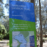
Narrabeen Lagoon Trail (from Middle Creek)
Narrabeen Lagoon Trail (from Middle Creek)

2 hrs 30 mins
105 m
Very easy
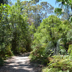
The Narrabeen Lagoon Trail is a wonderful and accessible walk on the Northern Beaches of Sydney. The trail is used by walkers, runners cyclists, kids on scooters and people in wheelchairs to explore the stunning bushland and lagoon views. There are bridges over rivers, quiet spots to enjoy the view, cafes to refuel as well as toilets and picnic areas. A quick lap for exercise or take the time enjoy all the facilities along the way.


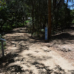


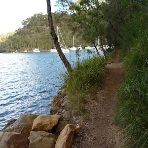
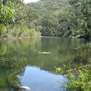
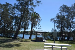
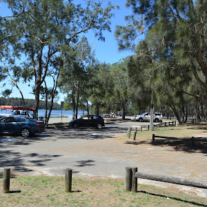
Middle Creek Reserve
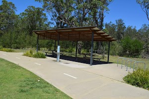
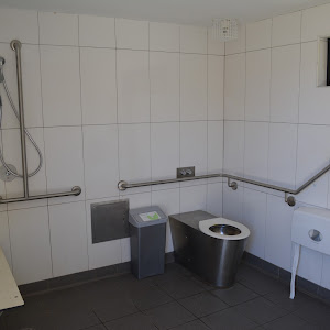
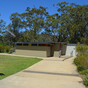
Ingleside at the northwestern edge of Narrabeen Lagoon. The modern picnic area hosts a public toilet and change areas

and an accessible toilet

. There are a series of picnic tables


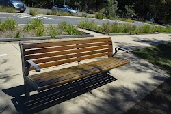
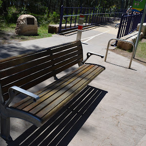
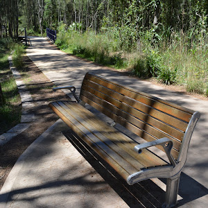
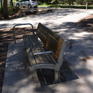
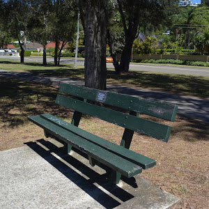
scattered throughout the picnic area. There are also plenty of bench seats


, BBQs

and drinking fountain

. There is space to park about 50 cars, including two mobility parking bays

. Parking is metered at $6 per hour[1]. There is also a concrete boat ramp[2]
(0km) Middle Creek Reserve boat ramp → Sport and Recreation boat shed
460 m
7 mins
3m
-2m
Very easy
[5], a toilet block
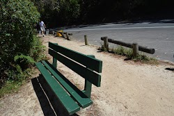
[6] and car parking. At the southern end of the picnic area just before Middle Creek the path bends left[7] past the sheltered tables
] to a seat

(on the right) and a ‘The Jim Somerville Bridge’ sign[8] on a rock (on the left) just before a bridge[9]. The seat continues the the Jim Somerville Bridge[10] ramp then after about 60m the bridge turns right and flattens out for 70m to cross the creek and after 70m then leads gently downhill for about 50m, passing a fenced off abseiling area[11]. At the end of the bridge[12] this walk continues on a concrete path[13] for another 60m to come to a grassy clearing[14] (on the left) with two seats

just before the boat shed for the Sport and Recreaction Center[15].
(0.46km) Sport and Recreation boat shed → James Wheeler Place Intersection
750 m
12 mins
7m
-7m
Very easy

(on the left).
From this seat this walk continues along the footpath[22] for about 190m past a seat

(on the left) to come to a another seat

(on the left). From the seat this walk continues along the concrete path[23] gently uphill for about 35m to the start of fence[24] and fiberglass bridge with handrails[25]. This walk zig zags on the bridge for about 70m, offering beautiful views[26][27] across the lagoon. This walk then heads gently downhill for about 20m to come to a concrete path[28] and end of handrails where the path flattens out and comes to another seat

(on the left). From here this walk follows the concrete path for about 190m past a seat

(on the left) to come to another seat

(on the left) just before the intersection[29] beside James Wheeler Place, marked by a ‘South Creek Reserve’ sign[30] (on the left).
(1.21km) James Wheeler Place Intersection → RSL War Veterans access intersection
440 m
7 mins
5m
-2m
Very easy
‘Cyclists slow down’ sign[32] (on the left) and a ‘Wildlife Protection Area’ sign[33] (on the right) and follows the gravel track for about 90m to come to an intersection with a short informal track to the water[34] (on the left). This walk then continues along the wide track for another 110m past a series of signs (on the left) remembering each war [35][36][37] before coming to a Y-intersection marked by a sign (on the right)[38]. This walk then veers left, following the ‘Jamieson Park 2.1km’ arrow along the track for the next 80m past more signs in the series (on the left) remembering each war [39][40][41][42] before crossing a 40m long fiberglass ‘RSL War Veterans Footbridge’ with timber handrails[43]. At the end of the footbridge this walk comes to an intersection[44] with a faint informal steep rough track to the right just below the Dardanelles coffee shop[45].
Continue straight: From the intersection, this walk follows the ‘Jamieson Park 2km’ arrow[46] along the gravel track keeping the road and village a short distance to the right. This walk continues for about 50m past the continuing series of information signs (on the left) remembering each war [47][48][49] before crossing to a 15m long fiberglass bridge with timber handrailing[50] and then continues along the gravel track for about 40m past more information signs (on the left) [51][52][53]. This walk then heads gently uphill to a 3-way intersection marked by a ‘RSL War Veterans North’ signpost[54] (on the right).
(1.64km) RSL War Veterans access intersection → Northern end of Jamison Park
1.6 km
28 mins
20m
-25m
Very easy

[79] to find the ‘Jamieson Park Trail Entry’ post[80]. The walking continues along the wide gravel track for 30m, to pass the ‘Jamieson Park’[81] to then come to a 3-way intersection[82] (with a concrete track and picnic area[83]


on the left).
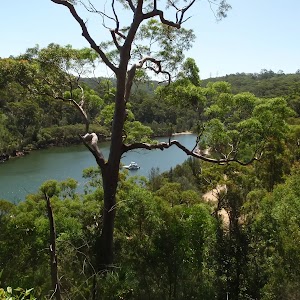
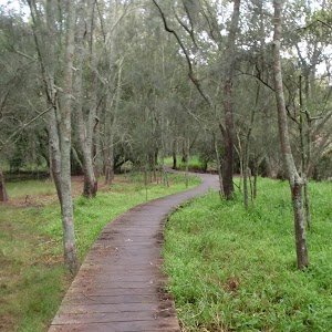
(3.29km) Northern end of Jamison Park → Int behind Jamison Park
260 m
4 mins
2m
-1m
Easy track
[86] (on the right), (and past the other picnic facilities
) as the path then bends right and leads beside the lagoon for about 80m to come to, then cross a small creek on a narrow (1.07m wide[87]) timber footbridge[88] with metal handrails (1.02m high[89]. On the other side of the bridge this walk leads past a picnic table

[90] to come beside the boat ramp[91] at the end of Jamison Park car park.
Turn right: From just beside the boat ramp[92] at the end of Jamison Park car park, this walk follows the footpath gently uphill towards the sailing club. After about 20m this walk passes a picnic table
[93], BBQ

[94], as well at the accessible

and public toilets

[95] (in the ‘Narrabeen Lakes sailing Club’ building). The walk continues along the footpath for just over 100m, as it leads behind the club building, past another picnic table

[96], to come to a T-intersection beside the ‘Water Refill Jamison Park’

[97] station. Now Turn left to rejoin the main walk .
(3.29km) Northern end of Jamison Park → Int behind Jamison Park
230 m
4 mins
3m
-1m
Very easy
[104] station.
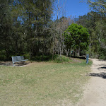
Jamison Park
Narrabeen. The picnic area has a large paid[105] parking area, including two mobility parking bays

and is home to the ‘Narrabeen Lakes Sailing Club’[106]. There is a boat ramp, picnic tables
, BBQ’s
, drinking fountain
, public
and accessible toilets
. A pleasant area to enjoy the lagoon.
(3.53km) Int behind Jamison Park → Wheeler Park
760 m
13 mins
7m
-7m
Very easy
[107] station), this walk heads along the wide concrete footpath 30m towards the road, to pass the large ‘Narrabeen Lagoon Trail’ sign[108] then cross ‘The Esplanade’ at the main entrance to Jamison Park.
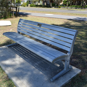
Continue straight: From the entrance to ‘Jamison Park’, this walk follow the footpath out of the park keeping ‘The Esplanade’ to the right[109]. The path leads between the lagoon and the road for about 130m to pass the end of ‘Nioka Rd’. The walk continues beside the lagoon for another 250m to find a green timber bench seat

[110], then just 100m later to find another metal[111] and timber seat
[112]. The walk continues along the footpath for 70m to pass a roundabout, then past some houses to turn left onto the footpath beside ‘Lakeside Rd’[113]. The walk continues beside ‘Lakeside Rd’ for about 70m to come to the ‘water refill’ station

Wheeler Park
and bench seat
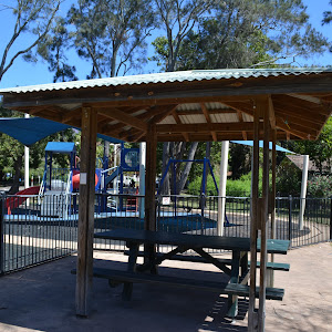
beside the footpath. A great fenced and shaded children’s playground[116] as well as rubbish bins[117]. Behind the playground is a sheltered BBQ

and sheltered picnic tables

(as well as some other unsheltered picnic tables) beside the open grassy area[118].
(4.28km) Wheeler Park → Coffee and Kayaks
470 m
7 mins
2m
-3m
Very easy
[119] beside the playground[120] at Wheeler Park (Lakeside Rd Narrabeen), this walk follows the footpath, past the garbage bins and seat
, initially keeping the road to the right. After about 25m this walk leads past the large ‘Narrabeen Lagoon Trail’ sign[121] to continue for just shy of 100m past the scout hall[122] to head between the timber bollards[123] (1.2m wide and 1m high). The walk continues along the footpath for another 50m to pass the end of ‘Devitt St’[124], then continues for another 120m to come to a seat

[125] (on the left) at the end of ‘Roberston St’. From here this walk continues straight, following the ‘Berry Reserve 500m’[126] arrow along the footpath for 90m to pass another bench seat
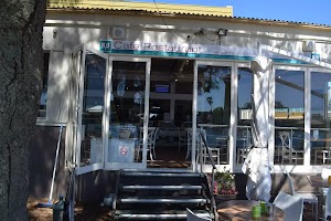
[127] (on the left) and continues for another 80m to come to the ‘Pro-kayaks’[128] and the ‘The Boatshed’ cafe[129] (on the right), beside the lagoon.
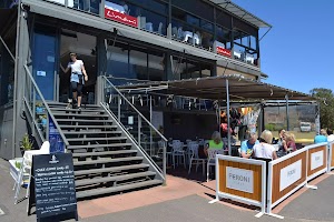
The Boatshed cafe
(4.75km) Coffee and Kayaks → Berry Reserve
370 m
6 mins
1m
-1m
Very easy

[135]). After about 40m the path leads past the end of ‘Narrabeen St’[136] and past the seat

[137] (on the left) then continues for just shy of 200m beside the lagoon, through the casuarina grove, to find a picnic table

[138] (on the left). About 45m further along this path this walk passes a BBQ shelter

[139] then continues for another 70m through the open park (beside the car park) to come to the ‘Narrabeen Lagoon Trail – Berry Reserve’ signposted intersection (beside the exercise equipment [140]).
Berry Reserve

[141] , picnic tables


, 2hr car parking

, short basketball court[142], exercise area[143], garbage bins[144], and sheltered BBQs
. There are a wide range of shops within 100m along Pittwater Rd as well as bus stops. warringah.nsw.gov.au
Berry Markets are held on the 3rd Sunday of every month. It is a busy time with around 80 stalls offering arts & crafts, home wares & fashion as well as yummy food.
(5.12km) Berry Reserve → H20 cafe
120 m
2 mins
0m
-1m
Very easy
H20 cafe
(5.23km) H20 cafe → South end of Pitwater Rd Bridge
90 m
1 mins
0m
0m
Very easy

[152][153][154] as the path bends right and headhill up to a T-intersection with another footpath beside Pittwater Road[155].
(5.33km) South end of Pitwater Rd Bridge → East end of Billarong Reserve
610 m
10 mins
10m
-4m
Very easy
(5.93km) East end of Bilarong Reserve → Bilarong Reserve playground
330 m
5 mins
1m
-6m
Very easy


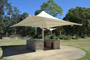
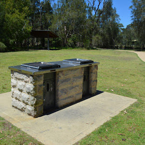
(one on each side of the track) to then cross a concrete ford with 57cm high timber guiding (2.6m wide)[174]. From the ford the track heads gently uphill to pass the exercise area[175] (on the right). Here this walk flattens and continues for another 130m passing a scattering of picnic tables (on both sides of the path)


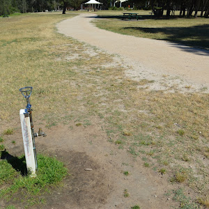
, a drinking fountain (on the left)

, a double BBQ (on the right) to come to Y-intersection[176] beside a picnic area with another drinking fountain

and a playground[177] (on the right).
Bilarong Reserve playground and picnic area
In the centre of the carpark is a scout hall with toilets

.
(6.26km) Bilarong Reserve playground → Bilarong Reserve boat ramp
140 m
2 mins
1m
0m
Very easy

and continues for about 40m to cross a flat fiber glass bridge (6m long, 2.6m wide, no handrails)[184] over a small creek. This walk heads below the carpark[185] for about 90m to just before the boat ramp[186] where there’s a 1.8m high shower (on the left)[187]. (Opposite the canoe ramp across the parking lot are accessible public toilets
.)
Bilarong Reserve car park
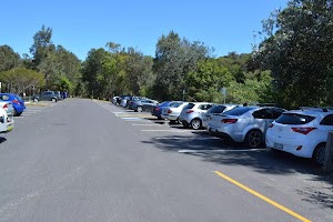
[188] bays, a space for motor bikes[189] and plenty of car parking[190]. Parking fees ($6hr) apply[191]. There is a boat ramp[192] opposite the scout hall[193]. Also beside the scout hall are accessible
public toilets[194].
(6.41km) Bilarong Reserve boat ramp → Bilarong Reserve turning circle
180 m
3 mins
0m
0m
Very easy

, a scattering of picnic tables


, a seat

and a BBQ

(all on the left). From here this walk bends right and through the forest[195] for about 20m to lead up to a T-intersection[196] with a road (at the end of car park area).
Turn left: From the intersection, this walk heads along the road[197] past the timber bollards keeping the lagoon (through the trees) to the left. This walk continues for about 60m to come to the ‘Bilarong Sanctuary’ gate [198] (1.3m wide) at the far end of the turning circle.
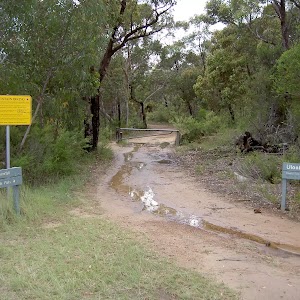
(6.59km) Billarong Reserve turning circle → Deep Creek Intersection
1 km
19 mins
26m
-27m
Very easy
(on the left) to come to a ’80’ km/h sign[208] (on the right). From the sign this walk starts to head moderately steeply downhill for about 30m to a flat fibreglass bridge[209]. From here this walk continues for the next 100m, crosses another flat fibreglass bridge [210] and follows the 80m section of timber boardwalk (1.78m wide)[211]. This walk continues along the gravel track for the next 70m, across another 12m long flat fiberglass bridge[212] to come to timber lookout[213] with 2 seats


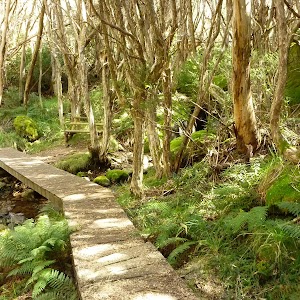
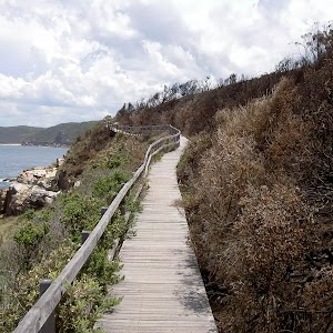
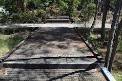
(at time of writing the platform was closed of for repair), located by a gorgeous angophora tree[214]. This walk continues gently uphill to then pass a 15m long moderately steep dowhnill section of gravel track[215] and a flat fibreglass bridge[216]. This walk follows the gravel track for about 140m past a timber fence[217] (on the left) and a facing away ‘Welcome to Pittwater’ sign[218] (opposite the fence) to come to a Y-intersection[219] at the start of the concrete path.
(7.59km) Deep Creek Intersection → Cement Works Lookout
310 m
5 mins
2m
-2m
Very easy

. This walk now continues along the fiberglass footpath with handrails (handrails stop after 45m) for about 90m to come to another seat

(on the left). This walk then leads into a forest and zig-zags a little bit away from the Wakehurst Parkway to come to a handrailed (116cm high) lookout (on the left) with a seat

, just by the ‘Cement Works’ sign (on the left) and a shaded seat (on the right).
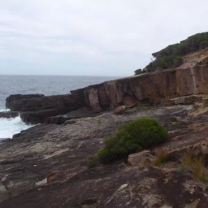
Cement Works Lookout
The lookout offers beautiful views across the lagoon[226] and unique seats

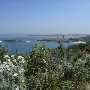
as a reminder of the works that were done here. There is a 1.2m high railing[227] at the main viewing area.
(7.9km) Cement Works Lookout → Northern end of Middle Creek Reserve
630 m
12 mins
17m
-14m
Very easy

(on the right) and an unfenced timber viewing platform[231] (on the left) with 4 steps[232], offering beautiful views across the lagoon[233].
From beside this viewing platform this walk continues straight, along the 15m section of boardwalk with handrails[234] then another 80m of boardwalk to come to another viewing platform (on the left) and a seat

(on the right).
This walk continues along the fibreglass board for the next 140m as it meanders through the forest to come to the next viewing platform[235] (on the left) and a seat

(on the right).
From this viewing platform this walk continues along the fibreglass board for the next 120m through the forest to come to yet another viewing platform[236] (on the left) with a trip hazard
and a seat

(on the right).
From the viewing platform this walk continues along the fibreglass board and after about 70m this walk comes closer to the road and to yet another similar viewing platform[237] (on the left) and a seat

(on the right).
This walk continues along fiberglass board for the next 40m to come across a small handrailed bridge[238] then the end of the fiberglass boardwalk and a start of the gravel track[239].
This walk continues along the wide gravel track for the next 80m to come to a seat

and a timber viewing platform (on the left), marked by a ‘Middle Creek Reserve’ sign[240](on the right) and ‘The Graham Jones Track’ sign[241] on a rock (on the left) at the start of the Middle Creek Reserve.
(8.53km) Northern end of Middle Creek Reserve → Middle Creek Reserve boat ramp
90 m
2 mins
0m
-3m
Very easy
(on the left) and 15m later a parking pay station[244] (on the left), to come to the boat ramp[245] in the middle of the Middle Creek Reserve parking area (be mindful of a ‘Give way’ sign[246] when crossing).
Maps for the Narrabeen Lagoon Trail (from Middle Creek) walk
You can download the PDF for this walk to print a map.
These maps below cover the walk and the wider area around the walk, they are worth carrying for safety reasons.
| Mona Vale | 1:25 000 Map Series | 91301S MONA VALE | NSW-91301S |
| Sydney | 1:100 000 Map Series | 9130 SYDNEY | 9130 |
Cross sectional view of the Narrabeen Lagoon Trail (from Middle Creek) bushwalking track

Analysis and summary of the altitude variation on the Narrabeen Lagoon Trail (from Middle Creek)

Accessibility summary information for the Narrabeen Lagoon Trail (from Middle Creek)
They are on average 2140m apart, with a maximum gap of 3480m.
Toilets: There are 2 designated accessible toilets on this walk.
They are 6390m apart.
Seats: There are 58 places to sit on this walk.
They are on average 150m apart, with a maximum gap of 1990m.
Hazards: There are 2 specific noteable accessability related hazards on this walk.
Trip Hazard The footpath beside the Boastshed Cafe has an unfenced direct 1m drop into the lagoon. There is a white line marking the edge but no change in texture. Found about 4730m into the walk.
Trip Hazard A 15cm step on a timber viewing platform with no handrails. Found about 8290m into the walk.
Accessibility Details


Overview of this walks grade – based on the AS 2156.1 – 2001
Under this standard, a walk is graded based on the most difficult section of the walk.
| Length | 8.6 km | ||
| Time | 2 hrs 30 mins | ||
| . | |||
| Grade 1/6 Very easy |
AS 2156.1 | Gradient | Flat, no steps (1/6) |
| Quality of track | Smooth and hardened path (1/6) | ||
| Signs | Clearly signposted (1/6) | ||
| Experience Required | No experience required (1/6) | ||
| Weather | Weather generally has little impact on safety (1/6) | ||
| Infrastructure | Generally useful facilities (such as fenced cliffs and seats) (1/6) |
Some more details of this walks Grading
Here is a bit more details explaining grading looking at sections of the walk
Gradient
This whole walk, 9km is flat with no steps.
Quality of track
This whole walk, 9km follows a smooth and hardened path.
Signs
This whole walk, 9km is clearly signposted.
Experience Required
This whole walk, 9km requires no previous bushwalking experience.
weather
This whole walk, 9km is not usually affected by severe weather events (that would unexpectedly impact safety and navigation).
Infrastructure
This whole walk, 9km is close to useful facilities (such as fenced cliffs and seats).
Similar walks
A list of walks that share part of the track with the Narrabeen Lagoon Trail (from Middle Creek) walk.
Other Nearby walks
A list of walks that start near the Narrabeen Lagoon Trail (from Middle Creek) walk.
8.2 km Return
3 hrs 15 mins
Moderate track

5.5 km One way
2 hrs 15 mins
Hard track
4.4 km Circuit
2 hrs
Moderate track

3.5 km Return
1 hr 30 mins
Moderate track

3.2 km One way
1 hr 30 mins
Moderate track

3 km Return
1 hr 15 mins
Moderate track

5.8 km One way
2 hrs 30 mins
Hard track
9.4 km One way
4 hrs 15 mins
Moderate track

14.6 km One way
6 hrs 30 mins
Hard track

6.6 km One way
2 hrs 45 mins
Moderate track

4.2 km One way
1 hr 45 mins
Moderate track

2.4 km Return
1 Hr
Hard track
Plan your trip to and from the walk here
The Narrabeen Lagoon Trail (from Middle Creek) walk starts and ends at the Middle Creek Reserve boat ramp (gps: -33.716926, 151.26987)
Your main transport option to Middle Creek Reserve boat ramp is by;
![]() Car. Parking fees apply in the area.
Car. Parking fees apply in the area.
(get details)
Short URL = http://wild.tl/nltmc
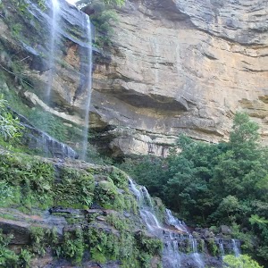
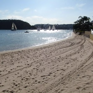
Gallery images
There are other downloads I am still working on.
You will probably need to login to access these — still all free.
* KML (google earth file)
* GPX (GPS file)
Special Maps/ brochures
* A3 topo maps
* PDF with Lands Topo map base
* PDF with arial image (and map overlay)
I wanted to get the main site live first, this extra stuff will come in time.
Happy walking
Matt 🙂
Community Resources
Username: User email: User level: User first name: User last name: User display name: User ID: 0
Comments