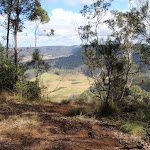
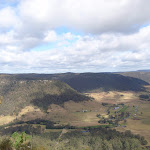
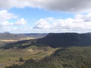
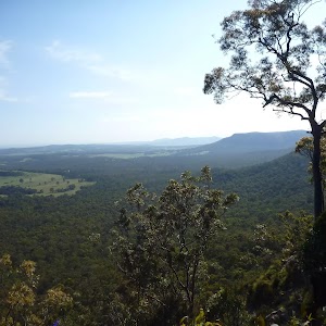
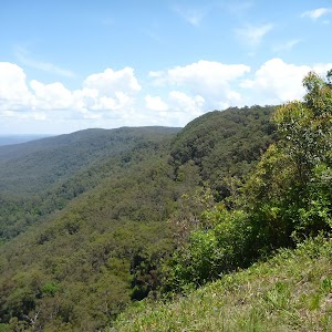
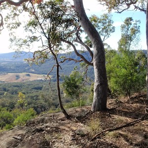
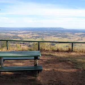
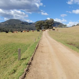
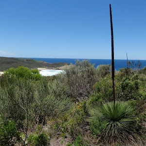
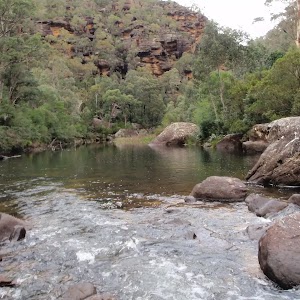
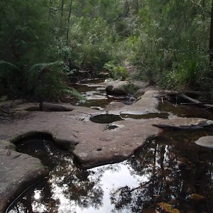
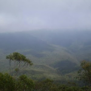
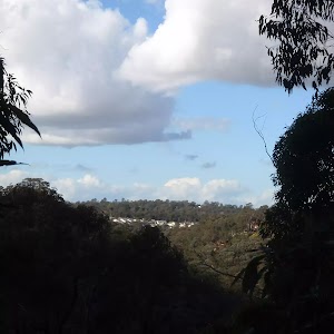
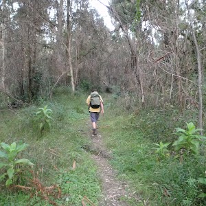
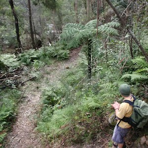
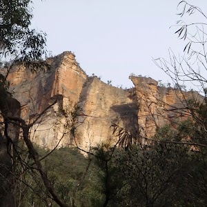
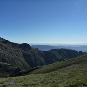
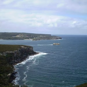
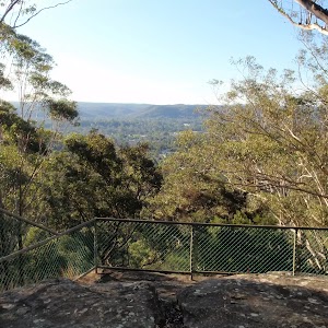
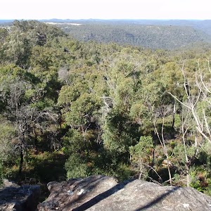
This return walk starts from a nice rest area on Georges Road and follows the road along the ridge, passing several great lookout points across the valley, to the quiet little 125r lookout, which provides a nice open clearing that just screams lunch time. Please note that Watagan and Georges Roads are dry weather roads only, if you are unsure, check with the park office before heading out. This walk can be made shorter by driving further along Georges Rd.
Georges Road Rest Area to 125r Lookout
Georges Road Rest Area to 125r Lookout


3 hrs 30 mins
4.4 km Return

209 m
Moderate track


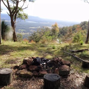
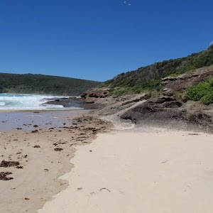
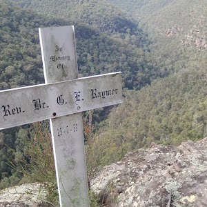
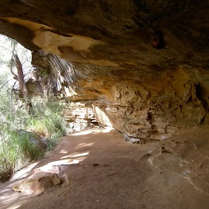
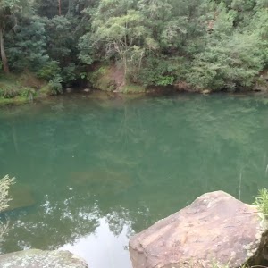
Great North Walk Rest Area

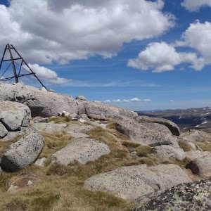
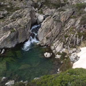
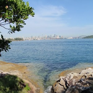
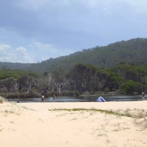
This is a small rest area on the side of Georges Road, providing room to rest up and for a small campfire. There are also some nice views through the trees but be careful as this rest area is near a steep drop.
(0km) Northern rest area → Top of the 125r Lookout trail

1.3 km
31 mins
68m
-76m
Moderate track
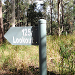
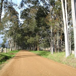
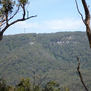
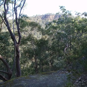
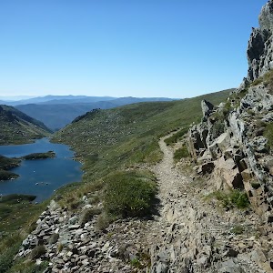
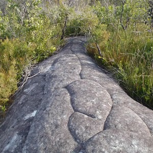
From the clearing, this walk follows Georges Road, initially keeping the views on your right. The walk leads downhill for a few hundred metres, then notably becomes moderately steep downhill for another 400m before flattening to cross a wide saddle. On the other side of the saddle, this walk leads uphill for about 400m, then the track flattens out and bends right to come to a three-way intersection[1], with the signposted ‘125r Lookout’ trail (on the left).
(1.32km) Top of the 125r Lookout trail → 125r Lookout Rest Area
860 m
17 mins
15m
-50m
Moderate track
Maps for the Georges Road Rest Area to 125r Lookout walk
You can download the PDF for this walk to print a map.
These maps below cover the walk and the wider area around the walk, they are worth carrying for safety reasons.
| Quorrobolong | 1:25 000 Map Series | 91322S QUORROBOLONG | NSW-91322S |
| Cessnock | 1:50 000 Map Series | 91322 CESSNOCK | CW-91322 |
| Cessnock | 1:100 000 Map Series | 9132 CESSNOCK | 9132 |
Cross sectional view of the Georges Road Rest Area to 125r Lookout bushwalking track

Analysis and summary of the altitude variation on the Georges Road Rest Area to 125r Lookout

Overview of this walks grade – based on the AS 2156.1 – 2001
Under this standard, a walk is graded based on the most difficult section of the walk.
| Length | 4.4 km | ||
| Time | 3 hrs 30 mins | ||
| . | |||
| Grade 3/6 Moderate track |
AS 2156.1 | Gradient | Short steep hills (3/6) |
| Quality of track | Clear and well formed track or trail (2/6) | ||
| Signs | Directional signs along the way (3/6) | ||
| Experience Required | No experience required (1/6) | ||
| Weather | Weather generally has little impact on safety (1/6) | ||
| Infrastructure | Limited facilities, not all cliffs are fenced (3/6) |
Some more details of this walks Grading
Here is a bit more details explaining grading looking at sections of the walk
Gradient
Around 1.3km of this walk has short steep hills, whilst the remaining 860m has gentle hills with occasional steps.
Quality of track
This whole walk, 2.2km follows a clear and well formed track or trail.
Signs
This whole walk, 2.2km has directional signs at most intersection.
Experience Required
This whole walk, 2.2km requires no previous bushwalking experience.
weather
This whole walk, 2.2km is not usually affected by severe weather events (that would unexpectedly impact safety and navigation).
Infrastructure
This whole walk, 2.2km has limited facilities (such as not all cliffs fenced).
Similar walks
A list of walks that share part of the track with the Georges Road Rest Area to 125r Lookout walk.
17.2 km One way
7 hrs
Hard track

29.7 km One way
2 Days
Hard track

60.5 km One way
4 Days
Hard track

Other Nearby walks
A list of walks that start near the Georges Road Rest Area to 125r Lookout walk.
12.5 km One way
6 hrs
Hard track

8.1 km One way
4 hrs
Hard track

5.6 km Circuit
2 hrs 30 mins
Hard track

2.5 km Circuit
1 Hr
Hard track

718 m Circuit
30 mins
Moderate track


516 m Return
15 mins
Moderate track


4.3 km One way
2 hrs
Hard track

13.8 km One way
5 hrs
Hard track

14.8 km One way
6 hrs
Hard track


1.5 km Return
1 Hr
Moderate track

1.7 km Return
1 Hr
Hard track


406 m Return
30 mins
Hard track

Plan your trip to and from the walk here
The Georges Road Rest Area to 125r Lookout walk starts and ends at the Northern rest area (gps: -32.973467, 151.34537)
Your main transport option to Northern rest area is by;
![]() Car. There is free parking available.
Car. There is free parking available.
(get details)


Short URL = http://wild.tl/grrat1l
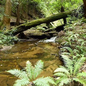
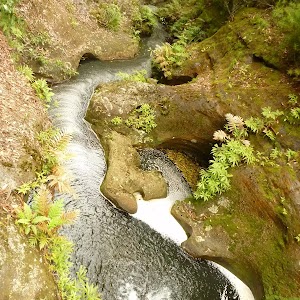
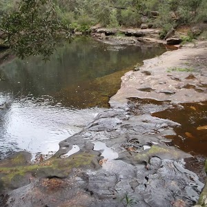
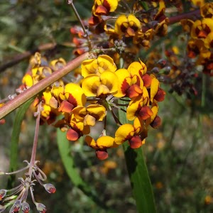
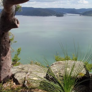
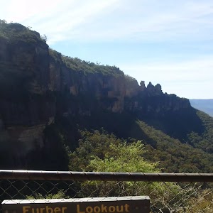
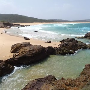
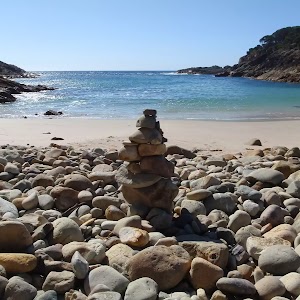
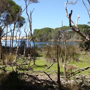
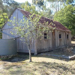
Gallery images
There are other downloads I am still working on.
You will probably need to login to access these — still all free.
* KML (google earth file)
* GPX (GPS file)
Special Maps/ brochures
* A3 topo maps
* PDF with Lands Topo map base
* PDF with arial image (and map overlay)
I wanted to get the main site live first, this extra stuff will come in time.
Happy walking
Matt 🙂
Alpine Bushwalking from Kosciusko Chalet at Charlotte Pass Village : Australia’s Highest Village (altitude 1765m) : A Guide To The Bushwalking Tracks In The Kosciusko National Park
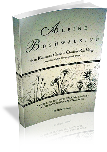
Title: Alpine Bushwalking from Kosciusko Chalet at Charlotte Pass Village : Australia's Highest Village (altitude 1765m) : A Guide To The Bushwalking Tracks In The Kosciusko National Park
Author: Robert Sloss
Edition: 1
Publisher: Robert Sloss
ISBN: 0958651256
Number of pages: 31
Year of Publication: 1995
Cover Price (au$): 9.90
Format: Paperback
Website: http://www.robertsloss.com.au/Guide%20Index.htm
Weight (grams): 45
Regions the book covers: Kosciuszko National Park
Height (cm): 21
Subjects:
Hiking - New South Wales - Kosciuszko National Park,Hiking - New South Wales - Charlotte Pass
Interpretive Information: Minimal
Grade system explained: Yes
Ascent and/or Decent provided: No
Driving directions provided: No
Date walks last reviewed provided: No
A summary of walks provided: No
Regional Map of walks provided: No
Maps designed for walking: Yes - limited detail
Type of maps used (for walking): Detailed Topographic
Colour used in walking maps: Simple colour
Size of walking maps: Full page
Colour depth of photos: Black and White
Comment on Photographs: A route overview photograph is provided for most walks.
Level of detail in tracknotes: General route description
Experienced Only (Grade 5 walks)
630 m Return
15 mins
Experienced only

862 m One way
30 mins
Experienced only

2 km Return
1 Hr
Experienced only

2.2 km Circuit
45 mins
Experienced only

2.6 km Return
2 hrs
Experienced only

3.1 km Return
3 hrs 30 mins
Experienced only

3.3 km One way
1 hr 30 mins
Experienced only

3.4 km Return
1 hr 15 mins
Experienced only

3.8 km Return
4 hrs
Experienced only


4.2 km One way
1 hr 45 mins
Experienced only

4.3 km One way
1 hr 45 mins
Experienced only

4.6 km One way
2 hrs
Experienced only

5 km Return
1 hr 45 mins
Experienced only

5.4 km Return
3 hrs 30 mins
Experienced only

5.8 km Return
2 hrs 30 mins
Experienced only

6.8 km One way
3 hrs
Experienced only

8 km Circuit
3 hrs 30 mins
Experienced only

8.4 km Circuit
3 hrs 45 mins
Experienced only

8.9 km One way
2 Days
Experienced only

9.1 km Circuit
3 hrs 30 mins
Experienced only

10.4 km One way
5 hrs 30 mins
Experienced only

11.5 km Return
6 hrs
Experienced only

11.7 km Return
8 hrs 45 mins
Experienced only

13.5 km One way
6 hrs
Experienced only

13.8 km One way
8 hrs
Experienced only

14 km Return
6 hrs 30 mins
Experienced only

14.8 km Return
6 hrs 45 mins
Experienced only

15.1 km Circuit
5 hrs 45 mins
Experienced only

15.2 km One way
6 hrs 30 mins
Experienced only

15.2 km One way
2 Days
Experienced only

15.9 km One way
7 hrs
Experienced only

16.1 km One way
6 hrs 30 mins
Experienced only

16.2 km Return
11 hrs
Experienced only

16.6 km Circuit
2 Days
Experienced only

17.4 km Return
8 hrs
Experienced only

17.6 km One way
9 hrs
Experienced only

18.1 km One way
7 hrs 30 mins
Experienced only

18.3 km One way
7 hrs 15 mins
Experienced only

22.2 km One way
2 Days
Experienced only

22.5 km One way
3 Days
Experienced only

23.4 km One way
2 Days
Experienced only

24 km One way
8 hrs 30 mins
Experienced only

25.8 km One way
2 Days
Experienced only

27.7 km Circuit
2 Days
Experienced only

28.1 km One way
2 Days
Experienced only


29.2 km One way
2 Days
Experienced only


29.3 km One way
3 Days
Experienced only

33.8 km Circuit
3 Days
Experienced only

45 km Circuit
4 Days
Experienced only

9 Best Pokéwalks
Enjoy nature and Pokémon GO at the same time.
Here are some nice bushwalks with public transport access, where you will find towers, gyms and Pokémons.
Remember to stay safe, tell someone where you are going and when you are expected back. Keep you phone in your pocket whilst you walk, and keep to the track.
Enjoy the PokéWalk.
Here are some nice bushwalks with public transport access, where you will find towers, gyms and Pokémons.
Remember to stay safe, tell someone where you are going and when you are expected back. Keep you phone in your pocket whilst you walk, and keep to the track.
Enjoy the PokéWalk.
Leave no PokéTrace
1) Plan Ahead and Prepare
2) Travel and Camp on Durable Surfaces
3) Dispose of Waste Properly
4) Leave What You Find
5) Minimise Campfire Impacts
6) Respect Wildlife
7) Be Considerate of Your Hosts and Other Visitors
Think before you PokéTREK
T – Take adequate supplies of food, water, navigation and first aid equipment.
R – Register your planned route and tell friends and family when you expect to return.
E – Emergency beacon (PLB’s) are available free of charge from NSW Police Force and NPWS.
K – Keep to your planned route and follow the map and walking trails.
9.8 km One way
4 hrs
Moderate track

6.8 km One way
3 hrs
Hard track

9.1 km One way
3 hrs 45 mins
Moderate track

2.2 km One way
1 Hr
Moderate track

4.1 km Circuit
1 hr 45 mins
Hard track


6.7 km Circuit
3 hrs
Hard track


10.7 km One way
4 hrs 30 mins
Hard track


6.8 km One way
3 hrs 30 mins
Moderate track

11.3 km One way
4 hrs 30 mins
Hard track

Map Attribution
Maps used on wildwalks are used with permission and come from different sources.
Water Colour Maps
 The beautiful maps used on the home page and general overview pages where designed and developed by the clever map architects at Stamen. The provide a range of mapping services worth checking them out. These maps are rendered using OSM.org data.
Online Topographic base maps
The detailed maps used on the walk and park pages are created by NSW LPI. The tiles have been kindly released under a creative commons licence and we are hosting a CDN mirror of the tiles to off set the load on on the tile server.
Wildwalks Printable Walk Maps
 These maps have been created by wildwalks using a variety of data. Our own data has been collected for track and poi of interest information. Roads and many other tracks, trails and other data from the amazing OSM.org project. The terrain data is derived from best data from Nasa, Japan space agencies as well as other publicly available DEMS. Contours, hill shading and Most creeks are derived from this same DEM. The vegetation layer has been created by analyzing NASA data using Google Earth Engine. These map images are copyright wildwalks, but if you want to use them in a project give me a yell, happy to see if I can render something useful for you.
Maps are generated using the opensource Mapserver engine. The online dynamic GUI maps are created using our own hosted Cartodb server. Both amazing tools.
About Us
Wildwalks is an online Bushwalking Guide Book with the aim of helping more people get out and safely enjoy the many great bushwalks and camping opportunities in NSW. It does not matter if you are new to bushwalking or experienced, there is something here for everyone.
Wildwalks is developed by small group of people who are passionate about the outdoors. We want to encourage people to “get out there” and enjoy the great places on offer.
Our goal is build a massive database of bushwalking tracks from around Australia. I am conscious we are a long way from there now, but over the next few years I hope to grow this site.
Learn more about our Vision and Values.
We are committed to supporting businesses and organisation with similar goals. Wildwalks just provides information, there are many other hard working people out there who build, maintain and support these tracks and campsites.
We currently get about 1300 unique people a day using this service, thanks for your encouragement.
I get many e-mails from people asking how to help out (thanks); here are a few idea.
- Use our website, maps and notes, get out there and enjoy it.
- Let us know how things go, use out feedback section at the end of each article.
- Tell people about the site and what we are doing.
- Support our sponsors – they allow all this to happen
- Sign up to our newsletter and stay upto date with life at Wildwalks
- Link to us (or ask your web friends to link to us) see the FAQ on linking to Wildwalks.
A few FAQ’s
1) Should I still carry a traditional topographical Map?
YES. I recommend that you still have at least one set of maps that cover an area, the maps provided by Wildwalks cover just the walk, and are limited help in case of emergency change in plans. Also some printers and paper do not handle the rugged outdoors as well as the maps you can buy.
2) Can I print the notes and maps?
YES. Use the PDF button or link to generate a nice printable version with a much better map what what is the webpage.
3) Can I print copies for my fellow walkers?
YES. I think that everyone in the walking group should have a copy, please print as many as you want.
4) Can I use the notes and maps for my School, Club or Commercial group.
YES. Again I think that every one should have a copy of the map at the very least, Please to not change or trim the notes to hide logo or any other information though.
5) What if I think something is wrong?
Please use the user feedback in each article to let us know how we can improve things, we really love feedback. We know the notes are not perfect, we try hard so please let us know how we can do better.
6) Can I suggest a walk to be included?
YES. Our goal is to grow and build lots more walks. I plan to add a “suggest / vote for a walk page” but until then e-mail me your thoughts. If you want variations on existing walks, please also let me know, we can usually turn those around quickly. I hope by the end of the year we will also have a very cool “reverse” this walk feature, so that if you want to do the walk the other way round, it will be easy (the map and the tracknotes will be changed as if it was meant to be like that).
7) Can I download the walk to my GPS?
Not Yet. We are working on this, We have the data and the technology, but there are a few issues with it at this stage. Firstly we have a problem with people stealing info from our website and putting it up on there own, and this just makes that to easy for them (this data costs us a lot of money to produce, I am happy for people to use it for free, but not to claim it as there own and have no plans to maintain it.) Secondly there are some social/safety issues on using GPS for bushwalks. I am keen to address these issues and get this GPS data to you sooner then later.
8) Can I view the walks in Google Earth?
Not Yet. For similar reasons to FAQ 7, but I hope to resolve this one sooner. We are playing with this and just to tease you, it is pretty cool. Once we release this you will be able to do virtual fly overs or all the walks, view the sat image and Topomaps, see the photos in the place they were taken and a few other cool things.
9) How can I search for walks on Wildwalks?
We have got a Bushwalk search page for finding walks on the website. It has an advanced search options as well.
10) Can I link to Wildwalks?
Yes, Please do. Links to Wildwalks help more people find a useful bushwalking site, and it help us by bringing more people to our service. When linking to wildwalks it would help us further if you also link descriptive keywords, such as bushwalking or hiking. So if linking to the home page try something like Wildwalks an online bushwalking guidebook or if link to a specific walk or list of walks you may want to try something like Bushwalking tracks in Royal National Park . Our URL’s are pretty stable so you should rarely have issues with broken links.
Thanks for your interest
Matt 🙂
Privacy
Your Privacy
Wildwalks aims to comply with the Privacy and Personal Information Protection Act 1998 (NSW), which regulates the collection, storage, quality, use and disclosure of personal information.
Wildwalks App subscriptions
To help us continue making this app awesome and to allow us to continue to add more wonderful walks we charge users to access longer walks in this app.
There are two subscriptions length options Monthly or Annual. Once subscribed you get unlimited access to all the information on the walks displayed in the app. You can then download the maps, photos and tracknotes so that the app will work offline.
The current price of each subscription is available on the updates page and is displayed in Australian dollars. Payment will be charged to iTunes Account at confirmation of purchase. Subscription automatically renews unless auto-renew is turned off at least 24-hours before the end of the current period. Your Itunes account will be charged for renewal within 24-hours prior to the end of the current period at the same price. Your subscriptions may be managed and auto-renewal may be turned off by going to your Itunes Account Settings after purchase.
The current price of each subscription is available on the updates page and is displayed in Australian dollars. Payment will be charged to iTunes Account at confirmation of purchase. Subscription automatically renews unless auto-renew is turned off at least 24-hours before the end of the current period. Your Itunes account will be charged for renewal within 24-hours prior to the end of the current period at the same price. Your subscriptions may be managed and auto-renewal may be turned off by going to your Itunes Account Settings after purchase.
Use and disclosure of personal information.
Information that in some way identifies you may be gathered when you use our website or send us an email.
Collection of information
Information collected from browsing When you view the Wildwalks website and app, we may collect the following information: • your IP (Internet protocol) address or host name eg. 123.123.123.12 or xxx.yyy.com.au • the date and time you visited the website • the pages or documents you download • the web browser, operating system, screen resolution, Internet settings you are using • the previous site you visited, if you reached our website by clicking on a link • whether you have previously visited our website (only if you accept Cookies). Information collected from online forms When you submit a form on the Wildwalks website we collect information from it. This information may include personal and organisational details such as your full name, phone number, business name and ACN details, email address and street address. Clicking on the ‘submit’ button on any form acts as your consent for Wildwalks to collect the information you have provided. Before you submit this information we will take reasonable steps to inform you of: • where applicable, any law that requires the particular information to be collected • which fields are mandatory and which are optional. Information collected from email If you send us an email, we will record your email and email address for the purpose of responding to you.
Use and disclosure of information collected
Information collected from web browsing is used to identify patterns of usage of the Wildwalks website and app. This will help us improve the website and the services offered we offer. Information collected from forms and email will only be used for the purpose for which you have provided it. We will not use it for any other purpose, nor will we disclose it, unless with your consent or in other circumstances where such use or disclosure is permitted under the Privacy and Personal Information Protection Act 1998. Your personal information (including your email address) will not be automatically added to a mailing list, or sold or otherwise transferred to a third party. We take reasonable steps to protect information during transfer and storage. Physical measures, such as building and equipment security, are used in conjunction with digital technology, such as data encryption and firewalls, to minimise unauthorised access to information.
- Wildwalks uses Google Analytics including Google Analytics Demographics and Interest Reporting to help monitor, report, understand and improve the service.
- Visitors can opt-out of Google Analytics for Display Advertising and customize Google Display Network ads using the Ads Settings.
- we also use Facebook Pixel
Beta Feedback Page
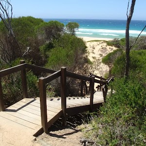
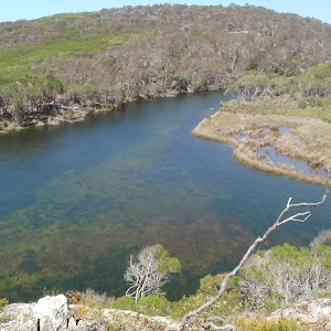
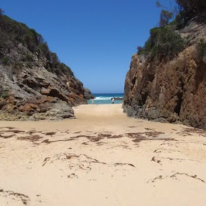
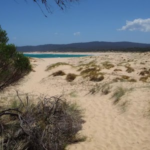
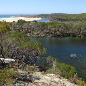
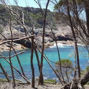
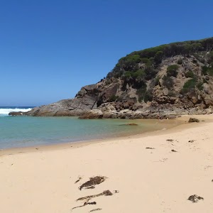
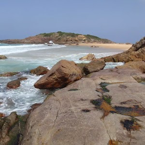
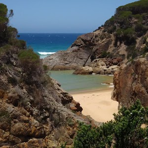
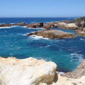
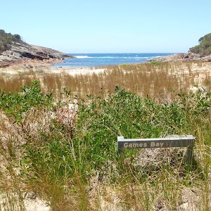
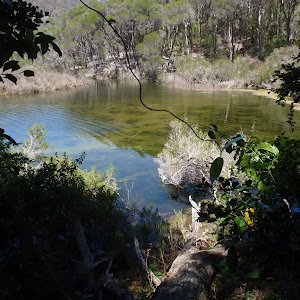
Bournda National Park
Bournda National Park

124 m Return
5 mins
Very easy


194 m Circuit
10 mins
Hard track

286 m Return
5 mins
Moderate track

316 m Return
10 mins
Moderate track

416 m Return
15 mins
Hard track

464 m Return
10 mins
Moderate track

471 m Circuit
15 mins
Moderate track

482 m Return
12 mins
Hard track

648 m Return
15 mins
Easy track

1 km Return
30 mins
Moderate track

1.2 km Circuit
45 mins
Moderate track

1.8 km One way
45 mins
Moderate track

1.8 km Return
1 Hr
Hard track

2.1 km Return
45 mins
Hard track

2.3 km Return
45 mins
Hard track

3.5 km Return
2 hrs
Hard track

3.5 km One way
1 hr 15 mins
Hard track

3.6 km Return
1 hr 15 mins
Easy track


5 km Return
1 hr 30 mins
Moderate track

5 km Return
1 hr 45 mins
Experienced only
5.2 km Circuit
2 hrs
Hard track

5.2 km Return
2 hrs
Hard track

6 km Return
1 hr 45 mins
Moderate track

7.6 km Circuit
2 hrs 15 mins
Hard track

8 km Circuit
3 hrs 30 mins
Experienced only
8.8 km One way
4 hrs
Hard track

9 km Return
3 hrs 30 mins
Hard track

10.5 km Return
3 hrs 30 mins
Hard track

10.6 km Circuit
3 hrs 45 mins
Hard track

11.5 km One way
4 hrs 30 mins
Hard track

Popran NP
Popran National Park

4.4 km Return
2 hrs
Hard track

8.3 km Return
3 hrs 15 mins
Moderate track

10.1 km Return
4 hrs 15 mins
Hard track

10.8 km Circuit
4 hrs 15 mins
Hard track

Comments