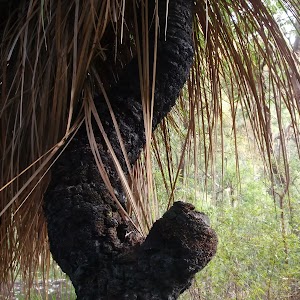
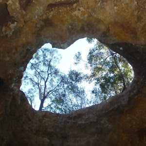
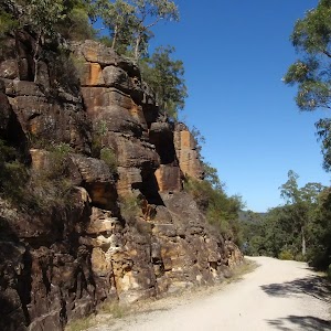
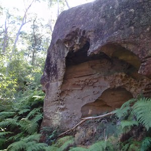
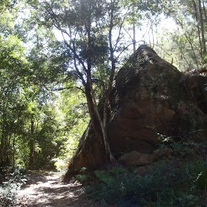
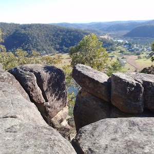
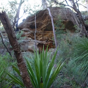
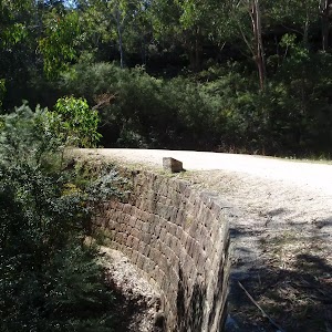
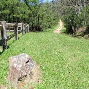
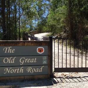
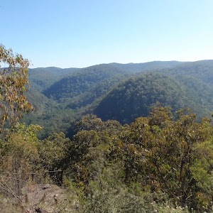
Dharug NP
Dharug NP

1.7 km Circuit
1 Hr
Moderate track

2.2 km Return
1 hr 15 mins
Moderate track

3.6 km Return
2 hrs
Moderate track

4 km One way
2 hrs
Moderate track

4.3 km Return
2 hrs
Moderate track

4.4 km Return
2 hrs 15 mins
Moderate track

4.5 km Return
2 hrs 15 mins
Hard track

7.2 km Return
3 hrs 15 mins
Moderate track

8.2 km Circuit
4 hrs 15 mins
Hard track

9.9 km Circuit
4 hrs 30 mins
Moderate track

24.3 km Circuit
2 Days
Hard track

27.3 km One way
2 Days
Hard track

28.3 km One way
2 Days
Moderate track

27Mhz (AM) CB frequency table
 Australia has two main types of CB or Citizen Band radio. This articles lists the channels and frequencies used by the AM or 27MHz type. This is the cheapest type of CB available and used for long distance communications.
| Channel | Freq (MHz) | Use |
| 1 | 26.965 | |
| 2 | 26.975 | |
| 3 | 26.985 | |
| 4 | 27.005 | |
| 5 | 27.015 | |
| 6 | 27.025 | |
| 7 | 27.035 | |
| 8 | 27.055 | Road contact |
| 9 | 27.065 | Emergency Calling only |
| 10 | 27.075 | |
| 11 | 27.085 | General Call (IE contact then find another channel) |
| 12 | 27.105 | |
| 13 | 27.115 | |
| 14 | 27.125 | |
| 15 | 27.135 | |
| 16 | 27.155 | General call for Side Band (LSB) |
| 17 | 27.165 | |
| 18 | 27.175 | |
| 19 | 27.185 | |
| 20 | 27.205 | |
| 21 | 27.215 | |
| 22 | 27.225 | |
| 23 | 27.245 | |
| 24 | 27.235 | |
| 25 | 27.255 | |
| 26 | 27.265 | |
| 27 | 27.275 | |
| 28 | 27.285 | |
| 29 | 27.295 | |
| 30 | 27.305 | |
| 31 | 27.315 | |
| 32 | 27.325 | |
| 33 | 27.335 | |
| 34 | 27.345 | |
| 35 | 27.355 | |
| 36 | 27.365 | |
| 37 | 27.375 | |
| 38 | 27.385 | |
| 39 | 27.395 | |
| 40 | 27.405 | |
470Mhz (FM) CB frequency table
 This article lists the channel, use and frequency table for the 470 MHz FM CB radio for Australia. These radios are becoming very common in the outdoors. Cheap handed held radios that operate over 1-2km are available for less than $100 at many electronic shops. These types of CB radios give access to a large network of freely accessible repeaters throughout Australia. The use of these repeaters can extend the range of communications up 50km. Includes links to lists of all UHF CB repeaters in Australia
UHF CB repeaters NSW
UHF CB repeaters VIC
UHF CB repeaters TAS
UHF CB repeaters SA
UHF CB repeaters WA
UHF CB repeaters QLD
UHF CB repeaters ACT
UHF CB repeaters NT
| Channel | Freq (MHz) | Use |
| 1 | 476.425 | Repeater access (In Duplex mode) |
| 2 | 476.450 | Repeater access (In Duplex mode) |
| 3 | 476.475 | Repeater access (In Duplex mode) |
| 4 | 476.500 | Repeater access (In Duplex mode) |
| 5 | 476.525 | Emergency Call channel (simplex or duplex) |
| 6 | 476.550 | Repeater access (In Duplex mode) |
| 7 | 476.575 | Repeater access (In Duplex mode) |
| 8 | 476.600 | Repeater access (In Duplex mode) |
| 9 | 476.625 | |
| 10 | 476.650 | |
| 11 | 476.675 | Call channel |
| 12 | 476.700 | |
| 13 | 476.725 | |
| 14 | 476.750 | |
| 15 | 476.775 | |
| 16 | 476.800 | |
| 17 | 476.825 | |
| 18 | 476.850 | |
| 19 | 476.875 | |
| 20 | 476.900 | |
| 21 | 476.925 | |
| 22 | 476.950 | Telemetry and Remote control (ie no talking) |
| 23 | 476.975 | Telemetry and Remote control (ie no talking) |
| 24 | 477.000 | |
| 25 | 477.025 | |
| 26 | 477.050 | |
| 27 | 477.075 | |
| 28 | 477.100 | |
| 29 | 477.125 | |
| 30 | 477.150 | |
| 31 | 477.175 | (Outgoing channel for duplex repeater access) |
| 32 | 477.200 | (Outgoing channel for duplex repeater access) |
| 33 | 477.225 | (Outgoing channel for duplex repeater access) |
| 34 | 477.250 | (Outgoing channel for duplex repeater access) |
| 35 | 477.275 | (Outgoing channel for duplex repeater access -Emergency) |
| 36 | 477.300 | (Outgoing channel for duplex repeater access) |
| 37 | 477.325 | (Outgoing channel for duplex repeater access) |
| 38 | 477.350 | (Outgoing channel for duplex repeater access) |
| 39 | 477.375 | |
| 40 | 477.400 | Road channel |
Beaufort Scale (for wind speed)
 The Beaufort scale is a standard scale to communicate wind force. The scale starts at traditionally ranges from 0 to 12, with zero been no wind and 12 been a hurricane force wind of over 120km/h. The scale has since grown to 17, to describe more severe hurricane winds. For the sake of this article I have just included the 0-12. The scale include descriptions of the what to expect to see from such a force. Rear-Admiral, Sir Francis Beaufort, was born in Ireland in 1774. He entered the Royal Navy at the age of 13 and was a midshipman aboard the Aquilon. By 1800 he had risen to the rank of Commander. In the summer of 1805 Beaufort was appointed to the command of the Woolwich, a 44 gun man-of-war.
In 1806 he wrote in his log book a wind force scale. The scale was simple and very similar to one that Alexander Dalrymple had written in a book in 1789. A year later he added some criteria to the 0-12 scale that indicated how much of a ship’s sails would be employed by a British man-of-war under each condition. It was not relate to the speed of the wind.
Over the following years he continued to use his scale in his logs. It was finally adopted in December 1838 by the British Admiralty for use in all Royal Navy logbooks. However, as ship design and the introduction of steam power became widespread even that scale had to be modified.
In 1912 the International Commission for Weather Telegraphy sought some agreement on velocity equivalents for the Beaufort scale. A uniform set of equivalents was accepted in 1926 and revised slightly in 1946, extending the scale to 17 values (the added five values further refining the hurricane-force winds). By 1955, wind velocities in knots replaced Beaufort numbers on weather maps.
Today’s Beaufort Scale including the observed land conditions…
| Beaufort | Wind speed | Description | Land conditions | |
| kt | km/h | |||
| 0 | 0 | 0 | Calm | Calm. Smoke rises vertically. |
| 1 | 1-3 | 1-6 | Light air | Wind motion visible in smoke. |
| 2 | 4-6 | 7-11 | Light breeze | Wind felt on exposed skin. Leaves rustle. |
| 3 | 1-10 | 12-19 | Gentle breeze | Leaves and smaller twigs in constant motion. |
| 4 | 11-15 | 20-29 | Moderate breeze | Dust and loose paper raised. Small branches begin to move. |
| 5 | 16-21 | 30-39 | Fresh breeze | Smaller trees sway. |
| 6 | 22-27 | 40-50 | Strong breeze | Large branches in motion. Whistling heard in overhead wires. Umbrella use becomes difficult. |
| 7 | 28-33 | 51-62 | Near gale | Whole trees in motion. Effort needed to walk against the wind. |
| 8 | 34-40 | 63-75 | Gale | Twigs broken from trees. Cars veer on road. |
| 9 | 41-47 | 76-87 | Strong gale | Light structure damage. |
| 10 | 48-55 | 88-102 | Storm | Trees uprooted. Considerable structural damage. |
| 11 | 56-63 | 103-119 | Violent storm | Widespread structural damage. |
| 12 | 64-80 | >120 | Hurricane | Considerable and widespread damage to structures. |
Wind Chill
 The wind chill is the effect of the wind on people and animals. The wind chill temperature is based on the rate of heat loss from exposed skin caused by wind and cold and is to give you an approximation of how cold the air feels on your body.
As the wind increases, it removes heat from the body, driving down skin temperature and eventually the internal body temperature. Therefore, the wind makes it FEEL much colder. If the temperature is -11°C and the wind is blowing at 30km/h , the wind chill temperature is -20°C. At this level, exposed skin can freeze in just a few minutes.
The only effect wind chill has on inanimate objects, such as car radiators and water pipes, is to shorten the amount of time for the object to cool. The inanimate object will not cool below the actual air temperature. For example, if the temperature outside is -11°C and the wind chill temperature is -20°C, then your car’s radiator temperature will be no lower than the air temperature of -11°C.
The Wind Chill Chart
To determine the wind chill temperature, find the value closest to your outside air temperature. Find the value that most closely represents your present wind speed. Your wind chill temperature is the value where lines drawn from the air temperature and wind cross.
|
Air Temperature (°C) |
|||||||||||||||||||||
|
W I N D S P E E D km / h |
Calm |
4 |
2 |
-1 |
-4 |
-7 |
-9 |
-12 |
-15 |
-18 |
-21 |
-23 |
-26 |
-29 |
-32 |
-34 |
-37 |
-40 |
-43 |
||
|
8 |
2 |
-1 |
-4 |
-7 |
-11 |
-14 |
-17 |
-21 |
-24 |
-27 |
-30 |
-33 |
-37 |
-40 |
-43 |
-47 |
-49 |
-53 |
|||
|
16 |
1 |
-3 |
-6 |
-9 |
-13 |
-16 |
-20 |
-23 |
-27 |
-30 |
-33 |
-37 |
-41 |
-44 |
-47 |
-51 |
-54 |
-58 |
|||
|
24 |
0 |
-4 |
-7 |
-11 |
-14 |
-18 |
-22 |
-25 |
-28 |
-32 |
-36 |
-39 |
-43 |
-46 |
-50 |
-53 |
-57 |
-61 |
|||
|
32 |
-1 |
-4 |
-8 |
-12 |
-15 |
-19 |
-23 |
-26 |
-30 |
-34 |
-37 |
-41 |
-44 |
-48 |
-52 |
-56 |
-59 |
-63 |
|||
|
40 |
-1 |
-5 |
-9 |
-13 |
-16 |
-20 |
-24 |
-27 |
-31 |
-35 |
-38 |
-42 |
-46 |
-50 |
-53 |
-57 |
-61 |
-64 |
|||
|
48 |
-2 |
-6 |
-9 |
-13 |
-17 |
-21 |
-24 |
-28 |
-32 |
-36 |
-39 |
-43 |
-47 |
-51 |
-55 |
-58 |
-62 |
-66 |
|||
|
56 |
-2 |
-6 |
-10 |
-14 |
-18 |
-22 |
-26 |
-29 |
-33 |
-37 |
-41 |
-44 |
-48 |
-52 |
-56 |
-60 |
-63 |
-67 |
|||
|
64 |
-3 |
-7 |
-11 |
-14 |
-18 |
-22 |
-26 |
-30 |
-34 |
-38 |
-42 |
-46 |
-49 |
-53 |
-57 |
-61 |
-64 |
-68 |
|||
|
72 |
-3 |
-7 |
-11 |
-15 |
-19 |
-23 |
-27 |
-31 |
-34 |
-38 |
-42 |
-46 |
-50 |
-54 |
-58 |
-62 |
-66 |
-69 |
|||
|
80 |
-3 |
-7 |
-11 |
-16 |
-19 |
-23 |
-27 |
-31 |
-35 |
-39 |
-43 |
-47 |
-51 |
-55 |
-59 |
-63 |
-67 |
-71 |
|||
|
89 |
-4 |
-8 |
-12 |
-15 |
-19 |
-24 |
-28 |
-32 |
-36 |
-39 |
-43 |
-48 |
-52 |
-56 |
-59 |
-63 |
-67 |
-72 |
|||
|
97 |
-4 |
-8 |
-12 |
-16 |
-20 |
-24 |
-28 |
-32 |
-36 |
-40 |
-44 |
-48 |
-52 |
-56 |
-60 |
-64 |
-68 |
-72 |
|||
What is important about the wind chill besides feeling colder than the actual air temperature? The lower the wind chill temperature, the greater you are at risk for developing frost bite and/or hypothermia.
Frostbite occurs when your body tissue freezes. The most susceptible parts of the body are fingers, toes, ear lobes, and the tip of the nose. Hypothermia occurs when body core temperature, normally around 37°C falls below 35°C. The following table shows how fast frostbite can occur at various wind chill temperatures.
|
Wind Chill |
Cold Threat |
|
-6°C to 4°C |
COLD. Unpleasant. |
|
-17°C to -7°C |
VERY COLD. Very unpleasant. |
|
-28°C to -18°C |
BITTER COLD. Frostbite possible. Exposed skin can freeze within 5 minutes. |
|
-56°C to -29°C |
EXTREMELY COLD. Frostbite likely. Exposed skin can freeze within 1 minute. Outdoor activity becomes dangerous. |
|
-57°C and lower |
FRIGIDLY COLD. Exposed skin can freeze in 30 seconds. |
The best way to avoid hypothermia and frostbite is to stay warm and dry indoors. When you must go outside, dress appropriately. Wear several layers of loose-fitting, lightweight, warm clothing. Trapped air between the layers will insulate you. Remove layers to avoid sweating and subsequent chill.
Outer garments should be tightly woven, water repellent, and hooded. Wear a hat, because half of your body heat can be lost from your head. Cover your mouth to protect your lungs from extreme cold. Mittens, snug at the wrist, are better than gloves. Try to stay dry and out of the wind.
Tracking through the South East Forests of New South Wales : touring guide
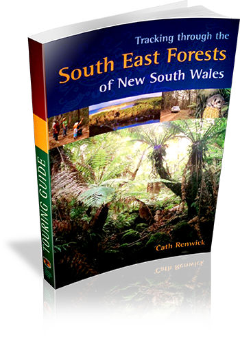
Author: Cath Renwick
Edition: 1
Publisher: The Beaten Track Press
ISBN: 1876131063
Number of pages: 65
Year of Publication: 2004
Cover Price (au$): 14.95
Format: Paperback
Website: http://www.environment.nsw.gov.au/nationalparks/
Weight (grams): 200
Regions the book covers: South coast NSW
Height (cm): 24
Subjects:
National parks - New South Wales - Guidebooks,Forests and forestry - Environmental aspects - New South Wales - Guidebooks
Overview of Book:
This book is primarily an interpretive guide to the South East NSW National Parks. There is a chapter devoted to 'Enjoying the forests', with details on driving tours, bushwalks and campsites.
Interpretive Information: Detailed
Grade system explained: No
Ascent and/or Decent provided: No
Driving directions provided: No
Date walks last reviewed provided: No
A summary of walks provided: Yes
Regional Map of walks provided: Yes
Maps designed for walking: No - no maps intended for use when walking
Walking map Comment: Regional driving maps provided in full colour, however no walking maps provided.
Colour depth of photos: Colour
Comment on Photographs: Glossy photographs throughout the book.
Level of detail in tracknotes: Overview only
Alternate route and side trip suggestions: None
The Beaten Track : A Guide to the Bushland Around Sydney
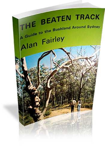
Author: Alan Fairley
Edition: 1
Publisher: Alan Fairley
ISBN: 0959903208
Number of pages: 106
Year of Publication: 1972
Format: Paperback
Weight (grams): 165
Regions the book covers: Sydney, Blue Mountains, Southern Highlands
Height (cm): 21
Subjects:
Hiking - New South Wales - Sydney region,Sydney Region (N.S.W.) - Guidebooks
Interpretive Information: Plenty
Grade system explained: No
Ascent and/or Decent provided: No
Driving directions provided: Yes
Date walks last reviewed provided: No
A summary of walks provided: No
Regional Map of walks provided: No
Maps designed for walking: Yes - limited detail
Type of maps used (for walking): Sketch
Colour used in walking maps: Black and White
Size of walking maps: Full page
Colour depth of photos: Black and White
Comment on Photographs: There are a number of regional photographs throughout the book, and pictographs of wildflowers.
Level of detail in tracknotes: General route description
Terror and the Scenic Coast : Walking Tracks Between Batemans Bay And Green Cape
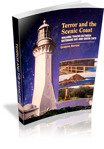
Author: Graeme Barrow
Edition: 1
Publisher: Dagraja Press
ISBN: 0958755264
Number of pages: 76
Year of Publication: 2004
Cover Price (au$): 16.50
Format: Paperback
Weight (grams): 145
Regions the book covers: South Coast NSW
Height (cm): 21
Subjects:
Hiking - New South Wales - South Coast - Guidebooks,South Coast (N.S.W.) - Description and travel - Guidebooks
Interpretive Information: Plenty
Grade system explained: No
Ascent and/or Decent provided: No
Driving directions provided: Yes
Date walks last reviewed provided: No
A summary of walks provided: No
Regional Map of walks provided: Yes
Maps designed for walking: Yes - reasonable detail
Type of maps used (for walking): Detailed Topographic
Colour used in walking maps: Multicolour
Size of walking maps: Full page
Colour depth of photos: Colour
Comment on Photographs: Large photographs every 1-2 pages.
Level of detail in tracknotes: Detailed route information
Take a walk in the Blue Mountains
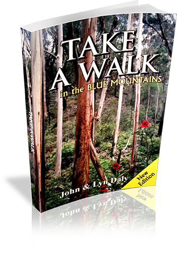
Author: John Daly,Lyn Daly
Edition: 2
Publisher: Take a Walk Publications
ISBN: 9780957793163
Number of pages: 167
Year of Publication: 2007
Cover Price (au$): 24.95
Format: Paperback
Website: http://www.takeawalk.com.au/
Weight (grams): 235
Regions the book covers: Blue Mountains
Height (cm): 21
Subjects:
Hiking - New South Wales - Blue Mountains - Guidebooks,National parks and reserves - New South Wales - Blue Mountains - Guidebooks,Blue Mountains (N.S.W. : Mountains) - Guidebooks
Niche: Blue Mountains
Interpretive Information: Plenty
Grade system explained: Yes
Ascent and/or Decent provided: No
Driving directions provided: No
Date walks last reviewed provided: No
A summary of walks provided: Yes
Regional Map of walks provided: No
Maps designed for walking: Yes - reasonable detail
Type of maps used (for walking): Sketch
Colour used in walking maps: Multicolour
Size of walking maps: 1/4 page
Walking map Comment: Maps are varied in size, mainly 1/4 page but up to full page in size
Colour depth of photos: Colour
Comment on Photographs: Photographs, on average, every second page
Level of detail in tracknotes: Detailed route information
Alternate route and side trip suggestions: Many walks
Kanangra Boyd National Park : Identified Wilderness Area : Information about camping and walking in Kanangra-Boyd National Park
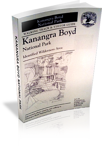
Author: Stephen Alton
Edition: 1
Publisher: NSW National Parks and Wildlife Service
ISBN: 0731088220
Number of pages: 23
Year of Publication: 1995
Cover Price (au$): 2.20
Format: Paperback
Website: http://www.environment.nsw.gov.au/nationalparks/
Weight (grams): 40
Regions the book covers: Kanangra-Boyd National Park
Height (cm): 21
Subjects:
National parks and reserves - New South Wales - Blue Mountains - Guidebooks,Nature trails - New South Wales - Kanangra-Boyd National Park - Guidebooks,Kanangra-Boyd National Park (N.S.W.) - Guidebooks
Interpretive Information: Detailed
Grade system explained: No
Ascent and/or Decent provided: No
Driving directions provided: No
Date walks last reviewed provided: No
A summary of walks provided: No
Regional Map of walks provided: Yes
Maps designed for walking: Yes - limited detail
Type of maps used (for walking): Sketch
Colour used in walking maps: Black and White
Size of walking maps: Full page
Walking map Comment: Additional maps required for basically all walks.
Colour depth of photos: None
Comment on Photographs: Pictograms of flora and fauna.
Level of detail in tracknotes: General route description