6 Best walks with Primary kids
Happy Walking 🙂
1.9 km Circuit
1 Hr
Moderate track

1.6 km Return
40 mins
Moderate track

2.2 km One way
1 Hr
Moderate track

6.5 km One way
2 hrs 30 mins
Hard track

5.6 km Return
2 hrs
Moderate track

6.8 km One way
3 hrs
Hard track

6 Best hill training walks
Happy Walking 🙂
4.4 km Circuit
2 hrs
Moderate track

13.4 km One way
5 hrs 30 mins
Hard track

17.2 km One way
8 hrs
Hard track

19.5 km One way
7 hrs 30 mins
Hard track

17.6 km One way
9 hrs
Experienced only

3.8 km Return
4 hrs
Experienced only

6 Best bushwalks with a cafe break
Happy Walking 🙂
5 km Circuit
4 hrs
Hard track

9.6 km Circuit
4 hrs
Moderate track

12.9 km One way
6 hrs
Hard track

14.6 km One way
6 hrs 30 mins
Hard track

6.8 km One way
3 hrs
Hard track
11 km One way
4 hrs
Hard track

6 Best overnight walks (getting started)
44.8 km One way
3 Days
Hard track

27.4 km One way
2 Days
Hard track


35.9 km One way
2 Days
Hard track

24.3 km Circuit
2 Days
Hard track

26.2 km One way
2 Days
Hard track

30.9 km One way
3 Days
Hard track

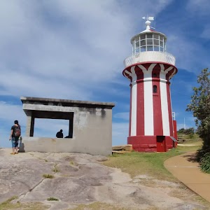
6 Best walks around Sydney Harbour
9.1 km One way
3 hrs 45 mins
Moderate track

6.8 km One way
3 hrs
Hard track
9.8 km One way
4 hrs
Moderate track

2.8 km Return
1 hr 15 mins
Easy track

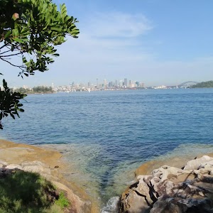
2.2 km One way
1 Hr
Moderate track

1.9 km Circuit
1 Hr
Moderate track
Jenolan Caves & The 6 Foot Track
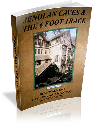
Author: Robert Sloss
Edition: 1
Publisher: Robert Sloss
ISBN: 0958651280
Number of pages: 26
Year of Publication: 2000
Cover Price (au$): 11.90
Format: Paperback
Website: http://www.robertsloss.com.au/Guide%20Index.htm
Weight (grams): 55
Regions the book covers: Jenolan Caves, Six Foot Track
Height (cm): 21
Subjects:
Hiking -- New South Wales -- Jenolan Caves -- Guidebooks,Hiking -- New South Wales -- Blue Mountains -- Guidebooks,Jenolan Caves (N.S.W.) -- Guidebooks,Blue Mountains (N.S.W.) -- Guidebooks
Interpretive Information: Some
Grade system explained: Yes
Ascent and/or Decent provided: No
Driving directions provided: No
Date walks last reviewed provided: No
Regional Map of walks provided: Yes
Maps designed for walking: Yes - limited detail
Type of maps used (for walking): Sketch
Colour used in walking maps: Simple colour
Size of walking maps: Full page
Colour depth of photos: Colour
Comment on Photographs: Small photograph on most pages, giving a sense of the region
Level of detail in tracknotes: Detailed route information
Alternate route and side trip suggestions: Many walks
Alpine Bushwalking from Kosciusko Chalet at Charlotte Pass Village : Australia’s Highest Village (altitude 1765m) : A Guide To The Bushwalking Tracks In The Kosciusko National Park
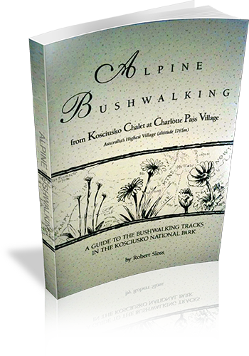
Author: Robert Sloss
Edition: 1
Publisher: Robert Sloss
ISBN: 0958651256
Number of pages: 31
Year of Publication: 1995
Cover Price (au$): 9.90
Format: Paperback
Website: http://www.robertsloss.com.au/Guide%20Index.htm
Weight (grams): 45
Regions the book covers: Kosciuszko National Park
Height (cm): 21
Subjects:
Hiking - New South Wales - Kosciuszko National Park,Hiking - New South Wales - Charlotte Pass
Interpretive Information: Minimal
Grade system explained: Yes
Ascent and/or Decent provided: No
Driving directions provided: No
Date walks last reviewed provided: No
A summary of walks provided: No
Regional Map of walks provided: No
Maps designed for walking: Yes - limited detail
Type of maps used (for walking): Detailed Topographic
Colour used in walking maps: Simple colour
Size of walking maps: Full page
Colour depth of photos: Black and White
Comment on Photographs: A route overview photograph is provided for most walks.
Level of detail in tracknotes: General route description
Very Experienced (Grade 6 walks)

2.8 km Circuit
1 hr 30 mins
Very experienced only

2.8 km Return
3 hrs
Very experienced only

6 km Return
4 hrs
Very experienced only


6 km Return
3 hrs
Very experienced only

6.4 km Circuit
4 hrs
Very experienced only

6.4 km Return
2 hrs 30 mins
Very experienced only

7 km One way
3 hrs 30 mins
Very experienced only

7.1 km Circuit
4 hrs 30 mins
Very experienced only

10.3 km Circuit
2 Days
Very experienced only

18.8 km One way
2 Days
Very experienced only

47.8 km One way
2 Days
Very experienced only

47.8 km One way
3 Days
Very experienced only

Community Resources
Username: User email: User level: User first name: User last name: User display name: User ID: 0