Some bushwalking ways weave back and forth across rivers, cross large open rock platforms, or meander through urban villages before emerging on the other side and continuing. It’s easy to lose the way in these cases, as it’s not entirely clear where or how the way rejoins again. Here are a few tips to find the way again.
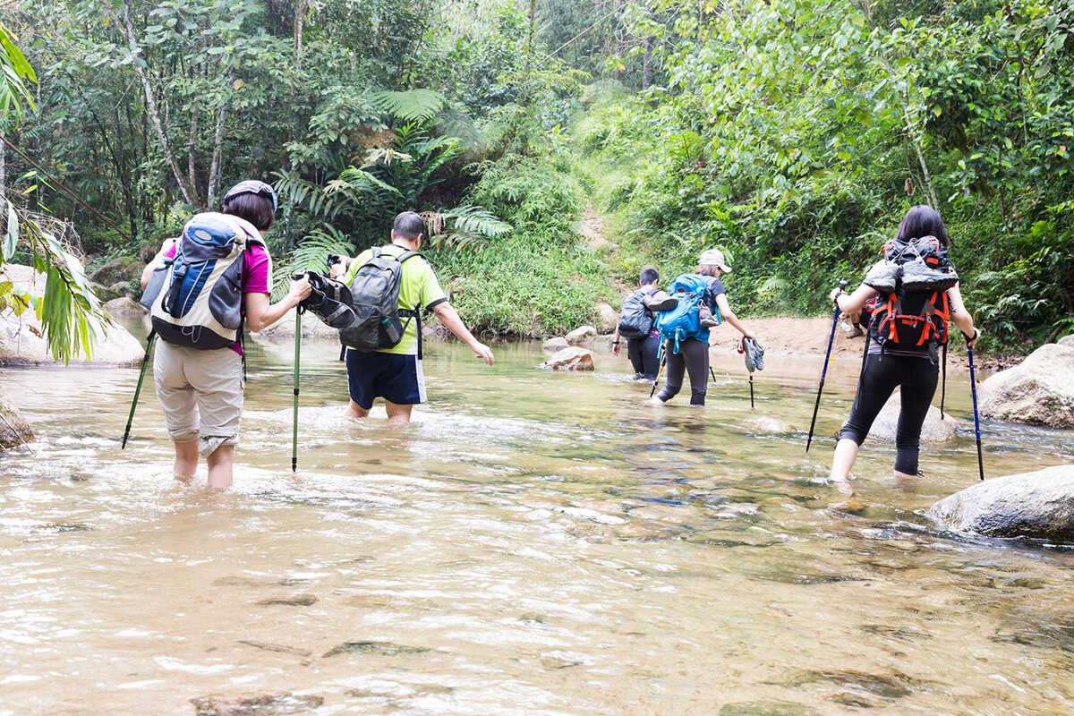
Some bushwalking ways end at the river side, implying that the route crosses over and starts again directly on the other side.
Before crossing, double check that the way indeed crosses over, rather than continuing along the same river bank. Do this by having a quick scout around on the side of the bank you’re on, and looking over to the other side. Sometimes, there’s a clear sign where the way starts again, or there’s a signpost, a small arrow, or a marker. Don’t be surprised though if the way only becomes visible once you’re on the other side: many river crossings are implied rather than signposted.
Assess if the river is safe to cross. Then choose where to cross the river, bearing in mind that this might involve detouring slightly upstream or downstream of the path. Then continue along the way again.
If you cannot pick up the way again after the river crossing, cross back to the way you were on and go back to the last known point. You may have accidentally strayed from the main way, or picked up a way leading off the main one to the river (typical for lunch or swimming spots).
Maps are not that reliable when it comes to river crossings. Ways change over time, and where the way originally crossed the river, it may not do so any more.
The best general advice is to follow the main way whenever given a choice. That is, if the main way continues on one side of the river and you spot another smaller way on the other side of the river, then don’t cross over, stick to the main one. Conversely, if the main way continues on the other side of the river, and only a minor one follows on the same side, cross over.
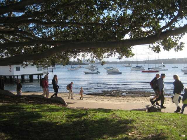
Walks often pass through small urban towns when going from one section of bush to another. It is particularly common on multiday trips, for example, the Great North Walk.
As ironic as it sounds, it can be quite easy to lose the way through a township due to poor signage, or changes to the route due to development. Often the way may disappear at one edge of the town, and bushwalkers need to pick it up at the other side, but it’s not always entirely clear where to do it. Remember that maps may not have up to date information on housing development, particularly on the edges of urban townships. Hence, it can be embarrassingly easy to miss where the way starts again in an urban area!
The good news is that it’s usually pretty straightforward to figure it out. If the way doesn’t have obvious signposts, why not try dropping into the local cafe and chatting to the owners? Most locals are keen to talk about their local bushwalks, and they can probably give you some great advice on where to pick up the way again. Be sensitive to ways that pass through private properties and make sure to ask permission before using them.
In this day and age, modern townships usually mean reasonable mobile phone reception. Google maps may provide useful satellite data on where bushwalking ways start and stop. Even tourist websites and blogs can help.
Failing all that, you can usually work out where the way goes by a process of elimination: if the way comes into the township from the south, it’s going to leave via the North, East or West side. If there’s major bushland on the northern part of the township, then that’s a good place to start scouting out for the way. Roads that are dead ends onto bushland are likely candidates for where the way continues.
Being lost in a township can be quite an enjoyable experience, particularly if there’s a nice place to stop for ice-cream en-route!
Bushwalking tracks will often cross rock platforms, large open slabs of rock with a small amount of vegetation growing between the rock cracks. From a trackmaker’s point of view, including a section of rock is much less work than having to lug in rocks or create a track themselves. It takes little work to maintain and is easy walking for visitors. The downside is that most rock platforms are around 10-20m wide and bushwalkers have to find the track again on the other side. Putting signs on every single rock platform is impractical, so bushwalkers are usually left to locate the track on their own.
In general, a track that goes in on one side of the rock platform forms again on the opposite side of the platform…but not always! On rock platforms where the track continuation is ambiguous, many smaller tracks form where bushwalkers have thought the track continues. This is a big problem for local wildlife and plants due to soil erosion and compaction damage.
Best practice is to avoid using smaller side tracks to scout out the main track. Stay on the rock platform until it’s clear your group has found the correct track. If the track turns out to be wrong, backtrack until you know where you are again.
Rock platforms make for easy walking compared to rough scrub, but be sensitive towards delicate rock formations. Around Sydney, the sandstone pagoda country is stunningly beautiful but extraordinarily delicate. Rock pagodas formed over millennia are easily broken by careless bushwalkers stepping on their edges. Tread lightly and Leave No Trace!
Coastal walks often involve walking in parts along beaches. It’s a great opportunity to take your shoes off and feel the sand on your feet. Finding the way again is usually pretty straightforward, but the way may not be well signposted, or the signs only works well if you’re walking in a particular direction.
 A typical setup is where the way joins at one end of the beach and leaves at the other end.
Or the route continues next to beach, and joins beach halfway along.
Or the route leaves beach halfway along.
Or the route never joins beach.
A typical setup is where the way joins at one end of the beach and leaves at the other end.
Or the route continues next to beach, and joins beach halfway along.
Or the route leaves beach halfway along.
Or the route never joins beach.
Once again, a map of the route may not be a reliable guide to where the route goes. Routes along beaches may change with tides, or be hidden by shifting sand. It can be worth contacting local land rangers to ask about the current condition of the route first.
Leave no Trace by walking on the hard sand nearest the ocean and avoid walking on delicate sand dunes as much as possible. Spread out to even out footprints on the sand.