I think in the interests of assisting people in what is a recognized walk at the expense of posting something that might not be seen as too favourable in the eyes of some in relation to sharing specific information on walks that you shouldn't be on for your own safety if you aren't experienced enough to figure it out (that was a mouthful)...
Leave the Masif bowl and when you are at the eastern end of the cliffs you see a lower ridge heading east that leads to Castle Crag and Falling Mountain. You have a number of choices.
Straight ahead, turn left, or turn right.
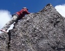
Turn right - covered before - NOT the way. You go a long way down and come to a notch that you climb up to, look through, to discover a huge drop on the other side that might be fun for a rock climber with all the gear, but not for a walker with a pack. Further down may be possible but you would have to go a long way down, then traverse under the cliffs to the north to meet up with the ridge heading east. Lots of work, likely very scrubby, and not the way.
Straight ahead - goes down a very (very) steep bank with rocks, pineapple grass, and many leads that, if taking the wrong one, you may find it very difficult or impossible to climb again, particularly with a pack. We had a go and a large rock I stepped onto gave way and I slid feet first down a steep bank for perhaps 3 or 4 metres, as soon as I made the next shelf I dived to the left and braced for the rock in case it hit me, but it didn't. I look, and it is teetering up the top. I move aside and get my wife to gently push it - she uses one finger with ease and the rock (sort of beachball size but flatter) came tumbling down. Lucky... Not that way...
Several attempts without packs down the pineapple grass / rock embankment ended in vain. We have heard people have come up that way but perhaps it's easier to see and pick a route when at the bottom.
So, Turn left. There is a bit of a valley to the north which does have a cairn there somewhere. We were going to head down this and sidle around the worst of the northern cliffline so as to meet up with the lower ridge, which we think would be the best option, but instead we turned back - half a day was lost due to thick fog.
Some photos that would help.
These are my notes on this photo - does anyone agree / disagree?
 Viewed 8384 times")
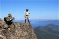
- Looking down over Big Gun Pass towards Mt Masif
When on the eastern end of the Masif plateau (further east from the summit and summit bowl), you come to a cliff line. Looking east from it, you can see the ridge which is your destination -
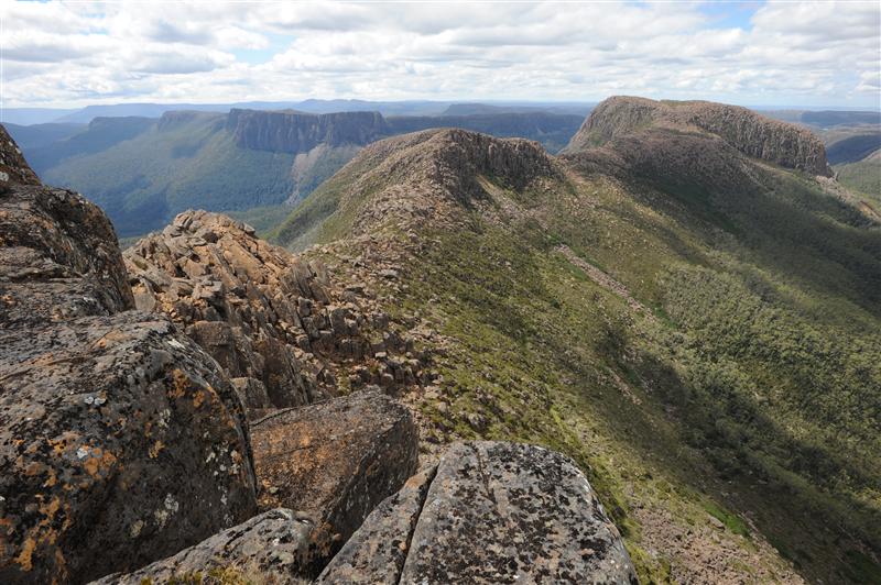
- destination-east-ridge.JPG (99.37 KiB) Viewed 8384 times
Back off a bit and head north down a gully and this is what you would see -
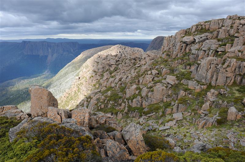
- view-north-gully.JPG (93.25 KiB) Viewed 8384 times
Unless, of course, the clouds are in your face -

- north-gully-2.JPG (62.49 KiB) Viewed 8384 times