Does anyone know if there's a track up Western Bluff (peak on the Great Western Tiers near Mole Creek)?
Wello
Western Bluff
Forum rules
Tasmania specific bushwalking discussion. Please avoid publishing details of access to sensitive areas with no tracks.
Tasmania specific bushwalking discussion. Please avoid publishing details of access to sensitive areas with no tracks.
37 posts
• Page 1 of 2 • 1, 2
Western Bluff
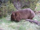
![]() by wello » Sun 05 Sep, 2010 9:27 pm
by wello » Sun 05 Sep, 2010 9:27 pm
- wello
- Athrotaxis cupressoides

- Posts: 147
- Joined: Sat 05 Apr, 2008 10:43 am
Re: Western Bluff
![]() by ILUVSWTAS » Mon 06 Sep, 2010 4:17 am
by ILUVSWTAS » Mon 06 Sep, 2010 4:17 am
The Abels talks of one off the Urks loop road.
Nothing to see here.
-

ILUVSWTAS - Lagarostrobos franklinii

- Posts: 11027
- Joined: Sun 28 Dec, 2008 9:53 am
- Region: Tasmania
- Gender: Male
Re: Western Bluff
![]() by sirius Tas » Thu 09 Sep, 2010 10:31 pm
by sirius Tas » Thu 09 Sep, 2010 10:31 pm
I'm sure the walking club goes in off Urks Loop...about half way around....follows up Kansas Creek(shown on 1:25000 maps)....then across section of plateau.
After a day's walk everything has twice its usual value.
-

sirius Tas - Athrotaxis cupressoides
- Posts: 184
- Joined: Fri 03 Oct, 2008 2:18 pm
- Location: Ulverstone
- Region: Tasmania
- Gender: Male
Re: Western Bluff
![]() by ILUVSWTAS » Sun 05 Dec, 2010 11:31 am
by ILUVSWTAS » Sun 05 Dec, 2010 11:31 am
We did Western Bluff yesterday.
Looking at the maps it made much more sense to me to attempt it from the plateau along the Lake Mckenzie road. It was around 6k's away, but started much much higher than the track.
Proved to be a much better option as we were on the summit in around 2 hrs. The walking was delightfully open and easy. We even passed a cairn or 2 in one section.
- Attachments
-
Nothing to see here.
-
ILUVSWTAS - Lagarostrobos franklinii
- Posts: 11027
- Joined: Sun 28 Dec, 2008 9:53 am
- Region: Tasmania
- Gender: Male
Re: Western Bluff
![]() by Drifting » Sun 05 Dec, 2010 1:54 pm
by Drifting » Sun 05 Dec, 2010 1:54 pm
Any good spots for camping?
All good things are wild, and free.
-

Drifting - Phyllocladus aspleniifolius

- Posts: 969
- Joined: Mon 02 Nov, 2009 8:24 am
- Region: Tasmania
Re: Western Bluff
![]() by ILUVSWTAS » Sun 05 Dec, 2010 4:16 pm
by ILUVSWTAS » Sun 05 Dec, 2010 4:16 pm
Plenty.
Lots of nice grassy areas all over the place. Creeks and ponds were also plentiful
Lots of nice grassy areas all over the place. Creeks and ponds were also plentiful
Nothing to see here.
-
ILUVSWTAS - Lagarostrobos franklinii
- Posts: 11027
- Joined: Sun 28 Dec, 2008 9:53 am
- Region: Tasmania
- Gender: Male
Re: Western Bluff
![]() by sainterone » Sun 26 Dec, 2010 1:06 pm
by sainterone » Sun 26 Dec, 2010 1:06 pm
I was at Cradle Mtn yesterday and looking eastwards I was thinking i could see Western Bluff - almost 30 km away
Does this sound right? What other landmark could I have been looking at?
Does this sound right? What other landmark could I have been looking at?
Last edited by sainterone on Mon 27 Dec, 2010 8:34 am, edited 1 time in total.
-
sainterone - Nothofagus gunnii

- Posts: 12
- Joined: Thu 23 Dec, 2010 8:25 am
- Region: Tasmania
- Gender: Male
Re: Western Bluff
![]() by taswegian » Mon 27 Dec, 2010 6:42 am
by taswegian » Mon 27 Dec, 2010 6:42 am
I would say you were looking at WB.
It is a very prominent landscape formation from many areas.
It is a very prominent landscape formation from many areas.
-
taswegian - Phyllocladus aspleniifolius
- Posts: 899
- Joined: Tue 27 Jul, 2010 8:34 pm
- Region: Tasmania
- Gender: Male
Re: Western Bluff
![]() by sainterone » Mon 27 Dec, 2010 8:35 am
by sainterone » Mon 27 Dec, 2010 8:35 am
Thanks taswegian
I thought I had posted a pic but it didn't come across.
I'll try again soon.
Thanks again
I thought I had posted a pic but it didn't come across.
I'll try again soon.
Thanks again
-
sainterone - Nothofagus gunnii
- Posts: 12
- Joined: Thu 23 Dec, 2010 8:25 am
- Region: Tasmania
- Gender: Male
Re: Western Bluff
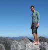
![]() by wello » Sun 27 Feb, 2011 3:07 pm
by wello » Sun 27 Feb, 2011 3:07 pm
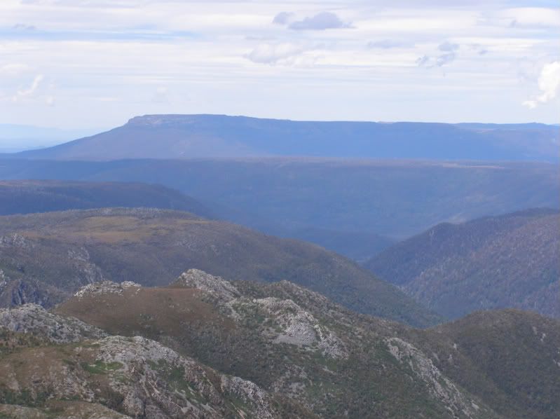
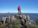
Thanks to ILUVSWTAS for the GPS track, I had a very easy and enjoyable walk across to Western Bluff to mark new year's day. 6km of roughly flat walking has to beat 700m of climbing! It was windy and cool (wore a beanie most of the day!). I saw some cairns too, looked like they were running from the summit toward Lake Mackenzie, but fairly well spaced and little in the way of a pad between them.
Great colour in the scoparia up there too, shame about all the logging you can see from the top.
Wello
- Lake Rowallen and Clumner Bluff from Western Bluff summit
- Central Plateau country
Great colour in the scoparia up there too, shame about all the logging you can see from the top.
Wello
- wello
- Athrotaxis cupressoides
- Posts: 147
- Joined: Sat 05 Apr, 2008 10:43 am
Re: Western Bluff
![]() by Nick S » Sun 27 Feb, 2011 10:42 pm
by Nick S » Sun 27 Feb, 2011 10:42 pm
Nice Wello, seems like a great walk if you're keen for a ramble along the plateau.
-
Nick S - Phyllocladus aspleniifolius
- Posts: 608
- Joined: Thu 20 Mar, 2008 4:55 pm
- Location: Launceston
- Region: Tasmania
- Gender: Male
Re: Western Bluff
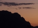
![]() by sainterone » Tue 26 Apr, 2011 1:07 pm
by sainterone » Tue 26 Apr, 2011 1:07 pm
Finally got around to posting the photo I took from Cradle.
I guess this is Western Bluff?
-
sainterone - Nothofagus gunnii
- Posts: 12
- Joined: Thu 23 Dec, 2010 8:25 am
- Region: Tasmania
- Gender: Male
Re: Western Bluff
![]() by flyfisher » Tue 26 Apr, 2011 8:25 pm
by flyfisher » Tue 26 Apr, 2011 8:25 pm
Certainly looks like Western bluff.
Great shot of February plains in the middle distance too.
Great shot of February plains in the middle distance too.
If you don't know what I'm talking about, then you need to drink more.
-
flyfisher - Athrotaxis selaginoides

- Posts: 1528
- Joined: Sat 14 Jul, 2007 8:39 pm
- Location: hobart
- ASSOCIATED ORGANISATIONS: landrover owners club of tasmania
- Region: Tasmania
Re: Western Bluff
![]() by Ent » Thu 20 Jun, 2013 6:50 pm
by Ent » Thu 20 Jun, 2013 6:50 pm
sirius Tas wrote:I'm sure the walking club goes in off Urks Loop...about half way around....follows up Kansas Creek(shown on 1:25000 maps)....then across section of plateau.
Hi
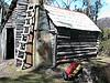
I did the climb this way with the LWC but the start of the track was missed until it hit the remains of an old hut just before the cliffs. My fading memory from five years ago is a bit suspect so does anyone have the GPX trace of that way or just the starting waypoint as the track is reasonably clear on the ground. I am interested in going this way as I believe from memory it has one of the few rare water courses that splits on the downward side.
Cheers
"lt only took six years. From now on, l´ll write two letters a week instead of one."
(Shawshank Redemption)
(Shawshank Redemption)
-

Ent - Lagarostrobos franklinii
- Posts: 4059
- Joined: Tue 13 May, 2008 3:38 pm
- Region: Tasmania
Re: Western Bluff
![]() by Ent » Mon 15 Jul, 2013 9:52 am
by Ent » Mon 15 Jul, 2013 9:52 am
sirius Tas wrote:I'm sure the walking club goes in off Urks Loop...about half way around....follows up Kansas Creek(shown on 1:25000 maps)....then across section of plateau.
Um? Like the Overland Track is in Tasmania?
Ok time for better instructions. The track start is about one plus kilometres further on from Kanas Creek if you come up from the Devil Gullet side. The is a small opening and flat land with bit of tape around. As it is a old Forestry track and well marked I will put it up on OSM for those that understand GPS.
Warning. Urks Road is not suitable for cars, in fact a "proper" 4wd is required and still expect scratched paint work and be aware that the bridge over Kanas Creek has a hole where a log has rotted through. Best to come up the other way and park where the road splits and walk. Though you well get very wet feet and be attacked by a legion of leeches. Yet once on the track leech count drops.
Oh yes, if you do come in from the Devil Gullet side about two hundred and fifty metres on the right is a flat area you can park. There is a set of walking polls. Err? Be appreciated if you could PM as they are much missed.
Cheers
"lt only took six years. From now on, l´ll write two letters a week instead of one."
(Shawshank Redemption)
(Shawshank Redemption)
-
Ent - Lagarostrobos franklinii
- Posts: 4059
- Joined: Tue 13 May, 2008 3:38 pm
- Region: Tasmania
Re: Western Bluff
![]() by sirius Tas » Mon 15 Jul, 2013 5:30 pm
by sirius Tas » Mon 15 Jul, 2013 5:30 pm
Any chance of co-ords as I'm totally lost.
After a day's walk everything has twice its usual value.
-
sirius Tas - Athrotaxis cupressoides
- Posts: 184
- Joined: Fri 03 Oct, 2008 2:18 pm
- Location: Ulverstone
- Region: Tasmania
- Gender: Male
Re: Western Bluff
![]() by sthughes » Mon 15 Jul, 2013 6:53 pm
by sthughes » Mon 15 Jul, 2013 6:53 pm
Have a look on OSM. I've put in Urks Loop and the walking track as far as it could be followed into the snow. It starts about 1km past Kansas Creek (assuming you come in from the southern end of Urks Loop) 
"Don't do today what you can put off 'till tomorrow." (Work that is!)
-
sthughes - Lagarostrobos franklinii
- Posts: 2414
- Joined: Wed 05 Mar, 2008 12:53 pm
- Location: Ulverstone
- Region: Tasmania
- Gender: Male
Re: Western Bluff
![]() by sirius Tas » Thu 18 Jul, 2013 1:56 pm
by sirius Tas » Thu 18 Jul, 2013 1:56 pm
sthughes wrote:Have a look on OSM. I've put in Urks Loop and the walking track as far as it could be followed into the snow. It starts about 1km past Kansas Creek (assuming you come in from the southern end of Urks Loop)
Many thanks for that info....it's the first time I've been to OSM...quite interesting. Is it possible to download the actual gpx file?
So far I could get individual co-ords along various routes, but would be handy to actually get gpx files.
BTW sorry for my ignorance but completely new to OSM.
Many thanks sthughes...cheers.
After a day's walk everything has twice its usual value.
-
sirius Tas - Athrotaxis cupressoides
- Posts: 184
- Joined: Fri 03 Oct, 2008 2:18 pm
- Location: Ulverstone
- Region: Tasmania
- Gender: Male
Re: Western Bluff
![]() by sthughes » Thu 18 Jul, 2013 2:03 pm
by sthughes » Thu 18 Jul, 2013 2:03 pm
sirius Tas wrote:sthughes wrote:Have a look on OSM. I've put in Urks Loop and the walking track as far as it could be followed into the snow. It starts about 1km past Kansas Creek (assuming you come in from the southern end of Urks Loop)
Many thanks for that info....it's the first time I've been to OSM...quite interesting. Is it possible to download the actual gpx file?
So far I could get individual co-ords along various routes, but would be handy to actually get gpx files.
BTW sorry for my ignorance but completely new to OSM.
Many thanks sthughes...cheers.
I think you can, sort of. All too hard for me though! If you PM me your email I can send it to you
"Don't do today what you can put off 'till tomorrow." (Work that is!)
-
sthughes - Lagarostrobos franklinii
- Posts: 2414
- Joined: Wed 05 Mar, 2008 12:53 pm
- Location: Ulverstone
- Region: Tasmania
- Gender: Male
Re: Western Bluff
![]() by sthughes » Thu 18 Jul, 2013 2:04 pm
by sthughes » Thu 18 Jul, 2013 2:04 pm
Better still, try this link:
http://www.openstreetmap.org/user/sthughes/traces/1502622
http://www.openstreetmap.org/user/sthughes/traces/1502622
"Don't do today what you can put off 'till tomorrow." (Work that is!)
-
sthughes - Lagarostrobos franklinii
- Posts: 2414
- Joined: Wed 05 Mar, 2008 12:53 pm
- Location: Ulverstone
- Region: Tasmania
- Gender: Male
Re: Western Bluff
![]() by Ent » Thu 18 Jul, 2013 2:08 pm
by Ent » Thu 18 Jul, 2013 2:08 pm
Hi
Depending on your GPS should be able to help you out with a img of Tassie. It is still very much a work in progress.
Cheers
Depending on your GPS should be able to help you out with a img of Tassie. It is still very much a work in progress.
Cheers
"lt only took six years. From now on, l´ll write two letters a week instead of one."
(Shawshank Redemption)
(Shawshank Redemption)
-
Ent - Lagarostrobos franklinii
- Posts: 4059
- Joined: Tue 13 May, 2008 3:38 pm
- Region: Tasmania
Re: Western Bluff
![]() by sirius Tas » Thu 18 Jul, 2013 2:49 pm
by sirius Tas » Thu 18 Jul, 2013 2:49 pm
sthughes wrote:Better still, try this link:
http://www.openstreetmap.org/user/sthughes/traces/1502622
Yep all ok....very much appreciated....cheers ST.
After a day's walk everything has twice its usual value.
-
sirius Tas - Athrotaxis cupressoides
- Posts: 184
- Joined: Fri 03 Oct, 2008 2:18 pm
- Location: Ulverstone
- Region: Tasmania
- Gender: Male
Re: Western Bluff
![]() by sirius Tas » Fri 19 Jul, 2013 12:21 pm
by sirius Tas » Fri 19 Jul, 2013 12:21 pm
For other likely users of this track, I found a complete gpx file at...
http://tastracks.webs.com/greatwesternt ... #587094225
The above link is a top site with many tracks in detail.
http://tastracks.webs.com/greatwesternt ... #587094225
The above link is a top site with many tracks in detail.
After a day's walk everything has twice its usual value.
-
sirius Tas - Athrotaxis cupressoides
- Posts: 184
- Joined: Fri 03 Oct, 2008 2:18 pm
- Location: Ulverstone
- Region: Tasmania
- Gender: Male
Re: Western Bluff
![]() by Ent » Sat 20 Jul, 2013 11:19 pm
by Ent » Sat 20 Jul, 2013 11:19 pm
Good find. Bet giving it a good look. Ps the walking poles are much missed.
"lt only took six years. From now on, l´ll write two letters a week instead of one."
(Shawshank Redemption)
(Shawshank Redemption)
-
Ent - Lagarostrobos franklinii
- Posts: 4059
- Joined: Tue 13 May, 2008 3:38 pm
- Region: Tasmania
Re: Western Bluff
![]() by sirius Tas » Sun 21 Jul, 2013 2:51 pm
by sirius Tas » Sun 21 Jul, 2013 2:51 pm
Hi Ent,
Hope to be going there in the next couple of weeks...so if poles still there I'll certainly return them. I've already got some...lol.
Got some walking to complete along Dooleys Trail Wilmot first..then over to WB.
BTW...does the track need any/much work done on it with regards to fallen logs or trees?
After a day's walk everything has twice its usual value.
-
sirius Tas - Athrotaxis cupressoides
- Posts: 184
- Joined: Fri 03 Oct, 2008 2:18 pm
- Location: Ulverstone
- Region: Tasmania
- Gender: Male
Re: Western Bluff
![]() by Ent » Mon 22 Jul, 2013 12:45 am
by Ent » Mon 22 Jul, 2013 12:45 am
Hi Sirius Tas
Track is clear of logs but hiding in a few ferns are the ends of some very big logs so be careful of assuming that you are only pushing through a fern. As mentioned the bridge over Kanas Creek has a log running parallel to the road missing so you could wedge a wheel or worst on that. The main issue is ground clearance with a few 400mm drops. Plus mud in a few sections that might count against a heavier 4wd.
I would not think that the full loop would worry greatly a person use to 4wd tracks but not for cars nor car like 4wd or people that have just brought their new toy.
Be great to get your GPX tracks. I think that the walks you mentioned are up on OSM. I have pushed out a rough draft of OSM maps for Garmins on the techno babble section.
Yes I am having pole separation issues.
Cheers and have fun.
"lt only took six years. From now on, l´ll write two letters a week instead of one."
(Shawshank Redemption)
(Shawshank Redemption)
-
Ent - Lagarostrobos franklinii
- Posts: 4059
- Joined: Tue 13 May, 2008 3:38 pm
- Region: Tasmania
Re: Western Bluff
![]() by sirius Tas » Tue 23 Jul, 2013 11:58 am
by sirius Tas » Tue 23 Jul, 2013 11:58 am
No worries....I'll see how I go with 4wd....used to rough tracks etc so should be ok.
I'll take my trusty slash hook with me and do as much cleaning as I can..both in and out.
I think all the Dooleys Trails are now on the latest LIST mapping as well.....they mostly just follow the river, but have a few crossings to avoid the private property.
Would have been a perfect day up there today, but will wait until completing the Wilmot walks...so expect it'll be early August before I get up there.
After a day's walk everything has twice its usual value.
-
sirius Tas - Athrotaxis cupressoides
- Posts: 184
- Joined: Fri 03 Oct, 2008 2:18 pm
- Location: Ulverstone
- Region: Tasmania
- Gender: Male
Re: Western Bluff
![]() by sthughes » Tue 23 Jul, 2013 2:56 pm
by sthughes » Tue 23 Jul, 2013 2:56 pm
Hi Sirius,
The Western Creek track is pretty well maintained but for a handful of trees across it, most of which have been down a good while and would need at least a decent bow saw (and more sensibly a chain saw) to clear. But none are a problem to go around. It's well taped too for the most part. The only bit we found vague was due to snow cover on the day.
Urks Road is nice and clear, apart from, like Ent said, a few overhanging man ferns etc, one of which concealed a log - but don't worry I think I cleared that with my front left wheel guard! It's not that rough, we made it through in pouring rain in a Mitsubishi Outlander, well most of the Outy made it through anyway! All the mud has a solid bottom, although it does conceal the odd little hole as you'd expect.
P.s. good to see a new OSM mapper by your name has signed up! It's a great little project and more contributors will really help it reach a critical mass so to speak
"Don't do today what you can put off 'till tomorrow." (Work that is!)
-
sthughes - Lagarostrobos franklinii
- Posts: 2414
- Joined: Wed 05 Mar, 2008 12:53 pm
- Location: Ulverstone
- Region: Tasmania
- Gender: Male
Re: Western Bluff
![]() by sirius Tas » Fri 26 Jul, 2013 2:25 pm
by sirius Tas » Fri 26 Jul, 2013 2:25 pm
Hi sthughes,
I'll take the small stihl ms170 with me up the track and see how I go. Will clear what's needed on the way in too.
I'll come in on the northern side of Urks Loop...as it seems the walking clubs go that way.....so will clear it as I go.
Thanks for all the info...cheers..ST.
I'll take the small stihl ms170 with me up the track and see how I go. Will clear what's needed on the way in too.
I'll come in on the northern side of Urks Loop...as it seems the walking clubs go that way.....so will clear it as I go.
Thanks for all the info...cheers..ST.
After a day's walk everything has twice its usual value.
-
sirius Tas - Athrotaxis cupressoides
- Posts: 184
- Joined: Fri 03 Oct, 2008 2:18 pm
- Location: Ulverstone
- Region: Tasmania
- Gender: Male
Re: Western Bluff
![]() by NickD » Sat 20 Jun, 2015 12:23 pm
by NickD » Sat 20 Jun, 2015 12:23 pm
Just for people's interest, I headed up here on Thursday on a beautiful but cold day.
Urks Loop Road has fallen into some pretty dire disrepair. My step-dad had ventured up there in 2012 or 2013 and drove up in a Honda CR-V which made it easily, however now driving in a 1992 Mazda Bravo with very good clearance it took some handy 4wd-ing to get to the start of the trail. There is a lot of overhanging trees and bush and lots of very deep ruts (we even bottomed out once!) so you'll need a 4WD where you don't care for the outcome of the car's body
However once on the walking trail itself it was fantastically clear and seemingly recently taped. There is a little bit of uncertainty around where the track crosses Kansas Creek but its pretty easy to work out. The pad leads you easily into the gully/ravine which is quite a beautiful location especially with the semi frozen Marakoopa Creek pouring over dolerite shale. From there it is an easy off-track-alpine walk to the summit cairn/trig station. recommended.
-
NickD - Athrotaxis cupressoides
- Posts: 185
- Joined: Mon 07 Jul, 2008 4:20 pm
- Location: Travellers Retreat
- Region: Tasmania
37 posts
• Page 1 of 2 • 1, 2
Who is online
Users browsing this forum: No registered users and 66 guests