GAME: Where am I?
Only administrators may post new topics to this forum. Registered users can post replies.
Re: GAME: Where Am I? (Continued)
![]() by wobbly » Mon 14 Sep, 2009 7:21 am
by wobbly » Mon 14 Sep, 2009 7:21 am
-
wobbly - Phyllocladus aspleniifolius

- Posts: 774
- Joined: Thu 30 Oct, 2008 1:10 pm
- Location: Victoria
Re: GAME: Where Am I? (Continued)
![]() by robl » Mon 14 Sep, 2009 9:15 am
by robl » Mon 14 Sep, 2009 9:15 am
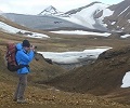
New pic.

- robl
- Athrotaxis cupressoides

- Posts: 454
- Joined: Fri 04 Jan, 2008 8:01 pm
Re: GAME: Where Am I? (Continued)
![]() by eggs » Mon 14 Sep, 2009 10:45 am
by eggs » Mon 14 Sep, 2009 10:45 am
-

eggs - Lagarostrobos franklinii

- Posts: 10856
- Joined: Fri 23 May, 2008 2:58 pm
- Location: Para Vista, South Australia
- Region: South Australia
Re: GAME: Where Am I? (Continued)
![]() by eggs » Mon 14 Sep, 2009 11:35 am
by eggs » Mon 14 Sep, 2009 11:35 am
This is an old slide where I really like the colour brought out by the late afternoon sun.
-
eggs - Lagarostrobos franklinii
- Posts: 10856
- Joined: Fri 23 May, 2008 2:58 pm
- Location: Para Vista, South Australia
- Region: South Australia
Re: GAME: Where Am I? (Continued)
![]() by robl » Mon 14 Sep, 2009 11:59 am
by robl » Mon 14 Sep, 2009 11:59 am
- robl
- Athrotaxis cupressoides
- Posts: 454
- Joined: Fri 04 Jan, 2008 8:01 pm
Re: GAME: Where Am I? (Continued)
![]() by eggs » Mon 14 Sep, 2009 12:08 pm
by eggs » Mon 14 Sep, 2009 12:08 pm
A magical place - where the mat of vegetation in the foreground is floating over the lake.
-
eggs - Lagarostrobos franklinii
- Posts: 10856
- Joined: Fri 23 May, 2008 2:58 pm
- Location: Para Vista, South Australia
- Region: South Australia
Re: GAME: Where Am I? (Continued)
![]() by robl » Mon 14 Sep, 2009 1:23 pm
by robl » Mon 14 Sep, 2009 1:23 pm
I will give a hint this evening.

- robl
- Athrotaxis cupressoides
- Posts: 454
- Joined: Fri 04 Jan, 2008 8:01 pm
Re: GAME: Where Am I? (Continued)
![]() by ILUVSWTAS » Mon 14 Sep, 2009 1:28 pm
by ILUVSWTAS » Mon 14 Sep, 2009 1:28 pm
-

ILUVSWTAS - Lagarostrobos franklinii
- Posts: 11027
- Joined: Sun 28 Dec, 2008 9:53 am
- Region: Tasmania
- Gender: Male
Re: GAME: Where Am I? (Continued)
![]() by kramster » Mon 14 Sep, 2009 1:43 pm
by kramster » Mon 14 Sep, 2009 1:43 pm
-

kramster - Athrotaxis cupressoides
- Posts: 234
- Joined: Wed 05 Dec, 2007 10:18 am
- Location: Hobart, Tasmania
- Region: Tasmania
- Gender: Male
Re: GAME: Where Am I? (Continued)
![]() by stu » Mon 14 Sep, 2009 1:58 pm
by stu » Mon 14 Sep, 2009 1:58 pm
-

stu - Lagarostrobos franklinii
- Posts: 2168
- Joined: Fri 02 May, 2008 8:31 am
- Region: Tasmania
Re: GAME: Where Am I? (Continued)
![]() by robl » Mon 14 Sep, 2009 6:12 pm
by robl » Mon 14 Sep, 2009 6:12 pm
Hints:
There are campsites, hut and toilet nearby. (100 metres)
- robl
- Athrotaxis cupressoides
- Posts: 454
- Joined: Fri 04 Jan, 2008 8:01 pm
Re: GAME: Where Am I? (Continued)
![]() by ILUVSWTAS » Mon 14 Sep, 2009 6:57 pm
by ILUVSWTAS » Mon 14 Sep, 2009 6:57 pm
-
ILUVSWTAS - Lagarostrobos franklinii
- Posts: 11027
- Joined: Sun 28 Dec, 2008 9:53 am
- Region: Tasmania
- Gender: Male
Re: GAME: Where Am I? (Continued)
![]() by tastrax » Mon 14 Sep, 2009 8:06 pm
by tastrax » Mon 14 Sep, 2009 8:06 pm
-

tastrax - Lagarostrobos franklinii
- Posts: 2030
- Joined: Fri 28 Mar, 2008 6:25 pm
- Location: What3words - epic.constable.downplayed
- ASSOCIATED ORGANISATIONS: RETIRED! - Parks and Wildlife Service
- Region: Tasmania
Re: GAME: Where Am I? (Continued)
![]() by robl » Mon 14 Sep, 2009 8:25 pm
by robl » Mon 14 Sep, 2009 8:25 pm
Big Hill from Encampment Cove on Maria Island.
- robl
- Athrotaxis cupressoides
- Posts: 454
- Joined: Fri 04 Jan, 2008 8:01 pm
Re: GAME: Where Am I? (Continued)
![]() by tastrax » Mon 14 Sep, 2009 8:33 pm
by tastrax » Mon 14 Sep, 2009 8:33 pm
-
tastrax - Lagarostrobos franklinii
- Posts: 2030
- Joined: Fri 28 Mar, 2008 6:25 pm
- Location: What3words - epic.constable.downplayed
- ASSOCIATED ORGANISATIONS: RETIRED! - Parks and Wildlife Service
- Region: Tasmania

Re: GAME: Where Am I? (Continued)
![]() by ILUVSWTAS » Mon 14 Sep, 2009 9:10 pm
by ILUVSWTAS » Mon 14 Sep, 2009 9:10 pm
-
ILUVSWTAS - Lagarostrobos franklinii
- Posts: 11027
- Joined: Sun 28 Dec, 2008 9:53 am
- Region: Tasmania
- Gender: Male
Re: GAME: Where Am I? (Continued)
![]() by eggs » Mon 14 Sep, 2009 9:16 pm
by eggs » Mon 14 Sep, 2009 9:16 pm
Probably from part way down the "track" to the lake.
Now there is a laugh.
The old map I had did not have a track to the top of Hartz Peak - but showed the path to the Lake.
But while the track to the top is great - this track down is very overgrown - probably unmaintained.
My little 10 year old was having a struggle with the scoparia as we worked our way down. I was pressing it back for her to get past.
-
eggs - Lagarostrobos franklinii
- Posts: 10856
- Joined: Fri 23 May, 2008 2:58 pm
- Location: Para Vista, South Australia
- Region: South Australia
Re: GAME: Where Am I? (Continued)
![]() by ILUVSWTAS » Mon 14 Sep, 2009 9:19 pm
by ILUVSWTAS » Mon 14 Sep, 2009 9:19 pm
eggs wrote:My little 10 year old was having a struggle with the scoparia as we worked our way down. I was pressing it back for her to get past.
Your doing well to be able to budge the stuff at all.
Yes of course, Hartz. Used to be a popular campspot aparantly. Before the road I guess. Spent a night at Weld earlier this year, looks very much like the un-named lake near the summit. Same grey view I remember seeing too
-
ILUVSWTAS - Lagarostrobos franklinii
- Posts: 11027
- Joined: Sun 28 Dec, 2008 9:53 am
- Region: Tasmania
- Gender: Male
Re: GAME: Where Am I? (Continued)
![]() by robl » Mon 14 Sep, 2009 9:33 pm
by robl » Mon 14 Sep, 2009 9:33 pm
I didn't have time to get to the top but I had to see the lake.
- robl
- Athrotaxis cupressoides
- Posts: 454
- Joined: Fri 04 Jan, 2008 8:01 pm
Re: GAME: Where Am I? (Continued)
![]() by eggs » Mon 14 Sep, 2009 9:39 pm
by eggs » Mon 14 Sep, 2009 9:39 pm
It is a zoom - but some peaks might be recognisable - where was I?
-
eggs - Lagarostrobos franklinii
- Posts: 10856
- Joined: Fri 23 May, 2008 2:58 pm
- Location: Para Vista, South Australia
- Region: South Australia
Re: GAME: Where Am I? (Continued)
![]() by ILUVSWTAS » Mon 14 Sep, 2009 9:43 pm
by ILUVSWTAS » Mon 14 Sep, 2009 9:43 pm
It looks like that place I havent been to much as yet so im going to just admire the picture for what it is!! Very visually stunnung!!!
-
ILUVSWTAS - Lagarostrobos franklinii
- Posts: 11027
- Joined: Sun 28 Dec, 2008 9:53 am
- Region: Tasmania
- Gender: Male
Re: GAME: Where Am I? (Continued)
![]() by Amanda » Mon 14 Sep, 2009 11:05 pm
by Amanda » Mon 14 Sep, 2009 11:05 pm
- Amanda
- Athrotaxis cupressoides
- Posts: 109
- Joined: Thu 15 Jan, 2009 8:21 pm
- ASSOCIATED ORGANISATIONS: Mountain Designs
- Region: Tasmania
Re: GAME: Where Am I? (Continued)
![]() by eggs » Mon 14 Sep, 2009 11:08 pm
by eggs » Mon 14 Sep, 2009 11:08 pm
[The ridge coming in from the right is part of Ossa]
-
eggs - Lagarostrobos franklinii
- Posts: 10856
- Joined: Fri 23 May, 2008 2:58 pm
- Location: Para Vista, South Australia
- Region: South Australia
- Amanda
- Athrotaxis cupressoides
- Posts: 109
- Joined: Thu 15 Jan, 2009 8:21 pm
- ASSOCIATED ORGANISATIONS: Mountain Designs
- Region: Tasmania
Re: GAME: Where Am I? (Continued)
![]() by eggs » Mon 14 Sep, 2009 11:21 pm
by eggs » Mon 14 Sep, 2009 11:21 pm
Your turn Amanda
-
eggs - Lagarostrobos franklinii
- Posts: 10856
- Joined: Fri 23 May, 2008 2:58 pm
- Location: Para Vista, South Australia
- Region: South Australia
- Amanda
- Athrotaxis cupressoides
- Posts: 109
- Joined: Thu 15 Jan, 2009 8:21 pm
- ASSOCIATED ORGANISATIONS: Mountain Designs
- Region: Tasmania
Re: GAME: Where Am I? (Continued)
![]() by Amanda » Tue 15 Sep, 2009 9:25 am
by Amanda » Tue 15 Sep, 2009 9:25 am
- Amanda
- Athrotaxis cupressoides
- Posts: 109
- Joined: Thu 15 Jan, 2009 8:21 pm
- ASSOCIATED ORGANISATIONS: Mountain Designs
- Region: Tasmania
Return to Games and Competitions
Who is online
Users browsing this forum: No registered users and 46 guests