It is simple to find Ritchie's Hut.
When we get out of Plague prison follow these steps.
Drive to Mansfield
Drive to Merrijig
Continue towards Mt. Buller. Take the right hand turn along the dirt Howqua track to Sheepyard Flat.
Continue along Brock's road past Tunnel Bend. It can be a bit rough but a 2 WD can make it to the parking space opposite the 4 WD access track to 8 Mile Flat. The site is sign posted.
You can put on your packs and walk down this steepish short track to the excellent campsite at 8 Mile flat.
Then go up the hill up bit away from the river and you will find the high track. Go past the sign pointing out the track up 8 Mile spur. Stay on the sign posted track track . The High track is signposted at 8 Mile flat camp site so you cannot miss it. The low track has many river crossings and should be avoided in Spring when the river is flowing higher than usual. The Low track is signposted too so you cannot get them mixed up.
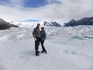
Walk along the high track. The path is obvious and does give you some views of the Bluff , Little Buller spur and the Howqua river.
After approximately 3 hours of walking you will reach Ritchie's hut. It is obvious. It is not possible to miss it. There are good tent sites in the flat area near the hut. There is a pit loo and water in the stream next to the hut and in the Howqua river itself.
If you spend two nights camping there then you can walk further upstream from the hut as an easy day excursion to where the path meets the 16 Mile jeep track, that requires zero navigation skills.
Even on an easy walk like this you can learn to read maps with a compass such as the latest edition of the Buller / Howitt area map which is published by Spatial Vision. Paddy Pallin should have a copy in their city shop or online.
There are videos on YOU TUBE on how to use a compass with a map for newbies.
I could use some Ritchie's hut therapy myself. I can just picture it now.