| Turn map |
Directions & comments |
|
|

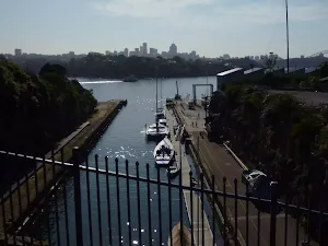
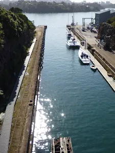
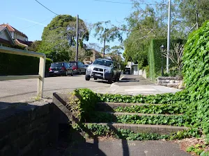
Start.

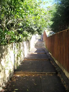
Then head up the surface|paving_stones steps (about 4 m long)

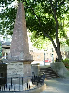
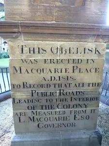
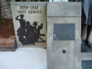
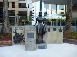
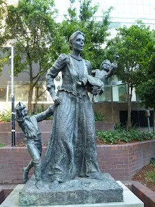
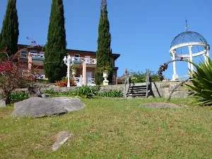
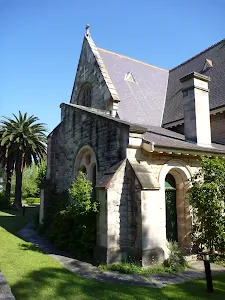
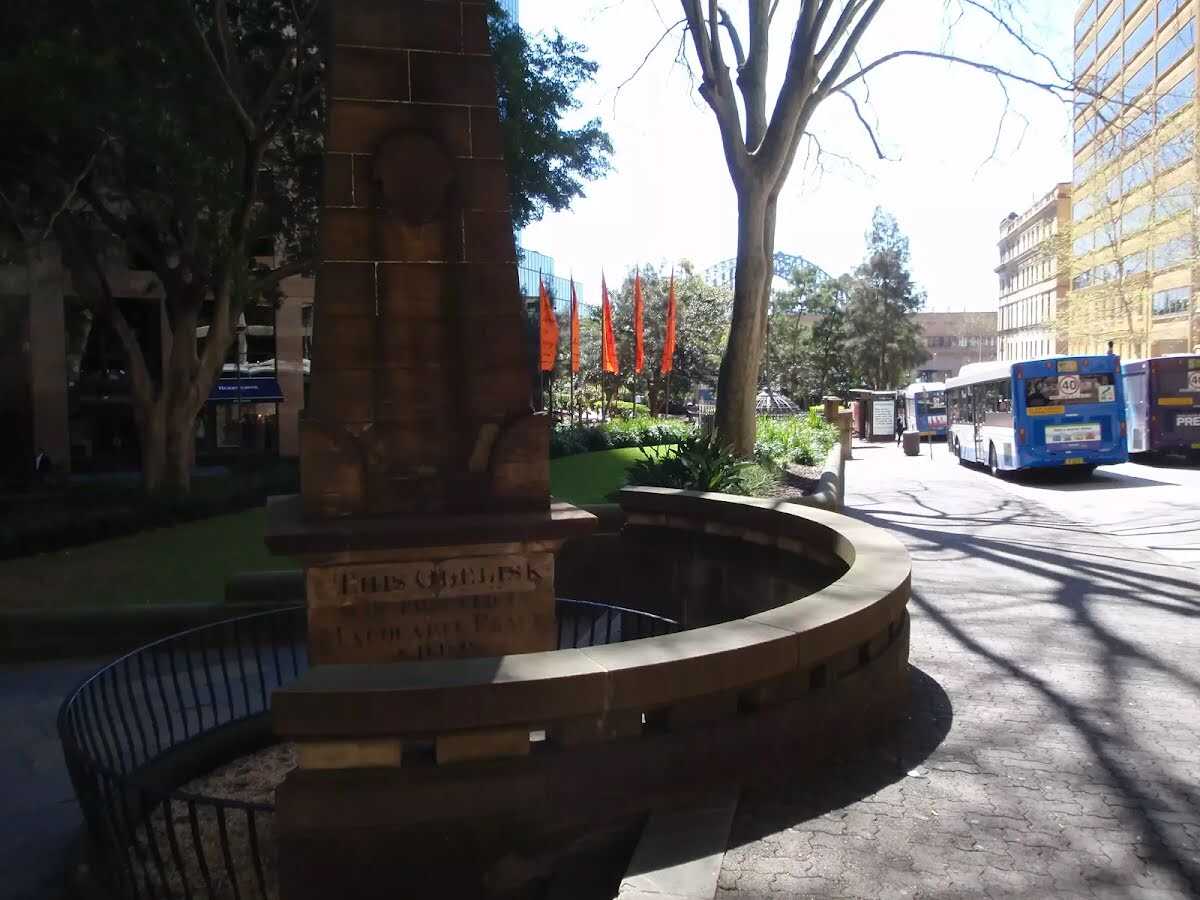
Find the The Obelisk at the start.

Find the Bridge Room at the start.
|
|
|

Turn left.
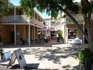
After 45 m pass the "Tribunes" (25 m on your left).
|
|
|

Turn right.
|
|
|
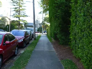
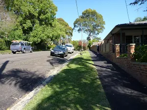
After another 5 m (from the Reiby Place) turn right, to head along Reiby Place (a residential road).
|
|
|

After another 15 m (from the Reiby Place) continue straight, to head along Reiby Place.

After another 20 m pass a seat (about 40 m ahead).
|
|
|
At the intersection of Loftus Street & Reiby Place turn left, to head along Loftus Street (a vehicle track).
After another 60 m pass a seat (15 m on your left).
Then pass the "Bubble Nini" (25 m on your right).

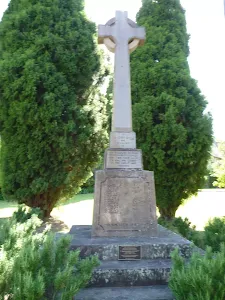
After another 15 m pass the "First Fleet Memorial" (9 m on your left).
After another 10 m pass the "Bouillon L'Entrecôte" (25 m on your right).
|
|
|
At the intersection of Loftus Street & Custom House Lane continue straight, to head along Loftus Street.
After another 55 m pass the "Jessie Street Gardens" (10 m on your left).

Then pass the toilet (55 m on your left).
|
|
|
After another 3 m (from the Loftus Street) continue straight, to head along Loftus Street.
After another 30 m pass the "McDonald's" (15 m on your left).

After another 30 m pass the water tap (25 m on your left).
|
|
|
At the intersection of Loftus Street & Alfred Street continue straight, to head along Loftus Street.
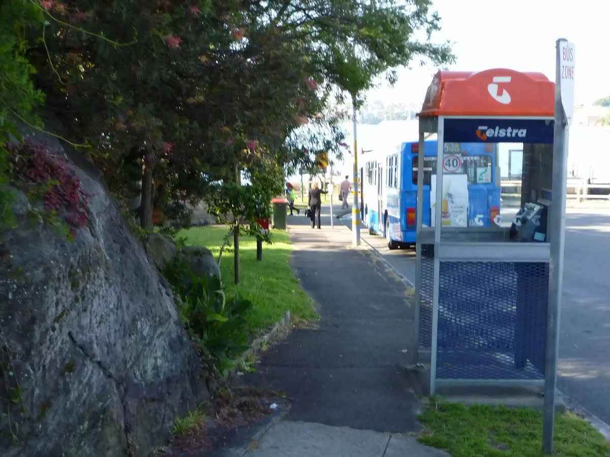
After another 10 m pass the pay phone (10 m on your left).
|
|
|
From the Loftus Street continue straight (a footpath).
|
|
|
From the Loftus Street continue straight, to head along Loftus Street (a highway|pedestrian).
After another 15 m pass a seat (about 40 m ahead)., has a backrest.
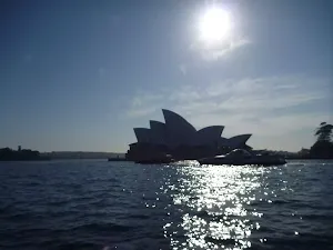
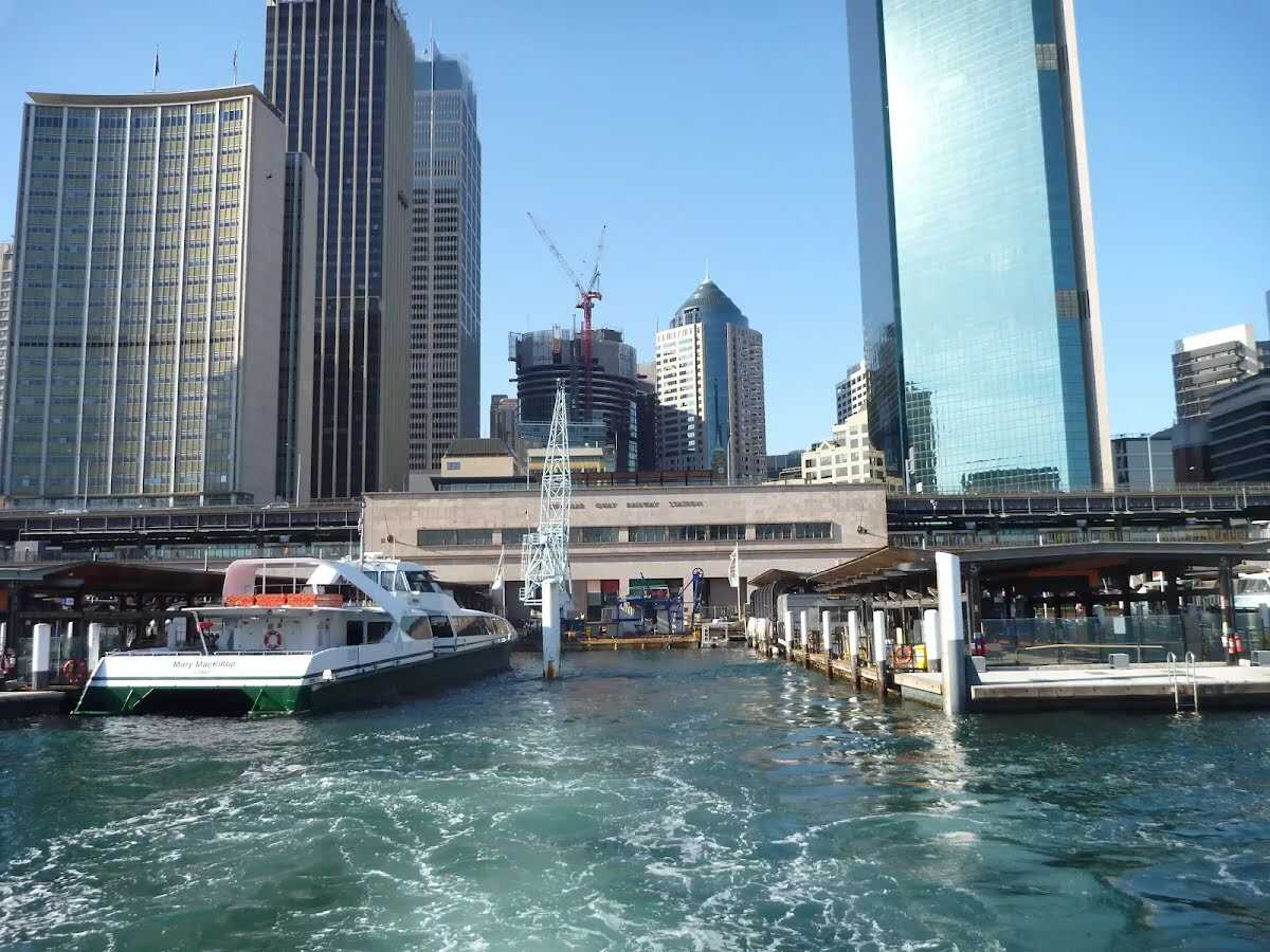
Then find the "Circular Quay" (about 40 m ahead).
Then pass the toilet (70 m on your left). This toilet is wheelchair accessible.
Then pass the pay phone (7 m on your left).

Then pass the emergency call device (about 20 m ahead).
|
|
|
At the intersection of Alfred Street & Loftus Street turn right, to head along Alfred Street.
Then pass the water tap (15 m on your left).

Then come to the viewpoint (35 m on your left). This viewpoint is wheelchair accessible.

After another 15 m head through the bollard.
After another 15 m pass a seat (15 m on your left).
|
|
|
From the Alfred Street continue straight, to head along Alfred Street.
After another 6 m pass a seat (15 m on your left)., has a backrest.
After another 20 m pass the "Hungry Jack's" (25 m on your left).
After another 25 m pass the "The Best Coffee" (10 m on your left).
After another 15 m head through the bollard.
|
|
|

From the Alfred Street veer left (a footpath).
Then pass the "Vietnamese Street Food" (10 m on your left).
After another 20 m pass the pay phone (15 m on your right).
|
|
|
Turn left.

Then head through the tunnel (about 40 m long)
Then pass the "Quick Bites" (7 m on your right).
After another 20 m pass the toilet (8 m on your right).
|
|
|
Continue straight.
Then head through the tunnel (about 20 m long)
Then pass the "Quay Seafood" (6 m on your right).
Then pass the toilet (40 m on your right).
Then pass the "Cityextra" (10 m on your left).
|
|
|
After another 5 m continue straight.
After another 20 m pass a seat (70 m on your right)., has a backrest.
After another 15 m pass the "Subway" (45 m on your left).

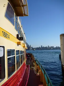
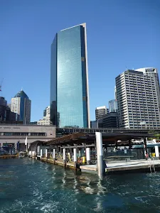
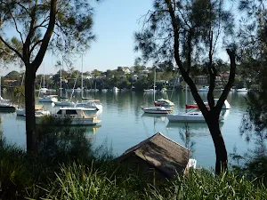
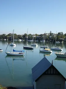
After another 50 m catch the ferry (about 5.5 km long)
Then catch the ferry (about 4.6 km long)
Then pass the "Simmons Point Reserve" (45 m on your left).
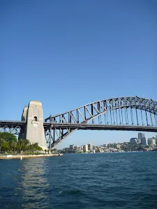
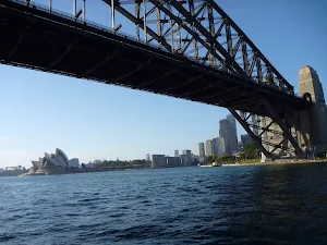
After another 1.4 km catch the ferry (about 1.5 km long)
Then catch the ferry (about 1.4 km long)
|
|
|
From the Balmain <-> Birchgrove continue straight, to head along Balmain <-> Birchgrove.
Then catch the ferry (about 1.3 km long)
Then pass the "Yurulbin Park" (20 m on your left).
|
|
|
Birchgrove Station continue straight, to head along Birchgrove <-> Grennwich Point.
Then catch the ferry (about 770 m long)
|
|
|
At the intersection of Birchgrove <-> Grennwich Point & Cockatoo Island - Birchgrove continue straight, to head along Birchgrove <-> Grennwich Point.
After another 470 m (from the Birchgrove <-> Grennwich Point) continue straight, to head along Birchgrove <-> Grennwich Point.
After another 190 m pass the "Mary Carlson Park" (40 m on your right).
Then pass a seat (55 m on your right).
Then pass the water tap (60 m on your right).
Then come to the viewpoint (65 m on your right).
|
|
|
Greenwich Point Wharf Station turn left, to head along Greenwich Point <-> Woolwich Wharf.
|
|
|
After another 125 m (from the Greenwich Point <-> Woolwich Wharf) continue straight, to head along Greenwich Point <-> Woolwich Wharf.
|
|
|
After another 480 m (Woolwich Wharf Stop_position) continue straight (a footpath).
After another 40 m pass the toilet (5 m on your right).

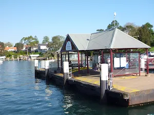
After another 20 m find the "Woolwich Wharf" (5 m on your right).
|
|
|

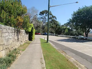
After another 15 m (from the Valentia Street) veer right, to head along Valentia Street (a residential road).

After another 6 m pass the "The Great North Walk" (5 m on your right).

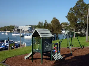
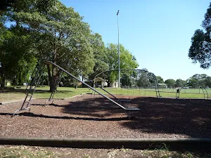
After another 6 m pass the playground (15 m on your left).
|
|
|
After another 70 m (at the intersection of The Point Road & Valentia Street) turn left, to head along The Point Road (a highway|tertiary).
|
|
|
After another 90 m (at the intersection of The Point Road & Angelo Street) continue straight, to head along The Point Road.
|
|
|
After another 225 m (at the intersection of The Point Road & Mayfield Avenue) continue straight, to head along The Point Road.
|
|
|
After another 45 m (at the intersection of The Point Road & Hunter Street) continue straight, to head along The Point Road.
|
|
|
After another 70 m (at the intersection of Gale Street & The Point Road) continue straight, to head along Gale Street.
|
|
|
After another 105 m (at the intersection of Gale Street & Hunter Lane) continue straight, to head along Gale Street.
|
|
|
After another 15 m (at the intersection of Gale Street & Collingwood Street) continue straight, to head along Gale Street.
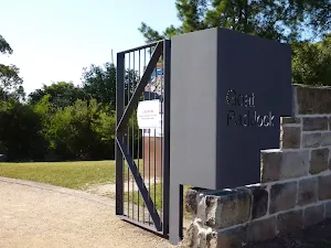
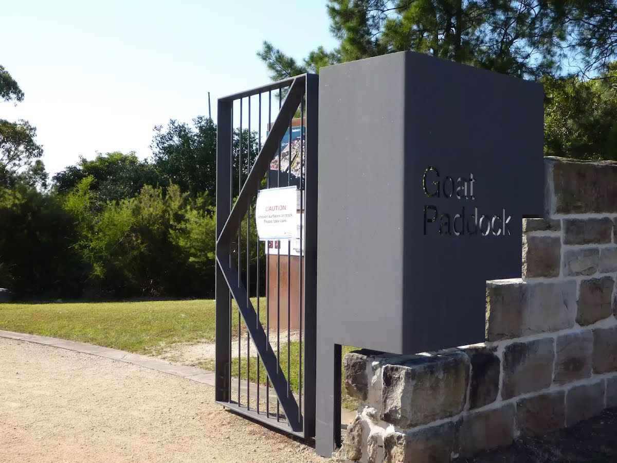
After another 90 m find the "Goat Paddock" (15 m on your left).
|
|
|
From the Gale Street continue straight, to head along Gale Street.
|
|
|
After another 15 m (at the intersection of Woolwich Road & Gale Street) veer right, to head along Woolwich Road.
|
|
|
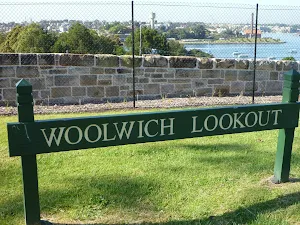
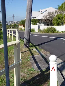
After another 40 m (from the Woolwich Road) turn left (a footpath).
After another 75 m find the "Woolwich Lookout" (4 m on your left).
|
|
|
Veer right.
|
|
|
After another 8 m continue straight.
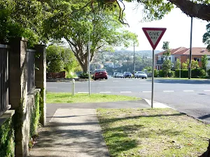
After another 65 m (at the intersection of Edgecliff Road & Clarke Road) veer left, to head along Edgecliff Road (a residential road).

After another 130 m pass the car park (45 m on your left).
After another 65 m (at the intersection of Alfred Street & Margaret Street) continue straight, to head along Alfred Street.
After another 115 m pass the car park (45 m on your left).
|
|
|
From the Alfred Street continue straight (a steps).
Then head up the steps (about 15 m long)
|
|
|
After another 80 m (from the The Great North Walk) turn right, to head along The Great North Walk.
|
|
|
After another 50 m (from the The Great North Walk) continue straight, to head along The Great North Walk.
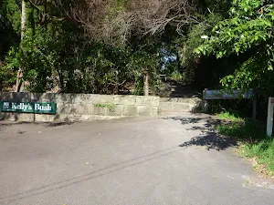
After another 55 m pass the "Kellys Bush" (on your right).
After another 7 m pass the sign (on your right).
Then pass a seat (on your left)., has a backrest.
After another 15 m find the "Kellys Bush" (on your right).
|
|
|
After another 7 m (at the intersection of Prince George Parade & Nelson Parade) continue straight, to head along Prince George Parade (a residential road).
|
|
|
After another 5 m (at the intersection of Prince George Parade & Prince Edward Parade) continue straight, to head along Prince George Parade.
After another 110 m pass the "Great North Walk" (on your right).
|
|
|
At the intersection of Gladstone Avenue & Prince George Parade turn right, to head along Gladstone Avenue.
After another 30 m (at the intersection of Gladstone Avenue & Prince Edward Parade) continue straight, to head along Gladstone Avenue.
|
|
|
After another 120 m (at the intersection of Gladstone Avenue & Woolwich Road) continue straight, to head along Gladstone Avenue.
|
|
|
After another 95 m (from the Vernon Street) turn left, to head along Vernon Street (a residential road).
After another 100 m (at the intersection of Vernon Street & The Great North Walk) continue straight, to head along Vernon Street.
|
|
|
After another 40 m (at the intersection of The Great North Walk & Vernon Street) turn right, to head along The Great North Walk (a steps).

Then head down the surface|paved steps (about 85 m long)
|
|
|
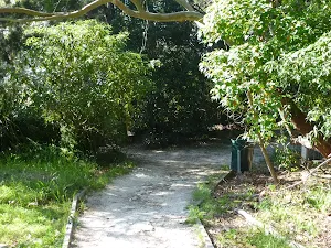
From the The Great North Walk turn left, to head along The Great North Walk (a walking track).
After another 200 m (at the intersection of Vernon Street & The Great North Walk) veer right, to head along Vernon Street (a residential road).
After another 15 m (at the intersection of Vernon Street & Brookes Street) continue straight, to head along Vernon Street.
After another 65 m (at the intersection of Vernon Street & St Ives Avenue) continue straight, to head along Vernon Street.
After another 60 m (at the intersection of Woolwich Road & Vernon Street) turn right, to head along Woolwich Road (a highway|tertiary).
|
|
|
After another 35 m (at the intersection of Woolwich Road & Glenview Road) continue straight, to head along Woolwich Road.
|
|
|
After another 115 m (at the intersection of Futuna Street & Woolwich Road) turn right, to head along Futuna Street (a residential road).
|
|
|
After another 210 m (at the intersection of Crescent Street & Futuna Street) turn right, to head along Crescent Street.
|
|
|
After another 50 m (at the intersection of Garrick Avenue & Crescent Street) turn left, to head along Garrick Avenue.
After another 200 m find the "Ivy Alley" (35 m on your left).
|
|
|
After another 60 m (at the intersection of Passy Avenue & The Great North Walk) turn right, to head along Passy Avenue (a residential road).
|
|
|
After another 70 m (at the intersection of Passy Avenue & Rooke Lane) continue straight, to head along Passy Avenue.
After another 70 m (at the intersection of Ambrose Street & Passy Avenue) turn left, to head along Ambrose Street.
|
|
|
After another 120 m (at the intersection of Woolwich Road & Ambrose Street) turn right, to head along Woolwich Road (a highway|tertiary).
|
|
|
After another 25 m (at the intersection of Woolwich Road & Foss Street) continue straight, to head along Woolwich Road.
|
|
|
After another 55 m (from the Alexandra Street) continue straight, to head along Alexandra Street.
|
|
|
After another 60 m (at the intersection of Alexandra Street & Ady Street) continue straight, to head along Alexandra Street.
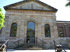
After another 30 m find the "Hunters Hill Shops" (9 m on your left).
|
|
|
After another 95 m (at the intersection of Alexandra Street & Ellesmere Avenue) continue straight, to head along Alexandra Street.
|
|
|
After another 165 m (at the intersection of Alexandra Street & D'Aram Street) continue straight, to head along Alexandra Street.
|
|
|
After another 30 m (at the intersection of Alexandra Street & Stanley Road) continue straight, to head along Alexandra Street.
|
|
|
After another 25 m (from the Alexandra Street) continue straight, to head along Alexandra Street.
|
|
|
After another 6 m (at the intersection of Ferdinand Street & Alexandra Street) turn right, to head along Ferdinand Street (a residential road).
|
|
|
After another 8 m (from the Ferdinand Street) continue straight, to head along Ferdinand Street.
After another 50 m (at the intersection of Ferdinand Street & Cullens Lane) continue straight, to head along Ferdinand Street.
After another 55 m (at the intersection of Madeline Street & Ferdinand Street) turn left, to head along Madeline Street.
After another 95 m (at the intersection of Madeline Street & Lot Lane) continue straight, to head along Madeline Street.
After another 35 m head up the steps (about 40 m long)
From the Mount Street turn right, to head along Mount Street (a residential road).
|
|
|
After another 95 m (at the intersection of Mount Street & Sea Street) continue straight, to head along Mount Street.
|
|
|
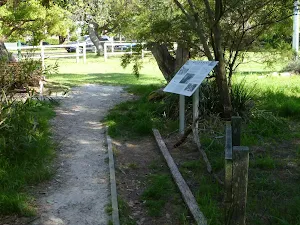
After another 50 m (at the intersection of The Great North Walk & Mount Street) turn left, to head along The Great North Walk (a footpath).
After another 265 m pass a seat (10 m on your right)., has a backrest.
After another 45 m head up the steps (about 15 m long)
Then pass the "Great North Walk" (on your right).
|
|
|
At the intersection of Reiby Road & The Great North Walk turn right, to head along Reiby Road (a residential road).
|
|
|
After another 105 m (at the intersection of The Great North Walk & Reiby Road) continue straight, to head along The Great North Walk (a footpath).
|
|
|
After another 50 m (from the The Great North Walk) continue straight, to head along The Great North Walk.
|
|
|
After another 150 m (at the intersection of Joubert Street North & The Great North Walk) turn left, to head along Joubert Street North (a residential road).
|
|
|
After another 40 m (at the intersection of Figtree Road & Joubert Street North) turn right, to head along Figtree Road.
|
|
|
After another 180 m (at the intersection of Figtree Road & Abigail Street) continue straight, to head along Figtree Road.
|
|
|
After another 180 m (at the intersection of Ryde Road & Figtree Road) turn right, to head along Ryde Road (a road).
|
|
|
After another 75 m (at the intersection of Ryde Road & Luke Street) continue straight, to head along Ryde Road.
|
|
|
After another 15 m (from the Ryde Road) continue straight, to head along Ryde Road.
|
|
|
After another 25 m (at the intersection of Ryde Road & Mark Street) continue straight, to head along Ryde Road.
|
|
|
After another 260 m (at the intersection of Ryde Road & Abigail Street) continue straight, to head along Ryde Road.
|
|
|
After another 110 m (at the intersection of Ryde Road & Mary Street) continue straight, to head along Ryde Road.
|
|
|
After another 70 m (at the intersection of Boronia Avenue & Ryde Road) turn right, to head along Boronia Avenue (a residential road).
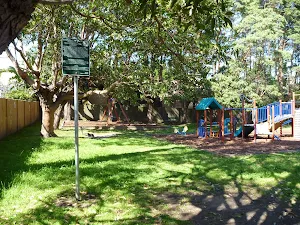
After another 20 m come to "Boronia Park".
About 25 m past the end is a playground .
|
|
|

Continue another 0 m to find from the Boronia Avenue at the end.
|