
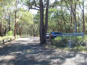


| Start | At the intersection of Timbarra Road & Warrimoo Track (-33.7006531,151.1657618) |
| Mode | Bus Car (There is free parking available.) |
| Directions | From Pennant Hills Road, A28
|
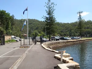
| Finish | (-33.6596461,151.1591056) |
| Mode (end) | Car Shuttle Car (A park entry fee is required for driving into the park.) |

|
|
Class 3/6 Moderate track |
|---|---|
| Length | 6 km |
| Time | 2 h 30 min to 2 h 45 min |
| Quality of track | Formed track, with some branches and other obstacles (3/6) |
| Gradient | Short steep hills (3/6) |
| Signage | Directional signs along the way (3/6) |
| Infrastructure | Limited facilities, not all cliffs are fenced (3/6) |
| Experience Required | Some bushwalking experience recommended (3/6) |
| Weather | Storms may impact on navigation and safety (3/6) |
| Item | From Start | Name & link to notes |
|---|---|---|
Toilet
| 5.6 km | [toilet] |
Shelter
| 5.9 km | [shelter] |
Toilet
| 6.1 km | [toilet] |
The Basin campground and picnic area will be closed on Wednesday 30 July and Thursday 31 July 2025 for weed spraying.
Penalties apply for non-compliance. For more information, contact the local NPWS office.
NSW National Parks and Wildlife Service will be conducting a baiting program using manufactured baits, fresh baits and Canid Pest Ejectors (CPEs) containing 1080 poison (sodium fluroacetate) for the control of foxes. The program is continuous and ongoing between Saturday 1 February 2025 and Thursday 31 July 2025 in Ku-ring-gai Chase National Park.
Please don’t touch baits or ejector devices. All baiting locations are identifiable by signs.
Domestic pets are not permitted in NSW national parks and reserves. Pets and working dogs may be affected (1080 is lethal to cats and dogs). Pets and working dogs must be restrained or muzzled in the vicinity and must not enter the baiting location. In the event of accidental poisoning seek immediate veterinary assistance.
Fox baiting in these reserves is aimed at reducing their impact on threatened species.
Penalties apply for non-compliance. For more information, contact the Forestville area office on 02 9451 3479 or the Lane Cove area office on 02 8448 0400 (business hours). Alternatively, call the NPWS after-hours call centre on 1300 056 294.
Berowra walking track is partially closed from Apple Tree Bay to the Mt-Ku-ring-gai access track until further notice. There is a threat of rockfalls due to slope instability caused by recent weather events. NPWS is in the process of carrying out necessary repair works.
Berowra walking track from Berowra Station to Mt Ku-ring-gai remains open.
Penalties apply for non-compliance. For more information, contact the local NPWS office on 02 8448 0400 or call 1300 072 757 (13000 PARKS).
Ryland trail and Cooyong/Neverfail trail in Ku-ring-gai Chase National Park will be closed weekdays from Wednesday 23 July until Tuesday 5 August 2025 inclusive for essential maintenance. Penalties apply for non-compliance. For more information, contact the Sydney North area office on 02 9451 3479.