Mowarry Bay to Red Cliffs
Yuin Country

3 h to 3 h 30 min

8.8 km
return

↑ 202 m
↓ -202 m

Hard track
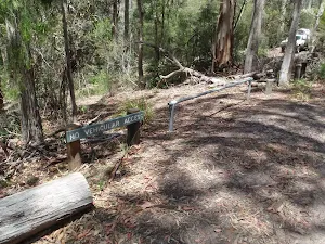
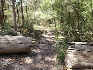
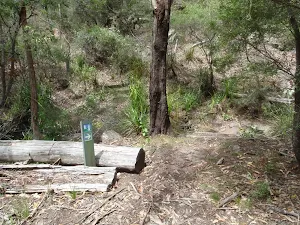
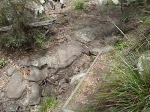
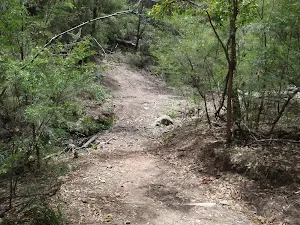
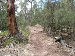
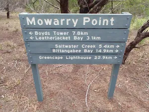
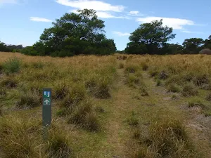
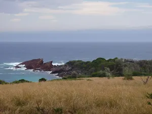
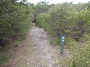
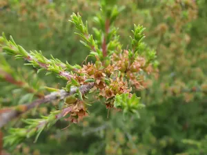
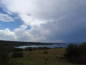
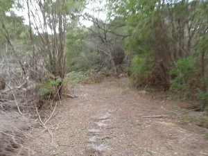
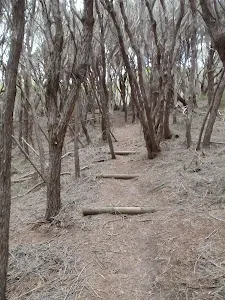
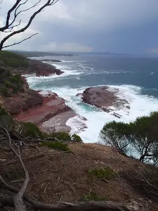
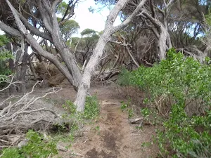
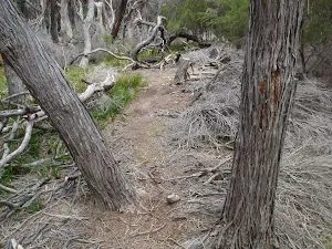
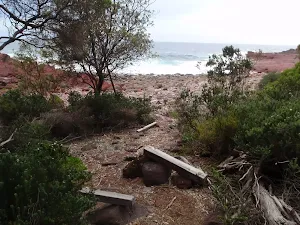
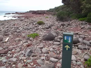
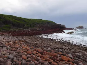
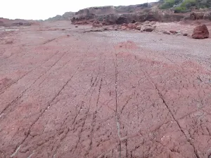
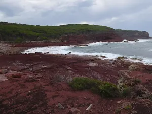
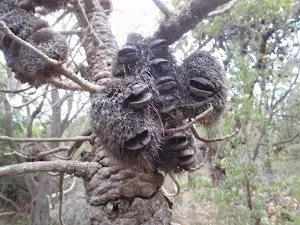
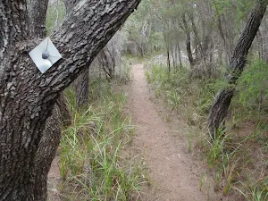
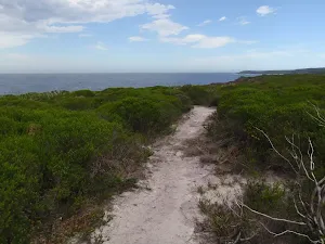
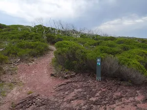
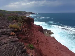
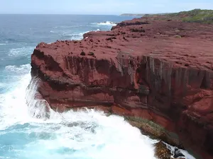
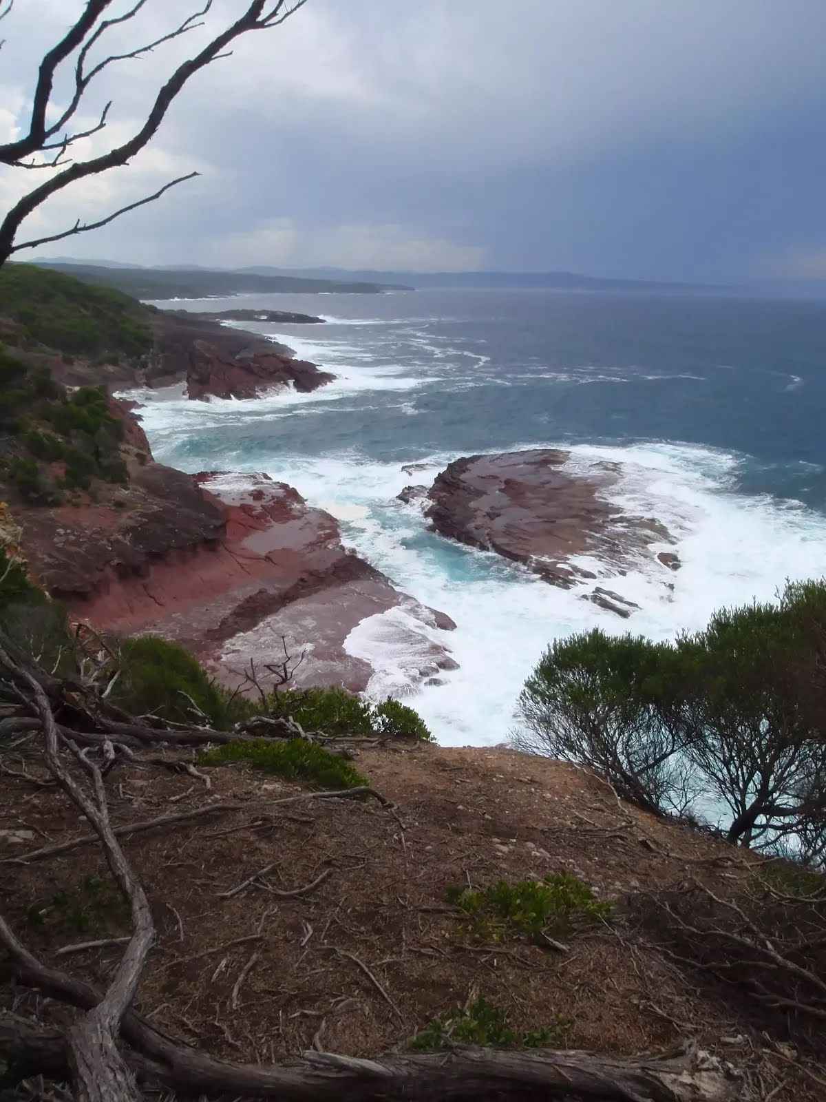
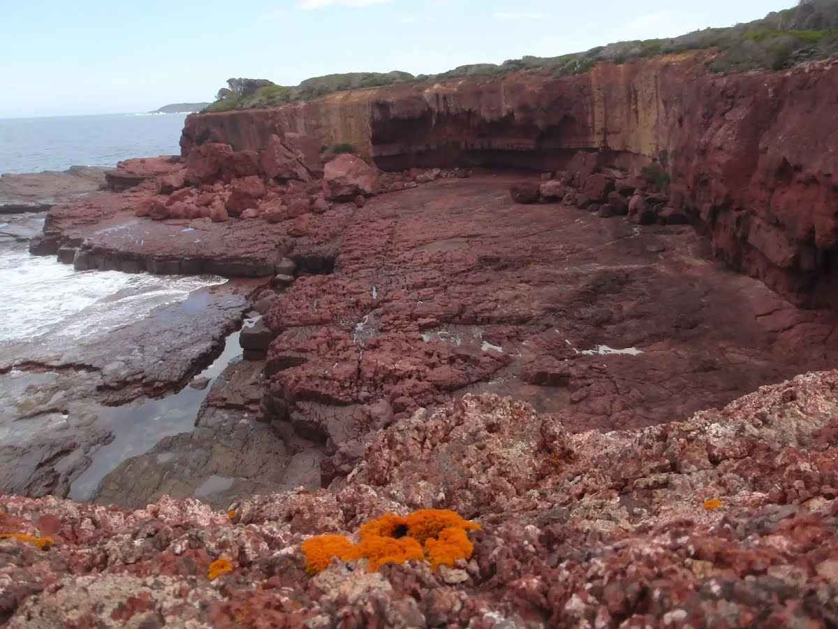
The walk from Mowarry Point to Red Cliffs is an interesting trip through quite a few distinct vegetation types, with a few money shots of the coast line. The grass, heaths, and melaleuca along the way break up the walk to Red Cliffs, which are absolutely stunning. Spend time at the Red Cliffs to see all the different rock formations and inlets that have been created by erosion. Be mindful to keep a safe distance from the edge. The road to the start of this walk is 4wd track only. Let us begin by acknowledging the Yuin people, Traditional Custodians of the land on which we travel today, and pay our respects to their Elders past and present. 
Show all
Mowarry Point car park. | Photo by admin, 2009.
Track through cut log. | Photo by admin, 2009.
Light to Light walk over a creek. | Photo by admin, 2009.
Track across creek at Mowarry. | Photo by admin, 2009.
Service trail from Mowarry car park. | Photo by admin, 2009.
Service trail to Mowarry Point. | Photo by admin, 2009.
Track down to Mowarry Bay. | Photo by admin, 2009.
Mowarry Point signpost. | Photo by admin, 2009.
Arrow marker through grass land. | Photo by admin, 2009.
Rocks at the tip of Mowarry Point. | Photo by admin, 2009.
Arrow marker through the heath. | Photo by admin, 2009.
Heath. | Photo by admin, 2009.
Coast to the north of Mowarry Point. | Photo by admin, 2009.
Light to Light walk on Mowarry Point. | Photo by admin, 2009.
Light to Light walk through the thick bush. | Photo by admin, 2009.
View from Mowarry Point Lookout. | Photo by admin, 2009.
Track south of Mowarry Point. | Photo by admin, 2009.
Fallen branches next to Light to Light walk. | Photo by admin, 2009.
Driftwood seats behind red platform bay. | Photo by admin, 2009.
Arrow marker along red platform bay. | Photo by admin, 2009.
Spectacular rock at red platform bay. | Photo by admin, 2009.
Red platform bay. | Photo by admin, 2009.
Red platform bay looking north. | Photo by admin, 2009.
Banksia men. | Photo by admin, 2009.
Track marker bolted to tree. | Photo by admin, 2009.
Track through the low heath. | Photo by admin, 2009.
Arrow marker away from red cliffs.. | Photo by admin, 2009.
View north of red cliffs. | Photo by admin, 2009.
Red cliffs with waves crshing. | Photo by admin, 2009.
Rod holder for rock fishing. | Photo by admin, 2009.
Downloads GPX PDF

+
-
Safer Bushwalks
Tips on staying safe on track
Before you start any bushwalk ensure you;
• Tell someone you trust where you are going and what to do if you are overdue
• Have adequate equipment, supplies, skills & knowledge for the whole journey
• Consider the impact of weather forecasts, park/track closures & fire dangers
• Can respond to emergencies & call for help at any point
• Are healthy and fit enough for this journey
If not, change plans and stay safe. It is okay to delay and ask people for help.
+
-
Getting There
Transport options and directions
Start (-37.142548,149.9851321)
Mode Car (A park entry fee is required for driving into the park.)
DirectionsFrom Princes Highway, A1
  • Turn on to Edrom Road then drive for 13.4 km
  • Turn right onto Midway Point trail and drive for another 2.4 km
+
-
Track Notes
Turn by turn instructions & maps
Getting started
From the intersection, this walk follows the sign to 'Mowarry Point 500m', down the hill. The track leaves the car park through the gap in the logs and tends right, heading down the hillside to an intersection (with a track marker present), above a creek.
From the intersection, this walk follows the track marker down the stairs and upstream of the creek, to turn left across the rocky creek bed. The walk heads up the stairs, leading to a service trail.....
Turn map Directions & comments
Start.
After another 215 m continue straight, to head along Light to Light Walk.
After another 180 m continue straight, to head along Light to Light Walk.
After another 780 m continue straight, to head along Light to Light Walk.
After another 680 m find the "Mowarry Point lookout" (10 m on your left).
Mowarry Point lookout

Mowarry Point lookout is an informal vantage on Mowarry Point in Ben Boyd National Park. There is no signage or other infrastructure. The lookout provides a unobstructed view to the north and north-east, along the coast of Ben Boyd National Park. The view extends up to Eden, into Twofold Bay and out over the South Pacific Ocean. There are some Melaleuca trees that offer limited shade.
+
-
Mowarry Point lookout is an informal vantage on Mowarry Point in Ben Boyd National Park. There is no signage or other infrastructure. The lookout provides a unobstructed view to the north and north-east, along the coast of Ben Boyd National Park. The view extends up to Eden, into Twofold Bay and out over the South Pacific Ocean. There are some Melaleuca trees that offer limited shade.

Continue another 2.6 km to find the end. Then turn around here and retrace the main route for 4.4 km to get back to the start.
"Red Cliffs".
Red Cliffs
Red Cliffs

Red Cliffs - These fantastic red coastal cliffs are found about 1km north of saltwater creek in Ben Boyd National Park. The cliffs are made of a red siltstone. As the name suggests, this rock is made from deposited silt, making it much finer grain than sandstone. The red silt came from nearby volcanic eruptions long ago, and is clearly different from the other brown siltstone and sandstone in the region. The cliff is unfenced and provides views out to sea and into a few surrounding bays.
+
-
Red Cliffs - These fantastic red coastal cliffs are found about 1km north of saltwater creek in Ben Boyd National Park. The cliffs are made of a red siltstone. As the name suggests, this rock is made from deposited silt, making it much finer grain than sandstone. The red silt came from nearby volcanic eruptions long ago, and is clearly different from the other brown siltstone and sandstone in the region. The cliff is unfenced and provides views out to sea and into a few surrounding bays.

+
-
Terrain
Know the Hills, grading & facilities

Mowarry Bay to Red Cliffs


Grading
Class 4/6
Hard track
Length 8.8 km
Time 3 h to 3 h 30 min
Quality of track Rough track, where fallen trees and other obstacles are likely (4/6)
Gradient Very steep (4/6)
Signage Minimal directional signs (4/6)
Infrastructure Limited facilities (such as cliffs not fenced, significant creeks not bridged) (4/6)
Experience Required No experience required (1/6)
Weather Storms may impact on navigation and safety (3/6)
+
-
Articles
Discover more details to thrive on track
+
-
Reviews & Feedback
Share your experience
+
-
Weather & Alerts
Check forecasts & closures
Show Full Weather
Alerts and Closures
Show all alerts
Show all alerts
Show all alerts
+
-
Other Journeys
Discover nearby and similar journeys
Some of the information and maps on this page was generated using data from the awesome © OpenStreetMap contributors.
Please see how you can embed some widgets, access data and other stuff to that might be helpful.